Beyond Assumptions: Why Accurate Geometry and LiDAR Scanning are the Gold Standard for Modern Projects

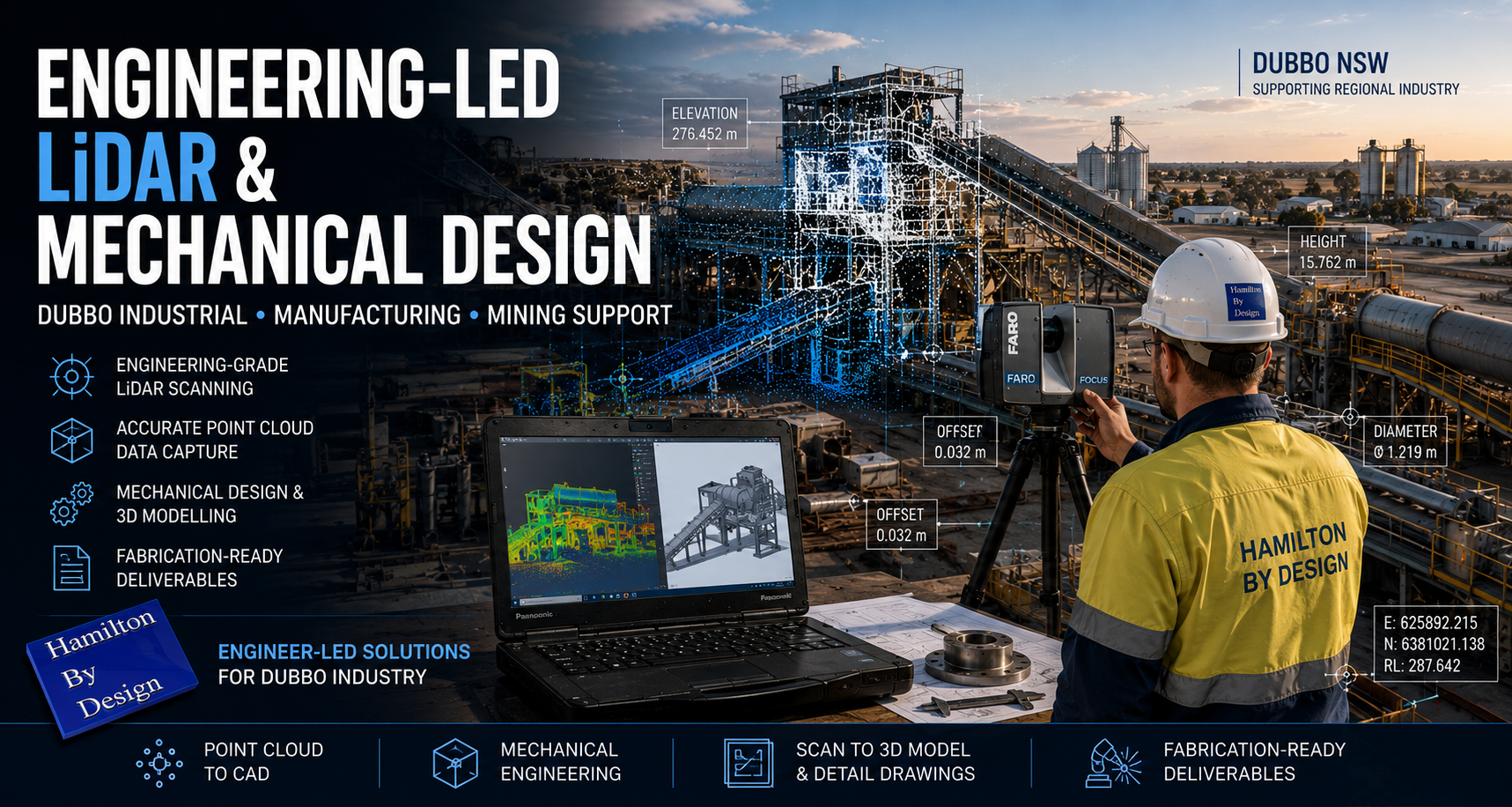
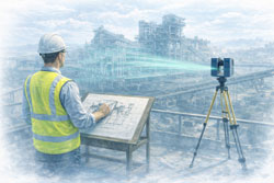
Engineering-grade LiDAR scanning infographic showing a FARO laser scanner capturing an industrial plant and converting site data into point clouds, scan-to-CAD models, and engineering-ready drawings to reduce rework and improve project outcomes.

In the world of industrial engineering and brownfield upgrades, there is a dangerous word: Assumption.

Whether you are upgrading a CHPP, modifying a conveyor system, or retrofitting a processing plant, your project is only as strong as the data itโ€™s built on. At Hamilton By Design, weโ€™ve seen how “near enough” measurements lead to costly rework, extended shutdowns, and safety risks.

The solution? Moving from manual estimation to Engineering-Led LiDAR Scanning.

The High Cost of Inaccurate Information

Traditional “manual” documentationโ€”using tape measures, spirit levels, and old 2D drawingsโ€”is prone to human error. In complex industrial environments, missing a single pipe interference or a slight structural lean by even 20mm can mean a prefabricated component wonโ€™t fit during a critical shutdown.

When site data is inaccurate:

  • Fabrication fails: Parts arrive on-site but don’t clear existing structures.
  • Costs skyrocket: Emergency “hot works” and on-site modifications blow out budgets.
  • Safety is compromised: Forced fits can create structural stress and unforeseen hazards.

Why Geometry is the Foundation of Engineering

Geometry isn’t just about shapes; it’s about the spatial relationship between every asset on your site. Accurate geometry is critical because:

  1. Clash Detection: It allows us to identify “soft” and “hard” clashes in a digital environment before a single bolt is turned.
  2. Structural Integrity: Precise angles and load-path documentation ensure that new modifications integrate safely with legacy steelwork.
  3. Efficiency: Understanding the exact volume, pitch, and clearance of a site allows for “First-Time-Fit” engineering.

LiDAR Scanning: The Simple Solution for Complex Reality

LiDAR (Light Detection and Ranging) removes the guesswork. A LiDAR scanner emits millions of laser pulses per second to create a Point Cloudโ€”a highly accurate 3D digital “twin” of your facility.

Why itโ€™s a game-changer:

  • Speed: Capture entire plant rooms or structural towers in minutes, not days.
  • Safety: We can scan hazardous or hard-to-reach areas from a safe distance, removing the need for scaffolding just to take a measurement.
  • Completeness: Unlike a manual survey that only measures what you think is important, LiDAR captures everything in its line of sight, providing context you might need later.

Beyond design, point cloud data serves as an indisputable “source of truth” in legal and insurance contexts. Because a scan is a timestamped, millimeter-accurate record of reality, it is increasingly used in:

  • Construction Disputes: Providing evidence of “as-built” conditions vs. “as-designed” plans to settle variations or defect claims.
  • Incident Investigation: In the event of a structural failure or site accident, a pre-existing or post-incident scan provides an objective 3D map for forensic analysis.
  • Asset Accountability: Scans serve as a permanent record of site conditions before a contractor begins work, protecting owners and contractors alike from liability.

The Hamilton By Design Difference

We don’t just provide “data.” We provide engineering-led reality capture. Because we are engineers and fabricators ourselves, we know what to look for when we scan. We don’t just give you a cloud of dots; we translate that data into usable CAD models and fabrication-ready drawings that respect Australian Standards (like AS 4324.1).

Stop guessing and start building with confidence. [Contact the Hamilton By Design team today] to discuss how our LiDAR scanning services can de-risk your next project.


Hamilton By Design logo displayed on a blue tilted rectangle with a grey gradient background
3D LiDAR scanning and 3D modelling service button โ€” laser scanner capturing a point cloud for engineering and CAD modelling
Mechanical engineering services
3D LiDAR scanning and 3D modelling service button โ€” laser scanner capturing a point cloud for engineering and CAD modelling
Mechanical engineering services
Finite Element Analysis (FEA) engineering simulation button
Mechanical engineering services

Mechanical Engineering | Structural Engineering


Engineering-Led 3D Scanning for Brownfield Industrial Upgrades

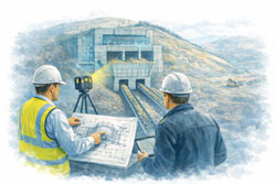
Mechanical engineer and client reviewing a ROM hopper with two discharge conveyors using LiDAR scanning at a mining bulk material handling facility

Engineering-Led 3D Scanning for Brownfield Industrial Upgrades

Safer Shutdowns, Smarter Design, and More Done With Fewer Resources

Brownfield industrial upgrades are some of the highest-risk engineering activities in mining and heavy industry. Existing assets, live plant interfaces, limited access, and tight shutdown windows leave little room for error.

At Hamilton By Design, we deliver engineering-led 3D LiDAR scanning to support brownfield upgradesโ€”providing accurate site data that enables safer design, efficient shutdown execution, and reliable outcomes when upgrading critical assets such as hoppers, chutes, pump boxes, conveyor transfers, and vertical shaft units.


Why Brownfield Upgrades Fail Without Accurate Site Data

Many brownfield failures trace back to the same root cause:

Design decisions made on assumptions, not reality.

Common issues include:

  • Outdated or incomplete drawings
  • Hidden interferences and undocumented modifications
  • Restricted access for survey and measurement
  • Time pressure during shutdowns

Engineering-led reality capture removes uncertainty before fabrication and installation begin.


Safety Starts Before the Shutdown

Safety in brownfield environments is largely determined during the design phase, not on site.

3D LiDAR scanning allows engineers to:

  • Design modifications without repeated site access
  • Reduce manual measurements in live plant areas
  • Identify clashes and pinch points early
  • Improve access, guarding, and maintainability outcomes

By reducing exposure hours and unplanned rework, scanning directly supports safer shutdown execution.


Typical Assets Upgraded in Brownfield Environments

Hamilton By Design supports upgrades to a wide range of industrial assets, including:

Hoppers & Chutes

  • ROM hoppers
  • Transfer chutes
  • Surge bins
  • Wear-prone interfaces

Conveyors & Transfer Stations

  • Conveyor head and tail stations
  • Transfer points
  • Discharge transitions
  • Supporting steelwork

Pump Boxes & Process Interfaces

  • Pump boxes and sumps
  • Pipework interfaces
  • Structural supports
  • Access platforms

Vertical Shaft & Drop Structures

  • Vertical shaft hoppers
  • Ore passes
  • Gravity-fed transfer systems

These assets are often deeply integrated into existing plant, making accurate as-built data critical.


Engineering-Led Scan-to-CAD for Upgrade Design

Our scan-to-CAD workflows are built around engineering outcomes, not just visual models.

This includes:

  • High-accuracy LiDAR capture of existing conditions
  • Engineering-intent CAD modelling
  • Design for fabrication and installation
  • Clash reduction across mechanical and structural scopes

The result is buildable design that aligns with real-world constraints.


Reliable Support for Shutdown-Driven Projects

Shutdowns demand precision. There is no time for re-measurements or redesign on site.

Engineering-led 3D scanning supports shutdown success by:

  • Allowing design to be completed well before shutdown
  • Supporting pre-fabrication of steelwork and chutes
  • Reducing RFIs and site queries
  • Increasing the amount of work completed per shutdown

When time and labour are limited, better information delivers better outcomes.


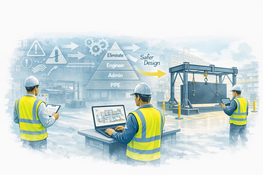
Mining engineers applying design-for-safety principles to improve material handling systems in an industrial workshop

Getting More Done With Fewer Resources

In todayโ€™s industrial environment, engineering teams are under pressure to:

  • Do more with fewer people
  • Reduce shutdown durations
  • Control capital and maintenance costs

Accurate digital site data allows teams to:

  • Minimise engineering rework
  • Reduce site-based labour
  • Improve coordination between disciplines
  • Make confident decisions faster

Reality capture becomes a force multiplier, not just a documentation tool.


Australian Engineering Quality You Can Rely On

Hamilton By Designโ€™s approach reflects Australian engineering standards and site experience.

We donโ€™t just scan โ€” we:

  • Understand how plant is built and maintained
  • Design with fabrication and installation in mind
  • Take responsibility for engineering outcomes

This sets our work apart from low-cost capture services that leave risk unresolved.


Hamilton By Design logo displayed on a blue tilted rectangle with a grey gradient background


3D LiDAR scanning and 3D modelling service button โ€” laser scanner capturing a point cloud for engineering and CAD modelling
Mechanical engineering services

Speak With an Engineer

If youโ€™re planning a brownfield upgrade involving:

  • Hoppers or chutes
  • Conveyor transfers
  • Pump boxes or sumps
  • Vertical shaft or drop structures
  • Shutdown-critical works

Hamilton By Design provides engineering-led 3D LiDAR scanning to support safer, more reliable brownfield upgrades.

Name
Would you like us to arrange a phone consultation for you?
Address

Our clients:


Finite Element Analysis (FEA) engineering simulation button
Mechanical engineering services

Mechanical Engineering | Structural Engineering


Engineering-Led LiDAR & Mechanical Design for Mining & Heavy Industry โ€“ Dubbo NSW

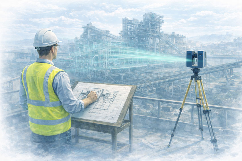
Engineer operating a terrestrial LiDAR scanner at an industrial facility in Dubbo while capturing point cloud data for mechanical engineering and plant design.

Hamilton By Design provides engineering-led LiDAR scanning and mechanical design services to support mining and heavy-industry projects in Dubbo and Central West New South Wales. Our work focuses on brownfield assets, live operating plant, and shutdown-driven projects where accuracy, constructability, and risk control are critical.

Mechanical engineer capturing a mining plant with LiDAR scanning, showing point cloud data integrated into engineering design workflows.

This is not survey-only scanning. We integrate engineering judgement with high-accuracy reality capture to deliver fabrication-ready, fit-first-time outcomes for mining, processing, and heavy industrial infrastructure across the Central West.


Engineering-Led LiDAR for Central West NSW Mining & Industry

Mining and heavy-industry operations around Dubbo support a mix of base-metals mining, materials handling, processing facilities, and regional industrial infrastructure. These environments commonly involve:

  • Legacy plant and infrastructure with incomplete as-built documentation
  • Multiple generations of modifications and upgrades
  • Restricted access in live operating environments
  • High consequence of errors during shutdowns or short outage windows

Our engineering-led LiDAR approach is designed for operating sites where assumptions introduce safety, cost, and schedule risk.


Integrated Scan-to-Engineering Workflow

We deliver a single, accountable workflow tailored to Central West NSW operations:

  1. On-site LiDAR scanning undertaken by engineers familiar with regional mining and industrial environments
  2. Engineering-grade point-cloud processing aligned to modelling tolerances and fabrication requirements
  3. Mechanical and structural CAD modelling developed directly from scan data
  4. Fabrication-ready drawings suitable for workshop manufacture and site installation
  5. Engineering support through fabrication, installation, and shutdown execution

This workflow reduces interface risk between scanning, design, fabrication, and construction โ€” particularly important where access and shutdown windows are limited.


Mining & Heavy Industry Applications in Dubbo

Brownfield Engineering & Existing Assets

Central West NSW operations rely on long-life assets that have evolved through decades of operation. We support brownfield engineering where:

  • Original drawings are unreliable or unavailable
  • Equipment interfaces are complex or undocumented
  • Clearance, access, and compliance are critical

LiDAR provides accurate existing-condition data, while engineering oversight ensures the information is applied correctly during design and verification.


Shutdown-Driven Projects

Shutdowns in regional operations are tightly planned and often resource constrained.

Our work supports shutdown success by:

  • Capturing existing conditions prior to outages
  • Eliminating site measurement during shutdowns
  • Verifying interfaces, access, and constructability
  • Reducing fabrication and installation risk

Pre-validated designs improve safety, execution quality, and schedule certainty.


Processing Plants & Materials Handling

Mining and industrial operations around Dubbo include complex processing and materials-handling systems.

Our engineering-led LiDAR services support:

  • Conveyors and transfer stations
  • Hoppers, bins, and chutes
  • Crushers, screens, and feeders
  • Walkways, platforms, and guarding upgrades

Accurate scan-to-CAD workflows enable confident redesign, replacement, and compliance upgrades in operating facilities.


Heavy Plant & Industrial Equipment

We support projects involving large and complex equipment where traditional measurement methods are unsafe or impractical, including:

  • Fixed and mobile processing plant
  • Structural steelwork and access systems
  • Maintenance platforms and guarding systems

Engineering-led scanning ensures interfaces, envelopes, and installation constraints are understood before fabrication begins.


Risk Management for Regional Mining & Industrial Projects

In regional centres like Dubbo, risk is driven by unknown conditions, ageing infrastructure, and limited tolerance for rework.

Our approach reduces risk by:

  • Removing reliance on outdated drawings and assumptions
  • Capturing accurate existing conditions prior to design
  • Identifying clashes and access constraints early
  • Reducing site rework and hot works
  • Supporting safer shutdown execution

Risk is managed upstream, where it is cheapest and safest to control.


What Makes Our Approach Different

  • Engineer-led LiDAR scanning, not technician-only capture
  • Mechanical and structural engineering capability in-house
  • Mining and heavy-industry focus
  • Brownfield and shutdown experience
  • Single point of responsibility from scan through to design output

Typical Deliverables

Depending on project scope, deliverables may include:

  • Registered point-cloud datasets
  • Engineering-grade 3D CAD models
  • Mechanical and structural drawings
  • Interface and clearance verification
  • Fabrication and installation documentation

All deliverables are developed with fabrication, installation, and operational use in mind.


Hamilton By Design logo displayed on a blue tilted rectangle with a grey gradient background
3D LiDAR scanning and 3D modelling service button โ€” laser scanner capturing a point cloud for engineering and CAD modelling
Mechanical engineering services

Who We Support

Our services support:

  • Mining asset owners and operators
  • Processing plant operators
  • Maintenance and shutdown teams
  • Project engineers and managers
  • Fabricators and constructors operating in Central West NSW

We work directly with asset owners or as part of multi-disciplinary project teams.


Talk to an Engineer

If you are planning:

  • A brownfield upgrade
  • A shutdown-driven project
  • Processing plant modifications
  • Materials-handling or heavy plant upgrades

Hamilton By Design can support your project in Dubbo and Central West NSW with engineering-led LiDAR scanning and mechanical design.

Contact us to discuss your site, constraints, and project objectives.

Name
Would you like us to arrange a phone consultation for you?
Address

Our clients:


3D CAD Modelling Australia service banner for Hamilton By Design


CHPP Engineering title graphic featuring bold white text reading "CHPP Engineering" centred on a blue rounded rectangle background.
Pipework Drafting title graphic featuring bold white text reading "Pipework Drafting" centred on a blue rounded rectangle background.
3D LiDAR Scanning for Engineering Projects title graphic featuring bold white text on a blue rounded rectangle background.


Finite Element Analysis (FEA) engineering simulation button
Structural drafting services button
Mechanical drafting services button


Australian Drafting logo featuring bold white text reading "Australian Drafting" centred on a blue rounded rectangle background.
Engineering Governance title graphic featuring bold white text reading "Engineering Governance" centred on a blue rounded rectangle background.
Engineering-Grade LiDAR Scanning title graphic featuring bold white text on a blue rounded rectangle background.


Mechanical drafting services button
Structural drafting services button


Fabrication and product design services
3D CAD Modelling Australia service banner for Hamilton By Design
Mechanical, Structural & Pipework Drafting service banner by Hamilton By Design featuring white text on a blue background.


3D LiDAR scanning and 3D modelling service button โ€” laser scanner capturing a point cloud for engineering and CAD modelling
Mechanical engineering services

Mechanical Engineering | Structural Engineering


Engineering-Led LiDAR & Mechanical Design for Mining & Heavy Industry โ€“ Singleton NSW

Engineer-led LiDAR scanning at a mining heavy-industry site with point cloud overlay used for mechanical design and brownfield engineering.

Engineering-Led LiDAR & Mechanical Design for Mining & Heavy Industry โ€“ Singleton NSW

Hamilton By Design provides engineering-led LiDAR scanning and mechanical design services to support mining and heavy-industry projects in Singleton and the Upper Hunter Valley, NSW. Our work focuses on brownfield assets, live operating plant, and shutdown-driven projects where accuracy, constructability, and risk control are critical.

This is not survey-only scanning. We integrate engineering judgement with high-accuracy reality capture to deliver fabrication-ready, fit-first-time outcomes for coal operations, CHPPs, and associated mining infrastructure across the Hunter Valley.


Mechanical engineer capturing a mining plant with LiDAR scanning, showing point cloud data integrated into engineering design workflows.

Engineering-Led LiDAR for the Hunter Valley Mining Region

Mining operations around Singleton operate in one of Australiaโ€™s most established coal regions, characterised by:

  • Long-life assets with decades of incremental modification
  • Incomplete or outdated as-built documentation
  • Tight shutdown windows aligned to production constraints
  • High consequence of rework in live operating environments

Our engineering-led LiDAR approach is designed for operating mine sites and processing facilities where assumptions introduce safety, cost, and schedule risk.


Integrated Scan-to-Engineering Workflow

We deliver a single, accountable workflow tailored to Hunter Valley mining operations:

  1. On-site LiDAR scanning undertaken by engineers familiar with coal operations, access constraints, and site safety requirements
  2. Engineering-grade point-cloud processing aligned to modelling tolerances and fabrication requirements
  3. Mechanical and structural CAD modelling developed directly from scan data
  4. Fabrication-ready drawings suitable for workshop manufacture and site installation
  5. Engineering support through fabrication, installation, and shutdown execution

This workflow reduces interface risk between scanning, design, fabrication, and construction โ€” a key issue on shutdown-critical coal sites.


Mining & Heavy Industry Applications in Singleton

Brownfield Engineering & Existing Assets

Singleton-region operations rely heavily on brownfield plant and infrastructure that has evolved over decades. We support brownfield engineering where:

  • Original drawings are unreliable or unavailable
  • Multiple generations of modifications exist
  • Interface accuracy and access are critical

LiDAR provides accurate existing-condition data, while engineering oversight ensures the information is applied correctly during design and verification.


Shutdown-Driven Projects

Shutdowns in the Hunter Valley are tightly planned and production-critical.

Our work supports shutdown success by:

  • Capturing existing conditions prior to outages
  • Eliminating site measurement during shutdowns
  • Verifying interfaces, access, and constructability
  • Reducing fabrication and installation risk

Pre-validated designs improve safety, execution quality, and schedule certainty.


CHPP & Bulk Materials Handling

Coal Handling and Preparation Plants dominate the Upper Hunter Valley.

Our engineering-led LiDAR services support:

  • Conveyors and transfer stations
  • Hoppers, bins, and chutes
  • Crushers, screens, and feeders
  • Walkways, platforms, and guarding upgrades

Accurate scan-to-CAD workflows enable confident redesign, replacement, and compliance upgrades in operating CHPP environments.


Heavy Plant & Mining Equipment

We support projects involving large and complex coal-handling plant where traditional measurement methods are unsafe or impractical, including:

  • Stackers and reclaimers
  • Large conveyor systems
  • Structural steelwork and access platforms

Engineering-led scanning ensures interfaces, envelopes, and installation constraints are understood before fabrication begins.


Risk Management for Hunter Valley Mining Projects

In mature coal regions like Singleton, risk is driven by unknown conditions, interface complexity, and limited tolerance for shutdown overruns.

Our approach reduces risk by:

  • Removing reliance on outdated drawings and assumptions
  • Capturing accurate existing conditions prior to design
  • Identifying clashes and access constraints early
  • Reducing site rework and hot works
  • Supporting safer shutdown execution

Risk is managed upstream, where it is cheapest and safest to control.


What Makes Our Approach Different

  • Engineer-led LiDAR scanning, not technician-only capture
  • Mechanical and structural engineering capability in-house
  • Coal and heavy-industry focus
  • Brownfield and shutdown experience
  • Single point of responsibility from scan through to design output

Typical Deliverables

Depending on project scope, deliverables may include:

  • Registered point-cloud datasets
  • Engineering-grade 3D CAD models
  • Mechanical and structural drawings
  • Interface and clearance verification
  • Fabrication and installation documentation

All deliverables are developed with fabrication, installation, and operational use in mind.


Hamilton By Design logo displayed on a blue tilted rectangle with a grey gradient background
3D LiDAR scanning and 3D modelling service button โ€” laser scanner capturing a point cloud for engineering and CAD modelling
Mechanical engineering services

Who We Support

Our services support:

  • Coal mine asset owners and operators
  • CHPP operators
  • Maintenance and shutdown teams
  • Project engineers and managers
  • Fabricators and constructors operating in the Upper Hunter Valley

We work directly with asset owners or as part of multi-disciplinary project teams.


Talk to an Engineer

If you are planning:

  • A brownfield upgrade
  • A shutdown-driven project
  • CHPP modifications or replacements
  • Conveyor or heavy plant upgrades

Hamilton By Design can support your project in Singleton and the Upper Hunter Valley with engineering-led LiDAR scanning and mechanical design.

Contact us to discuss your site, constraints, and project objectives.

Name
Would you like us to arrange a phone consultation for you?
Address

Our clients:


Engineering-Led LiDAR & Mechanical Design for Mining & Heavy Industry โ€“ Cobar NSW

Engineer-led LiDAR scanning at a mining heavy-industry site with point cloud overlay used for mechanical design and brownfield engineering.

Engineering-Led LiDAR & Mechanical Design for Mining | Cobar NSW

Hamilton By Design provides engineering-led LiDAR scanning and mechanical design services to support mining and heavy-industry projects in Cobar and Western New South Wales. Our work focuses on brownfield assets, live operating plant, and shutdown-driven projects where accuracy, constructability, and risk control are critical.

This is not survey-only scanning. We integrate engineering judgement with high-accuracy reality capture to deliver fabrication-ready, fit-first-time outcomes for base-metals operations, processing facilities, and heavy industrial infrastructure in remote and legacy environments.


Engineering-Led LiDAR for Western NSW Mining

Mining operations in and around Cobar operate within established districts where assets have evolved over decades. Common challenges include:

  • Legacy infrastructure with incomplete or outdated as-built documentation
  • Multiple generations of plant modifications
  • Restricted access and ageing structures
  • High consequence of rework during shutdowns
  • Remote logistics that penalise design errors

Our engineering-led LiDAR approach is designed for operating mine sites and processing facilities where assumptions create safety, cost, and schedule risk.


Mechanical engineer capturing a mining plant with LiDAR scanning, showing point cloud data integrated into engineering design workflows.

Integrated Scan-to-Engineering Workflow

We deliver a single, accountable workflow suited to remote and brownfield mining operations:

  1. On-site LiDAR scanning undertaken by engineers familiar with mining safety, access, and constructability constraints
  2. Engineering-grade point-cloud processing aligned to modelling tolerances and fabrication requirements
  3. Mechanical and structural CAD modelling developed directly from scan data
  4. Fabrication-ready drawings suitable for workshop manufacture and site installation
  5. Engineering support through fabrication, installation, and commissioning

This workflow reduces interface risk between scanning, design, fabrication, and construction โ€” particularly important where site access and logistics are constrained.


Mining & Heavy Industry Applications in Cobar

Brownfield Engineering & Existing Assets

Cobar-region operations rely heavily on long-life assets that have been modified through decades of maintenance and shutdown work. We support brownfield engineering where:

  • Original drawings are unavailable or unreliable
  • Equipment interfaces are complex or undocumented
  • Clearance, access, and compliance are critical

LiDAR provides accurate existing-condition data, while engineering oversight ensures the information is applied correctly during design and verification.


Shutdown-Driven Projects

Shutdown windows in remote mining regions are tightly planned and high consequence.

Our work supports shutdown success by:

  • Capturing existing conditions before outages
  • Eliminating site measurement during shutdowns
  • Verifying interfaces, access, and constructability
  • Reducing fabrication and installation risk

Pre-validated designs improve safety, execution quality, and schedule certainty.


Processing Plants & Materials Handling

Mining operations in Western NSW include complex processing and materials-handling infrastructure.

Our engineering-led LiDAR services support:

  • Conveyors and transfer stations
  • Hoppers, bins, and chutes
  • Crushers, screens, and feeders
  • Walkways, platforms, and guarding upgrades

Accurate scan-to-CAD workflows enable confident redesign, replacement, and compliance upgrades in operating plants.


Heavy Plant & Industrial Equipment

We support projects involving large and complex equipment where traditional measurement methods are unsafe or impractical, including:

  • Fixed and mobile processing plant
  • Structural steelwork and access systems
  • Maintenance platforms and guarding systems

Engineering-led scanning ensures interfaces, envelopes, and installation constraints are understood before fabrication begins.


Risk Management for Remote & Legacy Mining Assets

In established mining districts like Cobar, risk is driven by unknown conditions, ageing infrastructure, and interface complexity.

Our approach reduces risk by:

  • Removing reliance on outdated drawings and assumptions
  • Capturing accurate existing conditions prior to design
    n- Identifying clashes and access constraints early
  • Reducing site rework and hot works
  • Supporting safer shutdown execution

Risk is managed upstream, where it is cheapest and safest to control.


Mining engineers applying design-for-safety principles to improve material handling systems in an industrial workshop

What Makes Our Approach Different

  • Engineer-led LiDAR scanning, not technician-only capture
  • Mechanical and structural engineering capability in-house
  • Mining and heavy-industry focus
  • Brownfield and shutdown experience
  • Single point of responsibility from scan through to design output

Typical Deliverables

Depending on project scope, deliverables may include:

  • Registered point-cloud datasets
  • Engineering-grade 3D CAD models
  • Mechanical and structural drawings
  • Interface and clearance verification
  • Fabrication and installation documentation

All deliverables are developed with fabrication, installation, and operational use in mind.


Who We Support

Our services support:

  • Base-metals mining asset owners
  • Processing plant operators
  • Maintenance and shutdown teams
  • Project engineers and managers
  • Fabricators and constructors operating in Western NSW

We work directly with asset owners or as part of multi-disciplinary project teams.


Hamilton By Design logo displayed on a blue tilted rectangle with a grey gradient background
3D LiDAR scanning and 3D modelling service button โ€” laser scanner capturing a point cloud for engineering and CAD modelling
Mechanical engineering services

Talk to an Engineer

If you are planning:

  • A brownfield upgrade
  • A shutdown-driven project
  • Processing plant modifications
  • Materials-handling or heavy plant upgrades

Hamilton By Design can support your project in Cobar and Western NSW with engineering-led LiDAR scanning and mechanical design.

Contact us to discuss your site, constraints, and project objectives.

Name
Would you like us to arrange a phone consultation for you?
Address

Our clients:


Mechanical Engineering | Structural Engineering


Engineer-Led LiDAR Mount Isa QLD

Engineer-led LiDAR scanning at a mining heavy-industry site with point cloud overlay used for mechanical design and brownfield engineering.

Engineering-Led LiDAR & Mechanical Design for Mining | Mount Isa QLD

Hamilton By Design provides engineering-led LiDAR scanning and mechanical design services for mining and heavy-industry operations in Mount Isa and North West Queensland. Our work supports brownfield assets, live operating plant, and shutdown-driven projects where accuracy, risk control, and constructability are critical.

This is not survey-only scanning. We integrate engineering judgement with high-accuracy reality capture to deliver fabrication-ready, fit-first-time outcomes for base metals operations, processing plants, and heavy industrial infrastructure in remote and operationally constrained environments.


Mechanical engineer capturing a mining plant with LiDAR scanning, showing point cloud data integrated into engineering design workflows.

Engineering-Led LiDAR for North West Queensland Mining

Mining operations in Mount Isa face unique challenges:

  • Remote location and logistics constraints
  • Legacy infrastructure with limited as-built documentation
  • Continuous operations with minimal downtime
  • High consequence of rework during shutdowns

Our engineering-led LiDAR approach is designed specifically for operating mine sites where assumptions carry cost, safety, and schedule risk.


Integrated Scan-to-Engineering Workflow

We deliver a single, accountable workflow tailored to remote mining operations:

  1. On-site LiDAR scanning performed by engineers familiar with mining access, safety, and operational constraints
  2. Engineering-grade point-cloud processing aligned to modelling tolerances and fabrication requirements
  3. Mechanical and structural CAD modelling developed directly from scan data
  4. Fabrication-ready drawings suitable for workshop manufacture and site installation
  5. Engineering support through fabrication, installation, and commissioning

This approach reduces interface risk between scanning, design, fabrication, and construction โ€” particularly important in remote regions where rework is costly.


Mining & Heavy Industry Applications in Mount Isa

Brownfield Engineering & Existing Assets

Mount Isa operations rely heavily on long-life assets that have evolved over decades. We support brownfield engineering where:

  • Original drawings are incomplete or unavailable
  • Multiple generations of plant modifications exist
  • Clearances, interfaces, and access are critical

LiDAR provides accurate existing-condition data, while engineering oversight ensures the information is applied correctly during design and verification.


Shutdown-Driven Projects

Shutdown windows in remote operations are limited and tightly managed.

Our work supports shutdown success by:

  • Capturing existing conditions before outages
  • Eliminating site measurement during shutdowns
  • Verifying interfaces, access, and constructability
  • Reducing fabrication and installation risk

Pre-validated designs improve safety, schedule certainty, and execution quality.


Processing Plants & Bulk Materials Handling

Mining operations in Mount Isa include complex processing and materials-handling infrastructure.

Our engineering-led LiDAR services support:

  • Conveyors and transfer stations
  • Hoppers, bins, and chutes
  • Crushers, screens, and feeders
  • Walkways, platforms, and guarding upgrades

Accurate scan-to-CAD workflows enable confident redesign, replacement, and compliance upgrades in operating plants.


Heavy Plant & Industrial Equipment

We support projects involving large and complex equipment where traditional measurement methods are unsafe or impractical, including:

  • Fixed and mobile processing plant
  • Large structural steel assemblies
  • Access systems and maintenance platforms

Engineering-led scanning ensures interfaces, envelopes, and installation constraints are understood before fabrication begins.


Mining engineers applying design-for-safety principles to improve material handling systems in an industrial workshop

Risk Management for Remote Mining Projects

In remote mining environments, risk is amplified by distance, logistics, and limited tolerance for error.

Our approach reduces risk by:

  • Removing reliance on outdated or assumed information
  • Capturing accurate existing conditions prior to design
  • Identifying clashes and access constraints early
  • Reducing site rework and hot works
  • Supporting safer shutdown execution

Risk is managed upstream, where changes are cheapest and safest to implement.


What Makes Our Approach Different

  • Engineer-led LiDAR scanning, not technician-only capture
  • Mechanical and structural engineering capability in-house
  • Mining and heavy-industry focus
  • Brownfield and shutdown experience
  • Single point of responsibility from scan through to design output

Typical Deliverables

Depending on project scope, deliverables may include:

  • Registered point-cloud datasets
  • Engineering-grade 3D CAD models
  • Mechanical and structural drawings
  • Interface and clearance verification
  • Fabrication and installation documentation

All deliverables are developed with fabrication, installation, and operational use in mind.


Who We Support

Our services support:

  • Base metals and mining asset owners
  • Processing plant operators
  • Maintenance and shutdown teams
  • Project engineers and managers
  • Fabricators and constructors operating in North West Queensland

We work directly with asset owners or as part of multi-disciplinary project teams.


Hamilton By Design logo displayed on a blue tilted rectangle with a grey gradient background
3D LiDAR scanning and 3D modelling service button โ€” laser scanner capturing a point cloud for engineering and CAD modelling
Mechanical engineering services

Talk to an Engineer

If you are planning:

  • A brownfield upgrade
  • A shutdown-driven project
  • Processing plant modifications
  • Conveyor or heavy plant upgrades

Hamilton By Design can support your project in Mount Isa and North West Queensland with engineering-led LiDAR scanning and mechanical design.

Contact us to discuss your site, constraints, and project objectives.

Name
Would you like us to arrange a phone consultation for you?
Address

Our clients:


Australian Drafting logo featuring bold white text reading "Australian Drafting" centred on a blue rounded rectangle background.
Engineering Governance title graphic featuring bold white text reading "Engineering Governance" centred on a blue rounded rectangle background.
Mechanical, Structural & Pipework Drafting service banner by Hamilton By Design featuring white text on a blue background.
Mechanical engineering services
Blue rounded button with the text โ€œSolidWorks Designโ€ in white.
Finite Element Analysis (FEA) engineering simulation button
3D LiDAR Scanning Darwin for engineering surveys, laser scanning, reality capture and point cloud modelling services
3D LiDAR Scanning Australia engineering services for laser scanning, reality capture, scan-to-CAD, Scan-to-BIM and as-built documentation across Australia
3D LiDAR scanning services on the Central Coast providing engineering-grade laser scanning, point cloud capture, scan-to-CAD modelling and industrial reality capture for infrastructure and industrial projects.
3D LiDAR Scanning Perth for engineering surveys, laser scanning, reality capture and point cloud modelling services
3D LiDAR Scanning Sydney for engineering surveys, laser scanning, reality capture and point cloud modelling services
3D LiDAR Scanning Brisbane for engineering surveys, laser scanning, reality capture and point cloud modelling services
3D LiDAR Scanning Canberra for engineering surveys, laser scanning, reality capture and point cloud modelling services
3D LiDAR Scanning Newcastle for engineering surveys, laser scanning, reality capture and point cloud modelling services
3D LiDAR Scanning Adelaide for engineering surveys, laser scanning, reality capture and point cloud modelling services