LiDAR Scanning for Council Infrastructure and Public Assets on the Central Coast NSW

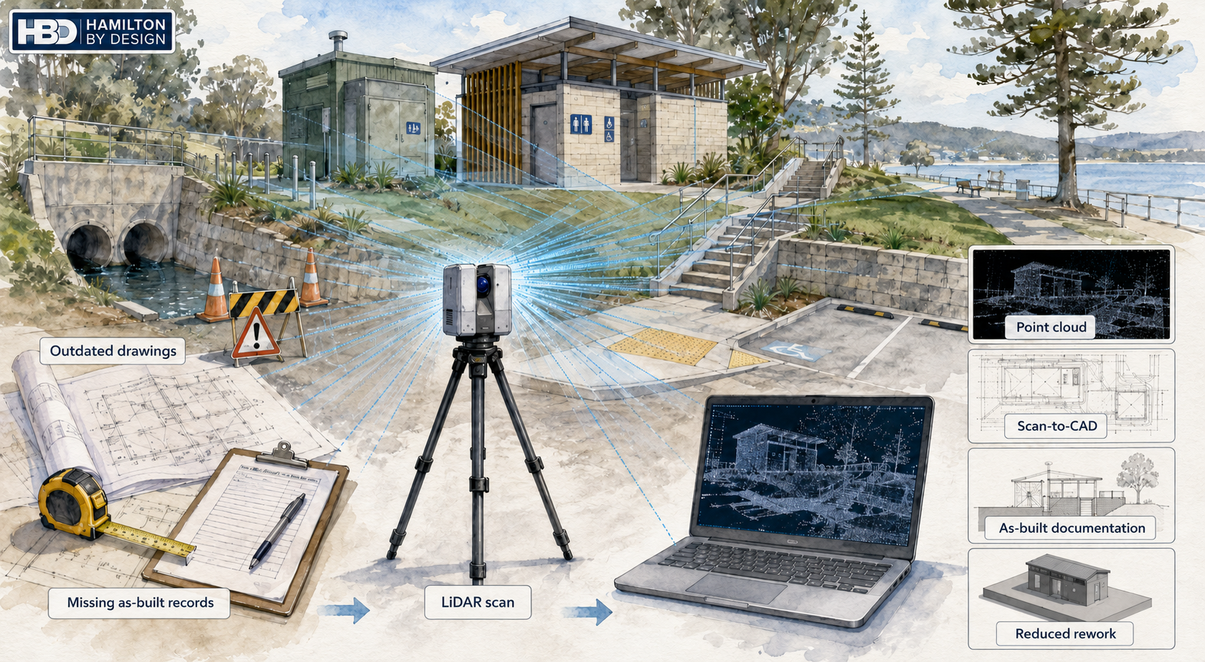
Watercolour illustration showing LiDAR scanning of council infrastructure, including stormwater culverts, public amenities, access stairs, carpark and point cloud outputs for scan-to-CAD and as-built documentation.
Blue 3D LiDAR scanner icon on a tripod with scanning waves

Councils manage a wide range of public infrastructure. This includes stormwater assets, pump stations, amenities buildings, carparks, parks, depots, retaining walls, roads, footpaths, coastal assets, water infrastructure and community facilities.

Many of these assets have been modified over time. Drawings may be outdated, site conditions may have changed, and important details may be missing from the original records.

Before a council, consultant or contractor can confidently plan an upgrade, maintenance project or renewal program, they need accurate existing-condition information.

This is where LiDAR scanning for council infrastructure can help.

LiDAR scanning captures accurate 3D site data and converts the real-world environment into a digital point cloud. From that point cloud, useful engineering outputs can be created, including CAD drawings, sections, elevations, 3D models and as-built documentation.

For councils, this means better information before design, procurement, construction and long-term asset management decisions are made.

Why Councils Need Accurate Existing-Condition Data

Public assets are often difficult to document properly using manual measurement alone.

A stormwater outlet may have irregular geometry. A pump station may contain pipework, valves, platforms and access constraints. A public amenities building may have been altered several times. A depot or workshop may have services, equipment and structures that are not shown correctly on old drawings.

When project teams rely on incomplete information, the risk increases.

Common problems include:

  • Design assumptions based on outdated drawings
  • Contractors needing repeated site visits
  • Fabrication errors caused by incorrect measurements
  • Poor tender information
  • Unexpected clashes during construction
  • Missing as-built records
  • Difficulty planning maintenance or renewals
  • Higher risk of rework and delay

LiDAR scanning helps reduce these problems by capturing the existing asset before work begins.

Where LiDAR Scanning Helps Council Projects

Council AssetHow LiDAR Scanning Helps
Stormwater pits, culverts and outletsCaptures existing geometry, levels, surrounding constraints and access conditions
Pump stations and water assetsDocuments pipework, valves, platforms, equipment, clearances and structures
Public amenities buildingsSupports refurbishment, accessibility upgrades and as-built plans
Carparks and access roadsCaptures kerbs, ramps, barriers, drainage and layout constraints
Parks and open space assetsHelps with renewal planning, pathways, ramps and public access improvements
Depots and workshopsRecords existing layouts, equipment zones, services and structures
Retaining walls and access stairsSupports condition review, replacement planning and design checks
Coastal and foreshore assetsUseful for localised structure, access and public asset documentation
Bridges and small structuresCaptures visible geometry for upgrade planning and design coordination

What Hamilton By Design Delivers

Hamilton By Design provides engineering-led LiDAR scanning and scan-to-CAD services for councils, consultants and contractors working on public infrastructure and asset renewal projects.

Depending on the project, deliverables may include:

  • Registered point cloud data
  • 2D CAD plans
  • Sections and elevations
  • 3D CAD models
  • Existing-condition drawings
  • As-built documentation
  • Mechanical and structural layout models
  • Site constraint records
  • Design verification data
  • Fabrication and upgrade support

The value is not just in capturing the scan. The real value is turning the point cloud into information that engineers, asset managers, designers and contractors can actually use.

Choosing the Right Scanning Method

Not every LiDAR method suits every council project.

Some projects need detailed terrestrial scanning of a pump station, public building, depot or stormwater structure. Other projects may need drone survey, mobile mapping, broad topographic data or input from a registered surveyor.

Hamilton By Design focuses on selecting the right capture method for the project outcome, rather than forcing one scanning approach onto every site.

Best Fit for LiDAR Scanning

Best FitMay Need Another Method
Pump station upgradesWhole-catchment flood mapping
Public amenities refurbishmentsLegal boundary survey
Stormwater outlet replacementsUnderground service locating
Depot and workshop layoutsLarge road corridor mapping
Small bridges and culvertsFull cadastral survey
Retaining walls and stairsDeep geotechnical investigation
Brownfield facility upgradesBroad aerial terrain mapping

LiDAR scanning is best used where accurate visible existing conditions matter.

It is not a replacement for every survey method, but it is a powerful tool for reducing uncertainty before design and construction begin.

Advantages of LiDAR Scanning for Councils

AdvantageCouncil Benefit
Better existing-condition dataReduces assumptions before design starts
Fewer site revisitsSaves time for council staff, consultants and contractors
Improved tender informationHelps contractors price from clearer site data
Reduced reworkHelps avoid clashes, wrong dimensions and incorrect fabrication
Better asset recordsSupports future maintenance and asset management
Safer site captureReduces manual measuring in difficult or awkward areas
Faster design coordinationAllows multiple stakeholders to work from the same site record
Stronger project evidenceCreates a digital record of what existed at the time of capture

Quick Project Matching Guide

If You Are PlanningAsk About
A pump station upgradeLiDAR scanning and scan-to-CAD modelling
A stormwater outlet replacementExisting-condition capture and sections
A public amenities refurbishmentAs-built plans and 3D building capture
A depot layout changePoint cloud modelling and clearance checks
A retaining wall replacementExisting geometry and access documentation
A contractor tender packageScan data, CAD drawings and site constraints
A council asset renewal programRepeatable asset capture workflow

LiDAR Scanning for Central Coast Council-Style Projects

Central Coast Council already publishes references to LiDAR in areas such as flood studies, coastal monitoring and dredging programs. This shows that LiDAR is already part of modern infrastructure, environmental and asset-related work.

The opportunity now is to apply the same digital capture thinking to smaller, asset-level projects such as pump stations, public buildings, stormwater assets, depots, carparks, retaining walls and local infrastructure upgrades.

For council-style projects, accurate site data can help answer important questions early:

  • What is actually on site?
  • Do the old drawings match reality?
  • Where are the access constraints?
  • What will the contractor need to work around?
  • Can the proposed design fit the existing asset?
  • What information should be included in the tender package?
  • What should be recorded for future asset management?

FAQs

What is LiDAR scanning for council infrastructure?
LiDAR scanning captures accurate 3D site data that can be used to create point clouds, CAD drawings, models and as-built documentation for public assets.

Can LiDAR scanning replace a registered surveyor?
No. LiDAR scanning can support engineering and asset documentation, but cadastral boundaries, legal survey and certified survey work must be completed by an appropriately qualified surveyor.

What council assets can be scanned?
Stormwater assets, pump stations, public buildings, amenities, depots, retaining walls, carparks, pathways, access structures and brownfield infrastructure can often be scanned.

Is LiDAR useful for stormwater works-as-executed records?
Yes. LiDAR can help capture existing drainage geometry and surrounding site conditions, although final works-as-executed requirements should match the relevant council specification.

What is the difference between LiDAR scanning and scan-to-CAD?
LiDAR scanning captures the site. Scan-to-CAD converts the point cloud into useful drawings, models, sections or design-ready geometry.

When is LiDAR scanning not the right tool?
It may not be the best option for simple measurements, legal boundaries, buried services, whole-region mapping or very large open terrain projects unless combined with other survey methods.

Need LiDAR Scanning for a Council Infrastructure Project?

Hamilton By Design provides engineering-led LiDAR scanning, point cloud modelling and scan-to-CAD services for council infrastructure, public assets and brownfield upgrade projects across the Central Coast, Hunter, Sydney and regional NSW.

If your project needs accurate existing-condition data before design, tendering or construction, we can help turn the real site into usable engineering information.

Talk to Us – Contact Us

Name
Would you like us to arrange a phone consultation for you?
Address

Our clients:

3D Laser Scanning of Pump Stations for Reverse Engineering Sydney NSW

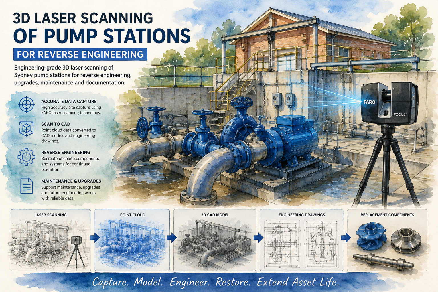
Watercolour illustration of 3D laser scanning of a Sydney pump station for reverse engineering, asset life extension and engineering documentation

Engineering-Grade 3D Laser Scanning of Sydney Pump Stations for Reverse Engineering, Upgrades, Maintenance and Documentation

Pump and Motor Assembly Icon for Reverse Engineering and Water Infrastructure Engineering Services

Hamilton By Design provides engineering-grade 3D laser scanning of pump stations throughout Sydney NSW. Using advanced FARO laser scanning technology, we capture highly accurate digital records of pump stations, mechanical equipment, pipework systems and structural infrastructure to support reverse engineering, maintenance planning, asset life extension, upgrades and engineering documentation.

Many water utilities, wastewater treatment facilities, councils and infrastructure owners operate ageing pump stations with incomplete drawings, obsolete equipment and limited documentation. Our 3D laser scanning services provide accurate as-built information that enables engineers, maintenance teams and asset managers to make informed decisions while reducing risk, downtime and costly site rework.

Whether the project involves reverse engineering a discontinued pump component, planning a pump station upgrade, developing manufacturing drawings or documenting an existing facility, Hamilton By Design delivers accurate engineering data that supports the entire asset lifecycle.


Why 3D Laser Scanning is Valuable for Pump Stations

Pump stations are complex facilities containing interconnected mechanical, structural and civil infrastructure. Over time, modifications are often made without updating drawings, resulting in discrepancies between existing documentation and actual site conditions.

Traditional measurement methods can be time-consuming, disruptive and prone to inaccuracies.

3D laser scanning captures millions of measurement points across an entire facility, creating a highly accurate digital representation of the site.

Benefits include:

  • Accurate As-Built Documentation
  • Reduced Site Rework
  • Improved Design Accuracy
  • Safer Data Collection
  • Faster Project Delivery
  • Reduced Shutdown Requirements
  • Improved Asset Management
  • Better Maintenance Planning
  • Enhanced Engineering Outcomes

Supporting Reverse Engineering of Pump Station Assets

One of the most valuable applications of 3D laser scanning is reverse engineering.

Many Sydney pump stations contain equipment that is no longer supported by the original manufacturer. Spare parts may be unavailable, drawings may be missing and replacement lead times may be unacceptable for critical infrastructure operations.

Hamilton By Design uses laser scanning and reverse engineering techniques to recreate:

  • Pump Casings
  • Pump Impellers
  • Pump Shafts
  • Bearing Housings
  • Wear Rings
  • Couplings
  • Valve Components
  • Pipework Assemblies
  • Structural Supports
  • Access Platforms
  • Equipment Mounting Systems

By capturing accurate geometry directly from the existing asset, replacement components can be engineered without relying on original OEM drawings.


Applications Across Sydney Water Infrastructure

Our 3D laser scanning services support a wide range of water and infrastructure assets across Sydney.

Water Pump Stations

Capture existing pump layouts, pipework systems, valve arrangements and structural infrastructure to support maintenance and future upgrades.

Wastewater Pump Stations

Document ageing facilities, verify site conditions and develop accurate engineering models for refurbishment projects.

Water Treatment Plants

Create digital twins of treatment infrastructure to support reverse engineering, plant modifications and ongoing asset management.

Wastewater Treatment Facilities

Capture process equipment, mechanical assets and structural systems to facilitate maintenance and engineering design.

Local Government Infrastructure

Support councils responsible for managing water and wastewater assets through accurate facility documentation and engineering-grade data capture.

Industrial and Mining Water Systems

Provide accurate site information for water transfer systems, pumping infrastructure and process water facilities.


FARO Laser Scanning Technology

Hamilton By Design utilises professional FARO laser scanning equipment capable of capturing engineering-grade measurements suitable for design and manufacturing applications.

Our technology enables:

  • High Accuracy Measurements
  • Detailed Facility Capture
  • Rapid Site Data Collection
  • Comprehensive Asset Documentation
  • Engineering-Grade Deliverables

Laser scanning allows the capture of equipment, structures and plant environments that would be difficult or impractical to measure using conventional methods.


Scan-to-CAD Services for Pump Stations

Following site capture, point cloud data is processed and converted into engineering deliverables suitable for design, drafting and maintenance projects.

Our Scan-to-CAD services include:

  • Existing Condition Drawings
  • General Arrangement Drawings
  • Equipment Layout Drawings
  • Structural Drawings
  • Pipework Drawings
  • Plant Documentation
  • Asset Records

These deliverables provide engineers and asset owners with reliable information for future projects.


3D Modelling and Digital Asset Creation

Laser scan data can be converted into detailed 3D CAD models using industry-leading engineering software.

Hamilton By Design develops:

  • SolidWorks Models
  • AutoCAD Models
  • STEP Files
  • Parasolid Files
  • Manufacturing Models
  • Assembly Models

These models can be used for:

  • Reverse Engineering
  • Asset Management
  • Upgrade Design
  • Interference Checking
  • Maintenance Planning
  • Replacement Component Design

Deliverables

Clients typically receive deliverables tailored to project requirements.

Common outputs include:

Point Cloud Deliverables

  • E57 Files
  • RCP Files
  • RCS Files
  • Registered Point Clouds

CAD Deliverables

  • DWG Drawings
  • DXF Drawings
  • AutoCAD Models
  • SolidWorks Models

Manufacturing Deliverables

  • STEP Files
  • Parasolid Files
  • Manufacturing Drawings
  • Fabrication Drawings
  • Assembly Drawings

Engineering Deliverables

  • Site Verification Reports
  • Asset Documentation
  • Reverse Engineering Models
  • Upgrade Planning Documentation

Supporting Asset Life Extension Projects

Water utilities and infrastructure owners are increasingly seeking ways to extend the life of existing assets while reducing capital expenditure.

3D laser scanning provides the foundation for asset life extension by delivering accurate information about existing conditions.

Our services support:

  • Asset Renewal Programs
  • Pump Replacement Projects
  • Maintenance Shutdowns
  • Infrastructure Upgrades
  • Equipment Refurbishments
  • Reverse Engineering Initiatives
  • Documentation Recovery Projects

Accurate data reduces uncertainty and enables more effective engineering decisions.


Typical Workflow

1. Site Inspection

Review project objectives, site access requirements and available documentation.

2. Laser Scanning

Capture the pump station using FARO laser scanning technology.

3. Point Cloud Registration

Process and register scan data into a unified engineering model.

4. Engineering Review

Verify dimensions, equipment layouts and site conditions.

5. Scan-to-CAD Modelling

Develop engineering drawings and 3D CAD models.

6. Reverse Engineering

Create replacement component models and manufacturing documentation where required.

7. Project Delivery

Provide engineering deliverables suitable for maintenance, upgrades and future asset management.


Why Choose Hamilton By Design?

Hamilton By Design combines practical engineering experience with advanced reality capture technology.

Unlike scanning companies that simply deliver point clouds, we provide engineering-focused solutions that support real-world maintenance, design and reverse engineering projects.

Our capabilities include:

  • Mechanical Engineering
  • Reverse Engineering
  • 3D Laser Scanning
  • Scan-to-CAD
  • Engineering Drafting
  • SolidWorks Modelling
  • AutoCAD Drafting
  • FEA Analysis
  • Manufacturing Documentation
  • Asset Life Extension Engineering

This combination allows us to deliver complete solutions from site capture through to engineered replacement components.


3D Laser Scanning of Pump Stations Across Sydney NSW

Hamilton By Design supports water utilities, wastewater operators, councils, infrastructure owners, engineering consultancies and maintenance contractors throughout Sydney NSW.

Whether you require accurate as-built documentation, reverse engineering of obsolete pump components, Scan-to-CAD services or support for a major pump station upgrade, our engineering-grade laser scanning services provide the information needed to reduce risk and improve project outcomes.

Contact Hamilton By Design to discuss your pump station scanning and reverse engineering requirements.

Talk to Us – Contact Us

Name
Would you like us to arrange a phone consultation for you?
Address

Our clients:

Scan to BIM Perth WA

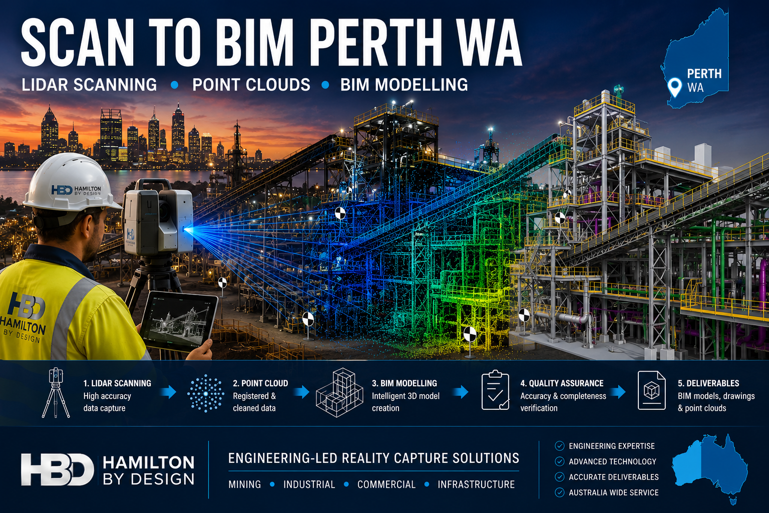
Scan to BIM Perth WA engineering workflow showing LiDAR scanning, point cloud processing and BIM modelling of a Western Australian industrial facility using Hamilton By Design reality capture services.

Scan to BIM Perth WA

Engineering-Led Scan to BIM Services Across Perth and Western Australia

Hamilton By Design provides professional Scan to BIM services throughout Perth and Western Australia, helping mining, industrial, commercial, infrastructure and construction organisations transform accurate 3D laser scan data into intelligent Building Information Models (BIM).

Using engineering-grade LiDAR scanning technology and advanced BIM workflows, we capture existing facilities, process plants, buildings and infrastructure assets and convert them into accurate digital models suitable for design, planning, construction and asset management.

Whether your project involves a brownfield mining upgrade in the Pilbara, a commercial building in the Perth CBD, a processing plant in Kwinana or infrastructure works across regional Western Australia, our Scan to BIM services deliver reliable information for better engineering and project outcomes.


What is Scan to BIM?

Scan to BIM is the process of converting 3D laser scan data into an intelligent Building Information Model.

The process begins with high-accuracy LiDAR scanning, which captures millions of measurement points across a site. This data forms a point cloud that accurately represents existing conditions.

The point cloud is then used to create a BIM model containing structural, architectural and mechanical information that can be used throughout the project lifecycle.

The result is a highly accurate digital representation of the asset that supports:

  • Engineering design
  • Construction planning
  • Asset management
  • Facility upgrades
  • Maintenance planning
  • Clash detection
  • Digital twin development

Engineering-Led BIM Modelling

Unlike many scanning providers that focus only on data capture, Hamilton By Design combines engineering experience with reality capture technology.

This means the final BIM model is developed with an understanding of:

  • Mechanical systems
  • Structural steel
  • Conveyors
  • Chutes
  • Tanks
  • Pipework
  • Platforms and access systems
  • Process equipment
  • Material handling infrastructure

Our engineering background allows us to understand how facilities operate and how accurate models can improve future design decisions.


Perth Industries Using Scan to BIM

Mining and Resources

Western Australia remains one of the world’s largest mining regions.

Scan to BIM supports:

  • Iron ore facilities
  • Gold processing plants
  • Lithium operations
  • Rare earth projects
  • Bulk material handling systems
  • Port infrastructure

Accurate BIM models help engineering teams reduce shutdown durations and improve planning for plant upgrades.


Industrial Manufacturing

Many Perth manufacturers operate facilities that have evolved over decades.

Often existing drawings are incomplete or outdated.

Scan to BIM enables:

  • Accurate facility documentation
  • Equipment replacement projects
  • Structural upgrades
  • Capacity expansion projects
  • Maintenance planning

Commercial Buildings

Commercial property owners increasingly use BIM models to manage assets.

Applications include:

  • Building refurbishment
  • Services upgrades
  • HVAC replacement
  • Tenant fit-outs
  • Facility management

Infrastructure Projects

Scan to BIM can support:

  • Rail infrastructure
  • Ports
  • Water treatment facilities
  • Pump stations
  • Utility corridors
  • Government infrastructure

Accurate BIM models reduce project risk by ensuring designs are based on real-world conditions.


Our Scan to BIM Workflow

1. Site LiDAR Scanning

We perform engineering-grade laser scanning using professional reality capture equipment.

Millions of measurement points are collected across the facility.


2. Point Cloud Registration

Individual scans are aligned and processed into a unified point cloud.

Typical deliverables include:

  • E57
  • RCP
  • RCS
  • LAS

3. BIM Model Development

The point cloud is converted into BIM geometry using industry-standard software.

Models may include:

  • Structural steel
  • Mechanical equipment
  • Pipework
  • Buildings
  • Platforms
  • Access systems

4. Quality Assurance

Models are checked against scan data to verify accuracy and completeness.


5. Deliverables

Typical outputs include:

  • Autodesk Revit Models
  • Navisworks Models
  • IFC Files
  • DWG Drawings
  • PDF Documentation
  • Point Cloud Files

Benefits of Scan to BIM

Improved Accuracy

Laser scanning captures existing conditions with significantly greater accuracy than traditional site measurement methods.

Reduced Design Risk

Design teams can work from verified information rather than assumptions.

Faster Project Delivery

Accurate digital models reduce site revisits and minimise redesign.

Better Asset Management

Facility owners gain an accurate digital representation of their assets.

Improved Collaboration

BIM models provide a common source of information for engineers, designers, contractors and asset owners.


Scan to BIM for Brownfield Mining Projects

Brownfield projects often present unique challenges.

Existing facilities may contain undocumented modifications, ageing infrastructure and limited historical records.

Scan to BIM allows engineering teams to:

  • Verify existing conditions
  • Identify clashes before construction
  • Reduce shutdown risks
  • Improve design confidence
  • Support future digital twin initiatives

For mining operations throughout Perth, the Pilbara, Goldfields and regional Western Australia, accurate BIM models can significantly improve project outcomes.


Why Choose Hamilton By Design?

Hamilton By Design combines:

โœ” Engineering Experience

โœ” LiDAR Scanning Expertise

โœ” BIM Modelling Capability

โœ” Mechanical Design Knowledge

โœ” Structural Drafting Experience

โœ” Australia-Wide Project Delivery

โœ” Mining Industry Experience

We understand both the technology and the engineering requirements behind successful Scan to BIM projects.


Hamilton By Design logo displayed on a blue tilted rectangle with a grey gradient background

Scan to BIM Perth WA

If you require Scan to BIM services in Perth or anywhere across Western Australia, Hamilton By Design can provide engineering-grade reality capture and BIM modelling solutions tailored to your project requirements.

From mining facilities and industrial plants to commercial buildings and infrastructure projects, we help organisations capture existing conditions and create accurate digital models that support safer, more efficient project delivery.

Talk to Us – Contact Us

Name
Would you like us to arrange a phone consultation for you?
Address

Our clients:
3D LiDAR Scanning Darwin for engineering surveys, laser scanning, reality capture and point cloud modelling services
3D LiDAR Scanning Australia engineering services for laser scanning, reality capture, scan-to-CAD, Scan-to-BIM and as-built documentation across Australia
3D LiDAR scanning services on the Central Coast providing engineering-grade laser scanning, point cloud capture, scan-to-CAD modelling and industrial reality capture for infrastructure and industrial projects.
3D LiDAR Scanning Perth for engineering surveys, laser scanning, reality capture and point cloud modelling services
3D LiDAR Scanning Sydney for engineering surveys, laser scanning, reality capture and point cloud modelling services
3D LiDAR Scanning Brisbane for engineering surveys, laser scanning, reality capture and point cloud modelling services
3D LiDAR Scanning Canberra for engineering surveys, laser scanning, reality capture and point cloud modelling services
3D LiDAR Scanning Newcastle for engineering surveys, laser scanning, reality capture and point cloud modelling services
3D LiDAR Scanning Adelaide for engineering surveys, laser scanning, reality capture and point cloud modelling services

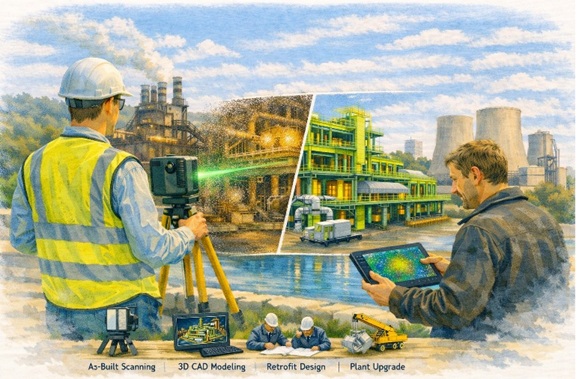
LiDAR Scanning for Industrial Retrofit Engineering

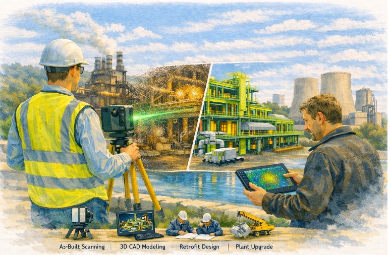
Industrial facility captured using 3D laser scanning for brownfield plant upgrade

LiDAR Scanning for Industrial Retrofit Engineering | Brownfield Plant As-Built Capture

Steel Mills, Manufacturing Plants & Legacy Facility Upgrades

Across industrial regions such as Pittsburgh, Carnegie and Norristown, engineering teams are not scanning sites for mapping โ€” they are scanning them because they are about to change something critical.

Brownfield facilities rarely match drawings.
Plant modifications fail when decisions are made from assumptions rather than measurements.

Hamilton By Design provides engineering-grade LiDAR scanning and modelling specifically for retrofit engineering โ€” capturing existing assets so upgrades install correctly the first time.


Engineer performing industrial LiDAR scan of a processing plant for retrofit design

Why Industrial Facilities Require Scanning Before Design

In heavy industry the problem is rarely design capability โ€” it is uncertainty of the existing plant.

Old facilities typically contain:

  • undocumented structural alterations
  • relocated services and pipework
  • equipment installed over decades
  • distorted steelwork
  • unavailable or unreliable drawings

When upgrades are designed from historical drawings, fabrication errors and shutdown overruns occur.

Our process replaces assumption with measured reality.

We capture what actually exists โ€” then design from truth.

Hamilton By Design combines mechanical engineering with LiDAR capture to reduce fabrication and installation risk on operating assets.


Typical Projects Supported

Brownfield Industrial Plants

  • plant expansions
  • conveyor modifications
  • structural replacement
  • maintenance shutdown preparation

Steel Mills & Heavy Manufacturing

  • equipment replacement
  • platform and access upgrades
  • retrofit guarding & compliance
  • mechanical component redesign

Utilities & Processing Facilities

  • pipe routing development
  • pump and tank replacement
  • asset life-extension upgrades
  • tie-in engineering

These projects require accurate as-built conditions before design โ€” not survey grade positioning, but engineering-grade dimensional certainty.


Our Retrofit Engineering Workflow

1. Field Capture โ€” Engineering LiDAR Scanning

We capture operating facilities without interrupting production and obtain full spatial reality of structures, equipment and services.

2. Digital As-Built Model

Point cloud data is converted into coordinated 3D engineering models for decision-making and clash prevention.

3. Mechanical & Structural Design

Designs are developed directly from measured geometry rather than historic drawings.

4. Fabrication-Ready Deliverables

We provide models and drawings suitable for fabrication and installation.

This approach allows components to fit existing plant conditions on installation rather than being adjusted in the field.


What This Solves

Industrial retrofit projects fail due to dimensional unknowns โ€” not poor engineering.

LiDAR-driven design removes:

  • shutdown delays
  • rework fabrication
  • on-site modifications
  • installation conflicts
  • access clashes

Hamilton By Design supports manufacturing, processing and heavy industry with accurate as-built data and coordinated models for upgrades, maintenance and asset life-extension projects.


Engineering-Led Scanning โ€” Not Just Surveying

Many scanning providers supply point clouds.

We provide engineering decisions.

The difference is accountability โ€” one team responsible from measurement to design.

One team accountable from scan to fabrication.


When to Engage Us

Engage scanning early when a project involves:
  • replacing equipment
  • modifying structure
  • adding services
  • shutdown installation
  • upgrading legacy facilities

If fabrication depends on existing conditions, scanning should precede design โ€” not follow it.


Hamilton By Design logo displayed on a blue tilted rectangle with a grey gradient background

Talk to Hamilton By Design

Hamilton By Design delivers engineering-grade LiDAR scanning and retrofit design support for operating industrial assets worldwide.

Reduce installation risk.
Design from measured reality.

Name
Would you like us to arrange a phone consultation for you?
Address
Name
Would you like us to arrange a phone consultation for you?
Address

3D CAD Modelling Australia service banner for Hamilton By Design
3D LiDAR scanning and 3D modelling service button โ€” laser scanner capturing a point cloud for engineering and CAD modelling
Mechanical engineering services
Finite Element Analysis (FEA) engineering simulation button
Mechanical engineering services

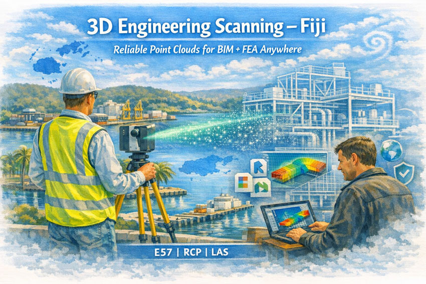
3D Engineering Scanning in Fiji โ€“ Reliable Point Clouds for Global Engineering

Engineer performing 3D laser scanning in Fiji with point cloud transforming into BIM model and FEA analysis beside a tropical port.

3D Engineering Scanning Fiji โ€“ Point Clouds for Design & FEA | Hamilton By Design

Hamilton By Design provides professional 3D laser scanning services across Fiji, delivering high-accuracy point clouds that allow designers, engineers, and asset owners anywhere in the world to work with real, measured dataโ€”without stepping foot on site.

Our focus is simple:
capture the truth of your asset once, and let every engineering discipline design from the same digital backbone.


Engineering-Grade Data You Can Design From

In Fiji, many industrial, marine, and commercial assets have:

  • incomplete or outdated drawings
  • decades of informal modifications
  • mixed construction standards
  • corrosion and cyclone damage history

Traditional measurement methods struggle in this environment. Our 3D scanning service produces a survey-accurate digital replica that can be used for:

  • 3D modelling in Revit, Plant3D, Tekla, SolidWorks
  • structural analysis and FEA studies
  • clash detection for new equipment
  • fabrication of steel and pipework
  • condition assessments and deformation checks

We deliver neutral, open formats so your teamโ€”anywhere in Australia, New Zealand, Fiji, or globallyโ€”can immediately begin engineering work.


What We Deliver

Core Outputs

  • Registered point clouds (E57 / RCP / LAS)
  • Colourised, engineering-accurate datasets
  • Site coordinate systems or project datum
  • Mesh models for Navisworks / visualisation
  • 2D plans, elevations, and sections

Optional Engineering Deliverables

  • Scan-to-BIM models (LOD 200โ€“350)
  • Steel and pipe geometry extraction
  • Tie-in coordinates for brownfields projects
  • Deformation and roundness reports
  • Clash and constructability reviews

Every dataset is processed in Australia under formal QA procedures so it can be relied upon for detailed design, certification, and FEA modelling.


Designed for Fiji Conditions

Scanning in Fiji requires more than equipmentโ€”it requires experience in Pacific environments.

We plan projects around:

  • tropical heat and humidity
  • sudden rain events
  • reflective stainless and bright sunlight
  • inter-island logistics
  • remote power and access constraints
  • cyclone season scheduling

Our workflows are built so field capture is efficient and robust, while processing and modelling are completed by our Australian engineering team.


Industries We Support in Fiji

  • Ports and wharves โ€“ Suva, Lautoka, Levuka
  • Power generation and utilities
  • Sugar and food processing plants
  • Water and wastewater infrastructure
  • Resorts and commercial buildings
  • Bridges and civil structures
  • Post-cyclone assessments
  • Mining and materials handling

A Digital Backbone for Global Teams

A quality scan is the backbone of every downstream task.
If the backbone is wrong, every model, drawing, and FEA result is compromised.

Our aim is to give your project a foundation that:

  • removes re-measure risk
  • allows off-site fabrication
  • supports remote engineering teams
  • shortens shutdowns
  • improves safety and constructability

Designers and engineers in any location can open our data and begin work immediatelyโ€”confident it represents the real world.

3D LiDAR scanning and 3D modelling service button โ€” laser scanner capturing a point cloud for engineering and CAD modelling
Mechanical engineering services

Hamilton By Design logo displayed on a blue tilted rectangle with a grey gradient background

Why Choose Hamilton By Design

  • Engineer-led scanning team
  • Australian processing and QA
  • experience in PNG and Pacific brownfields
  • deliverables tailored to your software
  • practical understanding of fabrication and FEA requirements

We donโ€™t just capture pointsโ€”we deliver usable engineering information.


Talk to Us About Your Fiji Project

Whether you need a single building, a wharf, or a full processing plant captured, we can mobilise quickly and provide data your global team can trust.

Hamilton By Design
Engineering certainty through 3D scanning.

Name
Would you like us to arrange a phone consultation for you?
Address

3D CAD Modelling Australia service banner for Hamilton By Design
Finite Element Analysis (FEA) engineering simulation button
Mechanical engineering services

Digital Twin Creation & Long-Term Asset Management

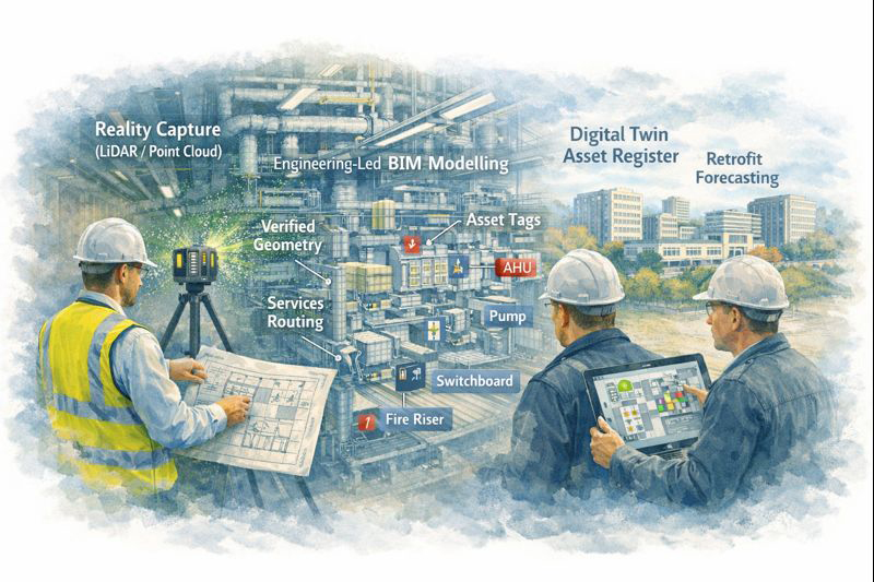
Digital twin created from LiDAR scanning showing asset tags and maintenance planning in industrial facility

Digital Twin Asset Management Sydney | Hamilton By Design

From Point Cloud to Digital Twin: Better Asset Control for Sydney Precincts

For asset owners and facilities managers across Greater Sydney and the Central Coast, accurate and accessible building data is no longer a luxury โ€” it is critical for maintenance planning, compliance, risk management, and future upgrades.

Yet many facilities still rely on incomplete drawings, outdated asset registers, or disconnected documentation spread across multiple systems.

At Hamilton By Design, we use high-accuracy 3D scanning and engineering-led modelling to create digital twins โ€” intelligent, data-rich representations of real facilities that support long-term asset management, not just one-off construction projects.


Why Traditional Building Records Fall Short

Over the life of a facility, buildings change constantly:

  • Services are upgraded or rerouted
  • Plant is replaced or relocated
  • Structural movement occurs over time
  • Temporary works become permanent
  • Documentation becomes fragmented or lost

As a result, asset owners are often forced to make decisions based on assumptions instead of verified data, increasing operational risk and lifecycle costs.

Digital twins replace uncertainty with measurable, current, and verifiable building intelligence.


What Is a Digital Twin โ€” and Why It Matters

A digital twin is more than a 3D model. It is a continuously usable digital representation of your physical asset that can support:

  • Asset lifecycle management
  • Maintenance planning and scheduling
  • Retrofit and upgrade forecasting
  • Compliance verification and reporting
  • Insurance documentation and risk mitigation

Using LiDAR and reality capture, we first create highly accurate point cloud data of your facility. This is then converted into structured engineering models and documentation, forming the foundation of a usable digital twin environment.


Supporting the Full Asset Lifecycle

Digital twins created by Hamilton By Design are designed to support decision-making across the entire life of an asset.

Asset Lifecycle Management

Digital twins provide a verified reference for:

  • Plant locations and access paths
  • Service routing and capacity
  • Structural geometry and tolerances
  • Interface points between systems

This allows asset teams to plan interventions without repeated site surveys or intrusive investigations.


Maintenance Planning and Access Strategy

Maintenance activities often fail not due to equipment faults, but due to poor access planning and unknown service constraints.

Digital twins allow teams to:

  • Visualise maintenance access zones
  • Plan shutdown sequences
  • Coordinate contractor access safely
  • Reduce unexpected site conditions

This is particularly valuable in hospitals, transport facilities, and industrial plants where downtime is extremely costly.


From point cloud to digital twin for lifecycle management of Sydney industrial and precinct assets

Retrofit and Upgrade Forecasting

When assets age, upgrade programs become unavoidable โ€” but without accurate models, forecasting becomes unreliable.

With digital twins, asset owners can:

  • Test retrofit scenarios digitally
  • Assess spatial constraints early
  • Coordinate staged construction programs
  • Validate new services layouts before installation

This significantly reduces redesign cycles and programme risk.


Compliance, Insurance and Risk Documentation

High-accuracy digital records also support:

  • Compliance audits
  • Fire and safety system verification
  • Engineering certification
  • Insurance risk assessments

Digital twins provide verifiable evidence of current conditions, which is increasingly important for regulatory and insurer requirements.


Enterprise-Value Scanning, Not Just Project Scanning

Many scanning services stop at delivering point clouds. Hamilton By Design goes further by integrating scanning into an engineering and asset management workflow.

Our service extends beyond capture into:

  • Mechanical engineering interpretation
  • Systems modelling and coordination
  • Project and asset integration support
  • Fabrication and modification planning

This makes digital twins a strategic asset tool, not just a design input.


Construction, Operations and Future-Proofing โ€” All in One Model

Our digital twin workflows support:

  • Operational facilities
  • Construction planning
  • Ongoing modifications
  • Future asset strategies

By maintaining continuity between engineering, construction, and asset management data, digital twins become a single source of truth for multiple stakeholders.


Deliverables Designed for Asset Teams

We provide digital twin outputs in formats compatible with enterprise asset and design systems:

  • High-resolution point clouds (RCP / E57)
  • Revit asset models
  • AutoCAD documentation
  • SolidWorks equipment and systems models
  • Asset-aligned 2D drawings
  • Data structured for future updates

These can be used directly by engineering consultants, maintenance teams, and facilities management platforms.


Supporting Sydney and Central Coast Asset Portfolios

We work with asset owners across:

  • Healthcare precincts
  • Commercial property portfolios
  • Industrial facilities
  • Infrastructure and transport sites
  • Education campuses
  • Heritage and government assets

Our local support allows ongoing engagement as facilities evolve, not just one-off capture projects.


Turn Building Data into an Asset Strategy

Digital twins transform buildings from static structures into data-driven, manageable systems.

They allow asset owners to move from reactive maintenance to planned lifecycle control, improving reliability, safety, and financial predictability.


Hamilton By Design logo displayed on a blue tilted rectangle with a grey gradient background
3D LiDAR scanning and 3D modelling service button โ€” laser scanner capturing a point cloud for engineering and CAD modelling
Mechanical engineering services

Arrange a Digital Twin Consultation

If you are responsible for long-term facility performance, compliance, or upgrade planning:

Please fill out the form below to arrange a phone consultation.

Weโ€™ll discuss your asset portfolio, operational requirements, and long-term objectives, and recommend a digital twin strategy that supports both current operations and future upgrades.

Name
Would you like us to arrange a phone consultation for you?
Address

3D CAD Modelling Australia service banner for Hamilton By Design


CHPP Engineering title graphic featuring bold white text reading "CHPP Engineering" centred on a blue rounded rectangle background.
Pipework Drafting title graphic featuring bold white text reading "Pipework Drafting" centred on a blue rounded rectangle background.
3D LiDAR Scanning for Engineering Projects title graphic featuring bold white text on a blue rounded rectangle background.


Finite Element Analysis (FEA) engineering simulation button
Structural drafting services button
Mechanical drafting services button


Australian Drafting logo featuring bold white text reading "Australian Drafting" centred on a blue rounded rectangle background.
Engineering Governance title graphic featuring bold white text reading "Engineering Governance" centred on a blue rounded rectangle background.
Engineering-Grade LiDAR Scanning title graphic featuring bold white text on a blue rounded rectangle background.


Mechanical drafting services button
Structural drafting services button


Fabrication and product design services
3D CAD Modelling Australia service banner for Hamilton By Design
Mechanical, Structural & Pipework Drafting service banner by Hamilton By Design featuring white text on a blue background.


3D LiDAR scanning and 3D modelling service button โ€” laser scanner capturing a point cloud for engineering and CAD modelling
Mechanical engineering services

Mechanical Engineering | Structural Engineering