


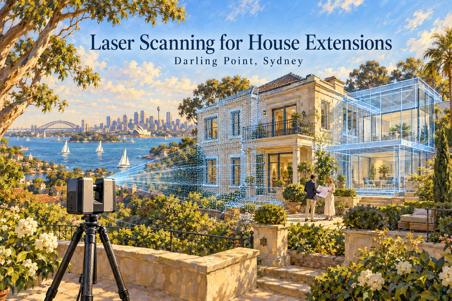
Measure your existing home before designing the extension
A successful house extension starts with understanding the building you already have. Wall positions, floor levels, ceiling heights and roof geometry all influence how the new work connects to the existing home.
Hamilton By Design provides laser scanning for house extensions in Darling Point, Sydney, capturing accessible building surfaces to create a detailed digital record of existing conditions. This information supports architects, building designers, engineers and builders as they plan additions and coordinate construction.
Whether you are extending a living area, adding an upper level or reconfiguring the connection between indoor and outdoor spaces, scanning early can help your project team make decisions using measured information.
Why scan your home before planning an extension?
Existing drawings may be unavailable, incomplete or different from what has actually been built. Previous renovations can also introduce changes that are difficult to recognise from a floor plan alone.
A house may have walls that are slightly out of square, floors at different levels or roof lines that vary across the building. These details become particularly important where an extension joins the existing structure.
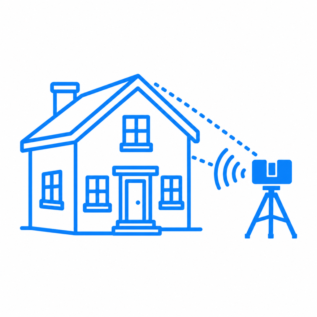
3D laser scanning captures visible surfaces as a point cloud: a digital collection of measured points representing the building’s geometry.
Your project team can use this information to:
- Check dimensions and spatial relationships.
- Understand existing floor and ceiling levels.
- Review wall alignment and opening positions.
- Plan connections between existing and proposed spaces.
- Develop drawings or models of the areas being altered.
- Identify potential clashes before construction.
The greatest value often comes from capturing the home before the extension design is finalised, when adjustments are easier to make.
Focus on where the extension meets the existing home
For a Darling Point house extension, the connection between old and new deserves particular attention. A small misunderstanding at this interface can affect several parts of the design.
Floor levels and thresholds
An extension may need to connect with an existing living room, hallway, kitchen or terrace. Scanning accessible surfaces helps document level changes and the geometry around doorways and thresholds.
This gives the designer a clearer basis for planning transitions between spaces.
Walls, doors and windows
Measured wall positions and opening sizes support the layout of the extension. They also help the project team assess how proposed openings relate to adjoining rooms and external elevations.
Roof lines and ceiling heights
Roof connections can be difficult to interpret using isolated measurements. Where there is suitable visibility, laser scanning can capture external roof geometry, eaves and internal ceiling surfaces.
These measurements support design coordination, while concealed framing and inaccessible roof areas may require separate investigation.
Stairs and circulation
Adding an upper level or changing the internal layout can affect stairs, landings and access routes. A scan provides measured geometry for reviewing available space, headroom and connections between levels.
The designer and relevant consultants remain responsible for assessing the proposed arrangement against applicable requirements.
Laser scanning for Darling Point renovation and extension projects
Every home has a different combination of access, geometry and proposed changes. A targeted scan can concentrate on the rooms and external areas that matter most to the extension, while a broader scan can document more of the property for a substantial renovation.
For Darling Point projects, the scope may include:
- Existing rooms adjoining the proposed extension.
- External walls and accessible façades.
- Courtyards, terraces and balconies.
- Door and window openings.
- Stairs and internal circulation areas.
- Visible roof lines and eaves.
- Interfaces for proposed glazing, joinery or fabricated components.
Access and visibility are reviewed when planning the work. Furniture, vegetation, reflective surfaces and neighbouring buildings can limit what can be captured, so the scanning scope should match the information your design team needs.
From laser scan to drawings and CAD models
Capturing the building is the first stage. The scan data then needs to be prepared for its intended use.
Hamilton By Design can scope deliverables around your project requirements, including:
Registered point cloud
Individual scans are aligned into a coordinated dataset representing the captured areas. The point cloud allows compatible software to display and interrogate the measured building geometry.
Existing-condition drawings
Where included in the agreed scope, scan data can support preparation of selected floor plans, elevations and sections.
These drawings give the project team a documented starting point for developing the extension.
3D CAD modelling
A model of selected building geometry can help communicate spatial relationships and coordinate the areas where proposed work meets existing construction.
The model’s coverage and level of detail are agreed before work begins.
Geometry for component coordination
Scan data can also support checking interfaces for items such as stairs, balustrades, glazing and joinery. Dimensions that are critical to fabrication should be identified early and verified using a method appropriate to the required tolerance.
Deliverables are tailored to the project. Scanning, drawings and modelling should each be clearly defined in the quotation so you know what will be supplied.
A practical process for your house extension
1. Define the proposed work
Share your property location, available drawings and a brief description of the extension. Your architect’s or designer’s information requirements help establish which areas need to be captured.
2. Plan access and scanning coverage
We review internal and external access, occupied areas and any features requiring particular attention. This helps establish a practical capture plan.
3. Scan the existing home
The scanner is positioned at multiple locations to capture overlapping views of accessible surfaces. Coverage is planned around the agreed project scope.
4. Process and review the data
The scans are registered and reviewed before the agreed outputs are prepared. Relevant coverage limitations are identified so the project team understands the dataset.
5. Supply the agreed deliverables
Your project team receives the point cloud and any drawings or models included in the scope, ready for use in the agreed workflow.
Reduce uncertainty before construction begins
An extension involves many decisions that depend on existing dimensions. Capturing those dimensions early can help reduce repeated site visits, clarify design assumptions and reveal geometric issues while the project is still being developed.
A shared dataset also helps the architect, engineer and builder work from consistent information.
Laser scanning cannot reveal concealed foundations, reinforcement, wall cavities or hidden services. Structural assessment, site investigation and approval work remain separate parts of the project. Its role is to provide a clearer record of the visible, accessible building geometry.
Frequently asked questions
When should I arrange laser scanning for a house extension?
Ideally, arrange scanning before detailed design begins. This gives your architect or building designer measured existing-condition information while the layout and connections are still being developed.
Scanning can also be useful during later coordination, although discovering an issue early generally leaves more options for resolving it.
Can you scan an occupied home in Darling Point?
Yes, occupied homes can be scanned, subject to suitable access. Clear views of important walls, openings and floor areas improve coverage. Any furniture movement or access arrangements can be discussed before the visit.
Can laser scanning help if I have no existing house plans?
Yes. A scan can provide measured information from which selected existing-condition drawings can be prepared. Drawing preparation needs to be included in the agreed scope.
Do I need to scan the whole house?
Not always. A smaller extension may only require the adjoining rooms, relevant external elevations and connection areas. A larger renovation may benefit from broader coverage.
The appropriate scope depends on your design team’s needs.
Can the scan capture the roof?
Visible roof surfaces and edges may be captured from suitable scanner positions. Coverage depends on sight lines, access and obstructions. Roof areas that cannot be seen require another agreed capture or measurement method.
How accurate is residential laser scanning?
The accuracy of the delivered dataset depends on the equipment, scanning conditions, coverage, registration and verification process. We discuss the intended use and required tolerances when defining the scope.
Critical dimensions for fabrication or close-fitting connections may need additional checks.
Will my architect be able to use the scan data?
Point clouds can be used in compatible design software. Before scanning, we confirm the required file format and whether your architect needs a point cloud, drawings, a model or a combination of outputs.
Does a laser scan replace a boundary survey?
No. A building scan records captured geometry. Property boundaries, cadastral information and any required survey certification should be addressed by an appropriately qualified surveyor.
Can scanning guarantee that the extension will fit?
Scanning provides measured information to support design and coordination. Fit also depends on how that information is interpreted, the design tolerances, fabrication and construction. Critical interfaces should be checked as part of the project’s verification process.
How much does laser scanning for a house extension cost?
Pricing depends on the areas to be captured, access, site time, processing and the required deliverables. Providing available plans, photographs and a description of the proposed work helps us prepare a quotation suited to your project.
Planning a house extension in Darling Point?
Start with measured information about your existing home.
Contact Hamilton By Design to discuss laser scanning for your Darling Point house extension. Send your property location, available drawings and a brief description of the proposed changes so we can scope the capture and deliverables around your project.
Capture the existing home. Give your design team a clearer starting point.
Laser Scanning for House Extensions in Darling Point, Sydney
Laser Scanning for House Extensions in Darling Point, Sydney
Measure your existing home before designing the extension
A successful house extension starts with understanding the building you already have. Wall positions, floor levels, ceiling heights and roof geometry all influence how the new work connects to the existing home.
Hamilton By Design provides laser scanning for house extensions in Darling Point, Sydney, capturing accessible building surfaces to create a detailed digital record of existing conditions. This information supports architects, building designers, engineers and builders as they plan additions and coordinate construction.
Whether you are extending a living area, adding an upper level or reconfiguring the connection between indoor and outdoor spaces, scanning early can help your project team make decisions using measured information.
Why scan your home before planning an extension?
Existing drawings may be unavailable, incomplete or different from what has actually been built. Previous renovations can also introduce changes that are difficult to recognise from a floor plan alone.
A house may have walls that are slightly out of square, floors at different levels or roof lines that vary across the building. These details become particularly important where an extension joins the existing structure.
3D laser scanning captures visible surfaces as a point cloud: a digital collection of measured points representing the building’s geometry.
Your project team can use this information to:
- Check dimensions and spatial relationships.
- Understand existing floor and ceiling levels.
- Review wall alignment and opening positions.
- Plan connections between existing and proposed spaces.
- Develop drawings or models of the areas being altered.
- Identify potential clashes before construction.
The greatest value often comes from capturing the home before the extension design is finalised, when adjustments are easier to make.
Focus on where the extension meets the existing home
For a Darling Point house extension, the connection between old and new deserves particular attention. A small misunderstanding at this interface can affect several parts of the design.
Floor levels and thresholds
An extension may need to connect with an existing living room, hallway, kitchen or terrace. Scanning accessible surfaces helps document level changes and the geometry around doorways and thresholds.
This gives the designer a clearer basis for planning transitions between spaces.
Walls, doors and windows
Measured wall positions and opening sizes support the layout of the extension. They also help the project team assess how proposed openings relate to adjoining rooms and external elevations.
Roof lines and ceiling heights
Roof connections can be difficult to interpret using isolated measurements. Where there is suitable visibility, laser scanning can capture external roof geometry, eaves and internal ceiling surfaces.
These measurements support design coordination, while concealed framing and inaccessible roof areas may require separate investigation.
Stairs and circulation
Adding an upper level or changing the internal layout can affect stairs, landings and access routes. A scan provides measured geometry for reviewing available space, headroom and connections between levels.
The designer and relevant consultants remain responsible for assessing the proposed arrangement against applicable requirements.
Laser scanning for Darling Point renovation and extension projects
Every home has a different combination of access, geometry and proposed changes. A targeted scan can concentrate on the rooms and external areas that matter most to the extension, while a broader scan can document more of the property for a substantial renovation.
For Darling Point projects, the scope may include:
- Existing rooms adjoining the proposed extension.
- External walls and accessible façades.
- Courtyards, terraces and balconies.
- Door and window openings.
- Stairs and internal circulation areas.
- Visible roof lines and eaves.
- Interfaces for proposed glazing, joinery or fabricated components.
Access and visibility are reviewed when planning the work. Furniture, vegetation, reflective surfaces and neighbouring buildings can limit what can be captured, so the scanning scope should match the information your design team needs.
From laser scan to drawings and CAD models
Capturing the building is the first stage. The scan data then needs to be prepared for its intended use.
Hamilton By Design can scope deliverables around your project requirements, including:
Registered point cloud
Individual scans are aligned into a coordinated dataset representing the captured areas. The point cloud allows compatible software to display and interrogate the measured building geometry.
Existing-condition drawings
Where included in the agreed scope, scan data can support preparation of selected floor plans, elevations and sections.
These drawings give the project team a documented starting point for developing the extension.
3D CAD modelling
A model of selected building geometry can help communicate spatial relationships and coordinate the areas where proposed work meets existing construction.
The model’s coverage and level of detail are agreed before work begins.
Geometry for component coordination
Scan data can also support checking interfaces for items such as stairs, balustrades, glazing and joinery. Dimensions that are critical to fabrication should be identified early and verified using a method appropriate to the required tolerance.
Deliverables are tailored to the project. Scanning, drawings and modelling should each be clearly defined in the quotation so you know what will be supplied.
A practical process for your house extension
1. Define the proposed work
Share your property location, available drawings and a brief description of the extension. Your architect’s or designer’s information requirements help establish which areas need to be captured.
2. Plan access and scanning coverage
We review internal and external access, occupied areas and any features requiring particular attention. This helps establish a practical capture plan.
3. Scan the existing home
The scanner is positioned at multiple locations to capture overlapping views of accessible surfaces. Coverage is planned around the agreed project scope.
4. Process and review the data
The scans are registered and reviewed before the agreed outputs are prepared. Relevant coverage limitations are identified so the project team understands the dataset.
5. Supply the agreed deliverables
Your project team receives the point cloud and any drawings or models included in the scope, ready for use in the agreed workflow.
Reduce uncertainty before construction begins
An extension involves many decisions that depend on existing dimensions. Capturing those dimensions early can help reduce repeated site visits, clarify design assumptions and reveal geometric issues while the project is still being developed.
A shared dataset also helps the architect, engineer and builder work from consistent information.
Laser scanning cannot reveal concealed foundations, reinforcement, wall cavities or hidden services. Structural assessment, site investigation and approval work remain separate parts of the project. Its role is to provide a clearer record of the visible, accessible building geometry.
Frequently asked questions
When should I arrange laser scanning for a house extension?
Ideally, arrange scanning before detailed design begins. This gives your architect or building designer measured existing-condition information while the layout and connections are still being developed.
Scanning can also be useful during later coordination, although discovering an issue early generally leaves more options for resolving it.
Can you scan an occupied home in Darling Point?
Yes, occupied homes can be scanned, subject to suitable access. Clear views of important walls, openings and floor areas improve coverage. Any furniture movement or access arrangements can be discussed before the visit.
Can laser scanning help if I have no existing house plans?
Yes. A scan can provide measured information from which selected existing-condition drawings can be prepared. Drawing preparation needs to be included in the agreed scope.
Do I need to scan the whole house?
Not always. A smaller extension may only require the adjoining rooms, relevant external elevations and connection areas. A larger renovation may benefit from broader coverage.
The appropriate scope depends on your design team’s needs.
Can the scan capture the roof?
Visible roof surfaces and edges may be captured from suitable scanner positions. Coverage depends on sight lines, access and obstructions. Roof areas that cannot be seen require another agreed capture or measurement method.
How accurate is residential laser scanning?
The accuracy of the delivered dataset depends on the equipment, scanning conditions, coverage, registration and verification process. We discuss the intended use and required tolerances when defining the scope.
Critical dimensions for fabrication or close-fitting connections may need additional checks.
Will my architect be able to use the scan data?
Point clouds can be used in compatible design software. Before scanning, we confirm the required file format and whether your architect needs a point cloud, drawings, a model or a combination of outputs.
Does a laser scan replace a boundary survey?
No. A building scan records captured geometry. Property boundaries, cadastral information and any required survey certification should be addressed by an appropriately qualified surveyor.
Can scanning guarantee that the extension will fit?
Scanning provides measured information to support design and coordination. Fit also depends on how that information is interpreted, the design tolerances, fabrication and construction. Critical interfaces should be checked as part of the project’s verification process.
How much does laser scanning for a house extension cost?
Pricing depends on the areas to be captured, access, site time, processing and the required deliverables. Providing available plans, photographs and a description of the proposed work helps us prepare a quotation suited to your project.
Planning a house extension in Darling Point?
Start with measured information about your existing home.
Contact Hamilton By Design to discuss laser scanning for your Darling Point house extension. Send your property location, available drawings and a brief description of the proposed changes so we can scope the capture and deliverables around your project.
Capture the existing home. Give your design team a clearer starting point.

Contact Us – Talk To Us
Our clients:

























Related 3D Scanning Services and Local Projects
Explore residential scanning in nearby suburbs and Sydney services supporting existing-condition capture, CAD modelling and construction coordination.
3D Scanning for Point Piper Property Renovations
Capture existing rooms, stairs and openings before planning property alterations. Measured geometry helps your project team review how proposed components will fit.
Explore Point Piper scanning →3D Scanning Bellevue Hill
Establish existing building geometry before developing renovation layouts or extension designs. As-built data supports checking openings, level changes and connections.
Explore Bellevue Hill scanning →3D Laser Scanning Vaucluse
Measure your home before renovating, extending or adding another level. Capture accessible surfaces to help designers coordinate new work with the existing building.
Explore Vaucluse home scanning →3D Point Cloud Scanning in Sydney
Understand how LiDAR captures existing site geometry as a registered point cloud. This measured dataset can support drawings, modelling and design coordination.
Learn about point cloud scanning →Scan to CAD Sydney
Convert captured site geometry into selected CAD drawings and models. Agree the required outputs so your project team receives information suited to its design workflow.
Explore Scan to CAD services →3D Point Cloud Modelling in Sydney
Develop usable digital geometry from registered scan data. Point cloud modelling supports reviewing spatial relationships, coordinating interfaces and documenting existing conditions.
Explore point cloud modelling →3D Scanning for Construction in Sydney
Discover how capturing existing and installed geometry can support construction planning, coordination and verification at agreed stages of a building project.
Explore construction scanning →3D LiDAR Scanning and Modelling in Sydney
Explore the workflow from terrestrial laser scanning to point cloud processing and optional CAD modelling for Sydney design and upgrade projects.
Explore Sydney LiDAR services →