

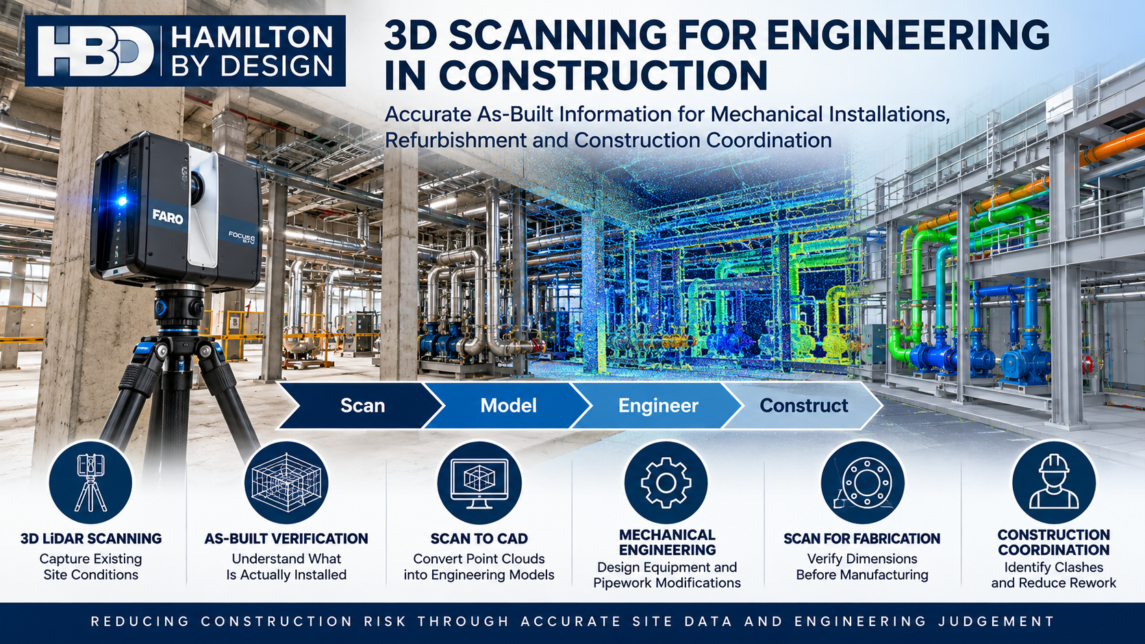
3D Scanning for Engineering in Construction โ€“ Accurate As-Built Information

3D LiDAR scanning for engineering in construction by Hamilton By Design, showing a FARO scanner, as-built point clouds, mechanical installations, scan-to-CAD modelling and construction coordination.

3D LiDAR Scanning | Mechanical Engineering | Construction Coordination | Scan to CAD | Refurbishment and Plant Upgrades

Accurate Existing-Condition Information Before Construction Begins

Blue 3D LiDAR scanner icon on a tripod with scanning waves

Construction projects frequently involve working around existing structures, mechanical equipment, pipework, services and building infrastructure.

Whether installing new equipment, modifying an industrial facility or refurbishing an existing building, one of the greatest engineering challenges is understanding what is actually present on site.

Original construction drawings may be incomplete, outdated or inconsistent with the installed arrangement. Equipment may have been relocated, pipework modified and structures altered over many years.

These uncertainties can lead to dimensional conflicts, fabrication errors, installation delays and expensive rework.

3D scanning for engineering in construction provides a practical method of capturing existing site geometry before design, fabrication and installation activities begin.

At Hamilton By Design, we combine 3D LiDAR scanning, point cloud processing, mechanical engineering and 3D CAD modelling to help construction and engineering teams make better-informed decisions.

Our approach follows a straightforward engineering workflow:

Scan โ†’ Model โ†’ Engineer โ†’ Upgrade

Rather than treating scanning as an isolated surveying activity, we use captured site information to support practical engineering outcomes.


1. How Is 3D Scanning Used for Engineering in Construction Projects?

3D scanning is used in construction to capture the geometry of existing buildings, industrial facilities, mechanical installations and structural interfaces.

A terrestrial 3D LiDAR scanner records millions of spatial measurements to generate a three-dimensional point cloud representing visible site conditions.

This information can support:

  • Existing-condition and as-built documentation.
  • Mechanical equipment installation and replacement.
  • Pipework modifications and routing.
  • Conveyor and materials-handling upgrades.
  • Plant refurbishment and brownfield construction.
  • Equipment access and maintenance planning.
  • Construction coordination and clash identification.
  • Development of 2D drawings and 3D engineering models.

For example, when installing a new pump skid inside an operating industrial facility, the project team may need to establish available floor space, pipework connection locations, structural clearances and maintenance access.

A registered point cloud provides a common spatial reference for developing and checking the proposed installation.

This can reduce reliance on repeated manual measurements and assumptions about existing site geometry.

Engineering Application: Mechanical Equipment Installation

Consider a construction project involving the replacement of existing mechanical equipment.

Before the new equipment is fabricated or delivered, engineers may need to confirm:

  • Equipment footprint and mounting locations.
  • Existing pipework connections and flange positions.
  • Structural obstructions.
  • Available lifting and installation clearances.
  • Access for operation and maintenance.

3D scanning provides geometric information that can be incorporated into a CAD environment to support these assessments.

However, scanning does not replace engineering verification of loading, structural capacity, tolerances or installation requirements.


2. What Are the Benefits of 3D Laser Scanning for Accurate As-Built Information in Construction?

One of the principal benefits of 3D laser scanning is the ability to establish a detailed digital record of existing site conditions.

Traditional drawings often represent the original design intent rather than the actual installed arrangement.

During construction, small differences between drawings and site conditions can become significant when equipment, pipework or prefabricated components must fit within constrained spaces.

Benefits of 3D Scanning for Construction

Construction challenge3D scanning contribution
Outdated construction drawingsCaptures visible existing geometry for comparison and documentation
Limited access to existing equipmentRecords accessible surfaces and surrounding spatial relationships
Pipework installation conflictsSupports identification of routing and clearance constraints
Mechanical equipment replacementHelps establish existing interfaces and installation envelopes
Fabrication dimensional uncertaintyProvides reference geometry for design and dimensional checks
Restricted maintenance accessSupports assessment of equipment removal and maintenance envelopes
Multiple construction disciplinesProvides a common spatial reference for coordination
Brownfield modificationsHelps identify existing obstructions before construction

Understanding Scanning Accuracy

Accuracy should always be considered in the context of the engineering application.

A scanner’s individual measurement specification is not necessarily the accuracy of a complete registered point cloud.

For industrial scanning projects, overall accuracy depends on factors including:

  • Scanner capability and calibration.
  • Distance to the measured surfaces.
  • Surface characteristics and visibility.
  • Scan registration methodology.
  • Site geometry and environmental conditions.
  • Control survey arrangements where required.

For typical industrial projects, Hamilton By Design may work with registered datasets having practical accuracy expectations in the order of several millimetres, depending on site conditions and the scanning methodology.

Critical fabrication interfaces, machined surfaces, bolt-hole patterns and tight-tolerance connections may require additional dimensional verification using appropriate measurement equipment.

This distinction is important because reliable engineering outcomes depend on selecting a measurement method appropriate to the required tolerance.


3. How Does 3D Scanning Improve Mechanical Installation and Construction Coordination?

Mechanical installation projects frequently require new equipment to interface with existing structures and services.

These interfaces can become particularly challenging in operating factories, processing plants, warehouses and other established facilities.

3D scanning improves construction coordination by allowing engineers and contractors to assess proposed equipment arrangements against captured existing geometry.

Mechanical Equipment and Pipework

Point cloud information can be used to develop or position 3D CAD models of:

  • Pump skids and mechanical equipment.
  • Pipework and supporting structures.
  • Conveyors and transfer stations.
  • Mechanical platforms and access arrangements.
  • Industrial ventilation equipment.
  • Equipment guarding and maintenance access.
  • Structural support interfaces.

The proposed equipment model can then be reviewed alongside the point cloud to identify potential geometric conflicts.

Construction Coordination and Clash Detection

For construction projects involving several disciplines, a shared digital model can improve communication between mechanical engineers, structural engineers, building contractors and installation teams.

For example, a proposed pipework route may conflict with an existing beam, cable tray, ventilation duct or maintenance access zone.

Identifying these conflicts during design is generally preferable to discovering them during installation.

Hamilton By Design can develop CAD models from point cloud data and provide model information suitable for coordination workflows using software such as Autodesk Navisworks.

The objective is not simply to create a digital model. It is to identify construction constraints before they become site problems.

Example: Installing New Equipment in an Existing Factory

Consider a project requiring the installation of a new production machine.

The design team may need to coordinate the machine footprint, access requirements, existing services, mechanical connections and supporting infrastructure.

By scanning the installation area and incorporating the proposed equipment model, the team can review the installation arrangement before fabrication and mobilisation.

This supports more informed decisions about equipment positioning, service modifications and construction sequencing.


4. Can 3D LiDAR Scanning Reduce Construction Errors During Refurbishment and Plant Upgrades?

Yes. When appropriately planned and verified, 3D LiDAR scanning can help reduce construction errors associated with inaccurate existing-condition information.

Refurbishment and brownfield construction projects are particularly exposed to dimensional uncertainty because the original facility may have undergone numerous undocumented modifications.

Refurbishment and Brownfield Construction

Typical applications include:

Industrial Plant Upgrades

Capturing existing mechanical equipment, conveyors, platforms, pipework and supporting infrastructure before modifications are designed.

Commercial Building Refurbishment

Recording existing plantrooms, mechanical service spaces and building interfaces to assist with proposed equipment replacements.

Mechanical Services Modifications

Supporting the development of new pipework routes, ventilation arrangements and equipment layouts within existing facilities.

Construction of Equipment Supports

Establishing existing interface geometry before new mechanical support arrangements are designed and detailed.

Shutdown and Installation Planning

Providing dimensional information to help plan equipment removal, replacement and installation activities.

Reducing Rework Through Better Engineering Information

Construction rework can occur when fabricated components do not match existing site conditions.

For example, a prefabricated pipe spool may be manufactured using outdated dimensions.

When the spool arrives on site, the existing connection points may not align with the assumed arrangement.

A properly scoped 3D scanning and dimensional verification process can help identify these discrepancies before fabrication.

However, the point cloud must be sufficiently complete and accurate for the intended engineering purpose.

Where critical dimensions cannot be reliably established from the scan, additional site measurements should be undertaken.

3D scanning helps reduce geometric uncertainty, but it does not eliminate the need for engineering judgement, appropriate tolerances and construction verification.


5. Who Provides 3D Scanning and Mechanical Engineering Services for Construction Projects in Australia?

Hamilton By Design provides 3D LiDAR scanning, point cloud processing, 3D CAD modelling and mechanical engineering services for industrial and commercial construction projects across Australia.

Our services are particularly relevant where construction activities involve existing mechanical equipment, plant modifications, industrial refurbishment and coordination between new and existing infrastructure.

Unlike workflows that stop at the delivery of a point cloud, Hamilton By Design can assist with subsequent mechanical design and drafting activities.

Our Construction Engineering Services

ServiceEngineering application
3D LiDAR scanningCapture existing site conditions
Point cloud registrationCombine individual scans into a coordinated dataset
Scan to CADDevelop CAD geometry from captured information
Mechanical engineering designDevelop equipment modifications and mechanical arrangements
3D CAD modellingModel equipment, pipework and installation interfaces
General arrangement drawingsCommunicate proposed equipment layouts and interfaces
Fabrication drawingsDetail mechanical components for manufacture where included in scope
Construction coordinationReview proposed installations against existing geometry
Reverse engineeringReconstruct existing components or equipment geometry
Engineering design reviewAssess relevant mechanical constraints and design requirements

Our mechanical engineering services can support projects involving industrial facilities, manufacturing plants, materials-handling systems and commercial mechanical installations.

Where structural design, certification or specialist engineering services are required, these should be undertaken or verified by appropriately qualified professionals within the relevant discipline.


From Point Cloud to Construction-Ready Engineering Information

A successful scanning project should begin with an understanding of the engineering decision the information must support.

At Hamilton By Design, we approach construction scanning through five stages.

Stage 1 โ€“ Define the Engineering Requirements

Identify the proposed construction activity, required deliverables, critical interfaces, accuracy expectations and access constraints.

Stage 2 โ€“ Capture Existing Site Conditions

Undertake 3D LiDAR scanning of the relevant installation area, including visible equipment, pipework, structural interfaces and surrounding obstructions.

Stage 3 โ€“ Register and Process the Point Cloud

Process the captured scans into a coordinated point cloud dataset suitable for engineering review and modelling.

Stage 4 โ€“ Develop Engineering Models and Drawings

Use the point cloud as a reference to develop 3D CAD models, equipment arrangements, general arrangement drawings and other agreed engineering deliverables.

Stage 5 โ€“ Support Construction and Installation

Provide the agreed engineering information to assist fabrication planning, installation coordination and construction review.

Where required, additional dimensional checks can be incorporated before critical fabrication or installation activities.

This workflow helps connect digital site capture with practical engineering outcomes.


3D Scanning Compared with Traditional Site Measurement

Both traditional measurement and 3D scanning have important roles in construction engineering.

ConsiderationTraditional site measurement3D LiDAR scanning
Data captureSelected individual dimensionsDense spatial measurements of visible surfaces
Complex geometryMay require numerous measurementsCan capture extensive geometric detail
Site documentationNotes, sketches and photographsRegistered point clouds and associated imagery where available
Design coordinationBased on recorded dimensionsSupports spatial review with CAD models
Repeat measurementsMay require additional site visitsExisting scan data may permit later measurements where geometry was adequately captured
Critical tolerancesPrecision tools can directly verify featuresAdditional verification may still be necessary
Engineering deliverablesDrawings and dimensional recordsPoint clouds, CAD models and drawings as scoped

The most effective approach is often a combination of both methods.

3D scanning captures the broader installation environment, while conventional dimensional measurement verifies critical interfaces.


Where Is 3D Scanning Most Valuable in Construction?

3D scanning can be particularly valuable when a project involves:

  • An existing facility with incomplete or outdated drawings.
  • Installation of equipment within restricted spaces.
  • Multiple mechanical and structural interfaces.
  • Complex pipework routing.
  • Prefabricated components requiring accurate site interfaces.
  • Construction activities during limited shutdown periods.
  • Brownfield modifications and equipment replacement.
  • Coordination between engineering disciplines.

The value of scanning increases when the captured information is used early enough to influence engineering design and construction planning.

Scanning after a dimensional conflict has already occurred may help diagnose the problem, but scanning before fabrication provides an opportunity to avoid it.


Frequently Asked Questions About 3D Scanning in Construction

Is 3D scanning suitable for existing industrial buildings?

Yes. 3D LiDAR scanning can capture visible geometry within factories, warehouses, mechanical plantrooms and industrial facilities to support refurbishment and modification projects.

Can a point cloud be converted into a SolidWorks or AutoCAD model?

Yes. Point cloud data can be used as a reference for developing CAD models in software such as SolidWorks and AutoCAD. The level of modelling detail depends on the engineering scope and intended deliverables.

Does 3D scanning replace construction drawings?

No. A point cloud represents measured site geometry. Engineering drawings communicate design intent, dimensions, materials, tolerances and fabrication or installation requirements. The two serve different purposes.

Can 3D scanning help with prefabricated pipework?

Yes. Scanning can support the identification of existing pipework routes, surrounding obstructions and connection locations. Critical flange dimensions, orientations and fabrication tolerances should be independently verified as required.

Can 3D scanning identify construction clashes?

Yes. By reviewing proposed CAD geometry against a suitably complete and registered point cloud, engineers can identify potential spatial conflicts. This does not guarantee detection of every clash, particularly where existing features are concealed or insufficiently captured.

Is 3D scanning suitable for small construction projects?

Yes. The value depends on the complexity of the existing conditions, dimensional risks and intended engineering deliverables rather than project size alone.

Does Hamilton By Design provide both scanning and engineering?

Yes. Hamilton By Design provides 3D LiDAR scanning, point cloud processing, mechanical engineering design, CAD modelling and drafting services, allowing captured site information to support subsequent engineering activities.


Supporting Construction Projects Across Australia

Hamilton By Design is based on the NSW Central Coast and provides engineering and 3D scanning services for projects across New South Wales and interstate.

Our services support clients in locations including Sydney, Newcastle, the Hunter Valley, regional NSW and other Australian industrial centres.

Projects may include industrial facilities, manufacturing plants, mechanical installations, processing facilities and commercial refurbishment works.

The scope of each engagement is developed around the site’s access conditions, engineering requirements and deliverables.


Why Choose Hamilton By Design?

Construction projects require more than dimensional information.

They require engineering decisions based on reliable existing-condition data.

Hamilton By Design combines practical industrial experience with 3D scanning and mechanical engineering capabilities to support the transition from site measurement to design development.

Our focus is on:

  • Understanding the intended engineering application before scanning.
  • Capturing the geometry relevant to the proposed modification.
  • Recognising the limitations of point cloud accuracy and visibility.
  • Developing practical mechanical engineering models and drawings.
  • Identifying potential construction and installation constraints.
  • Supporting informed decisions before fabrication and installation.

The objective is to reduce uncertainty between what exists on site, what is designed and what must ultimately be constructed.


Planning a Construction Project or Mechanical Installation?

If your project involves mechanical equipment installation, plant refurbishment, pipework modifications or construction coordination, accurate existing-condition information can help establish a more reliable starting point.

Hamilton By Design can assist with 3D LiDAR scanning, point cloud processing, mechanical engineering and CAD modelling to support your project requirements.

Contact Hamilton By Design to discuss your construction scanning and engineering requirements.

Hamilton By Design โ€“ Scan โ†’ Model โ†’ Engineer โ†’ Upgrade


Hamilton By Design logo displayed on a blue tilted rectangle with a grey gradient background

Contact Us – Talk To Us

Name
Would you like us to arrange a phone consultation for you?
Address

Our clients:
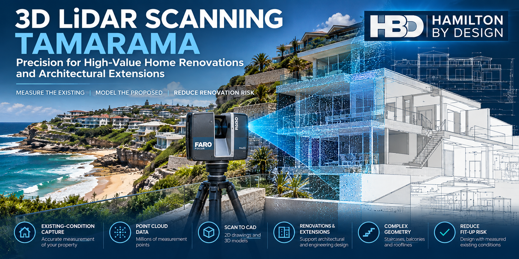


3D LiDAR Scanning Tamarama โ€“ Precision for High-Value Home Renovations and Architectural Extensions

3D LiDAR scanning Tamarama Sydney showing a FARO laser scanner capturing a coastal home, with point cloud data and architectural CAD modelling overlays.

Accurate Existing-Condition Measurements Before You Renovate

Planning a renovation, home extension or architectural alteration in Tamarama?

Blue 3D LiDAR scanner icon on a tripod with scanning waves

Hamilton By Design provides professional 3D LiDAR scanning in Tamarama, Sydney, helping homeowners, architects, builders and designers understand the existing geometry of residential buildings before design and construction begin.

Using terrestrial laser scanning technology, we capture millions of three-dimensional measurement points to create a digital record of accessible building surfaces.

This information can be used to develop point clouds, 2D drawings and 3D CAD models for architectural planning, engineering coordination and building modifications.

Whether you are extending an established coastal residence, modifying a multi-level home or preparing documentation for a major renovation, understanding the existing building is an important first step.

Measure the existing building. Reduce assumptions. Design with greater confidence.

Why 3D Laser Scanning Is Valuable for Tamarama Properties

Tamarama is one of Sydney’s distinctive coastal residential suburbs, located between Bondi and Bronte.

With a reported median house sale price of approximately $9 million in 2026, property renovations can involve substantial financial commitments.

High property values do not automatically make every renovation complex. However, where substantial alterations are proposed, inaccurate existing-condition information can create unnecessary design changes, fabrication problems and construction delays.

Tamarama properties may present challenges including:

  • Multi-storey homes constructed on sloping sites.
  • Restricted access between neighbouring buildings.
  • Existing structures with incomplete or outdated drawings.
  • Complex rooflines, balconies, terraces and staircases.
  • Irregular building geometry and changes in floor levels.
  • Architectural alterations requiring accurate dimensional coordination.
  • Coastal exposure and existing construction requiring specialist consideration.
  • Limited space for construction equipment and material handling.

3D LiDAR scanning helps document visible existing geometry before designers commit to proposed modifications.

For renovations involving structural alterations, the scanning information can assist the relevant engineers with geometric coordination. Structural adequacy, material condition and design compliance require separate engineering assessment.

What Is 3D LiDAR Scanning?

3D LiDAR scanning is a non-contact measurement process that uses laser technology to capture the visible geometry of buildings and structures.

A terrestrial laser scanner records millions of spatial measurements from multiple positions.

These measurements are combined into a registered three-dimensional dataset known as a point cloud.

The point cloud can be viewed digitally, measured within the limitations of the dataset and used as a reference for developing drawings and CAD models.

How Does 3D Scanning Help With Home Renovations?

Traditional building drawings may not accurately represent the current condition of an older or previously modified property.

3D scanning can help establish:

  • Existing wall positions and building geometry.
  • Floor-to-ceiling heights and level changes.
  • Staircase geometry and available clearances.
  • Roof profiles and accessible structural interfaces.
  • Existing plant and equipment locations.
  • Geometric relationships between different building areas.

This information allows designers to work with measured conditions rather than relying solely on assumptions or historical drawings.

3D LiDAR Scanning Services in Tamarama

1. Residential 3D Laser Scanning

Hamilton By Design captures accessible interior and exterior building geometry to support residential renovation projects.

Applications include existing homes, apartments, multi-level residences, extensions and alterations.

2. Scan to CAD and Existing-Condition Modelling

Registered point cloud data can be converted into selected CAD geometry and drawings.

Depending on project requirements, deliverables may include:

  • AutoCAD 2D general arrangement drawings.
  • SolidWorks 3D models.
  • Selected building geometry and component models.
  • Existing-condition plans, elevations and sections.
  • CAD exchange files for design coordination.

The level of modelling detail is agreed before work begins.

3. Home Extensions and Architectural Alterations

When new construction must connect to an existing building, dimensional coordination becomes particularly important.

3D scanning can support the planning of:

  • Second-storey additions.
  • Rear and side extensions.
  • Staircase alterations.
  • Roof modifications.
  • Balcony and terrace alterations.
  • New mechanical installations.
  • Architectural features with complex geometry.

Scanning documents existing geometry; it does not replace structural design, planning approvals or construction certification.

4. Complex Staircase and Building Geometry

Established residential buildings can include curved staircases, irregular walls, sloping ceilings and non-standard architectural details.

Laser scanning can capture visible geometric features that may be difficult or time-consuming to document through manual measurement alone.

This information can support the development of CAD geometry for further design work.

5. Mechanical Engineering and Equipment Coordination

Hamilton By Design combines 3D scanning with mechanical engineering and CAD modelling capabilities.

For residential projects, this may include scanning and modelling existing mechanical equipment, plant rooms, equipment supports and accessible service routes.

Structural engineering, architectural certification and regulated building design are undertaken by appropriately qualified practitioners where required.

Why Tamarama Homeowners and Architects Choose 3D Scanning

Protect the Design Process

When modifying an existing building, inaccurate dimensions can lead to changes after design work has commenced.

A measured point cloud provides a more detailed geometric reference for planning.

Reduce Construction Fit-Up Risk

New components, staircases, equipment and architectural features may need to fit within existing spaces.

Scanning can help identify clearances and geometric constraints before fabrication or installation.

Improve Communication Between Project Participants

A shared digital reference can help homeowners, architects, engineers and builders discuss the same existing-condition information.

Support More Efficient Design Decisions

Rather than repeatedly returning to site to confirm accessible dimensions, project teams can refer to the captured dataset, subject to its completeness and measurement limitations.

Document Existing Conditions

A point cloud provides a dated digital record of accessible building geometry before renovation works commence.

Hamilton By Design โ€“ From Site Scanning to Engineering Models

Hamilton By Design is an Australian mechanical engineering and 3D scanning business providing site measurement, point cloud processing, CAD modelling and engineering design services.

Our workflow combines digital measurement with practical engineering experience.

Step 1 โ€“ Understand the Renovation

We establish the project requirements, intended modifications, building access and required deliverables.

Step 2 โ€“ Capture the Building

Using a FARO Focus S70 terrestrial laser scanner, we collect point cloud data from accessible areas.

Multiple scanner positions may be required to capture complex building geometry.

Step 3 โ€“ Register and Review the Point Cloud

Individual scans are aligned into a coordinated dataset.

We review the registration and identify areas where access restrictions, obstructions or limited scan coverage may affect the information.

Step 4 โ€“ Develop CAD Models and Drawings

Where requested, the point cloud is used to develop selected CAD models, plans, elevations or engineering details.

Step 5 โ€“ Deliver the Information

The agreed digital files and drawings are supplied for use by the project team.

Assumptions, exclusions and relevant measurement limitations are identified as appropriate to the deliverables.

What Digital Files Can Be Supplied?

File formatTypical application
E57Point cloud exchange and coordination
RCP / RCSAutodesk point cloud workflows
LASPoint cloud data exchange
DWG / DXF2D CAD drawings
STEP3D geometry exchange
ParasolidCAD geometry exchange
SolidWorks3D mechanical modelling
PDFGeneral arrangement and technical drawings

Deliverables are tailored to the project.

Some clients require only registered point cloud data. Others require 2D drawings, selected CAD geometry or detailed mechanical models.

How Accurate Is 3D LiDAR Scanning?

Accuracy depends on scanner performance, distance, surface characteristics, scan registration, site conditions and the intended use of the information.

Under suitable conditions, individual terrestrial scan measurements can achieve millimetre-level precision.

For Hamilton By Design projects, typical registered point cloud datasets may have overall uncertainty in the order of ยฑ5โ€“10 mm, depending on the scanning arrangement and site conditions.

These values are indicative and must not be treated as guaranteed tolerances for every feature.

Projects involving close-fitting components, fabrication or critical connection details may require additional verification or higher-precision measurement.

3D LiDAR scanning is not automatically equivalent to a registered land survey, structural certification or fabrication-level dimensional inspection.

Who Benefits From 3D Scanning in Tamarama?

Homeowners

Understand the existing geometry of a property before committing to substantial renovation or extension work.

Architects

Obtain measured reference data for existing-condition documentation, alterations and architectural coordination.

Residential Builders

Use captured building geometry to assist with planning, identifying dimensional constraints and coordinating proposed construction.

Interior Designers

Document room geometry, staircases, ceiling profiles and existing architectural features.

Engineers

Use point cloud information as a geometric reference for design coordination and specialist assessments.

Property Developers and Project Managers

Improve visibility of existing conditions and assist communication between project stakeholders.

Frequently Asked Questions About 3D LiDAR Scanning in Tamarama

Can Hamilton By Design scan a house in Tamarama?

Yes. Hamilton By Design provides project-based 3D LiDAR scanning services for residential properties in Tamarama and surrounding Sydney suburbs, subject to access and scheduling.

Can you scan a house before a second-storey extension?

Yes. We can capture accessible rooflines, walls, floor geometry and other relevant existing features to support architectural and engineering coordination.

Can you create drawings from an existing house without original plans?

Yes. Point cloud data can be used to develop selected existing-condition drawings and CAD models. The required level of detail should be agreed before scanning.

Is 3D scanning useful for expensive residential renovations?

Yes. Where a renovation involves complex existing geometry or significant new-to-existing interfaces, scanning can reduce dimensional uncertainty during design. It does not eliminate construction risk or replace specialist inspections.

Can 3D scanning capture curved staircases?

Yes. Laser scanning can capture accessible curved and irregular surfaces. Further CAD modelling may be required to produce useful design or fabrication geometry.

How long does a residential 3D scan take?

The time depends on building size, number of levels, access, required scan coverage and site complexity. A project-specific assessment is required before confirming the scanning duration.

Can you supply the point cloud to my architect?

Yes. We can provide agreed point cloud formats for use in compatible software, including Autodesk workflows.

Does 3D LiDAR scanning replace a land survey?

No. Property boundaries, cadastral matters and other regulated surveying requirements must be addressed by an appropriately registered surveyor.

Can 3D scanning identify structural defects?

Not reliably on its own. Scanning captures visible geometry and may document apparent deformation, but identifying structural defects and determining structural adequacy require separate engineering investigation.

Do you service Bondi, Bronte and surrounding suburbs?

Yes. Hamilton By Design provides project-based scanning services across Sydney, including Tamarama, Bondi, Bronte and surrounding Eastern Suburbs locations.

3D LiDAR Scanning Across Sydney’s Eastern Suburbs

Hamilton By Design supports residential and architectural projects across Sydney, including:

  • Tamarama
  • Bondi
  • Bronte
  • Bondi Junction
  • Bellevue Hill
  • Double Bay
  • Rose Bay
  • Vaucluse
  • Darling Point
  • Point Piper

Services are provided on a project basis, with scope and site access confirmed before mobilisation.

Request a 3D LiDAR Scanning Quotation โ€“ Tamarama NSW

Planning a residential renovation, extension or architectural modification?

Hamilton By Design can help capture the existing building geometry and develop the point cloud or CAD information needed for the next stage of your project.

For an initial quotation, please provide:

  • Property location and approximate building size.
  • Number of levels.
  • Description of the proposed renovation.
  • Areas requiring scanning.
  • Required file formats or CAD deliverables.
  • Preferred site access and delivery dates.

Hamilton By Design

3D LiDAR Scanning | Point Cloud Processing | Scan to CAD | Mechanical Engineering

Website: https://www.hamiltonbydesign.com.au/

Measure the existing. Model the proposed. Reduce uncertainty before construction.


Hamilton By Design logo displayed on a blue tilted rectangle with a grey gradient background

Contact Us – Talk To Us

Name
Would you like us to arrange a phone consultation for you?
Address

Our clients:
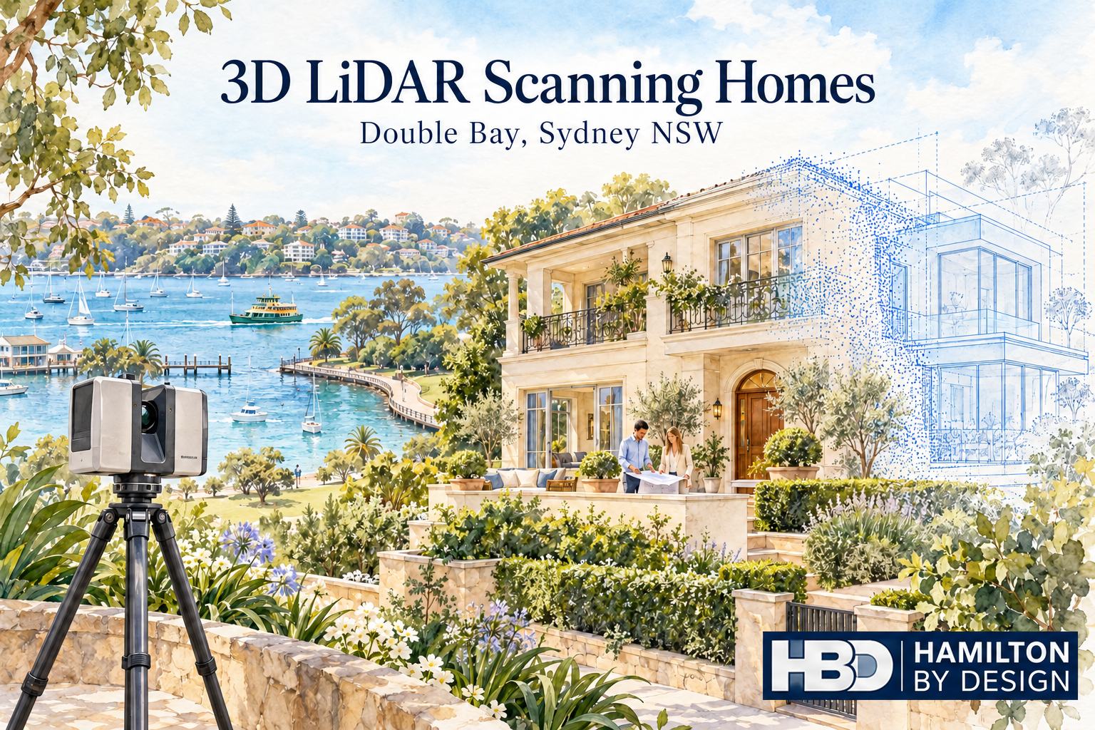


3D LiDAR Scanning Homes in Double Bay, Sydney NSW

Watercolour of a LiDAR scanner capturing a Double Bay home, with a blue point-cloud overlay, harbour views and Hamilton By Design logo.

Understand your home before planning changes

Blue outline icon of a tripod-mounted LiDAR scanner scanning a residential house.

Planning a renovation, extension or internal redesign in Double Bay? Before preparing detailed drawings, it helps to establish how your home is built today.

Original plans may be missing or may no longer reflect previous alterations. Walls, openings, floor levels and ceiling heights can differ from what appears on an old drawing.

Hamilton By Design provides 3D LiDAR scanning for homes in Double Bay, Sydney NSW, capturing visible, accessible building surfaces to create a measured digital record. This information helps architects, building designers, engineers and builders develop proposed changes around existing conditions.

Whether you are opening up a living area, replacing a staircase or extending your home, scanning provides a practical starting point for design.

What is residential 3D LiDAR scanning?

A terrestrial LiDAR scanner measures building surfaces from a series of stationary positions. Individual scans are combined into a registered point cloud, representing the geometry captured throughout the property.

Unlike a collection of separate room measurements, a coordinated point cloud allows the project team to review adjoining spaces together. This helps explain how rooms, openings and levels relate to one another.

Depending on access and the agreed scope, residential scanning can capture:

  • Internal walls, floors and ceilings.
  • Door and window openings.
  • Stairs, landings and surrounding spaces.
  • Visible beams, columns and bulkheads.
  • External faรงades and accessible roof geometry.
  • Balconies, terraces and courtyards.
  • Visible services and equipment.
  • Areas where proposed construction will connect to the existing home.

The dataset can then support selected existing-condition drawings or 3D CAD modelling where these outputs are commissioned.

Why scan a Double Bay home before renovating?

A renovation often changes how several spaces work together. Removing a wall, enlarging an opening or changing a staircase can affect adjoining rooms, circulation and the position of new fixtures.

Understanding these relationships early gives the designer more useful information when assessing options.

Replace assumptions with measured geometry

A room that appears rectangular may have walls that are slightly out of square. A ceiling may change height around a bulkhead. An opening may be positioned differently from the original plans.

These details can affect cabinetry, glazing, stairs and other components that must fit the existing building.

Scanning helps document accessible geometry so the design team can identify where closer checks are needed.

Review adjoining rooms together

For a kitchen and living room renovation, individual room dimensions may not explain the whole layout.

A registered point cloud can show the relationship between the kitchen, hallway, living area and outdoor opening. This helps the designer assess proposed layouts within the wider space.

Keep a record before demolition

Once walls, ceilings or fittings are removed, their original positions may be difficult to reconstruct.

A pre-renovation scan preserves a measured record of the surfaces captured. The project team can return to that information when reviewing an original opening, room arrangement or connection detail.

Applications for home scanning in Double Bay

Kitchen and living area alterations

Changing the kitchen layout or creating an open living area requires an understanding of existing wall positions, openings, ceiling geometry and floor levels.

Scanning can provide the spatial reference for developing the proposed layout. Structural decisions about removing walls require assessment by the appropriate engineer.

For custom cabinetry, critical installation dimensions should be checked to the tolerances required by the supplier.

House extensions

An extension must connect with the home already on site.

Scanning the adjoining rooms and relevant external surfaces helps document the geometry around floor transitions, doorways, eaves and accessible roof junctions.

This information supports the design of the connection between existing and proposed construction.

Staircase replacements

A new staircase needs to work within the available opening and connect with actual floor levels.

Capturing the stairwell, adjoining landings, nearby doors and ceiling surfaces helps the project team review the available space. Stair design, structural adequacy and compliance remain part of the relevant professional assessment.

Glazing, doors and joinery

Large windows, sliding doors and fitted joinery can depend on the relationship between several existing surfaces.

Scan data can support coordination and modelling of those interfaces. Where components require a close fit, targeted dimensional verification should form part of the agreed workflow.

Balconies and terraces

A renovation may involve changes to a balcony, terrace or the opening between indoor and outdoor areas.

Scanning accessible surfaces can help document thresholds, edges, nearby walls and level changes. Waterproofing, drainage, structural design and other specialist requirements need separate assessment.

Building services alterations

Visible pipework, ductwork and equipment can be captured where accessible. This can help coordinate proposed changes around existing services.

LiDAR does not reveal pipes, wiring or framing concealed behind walls and ceilings.

A practical example: redesigning a kitchen and terrace connection

Imagine renovating a Double Bay home to create a larger kitchen and improve access to an outdoor terrace.

The proposal includes new cabinetry, a wider glazed opening and a revised internal layout. The designer needs to understand how the kitchen floor, ceiling, adjoining walls and terrace threshold relate to one another.

A targeted scan can capture these accessible areas together before the design is finalised.

The project team can then use the point cloud and any commissioned drawings to review the layout and identify interfaces needing further investigation. Before ordering glazing or cabinetry, the relevant supplier can verify the critical dimensions.

This approach helps bring measurement questions into the design stage, when adjustments are easier to make.

From a home scan to useful project information

The right deliverable depends on who will use the data and what they need to do with it.

Some designers can work directly with point clouds. Others require selected drawings or a model of the building areas being changed.

Hamilton By Design can scope the following outputs around your project.

Registered point cloud

A coordinated dataset representing the captured surfaces, supplied in an agreed format compatible with the project teamโ€™s software.

Existing-condition drawings

Selected floor plans, elevations or sections prepared from the scan data where included in the quotation.

3D CAD models

Models of agreed building geometry to support layout review, communication and coordination.

Selected interface documentation

Drawings or modelled geometry focused on particular openings, stairs or connections relevant to the proposed work.

Scanning, drawing preparation and modelling are defined in the agreed scope. This makes clear which areas will be captured and what information will be supplied.

How we plan residential scanning

1. Understand the proposed changes

Share your property location, available plans and a description of the work. Your architect or designerโ€™s requirements help determine the capture areas and outputs.

2. Identify important interfaces

We discuss the dimensions and connections that matter most to the project, including any fabrication requirements or restricted areas.

3. Arrange access

Clear sight lines improve capture. Furniture, stored items and vegetation may obscure surfaces, so preparation is considered before the visit.

4. Capture the agreed areas

The scanner is positioned at multiple locations to collect overlapping views of accessible building surfaces.

5. Process and prepare the deliverables

The scans are registered and reviewed before the agreed point cloud, drawings or models are prepared. Relevant coverage limitations are communicated to the project team.

When should you scan your home?

For most renovation and extension projects, scanning is useful before detailed design is finalised and before demolition starts.

Capturing early allows the existing geometry to inform the proposal.

Further scanning may be appropriate after demolition exposes additional surfaces, before installing selected components or at completion. Each visit should have a defined purpose and an agreed scope.

Frequently asked questions

Can you scan an occupied home in Double Bay?

Yes, subject to suitable access arrangements. Furniture and personal items may obstruct surfaces, so we discuss the areas that need clear views before scanning.

Can I arrange scanning if I have no existing plans?

Yes. Scanning can provide measured information from which selected existing-condition drawings can be prepared. Those drawings need to be included in the agreed scope.

Do I need to scan the entire property?

Not necessarily. A focused renovation may only require the affected rooms and adjoining interfaces. A substantial extension or redesign may benefit from broader coverage.

How accurate is 3D LiDAR scanning?

Accuracy depends on the equipment, site conditions, scan positions, registration and the feature being measured.

The intended use and required tolerances should be discussed before capture. Critical fabrication dimensions may require additional verification.

Can the scanner see through walls?

No. LiDAR captures surfaces visible to the scanner. Concealed framing, wiring, pipes and other hidden features require access or a separate investigation method.

Will I automatically receive floor plans?

Floor plans, elevations, sections and models are additional outputs that must be included in the agreed scope. A point cloud is the underlying measured dataset.

Can my architect use the scan?

Yes, provided the deliverables suit their software and workflow. We confirm the required formats and outputs before work begins.

Does scanning confirm whether a wall can be removed?

No. Scanning can document visible wall positions and surrounding geometry. Determining whether a wall is load-bearing requires assessment by an appropriately qualified professional.

Does residential scanning replace a boundary survey?

No. Capturing building geometry does not establish legal property boundaries. Boundary and cadastral survey requirements should be addressed by an appropriately qualified surveyor.

How much does scanning a home in Double Bay cost?

The price depends on property size, capture areas, access, processing and the required drawings or models. Available plans, photographs and a project brief help establish an appropriate quotation.

Explore our nearby residential scanning posts:

Planning changes to your Double Bay home?

Give your project team a measured starting point before committing to detailed design.

Contact Hamilton By Design to discuss 3D LiDAR scanning for your home in Double Bay, Sydney NSW.

Send your property location, available drawings and a brief description of the proposed changes so we can define the capture areas and deliverables your project needs.


Hamilton By Design logo displayed on a blue tilted rectangle with a grey gradient background

Contact Us – Talk To Us

Name
Would you like us to arrange a phone consultation for you?
Address

Our clients:

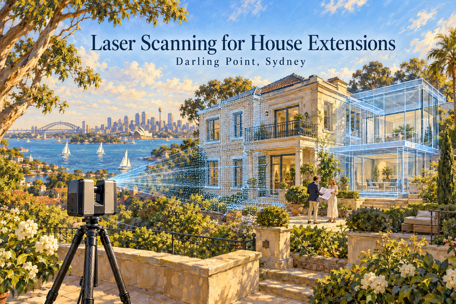
Laser Scanning for House Extensions in Darling Point, Sydney

Oil painting of a LiDAR scanner capturing a Darling Point home, with a blue point cloud, proposed extension and Sydney Harbour in the background.

Measure your existing home before designing the extension

Blue outline icon of a tripod-mounted LiDAR scanner scanning a residential house.

A successful house extension starts with understanding the building you already have. Wall positions, floor levels, ceiling heights and roof geometry all influence how the new work connects to the existing home.

Hamilton By Design provides laser scanning for house extensions in Darling Point, Sydney, capturing accessible building surfaces to create a detailed digital record of existing conditions. This information supports architects, building designers, engineers and builders as they plan additions and coordinate construction.

Whether you are extending a living area, adding an upper level or reconfiguring the connection between indoor and outdoor spaces, scanning early can help your project team make decisions using measured information.

Why scan your home before planning an extension?

Existing drawings may be unavailable, incomplete or different from what has actually been built. Previous renovations can also introduce changes that are difficult to recognise from a floor plan alone.

A house may have walls that are slightly out of square, floors at different levels or roof lines that vary across the building. These details become particularly important where an extension joins the existing structure.

3D laser scanning captures visible surfaces as a point cloud: a digital collection of measured points representing the buildingโ€™s geometry.

Your project team can use this information to:

  • Check dimensions and spatial relationships.
  • Understand existing floor and ceiling levels.
  • Review wall alignment and opening positions.
  • Plan connections between existing and proposed spaces.
  • Develop drawings or models of the areas being altered.
  • Identify potential clashes before construction.

The greatest value often comes from capturing the home before the extension design is finalised, when adjustments are easier to make.

Focus on where the extension meets the existing home

For a Darling Point house extension, the connection between old and new deserves particular attention. A small misunderstanding at this interface can affect several parts of the design.

Floor levels and thresholds

An extension may need to connect with an existing living room, hallway, kitchen or terrace. Scanning accessible surfaces helps document level changes and the geometry around doorways and thresholds.

This gives the designer a clearer basis for planning transitions between spaces.

Walls, doors and windows

Measured wall positions and opening sizes support the layout of the extension. They also help the project team assess how proposed openings relate to adjoining rooms and external elevations.

Roof lines and ceiling heights

Roof connections can be difficult to interpret using isolated measurements. Where there is suitable visibility, laser scanning can capture external roof geometry, eaves and internal ceiling surfaces.

These measurements support design coordination, while concealed framing and inaccessible roof areas may require separate investigation.

Stairs and circulation

Adding an upper level or changing the internal layout can affect stairs, landings and access routes. A scan provides measured geometry for reviewing available space, headroom and connections between levels.

The designer and relevant consultants remain responsible for assessing the proposed arrangement against applicable requirements.

Laser scanning for Darling Point renovation and extension projects

Every home has a different combination of access, geometry and proposed changes. A targeted scan can concentrate on the rooms and external areas that matter most to the extension, while a broader scan can document more of the property for a substantial renovation.

For Darling Point projects, the scope may include:

  • Existing rooms adjoining the proposed extension.
  • External walls and accessible faรงades.
  • Courtyards, terraces and balconies.
  • Door and window openings.
  • Stairs and internal circulation areas.
  • Visible roof lines and eaves.
  • Interfaces for proposed glazing, joinery or fabricated components.

Access and visibility are reviewed when planning the work. Furniture, vegetation, reflective surfaces and neighbouring buildings can limit what can be captured, so the scanning scope should match the information your design team needs.

From laser scan to drawings and CAD models

Capturing the building is the first stage. The scan data then needs to be prepared for its intended use.

Hamilton By Design can scope deliverables around your project requirements, including:

Registered point cloud

Individual scans are aligned into a coordinated dataset representing the captured areas. The point cloud allows compatible software to display and interrogate the measured building geometry.

Existing-condition drawings

Where included in the agreed scope, scan data can support preparation of selected floor plans, elevations and sections.

These drawings give the project team a documented starting point for developing the extension.

3D CAD modelling

A model of selected building geometry can help communicate spatial relationships and coordinate the areas where proposed work meets existing construction.

The modelโ€™s coverage and level of detail are agreed before work begins.

Geometry for component coordination

Scan data can also support checking interfaces for items such as stairs, balustrades, glazing and joinery. Dimensions that are critical to fabrication should be identified early and verified using a method appropriate to the required tolerance.

Deliverables are tailored to the project. Scanning, drawings and modelling should each be clearly defined in the quotation so you know what will be supplied.

A practical process for your house extension

1. Define the proposed work

Share your property location, available drawings and a brief description of the extension. Your architectโ€™s or designerโ€™s information requirements help establish which areas need to be captured.

2. Plan access and scanning coverage

We review internal and external access, occupied areas and any features requiring particular attention. This helps establish a practical capture plan.

3. Scan the existing home

The scanner is positioned at multiple locations to capture overlapping views of accessible surfaces. Coverage is planned around the agreed project scope.

4. Process and review the data

The scans are registered and reviewed before the agreed outputs are prepared. Relevant coverage limitations are identified so the project team understands the dataset.

5. Supply the agreed deliverables

Your project team receives the point cloud and any drawings or models included in the scope, ready for use in the agreed workflow.

Reduce uncertainty before construction begins

An extension involves many decisions that depend on existing dimensions. Capturing those dimensions early can help reduce repeated site visits, clarify design assumptions and reveal geometric issues while the project is still being developed.

A shared dataset also helps the architect, engineer and builder work from consistent information.

Laser scanning cannot reveal concealed foundations, reinforcement, wall cavities or hidden services. Structural assessment, site investigation and approval work remain separate parts of the project. Its role is to provide a clearer record of the visible, accessible building geometry.

Frequently asked questions

When should I arrange laser scanning for a house extension?

Ideally, arrange scanning before detailed design begins. This gives your architect or building designer measured existing-condition information while the layout and connections are still being developed.

Scanning can also be useful during later coordination, although discovering an issue early generally leaves more options for resolving it.

Can you scan an occupied home in Darling Point?

Yes, occupied homes can be scanned, subject to suitable access. Clear views of important walls, openings and floor areas improve coverage. Any furniture movement or access arrangements can be discussed before the visit.

Can laser scanning help if I have no existing house plans?

Yes. A scan can provide measured information from which selected existing-condition drawings can be prepared. Drawing preparation needs to be included in the agreed scope.

Do I need to scan the whole house?

Not always. A smaller extension may only require the adjoining rooms, relevant external elevations and connection areas. A larger renovation may benefit from broader coverage.

The appropriate scope depends on your design teamโ€™s needs.

Can the scan capture the roof?

Visible roof surfaces and edges may be captured from suitable scanner positions. Coverage depends on sight lines, access and obstructions. Roof areas that cannot be seen require another agreed capture or measurement method.

How accurate is residential laser scanning?

The accuracy of the delivered dataset depends on the equipment, scanning conditions, coverage, registration and verification process. We discuss the intended use and required tolerances when defining the scope.

Critical dimensions for fabrication or close-fitting connections may need additional checks.

Will my architect be able to use the scan data?

Point clouds can be used in compatible design software. Before scanning, we confirm the required file format and whether your architect needs a point cloud, drawings, a model or a combination of outputs.

Does a laser scan replace a boundary survey?

No. A building scan records captured geometry. Property boundaries, cadastral information and any required survey certification should be addressed by an appropriately qualified surveyor.

Can scanning guarantee that the extension will fit?

Scanning provides measured information to support design and coordination. Fit also depends on how that information is interpreted, the design tolerances, fabrication and construction. Critical interfaces should be checked as part of the projectโ€™s verification process.

How much does laser scanning for a house extension cost?

Pricing depends on the areas to be captured, access, site time, processing and the required deliverables. Providing available plans, photographs and a description of the proposed work helps us prepare a quotation suited to your project.

Planning a house extension in Darling Point?

Start with measured information about your existing home.

Contact Hamilton By Design to discuss laser scanning for your Darling Point house extension. Send your property location, available drawings and a brief description of the proposed changes so we can scope the capture and deliverables around your project.

Capture the existing home. Give your design team a clearer starting point.

Laser Scanning for House Extensions in Darling Point, Sydney

Laser Scanning for House Extensions in Darling Point, Sydney

Measure your existing home before designing the extension

A successful house extension starts with understanding the building you already have. Wall positions, floor levels, ceiling heights and roof geometry all influence how the new work connects to the existing home.

Hamilton By Design provides laser scanning for house extensions in Darling Point, Sydney, capturing accessible building surfaces to create a detailed digital record of existing conditions. This information supports architects, building designers, engineers and builders as they plan additions and coordinate construction.

Whether you are extending a living area, adding an upper level or reconfiguring the connection between indoor and outdoor spaces, scanning early can help your project team make decisions using measured information.

Why scan your home before planning an extension?

Existing drawings may be unavailable, incomplete or different from what has actually been built. Previous renovations can also introduce changes that are difficult to recognise from a floor plan alone.

A house may have walls that are slightly out of square, floors at different levels or roof lines that vary across the building. These details become particularly important where an extension joins the existing structure.

3D laser scanning captures visible surfaces as a point cloud: a digital collection of measured points representing the buildingโ€™s geometry.

Your project team can use this information to:

  • Check dimensions and spatial relationships.
  • Understand existing floor and ceiling levels.
  • Review wall alignment and opening positions.
  • Plan connections between existing and proposed spaces.
  • Develop drawings or models of the areas being altered.
  • Identify potential clashes before construction.

The greatest value often comes from capturing the home before the extension design is finalised, when adjustments are easier to make.

Focus on where the extension meets the existing home

For a Darling Point house extension, the connection between old and new deserves particular attention. A small misunderstanding at this interface can affect several parts of the design.

Floor levels and thresholds

An extension may need to connect with an existing living room, hallway, kitchen or terrace. Scanning accessible surfaces helps document level changes and the geometry around doorways and thresholds.

This gives the designer a clearer basis for planning transitions between spaces.

Walls, doors and windows

Measured wall positions and opening sizes support the layout of the extension. They also help the project team assess how proposed openings relate to adjoining rooms and external elevations.

Roof lines and ceiling heights

Roof connections can be difficult to interpret using isolated measurements. Where there is suitable visibility, laser scanning can capture external roof geometry, eaves and internal ceiling surfaces.

These measurements support design coordination, while concealed framing and inaccessible roof areas may require separate investigation.

Stairs and circulation

Adding an upper level or changing the internal layout can affect stairs, landings and access routes. A scan provides measured geometry for reviewing available space, headroom and connections between levels.

The designer and relevant consultants remain responsible for assessing the proposed arrangement against applicable requirements.

Laser scanning for Darling Point renovation and extension projects

Every home has a different combination of access, geometry and proposed changes. A targeted scan can concentrate on the rooms and external areas that matter most to the extension, while a broader scan can document more of the property for a substantial renovation.

For Darling Point projects, the scope may include:

  • Existing rooms adjoining the proposed extension.
  • External walls and accessible faรงades.
  • Courtyards, terraces and balconies.
  • Door and window openings.
  • Stairs and internal circulation areas.
  • Visible roof lines and eaves.
  • Interfaces for proposed glazing, joinery or fabricated components.

Access and visibility are reviewed when planning the work. Furniture, vegetation, reflective surfaces and neighbouring buildings can limit what can be captured, so the scanning scope should match the information your design team needs.

From laser scan to drawings and CAD models

Capturing the building is the first stage. The scan data then needs to be prepared for its intended use.

Hamilton By Design can scope deliverables around your project requirements, including:

Registered point cloud

Individual scans are aligned into a coordinated dataset representing the captured areas. The point cloud allows compatible software to display and interrogate the measured building geometry.

Existing-condition drawings

Where included in the agreed scope, scan data can support preparation of selected floor plans, elevations and sections.

These drawings give the project team a documented starting point for developing the extension.

3D CAD modelling

A model of selected building geometry can help communicate spatial relationships and coordinate the areas where proposed work meets existing construction.

The modelโ€™s coverage and level of detail are agreed before work begins.

Geometry for component coordination

Scan data can also support checking interfaces for items such as stairs, balustrades, glazing and joinery. Dimensions that are critical to fabrication should be identified early and verified using a method appropriate to the required tolerance.

Deliverables are tailored to the project. Scanning, drawings and modelling should each be clearly defined in the quotation so you know what will be supplied.

A practical process for your house extension

1. Define the proposed work

Share your property location, available drawings and a brief description of the extension. Your architectโ€™s or designerโ€™s information requirements help establish which areas need to be captured.

2. Plan access and scanning coverage

We review internal and external access, occupied areas and any features requiring particular attention. This helps establish a practical capture plan.

3. Scan the existing home

The scanner is positioned at multiple locations to capture overlapping views of accessible surfaces. Coverage is planned around the agreed project scope.

4. Process and review the data

The scans are registered and reviewed before the agreed outputs are prepared. Relevant coverage limitations are identified so the project team understands the dataset.

5. Supply the agreed deliverables

Your project team receives the point cloud and any drawings or models included in the scope, ready for use in the agreed workflow.

Reduce uncertainty before construction begins

An extension involves many decisions that depend on existing dimensions. Capturing those dimensions early can help reduce repeated site visits, clarify design assumptions and reveal geometric issues while the project is still being developed.

A shared dataset also helps the architect, engineer and builder work from consistent information.

Laser scanning cannot reveal concealed foundations, reinforcement, wall cavities or hidden services. Structural assessment, site investigation and approval work remain separate parts of the project. Its role is to provide a clearer record of the visible, accessible building geometry.

Frequently asked questions

When should I arrange laser scanning for a house extension?

Ideally, arrange scanning before detailed design begins. This gives your architect or building designer measured existing-condition information while the layout and connections are still being developed.

Scanning can also be useful during later coordination, although discovering an issue early generally leaves more options for resolving it.

Can you scan an occupied home in Darling Point?

Yes, occupied homes can be scanned, subject to suitable access. Clear views of important walls, openings and floor areas improve coverage. Any furniture movement or access arrangements can be discussed before the visit.

Can laser scanning help if I have no existing house plans?

Yes. A scan can provide measured information from which selected existing-condition drawings can be prepared. Drawing preparation needs to be included in the agreed scope.

Do I need to scan the whole house?

Not always. A smaller extension may only require the adjoining rooms, relevant external elevations and connection areas. A larger renovation may benefit from broader coverage.

The appropriate scope depends on your design teamโ€™s needs.

Can the scan capture the roof?

Visible roof surfaces and edges may be captured from suitable scanner positions. Coverage depends on sight lines, access and obstructions. Roof areas that cannot be seen require another agreed capture or measurement method.

How accurate is residential laser scanning?

The accuracy of the delivered dataset depends on the equipment, scanning conditions, coverage, registration and verification process. We discuss the intended use and required tolerances when defining the scope.

Critical dimensions for fabrication or close-fitting connections may need additional checks.

Will my architect be able to use the scan data?

Point clouds can be used in compatible design software. Before scanning, we confirm the required file format and whether your architect needs a point cloud, drawings, a model or a combination of outputs.

Does a laser scan replace a boundary survey?

No. A building scan records captured geometry. Property boundaries, cadastral information and any required survey certification should be addressed by an appropriately qualified surveyor.

Can scanning guarantee that the extension will fit?

Scanning provides measured information to support design and coordination. Fit also depends on how that information is interpreted, the design tolerances, fabrication and construction. Critical interfaces should be checked as part of the projectโ€™s verification process.

How much does laser scanning for a house extension cost?

Pricing depends on the areas to be captured, access, site time, processing and the required deliverables. Providing available plans, photographs and a description of the proposed work helps us prepare a quotation suited to your project.

Planning a house extension in Darling Point?

Start with measured information about your existing home.

Contact Hamilton By Design to discuss laser scanning for your Darling Point house extension. Send your property location, available drawings and a brief description of the proposed changes so we can scope the capture and deliverables around your project.

Capture the existing home. Give your design team a clearer starting point.


Hamilton By Design logo displayed on a blue tilted rectangle with a grey gradient background

Contact Us – Talk To Us

Name
Would you like us to arrange a phone consultation for you?
Address

Our clients:

3D Laser Scanning Vaucluse โ€” Measure Your Home Before You Extend or Renovate

Watercolour illustration of a Vaucluse home with a 3D laser scanner, blue point-cloud overlay and proposed extension outline.
Blue 3D LiDAR scanner icon on a tripod with scanning waves

Planning an extension, adding another level or renovating your home in Vaucluse? Before design decisions become construction commitments, it helps to understand the building you already have.

3D laser scanning captures the visible, accessible geometry of your existing home, providing a measured foundation for planning alterations and additions. Architects, building designers, engineers and builders can use this information to understand how proposed work will connect with existing spaces.

Hamilton By Design provides 3D LiDAR scanning and scan-to-CAD support for Vaucluse home renovation and extension projects.

Why Scan Your Home Before Building Work Starts?

An existing home may differ from its original drawings. Previous renovations, changes in floor levels, uneven walls and undocumented additions can all affect the next stage of construction.

A room that looks rectangular may have walls that are slightly out of square. A proposed staircase may need more space than expected. An extension may need to connect with several different floor or roof levels.

Discovering these details during design gives your project team time to respond. Discovering them after materials have been ordered or construction has started can lead to changes, delays and additional work.

Scanning early helps your team design around measured existing conditions.

What Is 3D Laser Scanning?

A 3D laser scanner measures visible surfaces from multiple positions around a property. These measurements are combined into a point cloudโ€”a three-dimensional dataset representing the surfaces captured.

Depending on the agreed scope and access, scanning can record:

  • Internal rooms, walls and ceiling geometry.
  • Door and window openings.
  • Staircases, landings and changes in level.
  • External faรงades and accessible roof geometry.
  • Balconies, terraces and adjoining building surfaces.
  • Visible services and equipment.
  • Accessible outdoor areas where they affect the proposed work.

The point cloud can then support the preparation of existing-condition plans, elevations, sections or selected 3D CAD geometry.

The Benefits of Scanning Before a Vaucluse Home Extension

1. Give Your Designer a Reliable Starting Point

An extension needs to work with the existing building.

Measured information helps your architect or building designer understand room arrangements, wall positions, openings and level changes before developing the proposed design.

This is particularly useful when original drawings are unavailable or no longer reflect the home.

2. Understand Where Old and New Construction Meet

The connection between an existing home and a new addition deserves careful attention.

Scanning can help document the geometry around:

  • Connections between existing rooms and new living areas.
  • Floor transitions at extension interfaces.
  • Doorways opening into proposed additions.
  • Existing eaves and accessible roof junctions.
  • Balcony and terrace connections.
  • Stair openings and landing positions.

Your design team can use this information to develop connection details and identify where further investigation is required.

3. Plan Stairs and Split-Level Spaces Earlier

For a Vaucluse renovation involving sloping ground or several floor levels, the relationship between spaces can be difficult to understand from isolated measurements.

Scanning records accessible stairs, landings, ceilings and surrounding surfaces together.

This helps designers assess available space and coordinate proposed layouts. Stair compliance and structural design still require assessment by the relevant project professionals.

A missed dimension can affect more than one trade.

For example, an opening measured incorrectly may influence a door order, wall layout, joinery detail and installation sequence.

A coordinated scan dataset gives the project team a shared reference for visible existing geometry. Used alongside appropriate design checks and site verification, it can help reduce avoidable measurement-related changes.

5. Support Better Builder and Trade Coordination

A builder can price and plan work more effectively when the existing conditions are clearly documented.

Selected drawings or sections derived from the scan can help explain:

  • Which spaces are being altered.
  • How an extension connects to the existing home.
  • Where access is restricted.
  • How floor and ceiling levels relate.
  • Where proposed equipment must fit around existing features.

This information supports clearer discussions between the homeowner, designer, engineer, builder and trades.

6. Retain a Record Before Demolition

Once walls, ceilings or other features are removed, their original geometry may be difficult to reconstruct.

A pre-construction scan preserves a measured record of the surfaces captured before work begins. This can remain useful when the team needs to revisit the original layout or clarify an existing detail.

A Practical Example: Planning a Rear Extension

Imagine extending the rear of a Vaucluse home to create a larger kitchen and living area.

The design must connect with an existing floor, work around nearby windows and account for the relationship between the ceiling, eaves and outdoor terrace.

A scan completed before design is finalised can document those accessible features together. The designer can then assess the proposed connection using the point cloud and any commissioned drawings.

If an important connection is concealed, the team can identify the need for a targeted inspection before finalising that detail.

When Should You Scan Your Home?

The most useful time is usually before detailed design is finalised and before demolition begins.

An early scan allows the existing conditions to inform the design, rather than requiring the design to be adjusted later.

Scanning may also be useful at later stages:

  • After demolition exposes previously concealed surfaces.
  • Before fabricating components that must fit existing openings.
  • During construction to document selected interfaces.
  • At completion to record the finished work.

Each stage should have a clear purpose and an agreed measurement scope.

What Can Hamilton By Design Deliver?

Depending on your project requirements, agreed deliverables may include:

  • Registered 3D point-cloud data.
  • Existing-condition floor plans.
  • Building elevations and sections.
  • Selected 3D CAD modelling.
  • Dimensional information for specific renovation interfaces.

Before scanning, we discuss what your designer or builder needs, which areas require capture and which file formats suit their workflow.

The scanning scope and the drawing or modelling scope are agreed separately so you know what will be delivered.

Frequently Asked Questions

Is 3D laser scanning worthwhile for a home renovation?

It is particularly useful when the project depends on understanding existing geometryโ€”for example, an extension, a staircase alteration, a split-level renovation or a complex roof connection.

For a small cosmetic renovation, a simpler measurement approach may be sufficient.

Can you scan a home while it is occupied?

An occupied home can often be scanned with suitable access arrangements. Furniture and stored items may obscure surfaces, so preparing the areas relevant to the project can improve coverage.

Can a scanner see through walls?

No. Laser scanning measures visible surfaces. It does not reveal concealed framing, reinforcement, wiring or pipes behind walls.

Concealed conditions require separate investigation where they affect the design.

Does scanning replace a boundary survey?

No. Building scanning records accessible physical geometry. Legal boundaries, title information and survey requirements should be addressed by an appropriately qualified surveyor.

How accurate will the measurements be?

Accuracy depends on the scanner, site conditions, scan positions, registration and the feature being measured.

Required tolerances should be discussed before work begins. Critical fabrication dimensions may need targeted measurement and verification.

Will I receive drawings automatically?

Drawings and models must be included in the agreed scope. A point cloud is a measured dataset; producing plans, elevations, sections or CAD models is a separate task.

Can the scan support structural engineering?

Yes. It can provide useful geometry for the structural engineerโ€™s assessment and design.

It does not establish structural capacity or confirm the condition of concealed connections and materials.

Plan Your Vaucluse Renovation with Better Existing Information

Before adding to your home, make sure your project team understands the building they are working with.

Hamilton By Design helps homeowners and project teams capture existing conditions through 3D laser scanning in Vaucluse, supporting clearer design decisions and better coordination before construction starts.

Contact Hamilton By Design to discuss your renovation, extension or addition, the areas to be scanned and the deliverables your project team needs.


Hamilton By Design logo displayed on a blue tilted rectangle with a grey gradient background

Contact Us – Talk To Us

Name
Would you like us to arrange a phone consultation for you?
Address

Our clients:
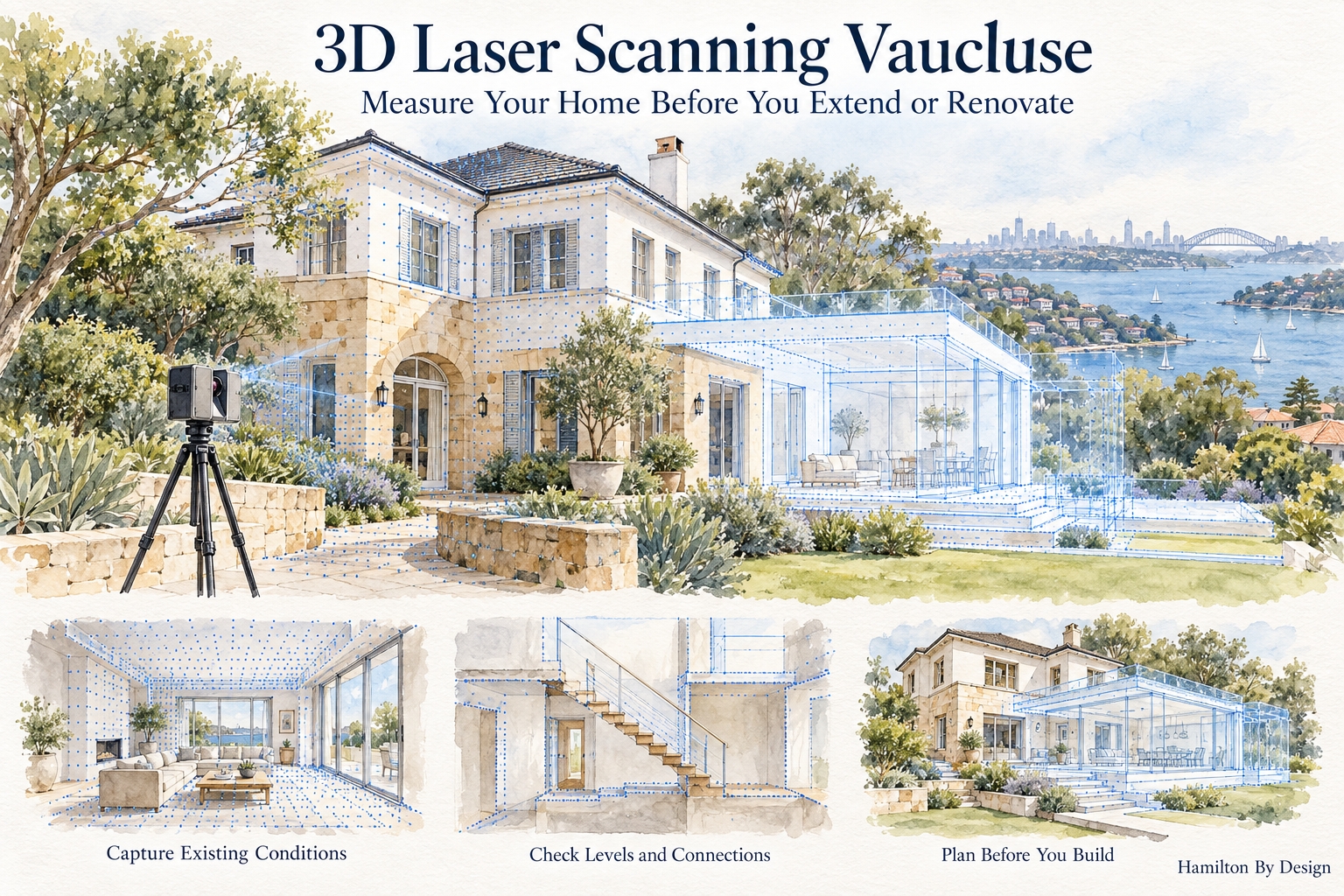


Related 3D Scanning, CAD and Drafting Services

Explore Hamilton By Design services that can help your project team capture existing conditions, develop drawings and coordinate proposed changes before renovating or extending your Vaucluse home.

3D Scanning Bellevue Hill: Start with As-Built Data to Establish What Is Possible

Watercolour illustration of a Bellevue Hill home transitioning from existing conditions to a blue point cloud and proposed renovation, with a LiDAR scanner in the foreground.
Blue 3D LiDAR scanner icon on a tripod with scanning waves

Planning changes to your Bellevue Hill property starts with understanding what is already there. Before developing a new layout, replacing a staircase or designing an extension, as-built data provides the measured foundation needed to explore what is possible.

Existing drawings may show the original design, but buildings change over time. Renovations, altered openings, different floor levels and undocumented additions can leave a gap between the drawings and the property as it stands today.

3D scanning in Bellevue Hill helps close that gap. By recording accessible, visible building surfaces, laser scanning creates a three-dimensional point cloud that your project team can use to understand existing geometry and develop proposed changes.

Understand Your Property Before Designing Changes

A renovation idea might begin with a simple question:

  • Can we fit a new staircase into the existing space?
  • Could the ground floor layout work better?
  • How would an extension connect to the existing building?
  • Is there sufficient clearance for new equipment or services?
  • Will a proposed balcony, balustrade or architectural feature fit?

Answering these questions requires more than an approximate room size. Designers need to understand how walls, floors, ceilings, openings and adjoining spaces relate to one another.

An as-built scan provides that spatial context. It helps your architect, designer, engineer and builder assess options against measured existing conditions.

Establish the existing geometry first, then develop the design around it.

What Can 3D Laser Scanning Capture?

Depending on access and the agreed scope, a property scan can record:

  • Internal room geometry and wall positions.
  • Floor surfaces and changes in level.
  • Ceiling heights and visible beams.
  • Doorways, windows and other openings.
  • Existing stairs, landings and surrounding spaces.
  • External faรงades and accessible roof surfaces.
  • Balconies, terraces and courtyard geometry.
  • Visible pipework, ductwork and plant.
  • Connections between existing buildings and proposed work areas.

The scans are combined into a registered point cloud, allowing the captured spaces to be reviewed together.

This is particularly useful when a project involves several levels or alterations that must connect accurately with an existing building.

Establish What Fits Before Committing to Construction

A proposed design can look convincing on paper while overlooking a constraint in the existing property.

For example, a replacement staircase must work within the available opening and connect with the actual floor levels. Its position also affects nearby doors, circulation space and overhead clearance.

Scanning the staircase area early gives the design team a measured reference for testing the proposal. Potential conflicts can then be identified while the design is still being developed.

The same approach applies to custom joinery, glazing, steelwork and other components that must fit into an existing space. Working from measured geometry can reduce uncertainty before fabrication, with critical dimensions verified to the tolerances required for the installation.

Support Renovations and Extensions in Bellevue Hill

For homeowners planning alterations in Bellevue Hill, as-built scanning can support several stages of a project.

Early feasibility and concept design

Captured geometry helps designers compare layout options and understand the space available. It provides a practical starting point for discussing what could change and where further investigation is needed.

Detailed design and coordination

As the proposal develops, the point cloud can help the project team coordinate new work with existing walls, floors, openings and visible services.

Fabrication and installation planning

Where new components interface with the existing building, scan data can support modelling, detailing and fit checks. The capture method and verification requirements should be agreed around the intended use.

Recording completed work

A further scan can document accessible completed geometry and support comparisons with the design where this forms part of the project scope.

From Point Cloud to Useful Drawings and Models

A point cloud is the starting dataset. Its value comes from how it is used.

Some project teams can work directly with the scan data. Others need selected geometry converted into CAD drawings or a 3D model.

Hamilton By Design combines terrestrial LiDAR scanning, point cloud processing and optional CAD modelling and drafting to support design and verification workflows. Learn more about our 3D point cloud scanning services in Sydney.

For your Bellevue Hill project, the required outputs should be agreed before scanning. These may include a registered point cloud, selected as-built drawings or a model of the areas relevant to the proposed work.

Defining the deliverables early helps ensure the information is useful to the people making the design decisions.

Match the Scanning Scope to the Project

The right scanning scope depends on what you are planning.

A staircase replacement may need detailed capture of the stairwell, adjoining landings and floor connections. A larger renovation may require several rooms, external elevations and surrounding access areas.

Before capture, useful questions include:

  • What changes are being considered?
  • Which existing surfaces and connections affect the design?
  • Who will use the data?
  • What file formats do they need?
  • Which dimensions are critical?
  • Are any areas concealed or difficult to access?

These questions help determine the scan coverage, level of detail and additional checks required.

What Does a Scan Tell You About Feasibility?

3D scanning helps establish geometric feasibility: the space available, the position of visible features and how proposed work might fit.

Other aspects of feasibility require specialist assessment. A scan does not reveal concealed reinforcement, establish structural capacity or determine planning approval requirements. Those questions need input from the relevant project professionals.

Providing them with clear existing-condition data helps make their assessment better informed.

Frequently Asked Questions

Should I scan my property before renovation drawings are prepared?

Scanning early can provide a measured reference for concept design and reduce reliance on outdated drawings. The scope should be discussed with your designer so the right areas are captured.

Can scanning help with a new staircase?

Yes. It can record the accessible stairwell, floor connections and surrounding geometry to support design development. Stair design and compliance checks remain part of the appropriate design review.

Can you scan only part of a property?

Yes. A focused scope can target the rooms, faรงades or interfaces relevant to the proposed changes.

Does laser scanning see through walls?

No. Terrestrial laser scanning records surfaces visible to the scanner. Concealed spaces require access or a separate investigation method.

Can scan data be used to create CAD drawings?

Yes. Selected captured geometry can be converted into drawings or models, with the required detail and outputs agreed before work begins.

Start Your Bellevue Hill Project with Measured Existing Conditions

Before investing in detailed design, establish a clear record of your property as it stands today.

3D scanning in Bellevue Hill provides the as-built foundation for exploring layouts, checking interfaces and planning alterations with greater confidence.

Contact Hamilton By Design to discuss your property, the changes you are considering and the data your project team needs.

Capture what exists. Understand the constraints. Establish what is possible.


Hamilton By Design logo displayed on a blue tilted rectangle with a grey gradient background

Contact Us – Talk To Us

Name
Would you like us to arrange a phone consultation for you?
Address

Our clients:
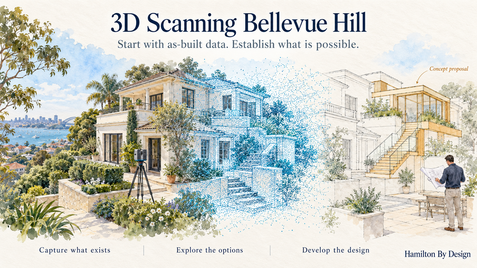


Related 3D Scanning Services in Sydney

Planning alterations to your Bellevue Hill property? Explore Hamilton By Designโ€™s Sydney scanning services for capturing existing conditions, developing digital models and supporting construction planning.
























