


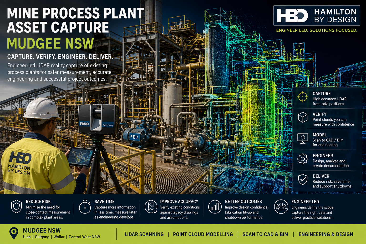
Mine Process Plant Asset Capture Mudgee NSW
Existing mine process plants are complex engineering environments. Mechanical equipment, pipework, structural steel, conveyors, chutes, access platforms, guarding and services are frequently installed within constrained spaces and across multiple elevations.
Over the operating life of a mine, these assets may also be modified, replaced or extended during maintenance programs, shutdowns and plant-expansion projects. As a result, the physical plant can progressively differ from the engineering drawings and models originally produced for the facility.
For engineers planning brownfield modifications, this creates a practical challenge:
How can existing process equipment be captured accurately when direct manual measurement is difficult, restricted or potentially exposes personnel to unnecessary plant hazards?
Hamilton By Design provides engineer-led mine process plant asset capture in Mudgee NSW and surrounding Central West mining areas, using terrestrial LiDAR scanning, registered point clouds and engineering CAD workflows to establish reliable existing-condition information.
The purpose is not simply to generate a visually impressive point cloud. The objective is to produce measurable engineering information that can support plant modifications, equipment replacement, shutdown preparation, fabrication and future asset management.
The Engineering Problem: Existing Plant Can Be Difficult to Measure Safely
Traditional field measurement remains valuable for many engineering activities. However, process plants often contain areas where comprehensive manual measurement becomes inefficient or difficult to undertake safely.
Existing equipment may be:
- elevated above operating plant;
- located behind guarding;
- surrounded by pipework and services;
- installed within congested structural framing;
- positioned close to moving equipment;
- accessible only during limited shutdown periods;
- surrounded by hot or process-sensitive surfaces;
- located beneath conveyors or transfer structures; or
- difficult to view from conventional measuring positions.
A mechanical engineer may need the location of a flange, equipment centreline, shaft position or support interface but find that direct physical access is restricted.
The engineering problem becomes more significant when the project requires an understanding of the complete three-dimensional relationship between several assets, rather than a single isolated dimension.
Hamilton By Design’s approach to engineering 3D scanning for mining and process plants uses reality capture as part of the engineering process, allowing structures, mechanical equipment, piping and surrounding plant to be recorded as measurable spatial data.
Why Engineer-Led Asset Capture Matters
Reality capture should ideally begin with an understanding of the engineering problem.
A scanning technician may ask:
Where can the scanner obtain coverage?
An engineer must also ask:
What information will be required to design the modification?
That distinction influences the quality and usefulness of the final dataset.
An engineer considering an equipment replacement may recognise the importance of capturing:
- equipment mounting interfaces;
- flange faces;
- pipework connections;
- shaft or pulley centres;
- equipment removal routes;
- surrounding structural steel;
- maintenance clearances;
- access platforms; and
- nearby services that could interfere with installation.
Hamilton By Design’s engineer-led approach is therefore intended to connect site capture directly with downstream engineering requirements.
The workflow can extend beyond point-cloud delivery into CAD modelling, equipment design, structural interfaces, drawings and fabrication-support information.
The value is not merely obtaining more scan data. It is capturing the right engineering information for the project.
What Mine Process Plant Assets Can Be Captured?
Engineering-grade reality capture can be applied to a broad range of mining and processing infrastructure.
Typical assets may include:
- crushers and screens;
- pumps and pump skids;
- tanks and vessels;
- bins and hoppers;
- chutes and transfer points;
- conveyors;
- pipework and valves;
- flanges and nozzles;
- structural steel;
- equipment supports;
- platforms and walkways;
- stairs and handrails;
- machine guarding;
- ducts;
- cable trays;
- concrete plinths;
- foundations; and
- interfaces between existing and proposed equipment.
The ability to capture surrounding context is particularly important.
A replacement pump, for example, does not exist independently. Its position may be constrained by foundations, pipework, structural members, walkways, lifting access and surrounding equipment.
A point cloud provides a digital reference to these relationships.
How Does LiDAR Asset Capture Reduce Personnel Exposure?
The objective of LiDAR scanning is not to replace site safety controls.
Plant isolations, permits, exclusion zones, working-at-height controls and client procedures remain essential.
However, terrestrial LiDAR can reduce the amount of close-contact manual measuring required in some plant environments.
A scanner can record a large volume of dimensional information from an appropriate stand-off position.
This may reduce the need for personnel to repeatedly:
- approach machinery;
- climb structures to obtain individual dimensions;
- work behind guards;
- access difficult corners of plant; or
- return to the same area for missing measurements.
Hamilton By Design’s work on engineering-grade 3D laser scanning for mining plant upgrades demonstrates how reality capture can establish existing-condition information before brownfield plant modifications are developed.
The key benefit is therefore not that scanning makes a mine site inherently safe.
It is that well-planned reality capture can reduce unnecessary exposure while improving the quantity of usable dimensional information collected during site access.
Capture Once, Measure as the Engineering Develops
One of the limitations of conventional field measurement is that engineers must anticipate every dimension required before detailed design begins.
This is not always practical.
A project engineer may collect the dimensions believed to be necessary, return to the office and commence modelling. During design, another interface may become important.
This creates the familiar cycle:
Measure → model → identify missing information → return to site → remeasure → revise
A registered LiDAR point cloud provides a different approach.
The site environment is captured comprehensively, allowing many additional dimensions to be obtained from the digital dataset after leaving site.
A useful principle is:
Capture comprehensively during the available site access, then measure selectively as the engineering develops.
This can be particularly valuable for Mudgee-region projects where engineering teams, specialist contractors or fabricators may be located considerable distances from the mine site.
Registering the Point Cloud
Terrestrial LiDAR projects generally involve multiple scanner locations.
Each scanner position records a portion of the plant from a different viewpoint.
These individual scans are subsequently processed and registered into a coordinated point-cloud dataset.
The resulting point cloud can provide measurable information including:
- equipment centres;
- flange positions;
- nozzle locations;
- structural member locations;
- elevations;
- equipment footprints;
- pipe routes;
- clearances;
- support geometry;
- floor levels; and
- maintenance envelopes.
The point cloud becomes a digital record of the visible plant condition at the time of scanning.
It should not, however, automatically be regarded as the final engineering deliverable.
The point cloud is often the evidence base from which further engineering information is developed.
Verifying Legacy Drawings Against Existing Conditions
Mining process plants may operate for several decades.
During this period, equipment replacement, shutdown repairs and production modifications can progressively alter the plant configuration.
Changes may include:
- relocated equipment;
- replacement pumps or motors;
- rerouted pipework;
- new supports;
- modified steelwork;
- added platforms;
- additional services; and
- changed equipment interfaces.
Existing drawings remain important engineering records, but critical dimensions should not necessarily be assumed to represent current conditions without verification.
The point cloud allows project teams to compare historical information with the physical plant.
This can help identify discrepancies before new equipment is designed or fabricated.
From Point Cloud to Engineering CAD
Some projects require only a measurable point-cloud dataset.
Others require selected assets to be reconstructed into CAD geometry.
Hamilton By Design’s Scan to BIM services for mining and industrial facilities provide one pathway for converting existing-condition LiDAR data into usable digital engineering information.
Depending on the project, modelling may include:
- mechanical equipment;
- tanks and vessels;
- structural steel;
- pipework;
- platforms;
- conveyors;
- chutes;
- equipment interfaces; and
- surrounding clearance envelopes.
The modelling strategy should be fit for purpose.
A project involving pump replacement may require detailed flange and support interfaces but only simplified representations of surrounding plant.
A structural modification may require accurate steel geometry while nearby equipment remains within the point cloud.
This avoids unnecessary modelling effort while maintaining the information required for engineering decisions.
Reducing Fabrication and Installation Risk
One of the most important applications of process-plant asset capture is verifying proposed modifications against existing conditions before fabrication.
A component can be manufactured accurately to a drawing and still fail to fit the plant if the original existing-condition information was incorrect.
Potential consequences include:
- fabrication rework;
- cutting or welding on site;
- revised pipe spools;
- altered structural connections;
- additional crane time;
- installation delays; and
- extended shutdown duration.
By developing the proposed design against registered scan data, engineers can identify many interface problems earlier.
The objective is simple:
Identify the dimensional conflict digitally before discovering it during installation.
Supporting Shutdown Planning
Process-plant modifications are frequently completed during scheduled mine shutdowns.
Shutdown periods may provide only limited access to equipment that cannot otherwise be approached while operating.
This makes preparation particularly important.
Hamilton By Design’s CHPP 3D scanning and shutdown engineering workflows demonstrate how captured site geometry can progress through point-cloud processing, engineering modelling and fabrication documentation before shutdown execution.
Reality capture can assist shutdown preparation by improving:
- understanding of existing conditions;
- fabrication confidence;
- installation planning;
- interface verification;
- equipment-removal planning;
- clash identification; and
- engineering readiness before the shutdown begins.
Scanning cannot eliminate every shutdown risk.
It can, however, improve the quality of the engineering information available when those risks are assessed and managed.
Mine Process Plant Asset Capture in Mudgee NSW
Mudgee is positioned within an established Central West NSW mining region, with major mining and processing activity around Mudgee, Ulan, Gulgong and Wollar.
Hamilton By Design can provide engineer-led reality capture for mining and industrial projects throughout:
- Mudgee;
- Ulan;
- Gulgong;
- Wollar; and
- surrounding Central West NSW mining areas.
The service is particularly relevant for existing brownfield facilities where equipment has been progressively modified, access is restricted or accurate engineering information is required before new plant is designed.
Tools Supporting the Asset-Capture Workflow
Depending on project requirements, Hamilton By Design can combine several technologies.
FARO Focus S70 can provide detailed terrestrial LiDAR capture of process equipment and surrounding infrastructure.
FARO Orbis may provide supplementary mobile capture where appropriate to the project.
FARO SCENE supports scan registration and point-cloud processing.
Autodesk ReCap can prepare point-cloud data for engineering workflows.
SolidWorks supports mechanical equipment modelling, reverse engineering and fabrication-focused design.
Autodesk Inventor and AutoCAD can support plant layouts, mechanical modelling and technical drawings.
Navisworks can assist with large-model coordination and clash review.
Revit may be appropriate where structured BIM information is required.
Potential deliverables can include E57, RCP, RCS and LAS point clouds together with SolidWorks, STEP, SAT, Parasolid, DWG, DXF, eDrawings and PDF engineering information.
The tools are important, but they remain secondary to the engineering purpose.
The principal deliverable is reliable information about the existing plant.
Frequently Asked Questions
What is mine process plant asset capture?
Mine process plant asset capture uses technologies such as terrestrial LiDAR scanning to record the three-dimensional geometry of existing equipment, structures, pipework and surrounding plant.
Why use LiDAR instead of manual measurements?
Manual measurement remains useful, but complex process plants may require hundreds of spatial relationships to be documented. LiDAR can capture much broader existing-condition information from suitable scanner positions.
Can scanning reduce the need to access difficult plant areas?
In some circumstances, yes. LiDAR can capture visible geometry from stand-off positions, potentially reducing the amount of close-contact measurement required. Normal mine-site safety procedures and access controls still apply.
Can measurements be obtained after the scanning is complete?
Yes. Once correctly registered, point-cloud datasets can be measured during later engineering stages, subject to the geometry being visible and adequately captured.
Can old engineering drawings be checked against the scan?
Yes. Point-cloud information can be compared with drawings and models to help identify differences between documented and installed conditions.
Can the point cloud be converted into CAD?
Yes. Selected equipment, structures and interfaces can be reconstructed as CAD or BIM geometry according to the engineering purpose of the project.
Can asset capture help with equipment replacement?
Yes. Existing mounting points, pipe connections, structural interfaces and surrounding clearances can be captured before replacement equipment is designed or selected.
Can LiDAR scanning support shutdown projects?
Yes. Reality capture can improve existing-condition information before or during shutdown access and support subsequent engineering, fabrication and installation planning.
What file formats can Hamilton By Design provide?
Depending on the agreed project scope, deliverables may include E57, RCP, RCS and LAS point clouds, CAD models, STEP, SAT, Parasolid, DWG, DXF, eDrawings and PDF documentation.
What areas around Mudgee can Hamilton By Design support?
Hamilton By Design can support mine and industrial projects throughout Mudgee, Ulan, Gulgong, Wollar and surrounding Central West NSW mining regions.
Mine Process Plant Asset Capture Mudgee NSW
Existing process plants can be difficult to measure comprehensively when equipment is operating, access is constrained or engineering teams have only limited opportunities to enter particular plant areas.
Engineer-led terrestrial LiDAR provides a practical method of capturing equipment, structures and surrounding interfaces as a measurable existing-condition dataset.
Hamilton By Design combines reality capture with point-cloud processing, CAD modelling and mechanical engineering to help project teams progress from site condition to engineering information.
For mine operators and project teams in Mudgee and Central West NSW, the principle is straightforward:
Capture safely where practical. Verify the installed condition. Engineer from measurable reality. Reduce uncertainty before fabrication and shutdown execution.

Contact Us – Talk To Us
Our clients:
























