CHPP 3D Scanning Services Singleton NSW

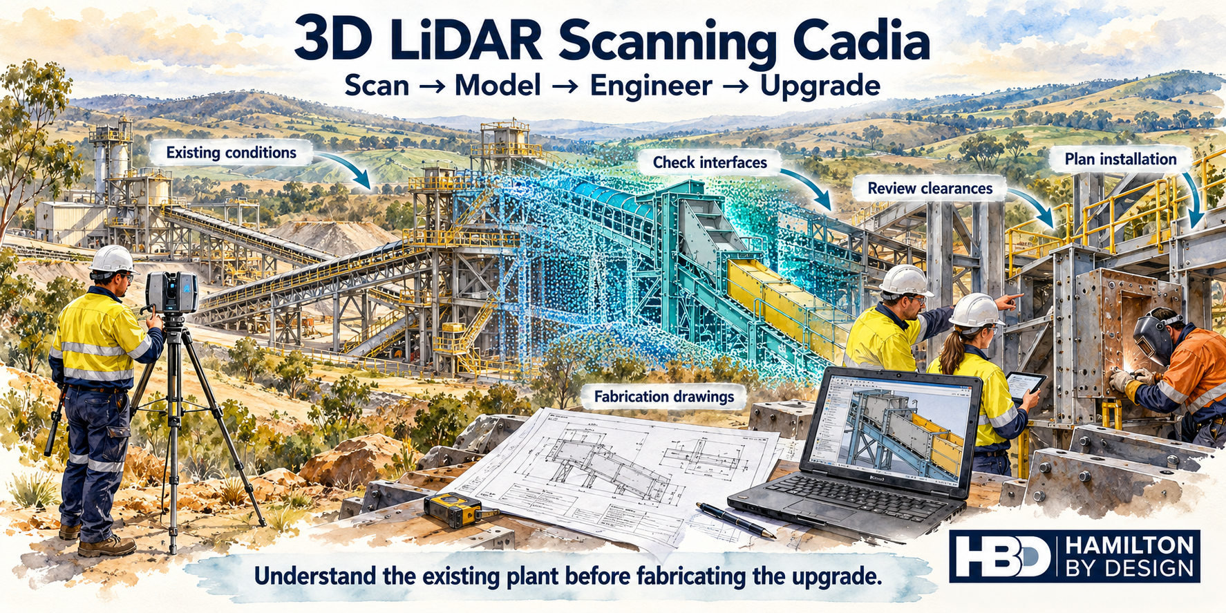
Technical drawing sheet showing CHPP 3D scanning services in Singleton NSW, with LiDAR point cloud data, coal handling plant structures, corrosion risk areas, scan-to-CAD modelling and Hamilton By Design branding.

LiDAR scanning for coal handling and preparation plants creating accurate engineering models and digital twins

Blue 3D LiDAR scanner icon on a tripod with scanning waves

Coal Handling and Preparation Plants are some of the most complex, congested and maintenance-heavy assets in the Hunter Valley coal industry. Around Singleton NSW, CHPP infrastructure supports mining operations by receiving, crushing, screening, washing, separating, dewatering, storing and transferring coal through a network of conveyors, chutes, bins, tanks, pumps, screens, cyclones, pipework, gantries, access platforms and structural steel.

For engineering teams, maintenance planners and shutdown managers, the challenge is not only that the plant is complex.

The bigger challenge is that the plant is often old, modified, congested, corroded and different from the original drawings.

That is why CHPP 3D scanning services in Singleton NSW are valuable. LiDAR scanning allows coal handling and preparation plant operators to capture the real existing condition of the plant before designing upgrades, fabricating replacement parts or planning shutdown work.

A point cloud scan can help create accurate engineering models, clash checks, reverse-engineered parts, digital twin foundations, fabrication drawings and brownfield design layouts. Hamilton By Design provides engineering-grade 3D laser scanning for mining plant upgrades, helping mining operations capture accurate plant geometry before design, fabrication or shutdown work begins.

But in a CHPP, 3D scanning is not only about measuring the shape of the plant. It is also about giving engineers better visibility of risk.

The key question is not simply:

Will the new equipment fit?

The better question is:

Will the new equipment fit into an existing plant that may already be worn, corroded, modified and structurally compromised?

That is the real value of engineer-led CHPP 3D scanning.


Key Issues in CHPP Brownfield Engineering

Before rebuilding or upgrading a CHPP, the project team needs to understand the main issues that make coal preparation plants difficult to design around.

The most common problems include:

  1. Complex existing infrastructure
  2. Old or missing drawings
  3. OEM drawings not available
  4. Short shutdown windows
  5. Deteriorated structural steel
  6. Corrosion from process water and coal fines
  7. Hidden damage under slurry and build-up
  8. Difficult access for inspection and measurement
  9. High risk of clashes during installation
  10. Poor digital records of the existing plant
  11. Unclear load paths through old steelwork
  12. Multiple disciplines working in the same area
  13. Abrasion and wear around chutes, conveyors and slurry systems
  14. A need for accurate models before fabrication
  15. The need to turn site data into practical engineering deliverables

A CHPP is not a clean, simple industrial building. It is a working process plant where coal, water, magnetite, slurry, fines, vibration, impact, corrosion and abrasion all interact.

This makes brownfield engineering more difficult than many people expect.


Why CHPP Infrastructure Is So Complex

A coal handling and preparation plant is full of interconnected equipment. A single upgrade may involve several systems at once.

For example, replacing or modifying a transfer chute may also affect:

Conveyor belt alignment
Skirt boards
Impact beds
Head pulleys
Tail pulleys
Walkways
Access stairs
Handrails
Dust covers
Guards
Structural support frames
Lifting access
Maintenance clearances
Pipework
Cable trays
Wash-down systems
Lighting
Fire services
Drainage
Nearby platforms

This is why manual measurement is often not enough. A person with a tape measure may be able to capture a few critical dimensions, but they may not capture all the surrounding interfaces that affect the final design.

In a CHPP, the clash may not be obvious until the new item is being installed.

A handrail may be in the way.
A beam may be lower than expected.
A pipe may have been rerouted.
A chute support may have been modified.
A stair stringer may clash with a new frame.
A conveyor guard may reduce access.
A cable tray may block installation.
A worn or corroded beam may no longer be suitable for reuse.

These are the types of problems that can stop a shutdown job from going smoothly.

LiDAR scanning helps by capturing the surrounding reality of the plant, not just the one item being replaced.


The Problem with Old Drawings

Many CHPPs have been modified over decades. Drawings may exist, but they may not reflect the current site condition.

Common drawing problems include:

Original construction drawings that do not include later changes
OEM drawings that are unavailable or incomplete
PDF scans of old drawings with limited dimensional detail
2D drawings that do not show the full 3D arrangement
Hand-marked drawings that were never updated properly
Drawings that show equipment that has since been removed
Drawings that miss pipework, guards, platforms or site-run modifications
Drawings that show design intent but not as-built reality

In a brownfield CHPP project, relying only on old drawings is risky.

The drawing may show where the structure was meant to be. The plant shows where the structure actually is.

For shutdown-critical work, the real plant matters more than the old drawing.

This is one of the strongest reasons to use CHPP 3D scanning services. A LiDAR scan gives the project team a measured record of the current plant condition. That point cloud can then be used as the basis for CAD modelling, clash detection, fabrication and engineering verification.


Corrosion: The Hidden CHPP Engineering Risk

One of the biggest engineering challenges in a CHPP is the deterioration and corrosion of structural steel.

This issue deserves more attention because it changes the way brownfield design should be approached.

A CHPP is not only a congested plant. It is often a corrosive plant.

Structural steel in a coal preparation plant may be exposed to:

Process water
Recycled water
Coal fines
Slurry
Magnetite
Wash-down water
Wet coal build-up
Acidic water potential
Sulphates
Chlorides
Poor drainage
Mud and residue
Damaged coatings
Wet/dry cycling
Abrasive wear

Over time, this environment can attack beams, columns, bracing, platforms, stairways, handrails, conveyor gantries, chute supports, pipe supports, screen supports, tank supports and floor framing.

This is where the engineering problem becomes more serious.

The issue is no longer only:

Can we fit the new chute into the existing space?

The issue becomes:

Is the existing steel still suitable to carry the new chute, the new loads, the new pipework, the new platform or the modified conveyor arrangement?

That distinction matters.

LiDAR scanning can measure the geometry of the plant, but the scan needs to be reviewed with engineering judgement. A point cloud can help identify the shape, location and arrangement of steelwork. It can also help visually flag areas where further inspection may be required. But if steel section loss, corrosion, cracking or coating breakdown is suspected, the engineering team may need closer inspection, thickness checks, structural review or replacement design.


Why CHPP Steel Can Corrode Faster Than Some Hard-Rock Processing Plants

A CHPP can corrode faster than some hard-rock processing plants because of the specific combination of coal, water, fines and chemistry.

This does not mean every CHPP is worse than every iron ore or copper plant. Some copper, gold and sulphide processing plants can also be extremely corrosive, especially where acidic water, reagents or saline water are present.

However, many CHPPs have a corrosion profile that is particularly aggressive because the plant combines:

Wet processing
Fine coal
Recycled process water
Slurry deposits
Potentially acidic water
High time-of-wetness
Abrasion
Difficult cleaning access
Poor drainage pockets
Hidden build-up on structural steel

In a hard-rock crushing and screening plant, abrasion may be the dominant problem. Iron ore, for example, can be extremely abrasive. It can wear liners, chutes, screens, feeders and transfer points quickly. But parts of the plant may be relatively dry compared with a coal wash plant.

A CHPP is different because coal preparation often involves water. The plant may include dense medium circuits, sprays, wet screens, sumps, pumps, cyclones, thickeners, slurry lines, wash-down hoses and wet transfer areas.

Where water and coal fines collect on steel, corrosion risk increases.

Coal fines can hold moisture against the steel surface. If the water contains sulphates, chlorides or acidic components, the risk increases further. If the steel coating is already damaged by abrasion, impact or age, corrosion can accelerate.

This is why CHPP corrosion can be so severe around:

Wet screens
Sumps
Pump areas
Slurry pipework
Dense medium circuits
Transfer towers
Coal preparation buildings
Chute supports
Conveyor gantries
Stairways and platforms
Areas under spillage
Poorly drained steelwork
Hidden ledges and beam flanges

In many cases, the steel does not corrode evenly. The worst deterioration may be localised. A beam may look reasonable from one side but be severely corroded where coal fines have sat on the top flange. A platform may appear serviceable until the underside is inspected. A stairway may be safe in one area but weakened around the stringer base or landing connection.

This makes accurate existing-condition capture and inspection planning very important.


CHPP Corrosion Compared with Ship Loader Corrosion

It is useful to compare CHPP corrosion with a ship loader operating near salt water.

A ship loader at a coal terminal or port is exposed to a marine environment. Salt-laden air, sea spray, humidity, rain, condensation and wind-blown chlorides attack steel continuously. Marine corrosion is severe because chloride salts settle on steel surfaces, attract moisture and accelerate electrochemical corrosion.

A ship loader beside the ocean is attacked by the external environment.

A CHPP is attacked by the process environment.

The ship loader corrodes because of where it is located.
The CHPP corrodes because of what it processes.

Both are serious, but they are different.

A ship loader is often exposed to broad atmospheric corrosion across booms, gantries, rails, bogies, luffing structures, slewing structures, platforms and conveyor frames.

A CHPP may suffer from more localised and hidden corrosion where coal fines, slurry and process water sit against steel. The corrosion may be buried under build-up or hidden behind guards, pipework, chutes and access platforms.

For a ship loader, the corrosion risk is often continuous and marine-driven.

For a CHPP, the corrosion risk is often process-driven and may be worst in wet, dirty, poorly drained and hard-to-inspect areas.

This comparison strengthens the case for CHPP 3D scanning. A ship loader may need scanning for geometry, boom alignment, rail interface checks and structural access planning. A CHPP needs scanning for those reasons too, but it also needs careful attention to hidden deterioration caused by the process itself.


Why Corrosion Changes the Design Risk

When engineers design a brownfield upgrade, they often assume the existing structure can be reused. That assumption can be dangerous in a CHPP.

If a new chute, conveyor frame, pump skid, pipe rack, access platform or maintenance structure is being attached to existing steel, the condition of that steel matters.

Corrosion can reduce:

Member thickness
Bolt capacity
Weld integrity
Base plate condition
Connection strength
Load-carrying capacity
Stiffness
Fatigue resistance
Safety margin

A corroded beam may still appear to be in the correct location, but it may no longer have the same structural capacity.

This is why CHPP scanning should not be treated as a simple measurement exercise. It should be part of a broader engineering workflow.

The scan helps identify where things are.
The engineering review helps decide whether they are still suitable.

For practical project work, the design team may need to combine:

LiDAR scan data
Site photos
Visual inspection notes
Structural member identification
Thickness testing where required
Existing drawings where available
Load assessment
Fabrication constraints
Shutdown planning
Access and lifting review
Replacement steel design

This is how scanning becomes valuable engineering information rather than just a point cloud file.


How LiDAR Scanning Helps CHPP Projects

LiDAR scanning uses a laser scanner to capture millions of measured points across the plant. These points form a point cloud, which is a 3D record of the existing site.

For a CHPP, this point cloud can capture:

Conveyors
Chutes
Bins
Hoppers
Screens
Crushers
Pumps
Tanks
Pipework
Cyclones
Structural steel
Platforms
Stairs
Handrails
Guards
Cable trays
Access zones
Maintenance clearances
Surrounding obstructions

The value is that engineers can measure the plant after the scan without needing to repeatedly return to site for every missed dimension.

This is especially useful in a CHPP because access can be difficult. Some areas are at height. Some are in wet or dirty zones. Some are near process equipment. Some require permits, isolation or shutdown access.

A scan reduces the reliance on manual measurement and helps the team review the plant in 3D. For broader mining and regional support, Hamilton By Design also provides Hunter Valley mining engineering and 3D laser scanning services for mining infrastructure, CHPP facilities, structural steelwork, shutdown engineering and brownfield plant modifications.


From Point Cloud to Engineering Model

A point cloud is useful, but the real value comes when the data is turned into practical engineering deliverables.

For CHPP projects, this may include:

3D CAD models
Scan-to-CAD layouts
General arrangement drawings
Fabrication drawings
Replacement part models
Structural steel models
Access platform models
Pipework models
Chute models
Conveyor interface models
Clash checks
Sections and elevations
Shutdown planning visuals
Digital twin base models

The level of modelling should match the project need.

Not every project needs a full plant model. Sometimes the best approach is to model only the area that affects the upgrade. For example, if a chute is being replaced, the model may need the chute, conveyor belt line, surrounding steel, access platform, guards, handrails, pipework and installation envelope.

For a pump replacement, the model may need the pump base, pipe spools, valves, access space, lifting zones and nearby obstructions.

For a platform upgrade, the model may need surrounding structure, stairs, handrails, clearances, existing beams, column locations and tie-in points.

The goal is not to model everything. The goal is to model what matters.

For worn, modified or undocumented assets, Hamilton By Design can also assist with reverse engineering using 3D scanning, converting real site geometry into engineered models and drawings suitable for fabrication and installation.


Clash Detection Before Fabrication

One of the most valuable uses of CHPP 3D scanning is clash detection.

A clash can happen when the proposed design conflicts with existing plant.

Examples include:

A new chute clashes with existing steel.
A pipe spool clashes with a handrail.
A platform clashes with a conveyor guard.
A stairway clashes with a cable tray.
A pump skid clashes with existing pipework.
A replacement frame clashes with a beam.
A crane lift path clashes with structure.
A maintenance access route is blocked.
A fabricated component cannot be installed because there is no clearance.

These problems are expensive when they are discovered during shutdown.

By placing the new design into the scanned plant model before fabrication, the project team can detect many of these problems earlier.

This helps reduce:

Site rework
Hot work during shutdown
Fabrication errors
Delayed installation
Lost production
Emergency redesign
Unplanned labour
Safety exposure
Disputes between designer, fabricator and installer

For CHPPs around Singleton and the Hunter Valley, this is one of the strongest reasons to invest in scanning before design is finalised.


CHPP 3D Scanning for Digital Twins

A digital twin begins with reliable existing-condition data.

In a CHPP, that data is often missing, outdated or scattered across drawings, site knowledge, OEM manuals, markups, inspection reports and maintenance records.

LiDAR scanning can create the spatial foundation for a CHPP digital twin. The point cloud or scan-derived CAD model can show where assets are located, how they relate to each other and what the plant looked like at a point in time.

Over time, this model can be developed further with:

Asset numbers
Equipment information
Maintenance data
Inspection notes
Structural condition records
Corrosion zones
Shutdown history
Upgrade history
Replacement part models
Pipework information
Access and safety information

This does not need to happen all at once. A practical digital twin can start with a targeted scan of a problem area and grow over time.

For CHPP operators, the digital twin concept is useful because the plant constantly changes. Every shutdown, repair and modification can make the old drawing set less reliable. A scan-based model gives the site a better foundation for future engineering work.

Hamilton By Design has also written about how LiDAR scanning is transforming mining process plants, including how scan data can support accurate plant records, digital engineering workflows and digital twin development.


Tools That Assist CHPP 3D Scanning and Engineering

A strong CHPP scanning and design workflow may use several tools together.

FARO laser scanning can capture detailed plant geometry quickly and accurately.

FARO SCENE can be used to register scan data and manage point clouds.

Autodesk ReCap can prepare point cloud files for use in CAD and coordination workflows.

SolidWorks can be used for mechanical design, reverse engineering, chute modelling, guarding, platforms, replacement parts and fabrication drawings.

AutoCAD can be used for 2D drawings, markups, layouts, sections and elevations.

Autodesk Inventor can support mechanical plant modelling and brownfield design workflows.

Navisworks can be used for clash detection and model coordination.

Rocky DEM can assist where coal flow, chute performance, wear zones, blockage risk or transfer performance needs to be reviewed.

3DEXPERIENCE / ENOVIA can support CAD data management, revision control and engineering collaboration.

The important point is that the scanner is only one part of the solution. The real value comes from combining scan data with mechanical design, drafting, engineering review and practical shutdown knowledge.


CHPP Areas That Benefit from 3D Scanning

CHPP 3D scanning can be applied to many plant areas, including:

Raw coal handling systems
Product coal conveyors
Rejects conveyors
Transfer towers
Preparation buildings
Screen houses
Crusher areas
Dense medium circuits
Cyclone areas
Magnetite systems
Pump areas
Thickeners
Slurry pipework
Chute replacements
Bin and hopper areas
Conveyor gantries
Access platforms
Stairways and walkways
Structural steel tie-in points
Maintenance access zones
Shutdown work fronts

The best projects for scanning are usually the ones where the cost of getting it wrong is high.

If a fabricated item must fit first time, scanning is valuable.

If the drawings are unreliable, scanning is valuable.

If the plant is congested, scanning is valuable.

If the existing steel may be corroded or modified, scanning is valuable.

If the shutdown window is tight, scanning is valuable.


Why Singleton CHPP Operators Need Accurate Site Data

Singleton and the broader Hunter Valley have long-established coal mining and processing infrastructure. Many plants have been operating, modified, maintained and upgraded over many years.

That history creates a brownfield engineering challenge.

The plant may have started with good drawings. But after years of repairs, replacement parts, site-run changes and shutdown modifications, the real site condition may be different.

For operators, this creates uncertainty.

The uncertainty affects:

Design
Procurement
Fabrication
Installation
Shutdown planning
Structural review
Maintenance access
Safety planning
Cost control
Project schedule

LiDAR scanning reduces that uncertainty by capturing the existing plant before decisions are locked in.


Why Use Hamilton By Design for CHPP 3D Scanning?

Hamilton By Design provides engineer-led 3D scanning, CAD modelling, reverse engineering and mechanical design support for industrial and mining clients.

For CHPP work, the key advantage is that the scan is captured with the engineering outcome in mind.

The objective is not simply to provide a point cloud. The objective is to support better engineering decisions.

Hamilton By Design can assist with:

CHPP LiDAR scanning
Point cloud registration
Scan-to-CAD modelling
SolidWorks modelling
AutoCAD drafting
Mechanical design
Reverse engineering
Chute and conveyor interface modelling
Access platform design support
Structural drafting support
Fabrication drawings
Brownfield clash checking
Digital twin base models
Shutdown planning support

For coal handling and preparation plants, this is important because the person scanning the plant needs to understand what the engineering team will need later.

A poor scan may miss the tie-in points.
A poor scan may miss the surrounding clash risks.
A poor scan may not capture access clearances.
A poor scan may not record enough of the corroded or modified structure.
A poor scan may create a point cloud that is difficult to use for design.

Engineer-led scanning improves the chance that the right areas are captured the first time.


Practical CHPP 3D Scanning Workflow

A typical CHPP scanning workflow may include the following steps.

1. Define the engineering problem

The first step is to identify what the scan needs to support. Is the job a chute replacement, conveyor upgrade, pipework modification, pump replacement, access platform, structural review, digital twin or shutdown package?

2. Review available drawings

Existing drawings are useful, even if they are outdated. They help identify equipment names, gridlines, levels, drawing history and likely tie-in points.

3. Plan the scan

Scan positions are selected to capture the target area and surrounding interfaces. In a CHPP, multiple scan positions are usually required because of obstructions.

4. Capture the site

The scanner captures the plant geometry from multiple locations. Photos and site notes may also be collected to support later modelling and review.

5. Register the point cloud

The scans are aligned into a single coordinate system and checked for accuracy.

6. Review the scan

The engineering team reviews the point cloud to identify relevant geometry, clashes, access issues and areas requiring further inspection.

7. Build the CAD model

Selected plant items are modelled from the point cloud. The level of detail depends on the project.

8. Insert the new design

The proposed chute, conveyor, platform, pipework, pump skid or replacement part is placed into the existing-condition model.

9. Check clashes and access

The team checks for physical clashes, installation clearance, maintenance access and possible structural issues.

10. Produce deliverables

Deliverables may include point clouds, 3D models, drawings, clash reports, fabrication drawings, sections, elevations and digital twin base models.


The Strongest Message for CHPP Operators

For CHPP operators, the strongest message is this:

Do not design from old drawings alone. Scan the plant, model the real conditions and review the existing steel before fabrication begins.

Coal handling and preparation plants are complex enough when everything is in good condition. They become much more difficult when the existing structure is corroded, worn, modified or hidden under coal build-up.

LiDAR scanning helps reduce risk by giving engineers accurate site data. But the best results come when scanning is combined with mechanical design, drafting, structural awareness and practical brownfield engineering experience.


Hamilton By Design logo displayed on a blue tilted rectangle with a grey gradient background

Conclusion

CHPP 3D scanning services in Singleton NSW provide an important engineering tool for coal handling and preparation plant operators.

The value is not only in creating a point cloud. The value is in capturing the real plant condition before design, fabrication and shutdown work begins.

In a CHPP, the biggest risks often come from the existing plant itself. The infrastructure is congested. The drawings may be unreliable. OEM information may not be available. Shutdown windows are short. Access is difficult. Steelwork may be corroded from process water, coal fines, slurry and acidic conditions. Wear and corrosion may be hidden under build-up.

That means the engineering team needs accurate site data before making design decisions.

LiDAR scanning supports:

Accurate existing-condition capture
Brownfield design confidence
Clash detection
Reverse engineering
Fabrication accuracy
Shutdown planning
Digital twin development
Structural review planning
Reduced reliance on old drawings
Better communication between engineers, fabricators and site teams

For Singleton CHPPs and Hunter Valley coal operations, this can reduce project risk, improve installation planning and help create a more reliable engineering record of the plant.

The final message is simple:

A CHPP is not just complex. It is complex, wet, abrasive, corrosive and constantly changing. 3D scanning helps capture the truth of the plant before the next engineering decision is made.

Talk to Us – Contact Us

Name
Would you like us to arrange a phone consultation for you?
Address

Our clients:


Smelter Brownfield Engineering Services in Newcastle NSW

Smelter brownfield engineering in Newcastle NSW showing LiDAR scanning, CAD modelling and clash detection used to reduce installation risk before fabrication.
Blue line-art icon of an industrial smelting furnace pouring molten metal into a ladle, representing engineering-grade 3D LiDAR scanning services for smelters, brownfield plant upgrades and as-built documentation.

Brownfield engineering projects within smelters are among the most technically challenging industrial projects undertaken in Australia. Unlike greenfield developments, where infrastructure is built on an empty site, brownfield projects require new equipment to be integrated into complex, operating facilities that have often evolved over decades.

For engineering teams working in Newcastle NSW and throughout the Hunter region, one of the most common and costly problems is discovering during installation that new equipment does not fit the existing plant. Hidden structural steel, undocumented pipework, cable trays, process equipment and access platforms frequently cause clashes that result in expensive rework and extended shutdowns.

At Hamilton By Design, we help reduce these risks by combining engineering-grade LiDAR scanning, Scan to CAD modelling, engineering verification, and detailed mechanical design to ensure every project is based on accurate, up-to-date site information before fabrication begins.


Why Brownfield Engineering Is Different

Smelters are continually evolving. New conveyors, upgraded furnaces, replacement ducting, additional pipework and revised process equipment are installed over many years, often without every modification being reflected in the original engineering drawings.

As a result, many facilities have:

  • Outdated General Arrangement (GA) drawings
  • Missing structural information
  • Incomplete pipe routing documentation
  • Legacy equipment with no CAD models
  • Multiple undocumented modifications
  • Limited confidence in existing dimensions

Designing from outdated drawings significantly increases the likelihood of installation problems.

Brownfield engineering begins with understanding the facility exactly as it exists todayโ€”not as it was originally designed.


The Biggest Problem: Equipment Clashes During Installation

One of the most expensive discoveries during a shutdown is finding that newly fabricated equipment cannot be installed because it clashes with existing infrastructure.

Common clashes include:

  • Structural steel columns and beams
  • Existing conveyors
  • Pipework and valves
  • Dust extraction ducting
  • Cable trays
  • Walkways and platforms
  • Handrails
  • Access ladders
  • Maintenance clearances
  • Crane operating envelopes

Even relatively small clashes can delay installation, requiring emergency redesigns, on-site fabrication, additional welding, crane hire and extended contractor time.

For smelter operators, these delays often translate directly into lost production and increased project costs.


Engineering-Grade LiDAR Scanning

Modern terrestrial LiDAR scanning has transformed how brownfield projects are planned.

Rather than relying solely on tape measures or outdated drawings, millions of highly accurate measurements are captured across the entire facility.

The resulting point cloud provides an engineering-grade digital representation of the plant, allowing designers to work from verified site conditions.

Hamilton By Design delivers registered point cloud datasets suitable for engineering workflows, including:

  • E57
  • Autodesk ReCap (RCP/RCS)
  • LAS
  • Engineering coordinate systems where required

These datasets become the foundation for accurate design and verification.


From Point Cloud to Engineering CAD

Capturing the site is only the first step.

Our engineering team converts laser scan data into intelligent CAD models suitable for design, fabrication and construction.

Typical deliverables include:

  • Mechanical assemblies
  • Structural steel models
  • Pipework layouts
  • Equipment models
  • Access platforms
  • Conveyors
  • Chutes
  • Hoppers
  • General Arrangement drawings
  • Fabrication drawings

Depending on project requirements, models can be produced using:

  • SOLIDWORKS
  • Autodesk Inventor
  • AutoCAD
  • Autodesk Navisworks
  • Revit (where BIM integration is required)

These models provide designers with accurate existing conditions before any new equipment is developed.


Engineering Verification Before Fabrication

Perhaps the greatest value in brownfield engineering comes from verifying the proposed design before fabrication begins.

Using the verified point cloud, engineers can overlay new equipment onto the existing facility to ensure:

  • Equipment fits correctly
  • Pipe routes are achievable
  • Structural supports align correctly
  • Maintenance access is maintained
  • Walkways comply with clearance requirements
  • Crane access is available
  • Installation sequences are practical

This engineering verification process significantly reduces uncertainty before manufacturing begins.


Clash Detection Saves Time and Money

Once both the existing plant and proposed design are available digitally, clash detection becomes possible.

Instead of discovering problems during installation, potential conflicts are identified during the design phase.

Typical clashes include:

  • Pipe-to-pipe interference
  • Pipe-to-structure clashes
  • Equipment-to-platform conflicts
  • Structural steel intersections
  • Cable tray interference
  • Insufficient maintenance access
  • Restricted lifting paths

Resolving these issues digitally is considerably faster and less expensive than making changes during a shutdown.


Supporting Smelter Shutdown Projects

Shutdown windows are often measured in days rather than weeks.

Every hour counts.

Accurate engineering information enables contractors to:

  • Fabricate components with confidence
  • Minimise on-site modifications
  • Reduce hot work
  • Improve installation efficiency
  • Shorten commissioning time
  • Reduce overall shutdown duration

By planning installation around verified site data, projects proceed more smoothly with fewer unexpected issues.


Typical Brownfield Engineering Applications

Hamilton By Design supports a wide range of smelter upgrade projects throughout Newcastle NSW and the Hunter region, including:

  • Conveyor upgrades
  • Furnace modifications
  • Dust extraction systems
  • Gas handling upgrades
  • Structural strengthening
  • Maintenance platform design
  • Pipe rerouting
  • Equipment replacement
  • Pump installations
  • Tank modifications
  • Material handling systems
  • Mechanical plant upgrades
  • Process equipment integration

Each project begins with accurate reality capture and ends with engineering documentation suitable for construction.


Why Choose Hamilton By Design?

Hamilton By Design combines practical engineering experience with advanced reality capture technology to deliver solutions tailored to complex industrial environments.

Our services include:

  • Engineering-grade terrestrial LiDAR scanning
  • Scan to CAD conversion
  • Reverse engineering of existing equipment
  • Mechanical engineering design
  • Structural steel detailing
  • Engineering drafting
  • 3D CAD modelling
  • As-built documentation
  • Engineering verification
  • Digital asset capture
  • Brownfield project support
  • Shutdown engineering assistance

Because we are engineersโ€”not simply surveyors or scanning techniciansโ€”we understand how captured data is used throughout the engineering design process.

Our workflow is designed to support fabrication, installation and long-term asset management.


Reducing Brownfield Project Risk

Successful brownfield engineering depends on having reliable information before work begins.

Accurate LiDAR scanning, detailed CAD modelling and engineering verification reduce uncertainty, minimise costly installation clashes and improve project outcomes.

For smelter operators in Newcastle NSW, investing in accurate reality capture before fabrication helps avoid shutdown delays, reduces rework, improves safety and provides confidence that new equipment will integrate with the existing facility.

Whether you are replacing a conveyor, upgrading a furnace, installing new process equipment or planning a major brownfield expansion, Hamilton By Design provides the engineering-led reality capture and design services needed to deliver successful outcomes.

Hamilton By Design logo displayed on a blue tilted rectangle with a grey gradient background

Partner with Hamilton By Design

If your next smelter project requires accurate as-built information, engineering-grade LiDAR scanning or detailed Scan to CAD modelling, Hamilton By Design can help.

Our experienced engineering team delivers practical brownfield solutions that reduce installation risk and support efficient project execution across Newcastle, the Hunter region and industrial facilities throughout New South Wales.

From initial site capture through to engineering verification and fabrication-ready documentation, we help ensure your project is built on accurate dataโ€”so new equipment fits the first time.

Talk to Us – Contact Us

Name
Would you like us to arrange a phone consultation for you?
Address

Our clients:


Smelter Scan to CAD Services in Newcastle NSW

Engineering pencil drawing illustrating Smelter Scan to CAD Services in Newcastle NSW, showing LiDAR laser scanning, point cloud registration and conversion into accurate 3D CAD models for brownfield smelter and heavy industrial facilities.
Blue line-art icon of an industrial smelting furnace pouring molten metal into a ladle, representing engineering-grade 3D LiDAR scanning services for smelters, brownfield plant upgrades and as-built documentation.

Heavy industrial facilities rarely remain unchanged. Smelters are continually upgraded to improve production, replace ageing equipment, meet environmental regulations and increase operational efficiency. Over decades of operation, countless modifications are made, many of which are only partially documented or never recorded at all. As a result, engineering teams are often forced to work with outdated drawings, incomplete documentation or no reliable three-dimensional CAD model of the facility.

Hamilton By Design provides Smelter Scan to CAD Services in Newcastle NSW, transforming high-accuracy terrestrial laser scan data into engineering-grade CAD models that accurately represent existing plant conditions. These models provide a trusted foundation for brownfield engineering projects, shutdown planning, equipment replacements, structural modifications and future asset management.

Whether your project involves replacing conveyors, upgrading process equipment, modifying structural steel, rerouting pipework or expanding a processing facility, having an accurate digital model of the existing plant dramatically reduces project risk while improving engineering confidence.


Why Existing Smelter Drawings Cannot Always Be Trusted

Many smelters operating throughout the Newcastle and Hunter Region have been in service for decades. During this time they have experienced numerous shutdowns, maintenance campaigns and capital improvement projects.

Typical undocumented changes include:

  • Additional platforms and access walkways
  • Modified conveyor systems
  • Pipe rerouting
  • Structural steel alterations
  • Equipment replacements
  • Cable tray additions
  • Temporary modifications becoming permanent
  • New services installed around existing infrastructure

While individual projects may have produced updated drawings, these revisions are not always consolidated into a complete plant model. Over time, engineering documentation becomes fragmented, making it increasingly difficult to determine the true “as-built” condition of the facility.

This creates significant challenges whenever new engineering work is required.


The Cost of Working from Outdated Information

When engineering teams lack an accurate three-dimensional representation of the plant, projects become more complex than necessary.

Common issues include:

  • Unexpected clashes during installation
  • Fabrication errors
  • Incorrect field measurements
  • Delayed shutdowns
  • Increased site rework
  • Additional crane time
  • More site welding and modifications
  • Higher project costs
  • Safety risks associated with unforeseen obstacles

Every incorrect assumption increases project risk.

Accurate Scan to CAD services eliminate much of this uncertainty by providing engineers with an engineering-grade digital representation of the existing facility before design work begins.


What is Scan to CAD?

Scan to CAD is the process of converting terrestrial laser scan data into intelligent engineering models.

Rather than relying solely on old drawings or manual measurements, millions of highly accurate laser measurements are captured throughout the facility to create a complete three-dimensional point cloud.

Experienced engineers then interpret this data to develop accurate CAD models representing existing equipment, structures and plant layouts.

The result is an engineering model that reflects the current state of the facilityโ€”not how it looked twenty years ago.


Our Scan to CAD Workflow

Hamilton By Design follows a structured engineering workflow designed specifically for complex industrial facilities.

1. High-Accuracy Laser Scanning

Using professional terrestrial laser scanners, millions of survey-grade measurements are captured throughout the plant.

Typical assets include:

  • Furnace buildings
  • Material handling systems
  • Pipework
  • Tanks
  • Chutes
  • Hoppers
  • Structural steel
  • Platforms
  • Conveyors
  • Cable trays
  • Mechanical equipment
  • Access structures

Large facilities can be captured with complete overlap to ensure comprehensive coverage and minimal shadowing.


2. Point Cloud Registration

Individual scans are registered into one accurate coordinate system.

This creates a unified digital representation of the entire facility while maintaining engineering-grade accuracy suitable for detailed design work.


3. Engineering Interpretation

Unlike automated modelling software, engineering interpretation identifies:

  • Structural members
  • Mechanical equipment
  • Process pipework
  • Equipment interfaces
  • Critical connection points
  • Existing plant constraints

Engineering judgement ensures the model reflects functional plant assets rather than simply reproducing raw geometry.


4. CAD Model Development

Point cloud data is converted into engineering CAD models suitable for design and documentation.

Depending on project requirements, deliverables may include:

  • Mechanical equipment
  • Structural steel
  • Pipework
  • Access platforms
  • Stairs
  • Handrails
  • Tanks
  • Ducting
  • Buildings
  • Foundations

Models can be produced to the required Level of Detail (LOD) to support conceptual studies, detailed engineering or fabrication.


5. Verification

Critical dimensions are checked against the registered point cloud before project completion.

Verification commonly includes:

  • Flange locations
  • Bolt centres
  • Equipment centres
  • Structural interfaces
  • Pipe elevations
  • Nozzle positions

This verification process gives engineering teams greater confidence that the CAD model accurately reflects existing site conditions.


Typical Smelter Applications

Scan to CAD services support a wide range of engineering activities, including:

Brownfield Plant Modifications

Existing infrastructure is accurately modelled before new equipment is designed.

This significantly reduces installation conflicts.


Shutdown Planning

Shutdown durations are often measured in hours rather than days.

Accurate CAD models enable:

  • Off-site fabrication
  • Installation planning
  • Lift studies
  • Construction sequencing
  • Clash reviews

Better planning helps minimise production downtime.


Conveyor Upgrades

Conveyor replacements frequently require precise integration with existing structures.

Scan to CAD provides engineers with accurate structural interfaces before fabrication begins.


Structural Modifications

Existing platforms, access systems and support structures can be accurately modelled before alterations are designed.

This improves fabrication accuracy while reducing field modifications.


Equipment Replacement

Replacement pumps, tanks, vessels, ductwork and process equipment can be designed to fit existing plant geometry before arriving on site.


Engineering Software Compatible Deliverables

Hamilton By Design can supply deliverables compatible with many common engineering platforms, including:

  • SOLIDWORKS
  • Autodesk Inventor
  • AutoCAD
  • Autodesk Plant 3D
  • Autodesk Revit
  • Navisworks
  • STEP
  • SAT
  • DWG
  • DXF
  • IFC
  • E57
  • RCP
  • LAS

This flexibility allows engineering teams to continue working within their preferred software environment.


Benefits of Accurate Scan to CAD Models

Investing in accurate engineering models provides measurable project benefits:

  • Reduced site measurements
  • Improved design accuracy
  • Lower fabrication risk
  • Fewer installation clashes
  • Reduced shutdown duration
  • Better project planning
  • Faster engineering workflows
  • Improved asset documentation
  • Enhanced maintenance planning
  • Long-term digital asset management

For facilities undertaking ongoing brownfield improvements, a reliable CAD model becomes a valuable engineering asset that continues delivering value long after the initial scanning project is complete.


Supporting Newcastle’s Heavy Industry

Newcastle has long been recognised as one of Australia’s major industrial centres, supporting steel manufacturing, mineral processing, bulk materials handling, port infrastructure and heavy engineering. Many of these facilities have evolved through decades of expansion, leaving engineering teams with incomplete or outdated documentation.

Hamilton By Design specialises in engineering-led Scan to CAD services that bridge this gap. By combining high-accuracy terrestrial laser scanning with mechanical engineering expertise, we produce practical CAD models that support real-world engineering decisions.

Whether your project involves a single process area or an entire smelter, our workflow provides engineering teams with accurate digital information they can rely on for design, fabrication and construction.


Hamilton By Design logo displayed on a blue tilted rectangle with a grey gradient background

Why Choose Hamilton By Design?

Hamilton By Design understands that successful brownfield projects begin with accurate existing-condition information. We combine terrestrial laser scanning with practical engineering experience to deliver CAD models that are not only geometrically accurate but also structured for engineering use.

Our services are tailored to the needs of heavy industry, with experience supporting shutdowns, equipment upgrades, structural modifications, process improvements and long-term asset management. From initial site capture through to verified CAD deliverables, we focus on reducing uncertainty so your engineering team can design with confidence.

If your Newcastle smelter or heavy industrial facility lacks reliable 3D CAD models, Hamilton By Design can help convert reality into accurate engineering dataโ€”providing the digital foundation needed for safer, faster and more cost-effective projects.

Talk to Us – Contact Us

Name
Would you like us to arrange a phone consultation for you?
Address

Our clients:


Aluminium Smelter Laser Scanning Services in Tomago NSW

Engineering-grade LiDAR laser scanning inside an aluminium smelter in Tomago NSW supporting brownfield upgrades, shutdown planning, Scan-to-CAD modelling and mechanical engineering.

Brownfield engineering projects are among the most technically demanding activities undertaken within an aluminium smelter. Unlike a new (greenfield) facility, every modification inside an operating smelter must integrate with decades of existing infrastructure, often installed during multiple expansion and upgrade phases. Over time, plant layouts evolve, undocumented modifications occur, and original engineering drawings become outdated or incomplete.

For facilities such as Tomago Aluminium in Tomago NSW, accurate existing-condition information is essential before any engineering design, shutdown planning or equipment installation begins. Without reliable dimensional data, project teams risk discovering clashes, incorrect fabrication dimensions and unforeseen site conditions only after installation has commencedโ€”when delays are most costly.

Hamilton By Design provides engineering-grade 3D laser scanning services that create highly accurate digital representations of existing assets. Using advanced LiDAR technology, millions of measurement points are captured in a matter of minutes, producing an engineering-quality point cloud that forms the foundation for mechanical design, structural engineering, Scan-to-CAD workflows and brownfield project delivery.

Whether your project involves replacing conveyors, upgrading process equipment or planning a major shutdown, laser scanning dramatically reduces uncertainty while improving safety, engineering confidence and project outcomes.


Why Accurate Measurement Matters in an Aluminium Smelter

Aluminium smelters operate continuously, twenty-four hours a day, every day of the year. Every hour of lost production has significant financial consequences, making shutdown windows tightly planned and carefully managed.

Unlike manufacturing facilities with spare production capacity, major engineering work often needs to occur within limited shutdown periods where multiple contractors work simultaneously.

This creates several engineering challenges:

  • Existing structures may not match historical drawings.
  • Pipework has often been modified over decades.
  • Equipment relocations are poorly documented.
  • Platforms and walkways have changed.
  • Electrical cable trays have expanded.
  • New services compete for limited installation space.
  • Structural members have been strengthened without drawing revisions.

Traditional surveying techniques simply cannot capture the complexity of these environments efficiently.


The Brownfield Engineering Challenge

Every brownfield project starts with one simple question:

What actually exists today?

Unfortunately, this is rarely easy to answer.

Many aluminium smelters have been operating for forty years or more. During that time, thousands of engineering changes may have occurred.

Common examples include:

  • Emergency repairs
  • Maintenance modifications
  • Temporary installations becoming permanent
  • Equipment replacements
  • Structural strengthening
  • Additional pipe supports
  • New cable routes
  • Instrument upgrades
  • Maintenance access improvements

Many of these modifications were completed under shutdown pressure where updating engineering drawings was understandably not the highest priority.

The result is that engineering teams often begin projects using documentation that no longer accurately reflects the physical plant.


Why Traditional Site Measurement Falls Short

Historically, engineers relied upon:

  • Tape measures
  • Total stations
  • Hand sketches
  • Photographs
  • Manual dimensions

While these methods still have their place, they become increasingly impractical inside large industrial facilities.

Consider attempting to measure:

  • 40 metres of overhead pipework
  • Multiple elevations
  • Congested cable trays
  • Structural steel connections
  • Existing conveyors
  • Crane beams
  • Process vessels

Access alone may require elevated work platforms, confined space permits, scaffolding and isolation procedures.

Even after several days onsite, only selected dimensions have been captured.

If additional information is later required, another site visit becomes necessary.


How Engineering Laser Scanning Changes the Process

Laser scanning fundamentally changes how brownfield engineering projects are delivered.

Instead of recording hundreds of manual dimensions, terrestrial LiDAR scanners collect millions of highly accurate measurements covering the complete work area.

The result is an engineering-grade point cloud that accurately represents existing plant geometry.

This digital environment allows engineers to perform much of their work from the office rather than returning repeatedly to site.

Once captured, the scan data can be converted into accurate Scan-to-CAD models and engineering drawings, enabling mechanical, structural and piping designers to work confidently using verified as-built information.

Typical benefits include:

  • Complete site capture
  • Reduced survey time
  • Improved design accuracy
  • Fewer site visits
  • Better collaboration
  • Improved documentation
  • Reduced engineering risk

Typical Areas Scanned Within an Aluminium Smelter

Engineering projects commonly occur throughout the facility, including:

Potlines

  • Structural modifications
  • Busbar alterations
  • Access platform changes
  • Mechanical equipment installation

Casthouse

  • Furnace upgrades
  • Casting equipment
  • Overhead cranes
  • Hydraulic systems
  • Cooling systems

Carbon Plant

  • Conveyors
  • Crushers
  • Dust extraction
  • Structural supports
  • Material handling systems

Utility Systems

  • Cooling water
  • Compressed air
  • Natural gas
  • Fire services
  • Hydraulic systems
  • Electrical substations

Highly congested service corridors benefit significantly from comprehensive reality capture.


Supporting Shutdown Engineering

Shutdowns represent one of the highest-value applications for engineering laser scanning.

Every task within a shutdown depends upon accurate planning.

When equipment has already been fabricated, there is little tolerance for discovering dimensional discrepancies during installation.

Laser scanning supports shutdown engineering and brownfield project planning by providing:

  • Existing-condition verification
  • Installation planning
  • Crane access studies
  • Temporary works design
  • Pipe spool verification
  • Structural modification planning
  • Clash detection
  • Construction sequencing

The result is improved confidence before shutdown activities begin.


Mechanical Engineering Applications

Mechanical engineering projects commonly include:

  • Pump replacements
  • Conveyor upgrades
  • Chute redesign
  • Tank modifications
  • Ducting replacement
  • Pressure vessel connections
  • Machine foundations

Instead of estimating dimensions from old drawings, engineers can design directly against the current plant geometry.

This greatly improves fabrication accuracy.


Structural Engineering Benefits

Structural engineers frequently encounter undocumented modifications.

Laser scanning enables accurate modelling of:

  • Structural steel
  • Columns
  • Bracing
  • Platforms
  • Stairways
  • Handrails
  • Crane beams
  • Pipe supports

Existing structures can then be verified before additional loads are introduced.


Digital Twins and Asset Management

Laser scanning also provides the foundation for developing digital twins.

Rather than relying solely on historical drawings, operators gain access to an accurate digital representation of the physical plant.

Benefits include:

  • Asset management
  • Maintenance planning
  • Future project planning
  • Condition assessments
  • Engineering verification
  • Operator training
  • Long-term documentation

Where legacy equipment has little or no documentation, Hamilton By Design can also provide reverse engineering services to recreate accurate CAD models and manufacturing drawings directly from laser scan data.


Engineering Software Used

Hamilton By Design supports engineering workflows using industry-recognised software, including:

  • FARO Focus terrestrial laser scanners
  • FARO SCENE
  • Autodesk ReCap
  • Autodesk Navisworks
  • SOLIDWORKS
  • Autodesk Inventor
  • AutoCAD
  • AutoCAD Plant 3D
  • Revit
  • E57 point cloud exchange
  • STEP and Parasolid mechanical models

This enables seamless collaboration with engineering consultants, asset owners and contractors.


Typical Deliverables

Every project is tailored to client requirements, but deliverables may include:

  • Registered point clouds
  • E57 files
  • Autodesk ReCap projects (RCP/RCS)
  • Scan-to-CAD drawings
  • Existing-condition layouts
  • General arrangement drawings
  • Mechanical models
  • Structural steel models
  • Pipework models
  • Equipment verification
  • Clash detection reviews
  • Engineering mark-ups
  • As-built documentation

Why Tomago NSW Is an Ideal Application

Tomago is one of Australia’s most significant heavy industrial precincts, and engineering projects are continually undertaken to improve safety, reliability and production efficiency.

Many upgrades involve integrating modern equipment into infrastructure that has evolved over decades.

This makes accurate existing-condition information invaluable.

Laser scanning enables project teams to:

  • Reduce uncertainty
  • Improve engineering quality
  • Minimise shutdown risk
  • Support prefabrication
  • Improve contractor coordination
  • Reduce costly rework

For brownfield engineering, accurate information at the beginning of the project often determines the success of the entire installation.


Hamilton By Design logo displayed on a blue tilted rectangle with a grey gradient background

Conclusion

Brownfield engineering projects succeed when decisions are based on accurate information. In aluminium smelters operating in Tomago NSW, where infrastructure has evolved over decades, relying on outdated drawings or incomplete measurements introduces unnecessary risk, delays and cost.

Engineering-grade laser scanning provides a reliable foundation for mechanical upgrades, shutdown planning, structural modifications and future asset management. By capturing millions of accurate measurements in a single survey, project teams gain confidence that new equipment will fit, fabrication can proceed with certainty, and installation risks are significantly reduced.

If your next project involves upgrading conveyors, replacing process equipment, modifying structural steel or planning a major shutdown, Hamilton By Design can deliver the accurate reality capture and engineering support needed to reduce uncertainty and keep your project moving forward. By combining advanced LiDAR technology with practical engineering expertise, we help aluminium smelter operators make better decisions, minimise rework and achieve safer, more efficient brownfield project outcomes throughout Tomago NSW.

Talk to Us – Contact Us

Name
Would you like us to arrange a phone consultation for you?
Address

Our clients:


Smelter 3D LiDAR Scanning Services Newcastle NSW

Technical blueprint illustration of a smelter facility in Newcastle NSW being captured with a FARO Focus S70 LiDAR scanner, showing point cloud reality capture, Scan to CAD conversion and engineering-grade as-built documentation for brownfield plant upgrades.

Smelter 3D LiDAR Scanning Services in Newcastle NSW

Blue line-art icon of an industrial smelting furnace pouring molten metal into a ladle, representing engineering-grade 3D LiDAR scanning services for smelters, brownfield plant upgrades and as-built documentation.

Many smelter facilities throughout Newcastle NSW have been operating for decades. During that time, plant expansions, maintenance shutdowns, emergency repairs and equipment upgrades have gradually changed the facility from its original design. Unfortunately, these changes are not always reflected in the engineering drawings.

The result is a common challenge faced by plant owners and engineering teams: the existing drawings no longer accurately represent what is installed on site.

This creates unnecessary risk during every engineering project. Pipework clashes with new equipment, structural steel connections differ from the drawings, platforms have been modified, cable trays have been rerouted, and access ways no longer match historical documentation.

Hamilton By Design provides Smelter 3D LiDAR Scanning Services in Newcastle NSW, delivering engineering-grade reality capture that allows project teams to work from accurate as-built information rather than outdated drawings. Using our 3D Laser Scanning Services, we capture millions of measurements across existing facilities and convert this information into engineering-ready point clouds, CAD models and digital as-built documentation.

Whether your project involves a shutdown, brownfield expansion, equipment replacement or complete plant upgrade, accurate site data is the foundation of successful engineering.


Why Existing Drawings Become Unreliable

Few industrial facilities remain unchanged over their operating life.

Most smelters have experienced numerous modifications, including:

  • New process equipment
  • Replacement pipework
  • Conveyor upgrades
  • Structural strengthening
  • Additional platforms and access ways
  • New services and cable trays
  • Dust extraction modifications
  • Pump replacements
  • Instrumentation upgrades
  • Temporary repairs that became permanent installations

While individual projects may have produced updated drawings, complete documentation is rarely maintained over several decades.

As a result, engineering teams frequently discover discrepancies only after arriving on site or during construction. These unexpected differences often lead to redesign, fabrication changes, additional site work and costly project delays.

Hamilton By Design helps eliminate this uncertainty by capturing the plant exactly as it exists today.


Engineering-Grade 3D LiDAR Scanning

Unlike traditional site measuring, terrestrial LiDAR scanning captures millions of highly accurate measurements in every scan position.

Our engineering workflow records:

  • Structural steel
  • Pipework
  • Tanks
  • Pressure vessels
  • Pumps
  • Valves
  • Conveyors
  • Chutes
  • Platforms
  • Walkways
  • Stairs
  • Handrails
  • Cable trays
  • Mechanical equipment
  • Existing foundations
  • Process buildings

This comprehensive digital record becomes the foundation for future engineering, drafting and asset management activities.

Once captured, the point cloud can be transformed into intelligent engineering models using our Scan to CAD Services, allowing designers to work efficiently from accurate digital information.


Reduce Brownfield Engineering Risk

Brownfield projects present unique engineering challenges because new equipment must integrate into an existing operating plant.

Typical risks include:

  • Unknown clearances
  • Hidden structural members
  • Pipe routing conflicts
  • Maintenance access restrictions
  • Interference with electrical services
  • Equipment clashes
  • Incorrect foundation locations

Without accurate site information, engineers are forced to make assumptions.

These assumptions often become expensive construction variations.

Hamilton By Design captures the existing plant with engineering-grade accuracy, allowing designers to verify every interface before fabrication begins. Our Brownfield Engineering Services help clients confidently integrate new equipment into existing facilities while reducing construction risk.


Support Shutdown Planning

Shutdown windows are expensive.

Every additional hour impacts production and increases contractor costs.

Accurate LiDAR scanning allows engineering teams to complete much of the design work before the shutdown begins.

Instead of relying on multiple site visits, designers work directly from the captured point cloud to develop:

  • Mechanical layouts
  • Structural modifications
  • Pipe routing
  • Equipment positioning
  • Maintenance access reviews
  • Installation sequencing

By reducing uncertainty during the design phase, shutdown activities become faster, safer and more predictable.


Accurate As-Built Documentation

One of the greatest long-term benefits of LiDAR scanning is the creation of accurate as-built documentation.

Hamilton By Design can provide:

  • Registered point clouds
  • AutoCAD drawings
  • 3D CAD models
  • SolidWorks assemblies
  • Autodesk Inventor models
  • STEP models
  • Navisworks coordination models
  • Structural steel models
  • Equipment models
  • General arrangement drawings
  • Engineering verification models

These deliverables provide a reliable engineering record that can be reused for future projects, maintenance planning and asset management.


Improve Design Accuracy

Engineering design is only as accurate as the information used to create it.

By working from an accurate point cloud, engineers can confidently design:

  • Replacement conveyors
  • Pipework systems
  • Pump installations
  • Structural platforms
  • Maintenance access systems
  • Mechanical upgrades
  • Process equipment
  • Tank modifications
  • Support steel
  • Ducting systems

This greatly reduces the need for redesign during construction.


Digital Twins for Smelter Facilities

Many industrial operators are now investing in digital engineering workflows.

A high-quality LiDAR scan forms the basis of a digital twin by accurately representing the current physical condition of the facility.

A digital twin can support:

  • Asset management
  • Future expansions
  • Shutdown planning
  • Maintenance strategies
  • Engineering studies
  • Safety assessments
  • Training
  • Plant familiarisation

Instead of relying on incomplete drawings, engineers have access to a complete digital representation of the plant.


Typical Areas We Scan

Hamilton By Design provides LiDAR scanning throughout industrial smelter facilities, including:

  • Ore handling systems
  • Crushing areas
  • Conveyors
  • Transfer towers
  • Smelting furnace buildings
  • Casting facilities
  • Refining areas
  • Pipe racks
  • Cooling water systems
  • Structural steel
  • Dust extraction systems
  • Process pipework
  • Pump stations
  • Tank farms
  • Workshops
  • Compressor rooms
  • Electrical substations
  • Cable tray systems
  • Access platforms
  • Walkways
  • Stair systems

Our approach ensures all critical engineering interfaces are captured for future design work.


Engineering-Led Scan-to-CAD Services

Hamilton By Design is more than a scanning provider.

As a mechanical engineering consultancy, we understand how captured data will be used during design, drafting and construction.

Our services include:

  • Engineering drafting
  • Mechanical design
  • Structural steel detailing
  • Scan-to-CAD conversion
  • Reverse engineering
  • Plant layout development
  • As-built verification
  • Brownfield engineering support
  • 3D modelling
  • Engineering documentation

Because scanning and engineering are delivered together, the final outputs are tailored to the needs of designers, fabricators and asset owners.

If replacement components need to be recreated where original OEM drawings no longer exist, our Reverse Engineering Services provide accurate engineering models developed directly from LiDAR scan data.

For clients requiring complete engineering support beyond scanning, our Mechanical Engineering Services deliver practical solutions from concept design through to detailed drafting and fabrication documentation.


Why Newcastle NSW?

Newcastle has a long history of heavy industry, steel manufacturing, minerals processing and industrial engineering. Many facilities have evolved through decades of operational improvements, making accurate engineering documentation increasingly important.

LiDAR scanning provides a practical solution for organisations managing ageing infrastructure by creating a reliable digital record of current plant conditions.

Whether the project involves equipment replacement, structural modifications, shutdown planning or long-term asset management, engineering teams benefit from working with accurate, up-to-date information rather than relying on historical drawings.


Why Choose Hamilton By Design?

Hamilton By Design combines advanced terrestrial LiDAR scanning technology with practical engineering experience.

Our clients value our ability to deliver:

  • Engineering-grade LiDAR scanning
  • Accurate as-built documentation
  • Brownfield engineering support
  • Scan-to-CAD modelling
  • Mechanical engineering expertise
  • Structural modelling
  • Reverse engineering
  • Shutdown planning assistance
  • High-quality engineering documentation

We understand the demands of operating industrial facilities and the importance of delivering information that engineers can confidently use for design, fabrication and construction.


Hamilton By Design logo displayed on a blue tilted rectangle with a grey gradient background

Ready to Modernise Your Smelter Documentation?

If your smelter drawings no longer reflect the current plant, now is the time to create an accurate digital record.

Hamilton By Design provides Smelter 3D LiDAR Scanning Services in Newcastle NSW, helping industrial operators reduce brownfield engineering risk, improve shutdown planning and develop reliable as-built documentation for future projects.

Whether you require a single process area, a complete facility scan or ongoing engineering support, our team can deliver engineering-grade reality capture tailored to your project requirements.

Contact Hamilton By Design today to discuss your next smelter upgrade, shutdown or brownfield engineering project and discover how engineering-grade LiDAR scanning can reduce project risk while improving design accuracy.

Talk to Us – Contact Us

Name
Would you like us to arrange a phone consultation for you?
Address

Our clients:


Brownfield Water Infrastructure Engineering in Sydney NSW โ€“ Reduce Risk Before Construction Begins

Engineering-grade LiDAR scanning of Sydney brownfield water infrastructure, capturing existing pipework, tanks, pumps and structural assets to support engineering verification, Scan to CAD and digital twin development.

Sydney’s water infrastructure is constantly evolving. Ageing water treatment plants, wastewater treatment facilities, pumping stations, reservoirs and transfer pipelines require ongoing upgrades to meet increasing demand, improve reliability and comply with changing environmental regulations.

Unlike greenfield projects where engineers begin with an empty site, brownfield projects involve modifying existing operational infrastructure. Every new pipe, pump, platform or structural support must integrate seamlessly with equipment that may have been installed decades ago.

The greatest challenge with brownfield engineering is simple:

Existing infrastructure rarely matches the available drawings.

Over many years, maintenance activities, emergency repairs, plant expansions and operational improvements alter facilities in ways that are often never fully documented. As a result, engineering teams frequently encounter unknown pipework, relocated equipment, modified structural steel and outdated as-built drawings.

These discrepancies create one of the biggest risks in industrial engineering:

Brownfield modifications causing costly site clashes.

Hamilton By Design provides Brownfield Water Infrastructure Engineering Services throughout Sydney NSW, combining engineering-grade LiDAR scanning, Scan to CAD, mechanical engineering and engineering verification to reduce project risk before construction begins.


Why Brownfield Projects Are More Complex Than Greenfield Projects

A greenfield project starts with a clean site.

Engineers control every dimension, every structural member and every equipment location.

Brownfield projects are completely different.

Existing facilities already contain:

  • Operating equipment
  • Underground services
  • Congested pipework
  • Electrical infrastructure
  • Instrumentation
  • Structural steel
  • Maintenance platforms
  • Access walkways
  • Cable trays
  • Temporary modifications
  • Legacy equipment

Every new design must fit around existing infrastructure while maintaining safe operation.

That is why accurate existing-condition data is essential.


The Hidden Cost of Site Clashes

A site clash occurs when newly designed equipment conflicts with existing infrastructure.

Typical clashes include:

  • Pipework intersecting structural steel
  • Pumps fouling maintenance platforms
  • Valves becoming inaccessible
  • Cable trays blocking pipe routing
  • Pipe supports interfering with existing equipment
  • Motors conflicting with overhead beams
  • Access ladders blocking maintenance paths
  • Concrete foundations overlapping underground services

Many of these issues are only discovered during construction.

By that stage:

  • fabrication is complete
  • contractors are mobilised
  • shutdowns have commenced
  • installation crews are waiting

The result is expensive redesign, fabrication changes and extended project durations.


Engineering-Grade LiDAR Scanning Eliminates Guesswork

Hamilton By Design uses professional terrestrial LiDAR scanning to accurately capture existing water infrastructure.

Rather than relying on tape measures or outdated drawings, millions of survey points are recorded across the entire facility.

This captures:

  • Pumps
  • Pipework
  • Valves
  • Tanks
  • Structural steel
  • Pipe bridges
  • Clarifiers
  • Digesters
  • Access platforms
  • Stairways
  • Handrails
  • Electrical equipment
  • Cable trays
  • Instrumentation
  • Concrete structures

The resulting point cloud becomes the single source of truth for engineering design.


Accurate Existing Conditions Lead to Better Engineering

Reliable engineering begins with reliable information.

Accurate point cloud data enables engineers to:

  • Verify dimensions
  • Confirm pipe routing
  • Check equipment locations
  • Validate maintenance access
  • Measure structural geometry
  • Review installation clearances
  • Detect clashes before construction
  • Plan shutdown activities

Instead of making assumptions, engineers work from the actual plant.


Supporting Water Infrastructure Projects Across Sydney

Hamilton By Design supports a wide range of brownfield water infrastructure projects.

These include:

Water Treatment Plant Upgrades

Treatment plants require continual investment to maintain water quality and increase capacity.

LiDAR scanning provides accurate existing-condition data before detailed engineering begins.


Wastewater Treatment Plant Modifications

Wastewater facilities often involve highly congested process pipework.

Accurate point clouds reduce installation risk during process upgrades.


Pump Station Engineering

Pump replacements frequently require:

  • new baseplates
  • pipework modifications
  • motor upgrades
  • structural changes

Scanning ensures replacement equipment integrates correctly.


Reservoir Infrastructure

Reservoir facilities require accurate engineering for:

  • inlet pipework
  • outlet manifolds
  • valve chambers
  • overflow systems
  • maintenance platforms

Reality capture improves design certainty.


Transfer Pipeline Connections

Tie-ins to existing pipelines require precise dimensional verification.

LiDAR scanning allows engineers to accurately model connection points before fabrication.


Scan to CAD Services

Point clouds are valuable, but engineering projects generally require CAD models.

Hamilton By Design converts point cloud data into:

  • Intelligent 3D models
  • General Arrangement drawings
  • Pipework models
  • Structural steel models
  • Equipment layouts
  • Sections
  • Elevations
  • Fabrication drawings
  • As-built documentation

These deliverables integrate with:

  • SOLIDWORKS
  • Autodesk Inventor
  • AutoCAD
  • Navisworks
  • Autodesk ReCap

Engineering Verification Before Construction

Engineering verification is one of the most valuable outcomes of reality capture.

Before fabrication begins, proposed designs can be compared against existing infrastructure.

Verification includes:

  • Equipment fit
  • Pipe routing
  • Structural interfaces
  • Maintenance access
  • Installation clearances
  • Lifting paths
  • Serviceability
  • Constructability

Resolving these issues during design significantly reduces project risk.


Supporting Digital Twin Development

Many Sydney water authorities are developing digital twins to improve long-term asset management.

LiDAR scanning provides the accurate geometric foundation required for these systems.

Digital twins assist with:

  • Asset management
  • Maintenance planning
  • Shutdown coordination
  • Future upgrades
  • Operator training
  • Lifecycle management
  • Engineering studies
  • Capital planning

Because the model reflects actual site conditions, future projects begin with reliable information.


Reducing Shutdown Risk

Brownfield water infrastructure projects often occur during tightly controlled shutdowns.

Unexpected site clashes can quickly extend shutdown durations.

LiDAR scanning helps engineers:

  • Detect clashes early
  • Validate fabrication
  • Optimise installation sequences
  • Improve access planning
  • Confirm equipment clearances

Many construction problems are therefore resolved before anyone arrives on site.


Typical Brownfield Engineering Workflow

Hamilton By Design follows an engineering-led workflow designed specifically for operational infrastructure.

1. Project Definition

Understand project objectives, operational constraints and shutdown requirements.

2. Engineering LiDAR Scanning

Capture existing infrastructure using terrestrial laser scanning.

3. Point Cloud Registration

Register scans into one accurate engineering dataset.

4. Quality Assurance

Verify scan completeness and registration accuracy.

5. Scan to CAD

Develop engineering-ready models from the point cloud.

6. Engineering Design

Complete mechanical, structural and pipework design using verified site information.

7. Engineering Verification

Compare proposed modifications against existing infrastructure before fabrication.

8. Construction Support

Provide engineering assistance during installation if required.


Why Choose Hamilton By Design?

Hamilton By Design combines practical engineering knowledge with advanced reality capture technology.

Our capabilities include:

  • Engineering-grade LiDAR scanning
  • Brownfield engineering support
  • Mechanical engineering
  • Reverse engineering
  • Scan to CAD
  • Engineering drafting
  • Structural modelling
  • Pipework modelling
  • As-built documentation
  • Digital twin development
  • Engineering verification
  • Construction support

Unlike traditional survey-only providers, we understand how engineering models will be used throughout the project lifecycle.

Our reality capture services are designed to produce information engineers can immediately use for design, verification and construction planning.


Supporting Sydney’s Essential Water Infrastructure

Sydney’s water infrastructure supports millions of residents, businesses and industries every day. As assets continue to age, brownfield engineering projects will become increasingly important to maintain reliable services and improve operational performance.

Successful brownfield engineering depends on one critical factor:

Accurate existing-condition information.

Without reliable data, unknown infrastructure creates unnecessary engineering risk, costly site clashes and expensive construction delays.

Hamilton By Design provides engineering-grade LiDAR scanning, Scan to CAD modelling and engineering verification services that replace uncertainty with confidence. By accurately capturing existing water infrastructure before design begins, we help engineering consultants, utilities and contractors reduce project risk, improve constructability and deliver successful brownfield upgrades.

Whether your project involves a water treatment plant, wastewater treatment facility, pumping station, reservoir or pipeline connection, our engineering-led approach ensures every design decision is based on the facility as it exists todayโ€”not outdated drawings or assumptions.

Talk to Us – Contact Us

Name
Would you like us to arrange a phone consultation for you?
Address

Our clients: