Surface Mine 3D LiDAR Scanning for Hunter Valley, Singleton, Muswellbrook & Upper Hunter NSW

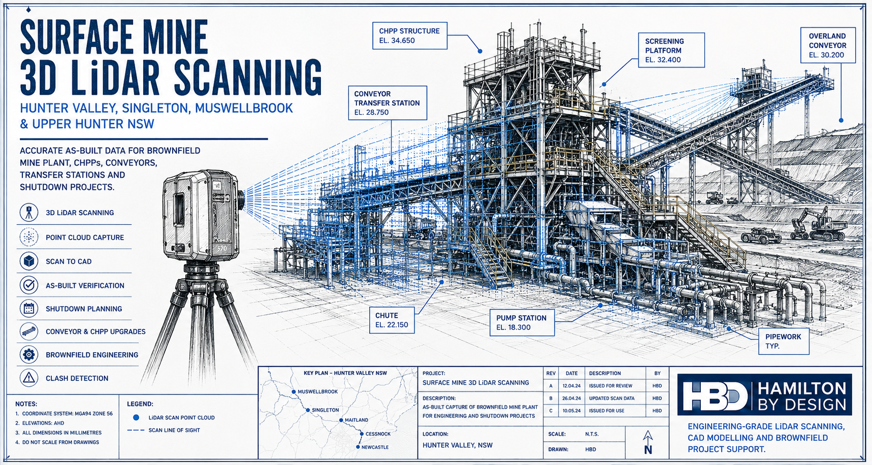
Technical drawing style hero image showing a 3D LiDAR scanner capturing a Hunter Valley surface mine processing plant with conveyors, CHPP structure, pipework, pump station and brownfield mining infrastructure.

Surface Mine 3D LiDAR Scanning for Brownfield Mine Sites

Blue 3D LiDAR scanner icon on a tripod with scanning waves

Surface mines across the Hunter Valley and Upper Hunter are constantly changing. Coal handling plants, conveyors, transfer stations, pump stations, workshops, access platforms, pipework, chutes, bins and rail load-out areas are regularly modified to keep production moving. Some changes are part of planned capital upgrades. Others happen during shutdowns, maintenance windows or urgent repair work.

After years of brownfield modifications, the problem becomes simple: the plant on site no longer matches the drawings.

For surface mine operators, outdated drawings create real engineering and shutdown risk. Engineers may design around old information. Fabricators may manufacture parts that do not fit. Shutdown planners may miss access restrictions, clashes or tie-in issues. Installation crews may arrive on site only to discover that pipework, steelwork, guards, walkways or equipment are not where the drawings say they are.

This is where 3D laser scanning provides real value. By capturing accurate existing-condition data of the installed plant, mine operators and engineering teams can make decisions based on what is actually on site, not what was originally drawn years ago.

Hamilton By Design provides engineering-grade 3D LiDAR scanning, point cloud processing, scan-to-CAD modelling and as-built verification for Hunter Valley surface mines and brownfield industrial sites.

Locations Supported Across the Hunter Valley and Upper Hunter

Hamilton By Design supports surface mine and heavy industrial projects across the Hunter Valley, Upper Hunter and surrounding mining support regions, including:

Singleton, Muswellbrook, Ravensworth, Lemington, Warkworth, Mount Thorley, Broke, Bulga, Camberwell, Hebden, Jerrys Plains, Rixs Creek, Glennies Creek, Maison Dieu, Whittingham, Liddell, Bayswater, Aberdeen, Denman, Scone, Maitland, Cessnock, Lake Macquarie, Newcastle and the Port of Newcastle corridor.

These locations are affected by the same brownfield engineering problem. Mine plant is modified over time, but the drawing register does not always keep up. A conveyor transfer station may have extra guarding. A pump station may have replacement pipework. A CHPP may have modified chutes, platforms, cable trays and access stairs. A rail load-out area may have structural or mechanical changes that are not fully documented.

Hamilton By Design also supports industrial and mining clients beyond the Hunter Valley through 3D laser scanning across Australia, helping project teams capture reliable as-built data for plant upgrades, shutdown planning, fabrication checks and engineering verification.

Why Existing Surface Mine Drawings Become Outdated

Surface mine infrastructure rarely stays the same for long. Production requirements change. Maintenance teams improve access. Process engineers adjust layouts. Shutdown crews replace equipment. Fabricators install revised steelwork. Emergency repairs become permanent. Over time, these small changes create a large difference between the original drawings and the actual plant.

Common causes of outdated drawings include:

Brownfield ChangeResulting Risk
Conveyor upgradesNew chutes, guards or drives may not match old layouts
CHPP modificationsPipework, platforms and equipment positions may change
Pump station changesFlanges, valves and pipe supports may not be in the documented location
Structural access upgradesStairs, ladders, handrails and platforms may have been added or replaced
Shutdown repairsTemporary supports or modifications may become permanent
Replacement equipmentNew motors, pumps, screens or gearboxes may have different footprints
Rail load-out changesStructural and mechanical interfaces may no longer match original drawings
Site services modificationsCable trays, water lines, air lines and drainage may be undocumented

When drawings are unreliable, engineering design becomes slower and riskier. More time is spent checking dimensions, confirming interfaces and resolving clashes. In a shutdown environment, that uncertainty can become expensive very quickly.

What 3D LiDAR Scanning Captures

3D LiDAR scanning captures the existing mine plant as a measured 3D point cloud. The scanner records millions of points from multiple positions, creating a detailed digital record of the installed site condition.

For surface mining projects, LiDAR scanning can capture:

  • Conveyor transfer stations
  • CHPP areas
  • Crusher stations
  • Screens and bins
  • Chutes and hoppers
  • Pump stations
  • Pipework and valve stations
  • Structural steelwork
  • Platforms, stairs, ladders and handrails
  • Workshops and maintenance bays
  • Rail load-out structures
  • Stockpile conveyor systems
  • Water management infrastructure
  • Electrical rooms and cable tray support areas
  • Brownfield tie-in zones

The point cloud can then be used for engineering review, CAD modelling, clash detection, as-built documentation, shutdown planning and fabrication support.

Turning Scan Data into Engineering Information

The scan is only the first step. The real value comes from turning point cloud data into information engineers, fabricators and project teams can use.

Hamilton By Design can convert captured site data into 3D CAD modelling outputs suitable for mechanical layouts, plant upgrades, fabrication planning, clash checking and as-built documentation.

For example, if a mine is planning to replace a chute, the scan can capture the surrounding steelwork, conveyor geometry, access platforms, guards and nearby equipment. The design team can then model the new chute around the actual site conditions. This reduces the chance of a clash during installation.

If a pump station is being modified, LiDAR scanning can confirm the true location of pipework, flanges, valves, supports and access clearances. This helps fabricators produce more accurate spools and reduces the need for site rework.

If a CHPP area has been modified many times, scanning can provide an updated as-built record that engineers can use for future upgrades.

For shutdown projects, the value is even greater. Shutdown windows are limited. Mistakes are costly. If parts do not fit, access is blocked or tie-in points are wrong, the project can lose valuable time. 3D LiDAR scanning helps reduce those unknowns before the shutdown begins.

Typical Deliverables

Hamilton By Design can support surface mine scanning projects with practical engineering deliverables, including:

DeliverablePurpose
Registered point cloudAccurate 3D record of the existing plant
E57 / RCP / RCS / LAS filesPoint cloud formats for CAD and review workflows
3D CAD modelEngineering model of selected plant, equipment or structure
2D GA drawingsPlans, elevations and sections for design and review
Scan-to-CAD modelConverts point cloud data into usable CAD geometry
Clash reviewChecks proposed equipment against existing site conditions
Tie-in verificationConfirms exact positions before fabrication
Shutdown work pack supportHelps planners, engineers and installers understand the site
As-built documentationUpdates records after years of brownfield change

The deliverable should match the engineering problem. Some projects only need a point cloud. Others need a detailed CAD model, fabrication drawings or clash detection review.

Example Project Applications

Surface mine 3D LiDAR scanning is useful for many common Hunter Valley mining projects, including:

  • Conveyor transfer station upgrades
  • Chute replacement and redesign
  • CHPP brownfield modifications
  • Pump station upgrades
  • Pipework replacement and spool verification
  • Access platform and stair upgrades
  • Structural steel verification
  • Crusher and screen area modifications
  • Rail load-out upgrades
  • Workshop and maintenance bay layout changes
  • Shutdown planning and installation checks
  • Reverse engineering of obsolete components
  • As-built documentation for undocumented plant

For worn, modified or undocumented mining equipment, Hamilton By Design can also support reverse engineering for mining and industrial equipment. This is useful where existing parts, structures or assemblies need to be captured, modelled and converted into practical engineering documentation.

Why Use an Engineering-Led Scanning Approach?

Not all scanning is the same. For surface mine projects, the scan needs to support engineering decisions. That means the scanner operator must understand what matters to the design team: tie-in points, access clearances, structural interfaces, equipment footprints, maintenance envelopes, lifting paths and shutdown constraints.

An engineering-led scanning approach focuses on the areas that affect design, fabrication and installation. It is not just about capturing a large point cloud. It is about capturing the right information so the project team can reduce risk.

Hamilton By Design combines 3D LiDAR scanning with mechanical engineering, CAD modelling, drafting and brownfield project experience. This allows the scan data to be turned into practical engineering outputs that support real site work.

Hamilton By Design logo displayed on a blue tilted rectangle with a grey gradient background

Conclusion

Surface mines across the Hunter Valley, Singleton, Muswellbrook and Upper Hunter region often operate with plant that has changed significantly over many years. Drawings may be incomplete, outdated or inconsistent with what is installed on site.

For brownfield mining projects, this creates risk. New equipment can clash with existing plant. Fabricated parts may not fit. Shutdown work can be delayed. Engineering teams may spend too much time checking dimensions manually.

Surface Mine 3D LiDAR Scanning helps solve this problem by capturing accurate as-built data of the existing plant. The point cloud can then be used for CAD modelling, clash checking, shutdown planning, fabrication support and engineering verification.

For Hunter Valley surface mine operators, the message is clear:

If the drawings are no longer reliable, scan the plant before designing, fabricating or installing the next modification.

Talk to Us – Contact Us

Name
Would you like us to arrange a phone consultation for you?
Address

Our clients:


Point Cloud to Engineering Model for Mining Infrastructure

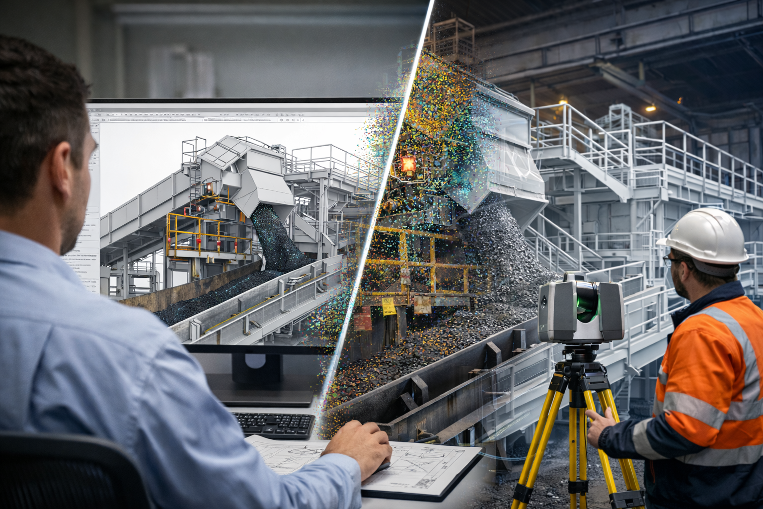
Point cloud mining infrastructure scanning connected to a 3D engineering model of a conveyor transfer chute.

Point Cloud to Engineering Model for Mining Infrastructure

Modern mining infrastructure is complex, constantly evolving, and rarely matches the original construction drawings. Over decades of plant upgrades, maintenance work, and operational modifications, the physical layout of conveyors, chutes, platforms, and structural steel often diverges significantly from historical design documentation.

For engineering teams planning plant upgrades or shutdown work, accurate site information is essential. One of the most effective ways to capture this information is through laser scanning and point cloud modelling, which allows engineers to convert real-world infrastructure into detailed digital engineering models.

The process of converting point cloud mining infrastructure data into engineering models is now widely used across the mining and bulk materials handling industries.


What Is a Point Cloud in Mining Infrastructure?

A point cloud is a dense collection of spatial measurements captured using 3D laser scanning equipment. Each point represents a precise location in space, allowing engineers to reconstruct the geometry of plant infrastructure with extremely high accuracy.

When scanning a mining facility, the point cloud may capture:

  • Conveyors and transfer stations
  • Structural steel platforms and walkways
  • Crushers, screens and processing equipment
  • Stockpile reclaim systems
  • Pipework and mechanical installations
  • Port and ship loading infrastructure

These datasets can contain millions or even billions of measurement points, forming a highly accurate digital representation of the plant environment.


Converting Point Clouds into Engineering Models

While point clouds provide valuable measurement data, they are not directly usable for engineering design. Engineers must convert the scan data into structured mechanical and structural models that can be used for analysis, fabrication and construction planning.

The typical engineering workflow includes:

1. Site Laser Scanning

The plant is scanned using high-accuracy laser scanning equipment to capture the geometry of existing infrastructure.

2. Point Cloud Processing

The raw scan data is registered and combined to form a unified point cloud representing the entire plant area.

3. Engineering Modelling

Engineers interpret the point cloud and convert key infrastructure elements into CAD models including:

  • Structural steel frameworks
  • Conveyor structures and galleries
  • Transfer chutes
  • Access platforms and walkways
  • Mechanical equipment interfaces

4. Engineering Design and Upgrades

The resulting model allows engineers to design plant modifications with confidence, ensuring equipment fits correctly within the existing infrastructure.

This workflow significantly reduces installation risk during shutdowns and upgrade projects.

For further information on mechanical engineering services for mining plants see:


Supporting Shutdown Planning and Plant Upgrades

Mining plants frequently undergo upgrades to improve reliability, throughput and maintenance access. Many of these upgrades are installed during planned shutdowns where downtime must be carefully controlled.

By developing accurate engineering models from point cloud data, engineers can:

  • Confirm clearances for new equipment
  • Identify potential clashes before fabrication
  • Design replacement transfer chutes and conveyors
  • Validate structural modifications
  • Improve maintenance access systems

These digital engineering models are particularly valuable for shutdown preparation.

More information about this process can be found here:


Transfer Chutes and Materials Handling Infrastructure

Transfer chutes are one of the most common areas requiring modification in coal handling plants and mining infrastructure. Poorly designed chutes can lead to excessive belt wear, blockages, dust generation and maintenance challenges.

Using point cloud models, engineers can analyse the surrounding infrastructure and design improved chute geometries that integrate correctly with existing conveyors and structures.

Learn more about chute engineering and materials handling design here:
โžก https://www.hamiltonbydesign.com.au/coal-chute-design/

Additional engineering insight is available in this technical article:
โžก https://chutesandtransferstations.blogspot.com/2025/07/designing-for-durability-chutes.html

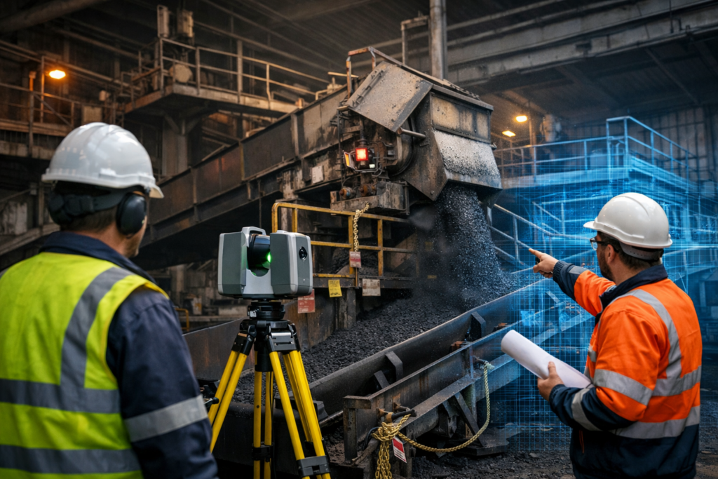
Coal plant shutdown engineering using a 3D laser scanner to capture conveyor and transfer chute infrastructure.

Engineering Applications Across Mining Infrastructure

The conversion of point clouds into engineering models is now widely used across many mining environments.

Common applications include:

  • Coal handling plants
  • Bulk materials handling infrastructure
  • Processing plants and concentrators
  • Port loading facilities
  • Conveyor systems and transfer stations
  • Industrial processing plants

By capturing existing infrastructure digitally, engineers can develop highly accurate models that support plant upgrades, shutdown planning and long-term asset management.


The Future of Digital Engineering in Mining

As scanning technology continues to improve, point cloud modelling is becoming a core component of modern mining engineering workflows.

The ability to convert real-world infrastructure into precise digital models allows engineers to design upgrades more efficiently, reduce installation risk and improve plant reliability.

For mining operators and engineering teams planning infrastructure upgrades, the integration of laser scanning, point clouds and engineering modelling is transforming how projects are designed and delivered.


Hamilton By Design logo displayed on a blue tilted rectangle with a grey gradient background

3D LiDAR scanning and 3D modelling service button โ€” laser scanner capturing a point cloud for engineering and CAD modelling
Mechanical engineering services
Name
Would you like us to arrange a phone consultation for you?
Address

CHPP Engineering title graphic featuring bold white text reading "CHPP Engineering" centred on a blue rounded rectangle background.
Pipework Drafting title graphic featuring bold white text reading "Pipework Drafting" centred on a blue rounded rectangle background.
3D LiDAR Scanning for Engineering Projects title graphic featuring bold white text on a blue rounded rectangle background.

3D CAD Modelling Australia service banner for Hamilton By Design

3D Scanning for Mining Shutdown Projects

3D Scanning for Mining Shutdown Projects | Engineering Laser Scanning

Mining shutdowns are critical windows where maintenance, upgrades, and engineering improvements must be completed quickly and safely. These shutdown periods often involve complex work scopes such as equipment replacements, structural upgrades, conveyor modifications, and new process installations.

One of the most effective technologies supporting shutdown planning today is engineering-grade 3D laser scanning. By capturing highly accurate spatial data of existing infrastructure, engineers can design and verify upgrades before the shutdown begins, reducing risk, rework, and costly delays.

At Hamilton By Design, 3D laser scanning plays a key role in helping mining operations capture accurate plant conditions and convert them into usable engineering data.


Why Mining Shutdowns Require Accurate Site Data

Mining plants evolve over decades. Equipment is modified, conveyors are relocated, structural steel is reinforced, and piping systems are extended or replaced. Unfortunately, plant drawings often do not reflect these changes.

During shutdown projects this creates significant risk, including:

  • Interference between new equipment and existing structures
  • Unexpected clashes with pipework or cable trays
  • Incorrect equipment fitment
  • Delays caused by rework or site modifications

3D laser scanning eliminates these uncertainties by capturing the true as-built condition of the plant.

Millions of spatial measurements are collected in minutes, producing a detailed point cloud model of the plant that engineers can use during design and planning.


How 3D Laser Scanning Supports Shutdown Planning

Engineering scanning provides accurate digital data that allows engineers to prepare shutdown work well before crews arrive onsite.

Capture Existing Plant Geometry

Scanning records the exact positions of key plant infrastructure including:

  • Conveyor structures
  • Transfer chutes
  • Structural steel
  • Pump skids
  • Pipework and services
  • Access platforms and walkways

This data forms a digital model of the plant that engineers can use during design.


Scan-to-CAD Engineering Models

Once scanning is complete, the point cloud data can be converted into CAD models. These models allow engineers to:

  • Design new components around existing infrastructure
  • Develop fabrication drawings
  • Plan shutdown installation sequences
  • Verify spatial clearances

This process is commonly known as Scan-to-CAD engineering modelling.


Clash Detection Before the Shutdown

One of the biggest advantages of scanning is the ability to identify problems before the shutdown begins.

Engineers can compare the scanned plant with proposed designs and identify potential clashes between:

  • Existing structures
  • Pipework and services
  • New equipment
  • Structural modifications

This ensures equipment will fit correctly when installation begins.


Typical Shutdown Projects That Benefit from 3D Scanning

Many mining upgrade projects benefit from scanning before shutdown work begins.

Conveyor and Transfer Upgrades

Mining conveyors are frequently modified during shutdowns. Engineers may need to:

  • Redesign transfer chutes
  • Install new belt cleaners
  • Upgrade pulley assemblies
  • Replace conveyor structures

Scanning ensures new equipment integrates correctly with existing infrastructure.


Pump and Process Equipment Replacement

Pump skids and process equipment often require precise alignment with existing pipework and foundations.

3D scanning allows engineers to verify:

  • Pipe flange locations
  • Equipment clearances
  • Structural support requirements

This reduces installation issues during shutdown.


Structural Steel Modifications

Structural upgrades are common in older processing plants. Scanning helps engineers assess:

  • Beam locations
  • Column spacing
  • Structural clearances
  • Equipment support interfaces

Accurate geometry reduces fabrication errors.


Brownfield Plant Expansions

Shutdowns are often used to integrate new plant sections into existing infrastructure.

Scanning allows engineers to design upgrades within tight spatial constraints, particularly in brownfield mining environments where space is limited.


Engineering-Grade Scanning vs Survey Scanning

Not all scanning services are the same.

Engineering-grade scanning focuses on design and fabrication accuracy, rather than simply generating visual models.

Hamilton By Design scanning workflows typically combine:

  • Engineering LiDAR scanners
  • Handheld metrology scanners where required
  • SolidWorks modelling
  • Engineering interpretation of point cloud data

This ensures the data supports real engineering decisions, not just visualisation.


Benefits for Mining Operations

Using 3D scanning during shutdown planning delivers several key advantages.

Reduced shutdown risk through accurate site data.

Faster engineering design using precise plant geometry.

Improved fabrication accuracy for shutdown components.

Reduced rework caused by installation clashes.

Improved safety through better shutdown planning.


Supporting Mining Shutdown Projects with Engineering 3D Scanning

Hamilton By Design provides engineering-led 3D laser scanning services for mining and industrial projects across Australia.

Our scanning workflows support:

  • Shutdown planning
  • Mechanical design upgrades
  • Scan-to-CAD modelling
  • Structural verification
  • Plant layout assessments
3D LiDAR scanning and 3D modelling service button โ€” laser scanner capturing a point cloud for engineering and CAD modelling
Mechanical engineering services

By combining advanced scanning technology with mechanical engineering expertise, we help mining companies reduce risk and deliver successful shutdown projects.


Name
Would you like us to arrange a phone consultation for you?
Address

3D CAD Modelling Australia service banner for Hamilton By Design
Australian Drafting logo featuring bold white text reading "Australian Drafting" centred on a blue rounded rectangle background.
Engineering Governance title graphic featuring bold white text reading "Engineering Governance" centred on a blue rounded rectangle background.
Mechanical, Structural & Pipework Drafting service banner by Hamilton By Design featuring white text on a blue background.
Mechanical engineering services
Blue rounded button with the text โ€œSolidWorks Designโ€ in white.
Finite Element Analysis (FEA) engineering simulation button
3D LiDAR Scanning Darwin for engineering surveys, laser scanning, reality capture and point cloud modelling services
3D LiDAR Scanning Australia engineering services for laser scanning, reality capture, scan-to-CAD, Scan-to-BIM and as-built documentation across Australia
3D LiDAR scanning services on the Central Coast providing engineering-grade laser scanning, point cloud capture, scan-to-CAD modelling and industrial reality capture for infrastructure and industrial projects.
3D LiDAR Scanning Perth for engineering surveys, laser scanning, reality capture and point cloud modelling services
3D LiDAR Scanning Sydney for engineering surveys, laser scanning, reality capture and point cloud modelling services
3D LiDAR Scanning Brisbane for engineering surveys, laser scanning, reality capture and point cloud modelling services
3D LiDAR Scanning Canberra for engineering surveys, laser scanning, reality capture and point cloud modelling services
3D LiDAR Scanning Newcastle for engineering surveys, laser scanning, reality capture and point cloud modelling services
3D LiDAR Scanning Adelaide for engineering surveys, laser scanning, reality capture and point cloud modelling services