Mechanical Engineering | 3D Scanning | 3D Modelling
Tag: point cloud to CAD
Explore articles and resources on point cloud to CAD workflows, including converting laser scan data into editable engineering models, as-built drawings, 3D CAD models, and accurate design deliverables for industrial and mining projects.
Point Cloud to CAD | Mechanical Engineering | Western Sydney Specialists
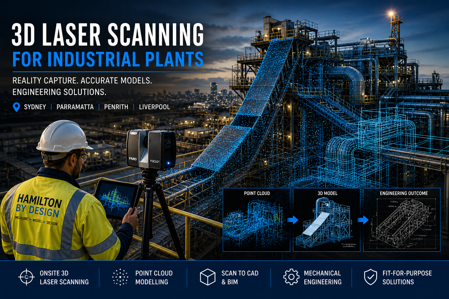
At Hamilton By Design, we provide engineering-grade 3D laser scanning for industrial plants, delivering accurate site data, detailed CAD models, and fit-for-purpose mechanical design solutions across Sydney, Parramatta, Penrith, and Liverpool.
Unlike typical 3D scanning companies, we are mechanical engineers first. That means every scan is captured with the end goal in mind — design, fabrication, and real-world application.
3D Laser Scanning Services (Sydney & Western Sydney)
We offer onsite and mobile 3D scanning services across:
Parramatta
Penrith
Liverpool
Greater Western Sydney
Our LiDAR scanning services are ideal for:
Industrial plants
Manufacturing facilities
Processing plants
Construction and building upgrades
If you’re searching for a “3D scanning company near me”, we deliver fast, accurate, and engineering-ready results.
From Point Cloud to CAD (Engineering-Ready Models)
Scanning is only the first step.
We convert scan data into:
Point cloud modelling
3D CAD models (SolidWorks, STEP, Parasolid)
2D AutoCAD drawings
Scan-to-BIM models
This allows for:
Accurate design modifications
Clash detection
Fabrication-ready outputs
Mechanical Engineering Services
Hamilton By Design provides full mechanical engineering support, including:
Process equipment design
Structural and mechanical upgrades
Preventative maintenance design
Fit-for-purpose engineering solutions
All work is aligned with relevant Australian Standards, including AS 4991 where applicable.
Mining & Bulk Handling (High-Value Applications)
We specialise in mining and bulk materials handling systems, including:
Coal chutes and transfer stations
Conveyor systems
Outbye mining infrastructure
Header transition chutes
Custom Design vs Off-the-Shelf
Off-the-shelf chute designs often lead to:
Poor fit
Increased wear
High maintenance costs
Our approach:
Scan existing plant conditions
Develop custom designs based on real data
Deliver solutions that reduce downtime and improve performance
Building & Construction Scanning
We also support:
Building scanning services
Construction site verification
Scan-to-BIM for refurbishment projects
Ideal for commercial, industrial, and infrastructure upgrades.
Industries We Support
Industrial plants
Manufacturing facilities
Food processing plants
Mining and bulk handling
Construction and infrastructure
Locations We Service
We provide 3D laser scanning and engineering services across:
Sydney Parramatta Penrith Liverpool Western Sydney
With project capability across NSW and Australia.
Common Questions
What are the best 3D scanning platforms?
We use industry-leading LiDAR systems such as FARO and Leica. However, the real value comes from how the data is used in engineering design.
Do I need scan-to-CAD or just scanning?
Most industrial projects require CAD models and engineering input — not just raw scan data.
Who provides professional 3D scanning near me?
Engineering-led companies like Hamilton By Design provide usable outcomes, not just visual data.
Get Started
If you need accurate site data, modelling, or engineering support for an industrial project, contact Hamilton By Design today.
Hamilton By Design provides engineering-led 3D scanning, LiDAR scanning, mechanical engineering and digital engineering services throughout Sydney and Greater Sydney.
Explore our related Sydney services:
3D Scanning Sydney – Engineering-grade terrestrial laser scanning, as-built surveys and point cloud capture for industrial, infrastructure and commercial projects.
Reality Capture Sydney – High-accuracy reality capture, digital twins, asset documentation and engineering-grade site verification.
Scan to CAD Sydney – Convert point cloud data into AutoCAD, SolidWorks, Inventor and other engineering-ready CAD deliverables.
Point Cloud Modelling Sydney– Engineering-grade point cloud processing, clash detection, as-built verification and 3D modelling.
Mechanical Engineering Sydney – Mechanical design, plant upgrades, materials handling systems, conveyors, chutes, platforms and engineering support.
Structural Drafting Sydney– Structural steel drafting, fabrication drawings, GA drawings, workshop detailing and as-built documentation.
Hamilton By Design supports projects throughout Sydney CBD, Parramatta, Liverpool, Penrith, Blacktown, Chatswood, Alexandria, Mascot, Newcastle and the Central Coast.
A Risk-Based Perspective for Project Managers and Company Directors
Executive Summary
The increasing availability of low-cost 3D scanning services has led to a perception that reality capture is a commoditised input to engineering projects. However, within fabrication-driven environments—particularly in mining, heavy industry, and brownfield infrastructure—this assumption is fundamentally flawed.
3D scanning is not an isolated deliverable; it is a foundational dataset upon which design, fabrication, and installation decisions are made. When this dataset lacks accuracy, completeness, or governance, downstream impacts emerge in the form of rework, delays, cost overruns, and elevated operational risk.
This paper outlines why low-cost scanning solutions frequently result in higher total project costs and provides a framework for evaluating scanning methodologies from a lifecycle and risk perspective.
1. The Role of Reality Capture in the Project Lifecycle
In modern engineering workflows, 3D scanning underpins a sequence of dependent activities:
Site capture (point cloud acquisition)
Data registration and validation
3D modelling and design development
Detailing for fabrication
Installation and commissioning
Each stage inherits the quality of the preceding one. As a result, deficiencies in the initial scan propagate throughout the project lifecycle. Errors introduced at the data capture stage are rarely isolated and are often only fully realised during fabrication or installation—when rectification costs are at their highest.
2. Accuracy as a Determinant of Fabrication Success
Fabrication processes require dimensional certainty. Tolerances associated with structural steel, piping systems, and mechanical assemblies are typically measured in millimetres. Deviations beyond these tolerances can render components unfit for purpose.
Lower-cost scanning methodologies, particularly those relying on unstructured workflows or drift-prone systems, often exhibit:
Accumulated positional error over distance
Inconsistent alignment between scan sets
Limited or absent survey control
Reduced reliability in complex industrial environments
While such datasets may appear visually acceptable, they frequently lack the dimensional integrity required for fabrication-grade outputs. The result is misalignment, rework, and increased reliance on site-based modification.
3. Cost Amplification Through Downstream Rework
The primary issue with low-cost scanning is not the initial saving, but the amplification of costs downstream.
A typical failure pathway includes:
Design based on inaccurate geometry
Fabrication to incorrect specifications
Installation conflicts and misalignment
At the installation stage, corrective actions may include:
Cutting and re-welding on site
Redesign under time constraints
Expedited fabrication of replacement components
Additional labour and supervision
A relatively small saving in scanning costs can therefore result in significant increases in total project cost, particularly in time-critical environments.
4. Operational Risk and Downtime Implications
In industrial environments, downtime represents one of the most significant cost drivers. Inaccurate scan data introduces risks that extend beyond fabrication and into operations, including:
Extended shutdown durations
Delayed commissioning
Installation clashes
Disruption to production schedules
Given the high cost of downtime in mining and processing facilities, even minor delays can have substantial financial consequences. Low-cost scanning therefore introduces not only technical risk but also operational and commercial risk.
5. Visual Fidelity Versus Engineering Validity
A common misconception is that visually impressive scan data equates to engineering accuracy. Modern software platforms can present dense, colourised point clouds that appear complete and reliable.
However, visual quality does not guarantee:
Verified spatial accuracy
Consistent coordinate alignment
Defined tolerances
Reliable integration into engineering workflows
For decision-makers, the critical question is whether the data is demonstrably accurate and suitable for its intended engineering purpose—not whether it appears visually convincing.
6. Data Completeness and Design Integrity
In addition to accuracy, completeness of data capture is essential.
Low-cost scanning approaches often result in incomplete datasets due to time constraints, access limitations, or insufficient planning. Common omissions include:
Undersides of structures
Connection points and bolt details
Congested or hard-to-reach areas
Critical interfaces between systems
Incomplete data forces engineers to make assumptions, which introduces uncertainty into the design process. This often leads to conservative design, increased material usage, additional site visits, and iterative revisions.
7. Governance and Traceability
Effective project delivery requires a clear and controlled data environment.
Engineering-grade scanning workflows typically include:
Registration reports and validation metrics
Defined coordinate systems
Version control and data management
Traceability from scan to model to drawing
Low-cost scanning services often lack these controls, resulting in:
Multiple conflicting datasets
Poor coordination between disciplines
Limited accountability
Increased risk during audits or dispute resolution
Without a single source of truth, project risk increases significantly.
8. Fabrication Constraints and Irreversibility
Fabrication environments operate on precision and adherence to documented design. Workshops do not reinterpret data—they execute it.
When inaccurate scan data informs fabrication:
Errors are embedded in physical components
Materials and labour are consumed unnecessarily
Corrections become costly and complex
By the time issues are identified, the opportunity for low-cost correction has passed.
9. Reframing the Investment Decision
The evaluation of scanning services should be based on total project cost rather than initial expenditure.
Engineering-grade scanning: moderate upfront cost, reduced risk and greater predictability
Given that scanning represents a small proportion of overall project cost, decisions based solely on price are often misaligned with project objectives.
10. A Structured Approach to Risk Mitigation
To reduce risk and improve outcomes, the following approach is recommended:
Define accuracy requirements aligned with fabrication tolerances
Select appropriate scanning methodologies
Implement controlled data acquisition and registration
Validate datasets prior to design development
Integrate scan data into coordinated modelling workflows
Maintain governance and version control throughout the project lifecycle
This ensures that reality capture supports, rather than undermines, project delivery.
Conclusion
Low-cost 3D scanning services may appear cost-effective at the outset, but they frequently result in increased costs, delays, and risk when evaluated across the full project lifecycle.
For project managers and company directors, the critical consideration is the integrity of the data informing engineering decisions. In fabrication-driven environments, accuracy and reliability are essential.
Investment in engineering-grade scanning should therefore be viewed not as an optional expense, but as a risk mitigation strategy that underpins successful project delivery.
Related Services
To support fabrication certainty and reduce project risk, the following engineering-led services are available:
These services are specifically structured to deliver accurate, validated datasets suitable for engineering design and fabrication.
Ensuring Confidence in Fabrication Data
Where projects involve brownfield modifications, shutdown execution, or critical structural and mechanical installations, the reliability of underlying data is a key determinant of success.
Engineering-grade 3D LiDAR scanning provides a controlled and verifiable foundation for design, reducing uncertainty and enabling informed decision-making throughout the project lifecycle.
At Hamilton By Design, the focus is on delivering fit-for-purpose engineering data—ensuring that models, drawings, and fabrication outputs align with real-world conditions.
Independent Review of Existing Scan Data
Where scan data has already been captured, an independent review can be undertaken to assess its suitability for engineering and fabrication use.
This includes evaluation of:
Registration quality and alignment integrity
Dimensional accuracy relative to project requirements
Completeness of captured geometry
Suitability for downstream modelling and detailing
This approach provides clarity before further design or fabrication investment is committed.
A professional 3D scanning company does more than capture data — it delivers accurate, engineering-ready information that can be used for design, construction, and asset management.
At Hamilton By Design, we provide engineering-led 3D laser scanning services, converting real-world conditions into precise digital models for industrial, mining, and infrastructure projects.
What We Do
We provide 3D scanning services including:
Terrestrial LiDAR scanning
Point cloud to CAD modelling
Reverse engineering
Industrial plant scanning
Brownfield project support
Our focus is on delivering accurate data that can be used for real engineering outcomes.
LiDAR Scanning
We use high-accuracy LiDAR scanners to capture millions of data points across your site.
This allows us to:
Capture true as-built conditions
Measure complex environments
Improve design accuracy
Reduce reliance on outdated drawings
Point Cloud to CAD
Captured scan data is processed into usable engineering models.
This helps:
Reduce design clashes
Improve installation accuracy
Minimise rework
Models are developed in platforms such as SolidWorks and delivered in formats suitable for design and fabrication.
Reverse Engineering
We convert scan data into detailed models where drawings are missing or outdated.
This is ideal for:
Legacy equipment
Conveyor systems
Pipework and mechanical assemblies
Brownfield Projects
Most scanning work is carried out in existing plants where drawings are limited or inaccurate.
We support these projects by:
Scanning existing infrastructure
Developing accurate 3D models
Supporting design that fits first time
Deliverables
We provide:
Registered point clouds (.E57, .RCP, .LAS)
3D CAD models
General arrangement drawings
Fabrication drawings
We also offer drawing management through the 3DEXPERIENCE Platform, providing secure access to project data.
Why Choose Hamilton By Design
Engineering-led approach
High-accuracy LiDAR scanning
Integration with CAD workflows
Fast turnaround times
Experience in mining and industrial environments
Get Started
If you need a reliable 3D scanning company, Hamilton By Design can support your project from scan through to design and fabrication.
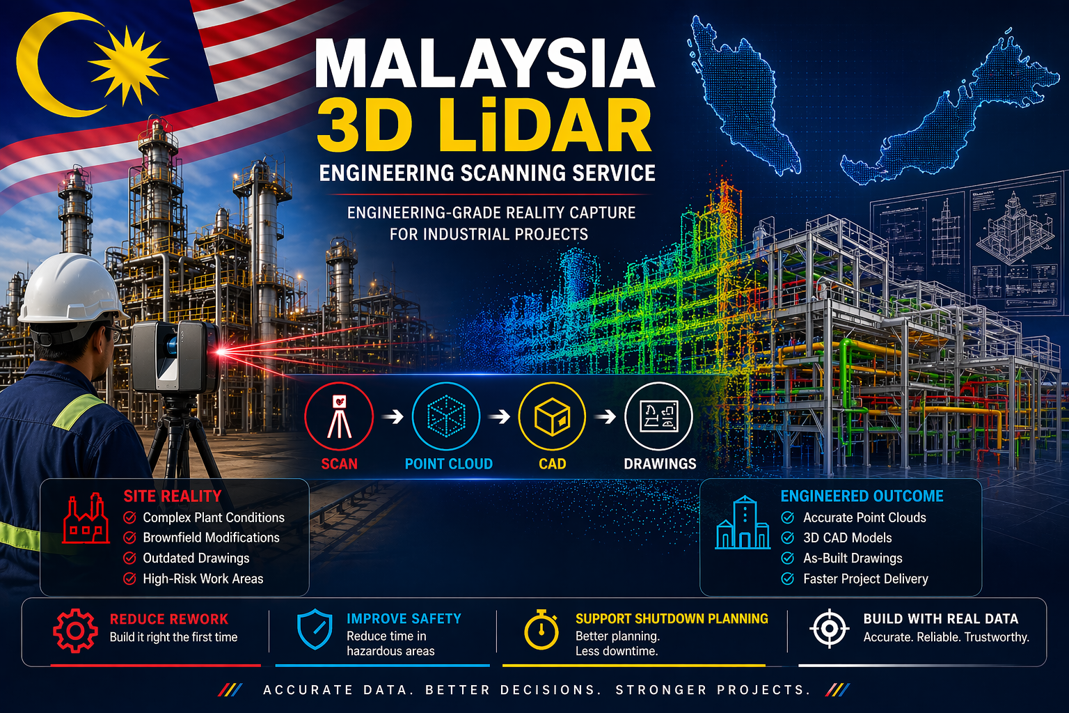
Malaysia is a major hub for industrial activity across oil and gas, manufacturing, palm oil processing, and infrastructure. These facilities are often complex environments where accuracy is critical to project success.
Hamilton By Design provides Malaysia 3D LiDAR engineering scanning services, delivering accurate site data that supports safer, faster, and more reliable engineering outcomes.
Traditional measurement methods rely on outdated drawings, manual measurements, and assumptions. Over time, industrial plants change, and what exists on paper often does not reflect what has actually been built.
This creates risk across design, fabrication, and installation.
3D LiDAR scanning removes this uncertainty. Using high-speed laser measurement, millions of data points are captured to create a point cloud. This point cloud represents the exact geometry of the site as it exists in reality.
The data can then be converted into 3D CAD models and engineering drawings, providing a reliable foundation for project delivery.
The benefits are immediate.
Engineering accuracy improves because designs are based on real-world conditions. Clash detection can be completed before fabrication begins, reducing rework and avoiding costly delays.
Project timelines are reduced. Engineering teams can work remotely using accurate data, limiting the need for repeated site visits.
Safety is improved by reducing the time spent in hazardous environments. This is especially important during shutdowns and brownfield upgrades.
Shutdown planning becomes more effective. Components can be prefabricated, installation can be planned in detail, and downtime can be minimised.
Most importantly, 3D LiDAR scanning provides true as-built documentation. Every visible element of the plant is captured, allowing accurate layouts, sections, and models to be generated without returning to site.
The real value comes from the workflow.
Scan the site. Process the point cloud. Build the CAD model. Produce engineering drawings.
This process transforms raw data into practical, engineering-ready deliverables that can be used across the full lifecycle of a project.
These services are widely used across oil and gas facilities, palm oil processing plants, manufacturing operations, mining infrastructure, and power generation sites throughout Malaysia.
Typical applications include plant upgrades, structural modifications, equipment installations, and shutdown planning.
In today’s environment, projects are expected to be delivered faster, safer, and with greater accuracy. 3D LiDAR scanning supports these outcomes by ensuring decisions are based on real data rather than assumptions.
If you are planning an upgrade, shutdown, or new installation within an industrial facility in Malaysia, accurate information is critical.
To learn more about how Hamilton By Design can support your project, visit:
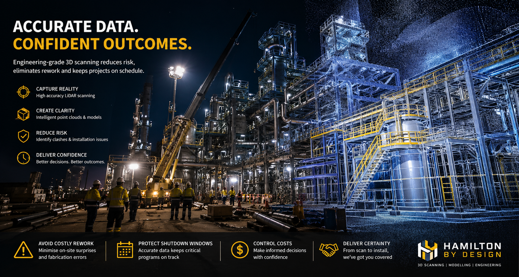
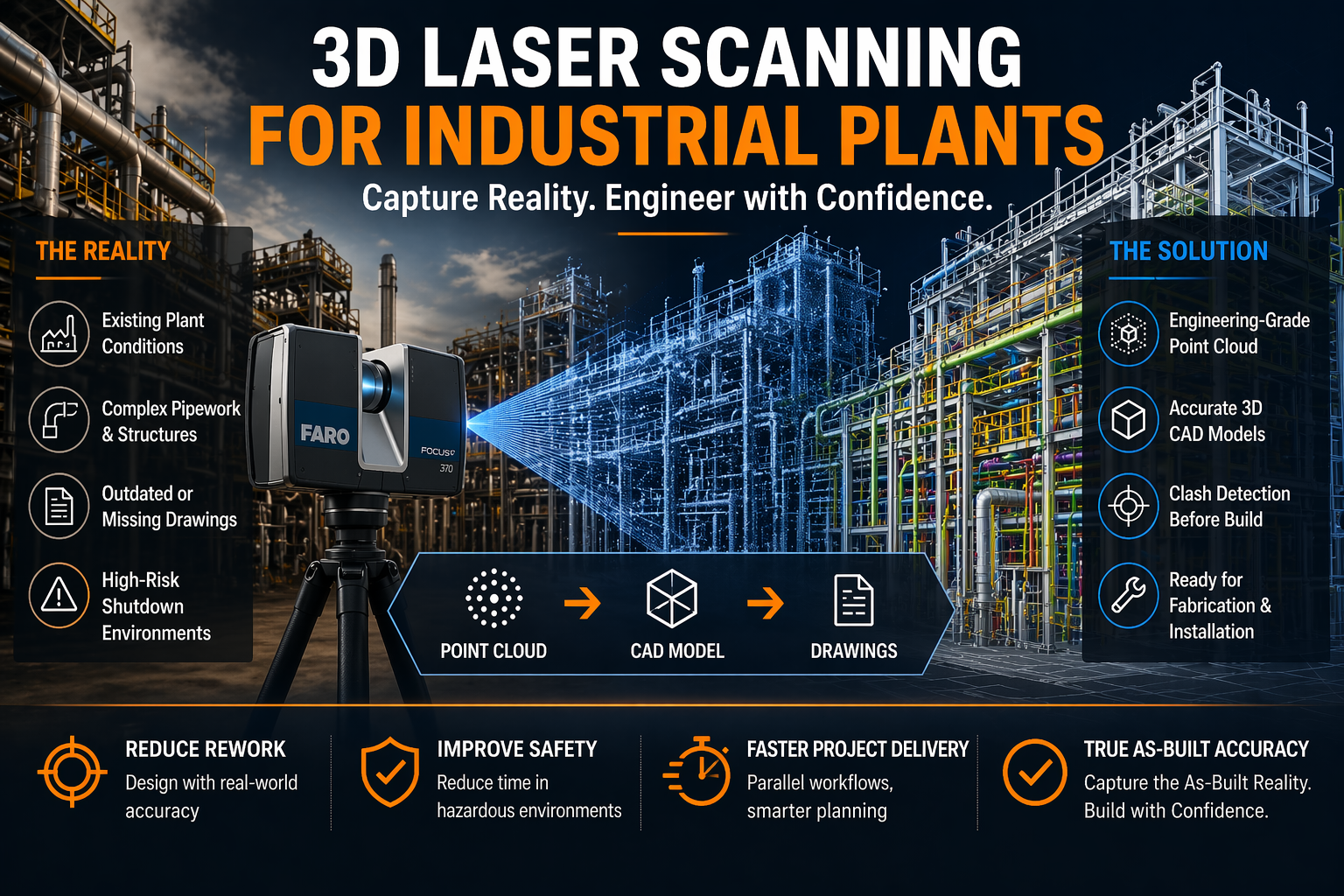
Industrial plants are complex, high-risk environments where accuracy is everything. Whether you’re working in mining, processing, manufacturing, or energy, one incorrect dimension can lead to costly rework, shutdown delays, or safety issues.
At Hamilton By Design, we specialise in 3D laser scanning for industrial plants—capturing real-world conditions with engineering-grade accuracy and turning them into usable models, drawings, and digital assets.
What is 3D Laser Scanning for Industrial Plants?
3D laser scanning (LiDAR) uses high-speed laser measurement technology to capture millions of points in space—creating a point cloud that represents the exact geometry of your plant.
Unlike traditional measuring methods:
No manual tape measurements
No guesswork or assumptions
No reliance on outdated drawings
Instead, you get a true digital representation of reality.
Why Industrial Plants Need 3D Laser Scanning
1. Brownfield Accuracy
Most industrial facilities have evolved over time. Drawings rarely reflect what’s actually been built.
3D scanning provides:
Accurate as-built conditions
Clash detection before fabrication
Confidence in design decisions
2. Shutdown Planning & Risk Reduction
Shutdowns are expensive. Every hour matters.
With a full point cloud:
Work can be planned offsite
Fabrication can occur before shutdown
Installation becomes faster and safer
3. Complex Geometry Capture
Industrial plants include:
Dense pipework
Structural steel
Conveyor systems
Mechanical equipment
3D scanning captures all of it—simultaneously—with millimetre-level detail.
4. Engineering-Ready Deliverables
At Hamilton By Design, we don’t just scan—we engineer.
In modern engineering, accuracy is everything. Whether you are working in mining, manufacturing, infrastructure, or plant design, the difference between success and costly rework often comes down to how well you understand what has actually been built.
This is where laser scanning for engineering has become a critical tool.
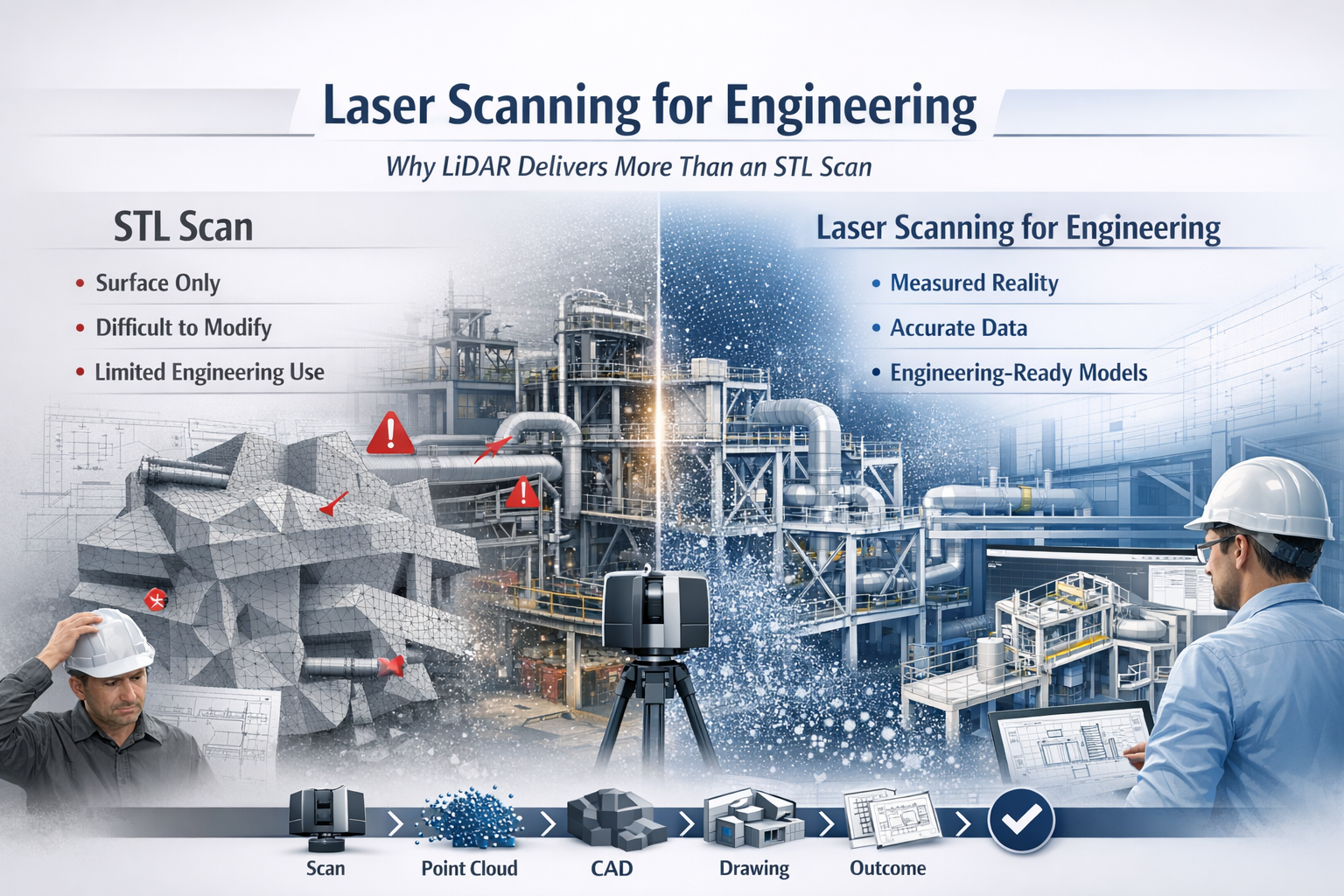
While many providers offer “3D scanning,” not all data is created equal. There is a significant difference between engineering-grade LiDAR point cloud data and basic STL mesh outputs. Understanding that difference can determine whether your project moves forward efficiently—or gets stuck in rework, assumptions, and redesign.
What is Laser Scanning for Engineering?
Laser scanning for engineering uses LiDAR (Light Detection and Ranging) technology to capture millions of precise measurements of a physical environment. The result is a high-density point cloud—a true digital representation of reality.
Unlike traditional measurement methods, LiDAR captures:
Complex geometry
Structural relationships
Equipment positioning
Real-world deviations from design
This data becomes the foundation for:
CAD modelling (SolidWorks, AutoCAD, Revit)
Engineering drawings
Clash detection
Retrofit and upgrade design
In short, it bridges the gap between design intent and as-built reality.
The Problem with STL-Based Scanning
Many scanning providers deliver outputs as STL, OBJ, or mesh files. While these formats are useful for visualisation or 3D printing, they fall short in engineering applications.
Key limitations of STL scans:
No intelligence – Meshes are just surfaces, not structured geometry
Difficult to modify – Not suitable for parametric design workflows
Poor for engineering drawings – Cannot easily generate sections, tolerances, or fabrication details
Heavy and inefficient – Large file sizes with limited usability
No clear chain of accuracy – Hard to verify measurement reliability
In practical terms, an STL file often becomes a dead-end deliverable—you can look at it, but you can’t engineer from it effectively.
Why LiDAR Point Clouds Are Built for Engineering
LiDAR-based laser scanning for engineering produces structured, measurable, and verifiable data that integrates directly into engineering workflows.
Key advantages:
1. True-to-Reality Accuracy
Point clouds capture millions of measured points, providing a high-confidence representation of the real world.
2. Direct CAD Integration
Data can be converted into:
Parametric 3D models
Fabrication-ready drawings
Plant layouts and assemblies
3. Supports Engineering Decisions
Engineers can:
Measure directly from the dataset
Validate clearances and tolerances
Design with confidence
4. Enables Retrofit and Brownfield Design
In existing plants, nothing is ever exactly “as drawn.” LiDAR ensures your design fits what is actually there, not what was intended years ago.
5. Reduces Risk and Rework
Accurate input data leads to:
Fewer site revisits
Reduced fabrication errors
Lower project costs
6. Maintains Chain of Custody
Engineering-grade scanning supports data governance, traceability, and verification—critical in legal, compliance, and high-risk environments.
Engineering vs Visualisation: A Critical Distinction
A key misunderstanding in the industry is assuming all 3D scanning is equal.
STL / Mesh Scanning → Visualisation Output
LiDAR Point Cloud → Engineering Input
If your goal is:
3D printing → STL may be enough
Engineering design, fabrication, or upgrades → LiDAR is essential
Real-World Application: Engineering in Practice
Across mining, manufacturing, and infrastructure, laser scanning for engineering is used to:
Capture conveyor systems before modification
Model structural steel for upgrades
Verify equipment installation
Design pipework and mechanical systems
Plan shutdown works with precision
Instead of guessing dimensions or relying on outdated drawings, engineers work from measured reality.
The Workflow That Delivers Results
A proper engineering workflow looks like this:
Scan → Register → Model → Detail → Deliver
Not:
Scan → Export STL → End
That difference defines whether you receive a usable engineering deliverable or just a digital artifact.
Laser scanning for engineering is not just about capturing data—it’s about enabling better engineering outcomes.
LiDAR-based point cloud data provides:
Accuracy
Usability
Engineering value
In contrast, STL-based scanning often limits what you can achieve.
If your project requires real design, real drawings, and real decisions, then the choice is clear:
Use laser scanning for engineering—not just scanning for appearance.
To provide the best experiences, we use technologies like cookies to store and/or access device information. Consenting to these technologies will allow us to process data such as browsing behaviour or unique IDs on this site. Not consenting or withdrawing consent, may adversely affect certain features and functions.
Functional
Always active
The technical storage or access is strictly necessary for the legitimate purpose of enabling the use of a specific service explicitly requested by the subscriber or user, or for the sole purpose of carrying out the transmission of a communication over an electronic communications network.
Preferences
The technical storage or access is necessary for the legitimate purpose of storing preferences that are not requested by the subscriber or user.
Statistics
The technical storage or access that is used exclusively for statistical purposes.The technical storage or access that is used exclusively for anonymous statistical purposes. Without a subpoena, voluntary compliance on the part of your Internet Service Provider, or additional records from a third party, information stored or retrieved for this purpose alone cannot usually be used to identify you.
Marketing
The technical storage or access is required to create user profiles to send advertising, or to track the user on a website or across several websites for similar marketing purposes.