Mechanical Engineering | 3D Scanning | 3D Modelling
Tag: point cloud to CAD
Explore articles and resources on point cloud to CAD workflows, including converting laser scan data into editable engineering models, as-built drawings, 3D CAD models, and accurate design deliverables for industrial and mining projects.
There’s a problem happening on projects across Australia right now:
Design says one thing. Site builds another.
And no one realises until it’s too late.
The Real Issue: Miscommunication Between Design and Build
It’s not that people aren’t doing their job.
It’s that the information they’re working from isn’t aligned.
Drawings don’t reflect reality
Existing plant conditions are assumed, not verified
Fabrication is based on outdated or incomplete data
Site modifications happen on the fly
👉 The result?
Rework
Delays
Cost blowouts
Frustrated teams
This is where most projects quietly bleed money.
“We Thought It Would Fit…” — The Most Expensive Words on Site
If you’ve ever heard:
“That’s not what we expected on site”
“We’ll just make it work”
“Can we modify it during install?”
You’re already in reactive mode.
And reactive mode is where projects lose control.
So What Are the Best 3D Scanning Platforms to Fix This?
Let’s be clear:
👉 It’s not just about the scanner 👉 It’s about how the data is captured, interpreted, and delivered
But here’s how the platforms stack up in the real world:
1. FARO Focus (Engineering-Grade Reality Capture)
✔ High accuracy (millimetre-level) ✔ Ideal for brownfield industrial environments ✔ Reliable for mechanical design, pipework, and structural interfaces
💡 This is where engineering-led scanning matters
Anyone can scan. Not everyone understands line-of-sight constraints, coverage, and design intent.
2. Leica RTC360 (Speed + Visualisation)
✔ Fast capture and good for large areas ✔ Strong visual workflows ✔ Great for general site documentation
⚠ But without engineering oversight, you still risk:
Missing critical geometry
Poor scan coverage
Misalignment with fabrication requirements
3. NavVis / Mobile Scanning (Speed Over Precision)
✔ Rapid walkthrough capture ✔ Useful for high-level coordination
⚠ Not suitable for:
Fabrication-level accuracy
Mechanical interfaces
Detailed engineering design
The Truth Most People Miss
The platform doesn’t fix the problem.
👉 Engineering-led scanning does.
Why Engineering-Led Scanning Changes Everything
At Hamilton By Design, we don’t just “scan a site”.
We capture it like engineers who have to design and build from it.
That means:
Understanding what needs to be modelled — and what doesn’t
Managing line-of-sight to eliminate data gaps
Delivering point clouds that actually support design decisions
Producing models and drawings that match real-world conditions
From Scan → Model → Build (No Guesswork)
When done properly, 3D scanning becomes:
✔ A single source of truth ✔ A digital twin of your site ✔ A way to align design, fabrication, and installation
No assumptions. No “we’ll fix it on site”. No disconnect.
If You’re Getting It Wrong on Site — This Is Why
It’s not your team.
It’s the gap between:
👉 What was designed 👉 And what actually exists
Fix the Gap — Not the Symptoms
If you’re serious about reducing rework, delays, and cost blowouts:
👉 Start with accurate, engineering-grade site data
Learn More
Explore how we deliver engineering-led 3D scanning in Sydney:
In industrial and mechanical projects, one of the most common — and costly — client concerns is simple:
“I don’t trust the design… and I don’t really know what I’m going to get.”
It usually starts with an existing asset.
Old drawings that don’t match reality
Missing documentation
Modifications made over time
Conflicting information between teams
At that point, every decision becomes a risk.
The Real Problem Isn’t the Design — It’s the Data
Most design issues don’t come from bad engineers.
They come from bad inputs.
If your base information is wrong:
Models won’t fit
Steel won’t align
Pipework clashes on install
Fabrication needs rework
And suddenly, what looked like a solid design becomes a site problem.
What Clients Are Actually Searching For
When clients say they don’t trust the design, they’re usually looking for:
point cloud to CAD conversion services
reverse engineering services
mechanical engineering models
engineering-grade verification
What they really mean is:
“I need to know this will fit before I spend money building it.”
Step 1: Capture Reality — Not Assumptions
The first step is removing uncertainty completely.
Using engineering-grade LiDAR scanning, you capture the real-world geometry of your asset — not what the drawings say, but what actually exists on site.
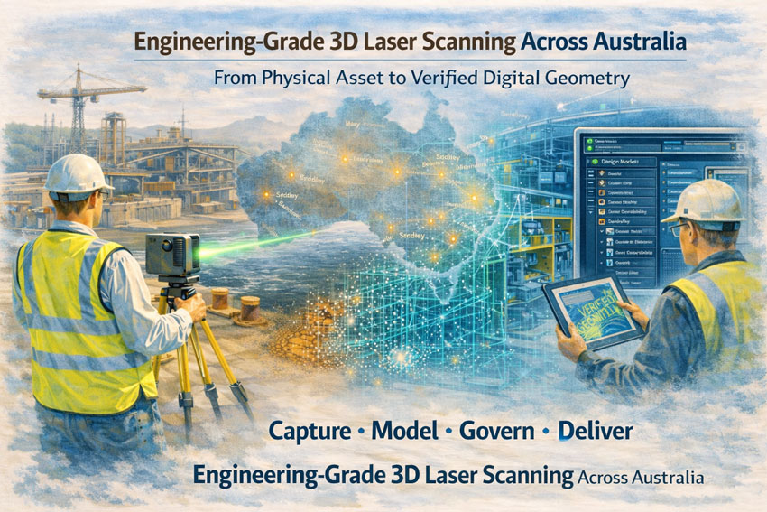
Engineering-Grade 3D Laser Scanning Across Australia | Hamilton By Design
Precision Capture. Engineering Accuracy. National Coverage.
Hamilton By Design delivers engineering-grade 3D laser scanning and LiDAR services across Australia — supporting mining, heavy industry, infrastructure and commercial projects with accurate, design-ready data.
We don’t just capture point clouds.
We deliver engineered geometry ready for decision-making, modification, compliance and fabrication.
Why Engineering-Grade Matters
Not all 3D scanning is equal.
Survey-grade and visual scans may produce impressive imagery, but engineering projects require:
Measurable accuracy
Structured point cloud management
Traceable coordinate systems
Cleaned and classified data
CAD-ready deliverables
Integration into engineering governance workflows
Our scanning workflows are built specifically for:
Hamilton By Design provides scanning services across:
New South Wales
Queensland
Western Australia
Victoria
South Australia
Northern Territory
We regularly support projects in:
Sydney • Newcastle • Central Coast • Brisbane • Mount Isa • Perth • Melbourne • Broken Hill • Darwin
Remote and regional projects are part of our operating model.
Our Engineering Workflow
Site Capture
Using professional LiDAR and engineering-grade scanning equipment, we capture:
Existing plant layouts
Structural steel
Mechanical systems
Confined and complex environments
Large industrial footprints
Data Processing
We clean, register and align point clouds into structured datasets suitable for:
3D modelling
Clash detection
FEA preparation
Fabrication detailing
Engineering verification
Engineering Integration
Unlike survey-only providers, we integrate scans into:
Solid models
Assembly models
2D drawings
Revision-controlled documentation
Compliance frameworks
This ensures your scan becomes a working engineering asset — not just a visual reference.
Typical Applications
Mining plant modifications
Conveyor upgrades
Chute redesign
Lifting beam retrofits
Tank and vessel alterations
Brownfield automation projects
Shutdown verification and planning
As-built validation for compliance
Accuracy & Deliverables
We provide:
Registered point clouds
Cleaned and segmented datasets
STEP / IGES / native CAD formats
2D layouts
3D assemblies
Structured file naming and revision control
Deliverables can align with your:
Engineering standards
ISO document control
Mining governance frameworks
AS compliance requirements
Governance & Data Security
Engineering data is intellectual property.
We integrate our scanning outputs into structured governance frameworks and can support secure data management workflows using enterprise-level platforms.
This means:
Controlled access
Version traceability
Secure archiving
24/7 accessibility
Your geometry remains protected and usable long-term.
Why Hamilton By Design?
✔ Engineering-led scanning (not survey-only) ✔ Mining and heavy industry experience ✔ National capability ✔ Governance-focused deliverables ✔ Integration into design, FEA and fabrication ✔ Practical understanding of shutdown constraints
We understand how scanning supports real engineering decisions — because we operate inside those environments.
Reduce Risk Before You Fabricate
Incorrect geometry causes:
Rework
Fabrication delays
Misalignment on site
Compliance issues
Cost escalation
Engineering-grade 3D laser scanning removes uncertainty before steel is cut.
Speak With Our Team
If you require engineering-grade 3D laser scanning anywhere in Australia, contact Hamilton By Design to discuss your project.
Precision capture is only valuable when it supports engineered outcomes.
Mobile 3D Scanning Services | Onsite LiDAR for Regional Australia
When a project is outside the major cities, access to accurate engineering data can be the difference between a smooth upgrade and an expensive mistake. Mobile 3D scanning services bring high-accuracy LiDAR and reality capture directly to your site—whether that’s a regional workshop, a mine in the outback, a water treatment plant, or a small manufacturing facility in a local town.
At Hamilton By Design, our approach is simple: we come to you, capture the site as it really exists, and convert that data into build-ready CAD and point clouds that engineers, fabricators, and asset owners can rely on.
What Are Mobile 3D Scanning Services?
Mobile 3D scanning means deploying professional laser scanners and engineering workflows on location, not in a lab or office. Instead of measuring with tape, sketches, and guesswork, we capture millions of precise points that represent:
Structural steel and concrete
Pipework and mechanical equipment
Conveyor systems and bulk handling plant
Buildings, workshops, and brownfield sites
Vehicles, tanks, and custom machinery
The result is a digital twin of your asset that can be used for design, fabrication, clash detection, and maintenance planning—without repeated site visits.
Perfect for Smaller Towns and Regional Projects
Regional businesses often face the same challenges:
Limited access to specialist surveyors
Old drawings that don’t match reality
Upgrades carried out over decades
Shutdown windows that are tight and costly
Our mobile service is designed for these exact conditions. We regularly travel to local towns, industrial hubs, and remote facilities to provide the same level of engineering capture normally reserved for major city projects.
Whether you’re in the Central Coast, Mount Isa, Broken Hill, Bathurst, Rockhampton, or anywhere in between, we can mobilise quickly and deliver professional data without the need for you to bring contractors from multiple companies.
How the Process Works
1. One Day Onsite – Minimal Disruption
Most projects can be captured in a single day. We position the scanner, record high-resolution point clouds, and focus extra detail around critical tie-in points.
2. Registered Point Cloud
Back in the office we register and clean the data into a single accurate model referenced to real-world coordinates.
3. Engineering Deliverables
From that scan we can provide:
Registered point cloud files
PDF site layouts
AutoCAD / SOLIDWORKS models
Fabrication drawings
Clash and tolerance checks
Because we are engineers first—not just surveyors—the outputs are created with practical fabrication and construction in mind.
Why Mobile Scanning Beats Traditional Measuring
✔ No more hand sketches that don’t fit
✔ Reduce rework during shutdowns
✔ Design directly to existing conditions
✔ Accurate tie-ins for conveyors, elevators, pipework
✔ Evidence for compliance and asset records
✔ Faster quoting for fabricators
For small towns where every hour counts and access is limited, this approach removes uncertainty before a single piece of steel is cut.
Industries We Support
Our mobile 3D scanning services are commonly used for:
CHPP and mining upgrades
Local manufacturing plants
Food and beverage facilities
Water and wastewater sites
Sawmills and timber processing
Vehicle and van fit-outs
Heritage and retrofit projects
Conveyor and bucket elevator installations
No site is too small—if it needs to fit first time, scanning makes sense.
Book Early – Our Calendar Fills Fast
Regional shutdowns and plant upgrades often happen at the same time of year. Booking early ensures:
Availability when your site is ready
Data delivered before design deadlines
Your project stays on track
We typically work on a 50% deposit with purchase order and balance on delivery of the registered point cloud and agreed outputs.
Let’s Capture Your Site – Wherever It Is
If you’re planning an upgrade in a smaller town or regional facility, talk to a team that understands both engineering and scanning.
Call Hamilton By Design www.hamiltonbydesign.com.au 📍 Servicing Sydney, Central Coast, Bathurst, Broken Hill, Perth, Mount Isa and regional Australia
Mobile 3D scanning services—bringing city-level engineering to every local town.
3D Scanning Meets SolidWorks AI: AURA & Automated Drawings
If you’ve spent any time in SolidWorks, you know the truth: the real work doesn’t start at modelling — it starts at documentation. Drawings, dimensions, revisions, and change control are where hours disappear.
That’s exactly where AURA — the AI Virtual Assistant inside 3DEXPERIENCE platform and SolidWorks Connected is quietly changing the game — especially when it’s paired with engineering-grade 3D scanning and LiDAR data.
For engineers, asset owners, and project teams working in brownfield or live environments, this combination is moving work from painful to almost effortless.
What Is AURA in SolidWorks?
AURA is the AI assistant embedded into the 3DEXPERIENCE ecosystem. It’s not a chatbot bolted on the side — it’s context-aware AI that understands what you’re doing inside SolidWorks and helps automate repetitive, high-friction tasks.
AURA is already leading the way in:
Automated drawing creation
Intelligent dimension and view suggestions
Faster annotation and documentation workflows
Reduced manual clean-up during revisions
In short, AURA reduces the time between a finished model and a usable drawing set.
Why 3D Scanning Changes Everything
On its own, AI automation is powerful. But when you feed it accurate real-world geometry from 3D scanning, it becomes transformational.
Traditional Workflow (The Old Pain)
Manual site measurement
Assumptions about what’s “square” or “level”
Rework when drawings hit site reality
Revisions, RFIs, delays
Modern Workflow with 3D Scanning + AURA
Site captured with 3D LiDAR scanning
Dense, accurate point clouds imported into SolidWorks
Models built from reality, not assumptions
AURA automates drawing views, dimensions, and documentation
Faster sign-off, fewer clashes, less rework
This is where 3D scanning stops being “nice to have” and becomes mission-critical.
Automated Drawings Built on Reality
When point cloud data drives the model, AURA has something incredibly valuable to work with: truth.
That means:
Drawings reflect as-built conditions, not legacy CAD
Dimensions align with real geometry
Hidden clashes are identified earlier
Fabrication drawings match site conditions the first time
For shutdowns, upgrades, and brownfield projects, this is huge.
The result: 👉 Fewer site variations 👉 Fewer fabrication surprises 👉 Faster approvals 👉 Lower project risk
Why Engineers Are Leaning Into AI + 3D Scanning
Once teams experience this workflow, it’s hard to go back.
Engineers quickly notice:
Drawing creation time drops dramatically
Less mental load managing repetitive documentation
More time spent on engineering decisions, not drafting chores
Greater confidence that drawings reflect reality
When 3D scanning feeds SolidWorks and AURA handles the busywork, engineering becomes cleaner, calmer, and far more predictable.
Where Hamilton By Design Fits In
At Hamilton By Design, we sit at the intersection of:
Engineering-led 3D scanning
Point cloud to SolidWorks modelling
Real-world industrial and building services projects
Practical deployment of AI-enabled workflows
We don’t just scan — we engineer with the data.
That means:
LiDAR scans captured with downstream modelling in mind
Clean, structured point clouds optimised for SolidWorks
Models built to support AURA-driven automated drawings
Outputs that fabrication teams and contractors can actually use
The Rise of the “AURA + LiDAR Consultant”
This is a new role emerging in modern engineering teams: someone who understands 3D scanning, SolidWorks, and how AI like AURA fits into real project delivery.
That’s exactly the conversation we’re having every day.
If you’re:
Struggling with drawing production time
Managing upgrades in complex existing facilities
Tired of site conditions not matching drawings
Curious how AI and 3D scanning actually work together (not just in marketing slides)
👉 Check in at www.hamiltonbydesign.com.au We’re always happy to chat with you as your AURA + LiDAR consultant.
Final Thought: This Isn’t the Future — It’s Already Here
AI-assisted design isn’t replacing engineers. It’s removing the friction that slows good engineers down.
When AURA automates drawing creation and 3D scanning ensures models are grounded in reality, the result is simple:
✔ Better drawings ✔ Faster delivery ✔ Fewer surprises ✔ More time spent engineering
And once you work this way, there’s no going back.
AS 1100 & LiDAR Scanning: Compliant Engineering Drawings from Point Clouds
If you’ve ever tried to update old plant drawings, verify a brownfield tie-in, or issue “as-built” documentation after a shutdown, you’ll know the pain: the site never matches the drawings, access is limited, and the smallest dimensional miss can cascade into rework, clashes, and schedule blowouts.
That’s where engineering-grade LiDAR scanning and AS 1100 (the Australian Standard for technical drawing) make a powerful combination. LiDAR gives you truth data (reality capture), and AS 1100 gives you a shared language for turning that truth into clear, consistent, contract-ready documentation.
AS 1100 standardises the way we communicate engineering information through drawings: layout, line types, projection methods, dimensioning rules, tolerancing conventions, symbols, notes, and drawing presentation.
In practice, AS 1100 helps you answer questions like:
Which edges are visible vs hidden? (line conventions)
How are views arranged and interpreted? (projection and view layout)
How do we dimension so the fabricator can’t misread it? (dimensioning rules)
How do we document what matters vs what’s “reference only”? (notes and drawing hierarchy)
How do we keep drawing sets consistent across multiple contributors? (formatting + standards)
That consistency is exactly what’s needed after a scan—because point clouds are rich, but they’re not automatically “communicable” in the way a compliant drawing set is.
What LiDAR scanning adds that drawings alone can’t
A LiDAR scanner captures millions (often billions) of spatial points that represent real surfaces—steel, concrete, pipe, equipment, structure—creating a point cloud that can be registered into a unified coordinate system.
In the engineering context, the big advantages are:
Speed: capture complex geometry quickly, often with minimal disruption
Coverage: see what’s hard to measure with tape/total station (overhead services, congested pipe racks, odd geometry)
Context: capture “everything,” not just what someone remembered to measure
Traceability: you can always “go back” to the scan for verification and queries
Clash prevention: scan-to-CAD makes it far easier to design upgrades that actually fit
But here’s the key: a point cloud isn’t a deliverable most trades can fabricate from directly. That’s why AS 1100 becomes the bridge between capture and construction.
The combined workflow: Point cloud → model → AS 1100 drawings
1) Capture the site as it really is
We scan the area of interest and register scans into a coordinated dataset. This becomes the base truth for everything that follows. If the project is shutdown-driven, we plan scanning around access windows and risk controls (often capturing adjacent tie-in zones too, because “nearby” services are where surprises live).
2) Establish intent: “What are we delivering?”
Not every project needs the same output. Typical outcomes include:
As-built drawings for existing assets
As-found models to support new design work
Dimensional verification for fit-up and prefabrication
Digital QA against design intent (scan-vs-model comparison)
3) Convert scan data into engineering geometry (as much as needed)
Sometimes the best output is a controlled 3D model (plant layout, pipe spools, structural members). Other times the project is best served by 2D drawings extracted from a model.
We’ll typically create:
key datums and grids
primary steel / structure
equipment envelopes and critical interfaces
piping runs and connection points (where relevant)
floor levels, platforms, access constraints, clearance zones
4) Document to AS 1100 so the drawing set is unambiguous
This is where AS 1100 shines. We turn geometry into drawings that read cleanly and consistently across teams.
drawing borders, title blocks, revision control, and drawing register discipline
In short: LiDAR gives accuracy, AS 1100 gives clarity.
Where AS 1100 + LiDAR scanning delivers immediate value
Brownfield upgrades and tie-ins
Tie-ins fail when the “as-built” condition is wrong. A scan gives you real geometry; AS 1100 drawings package it so designers, fabricators, and installers share the same reference. This is especially useful when multiple contractors are interfacing.
Fabrication and spool accuracy
If you’re fabricating offsite (pipe spools, platform steel, handrail sections, ducting), you need dependable dimensions and an agreed drawing language. Scan-derived models support accuracy; AS 1100 drawings support fabrication interpretation and QA sign-off.
Shutdown planning and constructability
A point cloud is a brilliant planning tool—access routes, crane clearances, removal paths, temporary works, and “what’s in the way.” But shutdown packages still need compliant drawings for permits, isolations, install workpacks, and handover packs. AS 1100 keeps those packages readable and defensible.
Verification and “what changed?”
Sites evolve. A scan provides a timestamped snapshot. Drawings updated to AS 1100 become the controlled record: what was there, what was installed, and what the current state is. That matters for maintenance, safety, and future projects.
Practical example: Turning a congested pipe rack into a buildable upgrade
Imagine you’re adding a new line through an existing pipe rack:
Scan the rack to capture all existing services, supports, cable trays, and steel
Model critical geometry (existing plus proposed) to check routing and supports
Clash check before fabrication begins
Issue AS 1100 drawings for:
support details
spool isometrics (if applicable)
arrangement drawings showing tie-in locations
sections through congestion zones
installation notes and tolerances where appropriate
Verify post-install with a follow-up scan if required for QA/closeout
That’s the “work together” part: the scan stops guesswork, and AS 1100 stops misinterpretation.
Common mistakes when scanning isn’t tied back to AS 1100
Delivering point clouds without a drawing strategy (stakeholders can’t use them effectively)
Over-modelling everything (time is spent modelling non-critical items instead of delivering useful documentation)
Unclear dimensioning (scan accuracy is wasted if dimensions are presented ambiguously)
No controlled datums (people argue about “where zero is” and models drift between disciplines)
Weak revision control (the drawing set becomes untrustworthy fast)
A standards-led drawing approach prevents most of these.
How we approach it at Hamilton By Design
Our angle is simple: engineering-led scanning—not scanning for its own sake.
We capture reality with LiDAR.
We translate it into the level of model detail the project actually needs.
We document outputs with the discipline and consistency expected in Australian engineering environments.
Closing thought: accuracy is only valuable if it’s understandable
LiDAR scanning can deliver millimetre-grade spatial truth. But in real projects, truth still has to travel through people—engineers, drafters, fabricators, installers, supervisors, and asset owners.
AS 1100 makes that truth readable. LiDAR makes it reliable.
Together, they turn messy real-world geometry into clear, controlled documentation that supports safer installs, faster shutdowns, and fewer surprises.
To provide the best experiences, we use technologies like cookies to store and/or access device information. Consenting to these technologies will allow us to process data such as browsing behaviour or unique IDs on this site. Not consenting or withdrawing consent, may adversely affect certain features and functions.
Functional
Always active
The technical storage or access is strictly necessary for the legitimate purpose of enabling the use of a specific service explicitly requested by the subscriber or user, or for the sole purpose of carrying out the transmission of a communication over an electronic communications network.
Preferences
The technical storage or access is necessary for the legitimate purpose of storing preferences that are not requested by the subscriber or user.
Statistics
The technical storage or access that is used exclusively for statistical purposes.The technical storage or access that is used exclusively for anonymous statistical purposes. Without a subpoena, voluntary compliance on the part of your Internet Service Provider, or additional records from a third party, information stored or retrieved for this purpose alone cannot usually be used to identify you.
Marketing
The technical storage or access is required to create user profiles to send advertising, or to track the user on a website or across several websites for similar marketing purposes.