Why Low-Cost 3D Scanning Often Results in Higher Fabrication Costs

Engineering-grade LiDAR scan of an industrial plant showing point cloud and CAD overlay for fabrication accuracy

A Risk-Based Perspective for Project Managers and Company Directors

Executive Summary

The increasing availability of low-cost 3D scanning services has led to a perception that reality capture is a commoditised input to engineering projects. However, within fabrication-driven environmentsโ€”particularly in mining, heavy industry, and brownfield infrastructureโ€”this assumption is fundamentally flawed.

3D scanning is not an isolated deliverable; it is a foundational dataset upon which design, fabrication, and installation decisions are made. When this dataset lacks accuracy, completeness, or governance, downstream impacts emerge in the form of rework, delays, cost overruns, and elevated operational risk.

This paper outlines why low-cost scanning solutions frequently result in higher total project costs and provides a framework for evaluating scanning methodologies from a lifecycle and risk perspective.


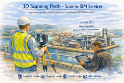
1. The Role of Reality Capture in the Project Lifecycle

In modern engineering workflows, 3D scanning underpins a sequence of dependent activities:

  • Site capture (point cloud acquisition)
  • Data registration and validation
  • 3D modelling and design development
  • Detailing for fabrication
  • Installation and commissioning

Each stage inherits the quality of the preceding one. As a result, deficiencies in the initial scan propagate throughout the project lifecycle. Errors introduced at the data capture stage are rarely isolated and are often only fully realised during fabrication or installationโ€”when rectification costs are at their highest.


2. Accuracy as a Determinant of Fabrication Success

Fabrication processes require dimensional certainty. Tolerances associated with structural steel, piping systems, and mechanical assemblies are typically measured in millimetres. Deviations beyond these tolerances can render components unfit for purpose.

Lower-cost scanning methodologies, particularly those relying on unstructured workflows or drift-prone systems, often exhibit:

  • Accumulated positional error over distance
  • Inconsistent alignment between scan sets
  • Limited or absent survey control
  • Reduced reliability in complex industrial environments

While such datasets may appear visually acceptable, they frequently lack the dimensional integrity required for fabrication-grade outputs. The result is misalignment, rework, and increased reliance on site-based modification.


3. Cost Amplification Through Downstream Rework

The primary issue with low-cost scanning is not the initial saving, but the amplification of costs downstream.

A typical failure pathway includes:

  • Design based on inaccurate geometry
  • Fabrication to incorrect specifications
  • Installation conflicts and misalignment

At the installation stage, corrective actions may include:

  • Cutting and re-welding on site
  • Redesign under time constraints
  • Expedited fabrication of replacement components
  • Additional labour and supervision

A relatively small saving in scanning costs can therefore result in significant increases in total project cost, particularly in time-critical environments.


3D CAD Modelling Australia service banner for Hamilton By Design

4. Operational Risk and Downtime Implications

In industrial environments, downtime represents one of the most significant cost drivers. Inaccurate scan data introduces risks that extend beyond fabrication and into operations, including:

  • Extended shutdown durations
  • Delayed commissioning
  • Installation clashes
  • Disruption to production schedules

Given the high cost of downtime in mining and processing facilities, even minor delays can have substantial financial consequences. Low-cost scanning therefore introduces not only technical risk but also operational and commercial risk.


5. Visual Fidelity Versus Engineering Validity

A common misconception is that visually impressive scan data equates to engineering accuracy. Modern software platforms can present dense, colourised point clouds that appear complete and reliable.

However, visual quality does not guarantee:

  • Verified spatial accuracy
  • Consistent coordinate alignment
  • Defined tolerances
  • Reliable integration into engineering workflows

For decision-makers, the critical question is whether the data is demonstrably accurate and suitable for its intended engineering purposeโ€”not whether it appears visually convincing.


6. Data Completeness and Design Integrity

In addition to accuracy, completeness of data capture is essential.

Low-cost scanning approaches often result in incomplete datasets due to time constraints, access limitations, or insufficient planning. Common omissions include:

  • Undersides of structures
  • Connection points and bolt details
  • Congested or hard-to-reach areas
  • Critical interfaces between systems

Incomplete data forces engineers to make assumptions, which introduces uncertainty into the design process. This often leads to conservative design, increased material usage, additional site visits, and iterative revisions.


7. Governance and Traceability

Effective project delivery requires a clear and controlled data environment.

Engineering-grade scanning workflows typically include:

  • Registration reports and validation metrics
  • Defined coordinate systems
  • Version control and data management
  • Traceability from scan to model to drawing

Low-cost scanning services often lack these controls, resulting in:

  • Multiple conflicting datasets
  • Poor coordination between disciplines
  • Limited accountability
  • Increased risk during audits or dispute resolution

Without a single source of truth, project risk increases significantly.


8. Fabrication Constraints and Irreversibility

Fabrication environments operate on precision and adherence to documented design. Workshops do not reinterpret dataโ€”they execute it.

When inaccurate scan data informs fabrication:

  • Errors are embedded in physical components
  • Materials and labour are consumed unnecessarily
  • Corrections become costly and complex

By the time issues are identified, the opportunity for low-cost correction has passed.


9. Reframing the Investment Decision

The evaluation of scanning services should be based on total project cost rather than initial expenditure.

  • Low-cost scanning: lower upfront cost, higher downstream risk
  • Engineering-grade scanning: moderate upfront cost, reduced risk and greater predictability

Given that scanning represents a small proportion of overall project cost, decisions based solely on price are often misaligned with project objectives.


10. A Structured Approach to Risk Mitigation

To reduce risk and improve outcomes, the following approach is recommended:

  • Define accuracy requirements aligned with fabrication tolerances
  • Select appropriate scanning methodologies
  • Implement controlled data acquisition and registration
  • Validate datasets prior to design development
  • Integrate scan data into coordinated modelling workflows
  • Maintain governance and version control throughout the project lifecycle

This ensures that reality capture supports, rather than undermines, project delivery.


Conclusion

Low-cost 3D scanning services may appear cost-effective at the outset, but they frequently result in increased costs, delays, and risk when evaluated across the full project lifecycle.

For project managers and company directors, the critical consideration is the integrity of the data informing engineering decisions. In fabrication-driven environments, accuracy and reliability are essential.

Investment in engineering-grade scanning should therefore be viewed not as an optional expense, but as a risk mitigation strategy that underpins successful project delivery.


Related Services

To support fabrication certainty and reduce project risk, the following engineering-led services are available:

These services are specifically structured to deliver accurate, validated datasets suitable for engineering design and fabrication.


Ensuring Confidence in Fabrication Data

Where projects involve brownfield modifications, shutdown execution, or critical structural and mechanical installations, the reliability of underlying data is a key determinant of success.

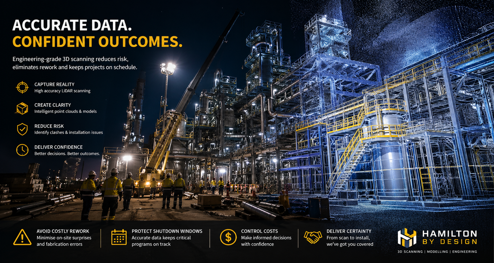
Engineering-grade 3D LiDAR scanning provides a controlled and verifiable foundation for design, reducing uncertainty and enabling informed decision-making throughout the project lifecycle.

At Hamilton By Design, the focus is on delivering fit-for-purpose engineering dataโ€”ensuring that models, drawings, and fabrication outputs align with real-world conditions.


3D LiDAR scanning and 3D modelling service button โ€” laser scanner capturing a point cloud for engineering and CAD modelling
Mechanical engineering services

Independent Review of Existing Scan Data

Where scan data has already been captured, an independent review can be undertaken to assess its suitability for engineering and fabrication use.

This includes evaluation of:

  • Registration quality and alignment integrity
  • Dimensional accuracy relative to project requirements
  • Completeness of captured geometry
  • Suitability for downstream modelling and detailing

This approach provides clarity before further design or fabrication investment is committed.


Hamilton By Design logo displayed on a blue tilted rectangle with a grey gradient background

Contact Us – Talk to Us

For further discussion regarding project requirements or to review an existing scanning approach:

Hamilton By Design
Email: info@hamiltonbydesign.com.au
Website: www.hamiltonbydesign.com.au

Enquiries are welcome to arrange a brief discussion to determine the most appropriate approach for achieving reliable, fabrication-ready outcomes.

Name
Would you like us to arrange a phone consultation for you?
Address

Our clients

Terrestrial LiDAR Scanner | Engineering-Grade 3D Laser Scanning

Terrestrial LiDAR scanner capturing industrial plant

What is a Terrestrial LiDAR Scanner?

A terrestrial LiDAR scanner is a ground-based 3D laser scanning system used to capture highly accurate measurements of real-world environments and convert them into detailed digital models known as point clouds.

At Hamilton By Design, we use engineering-grade terrestrial LiDAR scanning to support design, drafting, and construction across industrial, mining, and infrastructure projects.


3D LiDAR scanning and 3D modelling service button โ€” laser scanner capturing a point cloud for engineering and CAD modelling
Mechanical engineering services

How a Terrestrial LiDAR Scanner Works

A terrestrial LiDAR scanner measures distance using laser technology:

  • A laser beam is emitted from the scanner
  • The beam reflects off surfaces such as steel, concrete, or pipework
  • The scanner records the return signal
  • Distance is calculated using time-of-flight or phase shift
  • Millions of measurements are captured per second

The result is a dense and accurate 3D point cloud representing the scanned environment.


What is a Point Cloud?

A point cloud is a digital dataset made up of millions (or billions) of points.

Each point contains:

  • X, Y, Z coordinates
  • Spatial position in 3D space
  • Optional colour information (RGB)

This creates a true-to-life digital representation of physical assets, forming the foundation for CAD modelling and engineering design.


Why Use a Terrestrial LiDAR Scanner?

Accuracy

Terrestrial LiDAR scanners provide millimetre-level accuracy, making them suitable for engineering and fabrication.

Speed

Large and complex environments can be captured quickly compared to traditional survey methods.

Safety

Data can be captured without direct access to hazardous or difficult-to-reach areas.

Reduced Rework

Designs are based on real-world data, reducing clashes and site modifications.


3D CAD Modelling Australia service banner for Hamilton By Design

Engineering Applications

Terrestrial LiDAR scanning is widely used across:

  • Industrial plant upgrades
  • Mining and processing facilities
  • Structural and mechanical design
  • Brownfield engineering projects
  • As-built verification
  • Reverse engineering

For projects requiring integration with your team, this capability can also be delivered through our engineering secondment services:
https://www.hamiltonbydesign.com.au/home/secondment-services/


Engineering-Led LiDAR Scanning

Not all LiDAR scanning is equal.

At Hamilton By Design, scanning is performed with an engineering-first approach, ensuring the data is suitable for downstream use in CAD and design.

Key considerations include:

  • Line-of-sight limitations
  • Scan density and coverage
  • Registration accuracy
  • Data structure and usability

This ensures the output is not just a visual model, but a usable engineering dataset.


From Scan to CAD

Our workflow converts LiDAR data into practical deliverables:

Scan โ†’ Register โ†’ Model โ†’ Detail โ†’ Deliver

This includes:

  • Point cloud registration (.E57, .RCP, .LAS)
  • 3D CAD modelling (SolidWorks and other platforms)
  • 2D drawings and fabrication-ready documentation

Terrestrial vs Other Scanning Methods

  • Terrestrial LiDAR: High accuracy, long range, ideal for engineering
  • Handheld scanners: Faster but lower accuracy, suited to small objects
  • Photogrammetry: Visual models, not typically engineering-grade

For industrial and brownfield environments, terrestrial LiDAR remains the preferred method.


Terrestrial LiDAR scanner capturing industrial plant with Sydney Harbour Bridge in background

In-House & Secondment Delivery

We provide flexible delivery models to suit your project:

  • In-house scanning and modelling (fully managed)
  • Secondment services (embedded within your team)

Learn more about our secondment capability:
https://www.hamiltonbydesign.com.au/home/secondment-services/


Why Choose Hamilton By Design

  • Engineering-led LiDAR scanning
  • Integration with CAD modelling and drafting
  • Strong experience in industrial and mining environments
  • Brownfield project expertise
  • Practical, buildable outputs

Hamilton By Design logo displayed on a blue tilted rectangle with a grey gradient background

Get Started with Terrestrial LiDAR Scanning

If you require accurate, engineering-grade 3D data for your project, a terrestrial LiDAR scanner provides the foundation for reliable design and execution.

Hamilton By Design delivers scanning, modelling, and engineering support across Sydney and Australia.

Talk to Us – Contact Us

Name
Would you like us to arrange a phone consultation for you?
Address

3D Engineering Scanning โ€“ Solomon Islands

Engineer performing 3D laser scanning in the Solomon Islands with point cloud transitioning to BIM model and FEA analysis.

3D Engineering Scanning Solomon Islands โ€“ Point Clouds for BIM & FEA

Reliable Point Clouds for BIM, CAD & FEA Anywhere in the World

Hamilton By Design provides engineering-grade 3D laser scanning services across the Solomon Islands, delivering accurate point clouds that allow designers, engineers, and asset owners to work from real measured dataโ€”without the need to be on site.

From Honiara ports to remote island infrastructure, our scans create the digital backbone for modelling, analysis, and fabrication.


Engineering Data You Can Trust

Many assets in the Solomon Islands have:

  • limited or missing drawings
  • decades of informal modifications
  • corrosion from marine environments
  • cyclone and seismic exposure
  • mixed construction standards

Traditional measurement methods struggle in these conditions. Our 3D scanning service captures the true as-built condition so your team can:

  • create BIM and CAD models
  • perform structural and mechanical FEA
  • plan brownfields tie-ins
  • fabricate off-site with confidence
  • complete clash detection before shutdowns

We deliver open, neutral formats so engineers anywhere in Australia, New Zealand, Asia or Europe can immediately begin work.


3D engineering scanning in the Solomon Islands depicting site capture, point cloud creation and remote BIM and FEA design.

What We Deliver

Core Outputs

  • Registered point clouds โ€“ E57 / RCP / LAS
  • Colourised engineering datasets
  • Site grid or project datum
  • Mesh models for Navisworks
  • 2D plans, elevations and sections

Optional Engineering Deliverables

  • Scan-to-BIM models (LOD 200โ€“350)
  • Steel and pipe geometry extraction
  • Tie-in coordinates for upgrades
  • Deformation and roundness reports
  • Clash and constructability reviews

All data is processed in Australia under formal QA so it can be relied upon for design approvals and FEA studies.


Designed for Solomon Islands Conditions

Scanning in the Solomons requires Pacific experience:

  • high heat and humidity
  • sudden tropical rain
  • reflective stainless and bright sunlight
  • inter-island logistics
  • remote power availability
  • cyclone season planning

Our workflows are built for efficient field capture with processing completed by our Australian engineering team.


Industries We Support

  • Honiara ports and marine infrastructure
  • Power generation and substations
  • Water and wastewater assets
  • Timber and processing facilities
  • Government and commercial buildings
  • Bridges and civil structures
  • Post-cyclone condition surveys

A Digital Backbone for Global Teams

A quality scan is the backbone of every downstream task.
If the backbone is wrong, every model and FEA result is compromised.

Our service provides a foundation that:

  • removes re-measure risk
  • supports remote engineering
  • shortens shutdowns
  • improves safety and constructability

Designers anywhere in the world can open our data and begin work immediately.


3D LiDAR scanning and 3D modelling service button โ€” laser scanner capturing a point cloud for engineering and CAD modelling
Mechanical engineering services

Talk to Us About Your Solomon Islands Project

Whether you need a single building, a wharf, or a full plant captured, we can mobilise quickly and deliver data your team can trust.

Hamilton By Design
Engineering certainty through 3D scanning.

Name
Would you like us to arrange a phone consultation for you?
Address

3D CAD Modelling Australia service banner for Hamilton By Design

Advancing Digital Engineering through 3D Scanning Perth โ€“ Scan-to-BIM Services

Perth Scan-to-BIM workflow with LiDAR capture converting site conditions into coordinated BIM model for construction and asset management.

3D Scanning Perth โ€“ Scan-to-BIM Services | Hamilton By Design

In an era where digital precision underpins engineering success, the integration of 3D Scanning Perth โ€“ Scan-to-BIM Services has emerged as a vital component of contemporary project delivery. The services offered by Hamilton By Design โ€“ 3D Scanning Services Perth exemplify this integration, aligning advanced engineering-grade LiDAR capture with structured digital modelling workflows that directly support Building Information Modelling (BIM) deliverables.

3D laser scanner operating in Perth with point cloud transitioning into a BIM model illustrating Scan-to-BIM workflow and engineering deliverables.

At its core, 3D scanning in Perth is positioned not merely as a mechanism for acquiring visual datasets, but as a fundamental measurement process that transitions physical reality into validated digital representations. Engineering-grade terrestrial laser scanning produces high-resolution point clouds with measurable geometryโ€”data that BIM platforms rely on for spatial coordination, clash detection, and as-built accuracy in complex environments such as industrial plants, construction sites, and marine facilities.

A key advantage of this engineered data capture is its capacity to feed directly into Scan-to-BIM workflows. From the registered point clouds, detailed 3D models can be developed that adhere to the precision expectations of BIM deliverablesโ€”supporting design verification, stakeholder coordination, and multidisciplinary integration. These deliverables typically include:

  • Registered high-accuracy point cloud datasets suitable for BIM import
  • Scan-derived 3D CAD models aligned with BIM spatial and tolerance requirements
  • As-built BIM models that reflect true-to-site geometry for retrofit and renovation projects
  • Documentation packages that underpin regulatory compliance and construction sequencing

Such deliverables ensure that project stakeholders work from a common, reliable digital baseline, effectively bridging the gap between field conditions and model-based project execution. This alignment enhances predictability in engineering coordination and reduces rework associated with discrepancies between assumed conditions and actual site geometryโ€”a fundamental premise of BIM methodology.

Furthermore, when 3D scanning is integrated with BIM workflows in Perth, it supports advanced uses such as clash analysis, spatial coordination, and virtual construction planning. These processes provide multidisciplinary teams with confidence that modelled elements reflect real constraints and interfaces before fabrication and on-site assembly.

3D LiDAR scanning and 3D modelling service button โ€” laser scanner capturing a point cloud for engineering and CAD modelling
Mechanical engineering services
Hamilton By Design logo displayed on a blue tilted rectangle with a grey gradient background

In summary, the 3D Scanning Perth โ€“ Scan-to-BIM Services articulated by Hamilton By Design demonstrates how high-accuracy spatial capture, when embedded within an engineering-centric workflow, can produce BIM deliverables that elevate project outcomes. By anchoring digital models to measured realities and structuring data for downstream use, clients are equipped with robust, actionable information that enhances design quality, coordination, and constructability across complex ventures.

Name
Would you like us to arrange a phone consultation for you?
Address

Mining & Processing Perth WA banner for Hamilton By Design featuring white text on a blue background.
Scan to BIM Perth WA banner for Hamilton By Design featuring white text on a blue background.
Ship Building Perth WA banner for Hamilton By Design featuring white text on a blue background.
Mechanical Engineering Perth WA banner for Hamilton By Design featuring white text on a blue background.
3D Laser Scanning Perth WA banner for Hamilton By Design with white text on a blue background.
SolidWorks Perth WA banner for Hamilton By Design featuring white text on a blue background.

3D LiDAR scanning and 3D modelling service button โ€” laser scanner capturing a point cloud for engineering and CAD modelling
Mechanical engineering services

3D CAD Modelling Australia service banner for Hamilton By Design
3D LiDAR scanning and 3D modelling service button โ€” laser scanner capturing a point cloud for engineering and CAD modelling
Mechanical engineering services
Structural drafting services button
3D LiDAR scanning and 3D modelling services button
Mechanical drafting services button

3D CAD Modelling Australia service banner for Hamilton By Design


CHPP Engineering title graphic featuring bold white text reading "CHPP Engineering" centred on a blue rounded rectangle background.
Pipework Drafting title graphic featuring bold white text reading "Pipework Drafting" centred on a blue rounded rectangle background.
3D LiDAR Scanning for Engineering Projects title graphic featuring bold white text on a blue rounded rectangle background.


Finite Element Analysis (FEA) engineering simulation button
Structural drafting services button
Mechanical drafting services button


Australian Drafting logo featuring bold white text reading "Australian Drafting" centred on a blue rounded rectangle background.
Engineering Governance title graphic featuring bold white text reading "Engineering Governance" centred on a blue rounded rectangle background.
Engineering-Grade LiDAR Scanning title graphic featuring bold white text on a blue rounded rectangle background.


Mechanical drafting services button
Structural drafting services button


Fabrication and product design services
3D CAD Modelling Australia service banner for Hamilton By Design
Mechanical, Structural & Pipework Drafting service banner by Hamilton By Design featuring white text on a blue background.


Mining & Processing Perth WA banner for Hamilton By Design featuring white text on a blue background.
Scan to BIM Perth WA banner for Hamilton By Design featuring white text on a blue background.
Ship Building Perth WA banner for Hamilton By Design featuring white text on a blue background.
Structural drafting services button
3D LiDAR scanning and 3D modelling services button
Mechanical drafting services button

3D LiDAR Laser Scanning Services in Bahrain

Watercolour illustration of 3D LiDAR laser scanning in Bahrain showing engineers capturing an industrial site with a scanner and tablet, styled in Bahrain flag colours with Australian quality standards message.

3D LiDAR Laser Scanning Services in Bahrain | Australian Standards

Engineering Certainty Through Measured Reality

Bahrainโ€™s construction, industrial and infrastructure sectors are evolving rapidly. Successful projects depend on accurate knowledge of existing conditions rather than historical drawings or assumptions. 3D LiDAR laser scanning services in Bahrain provide that verified foundation.

Hamilton By Design delivers engineering-led 3D LiDAR scanning services in Bahrain, capturing complex facilities and structures with millimetre precision so that design, analysis and construction can proceed from fact.


Verification Before Calculation

Many Bahrain projects involve brownfield environments where documentation no longer reflects reality. Modifications, corrosion, settlement and incremental upgrades create risk for designers and contractors.

Terrestrial LiDAR scanning enables:

  • Objective measurement of existing assets
  • Accurate tie-ins for new works
  • Reduction of site variations
  • Shorter shutdown durations
  • Remote engineering collaboration
  • Reliable prefabrication

The scan is the backbone of the project.
The quality of the initial capture determines the ease of every task that follows. If the backbone is compromised, even simple engineering becomes difficult.


3D laser scanning services Bahrain visual showing LiDAR capture, point cloud workflow and Australian Standards compliance in watercolour engineering style.

Engineering-Led 3D LiDAR Scanning in Bahrain

Our services are not limited to data collection. We approach every Bahrain project as engineers first, ensuring the capture supports:

  • Structural and mechanical verification
  • Constructability and access reviews
  • Interface definition for fabrication
  • Maintenance and shutdown planning
  • Risk reduction for project teams

This perspective protects project managers, engineers, designers and fabricators from decisions based on assumption.


Tailored to Your Systems

Hamilton By Design delivers vendor-neutral outputs that integrate with your existing workflows.

We tailor Bahrain LiDAR deliverables to suit your:

  • CAD platforms
  • BIM environments
  • FEA and analysis tools
  • Engineering and asset systems

Our role is to provide accurate engineering information โ€” your team chooses the software.


Australian Quality โ€“ Across All Clients and All Climates

All 3D LiDAR laser scanning services in Bahrain are delivered in accordance with:

  • Australian quality expectations
  • Australian build standards
  • Proven engineering procedures
  • Consistent methodology across all climates

Our workflows are designed for heat, humidity, coastal exposure and heavy industrial environments common to Bahrain, providing defensible and traceable data for every client.


Sectors Supported in Bahrain

  • Oil & gas and process facilities
  • Ports and marine structures
  • Commercial and mixed-use buildings
  • Transport and utilities
  • Manufacturing and logistics
  • Heritage and architectural assets

Whether the requirement is a single tie-in or a full facility digital record, the principle remains the same โ€” measure first, then engineer.


Hamilton By Design logo displayed on a blue tilted rectangle with a grey gradient background

3D LiDAR scanning and 3D modelling service button โ€” laser scanner capturing a point cloud for engineering and CAD modelling
Mechanical engineering services

The Hamilton By Design Process

  1. Investigate โ€“ High-accuracy LiDAR capture on site in Bahrain
  2. Verify โ€“ Registration and quality assurance
  3. Design โ€“ Data prepared for your engineering workflow

This structured approach ensures Bahrain projects commence with measured reality rather than interpretation.


Engage 3D LiDAR Laser Scanning Services in Bahrain

If your Bahrain project requires reliable as-built information, Hamilton By Design can mobilise to capture, process and deliver engineering-ready data aligned with Australian standards.

Start your project with certainty, not assumption.

Contact Hamilton By Design to discuss 3D LiDAR laser scanning services in Bahrain.

Name
Would you like us to arrange a phone consultation for you?
Address
3D CAD Modelling Australia service banner for Hamilton By Design