Mechanical Engineering | 3D Scanning | 3D Modelling
Tag: industrial 3d scanning
Explore articles and resources on industrial 3D scanning, including LiDAR scanning, point cloud capture, as-built modelling, reality capture, plant scanning, and engineering-grade workflows used for mining, manufacturing, and industrial facilities.
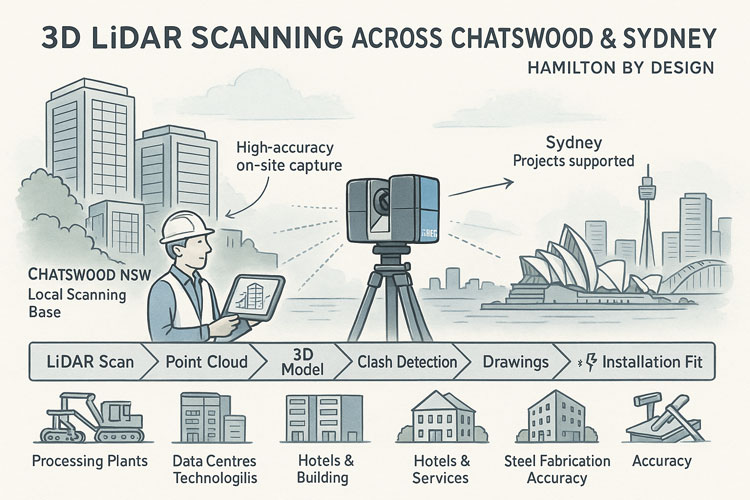
3D LiDAR Scanning in Chatswood and Sydney’s North Shore
Hamilton By Design provides high-accuracy 3D LiDAR laser scanning and drafting services for projects across Chatswood, the Lower North Shore and greater Sydney.
Whether you’re refurbishing an office floor, upgrading a plant room, planning a hotel fit-out or redeveloping an older building, we capture millimetre-accurate as-built data so your team can design with confidence and avoid costly rework on site.
Why 3D LiDAR Scanning for Sydney Projects?
Many Sydney buildings and industrial sites have been modified over decades. Original drawings are incomplete, out of date, or simply wrong. Tape measures and rough sketches aren’t enough when you’re trying to:
Fit new services into congested ceiling voids
Install new equipment into tight plant rooms
Convert offices, retail or hotels to new uses
Upgrade mechanical, electrical or hydraulic systems
Our 3D LiDAR scanning captures millions of data points to create an accurate digital twin of your site. This becomes the single source of truth for architects, engineers, builders and fabricators.
Who We Work With in Chatswood & Greater Sydney
We support a wide range of clients, including:
Architects & building designers – renovation, fit-out and adaptive-reuse projects
Property developers & commercial building owners – feasibility, refurbishment and change-of-use
Builders, shop-fitters & interior fit-out contractors – offices, retail, hospitality and medical suites
Hotel & hospitality operators – refurbishing guest rooms, lobbies and back-of-house areas
Consulting engineers, BIM and drafting teams – needing reliable as-built data to design from
Strata managers & property managers – accurate base drawings for long-term building management
From Chatswood, North Sydney and Macquarie Park through to the Sydney CBD, Parramatta and wider metropolitan region, we bring the same engineering-grade accuracy to every project.
Our 3D Scanning & Drafting Services
3D LiDAR Laser Scanning
On-site 3D LiDAR scanning of buildings, plant rooms, industrial areas and external structures
Safe, non-intrusive data capture with minimal disruption to tenants or operations
High-resolution point clouds suitable for detailed engineering and architectural design
As-Built Documentation & Point Cloud Deliverables
Cleaned and registered point clouds supplied in industry-standard formats
2D plans, sections and elevations derived from the scan
As-built drawings for compliance, approvals and record documentation
3D Modelling & Drafting
3D models developed in professional CAD platforms (e.g. SolidWorks and other CAD tools)
Structural steel, mechanical plant, pipework and platforms modelled directly from scan data
General arrangement drawings, details and DXF files ready for fabrication
Coordination, Clash Checks & Fit-Out Support
Model overlays for new works versus existing conditions
Early identification of clashes in ceilings, risers and plant rooms
Support for coordination meetings between architects, engineers and builders
Typical Projects in Chatswood & Sydney
Office and commercial fit-outs in Chatswood’s commercial towers
Refurbishment of aged office buildings into modern workplaces or mixed-use spaces
Plant-room upgrades for HVAC, fire, electrical and data infrastructure
Retail, hospitality and hotel refurbishments needing accurate existing conditions
Layout and expansion projects in industrial estates and light-manufacturing facilities
In each case, our role is to give your team accurate 3D project data so design, pricing and construction decisions are based on reality, not assumptions.
Related Sydney Services
Hamilton By Design provides engineering-led 3D scanning, LiDAR scanning, mechanical engineering and digital engineering services throughout Sydney and Greater Sydney.
Explore our related Sydney services:
3D Scanning Sydney – Engineering-grade terrestrial laser scanning, as-built surveys and point cloud capture for industrial, infrastructure and commercial projects.
Reality Capture Sydney – High-accuracy reality capture, digital twins, asset documentation and engineering-grade site verification.
Scan to CAD Sydney – Convert point cloud data into AutoCAD, SolidWorks, Inventor and other engineering-ready CAD deliverables.
Point Cloud Modelling Sydney– Engineering-grade point cloud processing, clash detection, as-built verification and 3D modelling.
Mechanical Engineering Sydney – Mechanical design, plant upgrades, materials handling systems, conveyors, chutes, platforms and engineering support.
Structural Drafting Sydney– Structural steel drafting, fabrication drawings, GA drawings, workshop detailing and as-built documentation.
Hamilton By Design supports projects throughout Sydney CBD, Parramatta, Liverpool, Penrith, Blacktown, Chatswood, Alexandria, Mascot, Newcastle and the Central Coast.
Why Work With Hamilton By Design?
Mechanical engineering background – not just survey data, but practical design insight
Millimetre-accurate capture for reliable as-built documentation
Drafting and design capability – from point cloud to fabrication-ready drawings
Local knowledge of Chatswood and the broader Sydney construction and industrial environment
Flexible engagement – from one-off scans to full scan-to-model-to-fabrication workflows
Let’s Talk About Your Chatswood or Sydney Project
If you’re planning a refurbishment, fit-out or plant upgrade in Chatswood or greater Sydney, accurate 3D data is the simplest way to reduce risk, avoid clashes and keep your project on schedule.
Get in touch with Hamilton By Design to discuss:
Your site and project objectives
What needs to be scanned
The outputs your designers, engineers or fabricators require
We’ll recommend a practical scanning and drafting scope that fits your budget and timeframes while giving your team the confidence that comes from working with trusted, verified as-built information.
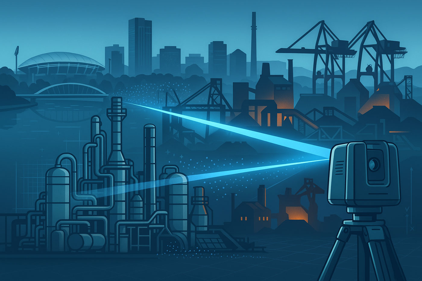
Adelaide is the engineering hub for South Australia’s gas plants, mining operations and the Whyalla steelworks. Hamilton By Design supports these assets with high-accuracy 3D LiDAR scanning, 3D modelling, mechanical and structural engineering and FEA, so upgrades and shutdowns go together first time, every time.
We help project teams reduce rework, improve safety and make better decisions with reliable, engineering-ready as-built data.
Who We Work With in South Australia
We provide 3D scanning and engineering support for:
Gas & power operations
Torrens Island power station and associated gas infrastructure near Adelaide
Gas processing, compressor stations and pipelines linked to Moomba and Cooper Basin supply
Mining operations engineered from Adelaide
Olympic Dam, Prominent Hill, Carrapateena and other copper, gold and uranium operations
Satellite processing plants, conveyors, crushers and SAG mills that feed these mines
Steel and heavy industrial assets
Whyalla Steelworks – Australia’s only manufacturer of rail and a major producer of structural steel
Associated ports, materials-handling systems and mining operations in the Middleback Range
Fabrication and maintenance workshops around Adelaide, Port Adelaide, Wingfield, Osborne and Whyalla handling heavy steel, OEM equipment and modular skids.
If your plant moves gas, ore, concentrate or steel, we can scan it, model it and help you engineer changes with confidence.
3D LiDAR Scanning for Gas, Mining & Steel
We deploy 3D laser scanners to capture dense point clouds of complex brownfield environments, including:
Gas plants, compressor stations and power station pipe racks
Process plants, crushers, screens, SAG/ball mills and transfer towers
Conveyors, stacker-reclaimers and stockpile systems
Structural steel, platforms, stairs and access ways
Tank farms, pump skids and utility systems
Steelmaking plant and materials-handling systems at Whyalla
Why use 3D scanning?
Accurate as-built data when drawings are outdated or missing
Less time on site and fewer return visits
Safer measurement in congested or high-risk areas
Better shutdown planning and tie-in design
Reduced rework when installing new equipment or modules
We can scan during shutdowns, night shifts or live-plant windows, working under your permit-to-work and safety systems.
From Point Cloud to Engineering-Ready Models
Using the scan data, we create clean 3D models suitable for design, verification and fabrication:
Piping and equipment models for gas plants and power stations
Mechanical models of crushers, feeders, chutes, SAG mills and associated structures
Structural steel models for access, maintenance and support frames
As-built models of conveyors, galleries and transfer towers
Key areas of the Whyalla steelworks where modifications or replacements are planned
Deliverables can include:
Registered point clouds (E57, RCP/RCS, LAS)
3D CAD models (SolidWorks, STEP/IGES, IFC)
2D drawings for fabrication and installation
Sections, clearances and clash-check views for design teams
Digital QA for Fabrication & Site Fit-Up
For Adelaide and Whyalla workshops fabricating for remote mines, gas plants or the steelworks, we provide digital quality assurance:
Scan fabricated skids, frames, spools or chutes in the workshop
Compare against the design model and/or original plant scan
Check flange positions, bolt patterns, centre distances and critical interfaces
Issue a clear report before the gear is shipped to site
This approach can catch misalignment and build issues early, avoiding costly rework at remote SA sites or within the Whyalla plant itself.
Mechanical, Structural & FEA Support
Where required, we combine scanning and modelling with engineering analysis:
Mechanical design and verification of chutes, hoppers, frames and supports
Structural checks on platforms, access systems and equipment supports
FEA on high-load or fatigue-critical components (e.g. mill components, support brackets)
Assessment of temporary lifting, transport or installation configurations
Results are documented in practical engineering reports, suited to internal review or third-party verification.
Why Adelaide & Whyalla Benefit from 3D Scanning
Centralised engineering in Adelaide, remote assets in the field – scan once, work from the digital twin for months or years
Brownfield plant everywhere – expansions, life-extension and decarbonisation projects all need accurate data
Tight shutdowns and limited access windows – better information = fewer surprises
Complex equipment such as mills, crushers, kilns and gas process skids that are difficult to measure by hand
3D scanning and digital workflows help owners and project teams manage risk on high-value, safety-critical assets.
Let’s Talk About Your SA Project
Whether you’re planning:
A gas plant upgrade near Adelaide
A mining project engineered in the CBD
Fabrication for Whyalla Steelworks or related mines
A shutdown requiring accurate as-built information
Hamilton By Design can support you with 3D LiDAR scanning, modelling and engineering.
Engineering-Grade Terrestrial LiDAR Scanning Services Across Perth and Western Australia
Hamilton By Design delivers high-precision 3D LiDAR scanning for Perth-based engineering teams, fabrication workshops and remote WA mining operations. Whether your project is in Welshpool, the Pilbara, Kalgoorlie, or anywhere across regional WA, our 3D scans provide the accurate as-built data you need to design, model and install with confidence.
LiDAR scanning has become one of the most effective methods for capturing accurate three-dimensional information from existing industrial facilities, infrastructure assets and commercial buildings. By using terrestrial laser scanning technology, millions of survey-grade measurement points can be collected in a matter of hours, creating a highly detailed digital representation of real-world environments.
Hamilton By Design provides engineering-led LiDAR scanning services throughout Perth and Western Australia, supporting mining operations, mineral processing facilities, manufacturing plants, infrastructure projects and complex industrial environments.
Unlike traditional measurement methods that rely on individual dimensions and manual site sketches, terrestrial LiDAR captures complete environments, enabling project teams to work from measured reality rather than assumptions.
The resulting point cloud data provides an accurate digital record of existing conditions and can be used to support asset management, engineering studies, refurbishment projects, shutdown planning, construction verification and digital transformation initiatives.
What Is LiDAR Scanning?
LiDAR (Light Detection and Ranging) is a measurement technology that uses laser pulses to determine the position of objects and surfaces within an environment. By recording the time taken for each laser pulse to travel to a surface and return to the scanner, millions of highly accurate measurements can be captured and converted into a three-dimensional digital representation of the real world.
Modern terrestrial LiDAR scanners can collect hundreds of thousands of measurements per second, enabling large industrial facilities, processing plants, infrastructure assets and commercial buildings to be documented quickly and accurately.
The resulting dataset is commonly referred to as a point cloud. Each point represents a measured location in three-dimensional space and collectively forms a detailed digital record of the scanned environment.
For industrial and engineering projects, LiDAR scanning provides a practical alternative to traditional tape measures, manual surveys and incomplete legacy drawings. Rather than measuring individual dimensions, entire facilities can be captured in a single coordinated dataset, allowing project teams to review, analyse and measure existing conditions long after the site visit has been completed.
LiDAR scanning is now widely used throughout mining, mineral processing, manufacturing, power generation, water treatment, transport infrastructure and commercial construction projects where accurate existing-condition information is essential for successful project delivery.
Terrestrial LiDAR scanners are positioned at multiple locations throughout a site to capture measurements from different viewpoints. During each scan, the instrument emits laser pulses that reflect from surrounding surfaces and return to the scanner. These measurements are combined with angular position information to determine the precise three-dimensional location of each point.
Because industrial facilities often contain equipment, structures, pipework and other objects that can obstruct the line of sight, multiple scan positions are typically required to capture the complete environment. The individual scans are then aligned and registered together to create a unified point cloud representing the entire site.
Modern LiDAR systems can capture millions of measurements within a relatively short period, allowing large areas to be documented efficiently while maintaining a high level of detail. Colour imagery can also be captured during the scanning process, providing additional visual context for project teams reviewing the data.
Once registration and quality checks have been completed, the resulting point cloud can be viewed, measured and analysed using specialised software platforms. Engineers, designers, asset owners and project managers can then access accurate existing-condition information without requiring repeated site visits.
This process creates a digital record of the facility at the time of capture, providing valuable information for refurbishment projects, shutdown planning, asset management, engineering studies, construction verification and future modifications.
Benefits of LiDAR Scanning for Industrial Facilities
Industrial facilities are constantly evolving. Equipment is upgraded, pipework is rerouted, structures are modified and assets are replaced over time. In many cases, existing drawings no longer accurately represent current site conditions, creating challenges for maintenance teams, engineers, contractors and asset owners.
LiDAR scanning provides a reliable method of capturing accurate existing-condition information before project work begins. By collecting millions of measurement points across an entire facility, project teams gain access to a detailed digital representation of the site that can be reviewed and measured long after fieldwork has been completed.
One of the primary benefits of LiDAR scanning is the reduction in repeat site visits. Rather than returning to site to confirm dimensions or investigate potential clashes, teams can often access the required information directly from the registered point cloud.
LiDAR scanning can also improve project planning and coordination. Designers, engineers and stakeholders can review existing conditions using a common dataset, helping to identify spatial constraints, access requirements and potential conflicts before fabrication or construction activities commence.
For operational facilities, data capture can often be completed while minimising disruption to production activities. This allows project teams to obtain accurate site information without the extended downtime that may be associated with traditional measurement methods.
Additional benefits of LiDAR scanning include:
Rapid capture of complex environments
Improved visibility of existing conditions
Reduced reliance on legacy drawings
Enhanced project planning and coordination
Better understanding of spatial relationships
Reduced risk of measurement errors
Improved documentation of assets and infrastructure
Support for digital engineering and asset management initiatives
As industrial facilities continue to adopt digital engineering workflows, LiDAR scanning is increasingly becoming a foundational tool for capturing reliable information that supports decision-making throughout the asset lifecycle.
LiDAR Scanning for Mining and Resources Projects
The mining and resources sector operates some of the most complex industrial facilities in Australia. Processing plants, conveyors, crushers, transfer stations, stockpile systems, workshops, tank farms, smelters and materials handling infrastructure often undergo continuous modification throughout their operational life.
Accurate existing-condition information is essential when planning upgrades, shutdowns, equipment replacements and brownfield expansion projects. Unfortunately, many sites rely on legacy drawings that may no longer accurately reflect the current configuration of the facility.
Terrestrial LiDAR scanning provides a practical solution by capturing the actual physical environment as it exists on site. Millions of measurement points can be collected across plant areas, creating a detailed digital record that supports engineering, maintenance and asset management activities.
Within mining and resource operations, LiDAR scanning is commonly used to document:
Processing plants and beneficiation facilities
Conveyors and materials handling systems
Crushers, screens and transfer stations
Smelters and refining operations
Structural steel and access platforms
Pipe racks and process services
Tank farms and storage facilities
Workshops and maintenance infrastructure
Shutdown and turnaround project areas
Brownfield expansion locations
The resulting point cloud provides project teams with a reliable source of information for planning and decision-making. Existing conditions can be reviewed before personnel return to site, helping improve project preparation and reducing uncertainty during design and construction activities.
LiDAR scanning is particularly valuable where access is difficult, production schedules are constrained or facilities have undergone numerous modifications over time. By capturing measured reality, project teams can work from current site information rather than assumptions or outdated documentation.
Across Western Australia, LiDAR scanning is increasingly supporting mining, mineral processing, oil and gas, bulk materials handling and heavy industrial facilities as organisations continue to adopt digital engineering and asset management practices.
Point Cloud Registration and Quality Assurance
The quality of a LiDAR scanning project is determined not only by the data collected in the field but also by the processes used to align, verify and validate that information after capture. Individual scans must be accurately combined to create a single coordinated dataset that represents the facility as a whole.
This process is known as point cloud registration. During registration, overlapping scan positions are aligned using common reference points and geometric features captured throughout the scanning process. The objective is to ensure that all scans occupy the correct position within the three-dimensional environment and accurately represent the physical site conditions.
For industrial facilities, registration is particularly important because projects often involve multiple scan locations, complex structures and extensive plant areas. Without proper registration, measurement accuracy can be reduced and inconsistencies may be introduced into the final dataset.
Quality assurance procedures are typically undertaken throughout both fieldwork and data processing activities. These checks may include:
Verification of scan coverage
Review of registration quality reports
Validation of overlapping scan positions
Identification of missing or obscured areas
Assessment of point cloud consistency
Confirmation of coordinate systems where applicable
Review of deliverable requirements
By applying structured registration and quality assurance processes, project teams can have greater confidence that the resulting point cloud accurately reflects the conditions present at the time of capture.
A well-registered point cloud provides a reliable foundation for future project activities including asset documentation, engineering studies, refurbishment planning, digital engineering workflows and construction verification. It also enables stakeholders to extract measurements, review spatial relationships and investigate site conditions without relying solely on field observations.
As industrial facilities become increasingly reliant on digital information, point cloud registration and quality assurance remain essential components of delivering accurate, dependable and usable LiDAR scanning data.
Engineering-Grade Accuracy and Data Validation
Accuracy is one of the primary reasons organisations choose terrestrial LiDAR scanning for industrial, infrastructure and asset management projects. The ability to capture millions of measured points across an environment provides project teams with a detailed representation of existing site conditions that can support planning, design and decision-making activities.
However, achieving reliable results requires more than simply operating a scanner. The quality of the final point cloud is influenced by factors including scan planning, equipment selection, site conditions, registration workflows and quality assurance procedures.
Engineering-grade LiDAR scanning focuses on capturing data that is suitable for practical project applications. This begins with identifying the objectives of the survey and understanding the level of detail required. Different projects may require different scanning resolutions, coverage areas and validation procedures depending on how the data will ultimately be used.
Several factors can influence data quality, including:
Distance between the scanner and the target
Surface characteristics and material reflectivity
Environmental conditions during capture
Line-of-sight restrictions
Plant congestion and equipment density
Scan position planning
Registration quality between scans
Industrial facilities can present additional challenges due to elevated structures, confined spaces, complex pipework arrangements and restricted access areas. Effective scan planning helps minimise these challenges and improves overall dataset quality.
Data validation is an important part of the workflow and helps confirm that the point cloud accurately represents the physical environment. Validation activities may include reviewing registration reports, checking critical dimensions, assessing coverage and confirming that project-specific requirements have been achieved.
It is also important to recognise that no measurement technology is entirely free from limitations. Areas hidden from the scanner’s line of sight, highly reflective surfaces and inaccessible locations may require additional scan positions or supplementary verification methods. Understanding these limitations helps ensure realistic project expectations and reliable outcomes.
When supported by appropriate planning, registration and quality assurance procedures, terrestrial LiDAR scanning provides a dependable source of existing-condition information for industrial facilities, mining operations, infrastructure assets and complex engineering environments.
As digital engineering and asset management practices continue to evolve, accurate and validated point cloud data is becoming an increasingly important resource for organisations seeking to make informed decisions based on measured reality rather than assumptions.
Point Cloud Deliverables and Data Formats
One of the advantages of terrestrial LiDAR scanning is the flexibility of the data that can be generated and shared with project stakeholders. The information collected during scanning can be processed into a range of deliverables depending on project objectives, software requirements and intended workflows.
The primary output of a LiDAR scanning project is typically a registered point cloud. This dataset contains millions of measured points representing the surfaces and geometry of the scanned environment. Point clouds can be viewed, measured and analysed using a variety of industry-standard software platforms.
Depending on project requirements, point cloud data may be delivered in formats such as:
E57
RCP
RCS
LAS
XYZ
PTS
PTX
These formats allow owners, engineers, consultants and contractors to access and utilise the captured information within their preferred software environment.
Point cloud data can support a wide range of activities including:
Existing-condition documentation
Asset management
Engineering studies
Refurbishment planning
Construction verification
Shutdown planning
Clash detection
Digital engineering workflows
Digital twin development
In addition to point cloud deliverables, project teams may use the captured data to generate drawings, models and visualisations that assist with planning and communication. The level of detail required will depend on the intended use of the information and the objectives of the project.
An important advantage of maintaining point cloud datasets is that measurements can often be extracted after the site visit has been completed. This allows stakeholders to review dimensions, investigate site conditions and obtain additional information without necessarily returning to the field.
As organisations continue to adopt digital engineering and asset management practices, LiDAR-generated datasets are becoming an increasingly valuable source of information for understanding, documenting and managing existing assets throughout their lifecycle.
By providing accurate and accessible digital representations of real-world environments, LiDAR scanning helps establish a foundation for informed decision-making across planning, design, operations and maintenance activities.
LiDAR Scanning Applications Across Western Australia
Western Australia is home to some of the world’s largest mining, processing, manufacturing and infrastructure assets. From metropolitan Perth through to the Pilbara, Goldfields and South West regions, organisations are increasingly adopting LiDAR scanning technologies to improve the way existing assets are documented, maintained and upgraded.
LiDAR scanning is particularly well suited to environments where accurate existing-condition information is critical for planning, engineering, construction and asset management activities. By capturing millions of measurement points, facilities can be documented quickly and accurately, providing stakeholders with a reliable digital representation of the physical environment.
Across Western Australia, LiDAR scanning is commonly applied within:
Mining Operations
Mining facilities often contain extensive materials handling systems, processing infrastructure, workshops, storage facilities and supporting assets. LiDAR scanning can assist with documenting existing conditions, planning upgrades and supporting brownfield expansion projects while reducing reliance on outdated drawings and manual measurements.
Mineral Processing Facilities
Mineral processing plants are continuously evolving as equipment is upgraded, replaced or modified to improve performance. LiDAR scanning enables plant operators and project teams to capture current site conditions before undertaking engineering studies, shutdown activities or capital projects.
Refineries and Smelters
Refineries and smelting operations contain complex networks of process equipment, pipework, structural steel and access systems. Accurate digital records can support maintenance planning, asset management initiatives and future project development by providing a detailed understanding of the existing facility layout.
Ports and Bulk Materials Handling Infrastructure
Western Australia’s export industries rely on extensive bulk materials handling infrastructure including conveyors, transfer stations, stockpile facilities and ship-loading systems. LiDAR scanning can assist with documenting these assets and supporting maintenance, refurbishment and expansion activities.
Industrial Manufacturing Facilities
Manufacturing facilities frequently require equipment upgrades, production line modifications and plant optimisation projects. LiDAR scanning provides a comprehensive record of existing conditions that can support planning and project coordination activities.
Commercial and Institutional Assets
In addition to industrial facilities, LiDAR scanning is increasingly used to document commercial buildings, hospitals, educational campuses, transport infrastructure and public facilities. Accurate digital records can support refurbishment projects, asset management programs and long-term maintenance planning.
Hamilton By Design supports LiDAR scanning projects throughout Perth and Western Australia, including Kwinana, Pinjarra, Wagerup, Bunbury, Geraldton, Kalgoorlie, Port Hedland, Karratha and the Pilbara region. Our engineering-led approach combines practical industrial experience with advanced reality capture technologies to deliver accurate and reliable digital representations of existing assets.
As organisations continue to invest in digital engineering, asset management and operational efficiency, LiDAR scanning is becoming an increasingly valuable tool for understanding existing conditions and supporting informed decision-making across the entire asset lifecycle.
Why Choose Hamilton By Design for LiDAR Scanning Perth
Successful LiDAR scanning projects require more than the ability to operate a laser scanner. The real value lies in understanding how the captured information will be used and ensuring that the resulting dataset supports project objectives.
Hamilton By Design combines terrestrial LiDAR scanning technology with practical engineering, drafting and industrial experience. This enables us to understand the challenges commonly encountered within mining operations, mineral processing facilities, manufacturing plants, infrastructure assets and complex industrial environments.
Our approach focuses on capturing information that supports informed decision-making. By understanding project requirements before fieldwork begins, scan coverage, resolution and deliverables can be aligned with the intended use of the data, helping project teams obtain information that is relevant, accurate and practical.
We regularly support projects involving:
Mining and resource operations
Mineral processing facilities
Refineries and smelters
Materials handling systems
Manufacturing facilities
Infrastructure assets
Commercial and institutional buildings
Brownfield expansion projects
Asset management initiatives
Digital engineering programs
Hamilton By Design utilises professional terrestrial LiDAR scanning equipment and industry-standard processing workflows to produce registered point cloud datasets suitable for a wide range of engineering, operational and asset management applications.
Beyond data capture, our team understands how point cloud information is commonly used throughout the project lifecycle. This broader understanding assists in identifying critical areas for capture, supporting quality outcomes and ensuring project stakeholders receive information that can be effectively integrated into existing workflows.
We support projects throughout Perth and Western Australia, including regional mining and industrial locations where accurate existing-condition information is essential for planning, maintenance, engineering and capital works activities.
As organisations continue to adopt digital engineering and asset management practices, LiDAR scanning is becoming an increasingly important tool for capturing measured reality and establishing a reliable foundation for future project activities.
Hamilton By Design remains committed to providing engineering-led LiDAR scanning services that deliver accurate, dependable and practical digital information for industrial, infrastructure and commercial projects across Western Australia.
Frequently Asked Questions
What is LiDAR scanning?
LiDAR (Light Detection and Ranging) is a technology that uses laser pulses to measure the position of objects and surfaces within an environment. The collected measurements are combined to create a highly detailed three-dimensional representation known as a point cloud. LiDAR scanning is widely used to document existing facilities, infrastructure and industrial assets.
How accurate is terrestrial LiDAR scanning?
Accuracy depends on the equipment used, scan planning, site conditions and registration processes. Modern terrestrial LiDAR scanners are capable of capturing highly accurate measurements suitable for engineering, asset management and industrial applications. Quality assurance and data validation procedures are important to ensure reliable project outcomes.
What is a point cloud?
A point cloud is a collection of millions of individual measurement points captured during the scanning process. Each point represents a location in three-dimensional space. When combined, these points create a digital representation of the scanned environment that can be viewed, measured and analysed using specialised software.
What deliverables can be provided?
LiDAR scanning projects can produce a variety of deliverables depending on project requirements. Common outputs include registered point clouds, E57 files, RCP files, RCS files, LAS files and other industry-standard formats that can be used within engineering, construction and asset management workflows.
Can LiDAR scanning be completed during plant shutdowns?
Yes. LiDAR scanning is frequently used during shutdowns, maintenance outages and capital works projects. Capturing accurate existing-condition information before work begins can help project teams plan modifications, identify potential constraints and improve overall project coordination.
How long does a LiDAR scanning project take?
Project duration depends on the size and complexity of the facility being captured. Small areas may be completed within a single day, while large industrial facilities, processing plants or mining operations may require multiple days of fieldwork and additional processing time to register and validate the point cloud data.
Do you provide LiDAR scanning services outside Perth?
Yes. Hamilton By Design supports projects throughout Western Australia, including mining, industrial and infrastructure locations. Services can be provided across Perth, Kwinana, Pinjarra, Wagerup, Bunbury, Geraldton, Kalgoorlie, Port Hedland, Karratha and the Pilbara region, as well as interstate locations where required.
What industries commonly use LiDAR scanning?
LiDAR scanning is used across a wide range of industries including mining, mineral processing, manufacturing, oil and gas, infrastructure, utilities, water treatment, ports, transport, commercial construction and asset management. The technology provides accurate existing-condition information that can support planning, maintenance, engineering and operational activities.
Why is LiDAR scanning becoming more popular?
Many organisations are adopting digital engineering and asset management practices that require reliable existing-condition information. LiDAR scanning enables facilities to be captured quickly and accurately, providing a digital record that can support decision-making throughout the lifecycle of an asset.
Can point cloud data be used in engineering software?
Yes. Point cloud datasets can typically be imported into a range of engineering, design and modelling software platforms. This allows project teams to reference existing site conditions, extract measurements and integrate scanned information into digital engineering workflows.
Discuss Your LiDAR Scanning Project
Whether you are planning a plant upgrade, documenting existing assets, preparing for a shutdown, or investigating digital engineering opportunities, accurate existing-condition information is the foundation of successful project delivery.
Hamilton By Design provides engineering-led terrestrial LiDAR scanning services throughout Perth and Western Australia, supporting mining operations, processing facilities, industrial plants, infrastructure assets and commercial projects.
Our team can help determine the most suitable scanning approach, required deliverables and level of detail needed to achieve your project objectives.
Complete the enquiry form below and tell us about your project requirements.
A member of our team will review your information and contact you to discuss scope, site access, deliverables, project timing and any technical requirements.
Typical Information to Include
Project location
Facility or asset type
Approximate area to be scanned
Required deliverables
Project timeframe
Site access requirements
Shutdown or outage windows
Any existing drawings or reference information
Need advice before requesting a quotation?
We are happy to discuss your project requirements and provide guidance on scanning methodology, deliverables and project planning before work commences.
Ready for 3D Scanning in Perth or WA?
Speak to our engineering team about your project, shutdown or scanning requirements.
In today’s world, accuracy and efficiency can make or break a project. Whether you’re working in architecture, construction, engineering, or product design, you need reliable data — and you need it fast. That’s where 3D point clouds come in.
But there’s an important catch: not all scans are created equal. The difference between an average scan and a great one often comes down to the person behind the scanner. Having someone who understands 3D modeling take the scans can dramatically improve your project’s accuracy, reliability, and overall success.
Let’s break down why.
The Power of 3D Point Clouds
Point clouds are essentially millions of tiny data points that capture the shape of an object, room, or entire site. Together, they create a highly detailed digital snapshot of the real world.
Here’s why this matters:
Precision you can trust – Point clouds deliver incredibly detailed measurements, capturing even the smallest curves and angles.
Nothing gets missed – Multiple scan angles ensure a full, 360° view of your site or object.
Speed and efficiency – What used to take hours (or days) with manual measurements can be captured in minutes.
Built-in context – You’re not just getting numbers; you’re getting a complete digital environment to work inside.
Future-proof data – Once you have a scan, you have a permanent record of your space, ready to use months or years later.
From clash detection to as-built verification, point clouds save time, reduce errors, and make collaboration across teams smoother than ever.
Why the Person Taking the Scan Matters
While technology is powerful, experience is what makes the results reliable. Having a skilled 3D modeler operate the scanner can be the difference between a good project and a great one.
Here’s why an expert makes all the difference:
They know what matters – A modeler understands which details are critical for your project and ensures they’re captured.
Fewer gaps, fewer surprises – Experienced pros know how to plan scan positions to cover every angle and avoid blind spots.
Cleaner, more accurate data – They reduce common issues like noise, misalignment, or missing sections that can throw off your model.
Time saved, headaches avoided – No one wants to redo a scan halfway through a project. A professional ensures you get it right the first time.
Confidence from start to finish – When you know your model is accurate, you can move forward with design and construction decisions without second-guessing.
In short: a great scanner operator doesn’t just deliver data — they deliver peace of mind.
The Bottom Line
3D point clouds are already transforming how projects are planned and delivered. But pairing them with an experienced 3D modeler takes things to the next level.
You’ll get better data, faster turnarounds, and a far lower risk of costly mistakes. And when your goal is to deliver projects on time, on budget, and with zero surprises, that’s an edge you can’t afford to miss.
To provide the best experiences, we use technologies like cookies to store and/or access device information. Consenting to these technologies will allow us to process data such as browsing behaviour or unique IDs on this site. Not consenting or withdrawing consent, may adversely affect certain features and functions.
Functional
Always active
The technical storage or access is strictly necessary for the legitimate purpose of enabling the use of a specific service explicitly requested by the subscriber or user, or for the sole purpose of carrying out the transmission of a communication over an electronic communications network.
Preferences
The technical storage or access is necessary for the legitimate purpose of storing preferences that are not requested by the subscriber or user.
Statistics
The technical storage or access that is used exclusively for statistical purposes.The technical storage or access that is used exclusively for anonymous statistical purposes. Without a subpoena, voluntary compliance on the part of your Internet Service Provider, or additional records from a third party, information stored or retrieved for this purpose alone cannot usually be used to identify you.
Marketing
The technical storage or access is required to create user profiles to send advertising, or to track the user on a website or across several websites for similar marketing purposes.