Engineering-Grade 3D Laser Scanning & Mechanical Engineering Services in Rutherford NSW

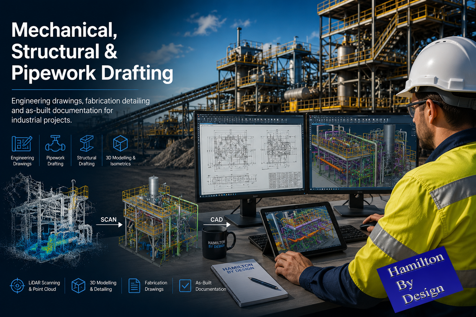
Mechanical, Structural & Pipework Drafting engineering banner showing an engineer reviewing CAD models, point cloud data and fabrication drawings for an industrial processing plant.

Rutherford NSW is one of the Hunter Region’s leading engineering, manufacturing, and mining support centres. Located within the Maitland industrial corridor and providing direct access to Newcastle, Singleton, Muswellbrook, and the Upper Hunter mining regions, Rutherford is home to a diverse range of fabrication workshops, maintenance providers, manufacturing facilities, and industrial service companies.

At Hamilton By Design, we provide engineer-led 3D laser scanning, mechanical engineering, drafting, reverse engineering, and industrial design services to support industrial operations throughout Rutherford and the broader Hunter Valley.

Supporting Rutherford’s Industrial Sector

Many facilities throughout Rutherford operate in industries such as:

  • Mining and mining services
  • Manufacturing
  • Heavy engineering
  • Fabrication
  • Bulk materials handling
  • Power generation
  • Transport and logistics
  • Industrial maintenance

As facilities grow and evolve, engineering teams often face challenges associated with outdated drawings, undocumented modifications, and the need to integrate new equipment into existing infrastructure.

Hamilton By Design helps bridge this gap by capturing accurate site information and converting it into practical engineering deliverables.

Engineering-Grade 3D Laser Scanning

Our engineering-grade LiDAR scanning services provide accurate existing-condition data for industrial projects.

We regularly scan:

  • Manufacturing facilities
  • Workshops
  • Conveyor systems
  • Transfer chutes
  • Structural steel
  • Pipework systems
  • Pump stations
  • Processing plants
  • Access platforms and walkways

Deliverables can include:

  • Registered point clouds
  • Scan-to-CAD modelling
  • Existing-condition drawings
  • Mechanical layouts
  • Structural layouts
  • Equipment models
  • Fabrication-ready drawings

Our focus is not simply creating a visual model. Our objective is to provide engineering information that can be used for design, fabrication, maintenance, and construction activities.

Mechanical Engineering & Drafting Services

Hamilton By Design provides practical engineering support for industrial facilities throughout Rutherford.

Our services include:

  • Mechanical design
  • Mechanical drafting
  • Structural drafting
  • SolidWorks modelling
  • Reverse engineering
  • Conveyor design
  • Chute design
  • Pump and piping modifications
  • Plant upgrade documentation
  • Fabrication drawing packages

Whether supporting a shutdown project, plant upgrade, equipment replacement, or brownfield expansion, we provide engineering documentation that assists contractors, fabricators, and project teams.

Reverse Engineering & Asset Documentation

Many industrial facilities operate equipment for which original drawings no longer exist.

Using a combination of LiDAR scanning, field measurements, and engineering assessment, we can develop:

  • Manufacturing drawings
  • Assembly drawings
  • General arrangement drawings
  • 3D CAD models
  • Equipment documentation
  • Asset records

This allows businesses to better manage ageing infrastructure and maintain critical equipment throughout its operational life.

Supporting the Hunter Valley Mining Industry

Rutherford is strategically positioned between Newcastle’s industrial precinct and the mining operations of the Upper Hunter.

The region supports industries including:

  • Coal mining
  • Bulk materials handling
  • Coal preparation plants
  • Power generation
  • Quarry operations
  • Heavy manufacturing
  • Rail infrastructure

Hamilton By Design understands the requirements of mining and industrial clients, providing engineering solutions that consider safety, constructability, maintenance access, and long-term asset performance.

Why Choose Hamilton By Design?

At Hamilton By Design, we are engineers first.

Our experience spans mechanical engineering, drafting, fabrication, manufacturing, maintenance, and industrial project delivery.

This means we understand the difference between simply collecting data and delivering engineering information that can be used in the real world.

Our goal is to provide practical, engineering-grade solutions that help clients reduce risk, improve project planning, and support successful project delivery.

Engineering Services for Rutherford NSW

Hamilton By Design proudly supports clients throughout Rutherford, Maitland, Newcastle, Singleton, Muswellbrook, and the wider Hunter Valley.

Our services include:

  • Engineering-grade 3D laser scanning
  • Scan-to-CAD modelling
  • Mechanical engineering
  • Mechanical drafting
  • Structural drafting
  • Reverse engineering
  • Conveyor and chute design
  • Brownfield project support
  • Shutdown planning and engineering documentation

Whether you require accurate as-built information, fabrication-ready drawings, or engineering support for an upcoming project, Hamilton By Design can assist.

Hamilton By Design โ€“ Engineering-Led 3D Laser Scanning, Mechanical Engineering, Reverse Engineering, and Industrial Drafting Services in Rutherford NSW.


Hamilton By Design logo displayed on a blue tilted rectangle with a grey gradient background
Mechanical engineering services
Mechanical, Structural & Pipework Drafting service banner by Hamilton By Design featuring white text on a blue background.

Name
Would you like us to arrange a phone consultation for you?
Address
3D LiDAR Scanning Hunter & Newcastle banner with white text on a blue background promoting engineering-grade laser scanning services for industrial, mining and infrastructure projects across the Hunter Valley and Newcastle region.
Mechanical Engineering Hunter & Newcastle banner promoting mechanical engineering services for mining, industrial plants, power generation, manufacturing and heavy industry throughout the Hunter Valley and Newcastle region.
Structural Drafting Hunter & Newcastle banner promoting structural drafting services for mining, industrial plants, power generation, manufacturing and infrastructure projects across the Hunter Valley and Newcastle region.
CHPP Engineering title graphic featuring bold white text reading "CHPP Engineering" centred on a blue rounded rectangle background.
Pipework Drafting title graphic featuring bold white text reading "Pipework Drafting" centred on a blue rounded rectangle background.
3D LiDAR Scanning for Engineering Projects title graphic featuring bold white text on a blue rounded rectangle background.
Mechanical engineering services
Australian Drafting logo featuring bold white text reading "Australian Drafting" centred on a blue rounded rectangle background.

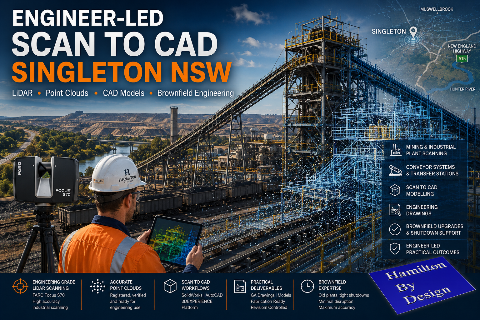
Engineer-Led Scan to CAD Services in Singleton NSW

Engineer-led scan to CAD services in Singleton NSW using industrial LiDAR scanning, point cloud modelling and brownfield engineering workflows for Hunter Valley mining infrastructure.

Engineer-Led Scan to CAD Services Singleton NSW | Industrial LiDAR Engineering

Blue 3D LiDAR scanner icon on a tripod with scanning waves

Mining and industrial facilities across Singleton and the wider Hunter Valley continue to operate within complex brownfield environments. Many plants have evolved over decades through shutdown upgrades, emergency modifications, structural alterations and conveyor system changes. In many cases, original drawings no longer reflect actual site conditions.

Hamilton By Design provides engineer-led scan-to-CAD services in Singleton NSW, helping mining and industrial operations convert real-world site conditions into practical engineering deliverables using engineering-grade LiDAR scanning and CAD modelling workflows.

Unlike general scanning providers that focus only on collecting point cloud data, our workflows are built around mechanical engineering, structural drafting and industrial plant modification projects.

Engineering-Grade LiDAR Scanning for Industrial Environments

Industrial plants present unique challenges that require more than basic reality capture.

Conveyor systems, transfer towers, maintenance platforms, pump skids, structural steel, pipework and access systems all require accurate understanding of existing geometry before fabrication or installation begins.

Hamilton By Design uses engineering-grade terrestrial LiDAR systems including the FARO Focus S70 to capture accurate site conditions within mining and industrial environments across Singleton and the Hunter Valley.

3D CAD Modelling Australia service banner for Hamilton By Design

Our services support:

  • Coal Handling Preparation Plants (CHPP)
  • Conveyor systems and transfer stations
  • Structural steel modifications
  • Mining workshops
  • Maintenance access platforms
  • Pipework upgrades
  • Brownfield plant expansions
  • Shutdown engineering projects
  • Mechanical equipment layouts
  • Industrial drafting and modelling workflows

Why Scan to CAD Matters in Brownfield Mining Environments

Many industrial projects fail due to inaccurate site information.

Legacy drawings may not reflect years of plant modifications, undocumented steelwork changes or conveyor alterations completed during shutdown periods. Small discrepancies in field measurements can result in fabrication errors, installation clashes and costly project delays.

Engineer-led scan-to-CAD workflows help reduce these risks by providing accurate as-built information before design and fabrication begins.

Accurate point cloud data allows engineering teams to:

  • Verify existing plant geometry
  • Identify clashes before fabrication
  • Reduce rework during shutdowns
  • Improve fit-up accuracy
  • Validate structural interfaces
  • Improve safety planning
  • Coordinate multiple contractors
  • Support fabrication-ready drafting

For mining and industrial facilities operating under tight shutdown windows, accurate site data can significantly improve planning confidence and reduce construction risk.

Engineer-Led Workflows โ€” Not Just Point Clouds

Hamilton By Design operates as an engineer-led organisation.

This means the scanning process is aligned with downstream engineering outcomes rather than simply delivering large volumes of unmanaged scan data.

Our workflows are designed to support:

  • Mechanical engineering
  • Structural engineering
  • Fabrication detailing
  • General arrangement drafting
  • Engineering governance
  • Revision-controlled documentation
  • Brownfield plant integration

We understand that industrial projects require practical deliverables that can move into fabrication, procurement and construction workflows.

3D LiDAR Scanning Hunter & Newcastle banner with white text on a blue background promoting engineering-grade laser scanning services for industrial, mining and infrastructure projects across the Hunter Valley and Newcastle region.
Mechanical Engineering Hunter & Newcastle banner promoting mechanical engineering services for mining, industrial plants, power generation, manufacturing and heavy industry throughout the Hunter Valley and Newcastle region.
Structural Drafting Hunter & Newcastle banner promoting structural drafting services for mining, industrial plants, power generation, manufacturing and infrastructure projects across the Hunter Valley and Newcastle region.

Typical Scan to CAD Workflow

1. Site LiDAR Scanning

Engineering-grade LiDAR scanners are used to capture existing site conditions across the required plant area.

Typical environments include:

  • Conveyors
  • Transfer towers
  • Access platforms
  • Pipework systems
  • Structural steel
  • Mechanical equipment
  • Processing infrastructure

2. Point Cloud Registration

Scan data is processed and registered using industrial workflows to align scans into a coordinated point cloud environment.

Deliverables may include:

  • Registered point clouds
  • Scan location plans
  • Registration reports
  • .E57 exports
  • .RCP exports
  • .LAS exports

3. Scan to CAD Modelling

Point cloud data is converted into practical engineering models and drafting outputs using platforms such as:

  • SolidWorks
  • AutoCAD
  • 3DEXPERIENCE Platform

4. Engineering Deliverables

Final deliverables may include:

  • General arrangement drawings
  • Structural layouts
  • Mechanical drafting
  • Conveyor layouts
  • Fabrication-ready models
  • Revision-controlled PDF issue packs

Supporting Singleton and Hunter Valley Industry

Singleton remains one of Australiaโ€™s most significant mining and industrial regions, supporting coal operations, bulk materials handling infrastructure and heavy industrial maintenance activities throughout the Hunter Valley.

Hamilton By Design supports companies operating across Singleton and surrounding regions by providing practical engineering-focused scanning and modelling workflows designed specifically for industrial environments.

Our focus is not on marketing-driven promises or unrealistic scanning claims.

Our focus is on delivering practical engineering outcomes that support real-world industrial projects.

3D LiDAR scanning and 3D modelling service button โ€” laser scanner capturing a point cloud for engineering and CAD modelling
Mechanical engineering services

Engineering Governance and Drawing Control

Industrial projects require more than accurate geometry.

Engineering governance, revision control and drawing lifecycle management remain critical for long-term project success.

Hamilton By Design can support structured engineering workflows through controlled drafting environments and the 3DEXPERIENCE platform, helping maintain:

  • Revision history
  • Controlled approvals
  • Issue status management
  • Audit traceability
  • Single source of truth documentation

This becomes increasingly important on large industrial and shutdown projects involving multiple stakeholders and contractors.

Hamilton By Design logo displayed on a blue tilted rectangle with a grey gradient background

Planning a Brownfield Upgrade in Singleton?

If your operation is planning a conveyor upgrade, plant modification, shutdown project or industrial expansion in Singleton NSW, Hamilton By Design can assist with engineer-led scan-to-CAD and industrial LiDAR workflows tailored to mining and heavy industrial environments.

For more information, lets connect

Name
Would you like us to arrange a phone consultation for you?
Address

Our clients

3D CAD Modelling Australia service banner for Hamilton By Design
CHPP Engineering title graphic featuring bold white text reading "CHPP Engineering" centred on a blue rounded rectangle background.
Pipework Drafting title graphic featuring bold white text reading "Pipework Drafting" centred on a blue rounded rectangle background.
3D LiDAR Scanning for Engineering Projects title graphic featuring bold white text on a blue rounded rectangle background.
Finite Element Analysis (FEA) engineering simulation button
Structural drafting services button
Mechanical drafting services button
Mechanical engineering services
Australian Drafting logo featuring bold white text reading "Australian Drafting" centred on a blue rounded rectangle background.

Engineering the Central Coast: From Gosford to Wyong with 3D Scanning, Steel Frames & Design

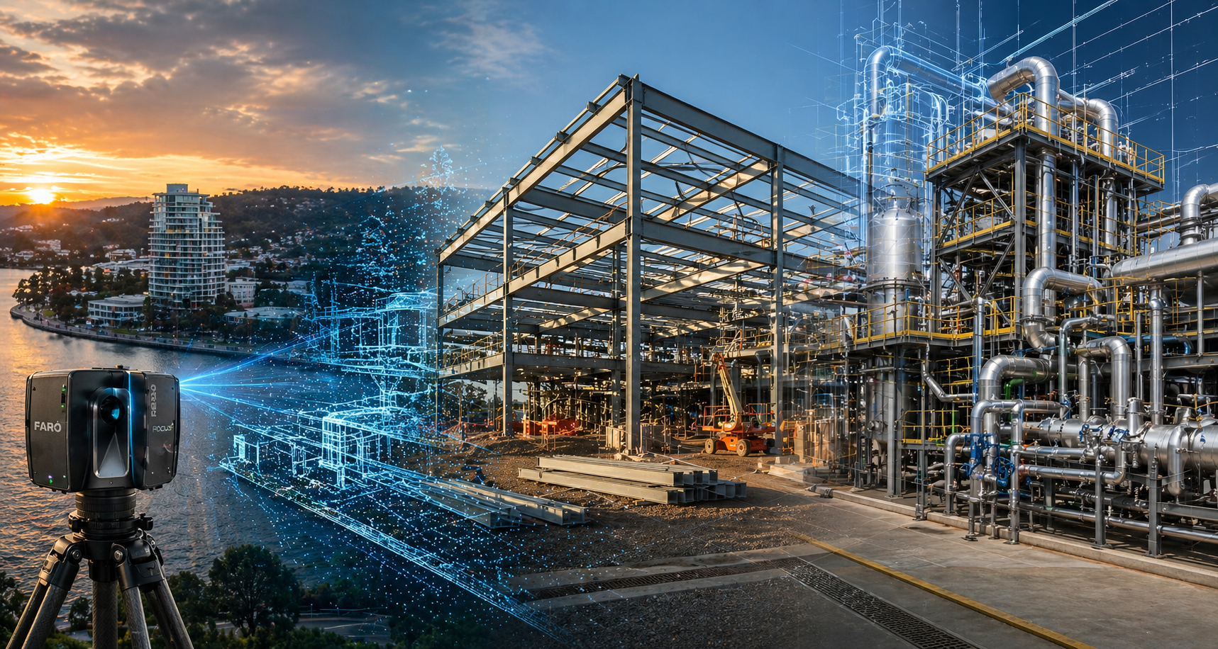
Engineering-led 3D laser scanning across the Central Coast showing LiDAR point cloud capture transitioning into steel frame construction and industrial mechanical design

A Story of Growth Across the Central Coast

From the waterfront of Gosford through the industrial expansion of Tuggerah and into the developing corridors of Wyong, the Central Coast is changing.

What was once a region defined by lifestyle is now becoming a hub for logistics, manufacturing, and commercial development. Warehouses are rising, steel frames are going up, and existing buildings are being repurposed and upgraded.

But beneath every successful project across the Central Coast sits something far less visible โ€” accurate engineering data and well-executed design.


3D LiDAR scanning and 3D modelling service button โ€” laser scanner capturing a point cloud for engineering and CAD modelling
Mechanical engineering services

Gosford: Starting with What Already Exists

In Gosford, many projects donโ€™t begin with a blank canvas. They begin with an existing structure โ€” a building that needs to be extended, upgraded, or completely rethought.

This is where 3D scanning in Gosford becomes critical.

Instead of relying on outdated drawings or assumptions, projects begin with:

  • 3D laser scanning
  • Reality capture
  • As-built surveys

Using LiDAR, existing structures are captured as detailed point cloud data. From there, that data is transformed into usable engineering information.

For projects across Gosford, this approach reduces uncertainty and provides a clear foundation for design.

You can learn more about this approach here:
https://www.hamiltonbydesign.com.au/gosford-3d-scanning-engineering-services/


Tuggerah: Steel Frames and Industrial Expansion

Moving north into Tuggerah, the landscape shifts.

Here, the focus is on industrial growth โ€” warehouses, distribution centres, and manufacturing facilities. Steel frames define the skyline, and projects move quickly from concept to construction.

Delivering steel frames on the Central Coast requires more than just fabrication. It requires:

  • Structural drafting
  • Steel detailing
  • CAD modelling
  • Integration with real-world site conditions

This is where engineering-led scanning and drafting comes into play.

For projects that extend beyond the Central Coast into the Hunter region, services such as:

  • Laser scanning Newcastle
  • 3D laser scanning Newcastle
  • 3D scanning Newcastle
  • CAD design Newcastle

become part of the same connected workflow.

Supporting drafting services can be found here:
https://www.hamiltonbydesign.com.au/structural-drafting-newcastle/


3D LiDAR scanning services on the Central Coast providing engineering-grade laser scanning, point cloud capture, scan-to-CAD modelling and industrial reality capture for infrastructure and industrial projects.
Drafting services on the Central Coast providing engineering drawings, fabrication detailing, as-built documentation, reverse engineering and CAD drafting for industrial and infrastructure projects.
Mechanical engineering services on the Central Coast providing industrial design, plant inspections, pump calculations, reverse engineering and engineering support for manufacturing, infrastructure and heavy industry projects.

Wyong: Where Design Meets Delivery

Further north, Wyong represents the transition from design into delivery.

Here, projects are no longer just about structures โ€” they involve:

  • Mechanical systems
  • Process equipment
  • Integrated plant and services

This is where mechanical engineering and drafting play a key role.

Using point cloud data captured earlier in the project, designs are developed into:

  • 3D models
  • Fabrication drawings
  • Installation-ready documentation

The result is a seamless connection between what exists on site and what is being built.

Projects across Wyong and into the Hunter Valley often rely on:

  • Hunter Valley laser scanning
  • Laser scanning Hunter Valley

to maintain accuracy across large and complex sites.


Connecting the Central Coast to Sydney

The Central Coast does not operate in isolation.

Many projects connect directly into Sydney โ€” whether through supply chains, engineering support, or design coordination.

This is where services such as:

  • 3D scanning Sydney
  • 3D laser scanning Sydney
  • CAD drafting Sydney
  • Mechanical engineering Sydney

become part of the same workflow.

Explore these services here:
https://www.hamiltonbydesign.com.au/home/3d-laser-scanning/3d-scanning-sydney/

And the full engineering-led approach here:
https://www.hamiltonbydesign.com.au/3d-scanning-sydney-lidar-cad-mechanical-engineering/


From Scan to Steel: A Practical Workflow

Across the Central Coast, successful projects follow a consistent process:

Capture โ€“ Using LiDAR to scan real-world conditions
Model โ€“ Converting point cloud data into CAD and BIM
Design โ€“ Developing structural and mechanical solutions
Deliver โ€“ Issuing drawings for fabrication and construction

This approach ensures that steel frames fit, equipment aligns, and installations proceed without costly rework.

3D CAD Modelling Australia service banner for Hamilton By Design

Why Engineering-Led Scanning Matters

There are many providers offering scanning services.

But scanning alone is not enough.

What matters is how that data is used.

Hamilton By Design focuses on:

  • Engineering-grade point cloud data
  • CAD models that can be used for design and fabrication
  • Integration between scanning, drafting, and engineering
  • Deliverables that support real construction outcomes

Conclusion: Building the Central Coast with Confidence

From Gosford to Tuggerah and Wyong, the Central Coast is growing โ€” and with that growth comes complexity.

Projects are no longer simple builds. They involve upgrades, integration, and coordination between existing and new systems.

With the right combination of:

  • 3D scanning
  • Steel frame design
  • Mechanical engineering
  • CAD drafting

projects can move forward with confidence โ€” from initial concept through to final construction.


Call to Action – Contact Us

If you are delivering a project on the Central Coast and need:

  • Steel frames Central Coast
  • 3D scanning services
  • CAD drafting or mechanical design
  • Laser scanning Newcastle or Hunter Valley

Hamilton By Design can support your project from site capture through to engineering delivery.

Our clients

Name
Would you like us to arrange a phone consultation for you?
Address

Mechanical Engineering | Structural Engineering


Reality Capture in the Hunter Valley

The Hunter Valley is one of Australiaโ€™s most technically complex industrial regions, combining power generation, mining, bulk materials handling, manufacturing, and logistics infrastructure within a tightly interconnected operational landscape. Projects in this environment frequently involve legacy assets, constrained access, and high consequences for design or construction error.

Reality capture in the Hunter Valley provides a structured, engineering-led method for documenting existing conditions using measured data rather than assumption-based interpretation. At Hamilton By Design, reality capture is applied as part of a broader engineering workflowโ€”ensuring captured information directly supports design development, upgrade planning, fabrication coordination, and risk management.


Defining reality capture in an industrial context

Reality capture is the process of recording physical site conditions using spatially accurate technologies and converting that information into usable engineering references. In practical terms, this includes:

  • Engineering-grade laser scanning and LiDAR acquisition
  • Spatial data registration and validation
  • Interpretation of existing geometry in the context of mechanical and structural systems
  • Translation of measured data into drawings, models, and coordination outputs

The objective is not simply to visualise a site, but to create a reliable, defensible representation of existing conditions that can be used throughout the project lifecycle.

For projects where laser scanning forms the core capture method, refer to:
3D Laser Scanning
https://www.hamiltonbydesign.com.au/home/3d-lidar-scanning-digital-quality-assurance/3d-laser-scanning/


Why reality capture is critical in the Hunter Valley

Industrial facilities across the Hunter Valley often operate continuously while upgrades, modifications, and expansions are undertaken. Common project challenges include:

  • Brownfield environments with incomplete or outdated documentation
  • Complex interfaces between mechanical, structural, and civil systems
  • Fabrication occurring off-site with limited tolerance for dimensional error
  • Restricted access windows and safety-critical operating conditions

In these scenarios, traditional measurement approaches are often insufficient. Reality capture reduces uncertainty by establishing a single source of measured truth, enabling informed decisions before fabrication or installation begins.

For an overview of how scanning is applied to regional industry, see:
3D Scanning for Industrial Projects in Newcastle and the Hunter Valley
https://www.hamiltonbydesign.com.au/3d-scanning-for-industrial-projects-in-newcastle-and-the-hunter-valley/


Typical Hunter Valley applications

Existing-condition baselining

Reality capture provides accurate documentation where legacy drawings no longer reflect actual site conditions. This baseline supports engineering assessments, upgrade feasibility studies, and staged project planning.

Plant upgrades and retrofit works

Measured spatial data allows new systems to be designed around existing plant, services, and structures, reducing clash risk and rework during installation.

Fabrication and construction coordination

Accurate capture of interfaces, clearances, and connection points improves alignment between design intent and fabricated componentsโ€”particularly where fabrication is completed remotely.

Risk reduction and decision support

From an engineering governance perspective, reality capture improves information quality, reduces assumptions, and supports more defensible technical decisions.


Engineering-led reality capture methodology

Hamilton By Design approaches reality capture as a project-specific engineering activity, not a generic surveying exercise.

1. Scope definition aligned to outcomes

Capture scope is defined based on how the data will be usedโ€”design development, drafting, verification, or coordinationโ€”ensuring the level of detail and accuracy is appropriate.

2. Structured site data acquisition

Capture activities are planned to manage occlusion, access limitations, and operational constraints commonly encountered on Hunter Valley industrial sites.

3. Data validation and preparation

Captured datasets are reviewed, registered, and structured so they can be confidently used for engineering interpretation rather than remaining as raw data.

4. Engineering-ready deliverables

Where required, reality capture outputs are converted into:

  • As-built drawings
  • General arrangement layouts
  • Reference models for coordination
  • Documentation suitable for engineering review and approvals

Relationship between reality capture and laser scanning

While laser scanning and LiDAR are commonly used tools within reality capture, the distinction lies in how the data is applied. Laser scanning provides the measurements; reality capture ensures those measurements are contextualised, validated, and integrated into engineering workflows.

This distinction is particularly important in industrial regions such as the Hunter Valley, where inaccurate interpretation of spatial data can have significant cost and safety implications.


Value for Hunter Valley stakeholders

Reality capture supports multiple stakeholder groups:

  • Asset owners and operators gain confidence in upgrade planning
  • Engineers work from verified existing-condition data
  • Fabricators receive clearer interface definitions
  • Project teams reduce site disruption and variation risk

From a systems engineering perspective, this represents an improvement in information reliability and traceabilityโ€”both key drivers of project performance.


Regional capability and service coverage

Hamilton By Design services the Hunter Valley as part of its broader NSW engineering and reality capture capability, supporting projects across industrial, energy, and infrastructure sectors.

Service coverage includes Newcastle and the wider Hunter region, as outlined in:
Frequently Asked Questions โ€“ Service Areas
https://www.hamiltonbydesign.com.au/frequently-asked-questions/


Next steps

For Hunter Valley projects, effective reality capture begins by clearly defining:

  1. Which areas and interfaces require measurement
  2. What engineering decisions the data must support
  3. The required accuracy for design, fabrication, or verification

Once these parameters are established, reality capture can be aligned to project risk, schedule, and delivery requirements.

For scanning-focused services, return to:
3D Laser Scanning
https://www.hamiltonbydesign.com.au/home/3d-lidar-scanning-digital-quality-assurance/3d-laser-scanning/

For industrial scanning examples in the region, see:
3D Scanning for Industrial Projects in Newcastle and the Hunter Valley
https://www.hamiltonbydesign.com.au/3d-scanning-for-industrial-projects-in-newcastle-and-the-hunter-valley/

3D LiDAR scanning and 3D modelling service button โ€” laser scanner capturing a point cloud for engineering and CAD modelling
Mechanical engineering services

Our clients:

Name
Would you like us to arrange a phone consultation for you?
Address
https://www.hamiltonbydesign.com.au/mechanical-engineering
3D CAD Modelling Australia service banner for Hamilton By Design
Australian Drafting logo featuring bold white text reading "Australian Drafting" centred on a blue rounded rectangle background.
Engineering Governance title graphic featuring bold white text reading "Engineering Governance" centred on a blue rounded rectangle background.
Mechanical, Structural & Pipework Drafting service banner by Hamilton By Design featuring white text on a blue background.
Mechanical engineering services
Blue rounded button with the text โ€œSolidWorks Designโ€ in white.
Finite Element Analysis (FEA) engineering simulation button
3D LiDAR Scanning Darwin for engineering surveys, laser scanning, reality capture and point cloud modelling services
3D LiDAR Scanning Australia engineering services for laser scanning, reality capture, scan-to-CAD, Scan-to-BIM and as-built documentation across Australia
3D LiDAR scanning services on the Central Coast providing engineering-grade laser scanning, point cloud capture, scan-to-CAD modelling and industrial reality capture for infrastructure and industrial projects.
3D LiDAR Scanning Perth for engineering surveys, laser scanning, reality capture and point cloud modelling services
3D LiDAR Scanning Sydney for engineering surveys, laser scanning, reality capture and point cloud modelling services
3D LiDAR Scanning Brisbane for engineering surveys, laser scanning, reality capture and point cloud modelling services
3D LiDAR Scanning Canberra for engineering surveys, laser scanning, reality capture and point cloud modelling services
3D LiDAR Scanning Newcastle for engineering surveys, laser scanning, reality capture and point cloud modelling services
3D LiDAR Scanning Adelaide for engineering surveys, laser scanning, reality capture and point cloud modelling services

3D LiDAR Scanning Hunter Valley Power Stations

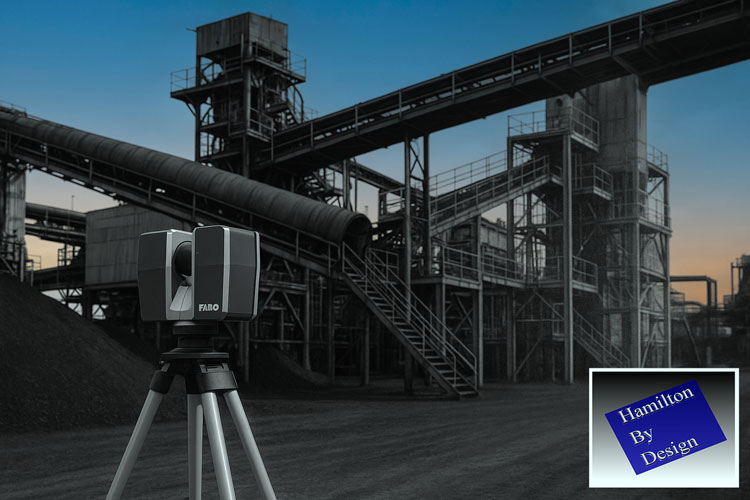
FARO 3D laser scanner set up on a tripod capturing an industrial plant for LiDAR scanning and digital modelling, with Hamilton By Design branding in the corner.

Unlocking Accuracy, Safety and Efficiency for Critical Infrastructure

The Hunter Valley is home to some of Australiaโ€™s most significant power generation assets. These power stations โ€” many of which have operated for decades โ€” supply energy to mining operations, manufacturing facilities, regional communities and industries throughout New South Wales. As these plants age and undergo continual maintenance, upgrades and redevelopment, the importance of accurate, reliable and safe measurement methods becomes increasingly critical.

Traditionally, engineers and maintenance teams have relied on manual measurements, outdated drawings or partial documentation to plan upgrades or execute shutdown work. But in complex, congested and ageing plant environments, this introduces risks, delays and expensive rework.

This is why 3D LiDAR scanning in Hunter Valley power stations has emerged as one of the most valuable tools for modern asset management, engineering and maintenance planning. LiDAR provides a millimetre-accurate digital snapshot of real-world conditions, enabling smarter, safer and more predictable project outcomes.

This article explores the benefits, applications, and pros and cons of 3D LiDAR scanning and explains why Hunter Valley power stations stand to gain significantly from adopting this technology.


Why Power Stations Need Accurate As-Built Data

Power stations are among the most complex industrial facilities in Australia. Over decades of operation, they experience:

  • Structural deformation
  • Settlement and movement
  • Corrosion and wear
  • Numerous undocumented modifications
  • Equipment realignments
  • Tight access restrictions
  • Ageing steelwork and infrastructure

In these environments, original construction drawings rarely match reality. As a result, engineers planning upgrades, shutdowns or replacements often face:

  • Inaccurate interface points
  • Misaligned structures
  • Unpredictable installation conditions
  • High rework costs
  • Safety delays
  • Poor shutdown timing

3D LiDAR scanning offers a precise, digital representation of the site, giving engineers the confidence they need to design upgrades accurately and eliminate guesswork.


The Benefits of 3D LiDAR Scanning for Hunter Valley Power Stations

1. Unmatched Measurement Accuracy for Complex Assets

A power station contains thousands of interconnected components:

  • Boilers
  • Turbines
  • Structural platforms
  • Pipe networks
  • Pressure vessels
  • Ducting systems
  • Conveyor bridges
  • Cooling towers
  • Electrical cabinets
  • Steel supports

Capturing these geometries manually is nearly impossible.

3D LiDAR scanning provides millimetre-level accuracy across enormous plant areas, allowing engineers to:

  • Create precise as-built models
  • Validate structural alignment
  • Check pipe routes and clearances
  • Identify interferences
  • Understand deformation over time
  • Design new works based on real geometry

This level of data is invaluable for maintaining safe and compliant power-generation operations.


2. Major Safety Improvements

Power stations present significant safety risks:

  • High-voltage environments
  • Confined spaces
  • Elevated platforms
  • Hot surfaces
  • Restricted access
  • Operational machinery

Manual measurement often requires workers to climb structures, enter hazardous zones or physically reach difficult areas.

3D LiDAR scanning dramatically reduces risk by:

  • Capturing data from safe distances
  • Eliminating the need for repeated access
  • Reducing time in hazardous zones
  • Minimising interaction with live equipment

For Hunter Valley power stations with strict safety requirements, this is a major benefit.


3. Reduced Shutdown Duration and Cost

Shutdowns are among the most expensive events for power-generation facilities. Every hour counts.

With 3D LiDAR scanning:

  • Engineers define accurate scopes before shutdown
  • Fabricators receive precise data and cut steel correctly
  • Digital fit checks identify issues early
  • Installation is faster and smoother
  • Delays due to bad measurements are eliminated

This leads to shorter outages, safer work and fewer unexpected problems.


4. Supports Engineering, Design and Structural Integrity Works

Power stations frequently require:

  • Boiler upgrades
  • Turbine area modifications
  • Ducting and flue replacements
  • Pipework rerouting
  • Cooling-system upgrades
  • Structural strengthening
  • Platform and walkway replacements
  • Electrical equipment relocations

All of these tasks depend on accurate geometry.

3D LiDAR scanning supports engineering teams by providing:

  • Reference geometry for load calculations
  • Verified connection points
  • True alignment data
  • Accurate slope and deflection measurements
  • High-resolution drawings and 3D models

This ensures engineering decisions are made using verified, real-world information.


5. Perfect for Brownfield and Congested Environments

Power stations are some of the most complex brownfield assets in the industrial landscape. They contain layers of modifications, years of retrofits and areas where access is extremely limited.

3D LiDAR scanning excels at capturing:

  • Tight clearances
  • Overlapping structures
  • Equipment clusters
  • Interconnected pipes
  • Hard-to-reach surfaces

This makes it ideal for planning:

  • New platforms
  • Replacement ducting
  • Pipe realignments
  • Structural upgrades
  • Asset lifecycle extensions

The result: fewer surprises during installation.


6. Better Collaboration Between Teams

Power stations typically involve:

  • Maintenance teams
  • OEMs
  • Engineering consultants
  • Fabricators
  • Shutdown managers
  • Safety personnel
  • Project delivery teams

3D LiDAR scanning enables everyone to work from the same digital truth.

Point clouds and 3D models allow:

  • Remote site understanding
  • Clear communication
  • Digital reviews instead of repeated site visits
  • Improved planning alignment

For Hunter Valley projects involving multiple contractors, this significantly boosts performance.


Pros and Cons of 3D LiDAR Scanning

Like any technology, LiDAR has strengths and limitations. Understanding both helps power station operators make informed decisions.


Pros

โœ” Extremely high accuracy

Millimetre precision for large and complex areas.

Fast data capture

Reduces time spent in hazardous areas.

Clear visibility of congested spaces

Captures geometry that traditional methods miss.

Enhances engineering confidence

Designers base work on verified conditions.

Reduces installation rework

Fabrication matches the real site exactly.

Supports digital engineering workflows

Perfect input for CAD, BIM, simulation and modelling.

Safer measurement practices

Less climbing, reaching and confined-space entry.


Cons

Requires skilled interpretation

Point cloud data must be processed by trained technicians or engineers.

Large file sizes

High-resolution scans require strong computing resources.

Reflective or transparent surfaces can create challenges

Requires technique or matte marking in some areas.

Upfront cost may seem higher

But it eliminates far greater downstream costs in rework and shutdown delays.

Despite these considerations, LiDAR scanning remains the most cost-effective measurement tool for power station environments.


Why Hunter Valley Power Stations Benefit More Than Most

The Hunter Valley industrial landscape presents unique challenges:

  • Ageing energy infrastructure
  • Multiple retrofits and undocumented modifications
  • Extremely tight maintenance windows
  • Harsh environmental conditions
  • Congested structures with difficult access
  • High safety standards
  • Heavy reliance on local fabrication accuracy

3D LiDAR scanning Hunter Valley power stations provides the one thing these facilities need most: confidence.

Confidence in measurements.
Confidence in fabrication.
Confidence during shutdowns.
Confidence in engineering decisions.
Confidence in safety performance.

Few regions stand to gain more from LiDAR than the Hunter.


Hamilton By Design: Supporting Hunter Valley Power Stations with Advanced LiDAR Solutions

Hamilton By Design brings together:

  • Engineering expertise
  • On-site scanning capability
  • CAD modelling and drafting
  • Fabrication-ready documentation
  • Digital fit-checking and clash detection
  • Mechanical and structural design experience

We understand the complex realities of power-station environments, and we deliver precise, reliable and engineering-ready digital data for:

  • Boiler upgrades
  • Turbine hall modifications
  • Structural replacements
  • Pipe rerouting
  • Platform and access upgrades
  • Ducting and flue modifications
  • Cooling tower projects
  • Balance-of-plant improvements

Every model, point cloud and drawing is produced with installation success and fabrication accuracy in mind.


Conclusion: 3D LiDAR Scanning is the New Standard for Hunter Valley Power Stations

As the Hunter Valley transitions into a future of renewable generation, asset extension and industrial redevelopment, 3D LiDAR scanning stands out as a technology that delivers real, immediate value.

It improves safety.
It increases accuracy.
It reduces rework.
It enables better engineering.
It shortens shutdowns.
It lowers project risk.

Power stations across the Hunter Valley rely on critical, ageing and highly complex infrastructure โ€” infrastructure that demands accurate, reliable digital measurement.

Hamilton By Design is proud to support the region with advanced laser scanning technologies that empower engineers, fabricators, supervisors and project managers to work smarter, safer and more efficiently.

Hamilton By Design logo displayed on a blue tilted rectangle with a grey gradient background
3D LiDAR scanning and 3D modelling service button โ€” laser scanner capturing a point cloud for engineering and CAD modelling
Mechanical engineering services

3D Laser Scanning

Hunter Valley Laser Scanning: Transforming Engineering Accuracy Across Mining, Manufacturing and Infrastructure

Finite Element Analysis (FEA) engineering simulation button
Mechanical engineering services

3D Laser Scanning in Singleton and the Hunter: Delivering Accuracy for Mining, Manufacturing and Industrial Projects

Laser Scanning Hunter Valley: Delivering Engineering-Grade Accuracy for Mining, Manufacturing and Industrial Projects

Our clients

Name
Address
You would like to:

3-D Lidar Scanning Hunter Valley

3-D Lidar Scanning Hunter Valley: Transforming Industrial Projects with Accuracy, Safety and Engineering Confidence

The Hunter Valley is one of Australiaโ€™s most strategically important industrial regions. It supports large mining operations, CHPP facilities, fabrication workshops, energy infrastructure, civil projects and heavy manufacturing. These industries depend on precision, safety and efficient project delivery โ€” yet most operate in aging brownfield environments where original drawings are outdated, equipment has shifted over time, and modifications have occurred for decades without accurate documentation.

In environments like these, traditional measuring methods often fail to provide the precision required for confident engineering and fabrication. This is why 3-D Lidar scanning in the Hunter Valley has become a critical tool for engineers, supervisors, fabricators and project managers. It captures the real-world site conditions with millimetre accuracy, creating a digital foundation for smarter, safer and more efficient project execution.

This article explores the benefits, pros and cons of 3-D Lidar scanning, and explains why the Hunter Valley is uniquely positioned to gain massive value from this technology.


Understanding 3-D Lidar Scanning

3-D Lidar (Light Detection and Ranging) scanning is a non-contact measurement technology that uses lasers to capture millions of points in seconds. The scanner emits laser pulses and measures the return time to determine distances, building a dense โ€œpoint cloudโ€ of the environment.

This point cloud is a precise 3-D representation of:

  • Structural steel
  • Conveyors and transfer towers
  • Chutes, bins and hoppers
  • Tanks, pipework and mechanical equipment
  • Platforms, walkways and buildings
  • Industrial plant rooms and process areas

Once captured, this digital data becomes the foundation for engineering models, fabrication drawings, digital fit checks and project planning.


Why 3-D Lidar Scanning Matters in the Hunter Valley

The Hunter Valley contains some of the most complex and heavily used industrial assets in Australia. Many facilities have been in operation for decades, and almost all have undergone modifications, expansions and repairs. Over time, the real-world geometry diverges significantly from the old drawings stored on paper or outdated CAD files.

This creates major challenges:

  • Measurements taken by hand are inaccurate or unsafe
  • Shutdown windows are extremely tight
  • Fabricators rely on precise data to avoid costly rework
  • Engineers require true geometry for load calculations and interface design
  • Supervisors need reliable information to scope replacement work

3-D Lidar scanning provides a millimetre-accurate representation of what exists onsite, removing guesswork and supporting engineering best practice.


The Benefits of 3-D Lidar Scanning in the Hunter Valley

1. Millimetre Accuracy Improves Engineering Outcomes

In heavy industrial environments, small measurement errors can create large, expensive problems. Structural misalignment, worn steel, bent frames, sagging conveyors and distorted chutes are all common in brownfield plants.

3-D Lidar scanning captures:

  • True dimensions
  • Variations from design
  • Deformation and misalignment
  • Complex curved surfaces
  • Differences caused by wear and tear

Engineers design with confidence because the digital model reflects actual site conditions โ€” not assumptions.


2. Huge Reduction in Rework and Fabrication Errors

Fabricators in Singleton, Muswellbrook, Rutherford, Tomago and throughout the Hunter region rely on accurate measurements to ensure steel and mechanical components fit the first time.

Without accurate data, common fabrication issues include:

  • Bolt holes misaligned
  • Steel members too short or too long
  • Chutes or hoppers not matching openings
  • Pipe spools missing clearances
  • Platforms not sitting square

These problems lead to:

  • Onsite cutting and welding
  • Delayed installations
  • Extended shutdown time
  • Additional crane costs
  • Extra labour expenses

3-D Lidar scanning eliminates these risks, ensuring every component is manufactured to match the as-built site geometry.


3. Improved Shutdown Planning and Faster Execution

Mining and CHPP shutdowns in the Hunter Valley operate under strict time constraints. Any unexpected measurement issue can cause delays affecting production and safety.

With 3-D Lidar scanning:

  • Scope is defined accurately before shutdown
  • Fabrication is completed correctly the first time
  • Digital fit checks identify problems early
  • Installation is faster and safer

Shutdowns become more predictable and efficient.


4. Massive Safety Improvements

Manual measurement often requires workers to:

  • Enter confined spaces
  • Access heights
  • Work around operating equipment
  • Lean over conveyors
  • Navigate dirty, uneven or hazardous areas

3-D Lidar scanning minimises physical access requirements. Technicians can scan large areas from safe positions, reducing:

  • Fall risks
  • Pinch-point exposure
  • Hot-work hazards
  • Time on elevated structures

This is a major benefit for HSE and maintenance teams across the Hunter Valley.


5. Better Communication, Collaboration and Visualisation

Point clouds and 3-D models make it easier for teams to understand the project environment, especially when stakeholders are spread across:

  • Mine sites
  • Fabrication workshops
  • Design offices
  • Engineering consultancies
  • Projects teams and OEM vendors

Digital data allows remote review, reducing the need for repeated site visits and improving decision-making.


6. Ideal for Brownfield Upgrades and Congested Areas

Many Hunter Valley facilities are decades old, with layers of modifications. Clearances are tight, geometry is irregular, and equipment alignment has changed over the years.

3-D Lidar scanning is perfect for:

  • Transfer towers with layered steel
  • Congested plant rooms
  • Pipe networks
  • Stockpile conveyors
  • Old building footprints
  • Complex structural junctions

The scanner captures the complexity instantly and precisely.

Hamilton By Design logo displayed on a blue tilted rectangle with a grey gradient background

Pros and Cons of 3-D Lidar Scanning

While 3-D Lidar scanning is a game-changing tool, it is important to understand both the advantages and limitations.

3D Scanning in The Hunter Valley

3D Laser Scanning

Hunter Valley Laser Scanning: Transforming Engineering Accuracy Across Mining, Manufacturing and Infrastructure

3D Laser Scanning in Singleton and the Hunter: Delivering Accuracy for Mining, Manufacturing and Industrial Projects

Laser Scanning Hunter Valley: Delivering Engineering-Grade Accuracy for Mining, Manufacturing and Industrial Projects

Name
Address
You would like to:
Mechanical engineering services
Australian Drafting logo featuring bold white text reading "Australian Drafting" centred on a blue rounded rectangle background.
Finite Element Analysis (FEA) engineering simulation button
Mechanical engineering services