Central Coast Pump Station 3D Scanning Services

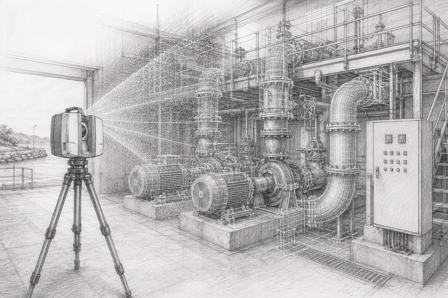
Grey pencil drawing of a LiDAR scanner capturing a Central Coast pump station with pumps, pipework, valves, access platforms and point cloud scan detail.

Engineering-Grade LiDAR Scanning for Pump Stations, Pipework, Access Platforms and As-Built Documentation

Blue 3D LiDAR scanner icon on a tripod with scanning waves

Hamilton By Design provides Central Coast pump station 3D scanning services for councils, water utilities, infrastructure owners, contractors, engineers and maintenance teams who need accurate site information before starting upgrade, maintenance or replacement work.

Pump stations are often congested, ageing and difficult to measure safely using traditional methods. Existing drawings may be missing, outdated or no longer match the real installation. This creates risk when replacing pumps, modifying pipework, installing new valves, upgrading access platforms or planning shutdown work.

Our 3D laser scanning service captures the existing pump station in high detail, creating accurate point cloud data that can be converted into CAD models, drawings and engineering documentation. This helps reduce rework, improve planning and give project teams confidence that new work will fit the existing site.

Hamilton By Design is based on the NSW Central Coast and supports pump station scanning projects across Gosford, Wyong, Tuggerah, Somersby, Erina, Woy Woy, Ourimbah, Lisarow, Lake Macquarie, Newcastle and the wider Hunter region.

Why Pump Stations Need 3D Scanning

Pump stations contain a mix of mechanical, civil, structural and electrical infrastructure. A single site may include pumps, motors, pipework, valves, supports, access platforms, pits, tanks, switchboards, cable trays and building structures.

Over time, many pump stations are modified during maintenance or upgrade work. Pipework may be rerouted, equipment may be replaced, platforms may be added, and drawings may not be updated. When engineers rely on old drawings or manual measurements, small errors can lead to major problems during installation.

3D scanning helps solve this by capturing the real site condition before design work begins.

Typical issues include:

  • Existing drawings do not match the site
  • Pipework routes are unclear
  • Pump and motor layouts are difficult to measure
  • Access platforms and handrails need upgrading
  • Valve locations and flange positions need verification
  • New equipment must fit around existing structures
  • Shutdown windows are short
  • Site access is limited
  • Manual measurement creates safety and accuracy risks

With accurate 3D scan data, engineers and contractors can plan upgrades using measured reality rather than assumptions.

What We Scan

Hamilton By Design can capture internal and external pump station assets, including:

  • Pump and motor assemblies
  • Pipework and valve layouts
  • Flanges, bends, reducers and fittings
  • Structural steel supports
  • Access platforms, stairs and handrails
  • Concrete pits, plinths and foundations
  • Tanks, vessels and wet well areas where accessible
  • Cable trays and service routes
  • Building envelopes and roof structures
  • Maintenance access zones
  • Existing clearances and installation constraints

The scan data can be used to support design, drafting, reverse engineering, clash checking and long-term asset documentation.

Scan-to-CAD for Pump Station Upgrades

A point cloud is useful, but the real value comes from converting the scan into practical engineering outputs.

Hamilton By Design can convert pump station scan data into:

  • 3D CAD models
  • 2D general arrangement drawings
  • Pipework layouts
  • Equipment location drawings
  • Structural platform layouts
  • As-built documentation
  • Fabrication drawings
  • Clearance studies
  • Reverse engineered components
  • Design-ready geometry for SolidWorks, AutoCAD, Inventor or ReCap workflows

This is especially useful when planning pump replacements, pipework modifications, new valve installations, access upgrades or structural support changes.

For broader industrial scanning capability, you can also refer to our Industrial 3D Scanning Services Australia page.

Local Central Coast Engineering Support

Because Hamilton By Design is based on the Central Coast, we can support local projects quickly and practically. We understand the needs of regional infrastructure, water assets, council facilities, industrial sites and brownfield upgrade work.

Our Central Coast scanning services are suited to:

  • Council pump stations
  • Water infrastructure
  • Wastewater facilities
  • Industrial pumping systems
  • Stormwater pump stations
  • Treatment plant assets
  • Manufacturing and process facilities
  • Brownfield plant upgrades
  • Maintenance and shutdown planning

For more general local scanning services, see our 3D Scanning Services Central Coast page.

Benefits of 3D Scanning Pump Stations

3D scanning provides a reliable foundation for engineering decisions.

Key benefits include:

  • Accurate as-built documentation
  • Reduced site rework
  • Fewer repeat site visits
  • Safer data capture
  • Improved design accuracy
  • Better shutdown planning
  • Faster engineering decisions
  • Better coordination between designers, fabricators and contractors
  • Clearer records for future asset management
  • Reduced risk when replacing or modifying equipment

For pump station projects, the biggest advantage is confidence. The design team can work from accurate existing conditions before fabrication or installation begins.

Typical Project Workflow

1. Project Review

We review the project scope, site access, required deliverables and available drawings. This helps determine the best scanning approach.

2. Site Scanning

Using FARO laser scanning equipment, we capture the pump station from multiple positions to record equipment, pipework, structures and surrounding constraints.

3. Point Cloud Registration

The scan data is processed and registered into a coordinated point cloud.

4. CAD Modelling and Drawing Production

Depending on the project, the point cloud can be converted into 3D models, 2D drawings, pipework layouts, equipment models or fabrication-ready documentation.

5. Engineering Support

We can support design review, reverse engineering, upgrade planning and documentation for contractors, councils and asset owners.

Common Pump Station Projects We Support

Hamilton By Design can assist with:

  • Pump replacement projects
  • Pipework upgrades
  • Valve and flange modifications
  • Access platform upgrades
  • Structural support design
  • Maintenance planning
  • Shutdown preparation
  • Reverse engineering of existing parts
  • As-built documentation recovery
  • Clash checking for new installations
  • Contractor tender documentation
  • Long-term asset records

For related pump station reverse engineering content, see our page on 3D Laser Scanning of Pump Stations for Reverse Engineering.

Why Choose Hamilton By Design

Hamilton By Design combines 3D laser scanning with mechanical engineering, CAD modelling and practical site experience.

We do more than capture a point cloud. We understand how the data will be used for design, fabrication, installation and maintenance.

Our strengths include:

  • Central Coast based service
  • Engineering-led scanning workflow
  • FARO laser scanning equipment
  • SolidWorks and AutoCAD capability
  • Scan-to-CAD modelling
  • Mechanical and structural drafting
  • Brownfield upgrade experience
  • Pump, pipework and plant layout understanding
  • Practical documentation for real projects

This makes our service suitable for clients who need accurate engineering information, not just visual site capture.

Central Coast Pump Station 3D Scanning

If you are planning a pump station upgrade, pipework change, equipment replacement or as-built documentation project on the Central Coast, Hamilton By Design can help capture the existing site accurately before design or fabrication begins.

Accurate scan data reduces uncertainty, improves project planning and helps ensure new work fits the real site conditions.

Contact Hamilton By Design to discuss your Central Coast pump station scanning project.

FAQs

What is pump station 3D scanning?

Pump station 3D scanning uses laser scanning technology to capture the real shape, position and layout of pumps, pipework, valves, structures and surrounding site conditions. The scan creates a point cloud that can be used for CAD modelling, drawings and engineering design.

Why is 3D scanning useful for pump station upgrades?

It helps confirm what is actually on site before design work begins. This is important because many pump stations have outdated drawings or undocumented modifications. Scanning reduces the risk of new pipework, pumps or platforms not fitting during installation.

Can you scan pipework and valve layouts?

Yes. We can scan pipework, valves, flanges, bends, reducers, supports and surrounding structures. This information can then be used to create CAD models, layouts or drawings for upgrade planning.

Can you convert the scan into CAD drawings?

Yes. Hamilton By Design can convert point cloud data into 2D drawings, 3D CAD models, general arrangements, pipework layouts and fabrication-ready documentation depending on the project requirements.

Do you work with councils and water infrastructure?

Yes. Our services are suitable for councils, water utilities, wastewater facilities, infrastructure contractors, engineers and asset owners managing pump stations or treatment plant assets.

What areas of the Central Coast do you service?

We support projects across Gosford, Wyong, Tuggerah, Somersby, Erina, Woy Woy, Ourimbah, Lisarow and surrounding Central Coast areas. We also service Newcastle, Lake Macquarie, Sydney and regional NSW.

What files can be delivered?

Common deliverables include registered point clouds, E57 files, RCP/RCS files, DWG drawings, DXF files, STEP models, SolidWorks models, Inventor models, AutoCAD layouts and PDF drawing packages.

Can scanning help with reverse engineering pump parts?

Yes. 3D scanning can assist with reverse engineering pump components, pipework assemblies, supports, access structures and other assets where drawings are missing or incomplete.

Is 3D scanning safer than manual measuring?

In many cases, yes. Laser scanning can capture large amounts of site information from a distance, reducing the need for repeated manual measurement around congested or difficult-to-access areas.

How do I know if my pump station needs scanning?

If the drawings are missing, outdated, unreliable or the upgrade needs to fit around existing equipment, scanning is usually worthwhile. It is especially useful before fabrication, shutdown work or equipment replacement.

Hamilton By Design logo displayed on a blue tilted rectangle with a grey gradient background

Talk to Us – Contact Us

Name
Would you like us to arrange a phone consultation for you?
Address

Our clients:


3D Scanning for Central West NSW Gold and Copper Processing Plants

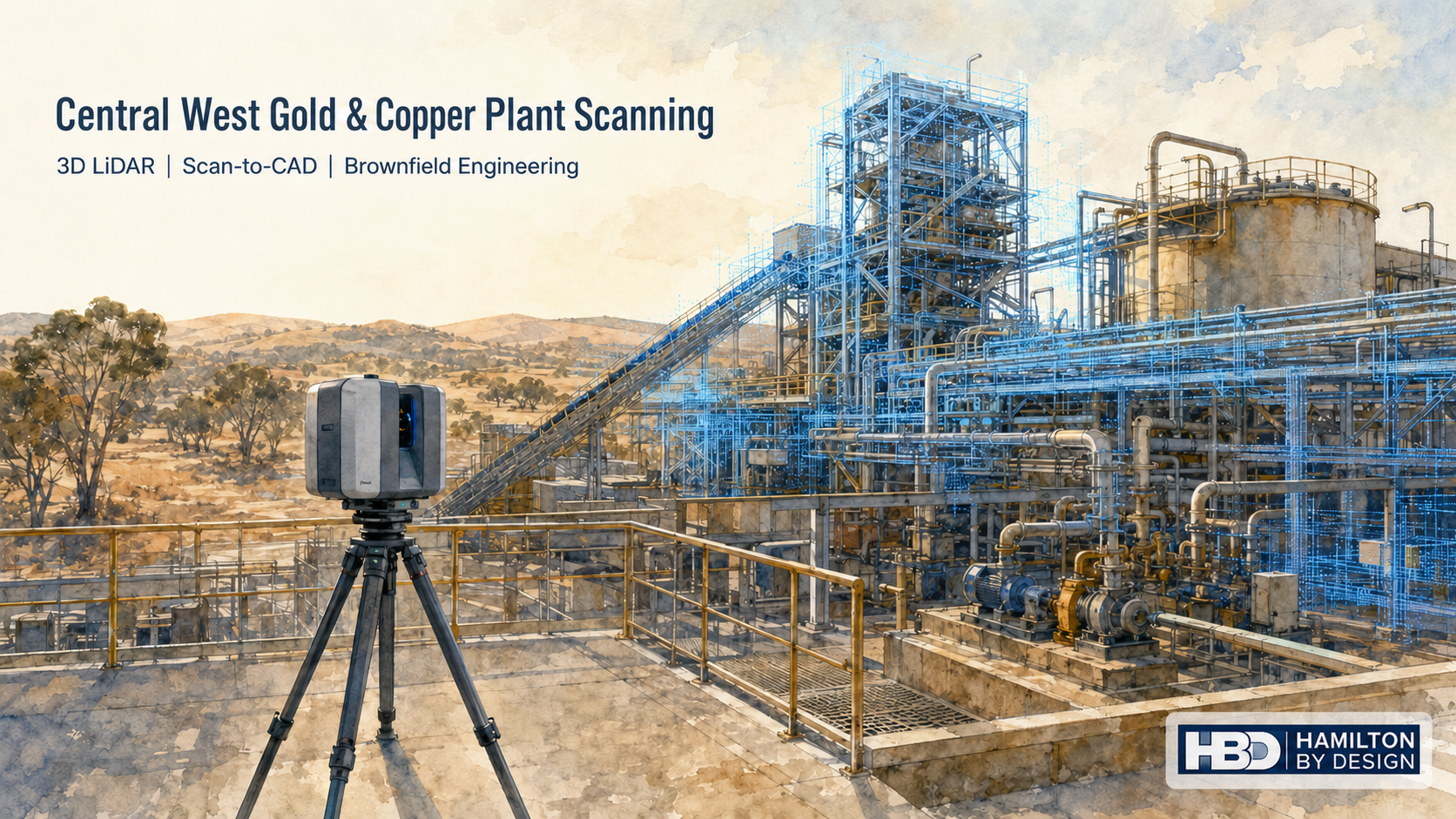
Watercolour illustration of 3D LiDAR scanning at a Central West NSW gold and copper processing plant, showing pipework, conveyors, structural steel and the Hamilton By Design logo.

Gold and copper processing plants are difficult places to measure accurately. They often include dense pipework, conveyors, chutes, tanks, platforms, pumps, valves, handrails, cable trays and structural steel, all working together in a tight operating environment. Over time, these plants are modified during shutdowns, maintenance works and production upgrades. The result is that the real plant may no longer match the original drawings.

For engineers, maintenance planners and project teams, this creates a major problem. If the existing site information is incomplete or wrong, design decisions are made on assumptions. That can lead to clashes, poor access, rework, fabrication errors and costly delays during shutdowns.

Hamilton By Design provides engineering-grade 3D LiDAR scanning for gold and copper processing facilities across Orange, Blayney, Bathurst, Parkes and the wider Central West NSW region. Our scanning workflow helps capture accurate plant, pipework and structural data so engineers can plan upgrades, modifications and shutdown works with greater confidence.

For local engineering support in the region, Hamilton By Design also provides 3D Scanning Engineering in Orange for industrial, mining, infrastructure and processing plant projects.

Why Gold and Copper Processing Plants Are Hard to Measure

Gold and copper processing infrastructure is rarely simple. A typical plant area may include crushing, grinding, flotation, concentrate handling, dewatering, pumping systems, pipe racks, access platforms and structural supports. These systems are often layered around one another and squeezed into existing plant envelopes.

Manual measurement can be slow and difficult in these environments. It may require repeated access to elevated areas, congested walkways, shutdown zones or restricted plant areas. Even with careful site work, it is easy to miss critical details such as flange positions, pipe offsets, structural interferences, access clearances, equipment footprints or support steel locations.

The issue becomes more serious when fabrication is involved. A pipe spool, chute liner, access platform or replacement support frame may look correct on a drawing, but if the existing plant has moved, been modified or was never built exactly as drawn, the new item may not fit.

3D LiDAR scanning helps reduce this risk by capturing the real site condition before design and fabrication decisions are made.

What 3D LiDAR Scanning Captures

A 3D LiDAR scanner captures millions of measurement points from the visible plant environment. These points form a digital point cloud that can be used to measure, model and verify existing site conditions.

In a Central West gold or copper processing plant, 3D scanning can be used to capture:

  • Pipework and pipe racks
  • Pumps, motors and drive arrangements
  • Tanks, vessels and hoppers
  • Conveyors and transfer points
  • Chutes, guards and skirt systems
  • Platforms, stairs, ladders and handrails
  • Structural steel frames and supports
  • Floor levels, slab edges and equipment bases
  • Existing equipment footprints
  • Access restrictions and maintenance zones
  • Building envelopes and surrounding infrastructure

This information can then be used by engineers, drafters, fabricators and maintenance teams to make better decisions before work reaches site.

Hamilton By Designโ€™s broader Engineering-Grade LiDAR Scanning service is focused on capturing scan data that can be used for real engineering decisions, not just visual reference.

Supporting Orange and Central West NSW Processing Projects

Orange and the Central West NSW region support major mining, processing, agricultural, industrial and infrastructure activity. For gold and copper processing plants in this region, accurate site information is especially important because many projects are brownfield upgrades rather than new greenfield construction.

Brownfield projects are difficult because the design has to fit around what already exists. Existing plant may have been modified over many years. Old drawings may be missing, incomplete or no longer correct. Access may be limited. The new work may need to be installed during a short shutdown window.

Hamilton By Design can support Central West NSW projects involving:

  • Processing plant upgrades
  • Conveyor and chute modifications
  • Pipework replacement
  • Pump and tank modifications
  • Structural platform upgrades
  • Access and maintenance improvements
  • Scan-to-CAD modelling
  • Shutdown planning
  • Fabrication drawing preparation
  • Clash checking and design verification

The aim is to capture the site once, process the information properly and give the project team data they can actually use.

Turning Site Reality into Engineering Data

The value of 3D scanning is not only in the scan itself. The real value comes from turning the scan into useful engineering information.

A point cloud can be used to check clearances, measure distances, create sections, confirm equipment positions and model existing infrastructure. From there, the data can support CAD modelling, general arrangement drawings, fabrication design and installation planning.

For example, if a processing plant needs a pipework modification, the scan can help confirm the existing pipe route, flange orientation, valve access, nearby structural steel and installation clearances. If a chute or transfer point needs work, the scan can help confirm belt position, head pulley geometry, surrounding access platforms and support steel. If a platform needs upgrading, the point cloud can help verify levels, columns, handrails and connection points.

For projects where existing conditions are uncertain, Hamilton By Designโ€™s 3D LiDAR Scanning for As-Built & Brownfield Engineering provides a practical workflow for capturing the real site before design decisions are locked in.

How the Scanning Process Works

A typical Central West plant scanning project starts with a short discussion about the problem being solved. Some clients need a registered point cloud only. Others need CAD modelling, drawings, sections, elevations or fabrication support.

The usual workflow includes:

  1. Review the plant area and project objective
  2. Plan scanner locations and site access requirements
  3. Complete LiDAR scanning of the required area
  4. Register the scan data into a single point cloud
  5. Review scan coverage and data quality
  6. Export point cloud files such as E57, RCP or RCS
  7. Complete scan-to-CAD modelling if required
  8. Prepare drawings, sections or engineering deliverables if required

This process gives the project team a reliable record of existing conditions. It also reduces the need for repeated site visits, which can be important when access is limited or the plant is operating.

Tools Used to Assist the Work

Hamilton By Design uses scanning, modelling and drafting tools suited to mechanical and structural plant work. Depending on the project, the workflow may include FARO LiDAR scanning, FARO SCENE, Autodesk ReCap, Navisworks, SolidWorks, Inventor and AutoCAD.

Common deliverables may include:

  • Registered point clouds
  • E57, RCP, RCS or LAS files
  • 3D CAD models
  • General arrangement drawings
  • Sections and elevations
  • Pipework layouts
  • Equipment set-out drawings
  • Fabrication drawings
  • Clash review models
  • As-built documentation

The purpose is to make the scan useful for engineering, fabrication and installation. A point cloud may be valuable on its own, but many clients need the next step: clear CAD geometry, practical drawings and engineering interpretation.

Hamilton By Design also provides 3D LiDAR Scanning & Digital QA Verification for projects where existing or fabricated components need to be checked against design requirements.

Reducing Shutdown and Fabrication Risk

Shutdown work is expensive because the available window is usually short. Labour, cranes, scaffolding, access equipment, fabrication, transport and production downtime all need to line up. If a fabricated item does not fit, the cost is rarely limited to the part itself. The real cost is the delay, rework and disruption around it.

3D scanning can help reduce this risk before shutdown work begins. It allows the project team to check the existing plant condition early and ask practical questions such as:

  • Does the proposed pipe route fit?
  • Are the existing drawings still reliable?
  • Is there enough access for installation?
  • Will the new chute clear the existing structure?
  • Are there clashes with handrails, cable trays or supports?
  • Can the replacement item be modelled before removal?
  • What needs to be verified before fabrication starts?

For processing plants, this is where scan data becomes a risk-reduction tool. It helps move uncertainty from site into the design stage, where problems are cheaper and easier to solve.

Why Use an Engineering-Led Scanning Provider?

Not all scanning services are the same. A scanner can capture geometry, but engineering judgement helps determine what needs to be captured, how the information will be used and which details matter.

Hamilton By Design combines 3D LiDAR scanning with mechanical engineering, CAD modelling and drafting experience. This means the scan is planned around the final outcome, whether that is a point cloud, a CAD model, a pipework layout, a platform drawing, a chute design or a shutdown planning model.

For gold and copper processing facilities, this is important because the site is not just a shape to be recorded. It is an operating plant with mechanical systems, access constraints, maintenance requirements and fabrication realities.

Engineering-led scanning helps ensure the right areas are captured, the correct interfaces are considered and the final deliverables support real project decisions.

FAQs

What is 3D scanning used for in a gold or copper processing plant?

3D scanning is used to capture accurate existing conditions of plant, pipework, conveyors, chutes, tanks, platforms, structural steel and access systems. The scan data can then support engineering design, shutdown planning, fabrication, clash checking and as-built documentation.

Why is 3D scanning better than manual measurement?

Manual measurement can be slow, incomplete and difficult in congested plant areas. 3D scanning captures millions of points across the visible environment, giving engineers a more complete digital record of the site. It also reduces the need for repeated site visits.

Can 3D scanning help with shutdown planning?

Yes. Scanning can help project teams verify existing conditions before a shutdown begins. This can reduce the risk of fabricated parts not fitting, clashes with existing plant, access problems and unexpected site issues.

What areas of a processing plant can be scanned?

Typical areas include pipe racks, pump bays, conveyors, transfer stations, chutes, tanks, platforms, stairs, handrails, structural steel, equipment bases and surrounding access areas.

What file formats can be supplied?

Depending on the project, point cloud data can be supplied in formats such as E57, RCP, RCS or LAS. CAD deliverables may include DWG, DXF, STEP, SAT, Parasolid, SolidWorks or Inventor files.

Can the scan be converted into CAD drawings?

Yes. Scan data can be converted into CAD models, general arrangement drawings, sections, elevations, pipework layouts, fabrication drawings and as-built documentation.

Is this suitable for brownfield plant upgrades?

Yes. Brownfield upgrades are one of the strongest uses for 3D scanning. It helps engineers understand what is already built before designing new work around it.

Does Hamilton By Design service Orange and Central West NSW?

Yes. Hamilton By Design supports engineering, 3D scanning, scan-to-CAD and drafting work across Orange, Blayney, Bathurst, Parkes and the wider Central West NSW region.

Central West Gold and Copper Plant Scanning

For gold and copper processing facilities across Orange and Central West NSW, 3D scanning provides a practical way to capture complex existing infrastructure before engineering work begins. It helps project teams reduce manual measurement, improve design confidence and plan upgrades with better information.

Hamilton By Design can assist with plant scanning, scan-to-CAD modelling, pipework verification, structural drafting, conveyor and chute upgrades, shutdown planning and brownfield engineering support.

If your team is planning work around a Central West NSW processing plant, 3D LiDAR scanning can help turn a complicated site into reliable engineering data before the job reaches fabrication, shutdown or site installation.

Talk to Us – Contact Us

Name
Would you like us to arrange a phone consultation for you?
Address

Our clients:


Sydney Port Asset Capture Services for Accurate As-Built Documentation

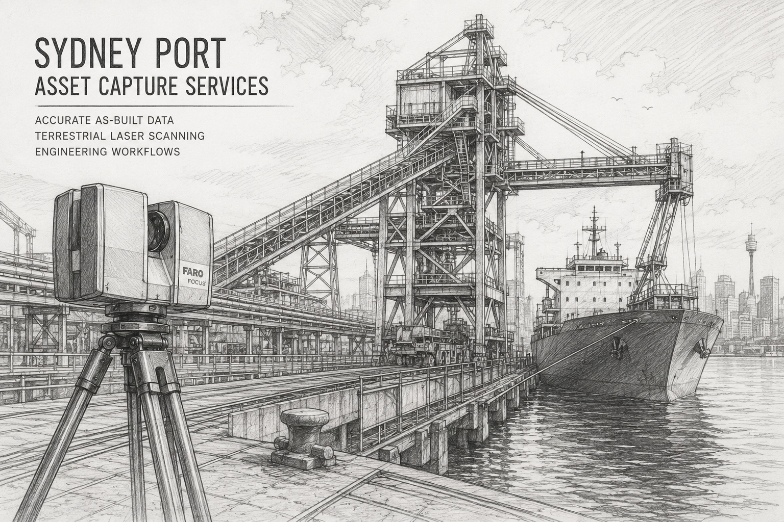
Pencil sketch of Sydney port infrastructure showing a terrestrial laser scanner capturing as-built data of conveyors, wharf structures and a cargo vessel for engineering asset capture services.
Blue 3D LiDAR scanner icon on a tripod with scanning waves

Hamilton By Design provides Sydney Port Asset Capture Services using engineering-grade terrestrial laser scanning, LiDAR technology, reality capture, and advanced engineering workflows. We capture accurate as-built data of port infrastructure, marine facilities, conveyors, ship loaders, bulk handling systems, structural steel, pipework, and mechanical assets throughout Sydney. Our services help port operators, engineering consultants, contractors, asset owners, and maintenance teams obtain reliable digital information for design, upgrades, maintenance, shutdown planning, and asset management projects.

Operating throughout Sydney and New South Wales, we deliver high-quality point cloud data, CAD drawings, 3D models, and engineering documentation suitable for brownfield industrial environments where accuracy and safety are critical.


Why Port Asset Capture Is Important

Many Sydney port facilities have been operating for decades and have undergone numerous modifications, expansions, repairs, and equipment upgrades. In many cases, original drawings no longer reflect actual site conditions.

Common challenges encountered at ports include:

  • Missing or outdated drawings
  • Undocumented modifications
  • Legacy infrastructure
  • Complex pipework networks
  • Congested mechanical installations
  • Structural steel changes over time
  • Limited access areas
  • Shutdown time constraints

Traditional tape measure and manual survey methods often struggle to capture the complexity of these environments accurately.

Terrestrial laser scanning allows millions of measurements to be collected rapidly, producing a highly detailed digital representation of existing conditions. This information forms the foundation for engineering design, asset management, maintenance planning, and future upgrades.


Sydney Port Infrastructure We Capture

Hamilton By Design provides asset capture services for a wide range of port and marine infrastructure assets throughout Sydney.

Marine Infrastructure

Our scanning services can capture:

  • Wharves
  • Berths
  • Jetties
  • Fender systems
  • Mooring facilities
  • Loading platforms
  • Ship loading infrastructure
  • Bulk export terminals

These assets often require detailed documentation to support maintenance, refurbishment, structural assessments, and future expansion projects.

Mechanical Infrastructure

Port facilities contain large amounts of mechanical equipment that can benefit from accurate reality capture.

Typical assets include:

  • Conveyors
  • Transfer towers
  • Chutes
  • Hoppers
  • Crushers
  • Ship loaders
  • Stackers
  • Reclaimers
  • Pumps
  • Valves
  • Hydraulic systems

Laser scanning enables engineers to model existing equipment accurately before modification or replacement projects commence.

Structural Assets

Our Sydney port asset capture services regularly support documentation of:

  • Structural steel
  • Buildings
  • Conveyor gantries
  • Access platforms
  • Walkways
  • Stairs
  • Handrails
  • Maintenance structures

Accurate structural information significantly reduces design risks during brownfield upgrade projects.

Pipework and Utilities

We can capture:

  • Process pipework
  • Fire services
  • Water systems
  • Fuel infrastructure
  • Hydraulic pipework
  • Compressed air systems
  • Utility corridors

Detailed point cloud data helps identify clashes and supports future engineering design activities.


Engineering-Grade Reality Capture Technology

Hamilton By Design uses professional terrestrial laser scanning equipment capable of capturing highly accurate spatial data in complex industrial environments.

Our workflows utilise technologies including:

  • FARO Focus Laser Scanners
  • Terrestrial LiDAR Scanning
  • High-resolution photography
  • Point cloud registration software
  • Engineering CAD software
  • 3D modelling platforms

The resulting datasets can be integrated directly into engineering and design workflows.

Software platforms commonly used include:

  • FARO SCENE
  • Autodesk ReCap
  • AutoCAD
  • Navisworks
  • SolidWorks
  • Autodesk Inventor
  • Revit

This ensures compatibility with client engineering systems and project requirements.


The Sydney Port Asset Capture Process

1. Project Planning

Every project begins with a detailed review of the clientโ€™s objectives.

This may include:

  • Asset identification
  • Access requirements
  • Safety planning
  • Site inductions
  • Survey control requirements
  • Deliverable specifications

Careful planning helps ensure the required information is captured efficiently during the site visit.

2. Site Data Capture

Our team conducts terrestrial laser scanning across the required areas.

During scanning we collect:

  • Point cloud data
  • Site photography
  • Asset information
  • Reference measurements
  • Engineering observations

Millions of measurements can be captured in a matter of hours, significantly reducing time spent on site compared with traditional methods.

3. Registration and Processing

Once field work is complete, the scan data is processed and registered.

This includes:

  • Scan alignment
  • Registration verification
  • Noise removal
  • Quality control
  • Data validation

The result is a complete and accurate digital representation of the scanned assets.

4. Engineering Modelling

The registered point cloud can then be used to create:

  • CAD drawings
  • General arrangement drawings
  • Structural models
  • Mechanical models
  • Pipework models
  • Equipment layouts
  • As-built documentation

Engineers can work directly from verified site conditions rather than relying on outdated information.

5. Project Delivery

Final deliverables are prepared and issued according to project requirements.

Data can be supplied in formats suitable for engineering, construction, maintenance, and asset management teams.


Deliverables Available

Hamilton By Design can provide a range of engineering and reality capture deliverables.

Point Cloud Deliverables

  • E57 files
  • RCP files
  • RCS files
  • LAS files
  • Registered point clouds

CAD Deliverables

  • DWG drawings
  • DXF drawings
  • General arrangement drawings
  • Site layouts
  • Sections
  • Elevations

3D Model Deliverables

  • SolidWorks models
  • Inventor models
  • STEP files
  • SAT files
  • Parasolid files

Engineering Documentation

  • As-built documentation
  • Asset verification reports
  • Engineering mark-ups
  • Digital asset records
  • Reality capture reports

Applications for Sydney Port Asset Capture Services

Asset capture data is commonly used for:

Brownfield Upgrades

Accurate site information allows engineers to design modifications that fit existing infrastructure.

Shutdown Planning

Detailed digital models enable planning work before site access windows become available.

Asset Management

Digital records assist with maintenance planning, inspections, and lifecycle management.

Scan to CAD Projects

Point clouds can be converted into engineering drawings and 3D models.

Reverse Engineering

Existing equipment can be digitally captured for redesign, refurbishment, or replacement.

Digital Twin Development

Reality capture forms the foundation for creating digital twins of port facilities and infrastructure assets.


Industries We Support

Our Sydney Port Asset Capture Services support clients across:

  • Ports and marine infrastructure
  • Container terminals
  • Bulk handling facilities
  • Mining export facilities
  • Manufacturing plants
  • Industrial processing facilities
  • Transport infrastructure
  • Utilities
  • Water infrastructure
  • Energy facilities

Whether the project involves a single asset or an entire terminal, our engineering workflows deliver reliable information that supports informed decision-making.


Why Choose Hamilton By Design?

Hamilton By Design combines engineering expertise with advanced reality capture technology to deliver practical outcomes for industrial clients.

Our team understands the challenges associated with brownfield infrastructure, complex mechanical systems, shutdown environments, and engineering documentation requirements.

By providing accurate as-built information, we help reduce project risk, minimise rework, improve design accuracy, and support the efficient management of critical port assets.

Need Sydney Port Asset Capture Services?

Hamilton By Design provides engineering-grade terrestrial laser scanning, LiDAR scanning, scan-to-CAD, 3D modelling, and asset capture services throughout Sydney and New South Wales.

Contact our team to discuss your next port infrastructure, marine facility, terminal upgrade, shutdown planning, or asset management project. Accurate data is the foundation of successful engineering outcomes.

Talk to Us – Contact Us

Name
Would you like us to arrange a phone consultation for you?
Address

Our clients:
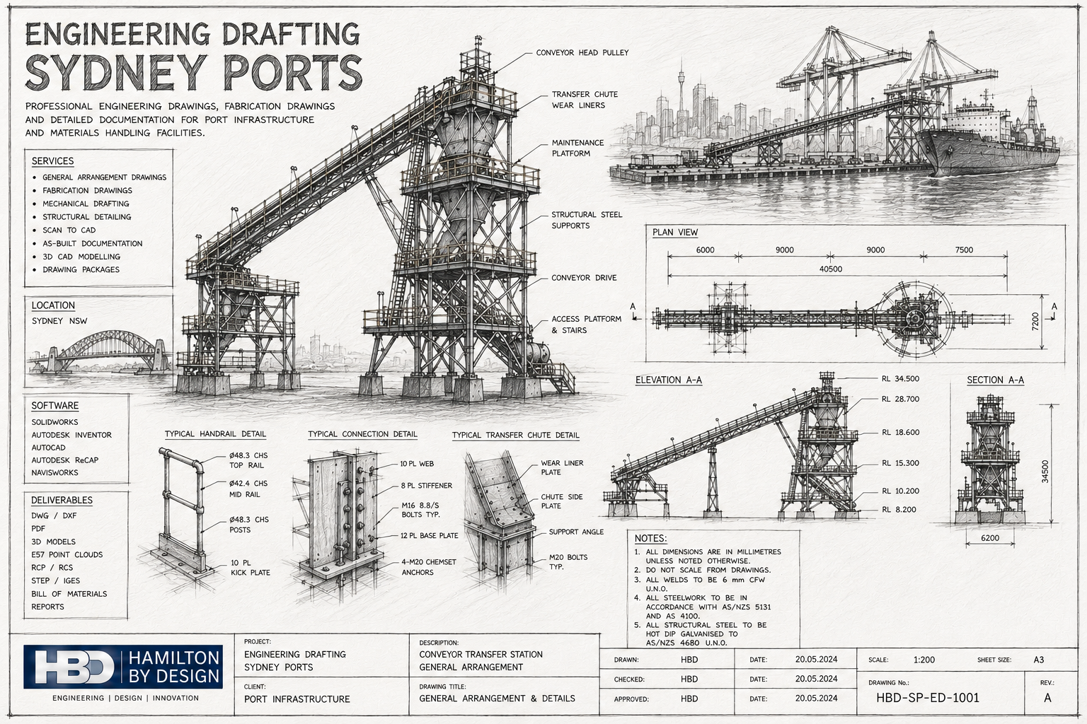


Engineering Drafting Sydney Ports

Engineering Drafting Sydney Ports technical drawing showing conveyor systems, fabrication drawings, general arrangement layouts, structural steel details and materials handling infrastructure.

Engineering Drafting Sydney Ports

Structural engineering drafting icon showing a seated engineer working at a drafting table in blue vector style.

Hamilton By Design provides engineering drafting services for Sydney ports, marine terminals, wharves, bulk handling facilities, container terminals and industrial port infrastructure. We prepare accurate general arrangement drawings, fabrication drawings, mechanical layouts, structural details, as-built documentation and CAD models for port operators, contractors, fabricators, manufacturers and maintenance teams across Sydney NSW.

Our drafting services support mechanical engineering projects, materials handling upgrades, conveyor modifications, structural steel works, access platforms, equipment layouts, pipework changes and brownfield plant upgrades. By combining practical trade knowledge, mechanical engineering experience, 3D LiDAR scanning and CAD design, we help clients produce clear, buildable and reliable engineering documentation.

Engineering Drafting Services for Sydney Ports

Sydney port facilities require accurate drawings to support safe installation, fabrication, maintenance and future asset management. Many existing facilities have been modified over time, which means old drawings may be incomplete, outdated or missing.

Hamilton By Design supports port infrastructure projects by producing technical drawings that reflect both the design intent and the real site conditions.

Our engineering drafting services include:

  • General arrangement drawings
  • Fabrication drawings
  • Mechanical layouts
  • Structural steel details
  • Conveyor arrangement drawings
  • Transfer chute drawings
  • Access platform drawings
  • Walkway, stair and handrail drawings
  • Equipment layout drawings
  • Pipework drafting
  • As-built drawings
  • Site measure drawings
  • Scan to CAD drawings
  • 3D CAD modelling
  • Drawing markups and revisions
  • Drawing package preparation

Drafting for Port Infrastructure and Materials Handling

Port environments often include conveyors, transfer stations, ship loaders, hoppers, chutes, platforms, pipework and support structures. These systems need clear documentation so that designers, fabricators, installers and maintenance teams can work from the same information.

We provide engineering drafting for:

  • Conveyor systems
  • Conveyor galleries
  • Transfer stations
  • Transfer chutes
  • Ship loading equipment
  • Maintenance platforms
  • Access stairs and walkways
  • Structural steel supports
  • Equipment bases and frames
  • Guarding and safety access
  • Pipework and mechanical services
  • Brownfield plant modifications
  • Industrial buildings and workshops

This makes the service suitable for Sydney ports, bulk material handling sites, infrastructure projects, manufacturing facilities, utilities, mining support operations and industrial plants.

Sydney NSW and Australia-Wide Support

Hamilton By Design supports engineering drafting projects throughout Sydney NSW, including port and industrial areas around Botany, Port Botany, Glebe Island, White Bay, Sydney Harbour, Kurnell, Parramatta River industrial areas and surrounding logistics hubs.

We also support clients across Newcastle, the Hunter Valley, Central Coast, Brisbane, Melbourne, Adelaide, Perth, Darwin, Mount Isa and regional Australia.

For clients outside Sydney, we can provide drafting support remotely using supplied drawings, site photos, point clouds, 3D scan data, markups and engineering sketches.

General Arrangement Drawings

General arrangement drawings show how equipment, structures and systems fit together. They are commonly used for design review, client approval, construction planning and installation coordination.

A GA drawing may include:

  • Plan views
  • Elevation views
  • Section views
  • Main dimensions
  • Equipment locations
  • Structural interfaces
  • Access clearances
  • Connection points
  • Drawing notes
  • Reference drawings
  • Revision history

For Sydney port projects, GA drawings are often required before fabrication drawings are produced. This helps confirm the design layout and reduce the risk of clashes during installation.

Fabrication Drawings

Fabrication drawings provide the detail required to manufacture steelwork, mechanical components and assemblies.

Depending on the project, fabrication drawings may include:

  • Plate details
  • Weld details
  • Material callouts
  • Hole sizes and locations
  • Cut lengths
  • Fold details
  • Machining details
  • Assembly information
  • Bill of materials
  • Finish requirements
  • Drawing notes

Fabrication drawings are especially important for conveyor supports, platforms, stairs, handrails, guarding, brackets, frames, hoppers, chutes and mechanical assemblies.

3D LiDAR Scanning and Scan to CAD

Many port projects are completed in brownfield environments where accurate site information is essential. When existing drawings are not reliable, Hamilton By Design can use 3D LiDAR scanning to capture the real site conditions before drafting begins.

3D scanning can capture:

  • Structural steel
  • Conveyors
  • Chutes
  • Platforms
  • Pipework
  • Equipment
  • Building layouts
  • Access areas
  • Obstructions
  • Existing services

The scan data can then be converted into CAD drawings, 3D models and as-built documentation.

Typical scan and CAD deliverables may include:

  • E57 point clouds
  • RCP files
  • RCS files
  • DWG drawings
  • DXF drawings
  • SolidWorks models
  • Autodesk Inventor models
  • STEP files
  • PDF drawing packages
  • As-built documentation

This workflow helps reduce site rework and improves confidence before fabrication or installation begins.

CAD Software and Technical Capability

Hamilton By Design works with commonly used engineering and drafting platforms to support practical project delivery.

Software and file formats may include:

  • SolidWorks
  • Autodesk Inventor
  • AutoCAD
  • Autodesk ReCap
  • Navisworks
  • STEP
  • Parasolid
  • DWG
  • DXF
  • PDF
  • E57
  • RCP
  • RCS

We can work from supplied sketches, old drawings, site markups, redline drawings, photographs, point cloud data or 3D models.

Relevant Standards and Drawing Considerations

Engineering drafting for port and industrial environments should be clear, consistent and suitable for the intended use.

Depending on the project, drawings may consider:

  • AS 1657 for fixed platforms, walkways, stairways and ladders
  • AS/NZS 4024 for machine safety and guarding considerations
  • AS 3990 for mechanical equipment and steelwork design considerations
  • AS 4100 for steel structures where applicable
  • Site-specific safety requirements
  • Client drawing standards
  • Fabricator requirements
  • Maintenance access requirements
  • Installation constraints

Drawings should be practical, readable and suitable for review by engineers, fabricators, project managers and site teams.

Step-by-Step Drafting Process

1. Project Review

We review the project scope, available drawings, sketches, photos, site information and client requirements.

2. Site Measure or 3D Scan

Where required, we attend site to measure or complete 3D LiDAR scanning to capture the existing conditions.

3. CAD Setup

Existing drawings, scan data or design sketches are brought into the CAD environment.

4. 3D Modelling or 2D Drafting

We prepare 3D models or 2D drawings depending on the project requirements.

5. Engineering Review

Drawings are reviewed for layout, access, interfaces, buildability and design intent.

6. Drawing Issue

The drawing package is issued for review, approval, fabrication, installation or as-built records.

7. Revisions and Final Documentation

Client comments, engineer markups and site changes are incorporated before final issue.

What the Client Receives

Depending on the project scope, clients may receive:

  • General arrangement drawings
  • Fabrication drawings
  • Mechanical detail drawings
  • Structural detail drawings
  • Conveyor layout drawings
  • Access platform drawings
  • As-built drawings
  • 3D CAD models
  • SolidWorks models
  • Inventor models
  • STEP files
  • DWG files
  • DXF files
  • PDF drawing sets
  • Bill of materials
  • Drawing registers
  • E57 point clouds
  • RCP and RCS files
  • Engineering notes and reports

The final deliverables are tailored to suit the project, whether the requirement is design review, fabrication, installation, asset management or maintenance planning.

Why Choose Hamilton By Design?

Hamilton By Design combines engineering drafting with practical mechanical engineering and site experience. This is important for port projects where drawings must be more than visually correct. They must also be practical, buildable and suitable for real site conditions.

Our strengths include:

  • Mechanical engineering experience
  • Trade and fabrication background
  • 3D CAD modelling capability
  • 3D LiDAR scanning capability
  • Brownfield industrial project experience
  • Materials handling knowledge
  • Conveyor and chute drafting experience
  • Port and infrastructure drafting support
  • Practical drawing documentation
  • Australia-wide project support

We understand the importance of clear drawings for shutdowns, fabrication, maintenance works and plant upgrade projects.

Hamilton By Design also provides related engineering and digital design services, including:

  • Mechanical Engineering Services
  • 3D LiDAR Scanning Sydney Ports
  • Scan to CAD Sydney Ports
  • Scan to BIM Sydney
  • Reverse Engineering Services
  • Structural Drafting Services
  • Industrial Plant 3D Scanning
  • Conveyor Design and Drafting
  • Fabrication Drawing Services

These related services allow clients to combine site capture, drafting, modelling and engineering support within one practical workflow.

Frequently Asked Questions

Do you provide engineering drafting for Sydney ports?

Yes. Hamilton By Design provides engineering drafting services for Sydney ports, port infrastructure, marine terminals, conveyors, transfer stations and industrial facilities.

What types of drawings can you produce?

We can produce general arrangement drawings, fabrication drawings, mechanical layouts, structural details, as-built drawings, conveyor drawings and CAD models.

Can you work from old or incomplete drawings?

Yes. We can work from existing drawings, site sketches, photos, redline markups and 3D scan data. Where drawings are unreliable, a site measure or 3D LiDAR scan may be recommended.

Can you provide fabrication drawings?

Yes. We prepare fabrication drawings for steelwork, platforms, brackets, frames, chutes, hoppers, conveyor supports and mechanical assemblies.

Do you provide Scan to CAD services?

Yes. We can convert 3D LiDAR scan data into DWG drawings, 3D CAD models, SolidWorks files and as-built documentation.

What software do you use?

We commonly use SolidWorks, Autodesk Inventor, AutoCAD, Autodesk ReCap and Navisworks.

Can you help with brownfield port upgrades?

Yes. We support brownfield upgrade projects where existing equipment, structures and services must be captured and documented before modification.

Do you provide drawing updates from site markups?

Yes. We can update drawings from redline markups, site measurements, scanned information and engineering comments.

Do you work outside Sydney?

Yes. We support clients across NSW and Australia, including Newcastle, Hunter Valley, Central Coast, Brisbane, Melbourne, Adelaide, Perth, Darwin and regional industrial sites.

What information do you need to prepare a quote?

Useful information includes the project scope, existing drawings, photos, site location, required drawing types, preferred file formats, deadlines and whether a site measure or 3D scan is required.

Hamilton By Design logo displayed on a blue tilted rectangle with a grey gradient background

Contact Hamilton By Design

If you require Engineering Drafting Sydney Ports services, Hamilton By Design can assist with general arrangement drawings, fabrication drawings, CAD modelling, Scan to CAD, as-built documentation and detailed engineering drawing packages for port and industrial infrastructure.

Contact Hamilton By Design to discuss your Sydney port drafting project and prepare a practical drawing solution for your site, workshop or engineering team.

Talk to Us – Contact Us

Name
Would you like us to arrange a phone consultation for you?
Address

Our clients:


Scan to BIM Newcastle & Hunter

Scan to BIM Newcastle and Hunter showing 3D LiDAR scanning, point cloud modelling and BIM development for industrial, mining and port infrastructure projects in the Hunter Valley region.

Scan to BIM Newcastle & Hunter | 3D LiDAR Scanning & BIM Modelling

Engineering-Led Scan to BIM Services Across Newcastle, the Hunter Valley and Regional NSW

Hamilton By Design provides professional Scan to BIM Newcastle & Hunter services for industrial, mining, manufacturing, infrastructure, commercial and government projects throughout the region.

Using advanced 3D LiDAR scanning, point cloud processing and BIM modelling technologies, we transform existing buildings, plants and infrastructure into accurate digital models that support engineering, design, construction and asset management workflows.

Whether your project is located in Newcastle CBD, the Port of Newcastle, Kooragang Island, Tomago, Maitland, Singleton, Muswellbrook, Cessnock, Kurri Kurri, Raymond Terrace or the wider Hunter Valley, our engineering-led approach helps deliver accurate information from the very beginning of a project.


Why Scan to BIM is Important for Newcastle & Hunter Projects

The Newcastle and Hunter region is home to some of Australia’s most significant:

  • Mining operations
  • Coal handling facilities
  • Power generation assets
  • Manufacturing plants
  • Port infrastructure
  • Water treatment facilities
  • Rail infrastructure
  • Heavy industrial sites
  • Commercial developments
  • Health and education facilities

Many of these assets have been operating for decades.

As facilities evolve, original drawings often become outdated, modifications are undocumented and site conditions differ significantly from available records.

Scan to BIM provides a reliable method of capturing existing conditions before design, construction or upgrade work begins.


What is Scan to BIM?

Scan to BIM is the process of converting high-accuracy 3D laser scan data into intelligent BIM models and engineering documentation.

The workflow typically includes:

Stage 1 โ€“ Site Capture

Using professional 3D LiDAR scanning equipment, millions of measurements are collected across the site.

The result is a highly detailed digital representation of existing conditions.

Stage 2 โ€“ Point Cloud Registration

Individual scans are aligned and registered into a unified coordinate system.

This creates an accurate point cloud representing the entire site.

Stage 3 โ€“ BIM Development

The point cloud is converted into BIM models, CAD drawings or digital engineering deliverables suitable for project requirements.

Stage 4 โ€“ Engineering Integration

The resulting information can be used for:

  • Design development
  • Asset management
  • Refurbishment projects
  • Structural modifications
  • Mechanical upgrades
  • Clash detection
  • Construction planning
  • As-built documentation

Engineering-Led Site Capture

Hamilton By Design is not simply a scanning provider.

We are mechanical engineering, drafting and design professionals who understand how the information will be used downstream.

This distinction is important.

Many scanning providers deliver a point cloud and leave interpretation to the client.

Our engineering-led approach focuses on creating deliverables that support:

  • Mechanical engineering
  • Structural engineering
  • Plant upgrades
  • Access system design
  • Fabrication projects
  • Shutdown planning
  • Asset management

The result is information that can be used immediately by engineers, designers, fabricators and project teams.


Scan to BIM for Mining Operations

The Hunter Valley remains Australia’s largest coal-producing region.

Mining operations continually require:

  • Conveyor upgrades
  • Transfer chute modifications
  • Structural upgrades
  • Processing plant improvements
  • Materials handling projects
  • Shutdown planning
  • Asset inspections

Scan to BIM allows project teams to capture existing conditions before engineering begins.

Benefits include:

  • Reduced site revisits
  • Improved design accuracy
  • Better project planning
  • Improved safety outcomes
  • Reduced rework during installation

For active mining sites, accurate digital information significantly reduces project risk.


Scan to BIM for Manufacturing Facilities

The Newcastle and Hunter region hosts a diverse manufacturing sector including:

  • Food processing
  • Packaging
  • Steel fabrication
  • Chemical processing
  • Industrial manufacturing
  • Warehousing and logistics

Plant modifications often occur within operational facilities where downtime is expensive.

Scan to BIM provides:

  • Existing plant layouts
  • Equipment locations
  • Pipe routing verification
  • Structural verification
  • Access and maintenance assessments

This information supports more efficient project execution and improved design coordination.


Port and Infrastructure Applications

The Port of Newcastle and associated industrial infrastructure continue to undergo significant upgrades and maintenance programs.

Scan to BIM is ideally suited for:

  • Port facilities
  • Ship loading infrastructure
  • Bulk materials handling systems
  • Rail infrastructure
  • Water treatment assets
  • Industrial terminals
  • Civil infrastructure

Accurate digital twins improve planning and reduce uncertainty before construction activities commence.


Scan to BIM Deliverables

Depending on project requirements, Hamilton By Design can provide:

Point Cloud Deliverables

  • E57 Files
  • LAS Files
  • RCP Files
  • RCS Files
  • Registered point clouds

BIM Deliverables

  • Revit Models
  • BIM Coordination Models
  • Existing Condition Models
  • Architectural Models
  • Structural Models
  • Mechanical Models

CAD Deliverables

  • AutoCAD Drawings
  • Floor Plans
  • Sections
  • Elevations
  • General Arrangement Drawings
  • Fabrication Support Models

Engineering Deliverables

  • Plant Layout Models
  • Equipment Models
  • Structural Steel Models
  • Access Platform Designs
  • Mechanical Engineering Documentation

Brownfield Engineering Projects

Most projects throughout Newcastle and the Hunter are brownfield projects.

These sites often present challenges including:

  • Missing drawings
  • Incomplete records
  • Historic modifications
  • Access restrictions
  • Complex service routes

Scan to BIM significantly reduces uncertainty by creating an accurate representation of existing conditions.

This allows project teams to design around real-world constraints rather than assumptions.


Digital Engineering and Asset Management

Beyond design and construction, Scan to BIM supports long-term asset management.

Benefits include:

  • Accurate asset records
  • Improved maintenance planning
  • Digital twin development
  • Lifecycle management
  • Future project planning
  • Improved facility documentation

As infrastructure owners increasingly adopt digital engineering strategies, accurate existing-condition models become a valuable long-term asset.


Why Choose Hamilton By Design?

Hamilton By Design combines:

  • Engineering expertise
  • 3D LiDAR scanning
  • Mechanical design
  • Structural drafting
  • BIM development
  • CAD modelling
  • Industrial project experience

Our team understands both the technology and the engineering outcomes required by clients.

This allows us to provide practical solutions that support project delivery rather than simply producing scan data.


Areas We Service

We support projects across:

  • Newcastle
  • Hunter Valley
  • Maitland
  • Singleton
  • Muswellbrook
  • Kurri Kurri
  • Cessnock
  • Raymond Terrace
  • Port Stephens
  • Lake Macquarie
  • Kooragang Island
  • Tomago
  • Central Coast
  • Upper Hunter
  • Mid North Coast

We also regularly support clients throughout regional NSW and interstate.


Hamilton By Design logo displayed on a blue tilted rectangle with a grey gradient background

Need a Scan to BIM Newcastle & Hunter Quote?

If you require accurate existing-condition information for an upcoming engineering, construction, mining or industrial project, Hamilton By Design can help.

Our Scan to BIM services provide reliable digital information that supports better decision-making, improved design outcomes and reduced project risk.

Contact Hamilton By Design today to discuss your Scan to BIM Newcastle & Hunter project.

Talk to Us – Contact Us

Name
Would you like us to arrange a phone consultation for you?
Address

Our clients:
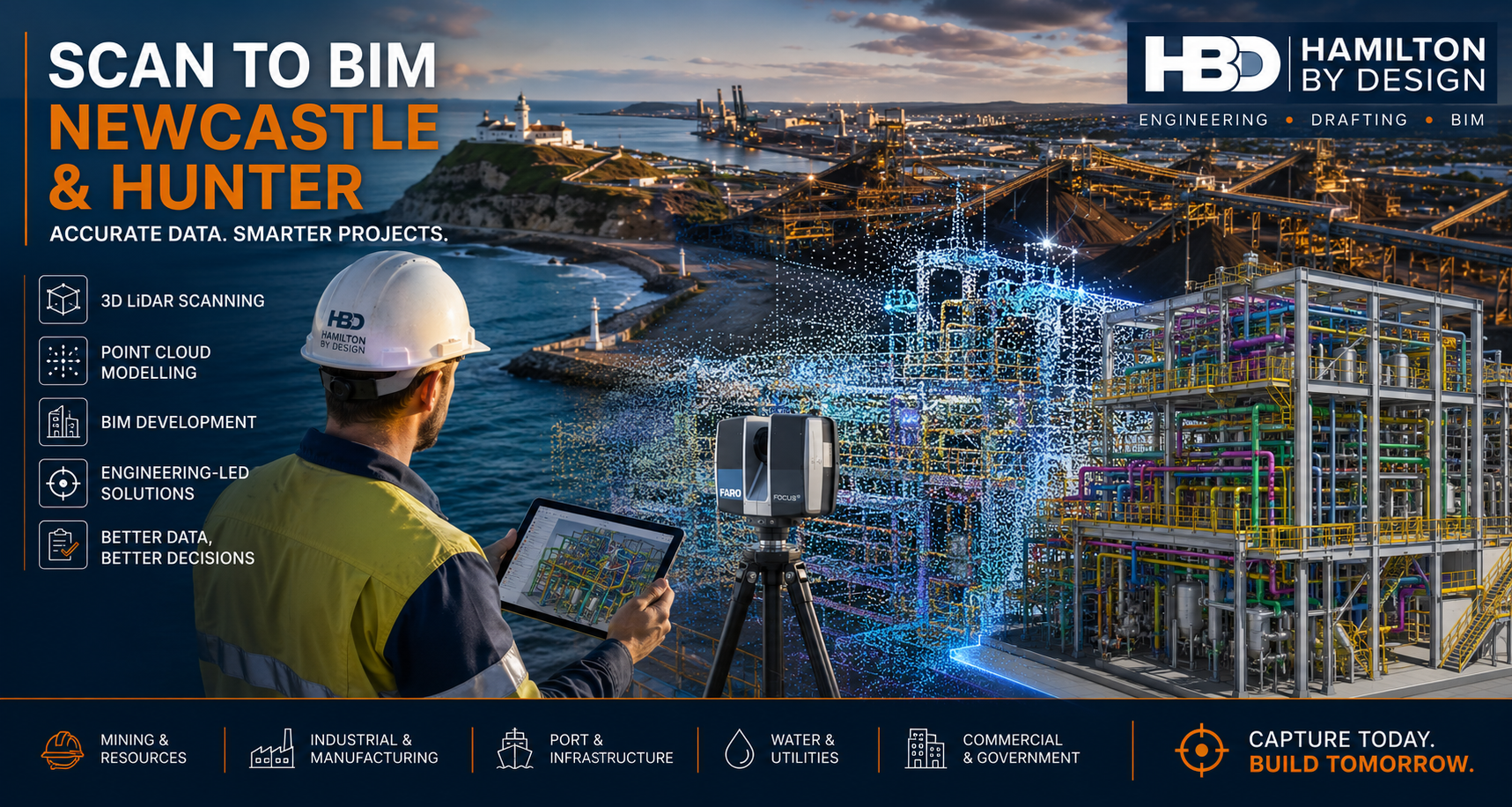
3D LiDAR Scanning Darwin for engineering surveys, laser scanning, reality capture and point cloud modelling services
3D LiDAR Scanning Australia engineering services for laser scanning, reality capture, scan-to-CAD, Scan-to-BIM and as-built documentation across Australia
3D LiDAR scanning services on the Central Coast providing engineering-grade laser scanning, point cloud capture, scan-to-CAD modelling and industrial reality capture for infrastructure and industrial projects.
3D LiDAR Scanning Perth for engineering surveys, laser scanning, reality capture and point cloud modelling services
3D LiDAR Scanning Sydney for engineering surveys, laser scanning, reality capture and point cloud modelling services
3D LiDAR Scanning Brisbane for engineering surveys, laser scanning, reality capture and point cloud modelling services
3D LiDAR Scanning Canberra for engineering surveys, laser scanning, reality capture and point cloud modelling services
3D LiDAR Scanning Newcastle for engineering surveys, laser scanning, reality capture and point cloud modelling services
3D LiDAR Scanning Adelaide for engineering surveys, laser scanning, reality capture and point cloud modelling services

Scan to BIM Perth WA

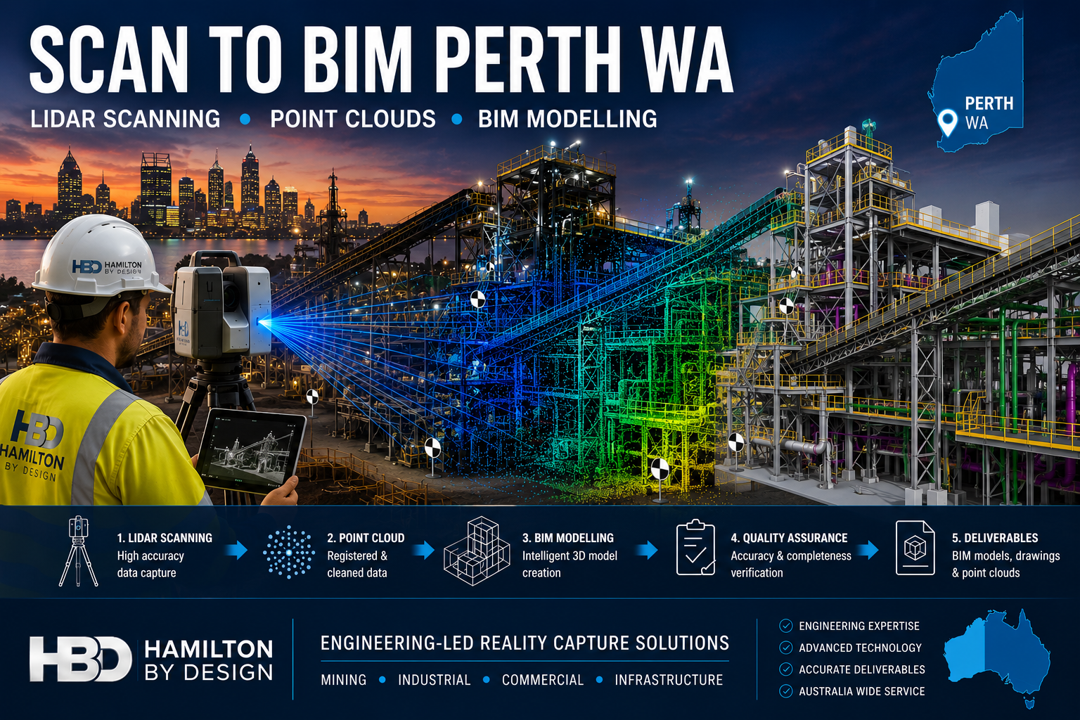
Scan to BIM Perth WA engineering workflow showing LiDAR scanning, point cloud processing and BIM modelling of a Western Australian industrial facility using Hamilton By Design reality capture services.

Scan to BIM Perth WA

Engineering-Led Scan to BIM Services Across Perth and Western Australia

Hamilton By Design provides professional Scan to BIM services throughout Perth and Western Australia, helping mining, industrial, commercial, infrastructure and construction organisations transform accurate 3D laser scan data into intelligent Building Information Models (BIM).

Using engineering-grade LiDAR scanning technology and advanced BIM workflows, we capture existing facilities, process plants, buildings and infrastructure assets and convert them into accurate digital models suitable for design, planning, construction and asset management.

Whether your project involves a brownfield mining upgrade in the Pilbara, a commercial building in the Perth CBD, a processing plant in Kwinana or infrastructure works across regional Western Australia, our Scan to BIM services deliver reliable information for better engineering and project outcomes.


What is Scan to BIM?

Scan to BIM is the process of converting 3D laser scan data into an intelligent Building Information Model.

The process begins with high-accuracy LiDAR scanning, which captures millions of measurement points across a site. This data forms a point cloud that accurately represents existing conditions.

The point cloud is then used to create a BIM model containing structural, architectural and mechanical information that can be used throughout the project lifecycle.

The result is a highly accurate digital representation of the asset that supports:

  • Engineering design
  • Construction planning
  • Asset management
  • Facility upgrades
  • Maintenance planning
  • Clash detection
  • Digital twin development

Engineering-Led BIM Modelling

Unlike many scanning providers that focus only on data capture, Hamilton By Design combines engineering experience with reality capture technology.

This means the final BIM model is developed with an understanding of:

  • Mechanical systems
  • Structural steel
  • Conveyors
  • Chutes
  • Tanks
  • Pipework
  • Platforms and access systems
  • Process equipment
  • Material handling infrastructure

Our engineering background allows us to understand how facilities operate and how accurate models can improve future design decisions.


Perth Industries Using Scan to BIM

Mining and Resources

Western Australia remains one of the world’s largest mining regions.

Scan to BIM supports:

  • Iron ore facilities
  • Gold processing plants
  • Lithium operations
  • Rare earth projects
  • Bulk material handling systems
  • Port infrastructure

Accurate BIM models help engineering teams reduce shutdown durations and improve planning for plant upgrades.


Industrial Manufacturing

Many Perth manufacturers operate facilities that have evolved over decades.

Often existing drawings are incomplete or outdated.

Scan to BIM enables:

  • Accurate facility documentation
  • Equipment replacement projects
  • Structural upgrades
  • Capacity expansion projects
  • Maintenance planning

Commercial Buildings

Commercial property owners increasingly use BIM models to manage assets.

Applications include:

  • Building refurbishment
  • Services upgrades
  • HVAC replacement
  • Tenant fit-outs
  • Facility management

Infrastructure Projects

Scan to BIM can support:

  • Rail infrastructure
  • Ports
  • Water treatment facilities
  • Pump stations
  • Utility corridors
  • Government infrastructure

Accurate BIM models reduce project risk by ensuring designs are based on real-world conditions.


Our Scan to BIM Workflow

1. Site LiDAR Scanning

We perform engineering-grade laser scanning using professional reality capture equipment.

Millions of measurement points are collected across the facility.


2. Point Cloud Registration

Individual scans are aligned and processed into a unified point cloud.

Typical deliverables include:

  • E57
  • RCP
  • RCS
  • LAS

3. BIM Model Development

The point cloud is converted into BIM geometry using industry-standard software.

Models may include:

  • Structural steel
  • Mechanical equipment
  • Pipework
  • Buildings
  • Platforms
  • Access systems

4. Quality Assurance

Models are checked against scan data to verify accuracy and completeness.


5. Deliverables

Typical outputs include:

  • Autodesk Revit Models
  • Navisworks Models
  • IFC Files
  • DWG Drawings
  • PDF Documentation
  • Point Cloud Files

Benefits of Scan to BIM

Improved Accuracy

Laser scanning captures existing conditions with significantly greater accuracy than traditional site measurement methods.

Reduced Design Risk

Design teams can work from verified information rather than assumptions.

Faster Project Delivery

Accurate digital models reduce site revisits and minimise redesign.

Better Asset Management

Facility owners gain an accurate digital representation of their assets.

Improved Collaboration

BIM models provide a common source of information for engineers, designers, contractors and asset owners.


Scan to BIM for Brownfield Mining Projects

Brownfield projects often present unique challenges.

Existing facilities may contain undocumented modifications, ageing infrastructure and limited historical records.

Scan to BIM allows engineering teams to:

  • Verify existing conditions
  • Identify clashes before construction
  • Reduce shutdown risks
  • Improve design confidence
  • Support future digital twin initiatives

For mining operations throughout Perth, the Pilbara, Goldfields and regional Western Australia, accurate BIM models can significantly improve project outcomes.


Why Choose Hamilton By Design?

Hamilton By Design combines:

โœ” Engineering Experience

โœ” LiDAR Scanning Expertise

โœ” BIM Modelling Capability

โœ” Mechanical Design Knowledge

โœ” Structural Drafting Experience

โœ” Australia-Wide Project Delivery

โœ” Mining Industry Experience

We understand both the technology and the engineering requirements behind successful Scan to BIM projects.


Hamilton By Design logo displayed on a blue tilted rectangle with a grey gradient background

Scan to BIM Perth WA

If you require Scan to BIM services in Perth or anywhere across Western Australia, Hamilton By Design can provide engineering-grade reality capture and BIM modelling solutions tailored to your project requirements.

From mining facilities and industrial plants to commercial buildings and infrastructure projects, we help organisations capture existing conditions and create accurate digital models that support safer, more efficient project delivery.

Talk to Us – Contact Us

Name
Would you like us to arrange a phone consultation for you?
Address

Our clients:

3D LiDAR Scanning Darwin for engineering surveys, laser scanning, reality capture and point cloud modelling services
3D LiDAR Scanning Australia engineering services for laser scanning, reality capture, scan-to-CAD, Scan-to-BIM and as-built documentation across Australia
3D LiDAR scanning services on the Central Coast providing engineering-grade laser scanning, point cloud capture, scan-to-CAD modelling and industrial reality capture for infrastructure and industrial projects.
3D LiDAR Scanning Perth for engineering surveys, laser scanning, reality capture and point cloud modelling services
3D LiDAR Scanning Sydney for engineering surveys, laser scanning, reality capture and point cloud modelling services
3D LiDAR Scanning Brisbane for engineering surveys, laser scanning, reality capture and point cloud modelling services
3D LiDAR Scanning Canberra for engineering surveys, laser scanning, reality capture and point cloud modelling services
3D LiDAR Scanning Newcastle for engineering surveys, laser scanning, reality capture and point cloud modelling services
3D LiDAR Scanning Adelaide for engineering surveys, laser scanning, reality capture and point cloud modelling services