3D Construction Scan in Brisbane

Engineering-Grade Reality Capture for Live Construction Environments

Construction projects in Brisbane operate under conditions that place unique pressure on engineers, builders, and asset owners. Subtropical climate, flood-affected sites, reactive soils, dense CBD logistics, and a strong reliance on brownfield upgrades all increase one fundamental risk: designing and constructing from incorrect or outdated site information.

A 3D construction scan in Brisbane provides engineering-grade certainty by capturing what actually exists on site, enabling informed decisions during live construction, refurbishment, and staged delivery projects.


3D construction scanning in Brisbane using a FARO laser scanner at a building site overlooking the Story Bridge and Brisbane River

3D LiDAR scanning and 3D modelling service button โ€” laser scanner capturing a point cloud for engineering and CAD modelling
Mechanical engineering services

What Is a 3D Construction Scan?

A 3D construction scan uses high-accuracy LiDAR laser scanning to capture the true as-built condition of a site at a specific point in time. Unlike visual scans or phone-based capture, engineering-grade scanning produces registered point clouds that can be trusted for:

  • Construction coordination
  • Design verification
  • Clash detection
  • Fabrication-ready modelling
  • As-built documentation

Hamilton By Design delivers these outcomes through its engineering-led laser scanning services, where accuracy, downstream use, and construction risk are defined before scanning begins.


https://www.hamiltonbydesign.com.au/laser-scanning-engineering-brisbane-cbd/3d-scanning-brisbane/


Why Brisbane Construction Projects Require a Different Approach

Subtropical Climate & Structural Movement

Brisbaneโ€™s humidity and temperature cycles contribute to thermal expansion, contraction, and cumulative movement across steelwork, pipe runs, conveyors, faรงades, and plant installations.

When construction decisions rely on assumed geometry or legacy drawings, even small movements can result in:

  • Misaligned interfaces
  • Fabrication clashes
  • Installation delays

A 3D construction scan captures the current, in-situ geometry, allowing engineers to design and coordinate based on reality โ€” not historical intent.

Flood-Affected & Modified Assets

Many Brisbane sites โ€” particularly river-adjacent commercial and industrial facilities โ€” have undergone multiple flood recovery and modification cycles. Over time, this results in:

  • Changed floor levels
  • Unrecorded ramps and bunds
  • Altered drainage and gravity-dependent systems

Construction scanning establishes a true datum and elevation baseline, supporting engineering verification of falls, access clearances, and tie-in points.

This capability aligns directly with Hamilton By Designโ€™s broader reality capture and as-built verification workflows.


https://www.hamiltonbydesign.com.au/reality-capture-services/


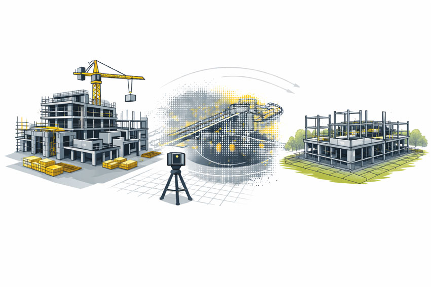
Brownfield Construction Is the Norm

A significant proportion of Brisbane construction work occurs in live, operational environments, including:

  • Commercial refurbishments
  • Industrial plant upgrades
  • Infrastructure modifications
  • Asset life-extension projects

These sites often contain undocumented steelwork, legacy penetrations, and accumulated modifications. A 3D construction scan enables non-intrusive capture of this complexity, supporting engineering coordination without disrupting operations.

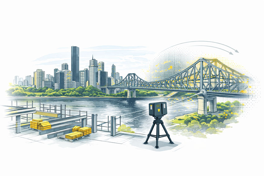
Tight CBD Logistics & Vertical Construction

Brisbaneโ€™s CBD presents unique logistical challenges:

  • Limited laydown space
  • Vertical risers and congested services zones
  • Restricted crane and hoist access
  • Staged installation sequencing

In these environments, components must fit first time. Construction scanning supports:

  • Early clash detection
  • Verification before fabrication
  • Confident off-site prefabrication

This process integrates directly with Hamilton By Designโ€™s 3D point cloud modelling and coordination services.

https://www.hamiltonbydesign.com.au/3d-point-cloud-modelling/

Reactive Soils & Differential Settlement

Reactive clay soils common throughout South-East Queensland contribute to long-term differential settlement, particularly where new construction interfaces with older structures. Over time, this can lead to:

  • Misaligned columns and beams
  • Drift in conveyors and pipe racks
  • Geometry that no longer matches design intent

A construction scan captures current condition, enabling engineers to design extensions and upgrades that reflect actual site geometry.


Construction Scanning vs Generic 3D Scanning

Not all scanning is suitable for construction engineering.

AspectGeneric ScanEngineering-Led Construction Scan
AccuracyVisual or indicativeMillimetre-grade
OutputMeshes or imagesRegistered point clouds
Engineering UseLimitedDesign & fabrication
Risk ReductionLowHigh
Construction ReadyNoYes

Hamilton By Design positions construction scanning as part of an integrated engineering workflow, not a standalone data capture exercise.


https://www.hamiltonbydesign.com.au/3d-engineering-services/


How 3D Construction Scans Are Used on Brisbane Projects

Engineering-grade construction scans are routinely used to support:

  • Clash detection across structure and services
  • Verification scans prior to fabrication
  • Construction sequencing and staging
  • As-built documentation for handover
  • Reduced RFIs, rework, and site delays

These outcomes are particularly valuable on commercial and construction projects where access, timing, and accuracy are critical.


https://www.hamiltonbydesign.com.au/commercial-construction-engineering/


3D laser scanning of a commercial building under construction showing as-built capture and coordination before wall closure

The Hamilton By Design Difference

Hamilton By Design delivers engineering-grade 3D construction scanning with a clear focus on constructability and downstream use.

Our approach combines:

  • Engineer-led scanning strategies
  • Defined accuracy requirements
  • Integration with mechanical and structural design
  • Outputs suitable for fabrication and installation

This approach ensures construction teams can rely on scan data with confidence โ€” especially on complex Brisbane projects.


When should a 3D Construction Scan Be Used?

A 3D construction scan in Brisbane is most valuable when:

  • Working in brownfield or live environments
  • Verifying conditions before fabrication
  • Coordinating multiple trades in tight spaces
  • Managing staged refurbishments
  • Reducing construction risk and uncertainty

Hamilton By Design logo displayed on a blue tilted rectangle with a grey gradient background

In Brisbane, construction risk is rarely driven by poor engineering.
It is driven by decisions made using incorrect or outdated information.

A 3D Construction Scan in Brisbane provides one critical advantage:
certainty about what actually exists on site, at the moment decisions are made.

Finite Element Analysis (FEA) engineering simulation button
3D LiDAR scanning and 3D modelling services button
Building and construction services button

Our clients:

Name
Would you like us to arrange a phone consultation for you?
Address
Finite Element Analysis (FEA) engineering simulation button
Mechanical engineering services

Reality Capture in the Hunter Valley

The Hunter Valley is one of Australiaโ€™s most technically complex industrial regions, combining power generation, mining, bulk materials handling, manufacturing, and logistics infrastructure within a tightly interconnected operational landscape. Projects in this environment frequently involve legacy assets, constrained access, and high consequences for design or construction error.

Reality capture in the Hunter Valley provides a structured, engineering-led method for documenting existing conditions using measured data rather than assumption-based interpretation. At Hamilton By Design, reality capture is applied as part of a broader engineering workflowโ€”ensuring captured information directly supports design development, upgrade planning, fabrication coordination, and risk management.


Defining reality capture in an industrial context

Reality capture is the process of recording physical site conditions using spatially accurate technologies and converting that information into usable engineering references. In practical terms, this includes:

  • Engineering-grade laser scanning and LiDAR acquisition
  • Spatial data registration and validation
  • Interpretation of existing geometry in the context of mechanical and structural systems
  • Translation of measured data into drawings, models, and coordination outputs

The objective is not simply to visualise a site, but to create a reliable, defensible representation of existing conditions that can be used throughout the project lifecycle.

For projects where laser scanning forms the core capture method, refer to:
3D Laser Scanning
https://www.hamiltonbydesign.com.au/home/3d-lidar-scanning-digital-quality-assurance/3d-laser-scanning/


Why reality capture is critical in the Hunter Valley

Industrial facilities across the Hunter Valley often operate continuously while upgrades, modifications, and expansions are undertaken. Common project challenges include:

  • Brownfield environments with incomplete or outdated documentation
  • Complex interfaces between mechanical, structural, and civil systems
  • Fabrication occurring off-site with limited tolerance for dimensional error
  • Restricted access windows and safety-critical operating conditions

In these scenarios, traditional measurement approaches are often insufficient. Reality capture reduces uncertainty by establishing a single source of measured truth, enabling informed decisions before fabrication or installation begins.

For an overview of how scanning is applied to regional industry, see:
3D Scanning for Industrial Projects in Newcastle and the Hunter Valley
https://www.hamiltonbydesign.com.au/3d-scanning-for-industrial-projects-in-newcastle-and-the-hunter-valley/


Typical Hunter Valley applications

Existing-condition baselining

Reality capture provides accurate documentation where legacy drawings no longer reflect actual site conditions. This baseline supports engineering assessments, upgrade feasibility studies, and staged project planning.

Plant upgrades and retrofit works

Measured spatial data allows new systems to be designed around existing plant, services, and structures, reducing clash risk and rework during installation.

Fabrication and construction coordination

Accurate capture of interfaces, clearances, and connection points improves alignment between design intent and fabricated componentsโ€”particularly where fabrication is completed remotely.

Risk reduction and decision support

From an engineering governance perspective, reality capture improves information quality, reduces assumptions, and supports more defensible technical decisions.


Engineering-led reality capture methodology

Hamilton By Design approaches reality capture as a project-specific engineering activity, not a generic surveying exercise.

1. Scope definition aligned to outcomes

Capture scope is defined based on how the data will be usedโ€”design development, drafting, verification, or coordinationโ€”ensuring the level of detail and accuracy is appropriate.

2. Structured site data acquisition

Capture activities are planned to manage occlusion, access limitations, and operational constraints commonly encountered on Hunter Valley industrial sites.

3. Data validation and preparation

Captured datasets are reviewed, registered, and structured so they can be confidently used for engineering interpretation rather than remaining as raw data.

4. Engineering-ready deliverables

Where required, reality capture outputs are converted into:

  • As-built drawings
  • General arrangement layouts
  • Reference models for coordination
  • Documentation suitable for engineering review and approvals

Relationship between reality capture and laser scanning

While laser scanning and LiDAR are commonly used tools within reality capture, the distinction lies in how the data is applied. Laser scanning provides the measurements; reality capture ensures those measurements are contextualised, validated, and integrated into engineering workflows.

This distinction is particularly important in industrial regions such as the Hunter Valley, where inaccurate interpretation of spatial data can have significant cost and safety implications.


Value for Hunter Valley stakeholders

Reality capture supports multiple stakeholder groups:

  • Asset owners and operators gain confidence in upgrade planning
  • Engineers work from verified existing-condition data
  • Fabricators receive clearer interface definitions
  • Project teams reduce site disruption and variation risk

From a systems engineering perspective, this represents an improvement in information reliability and traceabilityโ€”both key drivers of project performance.


Regional capability and service coverage

Hamilton By Design services the Hunter Valley as part of its broader NSW engineering and reality capture capability, supporting projects across industrial, energy, and infrastructure sectors.

Service coverage includes Newcastle and the wider Hunter region, as outlined in:
Frequently Asked Questions โ€“ Service Areas
https://www.hamiltonbydesign.com.au/frequently-asked-questions/


Next steps

For Hunter Valley projects, effective reality capture begins by clearly defining:

  1. Which areas and interfaces require measurement
  2. What engineering decisions the data must support
  3. The required accuracy for design, fabrication, or verification

Once these parameters are established, reality capture can be aligned to project risk, schedule, and delivery requirements.

For scanning-focused services, return to:
3D Laser Scanning
https://www.hamiltonbydesign.com.au/home/3d-lidar-scanning-digital-quality-assurance/3d-laser-scanning/

For industrial scanning examples in the region, see:
3D Scanning for Industrial Projects in Newcastle and the Hunter Valley
https://www.hamiltonbydesign.com.au/3d-scanning-for-industrial-projects-in-newcastle-and-the-hunter-valley/

3D LiDAR scanning and 3D modelling service button โ€” laser scanner capturing a point cloud for engineering and CAD modelling
Mechanical engineering services

Our clients:

Name
Would you like us to arrange a phone consultation for you?
Address

3D Scanning Engineering in Darwin

Engineer performing 3D LiDAR scanning in Darwin on an industrial processing plant with point cloud modelling and CAD engineering workflow overlay

3D Scanning in Darwin

Blue 3D LiDAR scanner icon on a tripod with scanning waves

Darwin occupies a unique position within Australiaโ€™s engineering and infrastructure landscape. As the northern gateway to mining regions, offshore energy developments, defence infrastructure and remote industrial operations, engineering projects in Darwin demand robust design, accurate site data, and practical delivery methods suited to extreme environments.

Hamilton By Design provides 3D LiDAR laser scanning, mechanical and structural engineering, 3D CAD modelling, finite element analysis (FEA), and fabrication-ready drafting to support projects across Darwin and the broader Northern Territory. Our services are specifically suited to brownfield sites, remote facilities, tropical conditions and high-consequence industrial assets.


Engineering in Darwin โ€“ A Distinct Operating Environment

Engineering work in Darwin differs significantly from metropolitan centres due to a combination of factors:

  • Remote and FIFO-supported operations, servicing mining, energy and infrastructure projects across the NT and northern WA
  • Tropical climate exposure, including cyclones, corrosion, heat and humidity
  • Defence and marine infrastructure, with strict compliance and asset-integrity requirements
  • Aging brownfield assets, often modified over decades with limited as-built documentation
  • Limited shutdown windows, requiring accurate planning and first-time-right execution

These conditions place a premium on accurate as-built data, digital planning and engineering-led decision making before fabrication or construction begins.


3D LiDAR Laser Scanning for Darwin Projects

Accurate site data is the foundation of reliable engineering outcomes. Hamilton By Design uses high-resolution 3D LiDAR laser scanning to capture existing facilities, structures and terrain with millimetre-level accuracy.

3D scanning is particularly valuable in Darwin for:

  • brownfield plant upgrades and expansions
  • remote facilities where repeat site access is costly
  • marine and port infrastructure
  • defence and energy assets
  • FIFO-supported mining and processing facilities

Laser scanning eliminates guesswork by delivering a complete digital record of the site, including steelwork, pipework, conveyors, foundations, platforms and surrounding constraints.

Learn more about our scanning capability:
3D Laser Scanning


3D CAD Modelling โ€“ From Point Cloud to Digital Asset

Following scanning, Hamilton By Design converts point-cloud data into accurate 3D CAD models that represent true as-built conditions.

Our models are used to:

  • develop retrofit and upgrade designs
  • validate equipment fit-up and clearances
  • perform clash detection before fabrication
  • support construction planning and sequencing
  • create long-term digital asset records

This approach is especially valuable in Darwinโ€™s industrial and remote environments, where errors can result in costly delays or rework.

Explore our modelling services:
3D CAD Modelling


Engineering Assessment & FEA for Harsh Conditions

Darwin projects frequently involve heavy loads, dynamic equipment, corrosion exposure and cyclone-rated structures. Hamilton By Design provides engineering assessment and finite element analysis (FEA) to verify performance, safety and compliance.

Our FEA capabilities support:

  • structural integrity assessments
  • equipment and support-frame design
  • fatigue and load-case evaluation
  • modification verification for existing assets
  • risk reduction prior to fabrication or installation

View our analysis capability:
FEA Capabilities


Drafting for Fabrication, Construction & Shutdown Works

Clear, accurate documentation is essential for FIFO workforces and remote fabrication. Hamilton By Design produces fabrication-ready drawings that are practical, buildable and aligned with site realities.

Deliverables include:

  • general arrangement (GA) drawings
  • detailed fabrication drawings
  • installation and modification layouts
  • isometrics and BOMs
  • as-built documentation

These drawings reduce ambiguity, improve construction efficiency and support safer execution in Darwinโ€™s challenging conditions.

Learn more about our drafting services:
Drafting


Supporting FIFO Engineering & Remote Projects

Darwin plays a critical role as a FIFO engineering and logistics hub, supporting mining, energy and infrastructure projects across the Northern Territory and northern Australia. Hamilton By Designโ€™s digital-first workflow enables:

  • reduced site visits through accurate upfront data capture
  • improved coordination between designers, fabricators and site crews
  • faster decision-making during shutdowns and maintenance windows
  • reliable documentation for remote execution

By combining scanning, modelling, engineering and drafting under one accountable provider, we help clients minimise risk and maximise certainty.


Hamilton By Design logo displayed on a blue tilted rectangle with a grey gradient background
3D LiDAR scanning and 3D modelling service button โ€” laser scanner capturing a point cloud for engineering and CAD modelling
Mechanical engineering services

Engineering Confidence for Northern Australia

Hamilton By Design delivers practical, engineering-led digital solutions tailored to Darwinโ€™s unique environment. Whether supporting FIFO-based mining operations, marine infrastructure, defence facilities or remote industrial assets, our services provide the clarity and confidence required to deliver complex projects successfully.

Our clients

Name
Would you like us to arrange a phone consultation for you?
Address

3D Scanning Engineering in Port Lincoln

3D Scanning in Port Lincoln

Port Lincoln is unlike any other regional centre in South Australia. Known as Australiaโ€™s seafood capital, it combines a working commercial harbour, marine-based industries, food processing, and export infrastructure within a tight coastal footprint. Engineering here must perform reliably in a marine environment, meet strict hygiene and biosecurity requirements, and minimise downtime in export-critical operations.

Hamilton By Design supports Port Lincoln projects with engineering-led 3D LiDAR laser scanning, 3D modelling, FEA, and easy-to-build fabrication drawings, helping clients upgrade, modify, and maintain assets with confidence.


Engineering in Port Lincoln: Marine, Food-Grade, and Export Driven

Engineering in Port Lincoln is shaped by a unique mix of conditions:

  • Saltwater corrosion and harsh coastal exposure
  • Continuous operations tied to fishing, aquaculture, and exports
  • Tight brownfield sites around wharves and processing facilities
  • High compliance expectations for hygiene, drainage, and separation

In this environment, assumptions are risky. Accurate as-built data and practical engineering solutions are essential to avoid rework, contamination risks, and unplanned downtime.


3D Laser Scanning for Port Lincoln Facilities

3D LiDAR laser scanning provides the foundation for successful engineering projects in Port Lincoln.

Hamilton By Design captures accurate as-built conditions of:

  • Seafood processing plants and cold-storage facilities
  • Port infrastructure, wharves, and marine interfaces
  • Conveyors, platforms, pipework, and structural steel
  • Buildings and plant within space-constrained coastal sites

Scanning records the true geometry of existing assets โ€” including misalignment, corrosion loss, undocumented modifications, and tight clearances โ€” all common in marine and food-processing environments.

This enables:

  • Reduced site visits
  • Safer design development
  • Fewer clashes during installation
  • Confident planning around live operations

Learn more about our scanning services:
3D Laser Scanning


3D Modelling Based on Real As-Built Data

From the point cloud, Hamilton By Design develops accurate 3D CAD models that reflect what is actually on site โ€” not what legacy drawings suggest.

Our 3D modelling services support:

  • Brownfield upgrades and plant modifications
  • Space-constrained layout changes
  • Clash detection around existing services
  • Fabrication planning and modular construction
  • Digital asset documentation

In Port Lincoln, where sites are tight and shutdown windows are limited, modelling from real data significantly reduces construction risk.

Explore our modelling capability:
3D CAD Modelling


FEA for Marine and Industrial Assets

Many Port Lincoln assets operate in corrosive, cyclic loading environments and must continue performing safely over long service lives. Finite Element Analysis (FEA) is used to verify performance and guide decision-making.

Hamilton By Design applies FEA to:

  • Assess structural capacity and fatigue
  • Check modifications to existing steelwork
  • Evaluate deflection, buckling, and load paths
  • Support life-extension and strengthening strategies

By analysing as-built geometry, FEA results are more representative of real behaviour โ€” especially important in marine and port environments.

Learn more here:
FEA Capabilities


Easy-to-Build Fabrication and Installation Drawings

Clear, practical documentation is critical for Port Lincoln projects, where fabrication and installation often occur under time pressure and around live operations.

Hamilton By Design delivers easy-to-build fabrication drawings, including:

  • General arrangement drawings
  • Fabrication and workshop details
  • Installation and lifting layouts
  • As-built documentation

Because drawings are generated directly from scanned data and validated 3D models, they align with site reality, reduce ambiguity, and support efficient construction.

View our drafting services:
Drafting Services


Hamilton By Design logo displayed on a blue tilted rectangle with a grey gradient background
3D LiDAR scanning and 3D modelling service button โ€” laser scanner capturing a point cloud for engineering and CAD modelling
Mechanical engineering services

Why Hamilton By Design in Port Lincoln?

Hamilton By Design offers an integrated digital engineering workflow โ€” from site capture through to modelling, analysis, and construction documentation.

For Port Lincoln clients, this means:

  • Fewer assumptions in marine and food-grade environments
  • Reduced risk in tight, brownfield sites
  • Designs that consider corrosion, hygiene, and constructability
  • Fabrication-ready drawings that support reliable installation

Whether youโ€™re upgrading seafood processing facilities, modifying port infrastructure, or maintaining marine-exposed assets, Hamilton By Design provides practical, engineering-led 3D scanning and digital engineering solutions tailored to Port Lincolnโ€™s unique conditions.

If youโ€™re planning a project in Port Lincoln, weโ€™re ready to help โ€” starting with accurate data and carrying it through to buildable outcomes.

Our Services

Name
Would you like us to arrange a phone consultation for you?
Address

Engineering in Dubbo and 3D Scanning

3D Scanning in Dubbo

How Hamilton By Design Supports Regional NSW With 3D LiDAR Scanning, Engineering, 3D CAD Modelling & Drafting

Dubbo is one of regional NSWโ€™s most important inland hubs โ€” a crossroads for agriculture, transport, utilities, manufacturing, defence, construction, and regional infrastructure. Its strategic central location and industrial diversity make it a city that relies heavily on precision engineering, reliable documentation, and efficient project delivery.

As facilities expand, upgrade, or transition into modern digital workflows, Dubboโ€™s industries increasingly require accurate site data, engineering-grade modelling, and fabrication-ready drawings.
Hamilton By Design delivers exactly that.

We bring 3D LiDAR laser scanning, mechanical and structural engineering, 3D CAD modelling, and professional drafting directly to Dubboโ€™s industrial, agricultural and construction sectors โ€” supporting clients who need certainty, accuracy, and efficient turnaround.

Why Dubbo Is Unique

What makes Dubbo stand out from other regional centres?

1. A major inland logistics & infrastructure hub
Dubbo sits at the intersection of key freight, rail and road corridors, supporting agriculture, mining supply lines, warehousing, utilities, and transport infrastructure.

2. Strong manufacturing and fabrication capability
Local workshops, steel fabricators, machinery builders, and transport-equipment manufacturers rely on accurate measurements and engineering documentation to minimise rework and site downtime.

3. Agriculture, water infrastructure & processing facilities
Irrigation systems, water treatment assets, processing facilities and agricultural mechanical plants demand precise alignment, structural integrity, and reliable as-built data.

4. Growing capital works & regional development
Government, utilities, councils, commercial builders and engineering firms increasingly require digital workflows โ€” 3D models, scans, clash detection and accurate documentation.

This combination makes Dubbo an ideal match for engineering-led scanning and digital-first design.


3D LiDAR Laser Scanning in Dubbo

Accurate data is the foundation of every successful engineering project.
Hamilton By Design provides high-accuracy 3D LiDAR scanning that captures real-world geometry to millimetre-level precision โ€” ideal for:

  • industrial plants & mechanical systems
  • agricultural processing equipment
  • structural steel, frames, conveyors & platforms
  • utilities, pumping stations & pipework
  • warehouses, sheds & fabrication workshops
  • site upgrades, retrofits and brownfield expansions

Our scans eliminate guesswork, reduce site time, and prevent costly fabrication errors.

Learn more about our scanning capabilities:
3D Laser Scanning


Turning Scans Into Intelligent Models โ€” 3D CAD Modelling

Once Dubbo sites are scanned, Hamilton By Design converts point-cloud data into accurate 3D CAD models for engineering, fabrication and construction.

We provide:

  • detailed mechanical assemblies
  • structural steel modelling
  • equipment and plant layouts
  • GA drawings, isometrics and BOMs
  • clash detection and fit-up verification
  • digital twins for future asset management

This ensures fabricators, installers and engineers all work from the same accurate source of truth.

Explore this service:
3D CAD Modelling


Engineering Services for Dubbo’s Industrial Needs

From agricultural machinery to pumping stations, civil structures, metal fabrication and industrial facilities, Dubbo relies on strong mechanical and structural engineering.

Hamilton By Design provides:

  • mechanical design and equipment layout
  • structural design of platforms, frames, supports
  • integrity assessments of existing structures
  • modification and upgrade design for brownfield assets
  • shutdown-driven engineering and fit-up solutions
  • workflow and plant-efficiency improvements

We also offer advanced simulation and verification tools.

Engineering validation & simulation:
FEA Capabilities

Whether youโ€™re fabricating a new platform, installing conveyors, adjusting equipment clearances or updating plant layouts โ€” we ensure every design decision is backed by engineering certainty.


Drafting & Fabrication-Ready Documentation

Good engineering is only as strong as the drawings that support it.
Hamilton By Design produces highly detailed, fabrication-ready drafting packages including:

  • GA drawings
  • detail drawings
  • weldment documentation
  • pipework & isometric drawings
  • assemblies & exploded views
  • bill of materials (BOM)
  • issue-for-construction (IFC) documentation
  • as-built updates from LiDAR scans

Our drawings are accurate, clean, and ready for immediate hand-off to fabricators and installers.

Drafting services:
Drafting


End-to-End Workflow for Dubbo Projects

With Hamilton By Design, clients benefit from a seamless engineering pipeline:

  1. Scan โ€” High-accuracy laser capture
  2. Model โ€” 3D CAD conversion and layout
  3. Engineer โ€” Structural & mechanical design
  4. Validate โ€” Simulation, FEA, fit-checks
  5. Draft โ€” Fabrication & construction documentation
  6. Deliver โ€” A complete, integrated package

One provider. One workflow. One accountable source.


Hamilton By Design logo displayed on a blue tilted rectangle with a grey gradient background
3D LiDAR scanning and 3D modelling service button โ€” laser scanner capturing a point cloud for engineering and CAD modelling
Mechanical engineering services

Why Dubbo Chooses Hamilton By Design

  • Millimetre-accurate scanning reduces fabrication risk
  • Engineers who understand real-world brownfield constraints
  • Fast turnaround for shutdowns and critical upgrades
  • Experience across agriculture, water treatment, utilities, workshops & manufacturing
  • Clear communication, professional standards and end-to-end compliance

Dubboโ€™s industrial economy keeps NSW moving. Our job is to ensure your assets, upgrades and fabrication projects are delivered with precision.

Our Clients

Name
Would you like us to arrange a phone consultation for you?
Address
Finite Element Analysis (FEA) engineering simulation button
Mechanical engineering services
3D LiDAR scanning and 3D modelling service button โ€” laser scanner capturing a point cloud for engineering and CAD modelling
Mechanical engineering services


Finite Element Analysis (FEA) engineering simulation button
Mechanical engineering services


3D CAD Modelling Australia service banner for Hamilton By Design


CHPP Engineering title graphic featuring bold white text reading "CHPP Engineering" centred on a blue rounded rectangle background.
Pipework Drafting title graphic featuring bold white text reading "Pipework Drafting" centred on a blue rounded rectangle background.
3D LiDAR Scanning for Engineering Projects title graphic featuring bold white text on a blue rounded rectangle background.


Finite Element Analysis (FEA) engineering simulation button
Structural drafting services button
Mechanical drafting services button


Australian Drafting logo featuring bold white text reading "Australian Drafting" centred on a blue rounded rectangle background.
Engineering Governance title graphic featuring bold white text reading "Engineering Governance" centred on a blue rounded rectangle background.
Engineering-Grade LiDAR Scanning title graphic featuring bold white text on a blue rounded rectangle background.

3D Scanning Engineering in Tamworth

3D Scanning in Tamworth

Tamworth is one of the most important inland cities in New South Wales โ€” a defence hub, agricultural powerhouse, logistics gateway and regional manufacturing centre. As the city continues to grow its industrial capability and upgrade infrastructure across defence, agriculture, transport, civil works and fabrication sectors, the need for modern engineering tools has never been stronger.

Hamilton By Design supports Wagga Wagga with 3D LiDAR scanning, mechanical and structural engineering, 3D CAD modelling, FEA simulation, and fabrication-ready drafting, delivering a complete digital engineering workflow from first site scan through to final drawings.

Whether youโ€™re upgrading a defence facility, redesigning an agricultural processing line, documenting a logistics depot, modernising a workshop or preparing a brownfield structure for retrofit โ€” our engineering-led approach gives you the confidence to build accurately and efficiently.

This article outlines how 3D scanning and digital engineering transform project outcomes in the Riverina region.


Why Wagga Wagga Is a Prime Location for 3D Scanning & Engineering

1. Dual Defence Bases โ€” RAAF Base Wagga + Kapooka Army Recruit Training Centre

Wagga is one of the only regional cities in Australia hosting two major defence establishments. Defence projects in the city require high levels of precision, compliance, digital documentation and engineering accuracy โ€” all supported by modern scanning and modelling tools.

2. Agricultural Powerhouse of the Riverina

Wagga supports one of the largest inland agricultural regions in the country. Facilities requiring regular upgrades include:

  • pump stations
  • irrigation systems
  • silos and grain-handling plants
  • processing equipment
  • machinery sheds
  • livestock and rural infrastructure

These sites often require accurate surveying, retrofit engineering and digital as-built documentation โ€” tasks perfectly suited to LiDAR scanning.

3. A Logistics, Freight & Manufacturing Hub

At the junction of the Sturt Highway, Olympic Highway and major freight routes, Wagga Wagga serves as:

  • a key transport centre
  • a manufacturing and fabrication district
  • a support hub for mining, defence, agriculture and civil construction

Accurate models, digital scans and engineering documentation help streamline upgrades, expansions and fabrication work across these sectors.

4. The Murrumbidgee River โ€” Civil & Hydrology Challenges

Riverside assets, bridges, levees, drainage systems and public structures require constant improvement. LiDAR scanning and digital modelling make civil engineering more predictable, safer, and easier to plan.


3D LiDAR Laser Scanning โ€” The Foundation of Accurate Engineering

Hamilton By Design provides high-accuracy 3D LiDAR scanning for buildings, industrial facilities, workshops, civil structures and brownfield environments. We capture millions of precise data points per second, producing millimetre-accurate digital twins used for engineering, modelling and drafting.

Our scanning service covers:

  • mechanical equipment
  • structural steel, platforms, walkways
  • pipework and tanks
  • sheds, workshops, farm facilities
  • buildings (internal and external)
  • terrain and drainage
  • defence and civil infrastructure

Learn more about our capabilities:
3D Laser Scanning

Benefits of 3D Scanning for Wagga Wagga Projects

  • Accurate as-built documentation
  • Reduced shutdown times
  • Less rework during fabrication
  • Better coordination between contractors
  • Improved safety (minimal manual measurement)
  • Faster engineering and design turnaround
  • Reliable models for upgrades and retrofits

In a city with ageing structures, brownfield facilities and diverse industrial activity, digital scanning creates clarity where traditional measurement falls short.


3D CAD Modelling โ€” Turning Scans into Intelligent Engineering Models

Once scanning is complete, Hamilton By Design transforms point-cloud data into detailed 3D CAD models, structural layouts and mechanical assemblies.

We model:

  • agricultural processing lines
  • pump systems and pipework
  • conveyors and mechanical equipment
  • structural frames, platforms and stairs
  • fabrication-ready steel structures
  • building layouts for redevelopment
  • defence facility upgrades

Our modelling supports precise engineering decision-making, alignment checks, clash detection and well-structured documentation.

Explore our modelling services:
3D CAD Modelling


FEA Analysis โ€” Engineering Confidence for Complex Projects

Many Wagga Wagga projects involve load-bearing structures, moving equipment, mechanical stress, fatigue risks or compliance requirements. Hamilton By Design performs Finite Element Analysis (FEA) to validate the safety, performance and reliability of your designs.

We analyse:

  • structural frames
  • mechanical components
  • tanks, brackets and supports
  • agricultural machinery
  • access platforms and retrofits
  • equipment subjected to vibration, pressure or fatigue

This ensures every design is safe, compliant and ready for construction.

Learn more about our simulation capability:
FEA Capabilities

(If youโ€™d like, I can correct the FEA URL if this is not the intended final link โ€” just tell me.)


Drafting Services โ€” Fabrication-Ready, Clear & Accurate

Wagga Waggaโ€™s industrial and agricultural workshops depend on drawings that are:

  • clear
  • accurate
  • fabrication-ready
  • compliant
  • easily interpreted by boilermakers, contractors and site crews

Hamilton By Design provides:

  • general arrangement drawings
  • fabrication detail drawings
  • isometrics and BOMs
  • structural drafting
  • mechanical drafting
  • P&ID updates
  • revision control and QA documentation

View our drafting services here:
Drafting

All drafting is generated from verified scan data and validated engineering models, ensuring first-time fit-up and reduced fabrication risk.


Where Hamilton By Design Adds Value in Wagga Wagga

1. Defence Projects and Facility Upgrades

Perfect for:

  • as-built modelling
  • mechanical/structural modifications
  • digital site capture
  • designing safe access systems
  • maintaining compliance records

2. Agricultural Infrastructure & Processing Plants

Ideal for:

  • pump stations
  • grain conveyors
  • silos and storage systems
  • livestock handling systems
  • machinery retrofits

3. Fabrication & Manufacturing Workshops

Supporting:

  • structural steel
  • machine frames
  • industrial components
  • site installations
  • complex fit-ups

4. Civil & Council Infrastructure

Including:

  • bridges
  • footpaths
  • drainage networks
  • public buildings
  • river-adjacent assets

5. Commercial & Industrial Redevelopment

Great for:

  • internal building scans
  • renovation planning
  • layout optimisation
  • service routing

Our clients:


End-to-End Workflow โ€” One Team, One Source of Accountability

Hamilton By Design ensures a smooth, unified digital engineering pipeline:

  1. 3D LiDAR Scan
  2. Point Cloud Registration & QA
  3. 3D CAD Modelling
  4. FEA Engineering Analysis
  5. Drafting & Fabrication Packages
  6. Digital QA & Final Documentation

No multi-contractor confusion.
No inconsistencies.
Just a clean, accurate workflow from measurement to construction.


Hamilton By Design logo displayed on a blue tilted rectangle with a grey gradient background
3D LiDAR scanning and 3D modelling service button โ€” laser scanner capturing a point cloud for engineering and CAD modelling
Mechanical engineering services

Wagga Waggaโ€™s Future Is Digital โ€” And Hamilton By Design Is Ready

With its growing defence, agricultural, logistics and manufacturing sectors, Wagga Wagga needs modern engineering methods to keep pace with development. Digital scanning, modelling, engineering analysis and drafting streamline the entire project lifecycle, reducing rework and increasing reliability.

Hamilton By Design delivers:

  • precision 3D scanning
  • engineering-grade modelling
  • validated FEA simulation
  • clear drafting
  • accurate, build-ready documentation
  • end-to-end project confidence

Whether your project is a shed, a defence facility, a processing plant, a workshop or a civil structure โ€” we are ready to support it from concept through to fabrication.

Name
Would you like us to arrange a phone consultation for you?
Address
3D LiDAR scanning and 3D modelling service button โ€” laser scanner capturing a point cloud for engineering and CAD modelling
Mechanical engineering services


Finite Element Analysis (FEA) engineering simulation button
Mechanical engineering services


3D CAD Modelling Australia service banner for Hamilton By Design


CHPP Engineering title graphic featuring bold white text reading "CHPP Engineering" centred on a blue rounded rectangle background.
Pipework Drafting title graphic featuring bold white text reading "Pipework Drafting" centred on a blue rounded rectangle background.
3D LiDAR Scanning for Engineering Projects title graphic featuring bold white text on a blue rounded rectangle background.


Finite Element Analysis (FEA) engineering simulation button
Structural drafting services button
Mechanical drafting services button


Australian Drafting logo featuring bold white text reading "Australian Drafting" centred on a blue rounded rectangle background.
Engineering Governance title graphic featuring bold white text reading "Engineering Governance" centred on a blue rounded rectangle background.
Engineering-Grade LiDAR Scanning title graphic featuring bold white text on a blue rounded rectangle background.