

3D Scanning in Darwin

Darwin occupies a unique position within Australia’s engineering and infrastructure landscape. As the northern gateway to mining regions, offshore energy developments, defence infrastructure and remote industrial operations, engineering projects in Darwin demand robust design, accurate site data, and practical delivery methods suited to extreme environments.
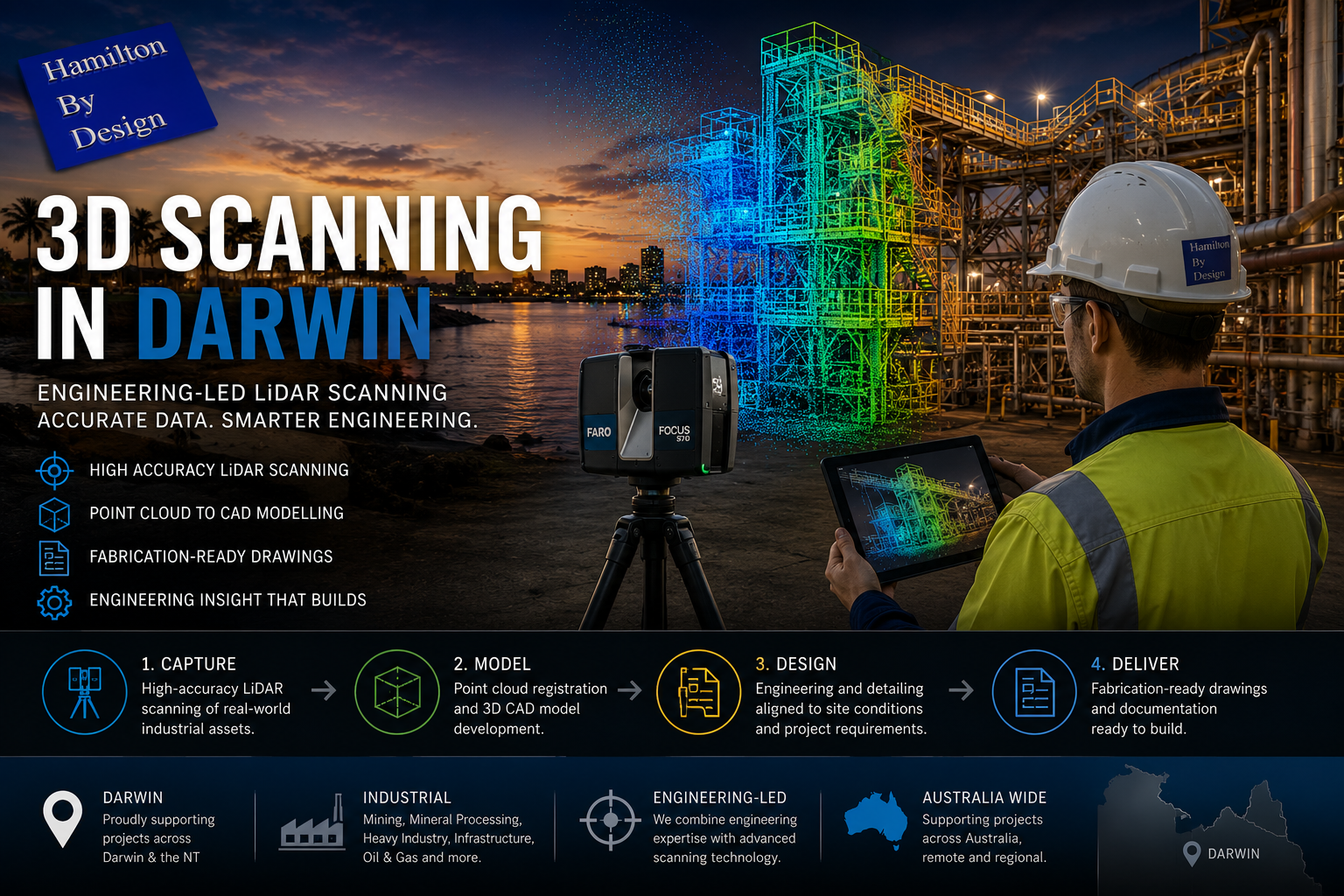
Hamilton By Design provides 3D LiDAR laser scanning, mechanical and structural engineering, 3D CAD modelling, finite element analysis (FEA), and fabrication-ready drafting to support projects across Darwin and the broader Northern Territory. Our services are specifically suited to brownfield sites, remote facilities, tropical conditions and high-consequence industrial assets.
Engineering in Darwin – A Distinct Operating Environment
Engineering work in Darwin differs significantly from metropolitan centres due to a combination of factors:
- Remote and FIFO-supported operations, servicing mining, energy and infrastructure projects across the NT and northern WA
- Tropical climate exposure, including cyclones, corrosion, heat and humidity
- Defence and marine infrastructure, with strict compliance and asset-integrity requirements
- Aging brownfield assets, often modified over decades with limited as-built documentation
- Limited shutdown windows, requiring accurate planning and first-time-right execution
These conditions place a premium on accurate as-built data, digital planning and engineering-led decision making before fabrication or construction begins.
3D LiDAR Laser Scanning for Darwin Projects
Accurate site data is the foundation of reliable engineering outcomes. Hamilton By Design uses high-resolution 3D LiDAR laser scanning to capture existing facilities, structures and terrain with millimetre-level accuracy.
3D scanning is particularly valuable in Darwin for:
- brownfield plant upgrades and expansions
- remote facilities where repeat site access is costly
- marine and port infrastructure
- defence and energy assets
- FIFO-supported mining and processing facilities
Laser scanning eliminates guesswork by delivering a complete digital record of the site, including steelwork, pipework, conveyors, foundations, platforms and surrounding constraints.
Learn more about our scanning capability:
3D Laser Scanning
3D CAD Modelling – From Point Cloud to Digital Asset
Following scanning, Hamilton By Design converts point-cloud data into accurate 3D CAD models that represent true as-built conditions.
Our models are used to:
- develop retrofit and upgrade designs
- validate equipment fit-up and clearances
- perform clash detection before fabrication
- support construction planning and sequencing
- create long-term digital asset records
This approach is especially valuable in Darwin’s industrial and remote environments, where errors can result in costly delays or rework.
Explore our modelling services:
3D CAD Modelling
Engineering Assessment & FEA for Harsh Conditions
Darwin projects frequently involve heavy loads, dynamic equipment, corrosion exposure and cyclone-rated structures. Hamilton By Design provides engineering assessment and finite element analysis (FEA) to verify performance, safety and compliance.
Our FEA capabilities support:
- structural integrity assessments
- equipment and support-frame design
- fatigue and load-case evaluation
- modification verification for existing assets
- risk reduction prior to fabrication or installation
View our analysis capability:
FEA Capabilities
Drafting for Fabrication, Construction & Shutdown Works
Clear, accurate documentation is essential for FIFO workforces and remote fabrication. Hamilton By Design produces fabrication-ready drawings that are practical, buildable and aligned with site realities.
Deliverables include:
- general arrangement (GA) drawings
- detailed fabrication drawings
- installation and modification layouts
- isometrics and BOMs
- as-built documentation
These drawings reduce ambiguity, improve construction efficiency and support safer execution in Darwin’s challenging conditions.
Learn more about our drafting services:
Drafting
Supporting FIFO Engineering & Remote Projects
Darwin plays a critical role as a FIFO engineering and logistics hub, supporting mining, energy and infrastructure projects across the Northern Territory and northern Australia. Hamilton By Design’s digital-first workflow enables:
- reduced site visits through accurate upfront data capture
- improved coordination between designers, fabricators and site crews
- faster decision-making during shutdowns and maintenance windows
- reliable documentation for remote execution
By combining scanning, modelling, engineering and drafting under one accountable provider, we help clients minimise risk and maximise certainty.


Engineering Confidence for Northern Australia
Hamilton By Design delivers practical, engineering-led digital solutions tailored to Darwin’s unique environment. Whether supporting FIFO-based mining operations, marine infrastructure, defence facilities or remote industrial assets, our services provide the clarity and confidence required to deliver complex projects successfully.
Our clients


