


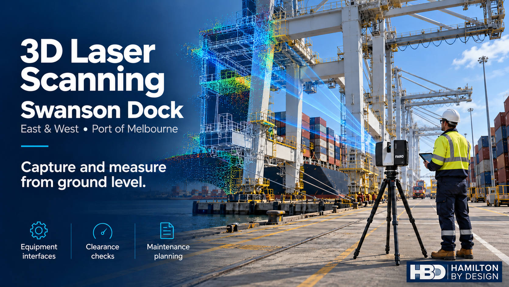
Capture and measure terminal infrastructure from ground level

Planning an equipment upgrade, checking a clearance or preparing for maintenance at Swanson Dock? Having reliable information about the existing installation helps your team make decisions before fabrication or site work begins.
Hamilton By Design offers 3D laser scanning for Swanson Dock East and West, supporting existing-condition capture, equipment interface measurements, clearance checks and maintenance planning.
Our approach is straightforward: capture visible equipment and infrastructure from ground level, then use the registered scan data to measure, model and plan the work. Where suitable sightlines are available, this can reduce the need to climb structures or arrange elevated access solely to obtain dimensions.
Container terminal scanning in Melbourne
Swanson Dock East and West are international container terminals within the Port of Melbourne. Their cargo-handling equipment and supporting infrastructure create a setting where existing geometry matters when planning maintenance and modifications.
An upgrade may need to fit between existing structures, connect to an established equipment interface or preserve access for maintenance. Drawings provide a starting point, but modifications made over time can leave gaps between the documented arrangement and the installation on site.
Container terminal scanning in Melbourne provides a three-dimensional record of the visible conditions within the agreed work area. This gives engineers, maintenance teams and fabricators a shared reference for developing the next stage of a project.
Capturing dimensions without leaving the ground
Traditional measurement of elevated equipment can require ladders, scaffolding or an elevated work platform. For suitable features, ground-based laser scanning offers another way to collect dimensional information.
A tripod-mounted scanner captures visible surfaces from several planned positions. The scans are combined into a registered point cloud, allowing the captured geometry to be reviewed and measured after the site visit.
Potential applications include:
- Measuring visible overhead structures and equipment.
- Capturing platform, stair and support arrangements.
- Checking the space between machinery and nearby infrastructure.
- Recording accessible external equipment geometry.
- Developing layouts for proposed modifications.
The scanning method depends on what the scanner can see. Containers, equipment and structural members can obscure surfaces, while distance and viewing angle affect the detail captured. We plan scan positions around the required measurements and identify features that need closer access or additional verification.
The aim is to obtain useful engineering information from ground level wherever the site conditions and measurement requirements allow.
Existing-condition capture for terminal upgrades
Before designing a modification, your team needs to understand the space it will occupy and the infrastructure it will connect to.
Hamilton By Design can capture an agreed project area to support:
- Equipment replacement and installation planning.
- Mechanical plant and service modifications.
- Access platform and guarding layouts.
- Fabrication drawing preparation.
- Coordination between existing assets and proposed equipment.
The point cloud records the visible arrangement at the time of scanning. Selected geometry can then be developed into CAD drawings or a 3D model, depending on the project scope.
For a targeted upgrade, the scan can focus on the equipment interface and surrounding constraints. For a wider maintenance project, the capture area can include access routes, nearby services and working space.
Equipment interfaces: understand the connection before fabrication
A replacement component must fit the existing installation. Its overall dimensions are only part of the problem: nearby steelwork, services, access requirements and connection positions can also determine whether installation succeeds.
3D laser scanning Swanson Dock can support the assessment of visible equipment interfaces, including:
- Machinery bases and surrounding structures.
- Brackets, frames and mechanical supports.
- Pipework routes and connection locations.
- Platforms, stairs and maintenance access.
- Space available for new guards or assemblies.
Hamilton By Design can use the captured geometry as the basis for mechanical layouts and selected component models.
For example, a proposed equipment support can be positioned within the scan to review its relationship with existing infrastructure before fabrication drawings are prepared. Where a connection requires tight tolerances, the relevant dimensions can be identified for direct measurement or more detailed capture.
Clearance checks before equipment changes
An equipment upgrade can fit its mounting position while leaving too little space for access, removal or maintenance.
Scanning helps your team assess the surrounding geometry early. Relevant checks may include:
- Overhead clearance beneath existing structures.
- Space between proposed equipment and adjacent assets.
- Access around guards and service points.
- Door, hatch and cover opening space.
- Routes for removing and replacing components.
Proposed CAD geometry can be compared with the captured installation to help identify clashes and restricted spaces. This use of scan data for equipment placement and clearance review is an established industrial application.
For moving equipment, the review also needs the relevant operating envelope and movement information. A scan captures the equipment’s position at the time of measurement; the clearance assessment must account for the positions it will occupy during operation.
Maintenance planning with a shared 3D reference
Maintenance planning becomes easier when the team can review the work area before arriving on site.
A registered point cloud can support discussions about equipment access, component replacement, nearby obstructions and the sequence of work. Instead of relying entirely on photographs and individual measurements, the project team can refer to the same captured geometry.
This can help with:
- Defining maintenance and modification scopes.
- Preparing drawings for replacement assemblies.
- Reviewing access for tools and personnel.
- Planning component removal routes.
- Coordinating fabrication and installation work.
The value lies in capturing the information needed for the maintenance task. We work with your team to establish the priority areas and required deliverables before scanning.
From scan data to practical engineering deliverables
Hamilton By Design combines 3D scanning with mechanical design and drafting support.
Depending on the agreed scope, deliverables can include:
- Registered point clouds for review and coordination.
- 2D plans, elevations and sections of selected areas.
- 3D CAD models of nominated equipment or infrastructure.
- Equipment interface drawings for design development.
- Clearance review drawings showing relevant constraints.
- Mechanical layouts and fabrication drawings for proposed modifications.
Point cloud and CAD formats are agreed to suit the project team’s software and intended use. Model detail is also defined around the task: a layout review needs different information from a replacement part drawing.
How a Swanson Dock scanning project works
1. Define the measurements and decisions
Tell us what you need to replace, modify, check or maintain. Existing drawings, photographs and marked-up areas help establish the capture scope.
2. Plan site access and scan positions
We coordinate the work with your nominated site representative, accounting for access permissions, operating equipment, traffic and available sightlines.
3. Capture the existing installation
Scanning is completed from approved positions, with ground-level capture used wherever suitable for the required geometry.
4. Register and review the data
The scans are combined and checked for coverage of the agreed areas. Any gaps affecting the intended deliverables are identified.
5. Measure, model and prepare the outputs
The registered data is used to develop the agreed drawings, models or dimensional reviews.
Frequently asked questions
Can elevated equipment be measured from ground level?
Often, visible elevated surfaces can be captured from ground-based scan positions. Suitability depends on distance, obstructions, viewing angle and the detail required. We assess these factors against the project scope.
Can scanning help check whether new equipment will fit?
Yes. The captured geometry can be used to review proposed equipment against existing structures and surrounding space. Relevant operating movements and maintenance access requirements should also be included in the review.
Do we need to scan the entire terminal?
The capture area can be limited to the equipment, interfaces and surrounding infrastructure relevant to your project. Defining the scope early helps keep the work focused.
Can you produce drawings from the scan?
Yes. Hamilton By Design can prepare selected CAD models, layouts and drawings from suitable scan data. Drawing requirements and critical dimensions are agreed before work begins.
What information should we provide for a quotation?
Send the location, a description of the work, photographs or drawings of the area, the measurements you need and your required delivery date. Include known access restrictions and any planned maintenance window.
Discuss your Swanson Dock scanning project
If you are planning maintenance, checking equipment interfaces or developing an upgrade at Swanson Dock East or West, Hamilton By Design can help establish the existing geometry before the next stage begins.
Capture from ground level. Measure the existing installation. Plan the work with better information.
Contact Hamilton By Design with your project scope, drawings and photographs to discuss 3D laser scanning and mechanical engineering support.

Contact Us – Talk To Us
Our clients:

























Related Services for Swanson Dock Maintenance and Upgrades
Explore Hamilton By Design services supporting existing-condition capture, equipment interfaces, clearance reviews, CAD documentation and maintenance planning.
3D Scanning for Fabrication Melbourne
Capture existing geometry before fabricating platforms, guards, supports and replacement assemblies. Use scan data to review equipment interfaces, fit-up and installation clearances.
Explore fabrication scanning →Mechanical Engineering Melbourne
Explore mechanical engineering support for industrial equipment and plant modifications, connecting existing-site information with practical design and project documentation.
Explore Melbourne engineering →As-Built Drawings from a LiDAR Scanner
Develop plans, sections and elevations from captured site conditions. As-built drawings provide a useful reference for maintenance planning and future equipment modifications.
Explore LiDAR as-built drawings →Point Cloud to AutoCAD
Convert registered point cloud information into AutoCAD documentation for layout reviews, equipment interfaces and brownfield modifications around existing infrastructure.
Explore point cloud to AutoCAD →Mechanical Drafting Australia
Prepare mechanical drawings to communicate equipment layouts, component details and proposed modifications, supporting coordination between engineers, fabricators and maintenance teams.
Explore mechanical drafting →3D Laser Scanning for Engineering Projects
Plan scanning around the engineering task, capturing relevant existing geometry for design development, interface coordination and proposed equipment upgrades.
Explore engineering project scanning →As-Built Documentation
Understand the value of current asset records when planning maintenance and upgrades. Documented existing conditions help teams review changes and coordinate future work.
Read about as-built documentation →3D LiDAR Scanning Dandenong South for Plant Layouts
Explore a related Melbourne industrial scanning application: capturing plant layouts before equipment additions and upgrades, with attention to surrounding assets and installation constraints.
Explore plant layout scanning →