


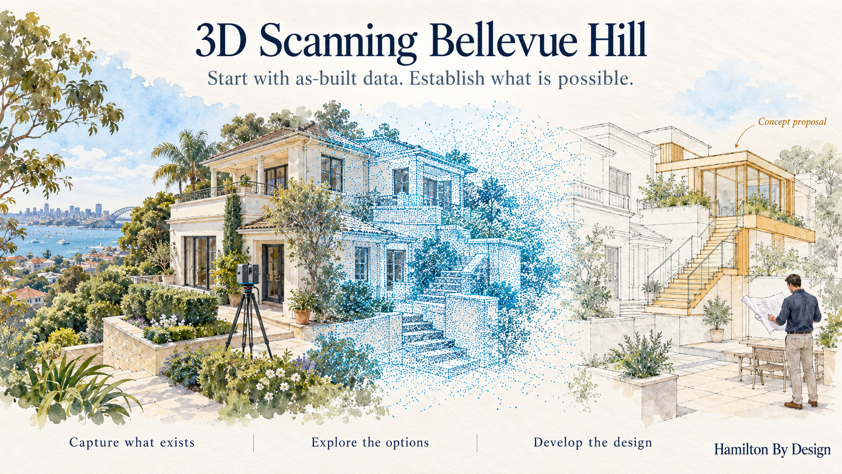

Planning changes to your Bellevue Hill property starts with understanding what is already there. Before developing a new layout, replacing a staircase or designing an extension, as-built data provides the measured foundation needed to explore what is possible.
Existing drawings may show the original design, but buildings change over time. Renovations, altered openings, different floor levels and undocumented additions can leave a gap between the drawings and the property as it stands today.
3D scanning in Bellevue Hill helps close that gap. By recording accessible, visible building surfaces, laser scanning creates a three-dimensional point cloud that your project team can use to understand existing geometry and develop proposed changes.
Understand Your Property Before Designing Changes
A renovation idea might begin with a simple question:
- Can we fit a new staircase into the existing space?
- Could the ground floor layout work better?
- How would an extension connect to the existing building?
- Is there sufficient clearance for new equipment or services?
- Will a proposed balcony, balustrade or architectural feature fit?
Answering these questions requires more than an approximate room size. Designers need to understand how walls, floors, ceilings, openings and adjoining spaces relate to one another.
An as-built scan provides that spatial context. It helps your architect, designer, engineer and builder assess options against measured existing conditions.
Establish the existing geometry first, then develop the design around it.
What Can 3D Laser Scanning Capture?
Depending on access and the agreed scope, a property scan can record:
- Internal room geometry and wall positions.
- Floor surfaces and changes in level.
- Ceiling heights and visible beams.
- Doorways, windows and other openings.
- Existing stairs, landings and surrounding spaces.
- External façades and accessible roof surfaces.
- Balconies, terraces and courtyard geometry.
- Visible pipework, ductwork and plant.
- Connections between existing buildings and proposed work areas.
The scans are combined into a registered point cloud, allowing the captured spaces to be reviewed together.
This is particularly useful when a project involves several levels or alterations that must connect accurately with an existing building.
Establish What Fits Before Committing to Construction
A proposed design can look convincing on paper while overlooking a constraint in the existing property.
For example, a replacement staircase must work within the available opening and connect with the actual floor levels. Its position also affects nearby doors, circulation space and overhead clearance.
Scanning the staircase area early gives the design team a measured reference for testing the proposal. Potential conflicts can then be identified while the design is still being developed.
The same approach applies to custom joinery, glazing, steelwork and other components that must fit into an existing space. Working from measured geometry can reduce uncertainty before fabrication, with critical dimensions verified to the tolerances required for the installation.
Support Renovations and Extensions in Bellevue Hill
For homeowners planning alterations in Bellevue Hill, as-built scanning can support several stages of a project.
Early feasibility and concept design
Captured geometry helps designers compare layout options and understand the space available. It provides a practical starting point for discussing what could change and where further investigation is needed.
Detailed design and coordination
As the proposal develops, the point cloud can help the project team coordinate new work with existing walls, floors, openings and visible services.
Fabrication and installation planning
Where new components interface with the existing building, scan data can support modelling, detailing and fit checks. The capture method and verification requirements should be agreed around the intended use.
Recording completed work
A further scan can document accessible completed geometry and support comparisons with the design where this forms part of the project scope.
From Point Cloud to Useful Drawings and Models
A point cloud is the starting dataset. Its value comes from how it is used.
Some project teams can work directly with the scan data. Others need selected geometry converted into CAD drawings or a 3D model.
Hamilton By Design combines terrestrial LiDAR scanning, point cloud processing and optional CAD modelling and drafting to support design and verification workflows. Learn more about our 3D point cloud scanning services in Sydney.
For your Bellevue Hill project, the required outputs should be agreed before scanning. These may include a registered point cloud, selected as-built drawings or a model of the areas relevant to the proposed work.
Defining the deliverables early helps ensure the information is useful to the people making the design decisions.
Match the Scanning Scope to the Project
The right scanning scope depends on what you are planning.
A staircase replacement may need detailed capture of the stairwell, adjoining landings and floor connections. A larger renovation may require several rooms, external elevations and surrounding access areas.
Before capture, useful questions include:
- What changes are being considered?
- Which existing surfaces and connections affect the design?
- Who will use the data?
- What file formats do they need?
- Which dimensions are critical?
- Are any areas concealed or difficult to access?
These questions help determine the scan coverage, level of detail and additional checks required.
What Does a Scan Tell You About Feasibility?
3D scanning helps establish geometric feasibility: the space available, the position of visible features and how proposed work might fit.
Other aspects of feasibility require specialist assessment. A scan does not reveal concealed reinforcement, establish structural capacity or determine planning approval requirements. Those questions need input from the relevant project professionals.
Providing them with clear existing-condition data helps make their assessment better informed.
Frequently Asked Questions
Should I scan my property before renovation drawings are prepared?
Scanning early can provide a measured reference for concept design and reduce reliance on outdated drawings. The scope should be discussed with your designer so the right areas are captured.
Can scanning help with a new staircase?
Yes. It can record the accessible stairwell, floor connections and surrounding geometry to support design development. Stair design and compliance checks remain part of the appropriate design review.
Can you scan only part of a property?
Yes. A focused scope can target the rooms, façades or interfaces relevant to the proposed changes.
Does laser scanning see through walls?
No. Terrestrial laser scanning records surfaces visible to the scanner. Concealed spaces require access or a separate investigation method.
Can scan data be used to create CAD drawings?
Yes. Selected captured geometry can be converted into drawings or models, with the required detail and outputs agreed before work begins.
Start Your Bellevue Hill Project with Measured Existing Conditions
Before investing in detailed design, establish a clear record of your property as it stands today.
3D scanning in Bellevue Hill provides the as-built foundation for exploring layouts, checking interfaces and planning alterations with greater confidence.
Contact Hamilton By Design to discuss your property, the changes you are considering and the data your project team needs.
Capture what exists. Understand the constraints. Establish what is possible.

Contact Us – Talk To Us
Our clients:

























Related 3D Scanning Services in Sydney
Planning alterations to your Bellevue Hill property? Explore Hamilton By Design’s Sydney scanning services for capturing existing conditions, developing digital models and supporting construction planning.
3D Point Cloud Scanning in Sydney
Capture visible existing geometry as a registered point cloud. Establish a measured reference for reviewing spaces, clearances and connections before developing proposed alterations.
Explore point cloud scanning →3D Construction Scan in Sydney
Use terrestrial LiDAR scanning to document site geometry and support construction coordination, as-built records and checks between proposed work and existing conditions.
Explore construction scanning →Reality Capture Sydney
Create a digital record of an existing property before refurbishment or extension design begins. Captured geometry helps project teams understand constraints and assess design options.
Explore reality capture →3D Point Cloud Modelling in Sydney
Develop selected scan geometry into usable 3D models. Support design reviews, clearance checks and coordination between existing features and proposed additions.
Explore point cloud modelling →Sydney 3D LiDAR Scanning
Record accessible building surfaces and site features using LiDAR scanning. Provide your project team with existing-condition data for planning, design and verification.
Explore Sydney LiDAR scanning →3D Scanning & BIM Across Greater Sydney
Discover how captured existing conditions can support building information modelling and coordination. Align the required model scope with your design team’s project needs.
Explore scanning and BIM →3D Scanning and LiDAR Modelling for Sydney Construction
Explore how scanning and modelling support Sydney construction and refurbishment projects, including the Eastern Suburbs. Identify potential clashes and interfaces during design development.
Read about scanning for construction →3D Scanning Sydney – LiDAR & Scan to CAD
Connect site capture with CAD drawings and modelling. Explore the workflow from measured existing conditions to practical information for design and project delivery.
Explore LiDAR and Scan to CAD →