Reality Capture in the Hunter Valley

The Hunter Valley is one of Australiaโ€™s most technically complex industrial regions, combining power generation, mining, bulk materials handling, manufacturing, and logistics infrastructure within a tightly interconnected operational landscape. Projects in this environment frequently involve legacy assets, constrained access, and high consequences for design or construction error.

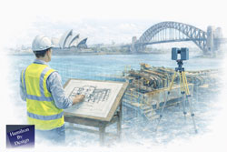
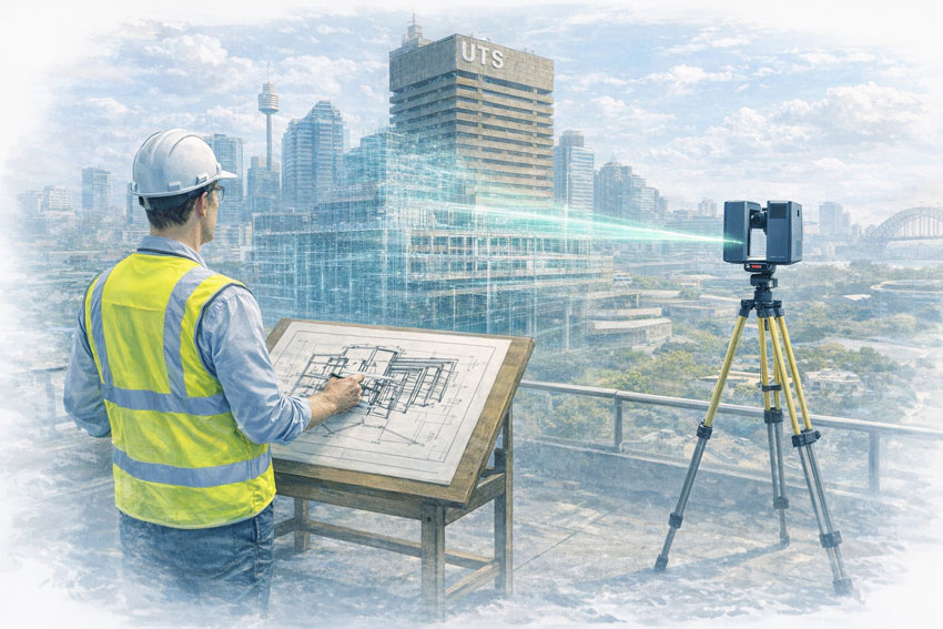
Reality capture in the Hunter Valley provides a structured, engineering-led method for documenting existing conditions using measured data rather than assumption-based interpretation. At Hamilton By Design, reality capture is applied as part of a broader engineering workflowโ€”ensuring captured information directly supports design development, upgrade planning, fabrication coordination, and risk management.


Defining reality capture in an industrial context

Reality capture is the process of recording physical site conditions using spatially accurate technologies and converting that information into usable engineering references. In practical terms, this includes:

  • Engineering-grade laser scanning and LiDAR acquisition
  • Spatial data registration and validation
  • Interpretation of existing geometry in the context of mechanical and structural systems
  • Translation of measured data into drawings, models, and coordination outputs

The objective is not simply to visualise a site, but to create a reliable, defensible representation of existing conditions that can be used throughout the project lifecycle.

For projects where laser scanning forms the core capture method, refer to:
3D Laser Scanning
https://www.hamiltonbydesign.com.au/home/3d-lidar-scanning-digital-quality-assurance/3d-laser-scanning/


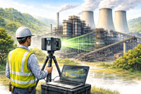
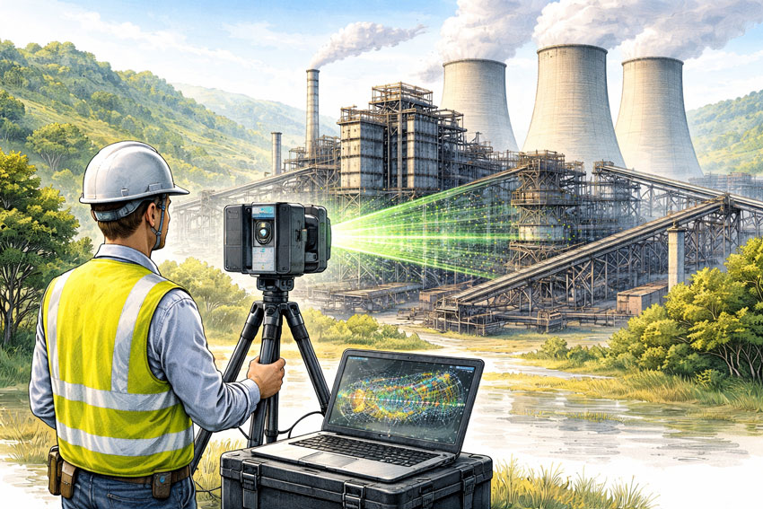
Why reality capture is critical in the Hunter Valley

Industrial facilities across the Hunter Valley often operate continuously while upgrades, modifications, and expansions are undertaken. Common project challenges include:

  • Brownfield environments with incomplete or outdated documentation
  • Complex interfaces between mechanical, structural, and civil systems
  • Fabrication occurring off-site with limited tolerance for dimensional error
  • Restricted access windows and safety-critical operating conditions

In these scenarios, traditional measurement approaches are often insufficient. Reality capture reduces uncertainty by establishing a single source of measured truth, enabling informed decisions before fabrication or installation begins.

For an overview of how scanning is applied to regional industry, see:
3D Scanning for Industrial Projects in Newcastle and the Hunter Valley
https://www.hamiltonbydesign.com.au/3d-scanning-for-industrial-projects-in-newcastle-and-the-hunter-valley/


Typical Hunter Valley applications

Existing-condition baselining

Reality capture provides accurate documentation where legacy drawings no longer reflect actual site conditions. This baseline supports engineering assessments, upgrade feasibility studies, and staged project planning.

Plant upgrades and retrofit works

Measured spatial data allows new systems to be designed around existing plant, services, and structures, reducing clash risk and rework during installation.

Fabrication and construction coordination

Accurate capture of interfaces, clearances, and connection points improves alignment between design intent and fabricated componentsโ€”particularly where fabrication is completed remotely.

Risk reduction and decision support

From an engineering governance perspective, reality capture improves information quality, reduces assumptions, and supports more defensible technical decisions.


Engineering-led reality capture methodology

Hamilton By Design approaches reality capture as a project-specific engineering activity, not a generic surveying exercise.

1. Scope definition aligned to outcomes

Capture scope is defined based on how the data will be usedโ€”design development, drafting, verification, or coordinationโ€”ensuring the level of detail and accuracy is appropriate.

2. Structured site data acquisition

Capture activities are planned to manage occlusion, access limitations, and operational constraints commonly encountered on Hunter Valley industrial sites.

3. Data validation and preparation

Captured datasets are reviewed, registered, and structured so they can be confidently used for engineering interpretation rather than remaining as raw data.

4. Engineering-ready deliverables

Where required, reality capture outputs are converted into:

  • As-built drawings
  • General arrangement layouts
  • Reference models for coordination
  • Documentation suitable for engineering review and approvals

Relationship between reality capture and laser scanning

While laser scanning and LiDAR are commonly used tools within reality capture, the distinction lies in how the data is applied. Laser scanning provides the measurements; reality capture ensures those measurements are contextualised, validated, and integrated into engineering workflows.

This distinction is particularly important in industrial regions such as the Hunter Valley, where inaccurate interpretation of spatial data can have significant cost and safety implications.


Value for Hunter Valley stakeholders

Reality capture supports multiple stakeholder groups:

  • Asset owners and operators gain confidence in upgrade planning
  • Engineers work from verified existing-condition data
  • Fabricators receive clearer interface definitions
  • Project teams reduce site disruption and variation risk

From a systems engineering perspective, this represents an improvement in information reliability and traceabilityโ€”both key drivers of project performance.


Regional capability and service coverage

Hamilton By Design services the Hunter Valley as part of its broader NSW engineering and reality capture capability, supporting projects across industrial, energy, and infrastructure sectors.

Service coverage includes Newcastle and the wider Hunter region, as outlined in:
Frequently Asked Questions โ€“ Service Areas
https://www.hamiltonbydesign.com.au/frequently-asked-questions/


Next steps

For Hunter Valley projects, effective reality capture begins by clearly defining:

  1. Which areas and interfaces require measurement
  2. What engineering decisions the data must support
  3. The required accuracy for design, fabrication, or verification

Once these parameters are established, reality capture can be aligned to project risk, schedule, and delivery requirements.

For scanning-focused services, return to:
3D Laser Scanning
https://www.hamiltonbydesign.com.au/home/3d-lidar-scanning-digital-quality-assurance/3d-laser-scanning/

For industrial scanning examples in the region, see:
3D Scanning for Industrial Projects in Newcastle and the Hunter Valley
https://www.hamiltonbydesign.com.au/3d-scanning-for-industrial-projects-in-newcastle-and-the-hunter-valley/

3D LiDAR scanning and 3D modelling service button โ€” laser scanner capturing a point cloud for engineering and CAD modelling
Mechanical engineering services

Our clients:

Name
Would you like us to arrange a phone consultation for you?
Address

Engineering Confidence in South Yarra, Melbourne

LiDAR scanning Melbourne

Melbourne has long been recognised as one of Australiaโ€™s most advanced engineering and manufacturing centres, and inner-city hubs such as South Yarra sit at the intersection of design, industry, infrastructure, and innovation. As projects become more complex and timelines more compressed, engineering teams are increasingly seeking partners who can reduce uncertainty, improve accuracy, and provide reliable technical insight from day one.

This is where Hamilton By Design delivers genuine value.

Hamilton By Design operates as an engineer-led consultancy focused on precision, constructability, and real-world outcomes. Rather than working from assumptions or incomplete information, the business is built around capturing existing conditions accurately and transforming that data into practical engineering deliverables that support confident decision-making.

Moving Beyond Assumptions in Modern Engineering

Many engineering challenges in metropolitan Melbourne are not greenfield projects. They involve existing buildings, operating facilities, constrained spaces, legacy assets, or staged upgrades that must integrate seamlessly with what is already in place. In these environments, relying on outdated drawings or manual measurements introduces risk โ€” misalignment, clashes, rework, and delays that can quickly erode budgets and schedules.

Hamilton By Design addresses this challenge by placing reality capture and engineering validation at the front end of projects. This ensures that every downstream decision is based on what truly exists on site, not what is assumed to exist.

For engineering teams working in and around South Yarra โ€” whether supporting manufacturing, infrastructure, plant upgrades, or specialist facilities โ€” this approach significantly reduces technical risk and increases confidence across all stakeholders.

LiDAR Scanning as a Foundation for Accuracy

A key capability that differentiates Hamilton By Design is its use of engineering-grade LiDAR scanning. Unlike traditional surveys that capture selective points, LiDAR scanning records millions of measurements across an entire environment, producing a high-resolution digital representation of buildings, plant, structures, and surrounding context.

This data becomes a reliable reference point for engineers, designers, fabricators, and project managers alike.

LiDAR scanning enables:

  • Accurate capture of complex geometries and tight spaces
  • Clear identification of spatial constraints and interfaces
  • Early detection of clashes and access issues
  • Reduced need for repeat site visits
  • Improved coordination between disciplines

By converting physical assets into precise digital data, Hamilton By Design helps teams eliminate ambiguity and work from a single source of truth.

From Scan Data to Engineering Outcomes

Importantly, Hamilton By Design does not operate as a scanning-only service. The real value lies in how scan data is interpreted, validated, and converted into engineering outputs that directly support delivery.

Scan information is used to develop structured models, layouts, and documentation that reflect real-world conditions. This supports engineering activities such as:

  • Mechanical and structural modifications
  • Plant upgrades and equipment integration
  • Space planning and layout optimisation
  • Fabrication and installation planning
  • Asset documentation and as-built records

Because the work is led by experienced engineers, the focus is always on what needs to be built, installed, or modified, not just on creating visually impressive models.

Supporting Engineering Teams and Decision-Makers

In a business and engineering environment like South Yarra โ€” where projects are often time-sensitive and commercially driven โ€” external engineering support must be reliable, efficient, and technically sound.

Hamilton By Design integrates smoothly with internal teams, consultants, and contractors, providing additional technical depth without adding unnecessary complexity. The consultancy model is deliberately structured to support decision-makers who need clarity, not noise.

This means:

  • Clear communication of constraints and risks
  • Practical recommendations grounded in real site data
  • Deliverables aligned with fabrication and construction needs
  • Engineering documentation that supports approval and execution

The result is fewer surprises downstream and a smoother path from concept through to implementation.

Engineering for Brownfield and Live Environments

One of the most challenging aspects of modern engineering is working within live or brownfield environments โ€” facilities that cannot simply shut down for measurement, redesign, or rework. In these settings, accuracy and planning are critical.

Hamilton By Designโ€™s LiDAR-driven workflows are particularly well suited to these conditions. Rapid data capture minimises disruption on site, while the detailed digital record allows engineering work to continue remotely with confidence.

This approach supports safer planning, better coordination, and reduced exposure to operational risk โ€” outcomes that are highly valued by engineering leaders and project managers alike.

A Practical, Engineer-Led Philosophy

At its core, Hamilton By Design operates on a simple but powerful principle: engineering should be grounded in reality. By combining high-accuracy site data with deep engineering experience, the consultancy helps organisations make informed decisions, avoid costly mistakes, and deliver projects that work the first time.

For organisations operating in South Yarra and the broader Melbourne region, this means access to an engineering partner who understands both the technical and commercial pressures of modern project delivery.

Engineering Certainty in a Complex World

As engineering projects continue to increase in complexity, the margin for error continues to shrink. Those who invest early in accurate data and sound engineering judgement gain a clear advantage โ€” fewer delays, lower risk, and better outcomes.

Hamilton By Design provides that advantage by bridging the gap between the physical site and the engineering office. Through precise LiDAR scanning, practical engineering insight, and a strong focus on constructability, the consultancy supports confident, efficient, and reliable project delivery across Melbourneโ€™s most demanding environments.

LiDAR scanning Melbourne

Hamilton By Design logo displayed on a blue tilted rectangle with a grey gradient background
3D LiDAR scanning and 3D modelling service button โ€” laser scanner capturing a point cloud for engineering and CAD modelling
Mechanical engineering services

Our clients:

Name
Would you like us to arrange a phone consultation for you?
Address
3D LiDAR scanning and 3D modelling service button โ€” laser scanner capturing a point cloud for engineering and CAD modelling
Mechanical engineering services
Finite Element Analysis (FEA) engineering simulation button
Mechanical engineering services

3D Point Cloud Modelling in Sydney

Engineer-led reverse engineering with 3D scanning and drafting overlooking Sydney Harbour and the Harbour Bridge

Engineering-Grade Digital Models Built from Reality

Across Sydney and the wider metropolitan region, engineering and construction projects increasingly depend on accurate digital representations of existing assets. As buildings become more complex and retrofit-driven, the gap between outdated drawings and on-site reality continues to widen. 3D Point Cloud Modelling in Sydney bridges this gap by transforming high-accuracy laser scan data into usable, engineering-ready digital models.

Hamilton By Design provides engineering-led 3D point cloud modelling services, converting LiDAR scan data into structured CAD models that support design, fabrication, verification, and asset management.


What Is 3D Point Cloud Modelling?

A point cloud is a dense collection of millions of spatially accurate points captured using terrestrial LiDAR laser scanning. Each point contains X, Y, Z coordinates and, where required, colour information.

3D point cloud modelling is the process of:

  • Interpreting scan data
  • Extracting relevant geometry
  • Converting raw points into structured 3D CAD models and drawings

Unlike visual-only models, engineering-grade point cloud modelling focuses on accuracy, constructability, and downstream usability.


3D laser scanning in Sydney with an engineer capturing as-built conditions using LiDAR technology.

3D LiDAR scanning and 3D modelling service button โ€” laser scanner capturing a point cloud for engineering and CAD modelling
Mechanical engineering services

Why 3D Point Cloud Modelling Is Critical in Sydney

Sydneyโ€™s built environment presents unique challenges:

  • High-density commercial buildings
  • Congested mechanical and electrical services
  • Limited access and live operational sites
  • A significant volume of ageing and undocumented assets

Traditional surveying and legacy drawings often fail to capture the true complexity of these environments. Point cloud modelling provides a single source of spatial truth, enabling engineers and designers to work with confidence.


Engineering-Led Point Cloud Modelling at Hamilton By Design

At Hamilton By Design, point cloud modelling is not treated as a drafting exercise. It is an engineering process.

Our workflow typically includes:

  • Engineer-supervised LiDAR scanning using high-accuracy terrestrial scanners
  • Controlled point cloud registration and validation
  • Interpretation of scan data by mechanical engineers
  • CAD modelling aligned with design, fabrication, and FEA requirements

This ensures the final model reflects engineering intent, not just geometry.


Typical Applications of 3D Point Cloud Modelling in Sydney

Mechanical and Services Modelling

One of the most common applications in Sydney is modelling of:

  • HVAC ductwork
  • Pipework and valves
  • Fire and hydraulic services
  • Electrical and cable tray systems

Accurate service models allow for:

  • Retrofit and upgrade design
  • Clash detection and coordination
  • Prefabrication planning

Plant Rooms and Industrial Spaces

Point cloud modelling is widely used for:

  • Basement and rooftop plant rooms
  • Mechanical equipment upgrades
  • Structural frames and access platforms

Models generated from scan data support fit-first-time design, reducing site rework and downtime.

Commercial Building As-Builts

For refurbishment and asset documentation, point cloud modelling delivers:

  • Accurate floor layouts
  • Structural elements
  • Ceiling and penetration data

These models form the foundation for architectural, structural, and mechanical design.

Construction Verification and Digital QA

Point cloud models are increasingly used for:

  • Installed versus design comparisons
  • Fit-up verification before fabrication
  • Quality assurance reporting

This provides a defensible digital record of site conditions at a specific point in time.


CAD Platforms and Deliverables

Hamilton By Design produces point cloud models and outputs suitable for:

  • SolidWorks-based mechanical design
  • Fabrication drawings and BOMs
  • FEA and structural assessments
  • IFC and exchange formats for multidisciplinary coordination

Deliverables can include:

  • Registered point cloud files
  • Fully modelled 3D CAD assemblies
  • GA drawings, sections, and details
  • Measurement and verification reports

Benefits of 3D Point Cloud Modelling

For Sydney projects, the benefits are tangible:

  • Reduced clashes and design uncertainty
  • Improved coordination across disciplines
  • Fewer site variations and rework
  • Faster design-to-fabrication cycles
  • Greater confidence in retrofit and brownfield projects

By working from reality rather than assumptions, teams make better decisions earlier.


Why Choose Hamilton By Design in Sydney

Hamilton By Design offers a single-source workflow that combines:

  • High-accuracy LiDAR scanning
  • Expert point cloud interpretation
  • Mechanical engineering design
  • Fabrication-ready documentation

This integrated approach ensures point cloud models are practical, accurate, and fit for purpose, not just visually impressive.


Hamilton By Design logo displayed on a blue tilted rectangle with a grey gradient background

3D Point Cloud Modelling in Sydney

Whether supporting a CBD refurbishment, a plant room upgrade, or a complex services retrofit, 3D Point Cloud Modelling in Sydney provides a reliable foundation for engineering design.

Hamilton By Design delivers models that engineers, builders, and fabricators can trust โ€” because they are built from reality, with engineering intent embedded from the start.


Industries We Support

Point cloud modelling services are regularly used across manufacturing facilities, industrial plants, commercial buildings, hospitals, rail infrastructure and data centres throughout Sydney.

Hamilton By Design transforms registered point cloud data into accurate 3D models that support engineering design, clash detection, as-built verification and digital asset management.


Blue banner graphic displaying the text "Point Cloud to CAD - Australia" in large white lettering, representing point cloud processing, scan-to-CAD conversion and digital engineering services across Australia.
Blue banner graphic displaying the text "Scan to CAD Sydney" in large white lettering, representing engineering-led point cloud to CAD conversion, LiDAR scanning and digital engineering services in Sydney.
Blue banner graphic displaying the text "Reality Capture Sydney - CBD" in large white lettering, representing engineering-led reality capture, LiDAR scanning and digital engineering services within Sydney CBD commercial buildings and infrastructure.

Related Sydney Services

Hamilton By Design provides engineering-led 3D scanning, LiDAR scanning, mechanical engineering and digital engineering services throughout Sydney and Greater Sydney.

Explore our related Sydney services:


  • 3D Scanning Sydney โ€“ Engineering-grade terrestrial laser scanning, as-built surveys and point cloud capture for industrial, infrastructure and commercial projects.
  • Reality Capture Sydney โ€“ High-accuracy reality capture, digital twins, asset documentation and engineering-grade site verification.
  • Scan to CAD Sydney โ€“ Convert point cloud data into AutoCAD, SolidWorks, Inventor and other engineering-ready CAD deliverables.
  • Point Cloud Modelling Sydney โ€“ Engineering-grade point cloud processing, clash detection, as-built verification and 3D modelling.
  • Mechanical Engineering Sydney โ€“ Mechanical design, plant upgrades, materials handling systems, conveyors, chutes, platforms and engineering support.
  • Structural Drafting Sydney โ€“ Structural steel drafting, fabrication drawings, GA drawings, workshop detailing and as-built documentation.

Hamilton By Design supports projects throughout Sydney CBD, Parramatta, Liverpool, Penrith, Blacktown, Chatswood, Alexandria, Mascot, Newcastle and the Central Coast.

Hamilton By Design provides point cloud modelling services throughout Sydney CBD, Parramatta, Liverpool, Penrith, Chatswood, Alexandria, Mascot, Newcastle and the Central Coast. We transform LiDAR scan data into accurate 3D models that support engineering design, clash detection, asset verification and project delivery.

Our Clients

Name
Would you like us to arrange a phone consultation for you?
Address

Blue banner graphic displaying the text "Point Cloud to CAD - Australia" in large white lettering, representing point cloud processing, scan-to-CAD conversion and digital engineering services across Australia.
Blue banner graphic displaying the text "Scan to CAD Sydney" in large white lettering, representing engineering-led point cloud to CAD conversion, LiDAR scanning and digital engineering services in Sydney.
Blue banner graphic displaying the text "Reality Capture Sydney - CBD" in large white lettering, representing engineering-led reality capture, LiDAR scanning and digital engineering services within Sydney CBD commercial buildings and infrastructure.

3D CAD Modelling Australia service banner for Hamilton By Design


CHPP Engineering title graphic featuring bold white text reading "CHPP Engineering" centred on a blue rounded rectangle background.
Pipework Drafting title graphic featuring bold white text reading "Pipework Drafting" centred on a blue rounded rectangle background.
3D LiDAR Scanning for Engineering Projects title graphic featuring bold white text on a blue rounded rectangle background.


Finite Element Analysis (FEA) engineering simulation button
Structural drafting services button
Mechanical drafting services button


Australian Drafting logo featuring bold white text reading "Australian Drafting" centred on a blue rounded rectangle background.
Engineering Governance title graphic featuring bold white text reading "Engineering Governance" centred on a blue rounded rectangle background.
Engineering-Grade LiDAR Scanning title graphic featuring bold white text on a blue rounded rectangle background.


Mechanical drafting services button
Structural drafting services button


Fabrication and product design services
3D CAD Modelling Australia service banner for Hamilton By Design
Mechanical, Structural & Pipework Drafting service banner by Hamilton By Design featuring white text on a blue background.


3D LiDAR scanning and 3D modelling service button โ€” laser scanner capturing a point cloud for engineering and CAD modelling
Mechanical engineering services

3D Scanning Engineering in Orange

3D Scanning Engineering in Orange

Orange is one of Australiaโ€™s most distinctive regional cities. Set high on the Central Tablelands, it combines a cool-climate environment with major health, education, agriculture, infrastructure, and mining-services activity. Engineering in Orange is shaped by altitude, frost, diverse industries, and a mix of modern and legacy assetsโ€”making accuracy, coordination, and practical design essential.

Hamilton By Design supports projects in and around Orange by combining 3D LiDAR laser scanning, mechanical and structural engineering, 3D CAD modelling, FEA, and fabrication-ready drafting. Our approach focuses on capturing real site conditions and turning them into buildable, engineering-approved outcomes.

Engineering challenges in a high-altitude regional city

Unlike many inland centres, Orangeโ€™s elevation brings colder temperatures, frost, and greater thermal movement. At the same time, the city supports critical assets such as hospitals, utilities, agricultural processing facilities, and infrastructure that must remain operational.

Engineering teams commonly deal with:

  • Brownfield sites with assets added over decades
  • Incomplete or outdated drawings
  • Tight staging requirements around live facilities
  • A need for conservative, reliable design

In this environment, assumptions introduce risk. Accurate as-built data is the foundation of successful projects.

3D Laser Scanning for Orange projects

Hamilton By Design uses high-accuracy 3D Laser Scanning to capture the true as-built condition of sites across Orange and the Central Tablelands. Laser scanning records millions of precise measurements, creating a detailed digital record of buildings, plant, structures, and surrounding interfaces.

3D laser scanning is particularly valuable in Orange for:

  • Health, education, and public infrastructure upgrades
  • Industrial and agricultural processing facilities
  • Mining-support and utilities assets
  • Sites where drawings no longer reflect reality

Scanning is typically completed during short, controlled site visits, minimising disruption while delivering data that can be relied on throughout the project.

Turning scan data into accurate 3D models

Once scanning is complete, the data is processed and converted into detailed 3D CAD Modelling. These models represent what actually exists on siteโ€”not what historic documentation suggests.

For Orange projects, scan-based 3D modelling supports:

  • Mechanical upgrades and equipment replacements
  • Structural additions such as platforms, supports, and access ways
  • Integration of new assets into existing facilities
  • Long-term digital records for future maintenance and expansion

Accurate models reduce uncertainty and allow design decisions to be made early and with confidence.

Mechanical and structural engineering built on real conditions

Engineering in Orange often involves coordinating multiple disciplines across constrained or operational sites. Working from scan-derived models allows engineers to:

  • Understand existing load paths and constraints
  • Check clearances and access early in the design
  • Coordinate mechanical and structural elements in a single environment

This leads to designs that are practical, buildable, and aligned with how assets are actually usedโ€”particularly important in a climate-affected region.

FEA to support performance and compliance

Where performance, safety, or compliance is critical, Hamilton By Design applies FEA Capabilities to support engineering decisions.

Finite Element Analysis is commonly used to:

  • Check structural capacity under operational and environmental loads
  • Assess modifications to existing steel and concrete
  • Review fatigue, vibration, and deflection
  • Support engineering approval and sign-off

Using FEA on scan-based geometry provides confidence that designs will perform as intended in real operating conditions.

Easy-to-build fabrication drawings with engineering approval

Clear documentation is essential for efficient constructionโ€”particularly in regional locations where rework can be costly. Hamilton By Design produces fabrication-ready Drafting directly from coordinated 3D models.

Typical deliverables include:

  • General arrangement and detail drawings
  • Fabrication and installation drawings
  • Engineering-reviewed and approval-ready documentation

This focus on clarity and constructability helps fabricators and contractors build accurately the first time.

Reducing risk through digital engineering

By capturing site conditions once and completing the majority of engineering off site, projects in Orange benefit from:

  • Reduced site visits and travel costs
  • Improved safety outcomes
  • Better coordination before fabrication
  • Fewer surprises during installation

This approach aligns well with Orangeโ€™s role as a regional hub supporting diverse industries across central NSW.

Hamilton By Design logo displayed on a blue tilted rectangle with a grey gradient background
3D LiDAR scanning and 3D modelling service button โ€” laser scanner capturing a point cloud for engineering and CAD modelling
Mechanical engineering services

Supporting Orange with practical, buildable engineering

Orangeโ€™s strength lies in its balanceโ€”health, agriculture, infrastructure, mining services, and community all intersect here. Hamilton By Designโ€™s integrated scanning and engineering workflow supports this complexity by delivering accurate data, sound engineering judgement, and clear documentation.

3D Scanning Engineering in Orange is about turning real-world site conditions into clear, buildable engineering outcomes that support growth, reliability, and long-term performance across the region.


Our clients:

Name
Would you like us to arrange a phone consultation for you?
Address
Finite Element Analysis (FEA) engineering simulation button
Mechanical engineering services

3D Scanning Engineering in Traralgon

Engineer using 3D LiDAR laser scanning to capture a power plant in the Latrobe Valley for engineering and as-built documentation.

3D Scanning Engineering in Traralgon

Traralgon sits at the centre of the Latrobe Valley โ€” one of Australiaโ€™s most significant energy and industrial regions. For decades, the area supported large-scale power generation and heavy infrastructure. Today, Traralgon is at the frontline of energy transition, where legacy assets, decommissioning works, rehabilitation, and new infrastructure all coexist.

Engineering in this environment is rarely simple. Projects often involve ageing plant, undocumented modifications, strict safety requirements, and high public scrutiny. Getting the data right up front is critical.

Hamilton By Design supports Traralgon projects with engineering-led 3D LiDAR laser scanning, mechanical and structural engineering, 3D modelling, FEA, and easy-to-build fabrication drawings with engineering approval, helping asset owners and contractors reduce risk and move confidently from concept to construction.


Engineering in Traralgon: Legacy Assets and Future Infrastructure

Most engineering work in Traralgon is brownfield by default. Typical projects include:

  • Power station and energy-related infrastructure
  • Decommissioning and staged demolition works
  • Industrial plant upgrades and repurposing
  • Transmission, substations, and supporting structures

Many assets were designed to older standards and modified repeatedly over decades. Accurate as-built information, conservative engineering judgement, and clear documentation are essential to safely manage change.


Engineer performing 3D laser scanning of an industrial power plant in the Latrobe Valley.

3D Laser Scanning for Traralgon Sites

High-accuracy 3D LiDAR laser scanning provides the foundation for safe and efficient engineering in Traralgon.

Hamilton By Design captures precise as-built data for:

  • Large industrial plant and energy infrastructure
  • Structural steel, conveyors, platforms, and access ways
  • Decommissioning and rehabilitation sites
  • Assets with limited, outdated, or unreliable drawings

3D scanning records the true as-built condition โ€” including deformation, misalignment, corrosion loss, and undocumented changes โ€” without disrupting live operations.

This enables:

  • Reduced assumptions in high-risk environments
  • Better planning for shutdowns and staged works
  • Safer decommissioning and modification strategies
  • Lower fabrication and installation risk

Learn more about our scanning services here:
3D Laser Scanning


3D Modelling from Real As-Built Data

From the point cloud, Hamilton By Design develops accurate 3D CAD models that reflect what actually exists on site โ€” not what legacy drawings suggest.

Our 3D modelling services support:

  • Brownfield upgrades and plant modifications
  • Decommissioning and dismantling planning
  • Clash detection between new and existing systems
  • Modular design and construction sequencing
  • Digital asset records for future redevelopment

In Traralgonโ€™s complex industrial environment, modelling from real data significantly reduces safety, cost, and schedule risk.

Explore our modelling capability:
3D CAD Modelling


FEA for Verification of Existing and Modified Assets

Traralgon engineering frequently involves verifying old assets under new conditions. Finite Element Analysis (FEA) plays a critical role in understanding real structural behaviour.

Hamilton By Design applies FEA to:

  • Assess structural capacity and load paths
  • Check deflection, fatigue, and buckling
  • Verify temporary and permanent works
  • Support strengthening, reuse, or staged demolition decisions

By analysing as-built geometry, FEA provides more reliable insight โ€” essential when working with large, safety-critical infrastructure.

Learn more about our analysis services:
FEA Capabilities


Easy-to-Build Fabrication Drawings with Engineering Approval

Clear, practical documentation is vital for Traralgon projects, where fabrication, installation, and demolition often occur in high-risk environments.

Hamilton By Design delivers easy-to-build fabrication and installation drawings, including:

  • General arrangement drawings
  • Fabrication and workshop details
  • Installation, lifting, and staging layouts
  • As-built documentation

Drawings are produced directly from scanned data and validated 3D models and can be issued with engineering approval, giving contractors confidence that what is built or modified will fit, function, and comply.

View our drafting services here:
Drafting Services


Hamilton By Design logo displayed on a blue tilted rectangle with a grey gradient background

Why Hamilton By Design in Traralgon?

Hamilton By Design provides a single, engineering-led digital workflow โ€” from site capture through to modelling, analysis, and construction documentation.

For Traralgon clients, this means:

  • Reduced risk on complex brownfield and transition sites
  • Better decision-making before shutdowns or demolition works
  • Designs grounded in real site conditions
  • Fabrication-ready drawings backed by engineering sign-off

Whether youโ€™re modifying legacy energy infrastructure, planning decommissioning works, or developing the next generation of industrial assets, Hamilton By Design delivers accurate, practical, and build-ready engineering solutions tailored to Traralgonโ€™s unique challenges.

Our clients


Name
Would you like us to arrange a phone consultation for you?
Address
3D LiDAR scanning and 3D modelling service button โ€” laser scanner capturing a point cloud for engineering and CAD modelling
Mechanical engineering services
Finite Element Analysis (FEA) engineering simulation button
Mechanical engineering services

3D Scanning Engineering in Warrnambool

3D Scanning Engineering in Warrnambool

Warrnambool is one of Victoriaโ€™s most demanding engineering environments. Sitting on the edge of the Southern Ocean, it combines harsh coastal exposure, food-grade industrial processing, and its role as the service hub for south-west Victoria. Engineering here must perform reliably in salt air, strong winds, and wet conditions โ€” often with very limited tolerance for downtime.

In this setting, assumptions are costly. Accurate as-built data, practical engineering judgement, and buildable documentation are essential.

Hamilton By Design supports Warrnambool projects with engineering-led 3D LiDAR laser scanning, mechanical and structural engineering, 3D modelling, FEA, and easy-to-build fabrication drawings with engineering approval, providing confidence from site capture through to construction.


Engineering in Warrnambool: Coastal, Food-Grade, and Reliability-Driven

Most engineering work in Warrnambool is brownfield and operationally critical. Typical projects involve:

  • Dairy and food-processing facilities operating year-round
  • Cold storage, refrigeration, and export infrastructure
  • Port-adjacent and coastal assets exposed to salt spray
  • Regional infrastructure that must work in bad weather

Future pressures around corrosion management, energy efficiency, climate resilience, and ageing assets mean engineering solutions must be robust, conservative, and well-verified before fabrication begins.


3D Laser Scanning for Warrnambool Facilities

High-accuracy 3D LiDAR laser scanning forms the foundation of successful engineering in Warrnambool.

Hamilton By Design captures precise as-built data for:

  • Food and dairy processing plants
  • Cold-storage facilities and services corridors
  • Port and coastal structures
  • Structural steel, platforms, and access systems
  • Sites with outdated or incomplete drawings

3D scanning records the true as-built condition โ€” including corrosion loss, misalignment, undocumented modifications, and tight clearances โ€” without interrupting live operations.

This enables:

  • Fewer design assumptions
  • Reduced site visits
  • Better planning around limited shutdown windows
  • Lower risk during fabrication and installation

Learn more about our scanning services here:
3D Laser Scanning


3D Modelling from Real As-Built Data

From the point cloud, Hamilton By Design develops accurate 3D CAD models that reflect what actually exists on site.

Our 3D modelling services support:

  • Brownfield upgrades and plant modifications
  • Layout optimisation in tight or coastal-exposed facilities
  • Clash detection between new and existing equipment
  • Modular and off-site fabrication
  • Digital asset records for long-term maintenance

In Warrnamboolโ€™s corrosive coastal environment, modelling from real data significantly reduces installation risk and helps ensure components fit first time.

Explore our modelling capability:
3D CAD Modelling


FEA for Coastal and Food-Processing Assets

Assets in Warrnambool are exposed to wind loading, corrosion, thermal variation, and continuous operation. Finite Element Analysis (FEA) is used to verify that structures and equipment can safely perform under these conditions.

Hamilton By Design applies FEA to:

  • Assess structural capacity and stiffness
  • Check deflection, fatigue, and load paths
  • Verify modifications to existing steelwork
  • Support strengthening and asset life-extension decisions

By analysing as-built geometry, FEA results better reflect real behaviour โ€” critical for coastal and food-processing environments where failure is expensive and disruptive.

Learn more about our analysis services:
FEA Capabilities


Easy-to-Build Fabrication Drawings with Engineering Approval

Clear, practical documentation is essential for Warrnambool projects, where construction often occurs around live operations and in challenging weather conditions.

Hamilton By Design delivers easy-to-build fabrication and installation drawings, including:

  • General arrangement drawings
  • Fabrication and workshop details
  • Installation and lifting layouts
  • As-built documentation

Drawings are developed directly from scanned data and validated 3D models and can be issued with engineering approval, giving fabricators and site teams confidence that what is built will fit, function, and comply.

View our drafting services here:
Drafting Services


Hamilton By Design logo displayed on a blue tilted rectangle with a grey gradient background
3D LiDAR scanning and 3D modelling service button โ€” laser scanner capturing a point cloud for engineering and CAD modelling
Mechanical engineering services

Why Hamilton By Design in Warrnambool?

Hamilton By Design provides a single, integrated digital engineering workflow โ€” from site capture through to modelling, analysis, and construction documentation.

For Warrnambool clients, this means:

  • Reduced risk in harsh coastal environments
  • Better decisions before shutdowns and upgrades
  • Designs grounded in real site conditions
  • Fabrication-ready drawings backed by engineering sign-off

Whether youโ€™re upgrading dairy processing facilities, modifying coastal infrastructure, or maintaining critical regional assets, Hamilton By Design delivers practical, build-ready engineering solutions tailored to Warrnamboolโ€™s unique conditions.

Our clients

Name
Would you like us to arrange a phone consultation for you?
Address
Finite Element Analysis (FEA) engineering simulation button
Mechanical engineering services