Mechanical Engineering | 3D Scanning | 3D Modelling
Tag: Digital twin
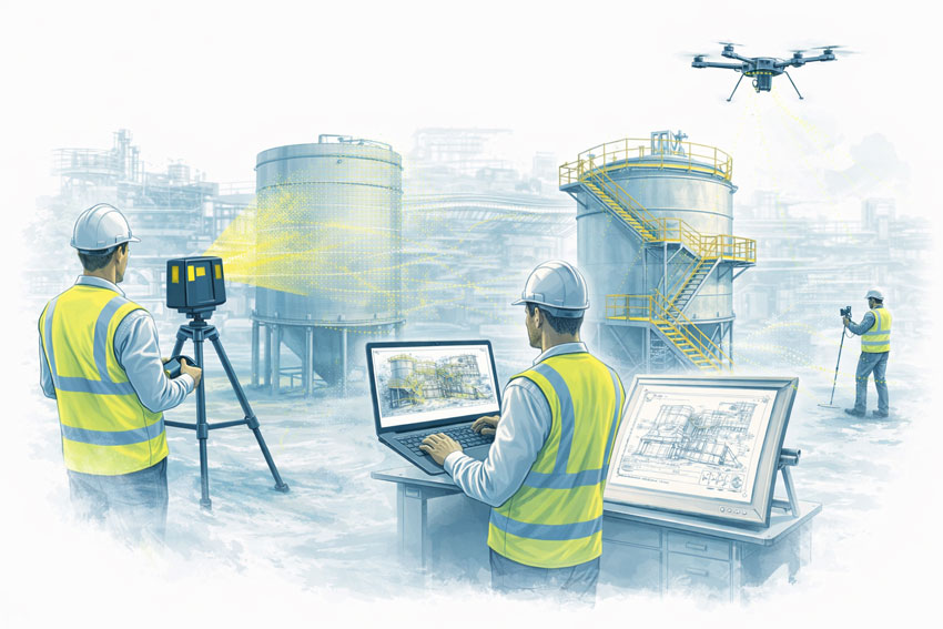
Digital twin refers to the creation of accurate digital representations of physical assets using real-world data. This tag brings together content showing how digital twins are developed from 3D laser scanning, LiDAR, and CAD modelling to support engineering design, analysis, asset management, maintenance, and lifecycle decision-making across industrial, infrastructure, mining, and building projects.
Terrestrial LiDAR Scanner Price – Buy or Hire Options
When organisations first explore terrestrial LiDAR scanning, the biggest question is usually not technical — it’s commercial: should we buy a scanner or hire one for the project?
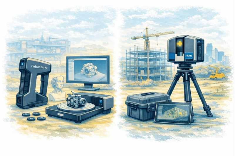
Terrestrial LiDAR scanners such as FARO and Leica systems are powerful tools for capturing accurate point clouds of buildings, industrial facilities, infrastructure and construction sites. They support as-built documentation, clash detection, shutdown planning and digital twin workflows. However, the right decision between purchase and hire depends on how often the equipment will be used and the level of in-house expertise available.
Buying a LiDAR Scanner
Purchasing a scanner can make sense for businesses that:
undertake regular surveying or as-built capture
need immediate access on multiple sites
want to build internal reality-capture capability
plan to integrate point clouds into ongoing design workflows
Ownership provides flexibility and control, but also involves training, software, calibration and maintenance considerations.
Hiring a LiDAR Scanner
Hiring is often the smarter option when:
the requirement is project-specific
workloads are seasonal or occasional
specialist software and support are needed
you want to trial the technology before committing
Hire packages can include advice on setup, data management and export formats so the results integrate smoothly with CAD and BIM platforms.
We Support Both Options
Hamilton By Design offers terrestrial LiDAR scanners for both hire and sale, backed by engineering support to ensure the data delivers real value on your project. Whether you need equipment for a short shutdown, a construction survey, or you are considering building your own scanning capability, our team can guide you through the most practical pathway.
Rather than publishing generic prices, we prefer to understand:
the type of site you need to capture
required accuracy and deliverables
software and CAD integration
duration and level of support
This allows us to recommend the right scanner package and commercial model for your specific needs.
Please contact our team for a price and availability. We’ll help you decide whether buy or hire is the best approach for your project.
3D Scanning in Greater Sydney NSW | Point Cloud to BIM & Digital Twins for Smarter Projects
Across Greater Sydney — including industrial hubs like Blacktown — asset owners and project teams are under increasing pressure to deliver upgrades, expansions, and maintenance projects with less downtime and lower risk. In congested brownfield environments, the biggest challenge is often not design — it is knowing exactly what already exists on site.
This is where engineering-grade 3D laser scanning and point cloud to BIM workflows are transforming the way projects are planned and delivered across NSW.
At Hamilton By Design, we support industrial and infrastructure projects by converting accurate site data into practical engineering models that improve project certainty from concept through to construction.
Why Accurate Site Data Matters in Greater Sydney
Many industrial facilities across Greater Sydney have evolved over decades. Services are added, conveyors rerouted, platforms extended, and temporary fixes become permanent. Unfortunately, drawings are rarely updated to reflect these changes.
For project managers, this creates risks such as:
Late discovery of clashes during installation
Unplanned scope changes and shutdown delays
Increased safety exposure during site rework
Cost overruns due to fabrication errors
Without accurate as-built data, project planning becomes reactive instead of proactive.
From 3D Scanning to Point Cloud to BIM
Using engineering-grade LiDAR scanners, we capture millions of spatial data points across entire facilities, producing highly accurate point clouds that represent the real-world geometry of structures, conveyors, services, and equipment.
These point clouds are then converted into:
BIM-ready 3D models
Fabrication-ready CAD geometry
Digital twins for ongoing asset management
This point cloud to BIM process allows project teams to design, coordinate, and review upgrades in a digital environment before any physical work begins.
For project management, this means fewer surprises and far better control over scope, schedule, and cost.
Digital Twin Creation for Ongoing Asset Management
Beyond individual projects, many asset owners in NSW are now adopting digital twins to manage facilities across their full lifecycle.
A digital twin created from accurate scan data allows teams to:
Visualise plant layouts remotely
Plan future upgrades with confidence
Improve maintenance access planning
Support safety reviews and training
In multi-site operations across Greater Sydney, digital twins also support consistent engineering standards and faster project scoping.
Rather than starting from scratch for every shutdown, project teams can build on a continually updated digital asset model.
Supporting Conveyor Design in Brownfield Environments
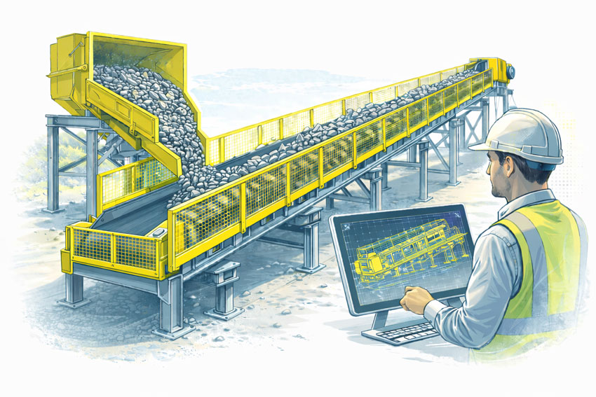
Conveyor systems remain critical to manufacturing, logistics, waste processing, and bulk materials handling facilities across Sydney’s western suburbs, including Blacktown and surrounding industrial precincts.
When conveyors are upgraded or rerouted, spatial constraints often drive:
Poor maintenance access
Compromised guarding
Clashes with services and structures
Scan-based conveyor modelling allows engineers to:
Verify belt paths, transfer points, and head drives
Design guarding that fits existing structures
Improve access platforms and walkways
Reduce installation time during shutdowns
For project managers, this directly translates into reduced safety risk and fewer installation delays.
Project Management Benefits of 3D Scanning
From a project delivery perspective, engineering-grade scanning supports:
More accurate scope definition
Better contractor coordination
Improved constructability reviews
Reduced variation claims
Safer installation planning
When all stakeholders are working from the same verified model, communication improves and decision-making becomes faster and more reliable.
This is particularly valuable on fast-tracked shutdown projects where every hour of downtime has a production cost.
Local Support Across Greater Sydney NSW
Hamilton By Design provides on-site 3D scanning, BIM modelling, and mechanical engineering support across Greater Sydney, including:
Blacktown
Western Sydney industrial precincts
Central Sydney infrastructure sites
Logistics and manufacturing facilities across NSW
As an engineering-led business, we integrate scanning directly into design, drafting, and fabrication support — ensuring that digital models deliver practical, buildable outcomes.
Our focus is not just capturing data, but turning it into engineering solutions that reduce risk and improve project performance.
Turning Reality Capture into Project Confidence
Whether planning a conveyor upgrade, plant expansion, or long-term asset management strategy, accurate site data is the foundation of successful delivery.
By moving from point cloud to BIM and digital twins, project teams across Greater Sydney are gaining better visibility, stronger risk control, and far greater confidence in their project outcomes.
Hamilton By Design provides engineering-led 3D scanning, LiDAR scanning, mechanical engineering and digital engineering services throughout Sydney and Greater Sydney.
Explore our related Sydney services:
3D Scanning Sydney – Engineering-grade terrestrial laser scanning, as-built surveys and point cloud capture for industrial, infrastructure and commercial projects.
Reality Capture Sydney – High-accuracy reality capture, digital twins, asset documentation and engineering-grade site verification.
Scan to CAD Sydney – Convert point cloud data into AutoCAD, SolidWorks, Inventor and other engineering-ready CAD deliverables.
Point Cloud Modelling Sydney– Engineering-grade point cloud processing, clash detection, as-built verification and 3D modelling.
Mechanical Engineering Sydney – Mechanical design, plant upgrades, materials handling systems, conveyors, chutes, platforms and engineering support.
Structural Drafting Sydney– Structural steel drafting, fabrication drawings, GA drawings, workshop detailing and as-built documentation.
Hamilton By Design supports projects throughout Sydney CBD, Parramatta, Liverpool, Penrith, Blacktown, Chatswood, Alexandria, Mascot, Newcastle and the Central Coast.
Digital Twin Asset Management Sydney | Hamilton By Design
From Point Cloud to Digital Twin: Better Asset Control for Sydney Precincts
For asset owners and facilities managers across Greater Sydney and the Central Coast, accurate and accessible building data is no longer a luxury — it is critical for maintenance planning, compliance, risk management, and future upgrades.
Yet many facilities still rely on incomplete drawings, outdated asset registers, or disconnected documentation spread across multiple systems.
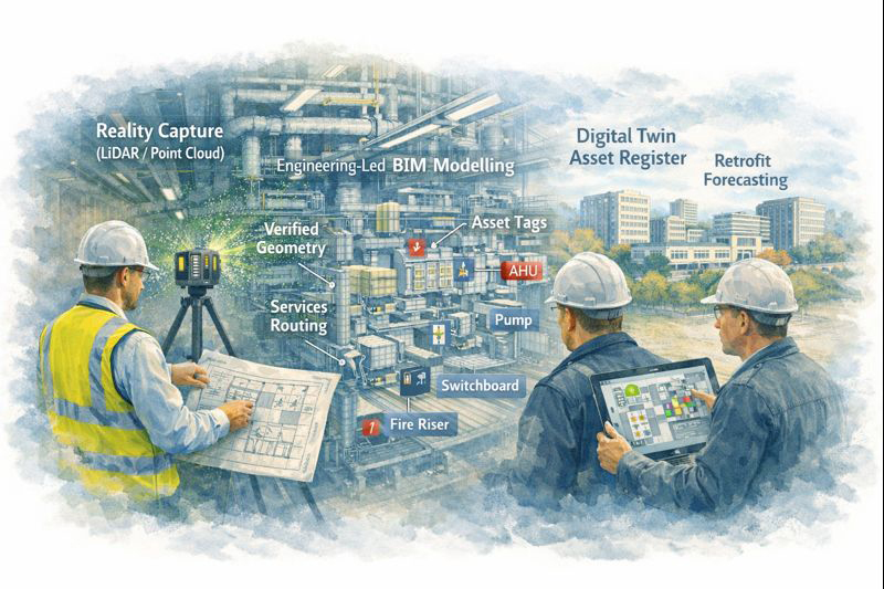
At Hamilton By Design, we use high-accuracy 3D scanning and engineering-led modelling to create digital twins — intelligent, data-rich representations of real facilities that support long-term asset management, not just one-off construction projects.
Why Traditional Building Records Fall Short
Over the life of a facility, buildings change constantly:
Services are upgraded or rerouted
Plant is replaced or relocated
Structural movement occurs over time
Temporary works become permanent
Documentation becomes fragmented or lost
As a result, asset owners are often forced to make decisions based on assumptions instead of verified data, increasing operational risk and lifecycle costs.
Digital twins replace uncertainty with measurable, current, and verifiable building intelligence.
What Is a Digital Twin — and Why It Matters
A digital twin is more than a 3D model. It is a continuously usable digital representation of your physical asset that can support:
Asset lifecycle management
Maintenance planning and scheduling
Retrofit and upgrade forecasting
Compliance verification and reporting
Insurance documentation and risk mitigation
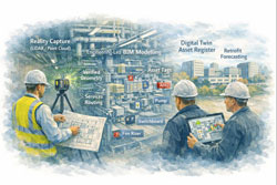
Using LiDAR and reality capture, we first create highly accurate point cloud data of your facility. This is then converted into structured engineering models and documentation, forming the foundation of a usable digital twin environment.
Supporting the Full Asset Lifecycle
Digital twins created by Hamilton By Design are designed to support decision-making across the entire life of an asset.
Asset Lifecycle Management
Digital twins provide a verified reference for:
Plant locations and access paths
Service routing and capacity
Structural geometry and tolerances
Interface points between systems
This allows asset teams to plan interventions without repeated site surveys or intrusive investigations.
Maintenance Planning and Access Strategy
Maintenance activities often fail not due to equipment faults, but due to poor access planning and unknown service constraints.
Digital twins allow teams to:
Visualise maintenance access zones
Plan shutdown sequences
Coordinate contractor access safely
Reduce unexpected site conditions
This is particularly valuable in hospitals, transport facilities, and industrial plants where downtime is extremely costly.
Retrofit and Upgrade Forecasting
When assets age, upgrade programs become unavoidable — but without accurate models, forecasting becomes unreliable.
With digital twins, asset owners can:
Test retrofit scenarios digitally
Assess spatial constraints early
Coordinate staged construction programs
Validate new services layouts before installation
This significantly reduces redesign cycles and programme risk.
Compliance, Insurance and Risk Documentation
High-accuracy digital records also support:
Compliance audits
Fire and safety system verification
Engineering certification
Insurance risk assessments
Digital twins provide verifiable evidence of current conditions, which is increasingly important for regulatory and insurer requirements.
Enterprise-Value Scanning, Not Just Project Scanning
Many scanning services stop at delivering point clouds. Hamilton By Design goes further by integrating scanning into an engineering and asset management workflow.
Our service extends beyond capture into:
Mechanical engineering interpretation
Systems modelling and coordination
Project and asset integration support
Fabrication and modification planning
This makes digital twins a strategic asset tool, not just a design input.
Construction, Operations and Future-Proofing — All in One Model
Our digital twin workflows support:
Operational facilities
Construction planning
Ongoing modifications
Future asset strategies
By maintaining continuity between engineering, construction, and asset management data, digital twins become a single source of truth for multiple stakeholders.
Deliverables Designed for Asset Teams
We provide digital twin outputs in formats compatible with enterprise asset and design systems:
High-resolution point clouds (RCP / E57)
Revit asset models
AutoCAD documentation
SolidWorks equipment and systems models
Asset-aligned 2D drawings
Data structured for future updates
These can be used directly by engineering consultants, maintenance teams, and facilities management platforms.
Supporting Sydney and Central Coast Asset Portfolios
We work with asset owners across:
Healthcare precincts
Commercial property portfolios
Industrial facilities
Infrastructure and transport sites
Education campuses
Heritage and government assets
Our local support allows ongoing engagement as facilities evolve, not just one-off capture projects.
Turn Building Data into an Asset Strategy
Digital twins transform buildings from static structures into data-driven, manageable systems.
They allow asset owners to move from reactive maintenance to planned lifecycle control, improving reliability, safety, and financial predictability.
Arrange a Digital Twin Consultation
If you are responsible for long-term facility performance, compliance, or upgrade planning:
Please fill out the form below to arrange a phone consultation.
We’ll discuss your asset portfolio, operational requirements, and long-term objectives, and recommend a digital twin strategy that supports both current operations and future upgrades.
Terrestrial vs LiDAR Scanners | What’s the Difference?
Confusion around terrestrial scanning and LiDAR scanning is common — and understandable. The two terms are often used interchangeably, even though they describe different things.
This page explains the difference in plain language, shows where each approach fits, and helps you decide what level of accuracy and risk is appropriate for your project.
Short Answer (If You’re in a Hurry)
LiDAR describes the laser measurement technology. Terrestrial describes how and where that LiDAR scanner is deployed.
Most terrestrial scanners use LiDAR, but not all LiDAR scanners are terrestrial.
What Is LiDAR?
LiDAR (Light Detection and Ranging) is a method of measuring distance using laser light.
How LiDAR works
A laser pulse is emitted
The pulse reflects off an object
The return time is measured
Distance is calculated and stored as a 3D point
Millions of these points form a point cloud that represents real-world geometry.
What LiDAR is good for
Accurate 3D measurement
Complex geometry
Low-light or enclosed environments
Engineering, construction, and industrial sites
LiDAR answers:How is distance measured?
What Is a Terrestrial Scanner?
A terrestrial scanner is a ground-based scanning system, usually mounted on a tripod or fixed position.
Key characteristics
Fixed scan position
Controlled setup and coverage
Known geometry and reference
High repeatability and validation
Typical environments
Processing plants and CHPPs
Structural steelwork
Conveyor systems
Brownfield tie-ins
As-built verification
Shutdown-critical fit-up work
Terrestrial answers:Where and how is the LiDAR deployed?
How the Two Terms Relate (This Is the Important Part)
A terrestrial scanner is a platform. A LiDAR scanner is a technology.
Most modern terrestrial scanners are terrestrial LiDAR scanners.
Example: a tripod-mounted system such as the FARO Focus S-Series is:
LiDAR-based (laser measurement)
Terrestrial (ground-based, fixed setup)
Other Common LiDAR Scanner Types (And Why It Matters)
Scanner Type
How It’s Used
Typical Outcome
Terrestrial LiDAR
Tripod / fixed
Highest control & accuracy
Mobile / SLAM LiDAR
Handheld / walk-through
Fast capture, lower control
Vehicle-mounted LiDAR
Car / trolley
Corridor mapping
Aerial LiDAR
Drone / aircraft
Large areas, low detail
All are “LiDAR”, but not all are suitable for engineering design or fabrication.
Why This Distinction Matters for Projects
Many issues occur when:
A LiDAR scan is assumed to be engineering-grade
A mobile or SLAM scan is used beyond its intent
Accuracy, validation, or limitations are not clearly understood
This doesn’t mean one method is wrong — it means each has a purpose.
The key is aligning the scanner type with:
Required accuracy
Risk tolerance
Fit-up criticality
Intended use of the data
Our clients:
Simple Decision Guide (Client in Control)
If you need:
Fabrication or replacement parts → Terrestrial LiDAR
Shutdown-critical fit-up → Terrestrial LiDAR
Structural verification → Terrestrial LiDAR
Rapid site context only → Mobile / SLAM LiDAR
Large terrain or stockpiles → Aerial LiDAR
There is no “one best scanner” — only the right scanner for the outcome you want.
Comparison at a Glance
Requirement
Terrestrial LiDAR
Mobile / SLAM LiDAR
Accuracy control
High
Moderate
Repeatability
High
Lower
Engineering defensibility
Strong
Limited
Fit-up confidence
Suitable
Not recommended
Capture speed
Slower
Faster
Best use case
Design & fabrication
Visualisation & context
A Note on Engineering Use
Where scanning data feeds into engineering design, documentation, or fabrication, higher-control methods are typically required to align with engineering practice and Australian Standards expectations.
That doesn’t remove choice — it simply means the assumptions and limitations must match the intended use.
How We Approach This (Without Locking You In)
We’re happy to:
Work with terrestrial, mobile, or supplied scan data
Validate data before design where required
Align scanning effort with your risk, budget, and outcome
Clearly document assumptions and limitations
You stay in control of the approach — our role is to make sure the data supports the outcome you expect.
Next Step
If you’re unsure which scanning method suits your project:
Fill out the contact form and tell us:
What you want to build, replace, or verify
How the data will be used
Any constraints (budget, time, shutdown windows)
We’ll help you select a fit-for-purpose scanning approach, not just a scanner.
Why Accuracy, Precision, and Calibration Matter for Engineering Outcomes
When 3D LiDAR scanning is used for engineering, fabrication, or certification, the most important question is not how detailed the point cloud looks, but whether the measurements can be trusted.
This is where AS ISO 5725 — Accuracy and Precision of Measurement becomes relevant. While AS ISO 5725 is not written specifically for LiDAR scanners, it defines the principles that determine whether any measurement system is suitable for engineering use.
In practical terms, AS ISO 5725 separates data that can support engineering decisions from data that is visually convincing but technically unreliable.
What AS ISO 5725 Covers
AS ISO 5725 defines how measurement systems should be evaluated in terms of:
Accuracy
Precision
Repeatability
Reproducibility
Measurement uncertainty
These principles apply directly to 3D LiDAR scanning because a LiDAR scanner is, at its core, a measurement instrument. When scanning data is used to inform design, fabrication, or certification, the expectations set by AS ISO 5725 apply regardless of scanner brand or software.
This is why engineering-grade 3D LiDAR scanning requires more than simply capturing a dense point cloud. It requires controlled measurement, understood uncertainty, and validated outputs, as delivered through engineering-grade 3D laser scanning workflows: https://www.hamiltonbydesign.com.au/home/engineering-services/3d-laser-scanning/
Accuracy vs Precision in LiDAR Scanning
AS ISO 5725 makes a clear distinction between accuracy and precision, a distinction that is often misunderstood in reality capture.
Accuracy describes how close a measurement is to the true value. Precision describes how consistently the same measurement can be repeated.
A LiDAR scan can appear highly precise, with clean and consistent geometry, while still being inaccurate if the scanner is miscalibrated or poorly controlled. In engineering terms, repeatable errors are still errors.
For engineering and fabrication, both accuracy and precision are required.
The Role of Calibration
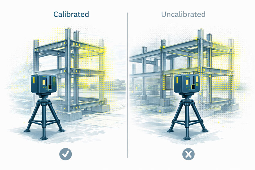
Calibration ensures that a scanner’s distance and angular measurements align with known reference values. Without calibration, a LiDAR scanner may still operate normally and still produce visually impressive results, but the measurements no longer have a known or defensible level of uncertainty.
Calibration directly affects:
Distance measurement
Angular accuracy
Alignment between internal sensors
Registration between multiple scans
AS ISO 5725 does not prescribe how calibration must be performed, but it does establish the expectation that measurement uncertainty is understood and controlled.
What Happens When Scanning Is Not Calibrated
When LiDAR scanning is not properly calibrated or verified, errors propagate into every downstream deliverable.
Common outcomes include:
Fabricated steelwork that does not fit on site
Bolt holes and connection points outside tolerance
Frames requiring on-site modification or rework
Assumed clearances that do not exist in reality
Delays or challenges during engineering sign-off
These issues are often discovered late in a project, where the cost of correction is highest. The root cause is frequently measurement error introduced at the scanning stage, not fabrication quality.
One of the most significant risks in unverified scanning workflows is that errors are often small enough to go unnoticed early.
A few millimetres of error at the scanning stage can compound into much larger discrepancies once geometry is modelled, detailed, and fabricated. Across multiple interfaces, these small deviations can lead to misalignment, rework, or compromised installation quality.
For fit-first-time fabrication, this risk is unacceptable.
Engineering Responsibility and Certification Risk
When LiDAR data is used to support engineering decisions, responsibility does not sit with the scanner or the software. It sits with the engineer relying on the data.
If measurements cannot be demonstrated as accurate, repeatable, and appropriately controlled, they are not suitable to support engineering sign-off. This is particularly relevant where scanning data contributes to certification outcomes, where accountability and defensibility are essential.
AS ISO 5725 is not about paperwork or compliance for its own sake. It provides the framework that ensures measurement data used for engineering decisions is fit for purpose.
When LiDAR scanning is undertaken with accuracy, precision, and calibration treated seriously, it becomes a powerful engineering tool. When these principles are ignored, scanning becomes a source of hidden risk that only emerges when it is too late to correct cheaply.
Final Thought
3D LiDAR scanning is only as reliable as the measurement discipline behind it.
AS ISO 5725 provides the foundation for understanding whether scanning data can be trusted. In engineering, fabrication, and certification contexts, that trust is not optional — it is essential.
Toowoomba’s Engineering Future: How 3D LiDAR Scanning & Digital Modelling Are Transforming Projects Across the Darling Downs
Toowoomba is quickly becoming one of Australia’s most important regional powerhouses — a city where agriculture, logistics, mining, construction and manufacturing intersect at a scale rarely seen outside capital cities. With major infrastructure investments, the growth of the Toowoomba Wellcamp Airport, and its position as a gateway to the Surat Basin and the Darling Downs, the region is undergoing a steady shift toward digitally enabled engineering and smarter project delivery.
At Hamilton By Design, we’re incredibly proud to support this growth by providing 3D LiDAR laser scanning, mechanical engineering consulting, 3D modelling and drafting, and digital quality assurance tailored specifically for the demands of Toowoomba’s industrial, commercial and rural sectors.
In this article, we explore why Toowoomba is so unique, the role of modern engineering technology in the region, and how accurate site data and digital models are helping local businesses reduce rework, improve safety and deliver better project outcomes.
Why Toowoomba Is the Perfect Fit for Modern Digital Engineering
Toowoomba is Australia’s largest inland city outside Canberra, with more than 180,000 people and an economy driven by a mix of agriculture, logistics, manufacturing, construction and energy projects. Its elevated position on the Great Dividing Range, combined with its access to the Surat Basin and major rural supply chains, makes it a critical service hub for heavy industry and regional infrastructure.
But what really sets Toowoomba apart is its transformation into a logistics and engineering centre. With Inland Rail connections, Wellcamp Airport’s freight terminal and constant agricultural expansion, the demand for precise, reliable engineering data has grown rapidly.
This is where 3D LiDAR scanning and digital engineering provide enormous value.
3D LiDAR Laser Scanning: Bringing Millimetre-Level Accuracy to Local Projects
Whether you’re working on a feed mill upgrade, a manufacturing facility expansion, a rural processing plant, a logistics warehouse fit-out or a mining-related modification, accurate site measurements are essential. Traditional surveys struggle to capture the complex geometry, alignment issues or hidden interferences common in brownfield environments.
Engineering-grade 3D LiDAR scanning solves this problem instantly.
Hamilton By Design uses high-accuracy terrestrial laser scanners capable of capturing:
complex plant layouts
conveyors, chutes, structural frames
pipework routing and clashes
equipment misalignment
deflections, corrosion and wear
existing foundations and tie-in points
site terrain and building envelopes
All delivered with millimetre-level accuracy.
For Toowoomba businesses, this means:
reduced rework
faster fabrication
fewer shutdown overruns
safer installations
accurate as-built documentation
In a region where travel, mobilisation and shutdown timing matter, these improvements translate directly into cost savings and smoother project execution.
3D Modelling & Drafting for Toowoomba Industry
After scanning, the next step is turning point-cloud data into intelligent 3D models and fabrication-ready drawings.
Hamilton By Design specialises in:
SolidWorks mechanical modelling
structural modelling for plant systems
equipment layouts and upgrade designs
skid-based systems
brownfield modification design
drawing packages (GA, detail, isometric, BOMs)
For Toowoomba industries — especially manufacturing workshops, agri-processing facilities, grain-handling plants, transport depots and rural engineering contractors — accurate 3D models significantly improve design coordination.
We often hear clients say:
“We used to rely on tape measures and photos. Now we can see the entire plant from our office.”
That is exactly the transformation 3D modelling provides.
Mechanical Engineering for Brownfield Upgrades Across the Darling Downs
The Toowoomba region is rich in brownfield mechanical assets: farm infrastructure, conveyor systems, grain silos, batching plants, food-processing lines, workshops, energy facilities and quarry machinery.
Hamilton By Design provides engineering support such as:
mechanical design for upgrades
structural integrity assessments
vibration, alignment and deflection reviews
buckling, fatigue and stress analysis (FEA)
chute, pipework and mechanical flow improvements
equipment mounting, lifting and access design
Our combination of engineer-led scanning + mechanical design ensures that every upgrade fits the first time and is supported by real data.
Why 3D Laser Scanning Is a Game-Changer for Toowoomba
Here’s where Toowoomba really benefits compared to many inland cities:
1. Large Agricultural Facilities Need Accurate Layouts
Feedlots, grain silos, packing sheds, processing plants and cold-storage facilities often evolve over many years. Scanning helps document these environments for compliance, redesign and expansion.
2. The Region Supports Mining & Energy Projects
Toowoomba acts as a service centre for the Surat Basin — Dalby, Chinchilla, Miles, Roma. LiDAR enables accurate tie-in points, pipe upgrades and shutdown planning.
3. Manufacturing & Fabrication Are Growing
Local workshops need precise data to avoid rework. Models based on point clouds give fabricators total confidence before cutting steel.
4. Logistics Infrastructure Continues Expanding
Wellcamp Airport, industrial estates and new warehousing projects benefit from accurate as-built documentation to speed up development approvals and construction decisions.
5. Reducing Travel Costs Is Critical for Regional Projects
A single scan eliminates multiple site trips — crucial for Toowoomba’s broad geographic service area.
Types of Toowoomba Projects Hamilton By Design Supports
Here are some of the local project types where our team adds immediate value:
grain-handling plant upgrades
feed mill expansions
water treatment & pumping stations
abattoir & food facility engineering
conveyor & materials-handling systems
batching plant upgrades
workshop fit-outs and machinery layouts
logistics warehouse redesigns
rural industrial buildings
mechanical equipment retrofits
energy & utility infrastructure
Whether it’s a small workshop or a multi-hectare industrial site, LiDAR scanning gives project teams a crystal-clear digital representation of the site.
Single-Source Accountability:
Scanning → Modelling → Engineering → Drawings
One of the biggest frustrations in regional engineering is fragmented contractors — one team scans, another models, another designs, and nobody takes responsibility when things don’t align.
Hamilton By Design solves this with an integrated workflow:
3D LiDAR scan of the site
Registration and accuracy validation
3D CAD modelling (SolidWorks)
Mechanical & structural engineering
Fabrication-ready drawings
Digital QA and installation support
Everything is handled by a single engineering-led team.
Toowoomba’s Future Needs Digital Engineering — And We’re Here to Support It
Toowoomba is entering a decade of growth — new industrial estates, expansions in agri-processing, energy transformation, airport-driven logistics and inland infrastructure. Digital engineering will be a major part of how these projects are delivered efficiently and safely.
Hamilton By Design is excited to provide Toowoomba businesses with:
precise 3D LiDAR scanning
mechanical engineering and assessment
professional 3D modelling and drafting
fabrication-ready design
digital documentation and QA
Whether you’re planning a small plant improvement or a major regional upgrade, our data-driven approach helps you design with confidence.
To provide the best experiences, we use technologies like cookies to store and/or access device information. Consenting to these technologies will allow us to process data such as browsing behaviour or unique IDs on this site. Not consenting or withdrawing consent, may adversely affect certain features and functions.
Functional
Always active
The technical storage or access is strictly necessary for the legitimate purpose of enabling the use of a specific service explicitly requested by the subscriber or user, or for the sole purpose of carrying out the transmission of a communication over an electronic communications network.
Preferences
The technical storage or access is necessary for the legitimate purpose of storing preferences that are not requested by the subscriber or user.
Statistics
The technical storage or access that is used exclusively for statistical purposes.The technical storage or access that is used exclusively for anonymous statistical purposes. Without a subpoena, voluntary compliance on the part of your Internet Service Provider, or additional records from a third party, information stored or retrieved for this purpose alone cannot usually be used to identify you.
Marketing
The technical storage or access is required to create user profiles to send advertising, or to track the user on a website or across several websites for similar marketing purposes.