Onsite Scanning Australia Wide

3D laser scanning services in Australia for mining and infrastructure modelling

Engineering-grade 3D laser scanning, LiDAR and digital captureโ€”delivered to site, anywhere in Australia.

When youโ€™re working in a live facility, a remote site, or an aging asset thatโ€™s been modified a hundred times, the biggest risk is uncertainty. Missing dimensions. Out-of-date drawings. Unknown interferences. A โ€œclose enoughโ€ site measure that turns into rework, delays, and variations.

Hamilton By Design provides onsite scanning Australia wide to capture accurate, verifiable site conditionsโ€”so your engineers, designers, fabricators, and project managers can make confident decisions from day one.
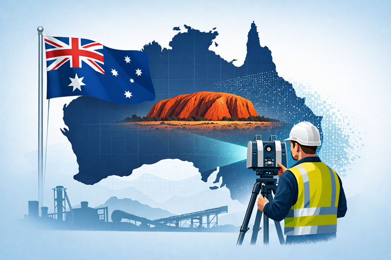

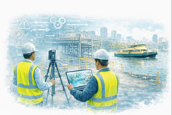
LiDAR scanning survey across Australia with engineer capturing industrial site data

Why onsite scanning matters

Onsite scanning is the fastest way to convert real-world assets into reliable digital informationโ€”especially in brownfield and retrofit environments where original documentation is incomplete or incorrect.

Our field capture provides a precise baseline for:

  • As-built verification before upgrades, tie-ins, and shutdown works
  • Retrofit engineering for legacy plants and facilities
  • Clash detection and constructability checks before fabrication or installation
  • Digital engineering workflows (scan-to-model / scan-to-drawings)
  • Condition documentation for risk reduction, scope definition and handover records

In plain terms: the scan becomes the backbone of your project. If that backbone is broken (poor capture, gaps, or low confidence), everything downstream becomes harderโ€”engineering, drafting, fabrication and installation.


Australia-wide coverage, site-ready delivery

We mobilise to projects across Australiaโ€”metro, regional and remoteโ€”bringing the scanning equipment, field workflow and practical site experience needed to operate safely and efficiently.

Typical deployment environments include:

  • Mining & resources (processing plants, conveyors, workshops, pump stations)
  • Industrial manufacturing (steel, smelting, production lines, utilities)
  • Infrastructure and utilities (water, wastewater, power, transport assets)
  • Commercial and government assets (plantrooms, services corridors, legacy buildings)
  • Marine and ship repair (fit-up checks, reverse engineering, space claims)

If your site is difficult to access, operational, or time-restricted (e.g., night works), we can plan around your constraints.


What we scan onsite

We support a wide range of scanning objectives, including:

As-built capture for engineering and design

Capture existing steelwork, pipework, structures, platforms, equipment skids, services, and building geometryโ€”so design is based on reality, not assumptions.

Retrofit and brownfield modification support

Ideal for upgrades where the facility has changed over time and legacy drawings donโ€™t match current conditions.

Fabrication and installation verification

Use scans to confirm fitment, alignment, clearances, and integration points before committing to fabrication or mobilisation.

Reverse engineering and metrology-style capture

Where components are undocumented, worn, or customโ€”scanning provides a measurement foundation for remanufacture or replacement design.


Deliverables that suit real projects

Every project is different, so we align deliverables to what your team actually needs.

Common outputs include:

  • Registered point clouds (for design coordination and record)
  • 2D CAD outputs (elevations, sections, plans where required)
  • 3D model-ready datasets to support engineering and drafting
  • Digital verification notes to support design sign-off and QA

If youโ€™re not sure what deliverable is best, weโ€™ll recommend a practical option based on your scope, schedule, and how the data will be used downstream.


How our onsite scanning service works

  1. Scope & goals โ€“ what needs to be captured, why, and what level of detail is required
  2. Site requirements โ€“ access windows, inductions, permits, traffic management, WAH/EWP needs
  3. Onsite scanning mobilisation โ€“ safe, efficient field capture with a plan to minimise disruption
  4. Processing & registration โ€“ structured datasets prepared for engineering use
  5. Delivery & support โ€“ files issued with clear naming, coordination notes, and handover guidance

Safety and site integration

We operate with a strong focus on safe field work, practical site coordination, and minimal disruption to operations. Where required, we can work alongside site teams to manage access, exclusion zones, and staged capture.


Why Hamilton By Design

Weโ€™re an engineering-led team. That mattersโ€”because onsite scanning isnโ€™t just โ€œcollecting data.โ€ Itโ€™s collecting the right data, at the right density, in the right areas, with a clear understanding of how the information will be used for design, verification, and construction.

If you need confidence in your existing conditionsโ€”we can help.


Hamilton By Design logo displayed on a blue tilted rectangle with a grey gradient background

3D LiDAR scanning and 3D modelling service button โ€” laser scanner capturing a point cloud for engineering and CAD modelling
Mechanical engineering services

Request onsite scanning Australia wide

If you have an upcoming retrofit, upgrade, verification, or design project and you need accurate site capture, get in touch.

Contact Hamilton By Design to discuss your site, your schedule, and the deliverables you needโ€”anywhere in Australia.


Send us your site location, a brief scope, and any drawings/photos available, and weโ€™ll advise the best scanning approach.

Name
Would you like us to arrange a phone consultation for you?
Address
3D Scanning Sydney banner promoting engineering-grade 3D laser scanning, LiDAR scanning, and reality capture services by Hamilton By Design.
Mechanical Engineering Sydney banner with white text on a blue background representing Hamilton By Design's mechanical engineering services in Sydney.
Mechanical Drafting and 3D Modelling Sydney banner highlighting Hamilton By Design's CAD drafting, 3D modelling, and engineering design services in Sydney.

3D CAD Modelling Australia service banner for Hamilton By Design

Mechanical Engineering | Structural Engineering


3D LiDAR Laser Scanning Services in Bahrain

Watercolour illustration of 3D LiDAR laser scanning in Bahrain showing engineers capturing an industrial site with a scanner and tablet, styled in Bahrain flag colours with Australian quality standards message.

3D LiDAR Laser Scanning Services in Bahrain | Australian Standards

Engineering Certainty Through Measured Reality

Bahrainโ€™s construction, industrial and infrastructure sectors are evolving rapidly. Successful projects depend on accurate knowledge of existing conditions rather than historical drawings or assumptions. 3D LiDAR laser scanning services in Bahrain provide that verified foundation.

Hamilton By Design delivers engineering-led 3D LiDAR scanning services in Bahrain, capturing complex facilities and structures with millimetre precision so that design, analysis and construction can proceed from fact.


Verification Before Calculation

Many Bahrain projects involve brownfield environments where documentation no longer reflects reality. Modifications, corrosion, settlement and incremental upgrades create risk for designers and contractors.

Terrestrial LiDAR scanning enables:

  • Objective measurement of existing assets
  • Accurate tie-ins for new works
  • Reduction of site variations
  • Shorter shutdown durations
  • Remote engineering collaboration
  • Reliable prefabrication

The scan is the backbone of the project.
The quality of the initial capture determines the ease of every task that follows. If the backbone is compromised, even simple engineering becomes difficult.


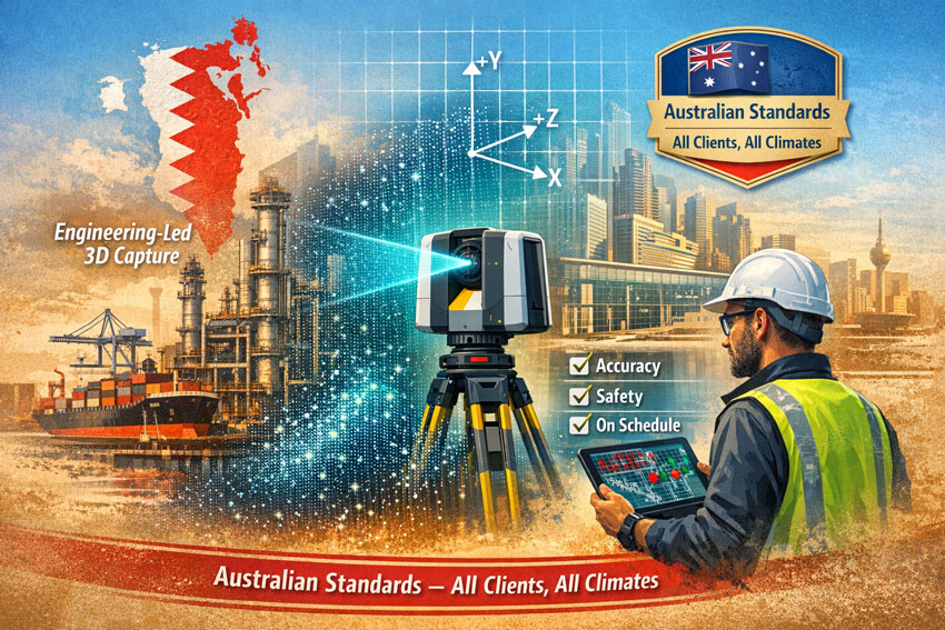
3D laser scanning services Bahrain visual showing LiDAR capture, point cloud workflow and Australian Standards compliance in watercolour engineering style.

Engineering-Led 3D LiDAR Scanning in Bahrain

Our services are not limited to data collection. We approach every Bahrain project as engineers first, ensuring the capture supports:

  • Structural and mechanical verification
  • Constructability and access reviews
  • Interface definition for fabrication
  • Maintenance and shutdown planning
  • Risk reduction for project teams

This perspective protects project managers, engineers, designers and fabricators from decisions based on assumption.


Tailored to Your Systems

Hamilton By Design delivers vendor-neutral outputs that integrate with your existing workflows.

We tailor Bahrain LiDAR deliverables to suit your:

  • CAD platforms
  • BIM environments
  • FEA and analysis tools
  • Engineering and asset systems

Our role is to provide accurate engineering information โ€” your team chooses the software.


Australian Quality โ€“ Across All Clients and All Climates

All 3D LiDAR laser scanning services in Bahrain are delivered in accordance with:

  • Australian quality expectations
  • Australian build standards
  • Proven engineering procedures
  • Consistent methodology across all climates

Our workflows are designed for heat, humidity, coastal exposure and heavy industrial environments common to Bahrain, providing defensible and traceable data for every client.


Sectors Supported in Bahrain

  • Oil & gas and process facilities
  • Ports and marine structures
  • Commercial and mixed-use buildings
  • Transport and utilities
  • Manufacturing and logistics
  • Heritage and architectural assets

Whether the requirement is a single tie-in or a full facility digital record, the principle remains the same โ€” measure first, then engineer.


Hamilton By Design logo displayed on a blue tilted rectangle with a grey gradient background

3D LiDAR scanning and 3D modelling service button โ€” laser scanner capturing a point cloud for engineering and CAD modelling
Mechanical engineering services

The Hamilton By Design Process

  1. Investigate โ€“ High-accuracy LiDAR capture on site in Bahrain
  2. Verify โ€“ Registration and quality assurance
  3. Design โ€“ Data prepared for your engineering workflow

This structured approach ensures Bahrain projects commence with measured reality rather than interpretation.


Engage 3D LiDAR Laser Scanning Services in Bahrain

If your Bahrain project requires reliable as-built information, Hamilton By Design can mobilise to capture, process and deliver engineering-ready data aligned with Australian standards.

Start your project with certainty, not assumption.

Contact Hamilton By Design to discuss 3D LiDAR laser scanning services in Bahrain.

Name
Would you like us to arrange a phone consultation for you?
Address
3D CAD Modelling Australia service banner for Hamilton By Design
3D LiDAR scanning and 3D modelling service button โ€” laser scanner capturing a point cloud for engineering and CAD modelling
Mechanical engineering services
Mechanical drafting services button
Blue rounded button with the text โ€œSolidWorks Designโ€ in white.
Blue banner graphic displaying the text "Point Cloud to CAD - Australia" in large white lettering, representing point cloud processing, scan-to-CAD conversion and digital engineering services across Australia.
Mechanical, Structural & Pipework Drafting service banner by Hamilton By Design featuring white text on a blue background.
Engineering Governance title graphic featuring bold white text reading "Engineering Governance" centred on a blue rounded rectangle background.
Mining Plant Upgrades promotional graphic with bold white text on a blue background representing mining infrastructure, plant improvement, and engineering upgrade projects.
3D Pipework promotional graphic with bold white text on a blue background representing pipework design, modelling, drafting, and engineering services.
Australian Drafting logo featuring bold white text reading "Australian Drafting" centred on a blue rounded rectangle background.
3D Pipework promotional graphic with bold white text on a blue background representing pipework design, modelling, drafting, and engineering services.
Mining Plant Upgrades promotional graphic with bold white text on a blue background representing mining infrastructure, plant improvement, and engineering upgrade projects.
3D LiDAR Scanning for Engineering Projects title graphic featuring bold white text on a blue rounded rectangle background.
Australian Drafting logo featuring bold white text reading "Australian Drafting" centred on a blue rounded rectangle background.
Engineering Governance title graphic featuring bold white text reading "Engineering Governance" centred on a blue rounded rectangle background.
Mechanical, Structural & Pipework Drafting service banner by Hamilton By Design featuring white text on a blue background.
Mechanical engineering services
Blue rounded button with the text โ€œSolidWorks Designโ€ in white.
Finite Element Analysis (FEA) engineering simulation button

Mechanical Engineering | Structural Engineering


3D Scanner Penrith

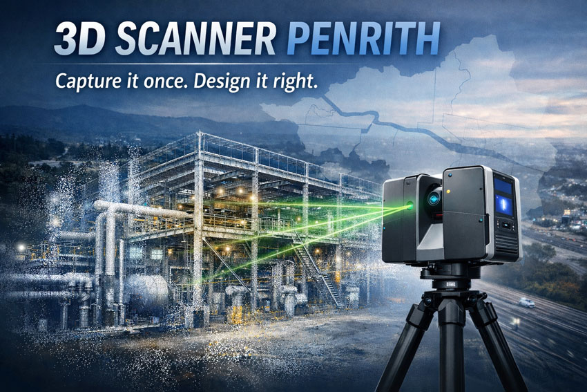
3D laser scanner in Penrith capturing industrial facility as point cloud for engineering design

3D Scanner Penrith | Engineering LiDAR Scanning

Engineering-grade LiDAR & laser scanning in Penrith, Western Sydney โ€” capture it once, design it right.

When youโ€™re upgrading a plant, refurbishing a building, or tying new steel into an existing structure, you donโ€™t want โ€œclose enoughโ€. You want site truth โ€” fast. Hamilton By Design delivers 3D laser scanning (LiDAR) and point clouds in Penrith and Western Sydney, so your engineers, designers, and fabricators can work from accurate as-built data and reduce rework.

Penrith is in the middle of major growth and infrastructure change across Western Sydney, which makes reliable existing-condition data even more valuable for upgrades and brownfields work.


3D scanner Penrith creating accurate as-built point cloud of factory for upgrades

What โ€œ3D scanningโ€ means for your project

A 3D scanner captures millions of points per second to create a high-density point cloud of your site. That point cloud becomes the backbone of the job:

  • Faster measuring and fewer return site visits
  • Better clash detection and tie-in confidence
  • Cleaner fabrication drawings and install fit-up
  • Reduced variations caused by missing or outdated as-built information

If the initial scan quality is poor, everything downstream gets harder โ€” modelling, detailing, QA checks, and construction coordination all suffer.


3D scanning services in Penrith

We support projects across Penrith, St Marys, Kingswood, Werrington, Emu Plains, Glenmore Park and surrounding industrial/commercial areas.

Typical use cases

  • Structural steel tie-ins & refurbishments (accurate interface points)
  • Industrial sites & plants (brownfields upgrades, shutdown planning)
  • Commercial buildings (facade/elevation capture, services coordination)
  • Mechanical & piping modifications (spools, supports, and retrofit work)
  • Condition capture for tendering (reduce unknowns before you price)

Deliverables that plug into your workflow

We keep deliverables practical and construction-ready, including:

  • Registered point cloud (industry-standard formats)
  • 2D outputs (plans/elevations/sections as required)
  • 3D model support (scan-to-model packages if needed)
  • Interface extraction (critical tie-in set-out points and checks)

(If you tell us what platform your team uses, weโ€™ll align deliverables to suit your workflow.)


How the onsite scan usually runs

  1. Scope & safety planning (access, traffic, operating plant constraints)
  2. Capture (multiple scan positions for full coverage)
  3. Registration & QA (clean, aligned dataset)
  4. Delivery (point cloud + agreed outputs, with notes on any occlusions)

For live environments we can plan around operations, access restrictions, and foot traffic to protect equipment and improve capture outcomes.


Why Hamilton By Design for Penrith scanning

Weโ€™re an engineering-led team. That matters because scanning isnโ€™t just โ€œcollecting dataโ€ โ€” itโ€™s collecting the right data to make design and fabrication easier.

Youโ€™ll get:

  • Practical capture strategies that target tie-ins and risk areas
  • Clear communication on whatโ€™s captured (and what canโ€™t be seen)
  • Outputs designed to reduce RFIs, assumptions, and rework

Penrithโ€™s ongoing development and precinct planning means brownfields interfaces are common โ€” and accurate as-builts help projects stay predictable.


Get a quote for 3D scanning in Penrith

If you want a fast, accurate capture and a dataset your team can trust:

Call / Email: (add your preferred contact details)
Service area: Penrith + Western Sydney
Turnaround: dependent on site size and deliverables

What to include in your enquiry

  • Site address + access constraints
  • What youโ€™re building / modifying
  • Priority areas (tie-ins, steel interfaces, plant items)
  • Required deliverables and required accuracy (if specified)

Hamilton By Design logo displayed on a blue tilted rectangle with a grey gradient background

Name
Would you like us to arrange a phone consultation for you?
Address
3D Scanning Sydney banner promoting engineering-grade 3D laser scanning, LiDAR scanning, and reality capture services by Hamilton By Design.
Mechanical Engineering Sydney banner with white text on a blue background representing Hamilton By Design's mechanical engineering services in Sydney.
Mechanical Drafting and 3D Modelling Sydney banner highlighting Hamilton By Design's CAD drafting, 3D modelling, and engineering design services in Sydney.

FAQ

How accurate is a 3D scan?

Accuracy depends on scanner type, site conditions, scan geometry, and required control. For most engineering upgrades, the goal is fit-for-purpose accuracy around tie-in areas, not just a pretty model.

3D LiDAR scanning and 3D modelling service button โ€” laser scanner capturing a point cloud for engineering and CAD modelling
Mechanical engineering services

Can you scan operating sites?

Yes โ€” we plan around operations, safe access, and line-of-sight limitations.

Do you do scan-to-model?

Yes. We can deliver point clouds only, or provide scan-to-model packages depending on your scope and downstream needs.


3D CAD Modelling Australia service banner for Hamilton By Design
Finite Element Analysis (FEA) engineering simulation button
Mechanical engineering services
Blue banner graphic displaying the text "Point Cloud to CAD - Australia" in large white lettering, representing point cloud processing, scan-to-CAD conversion and digital engineering services across Australia.
Blue banner graphic displaying the text "Scan to CAD Sydney" in large white lettering, representing engineering-led point cloud to CAD conversion, LiDAR scanning and digital engineering services in Sydney.
Blue banner graphic displaying the text "Reality Capture Sydney - CBD" in large white lettering, representing engineering-led reality capture, LiDAR scanning and digital engineering services within Sydney CBD commercial buildings and infrastructure.

Mechanical Engineering | Structural Engineering


AURA, SolidWorks AI, and 3D Scanning: Why Automated Drawings Just Got Effortless

3D Scanning Meets SolidWorks AI: AURA & Automated Drawings

If youโ€™ve spent any time in SolidWorks, you know the truth: the real work doesnโ€™t start at modelling โ€” it starts at documentation. Drawings, dimensions, revisions, and change control are where hours disappear.

Thatโ€™s exactly where AURA โ€” the AI Virtual Assistant inside 3DEXPERIENCE platform and SolidWorks Connected is quietly changing the game โ€” especially when itโ€™s paired with engineering-grade 3D scanning and LiDAR data.

For engineers, asset owners, and project teams working in brownfield or live environments, this combination is moving work from painful to almost effortless.


What Is AURA in SolidWorks?

AURA is the AI assistant embedded into the 3DEXPERIENCE ecosystem. Itโ€™s not a chatbot bolted on the side โ€” itโ€™s context-aware AI that understands what youโ€™re doing inside SolidWorks and helps automate repetitive, high-friction tasks.

AURA is already leading the way in:

  • Automated drawing creation
  • Intelligent dimension and view suggestions
  • Faster annotation and documentation workflows
  • Reduced manual clean-up during revisions

In short, AURA reduces the time between a finished model and a usable drawing set.


Why 3D Scanning Changes Everything

On its own, AI automation is powerful.
But when you feed it accurate real-world geometry from 3D scanning, it becomes transformational.

Traditional Workflow (The Old Pain)

  1. Manual site measurement
  2. Assumptions about whatโ€™s โ€œsquareโ€ or โ€œlevelโ€
  3. Rework when drawings hit site reality
  4. Revisions, RFIs, delays

Modern Workflow with 3D Scanning + AURA

  1. Site captured with 3D LiDAR scanning
  2. Dense, accurate point clouds imported into SolidWorks
  3. Models built from reality, not assumptions
  4. AURA automates drawing views, dimensions, and documentation
  5. Faster sign-off, fewer clashes, less rework

This is where 3D scanning stops being โ€œnice to haveโ€ and becomes mission-critical.


Automated Drawings Built on Reality

When point cloud data drives the model, AURA has something incredibly valuable to work with: truth.

That means:

  • Drawings reflect as-built conditions, not legacy CAD
  • Dimensions align with real geometry
  • Hidden clashes are identified earlier
  • Fabrication drawings match site conditions the first time

For shutdowns, upgrades, and brownfield projects, this is huge.

The result:
๐Ÿ‘‰ Fewer site variations
๐Ÿ‘‰ Fewer fabrication surprises
๐Ÿ‘‰ Faster approvals
๐Ÿ‘‰ Lower project risk


Why Engineers Are Leaning Into AI + 3D Scanning

Once teams experience this workflow, itโ€™s hard to go back.

Engineers quickly notice:

  • Drawing creation time drops dramatically
  • Less mental load managing repetitive documentation
  • More time spent on engineering decisions, not drafting chores
  • Greater confidence that drawings reflect reality

When 3D scanning feeds SolidWorks and AURA handles the busywork, engineering becomes cleaner, calmer, and far more predictable.


Where Hamilton By Design Fits In

At Hamilton By Design, we sit at the intersection of:

  • Engineering-led 3D scanning
  • Point cloud to SolidWorks modelling
  • Real-world industrial and building services projects
  • Practical deployment of AI-enabled workflows

We donโ€™t just scan โ€” we engineer with the data.

That means:

  • LiDAR scans captured with downstream modelling in mind
  • Clean, structured point clouds optimised for SolidWorks
  • Models built to support AURA-driven automated drawings
  • Outputs that fabrication teams and contractors can actually use

Hamilton By Design logo displayed on a blue tilted rectangle with a grey gradient background

The Rise of the โ€œAURA + LiDAR Consultantโ€

This is a new role emerging in modern engineering teams:
someone who understands 3D scanning, SolidWorks, and how AI like AURA fits into real project delivery.

Thatโ€™s exactly the conversation weโ€™re having every day.

If youโ€™re:

  • Struggling with drawing production time
  • Managing upgrades in complex existing facilities
  • Tired of site conditions not matching drawings
  • Curious how AI and 3D scanning actually work together (not just in marketing slides)

๐Ÿ‘‰ Check in at www.hamiltonbydesign.com.au
Weโ€™re always happy to chat with you as your AURA + LiDAR consultant.


Final Thought: This Isnโ€™t the Future โ€” Itโ€™s Already Here

AI-assisted design isnโ€™t replacing engineers.
Itโ€™s removing the friction that slows good engineers down.

When AURA automates drawing creation and 3D scanning ensures models are grounded in reality, the result is simple:

โœ” Better drawings
โœ” Faster delivery
โœ” Fewer surprises
โœ” More time spent engineering

And once you work this way, thereโ€™s no going back.

3D LiDAR scanning and 3D modelling service button โ€” laser scanner capturing a point cloud for engineering and CAD modelling
Mechanical engineering services
Name
Would you like us to arrange a phone consultation for you?
Address
3D LiDAR scanning and 3D modelling service button โ€” laser scanner capturing a point cloud for engineering and CAD modelling
Mechanical engineering services
Finite Element Analysis (FEA) engineering simulation button
Mechanical engineering services

How AS 1100 and LiDAR Scanning Work Together: From Point Cloud to Compliant Drawings

Graduate engineer and senior engineer using LiDAR scanning on a Parramatta River construction site, reviewing point cloud data for accurate design.

AS 1100 & LiDAR Scanning: Compliant Engineering Drawings from Point Clouds

If youโ€™ve ever tried to update old plant drawings, verify a brownfield tie-in, or issue โ€œas-builtโ€ documentation after a shutdown, youโ€™ll know the pain: the site never matches the drawings, access is limited, and the smallest dimensional miss can cascade into rework, clashes, and schedule blowouts.

Thatโ€™s where engineering-grade LiDAR scanning and AS 1100 (the Australian Standard for technical drawing) make a powerful combination. LiDAR gives you truth data (reality capture), and AS 1100 gives you a shared language for turning that truth into clear, consistent, contract-ready documentation.

At Hamilton By Design, we treat scanning and drawing as one joined workflow: capture accurately โ†’ model intelligently โ†’ document to AS 1100 so everyone downstream can build, fabricate, install, and sign off with confidence.
(If you want to see the service side of this workflow, start here: https://www.hamiltonbydesign.com.au/home/engineering-services/3d-laser-scanning/3d-laser-scanning-for-engineering-projects/ and here: https://www.hamiltonbydesign.com.au/home/3d-lidar-scanning-digital-quality-assurance/)


What AS 1100 actually โ€œdoesโ€ in the real world

AS 1100 standardises the way we communicate engineering information through drawings: layout, line types, projection methods, dimensioning rules, tolerancing conventions, symbols, notes, and drawing presentation.

In practice, AS 1100 helps you answer questions like:

  • Which edges are visible vs hidden? (line conventions)
  • How are views arranged and interpreted? (projection and view layout)
  • How do we dimension so the fabricator canโ€™t misread it? (dimensioning rules)
  • How do we document what matters vs whatโ€™s โ€œreference onlyโ€? (notes and drawing hierarchy)
  • How do we keep drawing sets consistent across multiple contributors? (formatting + standards)

That consistency is exactly whatโ€™s needed after a scanโ€”because point clouds are rich, but theyโ€™re not automatically โ€œcommunicableโ€ in the way a compliant drawing set is.


What LiDAR scanning adds that drawings alone canโ€™t

A LiDAR scanner captures millions (often billions) of spatial points that represent real surfacesโ€”steel, concrete, pipe, equipment, structureโ€”creating a point cloud that can be registered into a unified coordinate system.

Dassault Systรจmes SolidWorks Professional Weldments certification badge

In the engineering context, the big advantages are:

  • Speed: capture complex geometry quickly, often with minimal disruption
  • Coverage: see whatโ€™s hard to measure with tape/total station (overhead services, congested pipe racks, odd geometry)
  • Context: capture โ€œeverything,โ€ not just what someone remembered to measure
  • Traceability: you can always โ€œgo backโ€ to the scan for verification and queries
  • Clash prevention: scan-to-CAD makes it far easier to design upgrades that actually fit

But hereโ€™s the key: a point cloud isnโ€™t a deliverable most trades can fabricate from directly.
Thatโ€™s why AS 1100 becomes the bridge between capture and construction.


The combined workflow: Point cloud โ†’ model โ†’ AS 1100 drawings

1) Capture the site as it really is

We scan the area of interest and register scans into a coordinated dataset. This becomes the base truth for everything that follows. If the project is shutdown-driven, we plan scanning around access windows and risk controls (often capturing adjacent tie-in zones too, because โ€œnearbyโ€ services are where surprises live).

2) Establish intent: โ€œWhat are we delivering?โ€

Not every project needs the same output. Typical outcomes include:

  • As-built drawings for existing assets
  • As-found models to support new design work
  • Dimensional verification for fit-up and prefabrication
  • Digital QA against design intent (scan-vs-model comparison)

Hamilton By Design leans hard into this QA piece where it matters mostโ€”because catching a misalignment early is cheaper than discovering it on install day.
More on the QA angle here: https://www.hamiltonbydesign.com.au/home/3d-lidar-scanning-digital-quality-assurance/

3) Convert scan data into engineering geometry (as much as needed)

Sometimes the best output is a controlled 3D model (plant layout, pipe spools, structural members). Other times the project is best served by 2D drawings extracted from a model.

Weโ€™ll typically create:

  • key datums and grids
  • primary steel / structure
  • equipment envelopes and critical interfaces
  • piping runs and connection points (where relevant)
  • floor levels, platforms, access constraints, clearance zones

4) Document to AS 1100 so the drawing set is unambiguous

This is where AS 1100 shines. We turn geometry into drawings that read cleanly and consistently across teams.

That includes:

  • correct view layouts (plan/elevation/section/detail)
  • line conventions (visible/hidden/centre lines)
  • clear dimensioning strategy (functional dims first)
  • consistent annotation and notes
  • drawing borders, title blocks, revision control, and drawing register discipline

In short: LiDAR gives accuracy, AS 1100 gives clarity.


Where AS 1100 + LiDAR scanning delivers immediate value

Brownfield upgrades and tie-ins

Tie-ins fail when the โ€œas-builtโ€ condition is wrong. A scan gives you real geometry; AS 1100 drawings package it so designers, fabricators, and installers share the same reference. This is especially useful when multiple contractors are interfacing.

Fabrication and spool accuracy

If youโ€™re fabricating offsite (pipe spools, platform steel, handrail sections, ducting), you need dependable dimensions and an agreed drawing language. Scan-derived models support accuracy; AS 1100 drawings support fabrication interpretation and QA sign-off.

Shutdown planning and constructability

A point cloud is a brilliant planning toolโ€”access routes, crane clearances, removal paths, temporary works, and โ€œwhatโ€™s in the way.โ€ But shutdown packages still need compliant drawings for permits, isolations, install workpacks, and handover packs. AS 1100 keeps those packages readable and defensible.

Verification and โ€œwhat changed?โ€

Sites evolve. A scan provides a timestamped snapshot. Drawings updated to AS 1100 become the controlled record: what was there, what was installed, and what the current state is. That matters for maintenance, safety, and future projects.


Practical example: Turning a congested pipe rack into a buildable upgrade

Imagine youโ€™re adding a new line through an existing pipe rack:

  1. Scan the rack to capture all existing services, supports, cable trays, and steel
  2. Model critical geometry (existing plus proposed) to check routing and supports
  3. Clash check before fabrication begins
  4. Issue AS 1100 drawings for:
    • support details
    • spool isometrics (if applicable)
    • arrangement drawings showing tie-in locations
    • sections through congestion zones
    • installation notes and tolerances where appropriate
  5. Verify post-install with a follow-up scan if required for QA/closeout

Thatโ€™s the โ€œwork togetherโ€ part: the scan stops guesswork, and AS 1100 stops misinterpretation.


Common mistakes when scanning isnโ€™t tied back to AS 1100

  • Delivering point clouds without a drawing strategy (stakeholders canโ€™t use them effectively)
  • Over-modelling everything (time is spent modelling non-critical items instead of delivering useful documentation)
  • Unclear dimensioning (scan accuracy is wasted if dimensions are presented ambiguously)
  • No controlled datums (people argue about โ€œwhere zero isโ€ and models drift between disciplines)
  • Weak revision control (the drawing set becomes untrustworthy fast)

A standards-led drawing approach prevents most of these.


How we approach it at Hamilton By Design

Our angle is simple: engineering-led scanningโ€”not scanning for its own sake.

  • We capture reality with LiDAR.
  • We translate it into the level of model detail the project actually needs.
  • We document outputs with the discipline and consistency expected in Australian engineering environments.

If you want the practical breakdown of how we do scan capture and modelling for projects, start here:
https://www.hamiltonbydesign.com.au/home/engineering-services/3d-laser-scanning/3d-laser-scanning-for-engineering-projects/

And if your priority is dimensional verification, fit-up confidence, or proving compliance against design intent, this page explains our digital QA approach:
https://www.hamiltonbydesign.com.au/home/3d-lidar-scanning-digital-quality-assurance/


Hamilton By Design logo displayed on a blue tilted rectangle with a grey gradient background

Closing thought: accuracy is only valuable if itโ€™s understandable

LiDAR scanning can deliver millimetre-grade spatial truth. But in real projects, truth still has to travel through peopleโ€”engineers, drafters, fabricators, installers, supervisors, and asset owners.

AS 1100 makes that truth readable.
LiDAR makes it reliable.

3D LiDAR scanning and 3D modelling service button โ€” laser scanner capturing a point cloud for engineering and CAD modelling
Mechanical engineering services

Together, they turn messy real-world geometry into clear, controlled documentation that supports safer installs, faster shutdowns, and fewer surprises.

Name
Would you like us to arrange a phone consultation for you?
Address
3D CAD Modelling Australia service banner for Hamilton By Design
3D LiDAR scanning and 3D modelling service button โ€” laser scanner capturing a point cloud for engineering and CAD modelling
Mechanical engineering services
Mechanical drafting services button
Blue rounded button with the text โ€œSolidWorks Designโ€ in white.
Blue banner graphic displaying the text "Point Cloud to CAD - Australia" in large white lettering, representing point cloud processing, scan-to-CAD conversion and digital engineering services across Australia.
Mechanical, Structural & Pipework Drafting service banner by Hamilton By Design featuring white text on a blue background.
Engineering Governance title graphic featuring bold white text reading "Engineering Governance" centred on a blue rounded rectangle background.
Mining Plant Upgrades promotional graphic with bold white text on a blue background representing mining infrastructure, plant improvement, and engineering upgrade projects.
3D Pipework promotional graphic with bold white text on a blue background representing pipework design, modelling, drafting, and engineering services.
Australian Drafting logo featuring bold white text reading "Australian Drafting" centred on a blue rounded rectangle background.
3D Pipework promotional graphic with bold white text on a blue background representing pipework design, modelling, drafting, and engineering services.
Mining Plant Upgrades promotional graphic with bold white text on a blue background representing mining infrastructure, plant improvement, and engineering upgrade projects.
3D LiDAR Scanning for Engineering Projects title graphic featuring bold white text on a blue rounded rectangle background.
Australian Drafting logo featuring bold white text reading "Australian Drafting" centred on a blue rounded rectangle background.
Engineering Governance title graphic featuring bold white text reading "Engineering Governance" centred on a blue rounded rectangle background.
Mechanical, Structural & Pipework Drafting service banner by Hamilton By Design featuring white text on a blue background.
Mechanical engineering services
Blue rounded button with the text โ€œSolidWorks Designโ€ in white.
Finite Element Analysis (FEA) engineering simulation button

Mechanical Engineering | Structural Engineering


3D Laser Scanning on the Central Coast NSW: From Point Cloud to Build-Ready CAD

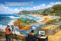
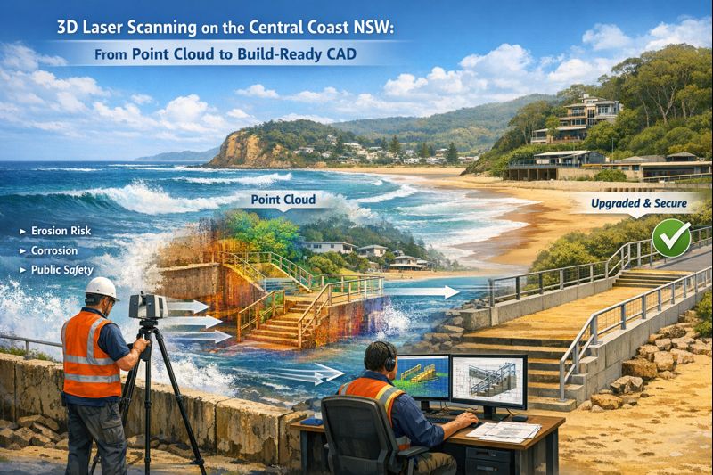
From laser scan to CAD: point cloud of Avoca Beach foreshore assets converted into build-ready engineering drawings.

Accurate site data is the difference between a smooth upgrade and a shutdown full of surprises.
At Hamilton By Design, we provide engineering-grade 3D laser scanning (LiDAR) across the Central Coast NSW โ€” including Wyong, Gosford, Tuggerah and Somersby โ€” and convert that data into design-ready CAD and 3D models for industrial and building projects.

If youโ€™re planning equipment upgrades, new conveyors, structural modifications or fabrication packages, scanning gives you reliable geometry before steel is cut or contractors mobilise.


Who this service is for

Our Central Coast scanning services are typically used by:

  • Project engineers planning plant or building upgrades
  • Maintenance teams preparing shutdown scopes
  • Fabricators needing accurate tie-in dimensions
  • Asset owners updating as-built records
  • Consultants managing brownfield modifications

If drawings donโ€™t match reality โ€” or donโ€™t exist at all โ€” scanning becomes the safest and fastest way to establish an accurate baseline.


3D LiDAR scanning services on the Central Coast providing engineering-grade laser scanning, point cloud capture, scan-to-CAD modelling and industrial reality capture for infrastructure and industrial projects.
Drafting services on the Central Coast providing engineering drawings, fabrication detailing, as-built documentation, reverse engineering and CAD drafting for industrial and infrastructure projects.
Mechanical engineering services on the Central Coast providing industrial design, plant inspections, pump calculations, reverse engineering and engineering support for manufacturing, infrastructure and heavy industry projects.

From scan to CAD: turning site data into buildable designs

A point cloud on its own doesnโ€™t solve project risk.
What matters is converting scan data into usable engineering outputs.

Our workflow supports:

  • 2D CAD drawings (plans, sections, elevations)
  • 3D CAD models for layout and clash detection
  • Tie-in modelling for new equipment and structures
  • Verification of clearances and access zones
  • Fabrication-ready geometry for workshop drawings

This scan-to-CAD process is especially valuable for retrofit projects where new components must integrate with existing assets.


Why 3D scanning is ideal for brownfield upgrades

Most Central Coast industrial and commercial sites are brownfield environments โ€” tight access, legacy equipment and undocumented modifications.

3D laser scanning helps to:

  • Reduce site re-visits and manual re-measuring
  • Identify clashes early in the design phase
  • Support off-site prefabrication
  • Shorten shutdown windows
  • Improve safety by limiting exposure time on site

When combined with engineering design, scanning becomes a risk-reduction tool, not just a survey method.


Engineer using 3D laser scanner at Avoca Beach foreshore with point cloud and CAD model showing upgrade of coastal stairs and seawall.

Typical Central Coast applications

We regularly support projects across:

Manufacturing and processing facilities

Equipment replacements, conveyor upgrades, access platform modifications.

Warehousing and logistics buildings

Structural modifications, mezzanine installations, services coordination.

Building services upgrades

Plantroom retrofits, mechanical services coordination, compliance verification.

Where Central Coast workshops are producing components for remote sites.


Local coverage: Wyong, Gosford, Tuggerah and Somersby

Being based on the Central Coast means we can support:

  • Rapid site capture
  • Staged scanning across multiple areas
  • Follow-up verification scans as scope evolves

That flexibility is important when designs change during live projects or shutdown preparation.


How accurate is engineering-grade LiDAR scanning?

Accuracy depends on site conditions and scope, but scanning provides consistent, repeatable geometry across complex environments that would be difficult and time-consuming to measure manually.

More importantly, it captures:

  • Spatial relationships
  • Real clearances
  • True equipment alignment

which are critical for retrofit engineering and fabrication.


When is scanning worth the investment?

Scanning typically delivers the best value when:

  • Drawings are outdated or incomplete
  • Fabrication must fit first time
  • Shutdown time is expensive
  • Access is restricted or unsafe
  • Multiple trades must coordinate in tight spaces

In many projects, preventing one major clash or rework cycle pays for the scan many times over.


Hamilton By Design logo displayed on a blue tilted rectangle with a grey gradient background

3D LiDAR scanning and 3D modelling service button โ€” laser scanner capturing a point cloud for engineering and CAD modelling
Mechanical engineering services

Planning an upgrade or fabrication project on the Central Coast?

If youโ€™re preparing for a shutdown, equipment upgrade or fabrication package across the Central Coast, early scanning can significantly reduce downstream risk.

Talk to Hamilton By Design about 3D laser scanning and point cloud to CAD support for your project.
Weโ€™ll help define the scope and deliverables that best suit your engineering and construction needs.

Name
Would you like us to arrange a phone consultation for you?
Address