


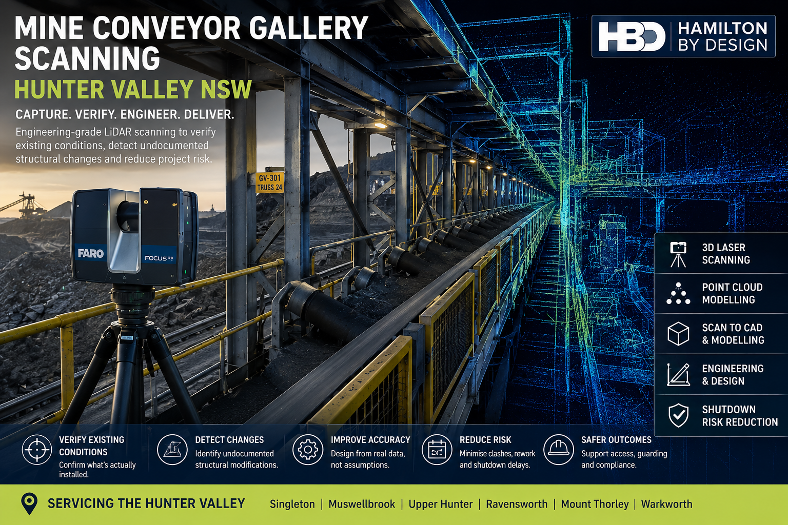
Mine Conveyor Gallery Scanning Hunter Valley NSW
Engineering-Grade LiDAR Scanning for Existing Conveyor Structures, Brownfield Upgrades and Shutdown Planning
Mine conveyor galleries are long-life assets that are frequently modified as operating requirements change. Over time, additional bracing may be installed, structural members may be strengthened, walkways altered, guarding replaced, services added and conveyor equipment upgraded.
The challenge is that these modifications are not always fully incorporated into the original engineering drawings.
For project, maintenance and structural engineering teams, this creates a significant source of uncertainty:
Does the available drawing represent the conveyor gallery that is actually installed on site?
Hamilton By Design provides mine conveyor gallery scanning services throughout the Hunter Valley NSW, using engineering-grade terrestrial LiDAR scanning, registered point clouds and CAD modelling to capture the actual existing condition of conveyor galleries and associated mining infrastructure.
The objective is not simply to create a 3D image of the conveyor.
It is to provide reliable engineering information that can be used to verify existing conditions, support structural modifications, reduce fabrication risk and improve shutdown planning.
The Problem: Undocumented Structural Changes
Mine conveyor galleries may operate for decades.
During their service life, structural and mechanical modifications can accumulate through maintenance projects, production upgrades, shutdown work and equipment replacement.
Examples may include:
- additional structural bracing;
- replacement beams or columns;
- strengthened connections;
- modified conveyor support frames;
- altered walkways;
- new access platforms;
- replacement handrails;
- additional equipment supports;
- pipework and service additions;
- relocated cable trays;
- modified guarding;
- changes to conveyor drives or pulleys; and
- local repairs following corrosion or damage.
The original drawings may remain useful, but they cannot always be assumed to represent the final installed arrangement.
Hamilton By Design’s work with 3D laser scanning for conveyor transfer towers addresses a closely related brownfield problem: conveyors, chutes, steelwork and access structures often evolve over time, creating differences between the physical plant and legacy drawings. (Hamilton By Design Co.)
For conveyor gallery upgrades, those differences can affect every stage from conceptual design through fabrication and installation.
What Risk Does Incorrect Existing Information Create?
The engineering risk is not simply that a drawing contains an incorrect dimension.
The larger issue is that a project may be developed around an incorrect understanding of the existing structure.
Structural Interface Risk
A proposed beam, support or platform may be designed around an assumed connection point that differs from the installed arrangement.
This can result in late redesign or unplanned field modifications.
Fabrication Fit-Up Risk
New steelwork may be fabricated accurately to the design model but still fail to fit because an undocumented brace, support or service occupies the required space.
Shutdown Risk
Unexpected existing conditions may only become apparent once the plant is isolated and installation work begins.
During a short shutdown window, even relatively minor fit-up problems can consume valuable time.
Access Risk
New equipment or structural modifications may interfere with walkways, platforms, guarding or maintenance access.
Scope and Cost Risk
Additional structural work may be discovered after detailed engineering has commenced, potentially affecting project scope, programme and cost.
The purpose of LiDAR scanning is therefore broader than dimensional measurement.
It is a method of reducing uncertainty before design decisions become expensive to change.
Who Can Benefit from Conveyor Gallery Scanning?
Mine conveyor gallery scanning can support:
- mine owners and operators;
- engineering managers;
- project engineers;
- structural engineers;
- mechanical engineers;
- maintenance teams;
- reliability engineers;
- shutdown planners;
- CHPP personnel;
- conveyor contractors;
- EPCM organisations;
- structural steel fabricators; and
- drafting and modelling teams.
The strongest use case is generally a brownfield project where new work must interface accurately with existing infrastructure.
A structural engineer may need to know the actual position of existing steel before developing strengthening details.
A mechanical engineer may need the conveyor centreline, drive arrangement or equipment envelope.
A fabricator may need confidence that a prefabricated assembly will fit when delivered to site.
All of these requirements depend on reliable existing-condition information.
Capture the Existing Conveyor Gallery
Terrestrial LiDAR scanning allows conveyor galleries and their surrounding structures to be captured from multiple positions.
The scanner records millions of spatial measurements that collectively describe the visible geometry of the structure.
Typical items captured may include:
- conveyor trusses;
- gallery steelwork;
- trestles and columns;
- structural bracing;
- conveyor stringers;
- idler frames;
- pulley arrangements;
- access platforms;
- stairs and walkways;
- handrails;
- guarding;
- equipment supports;
- pipework;
- cable trays;
- services; and
- interfaces with transfer towers.
The advantage over isolated field measurements is context.
Rather than measuring only the component thought to be important at the beginning of the project, the scan captures the broader physical relationship between the structure, conveyor equipment and surrounding plant.
Hamilton By Design’s broader 3D laser scanning services specifically address the limitations of outdated as-built drawings and manual measurement in complex industrial environments, where undocumented changes and difficult access can undermine design accuracy. (Hamilton By Design Co.)
Register the Point Cloud
Individual scans are processed and aligned into a registered point-cloud dataset.
This produces a measurable digital representation of the conveyor gallery at the time of capture.
Engineering teams can then inspect and measure the gallery away from site.
Potential measurements include:
- structural member positions;
- elevations;
- conveyor centrelines;
- beam spacing;
- column locations;
- bracing geometry;
- clearances;
- walkway widths;
- platform elevations;
- equipment offsets; and
- service locations.
This can substantially reduce the need to return to site every time an additional dimension becomes important during detailed design.
A useful project principle is:
Capture comprehensively on site, then measure selectively during engineering.
Compare Drawings with the Installed Structure
Where legacy drawings are available, LiDAR provides an opportunity to compare documented geometry with actual site conditions.
This may identify:
- additional structural members;
- removed members;
- relocated components;
- modified platforms;
- undocumented services;
- altered support arrangements; and
- differences in equipment position.
This is particularly important when historical drawings are labelled as-built but have not been comprehensively updated following later modifications.
Hamilton By Design also uses LiDAR for as-built drawings derived from registered point clouds, allowing structural, mechanical and service information to be documented from the physical installed condition rather than relying solely on historic mark-ups. (Hamilton By Design Co.)
For conveyor-gallery projects, the principle is straightforward:
Use the drawing as engineering information, but verify critical interfaces against reality.
From Point Cloud to CAD or BIM
A registered point cloud can often provide sufficient information for measurement and spatial review.
However, some projects benefit from converting selected elements into CAD or BIM geometry.
Depending on the engineering scope, modelling may include:
- primary structural steel;
- conveyor centreline;
- trestles;
- bracing;
- walkways;
- platforms;
- equipment supports;
- conveyor equipment; and
- interfaces with adjacent structures.
The appropriate level of modelling should be determined by the engineering purpose.
There is little value in modelling every nut, bolt and cable if those details do not influence the proposed modification.
For larger engineering and asset-information workflows, Hamilton By Design’s Scan to BIM services for Newcastle and the Hunter support conveyor upgrades, structural modifications, mining assets and brownfield projects using LiDAR capture, point clouds and digital modelling. (Hamilton By Design Co.)
The purpose is to create usable engineering information rather than digital complexity for its own sake.
Design Against the Actual Installed Condition
Once the existing conveyor gallery has been captured, proposed structural or mechanical modifications can be reviewed against the point cloud.
This allows engineers to assess:
- structural connection points;
- equipment clearances;
- conveyor alignment;
- new support locations;
- platform interfaces;
- access requirements;
- guarding;
- service clashes; and
- installation space.
A proposed steel assembly can be positioned within the existing scan before fabrication.
This provides an opportunity to identify clashes or incorrect assumptions while changes are still relatively inexpensive.
A useful engineering objective is:
Find the clash in the digital model rather than during the shutdown.
Improving Shutdown Preparation
Mine conveyor modifications are frequently undertaken during planned shutdowns.
The available installation period may be limited, while multiple trades and work fronts compete for access.
Unexpected structural conditions during these periods can create significant disruption.
Accurate LiDAR information can support shutdown planning by allowing engineering teams to investigate the existing gallery before the shutdown begins.
Potential benefits include:
- improved fabrication confidence;
- better identification of interface conditions;
- reduced field measuring;
- earlier clash detection;
- improved installation planning;
- better understanding of access limitations; and
- fewer unplanned modifications during installation.
This does not eliminate every project risk, but it can substantially improve the quality of information used to manage those risks.
Mine Conveyor Gallery Scanning Across the Hunter Valley
The Hunter Valley contains extensive mining, coal-processing and bulk-material-handling infrastructure.
Hamilton By Design supports engineering and 3D scanning projects throughout the region, including areas around:
- Singleton;
- Muswellbrook;
- Ravensworth;
- Mount Thorley;
- Warkworth;
- Lemington;
- the Upper Hunter; and
- the wider Hunter Region.
The Hunter region includes substantial mining, industrial, coal-handling and materials-handling infrastructure, making accurate existing-condition information particularly relevant for brownfield upgrades and ongoing asset maintenance. Hamilton By Design’s regional services include LiDAR scanning, point-cloud modelling, reverse engineering and scan-to-fabrication workflows. (Hamilton By Design Co.)
Tools Supporting Conveyor Gallery Scanning
A conveyor-gallery project may use several complementary technologies.
FARO Focus S70 can provide high-density terrestrial LiDAR capture of conveyor and structural infrastructure.
FARO Orbis may assist with supplementary mobile capture where appropriate to the required accuracy and site conditions.
FARO SCENE supports scan registration and point-cloud processing.
Autodesk ReCap assists with point-cloud preparation and use within CAD workflows.
SolidWorks can support mechanical modelling, equipment interfaces and fabrication-oriented design.
Autodesk Inventor and AutoCAD can support plant modelling, structural layouts and engineering documentation.
Navisworks can assist with model coordination and clash review.
Revit may be used where a structured BIM model is required.
Depending on the project, deliverables may include:
- E57 point clouds;
- RCP and RCS files;
- LAS datasets;
- measurable point clouds;
- CAD models;
- SolidWorks models;
- STEP or Parasolid files;
- DWG and DXF drawings;
- general arrangement drawings;
- sections and elevations;
- existing-versus-proposed models;
- clash-review models; and
- PDF engineering documentation.
The software is not the principal product.
The principal product is improved confidence in the existing-condition information used for engineering.
Frequently Asked Questions
What is mine conveyor gallery scanning?
Mine conveyor gallery scanning uses terrestrial LiDAR to capture the three-dimensional geometry of conveyor structures, structural steel, access systems, equipment and surrounding services.
Why scan a conveyor gallery if drawings already exist?
Existing drawings can remain valuable, but conveyor galleries may have undergone structural or mechanical modifications that are not fully documented. LiDAR allows critical existing conditions to be checked against the physical structure.
Can LiDAR identify undocumented structural changes?
LiDAR captures visible installed geometry. When compared with existing drawings or models, it can help identify differences such as additional bracing, relocated members, altered platforms and changed equipment positions.
Can additional measurements be taken after leaving site?
Yes. Once the scans are correctly registered, engineers can obtain many additional dimensions from the point cloud as the project develops.
Can the scan support structural upgrades?
Yes. Point-cloud information can support structural engineering by documenting existing member positions, connections, clearances and interfaces required for modification work.
Can the point cloud be converted into CAD?
Yes. Relevant portions of the gallery can be converted into fit-for-purpose CAD or BIM geometry depending on the project requirements.
Can conveyor gallery scanning reduce shutdown risk?
It can reduce uncertainty by improving knowledge of existing conditions before fabrication and installation. This may help identify clashes and interface issues before the shutdown begins.
What areas does Hamilton By Design service in the Hunter Valley?
Hamilton By Design can support projects throughout the Hunter Valley, including Singleton, Muswellbrook, the Upper Hunter and surrounding mining and industrial areas.
Mine Conveyor Gallery Scanning Hunter Valley NSW
For brownfield conveyor projects, one of the greatest risks is designing against an existing-condition record that no longer reflects the physical plant.
Engineering-grade LiDAR scanning provides a practical method of capturing conveyor galleries, structural steel, access systems and surrounding infrastructure before modification work begins.
The resulting point cloud can support verification, measurement, CAD modelling, structural design, fabrication and shutdown planning.
For mine operators and engineering teams throughout the Hunter Valley NSW, the principle is simple:
Verify what is installed. Design from measured reality. Reduce uncertainty before fabrication and shutdown execution.

Contact Us – Talk To Us
Our clients:
























