Engineer-Led Industrial LiDAR Scanning for Mining and Heavy Industry

Engineer performing industrial LiDAR scanning on an Australian mining plant with point cloud overlay and mechanical CAD modelling workflow

Engineering-Grade LiDAR Scanning Australia | Hamilton By Design

Engineer-Led Industrial LiDAR Scanning Australia | Hamilton By Design

At Hamilton By Design, we believe industrial 3D laser scanning should deliver far more than a visual model or virtual walkthrough. In mining, manufacturing and heavy industrial environments, scanning data must support engineering decisions, fabrication accuracy, shutdown planning and long-term asset management.

Many companies now offer โ€œ3D scanningโ€ services. However, not all scanning systems, workflows or providers are the same. Across Australia, the market has become crowded with companies focused on real estate visualisation, architectural walkthroughs and general BIM modelling. While these services have their place, industrial facilities require a very different level of technical understanding.

Hamilton By Design specialises in engineer-led industrial LiDAR scanning focused on mechanical and structural engineering outcomes.


Why Industrial Facilities Require a Different Approach

Industrial sites are complex environments involving:

  • conveyors,
  • transfer chutes,
  • structural steel,
  • pipework,
  • pump skids,
  • process equipment,
  • access platforms,
  • shutdown works,
  • and brownfield modifications.
3D CAD Modelling Australia service banner for Hamilton By Design

In these environments, inaccurate data can create significant commercial and operational risks.

Poor-quality scanning or incomplete site capture can lead to:

  • fabrication clashes,
  • installation delays,
  • shutdown overruns,
  • rework costs,
  • safety risks,
  • and engineering non-conformance.

Unlike architectural walkthroughs or property visualisation projects, industrial scanning must support measurable engineering outcomes.

This is why Hamilton By Design focuses on:

  • engineering-grade terrestrial LiDAR,
  • scan-to-CAD workflows,
  • controlled engineering documentation,
  • and engineering governance systems.

Engineer-Led Scanning vs General Scanning Services

Owning a scanner does not automatically make a company an engineering specialist.

Many scanning providers focus on:

  • virtual tours,
  • digital walkthroughs,
  • building visualisation,
  • or general BIM deliverables.

Hamilton By Design approaches scanning differently.

Our workflow is driven by:

  • mechanical engineering requirements,
  • structural engineering considerations,
  • fabrication suitability,
  • and industrial project delivery.

We understand:

  • plant shutdown environments,
  • fabrication tolerances,
  • maintenance access requirements,
  • structural modifications,
  • and brownfield installation challenges.

This allows us to deliver scanning outcomes aligned with real engineering applications rather than simply producing point cloud data.


Industrial LiDAR Applications

Our industrial LiDAR scanning services support a wide range of applications across Australia.

Mining and Processing Plants

We assist mining and processing facilities with:

  • conveyor system upgrades,
  • transfer chute modifications,
  • pump station upgrades,
  • SMP projects,
  • slurry transport systems,
  • structural steel modifications,
  • and brownfield plant expansions.

Shutdown Planning

Accurate point cloud capture allows engineering teams to:

  • verify as-built conditions,
  • reduce shutdown uncertainty,
  • improve prefabrication accuracy,
  • and minimise onsite fit-up issues.

Structural and Mechanical Engineering

LiDAR data can support:

  • General Arrangement (GA) drawings,
  • structural modelling,
  • equipment integration,
  • pipe routing,
  • and engineering verification workflows.

Digital Engineering and Asset Management

Our workflows support:

  • scan-to-CAD modelling,
  • controlled revisions,
  • engineering governance,
  • and long-term asset documentation.

Understanding the Different Types of 3D Scanning

Not all scanning technologies are designed for the same purpose.

Terrestrial LiDAR Scanning

Tripod-based terrestrial LiDAR systems are typically best suited for:

  • industrial facilities,
  • mining plants,
  • brownfield environments,
  • and engineering-grade capture.

These systems provide highly controlled and repeatable data suitable for engineering workflows.

Mobile SLAM Scanning

SLAM-based systems can rapidly capture large environments and are useful in some applications. However, depending on the project requirements, these systems may introduce drift or reduced control compared with fixed terrestrial workflows.

Handheld Scanners

Handheld systems are often useful for:

  • smaller components,
  • reverse engineering,
  • and detailed geometry capture.

Virtual Tour Systems

Matterport and walkthrough systems can provide excellent visualisation tools but may not always deliver the level of engineering control required for fabrication or detailed industrial design.

At Hamilton By Design, we work with the technology that best suits the engineering outcome required by the client.

We do not make promises we cannot keep.


Why Engineering Governance Matters

One of the largest risks in industrial projects is poor drawing and document control.

Many organisations continue operating with:

  • outdated PDFs,
  • disconnected revisions,
  • unmanaged redlines,
  • and uncontrolled drawing systems.

Hamilton By Design supports engineering governance through:

  • revision-controlled workflows,
  • issue states such as IFR / IFA / IFC,
  • audit-ready documentation,
  • and structured engineering deliverables.

We also support workflows using:

  • SolidWorks,
  • AutoCAD LT,
  • and the 3DEXPERIENCE platform.

This helps provide a controlled single source of truth for engineering information across the project lifecycle.


Supporting Australian Industry

Hamilton By Design supports clients across Australia including:

  • mining operations,
  • manufacturing facilities,
  • processing plants,
  • infrastructure projects,
  • and heavy industrial sites.

We understand the realities of:

  • remote site access,
  • shutdown windows,
  • operational constraints,
  • and industrial project delivery.

Our focus is not simply collecting scan data.

Our focus is helping clients reduce engineering risk and improve project outcomes.


Industrial Scanning Backed by Engineering Understanding

The value of LiDAR scanning is not only the scanner itself.

The true value comes from:

  • understanding the engineering problem,
  • capturing the correct information,
  • and delivering data that supports real project outcomes.

At Hamilton By Design, our engineer-led approach combines:

  • industrial LiDAR scanning,
  • mechanical engineering understanding,
  • structural engineering workflows,
  • and engineering governance systems.

This allows us to support projects from initial site capture through to engineering documentation and fabrication-ready deliverables.


3D LiDAR scanning and 3D modelling service button โ€” laser scanner capturing a point cloud for engineering and CAD modelling
Mechanical engineering services

Our clients

Contact Hamilton By Design

To discuss industrial LiDAR scanning, scan-to-CAD workflows or engineering support for your next project, contact:

Hamilton By Design

We support mining, manufacturing and industrial clients across Australia with engineer-led reality capture and engineering documentation solutions.

Hamilton By Design logo displayed on a blue tilted rectangle with a grey gradient background

FARO Technologies โ€” Industrial 3D laser scanning, metrology and reality capture hardware/software solutions.

SolidWorks โ€” Professional CAD, simulation and product development platform widely used in mechanical engineering.

Dassault Systรจmes 3DEXPERIENCE Platform โ€” Cloud-based engineering governance, collaboration and product lifecycle management platform.

3D CAD Modelling Australia service banner for Hamilton By Design
Australian Drafting logo featuring bold white text reading "Australian Drafting" centred on a blue rounded rectangle background.
Engineering Governance title graphic featuring bold white text reading "Engineering Governance" centred on a blue rounded rectangle background.
Mechanical, Structural & Pipework Drafting service banner by Hamilton By Design featuring white text on a blue background.
Mechanical engineering services
Blue rounded button with the text โ€œSolidWorks Designโ€ in white.
Finite Element Analysis (FEA) engineering simulation button
3D LiDAR Scanning Darwin for engineering surveys, laser scanning, reality capture and point cloud modelling services
3D LiDAR Scanning Australia engineering services for laser scanning, reality capture, scan-to-CAD, Scan-to-BIM and as-built documentation across Australia
3D LiDAR scanning services on the Central Coast providing engineering-grade laser scanning, point cloud capture, scan-to-CAD modelling and industrial reality capture for infrastructure and industrial projects.
3D LiDAR Scanning Perth for engineering surveys, laser scanning, reality capture and point cloud modelling services
3D LiDAR Scanning Sydney for engineering surveys, laser scanning, reality capture and point cloud modelling services
3D LiDAR Scanning Brisbane for engineering surveys, laser scanning, reality capture and point cloud modelling services
3D LiDAR Scanning Canberra for engineering surveys, laser scanning, reality capture and point cloud modelling services
3D LiDAR Scanning Newcastle for engineering surveys, laser scanning, reality capture and point cloud modelling services
3D LiDAR Scanning Adelaide for engineering surveys, laser scanning, reality capture and point cloud modelling services

Engineering and 3D LiDAR Scanning Services in Prineville, Oregon

Prineville, Oregon has a long industrial history built around timber, forestry, sawmills, and manufacturing. While the region is now recognised internationally for technology infrastructure and data centres, the timber and wood processing industries continue to play a major role in the local economy and industrial landscape.

Across sawmills, woodworking facilities, manufacturing plants, and industrial operations, companies are under increasing pressure to improve safety, reduce downtime, modernise aging infrastructure, and maintain accurate engineering documentation.

This is where Hamilton By Design Co. can assist.

Hamilton By Design Co. provides engineer-led 3D LiDAR scanning, scan-to-CAD services, structural drafting, mechanical engineering support, and industrial digital engineering workflows for timber processing facilities, woodworking operations, industrial plants, and manufacturing infrastructure.

By combining engineering knowledge with high-accuracy terrestrial LiDAR scanning technology, Hamilton By Design helps companies reduce project risk, improve fabrication accuracy, and develop reliable as-built documentation for maintenance, shutdowns, plant upgrades, and future expansion projects.

Many timber mills and woodworking facilities contain highly mechanical environments involving:

  • conveyors,
  • transfer systems,
  • saw lines,
  • material handling systems,
  • dust extraction infrastructure,
  • hydraulic equipment,
  • structural steel platforms,
  • rotating machinery,
  • and processing equipment.

Over decades of operation, many industrial facilities evolve through ongoing modifications, maintenance activities, and equipment replacements. In many cases, original drawings no longer reflect actual onsite conditions.

3D CAD Modelling Australia service banner for Hamilton By Design

This creates significant engineering and commercial risks when companies attempt to:

  • install new machinery,
  • modify conveyors,
  • replace structural steel,
  • increase production capacity,
  • redesign transfer systems,
  • or upgrade processing infrastructure.

Outdated or inaccurate drawings can result in:

  • fabrication clashes,
  • installation delays,
  • increased labour costs,
  • shutdown overruns,
  • safety concerns,
  • and costly rework onsite.

Hamilton By Design assists companies by capturing engineering-grade point cloud data using terrestrial 3D LiDAR scanning systems. Instead of relying on manual measurements or outdated PDFs, industrial facilities can be digitally captured with millimetre-level accuracy before engineering or fabrication work begins.

Unlike low-cost visual-only scanning services, Hamilton By Design operates as an engineer-led organisation focused on practical industrial and fabrication outcomes.

Using engineering-grade terrestrial LiDAR scanning equipment, facilities can be scanned to support:

  • sawmill upgrades,
  • conveyor redesigns,
  • mechanical modifications,
  • structural steel alterations,
  • equipment replacements,
  • dust extraction upgrades,
  • and brownfield shutdown projects.

Captured point cloud data can then be converted into:

  • 3D CAD models,
  • as-built layouts,
  • fabrication drawings,
  • structural steel models,
  • mechanical assemblies,
  • engineering sections and elevations,
  • and controlled documentation packages.

For timber mills and woodworking facilities, this provides a more reliable engineering foundation for maintenance planning, fabrication, construction, and operational upgrades.

The woodworking and timber industries contain significant operational and mechanical risks. Equipment failures involving conveyors, saw systems, platforms, guarding, lifting systems, or structural supports can create serious safety consequences if engineering design, modifications, or fabrication are not properly managed.

Hamilton By Design supports companies through:

  • accurate site measurement,
  • engineering-grade scanning,
  • structural and mechanical drafting,
  • engineering modelling,
  • and controlled engineering documentation systems.

Modern engineering workflows increasingly rely on:

  • accurate as-built data,
  • finite element analysis (FEA),
  • controlled revision systems,
  • and engineering governance platforms

to ensure modifications are properly documented and validated before installation.

Using technologies such as:

  • terrestrial LiDAR scanning,
  • SolidWorks 3D modelling,
  • engineering simulation tools,
  • and the 3DEXPERIENCE platform,

project teams can better understand loading conditions, structural interactions, fabrication requirements, and installation constraints before work proceeds onsite.

This helps reduce engineering uncertainty while improving safety, planning accuracy, and project coordination.

Hamilton By Design can also assist companies operating within brownfield industrial environments where construction and upgrades occur around existing operational equipment.

Brownfield facilities often present challenges including:

  • restricted access,
  • undocumented modifications,
  • tight shutdown windows,
  • difficult measurement conditions,
  • and limited historical engineering information.

Through engineer-led scanning and digital engineering workflows, Hamilton By Design supports:

  • shutdown planning,
  • point cloud registration,
  • scan-to-CAD conversion,
  • equipment modelling,
  • and engineering drawing development.

This allows engineers, fabricators, and project managers to work from accurate digital representations of the facility rather than assumptions or incomplete historical records.

For timber mills, woodworking facilities, and industrial plants in Prineville, this can significantly improve:

  • fabrication accuracy,
  • installation efficiency,
  • shutdown coordination,
  • and project delivery outcomes.

Hamilton By Design can support industrial facilities with:

  • conveyor engineering,
  • transfer chute layouts,
  • structural steel drafting,
  • equipment support structures,
  • maintenance platforms,
  • pipework drafting,
  • access systems,
  • and mechanical design support.

By integrating point cloud data directly into the engineering workflow, new infrastructure can be designed within the context of actual site conditions.

This is particularly valuable in older forestry and industrial facilities where:

  • tolerances are tight,
  • access is restricted,
  • and existing drawings may no longer reflect reality.

As industrial facilities continue modernising, engineering governance and drawing control are becoming increasingly important. Many projects now require controlled revision systems, audit-ready documentation, and accurate digital engineering records.

Hamilton By Design supports structured engineering workflows through:

  • controlled drawing revisions,
  • digital engineering management,
  • engineering document governance,
  • and coordinated CAD environments.

This assists companies in maintaining:

  • accurate as-built drawings,
  • traceable engineering changes,
  • controlled fabrication information,
  • and long-term digital asset records.

For industrial facilities in Prineville, this supports safer operations, improved maintenance planning, and more efficient future expansion projects.

As Prineville continues growing across timber processing, forestry, manufacturing, industrial infrastructure, and technology sectors, the demand for accurate engineering information will continue increasing.

Hamilton By Design combines:

  • engineering expertise,
  • industrial plant knowledge,
  • terrestrial LiDAR scanning,
  • 3D CAD modelling,
  • and engineering governance systems

to support safer and more efficient industrial project delivery.

Hamilton By Design logo displayed on a blue tilted rectangle with a grey gradient background

Whether assisting with a timber mill upgrade, woodworking facility expansion, conveyor modification, shutdown project, structural steel redesign, or industrial mechanical installation, engineer-led 3D scanning provides a practical pathway toward improved engineering accuracy, reduced project risk, and more reliable long-term infrastructure management.

3D LiDAR scanning and 3D modelling service button โ€” laser scanner capturing a point cloud for engineering and CAD modelling
Mechanical engineering services
3D LiDAR Scanning Darwin for engineering surveys, laser scanning, reality capture and point cloud modelling services
3D LiDAR Scanning Australia engineering services for laser scanning, reality capture, scan-to-CAD, Scan-to-BIM and as-built documentation across Australia
3D LiDAR scanning services on the Central Coast providing engineering-grade laser scanning, point cloud capture, scan-to-CAD modelling and industrial reality capture for infrastructure and industrial projects.
3D LiDAR Scanning Perth for engineering surveys, laser scanning, reality capture and point cloud modelling services
3D LiDAR Scanning Sydney for engineering surveys, laser scanning, reality capture and point cloud modelling services
3D LiDAR Scanning Brisbane for engineering surveys, laser scanning, reality capture and point cloud modelling services
3D LiDAR Scanning Canberra for engineering surveys, laser scanning, reality capture and point cloud modelling services
3D LiDAR Scanning Newcastle for engineering surveys, laser scanning, reality capture and point cloud modelling services
3D LiDAR Scanning Adelaide for engineering surveys, laser scanning, reality capture and point cloud modelling services

3D Scanning Company

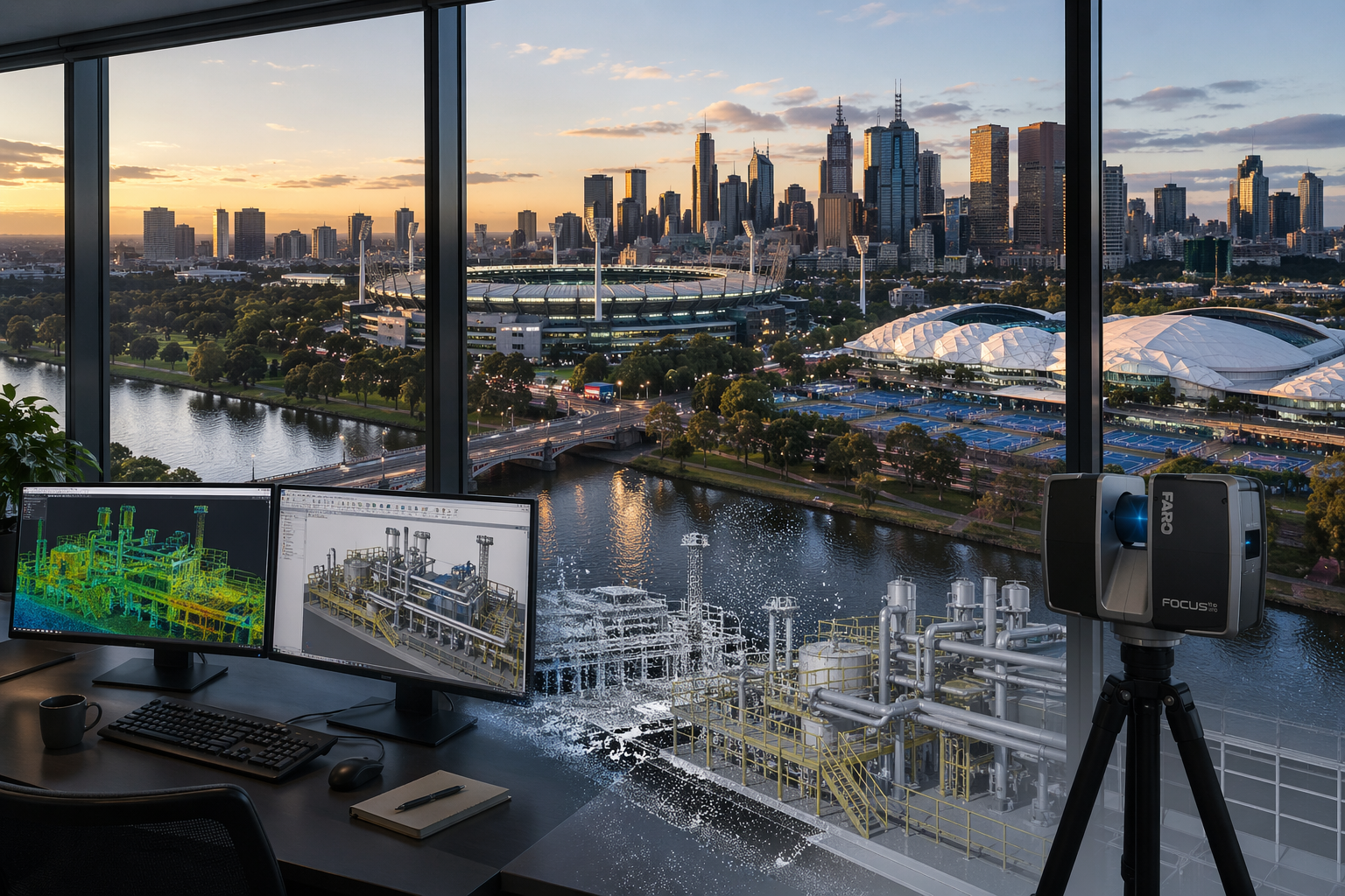
Melbourne office view with Yarra River, MCG and 3D modelling workstation
Blue 3D LiDAR scanner icon on a tripod with scanning waves

A professional 3D scanning company does more than capture data โ€” it delivers accurate, engineering-ready information that can be used for design, construction, and asset management.

At Hamilton By Design, we provide engineering-led 3D laser scanning services, converting real-world conditions into precise digital models for industrial, mining, and infrastructure projects.


What We Do

We provide 3D scanning services including:

  • Terrestrial LiDAR scanning
  • Point cloud to CAD modelling
  • Reverse engineering
  • Industrial plant scanning
  • Brownfield project support

Our focus is on delivering accurate data that can be used for real engineering outcomes.


3D LiDAR scanning and 3D modelling service button โ€” laser scanner capturing a point cloud for engineering and CAD modelling
Mechanical engineering services

LiDAR Scanning

We use high-accuracy LiDAR scanners to capture millions of data points across your site.

This allows us to:

  • Capture true as-built conditions
  • Measure complex environments
  • Improve design accuracy
  • Reduce reliance on outdated drawings

Point Cloud to CAD

Captured scan data is processed into usable engineering models.

This helps:

  • Reduce design clashes
  • Improve installation accuracy
  • Minimise rework

Models are developed in platforms such as SolidWorks and delivered in formats suitable for design and fabrication.


Reverse Engineering

We convert scan data into detailed models where drawings are missing or outdated.

This is ideal for:

  • Legacy equipment
  • Conveyor systems
  • Pipework and mechanical assemblies

Brownfield Projects

Most scanning work is carried out in existing plants where drawings are limited or inaccurate.

We support these projects by:

  • Scanning existing infrastructure
  • Developing accurate 3D models
  • Supporting design that fits first time

3D CAD Modelling Australia service banner for Hamilton By Design

Deliverables

We provide:

  • Registered point clouds (.E57, .RCP, .LAS)
  • 3D CAD models
  • General arrangement drawings
  • Fabrication drawings

We also offer drawing management through the 3DEXPERIENCE Platform, providing secure access to project data.


Why Choose Hamilton By Design

  • Engineering-led approach
  • High-accuracy LiDAR scanning
  • Integration with CAD workflows
  • Fast turnaround times
  • Experience in mining and industrial environments

Get Started

If you need a reliable 3D scanning company, Hamilton By Design can support your project from scan through to design and fabrication.


Our clients

Contact Us – Talk to Us

Name
Would you like us to arrange a phone consultation for you?
Address

Terrestrial LiDAR Scanner | Engineering-Grade 3D Laser Scanning

Terrestrial LiDAR scanner capturing industrial plant

What is a Terrestrial LiDAR Scanner?

A terrestrial LiDAR scanner is a ground-based 3D laser scanning system used to capture highly accurate measurements of real-world environments and convert them into detailed digital models known as point clouds.

At Hamilton By Design, we use engineering-grade terrestrial LiDAR scanning to support design, drafting, and construction across industrial, mining, and infrastructure projects.


3D LiDAR scanning and 3D modelling service button โ€” laser scanner capturing a point cloud for engineering and CAD modelling
Mechanical engineering services

How a Terrestrial LiDAR Scanner Works

A terrestrial LiDAR scanner measures distance using laser technology:

  • A laser beam is emitted from the scanner
  • The beam reflects off surfaces such as steel, concrete, or pipework
  • The scanner records the return signal
  • Distance is calculated using time-of-flight or phase shift
  • Millions of measurements are captured per second

The result is a dense and accurate 3D point cloud representing the scanned environment.


What is a Point Cloud?

A point cloud is a digital dataset made up of millions (or billions) of points.

Each point contains:

  • X, Y, Z coordinates
  • Spatial position in 3D space
  • Optional colour information (RGB)

This creates a true-to-life digital representation of physical assets, forming the foundation for CAD modelling and engineering design.


Why Use a Terrestrial LiDAR Scanner?

Accuracy

Terrestrial LiDAR scanners provide millimetre-level accuracy, making them suitable for engineering and fabrication.

Speed

Large and complex environments can be captured quickly compared to traditional survey methods.

Safety

Data can be captured without direct access to hazardous or difficult-to-reach areas.

Reduced Rework

Designs are based on real-world data, reducing clashes and site modifications.


3D CAD Modelling Australia service banner for Hamilton By Design

Engineering Applications

Terrestrial LiDAR scanning is widely used across:

  • Industrial plant upgrades
  • Mining and processing facilities
  • Structural and mechanical design
  • Brownfield engineering projects
  • As-built verification
  • Reverse engineering

For projects requiring integration with your team, this capability can also be delivered through our engineering secondment services:
https://www.hamiltonbydesign.com.au/home/secondment-services/


Engineering-Led LiDAR Scanning

Not all LiDAR scanning is equal.

At Hamilton By Design, scanning is performed with an engineering-first approach, ensuring the data is suitable for downstream use in CAD and design.

Key considerations include:

  • Line-of-sight limitations
  • Scan density and coverage
  • Registration accuracy
  • Data structure and usability

This ensures the output is not just a visual model, but a usable engineering dataset.


From Scan to CAD

Our workflow converts LiDAR data into practical deliverables:

Scan โ†’ Register โ†’ Model โ†’ Detail โ†’ Deliver

This includes:

  • Point cloud registration (.E57, .RCP, .LAS)
  • 3D CAD modelling (SolidWorks and other platforms)
  • 2D drawings and fabrication-ready documentation

Terrestrial vs Other Scanning Methods

  • Terrestrial LiDAR: High accuracy, long range, ideal for engineering
  • Handheld scanners: Faster but lower accuracy, suited to small objects
  • Photogrammetry: Visual models, not typically engineering-grade

For industrial and brownfield environments, terrestrial LiDAR remains the preferred method.


Terrestrial LiDAR scanner capturing industrial plant with Sydney Harbour Bridge in background

In-House & Secondment Delivery

We provide flexible delivery models to suit your project:

  • In-house scanning and modelling (fully managed)
  • Secondment services (embedded within your team)

Learn more about our secondment capability:
https://www.hamiltonbydesign.com.au/home/secondment-services/


Why Choose Hamilton By Design

  • Engineering-led LiDAR scanning
  • Integration with CAD modelling and drafting
  • Strong experience in industrial and mining environments
  • Brownfield project expertise
  • Practical, buildable outputs

Hamilton By Design logo displayed on a blue tilted rectangle with a grey gradient background

Get Started with Terrestrial LiDAR Scanning

If you require accurate, engineering-grade 3D data for your project, a terrestrial LiDAR scanner provides the foundation for reliable design and execution.

Hamilton By Design delivers scanning, modelling, and engineering support across Sydney and Australia.

Talk to Us – Contact Us

Name
Would you like us to arrange a phone consultation for you?
Address

Mechanical Engineering | Structural Engineering


Brownfield Project Management

Brownfield industrial plant point cloud compared to clean Navisworks model showing real-world conditions versus design coordination

The Reality of Brownfield Development – Brownfield Project Management: Why Point Cloud Data Should Not Be Managed in Navisworks

Brownfield projects are not clean, linear, or model-driven.

They are:

  • Reactive
  • Incremental
  • Constrained by existing infrastructure
  • Driven by time, cost, and operational pressure

In this environment, the idea of maintaining a fully coordinated 3D model is often unrealistic.

A simple example illustrates this:

An electrician installs an additional power point on site. The work is completed, energised, and signed off. The drawings may be updated later โ€” the model almost never is.

This is not a failure of process โ€” it is the reality of brownfield operations.


3D LiDAR scanning and 3D modelling service button โ€” laser scanner capturing a point cloud for engineering and CAD modelling
Mechanical engineering services

Engineering Reality: From Sketch to CAD

Before anything becomes a 3D model, it starts much simpler.

As engineers, we still:

  • Sketch ideas
  • Mark up drawings
  • Discuss constraints on site

Only after this thinking process do concepts become CAD models.

This reinforces a key principle:

Engineering decisions are not driven by software โ€” software supports engineering judgement.


The Problem with Model-Centric Workflows

Platforms such as Autodesk Navisworks Manage are often positioned as central coordination tools, and in the right context they are highly effective.

However, in brownfield environments they introduce challenges:

Model Drift

  • Models quickly become outdated
  • Site changes are rarely captured in real time

High Maintenance Cost

  • Continuous updates require time and budget
  • Maintenance of models is rarely prioritised operationally

Limited Long-Term Trust

  • Teams revert back to:
    • Drawings
    • Site verification
    • Experience

The result is that the model becomes a temporary tool rather than a reliable long-term asset.


Where Multi-Discipline Coordination Actually Matters

Navisworks is most powerful when used for:

  • Multi-discipline coordination
  • Clash detection
  • Design validation

This is critical in greenfield environments where:

  • Structural, mechanical, electrical, and civil systems are designed simultaneously
  • Multiple teams work in parallel
  • Design clashes must be resolved before construction

In these cases, Navisworks plays a vital role in reducing risk and improving delivery outcomes.


Brownfield Reality: Coordination Happens on Site

In brownfield environments, the situation is very different.

Work is typically:

  • Localised
  • Task-specific
  • Carried out in isolation

Constraints are:

  • Already physically present
  • Visible and measurable
  • Managed in real time on site

In many cases:

Multi-discipline coordination is minimal or already resolved physically.

For example, an electrician installing a new outlet:

  • Reviews the environment
  • Works around existing services
  • Completes the installation

There is no model update, no coordination session, and no Navisworks workflow involved.


Point Cloud Data: The True As-Built Record

Using platforms such as FARO SCENE, point cloud data provides:

  • A direct capture of real-world conditions
  • A measurable and verifiable dataset
  • A snapshot of the plant at a point in time

Unlike models, point clouds are not interpretations โ€” they are records of reality.


3D CAD Modelling Australia service banner for Hamilton By Design

Critical Limitation: Line-of-Sight

Point cloud data is inherently line-of-sight dependent.

This means:

  • Only visible surfaces are captured
  • Occlusions create gaps in the dataset

When navigating a point cloud โ€” whether in SCENE or Navisworks โ€” moving outside original scan positions reveals these gaps.

Importantly:

  • This is not a software limitation
  • It is a fundamental characteristic of LiDAR capture

Creating a Navisworks model from a point cloud does not resolve this issue. It simply introduces another layer of processing without improving data completeness.


Why Navisworks Adds Limited Value for Point Cloud Management

If the objective is:

  • Visualisation
  • Measurement
  • Inspection

Then native scan platforms already provide these capabilities.

Within SCENE, users can:

  • Navigate freely
  • Measure accurately
  • Clip and section data
  • Access models using free viewer tools

Introducing Navisworks adds:

  • Additional processing steps
  • Data conversion (e.g. E57 to RCP)
  • Larger and duplicated datasets
  • No improvement in scan accuracy or completeness

Navisworks does not remove line-of-sight limitations, does not fill missing data, and does not enhance the underlying scan.


Best Practice: Brownfield Data Strategy

A more practical and effective approach is:

1. Point Cloud as the Primary Asset

  • Maintain original scan data (e.g. E57)
  • Store registered datasets
  • Use native platforms for access and interrogation

2. Targeted Modelling Only Where Required

  • Model critical interfaces and tie-in points
  • Avoid full plant modelling unless necessary

3. Drawings for Formal Deliverables

  • Maintain as-built documentation
  • Use redlines where appropriate

4. Navisworks for Project Phases Only

  • Apply Navisworks during major upgrades or greenfield-style coordination
  • Do not rely on it as a long-term data environment

Key Project Management Insight

Models degrade over time in brownfield environments.

Point cloud data remains a verifiable record of reality.


Conclusion

Navisworks remains a powerful tool for coordination and design validation, particularly in greenfield projects where multi-discipline interaction is high.

However, for brownfield project management:

  • Point clouds provide truth
  • Drawings provide documentation
  • Navisworks provides temporary coordination

If the objective is to visualise, measure, and understand existing conditions, managing point cloud data within native scanning platforms is more efficient, more accurate, and more sustainable than relying on Navisworks models.


One-Line Summary

In brownfield projects, the scan is the asset โ€” the model is only a moment in time.


CHPP Engineering title graphic featuring bold white text reading "CHPP Engineering" centred on a blue rounded rectangle background.
Pipework Drafting title graphic featuring bold white text reading "Pipework Drafting" centred on a blue rounded rectangle background.
3D LiDAR Scanning for Engineering Projects title graphic featuring bold white text on a blue rounded rectangle background.

Our clients

Contact Us – Talk to Us

Name
Would you like us to arrange a phone consultation for you?
Address

Structural Drafting Sydney

Structural drafting workflow showing LiDAR scanning, point cloud modelling, and steel detailing for accurate construction in Sydney

Structural Drafting Sydney | Engineering-Grade CAD & Steel Detailing

Engineering-Grade Detailing for Real-World Construction

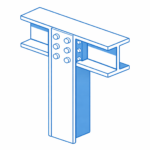
Structural steel I-beam bolted connection with column in isometric view.

Structural drafting in Sydney is often treated as a documentation exercise โ€” but in reality, it sits at the critical junction between design intent and construction reality.

At Hamilton By Design, we approach structural drafting as an engineering-led process, not just linework. By combining 3D LiDAR scanning, SolidWorks modelling, and practical site experience, we ensure drawings reflect what is actually built โ€” not what was assumed.


Why Structural Drafting Matters in Sydney

Sydney presents unique challenges:

  • Dense urban environments
  • Brownfield upgrades and legacy infrastructure
  • Tight construction tolerances
  • Multi-disciplinary coordination (mechanical, civil, structural)

Traditional drafting methods often rely on:

  • Outdated drawings
  • Manual measurements
  • Assumptions based on design models

This creates risk.


3D LiDAR scanning and 3D modelling service button โ€” laser scanner capturing a point cloud for engineering and CAD modelling
Mechanical engineering services

The Problem with Traditional Drafting

In many projects, structural drawings are created without verifying real-world conditions. This leads to:

  • Misaligned steelwork
  • Rework on-site
  • Fabrication errors
  • Cost overruns
  • Delays during installation

The issue is simple:
Design models โ‰  As-built reality


Our Approach: Scan โ†’ Model โ†’ Detail

We solve this using an engineering-grade workflow:

1. 3D Laser Scanning (LiDAR)

Using FARO terrestrial scanners, we capture accurate site geometry:

  • Steel structures
  • Concrete interfaces
  • Existing services
  • Connection points

Deliverables:

  • Registered point clouds (.E57, .RCP)
  • Full site coverage with traceable accuracy

2. Point Cloud to CAD Modelling

We convert reality into usable engineering models:

  • Clean, simplified geometry
  • Fabrication-ready references
  • Clash-aware modelling

3. Structural Drafting & Detailing

We produce:

  • GA drawings
  • Shop drawings
  • Sections and elevations
  • Connection details
  • Platework and steel member detailing

All drawings are structured for:

  • Fabrication
  • Installation
  • Compliance

Why Engineering-Led Drafting Wins

Most drafting services are CAD-driven.
We are engineering-driven.

This means:

  • Load paths are understood
  • Connections are practical
  • Fabrication methods are considered
  • Site constraints are built into the design

Sydney Project Applications

Our structural drafting services are ideal for:

  • Industrial plants
  • Mining infrastructure
  • Structural upgrades
  • Conveyor systems and transfer stations
  • Platforms, walkways, and access systems
  • Retrofit steelwork in existing buildings

The Role of Digital Engineering & Governance

By integrating with the 3DEXPERIENCE platform, we provide:

  • Version-controlled drawings
  • Full revision history
  • Chain of custody for engineering data
  • 24/7 access for stakeholders

This ensures:

  • One source of truth
  • Reduced miscommunication
  • Audit-ready documentation

Key Benefits

  • Reduced rework and site delays
  • Accurate fabrication first time
  • Faster project delivery
  • Improved safety and compliance
  • Better coordination across disciplines

Hamilton By Design logo displayed on a blue tilted rectangle with a grey gradient background

Hamilton By Design

Structural drafting in Sydney should not rely on guesswork.

By combining:

  • Reality capture (LiDAR scanning)
  • Engineering modelling
  • Practical drafting experience

Hamilton By Design delivers drawings that match reality โ€” not assumptions.


Industries We Support

Our structural drafting services support manufacturing facilities, industrial plants, commercial buildings, rail infrastructure, water treatment facilities and resource sector projects throughout Sydney.

Hamilton By Design prepares structural steel drawings, fabrication details, general arrangement drawings and as-built documentation to support construction, maintenance and asset improvement projects.

Hamilton By Design provides structural drafting services throughout Sydney CBD, Parramatta, Liverpool, Penrith, Chatswood, Alexandria, Mascot, Newcastle and the Central Coast. We prepare structural steel drawings, fabrication details, general arrangement drawings and as-built documentation for industrial, infrastructure and commercial projects.


Call to Action

If your project requires accurate, buildable structural drawings, contact:

Hamilton By Design
Engineering-led drafting and 3D scanning services across Sydney

Our clients

3D CAD Modelling Australia service banner for Hamilton By Design

Talk to Us – Contact Us

Name
Would you like us to arrange a phone consultation for you?
Address
3D Scanning Sydney banner promoting engineering-grade 3D laser scanning, LiDAR scanning, and reality capture services by Hamilton By Design.
Mechanical Engineering Sydney banner with white text on a blue background representing Hamilton By Design's mechanical engineering services in Sydney.
Mechanical Drafting and 3D Modelling Sydney banner highlighting Hamilton By Design's CAD drafting, 3D modelling, and engineering design services in Sydney.


Mechanical Engineering | Structural Engineering


Hamilton By Design provides engineering-led 3D scanning, LiDAR scanning, mechanical engineering and digital engineering services throughout Sydney and Greater Sydney.

Explore our related Sydney services:


  • 3D Scanning Sydney โ€“ Engineering-grade terrestrial laser scanning, as-built surveys and point cloud capture for industrial, infrastructure and commercial projects.
  • Reality Capture Sydney โ€“ High-accuracy reality capture, digital twins, asset documentation and engineering-grade site verification.
  • Scan to CAD Sydney โ€“ Convert point cloud data into AutoCAD, SolidWorks, Inventor and other engineering-ready CAD deliverables.
  • Point Cloud Modelling Sydney โ€“ Engineering-grade point cloud processing, clash detection, as-built verification and 3D modelling.
  • Mechanical Engineering Sydney โ€“ Mechanical design, plant upgrades, materials handling systems, conveyors, chutes, platforms and engineering support.
  • Structural Drafting Sydney โ€“ Structural steel drafting, fabrication drawings, GA drawings, workshop detailing and as-built documentation.

Hamilton By Design supports projects throughout Sydney CBD, Parramatta, Liverpool, Penrith, Blacktown, Chatswood, Alexandria, Mascot, Newcastle and the Central Coast.


Blue banner graphic displaying the text "Point Cloud to CAD - Australia" in large white lettering, representing point cloud processing, scan-to-CAD conversion and digital engineering services across Australia.
Blue banner graphic displaying the text "Scan to CAD Sydney" in large white lettering, representing engineering-led point cloud to CAD conversion, LiDAR scanning and digital engineering services in Sydney.
Blue banner graphic displaying the text "Reality Capture Sydney - CBD" in large white lettering, representing engineering-led reality capture, LiDAR scanning and digital engineering services within Sydney CBD commercial buildings and infrastructure.