Every Shutdown Matters โ€“ Engineering-Led Scanning with FARO LiDAR for As-Builts

Illustration showing LiDAR scanning workflow for industrial shutdown from capture to installation.

Every Shutdown Matters โ€“ FARO LiDAR for As-Built Scanning

In heavy industry, a shutdown is not just another project milestone โ€” it is the most expensive window on the calendar. Production stops, contractors mobilise, and every hour has a dollar value attached. When something does not fit, the cost is immediate and visible. This is why every shutdown matters, and why the approach to measurement and design before the outage has become critical.

Traditional site measurement relies on tape measures, sketches, and assumptions about existing conditions. In brownfield environments those assumptions are often wrong. Steel moves, plant is modified without drawings, and tolerances stack up over decades. Engineering-led 3D scanning, particularly using FARO terrestrial LiDAR for as-built capture, has changed the way shutdowns are planned and delivered.
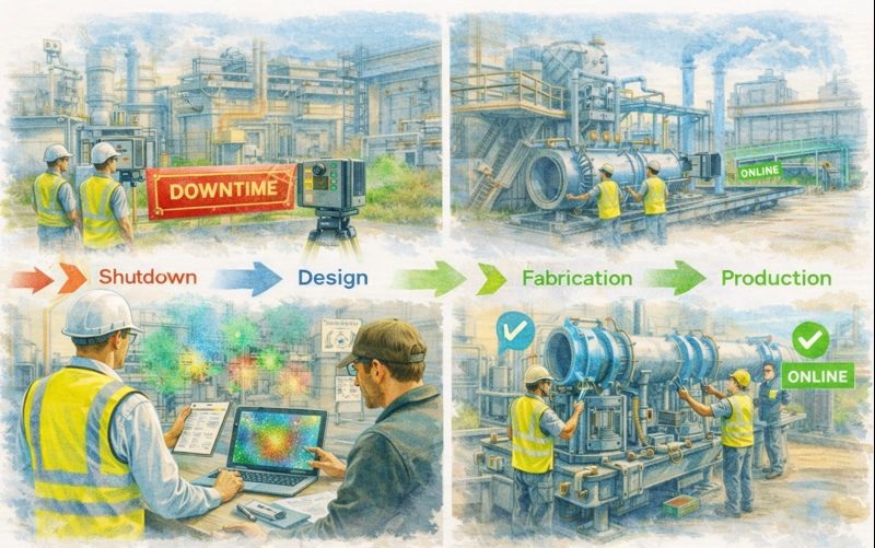

Engineering-led LiDAR scanning sequence from downtime to online restart.

From Guesswork to Measured Reality

A terrestrial LiDAR scanner captures millions of accurate points across an entire facility. Instead of a handful of manual dimensions, designers receive a complete digital replica of the plant โ€” every beam, pipe, handrail and obstruction recorded in context. The result is a point cloud that becomes the single source of truth for engineering decisions.

The difference between scanning and traditional measurement is not just accuracy; it is completeness. A fitter with a tape can only measure what they think is relevant. A LiDAR scan measures everything, including the issues no one knew to look for: misaligned bases, out-of-square structures, undocumented modifications and clearance problems that would otherwise appear during the shutdown itself.

When this data is managed by engineers rather than survey technicians alone, it becomes more than a pretty model โ€” it becomes a design tool.

Engineering-Led Scanning

Scanning by itself does not deliver value. The benefit comes when point clouds are interpreted through an engineering lens:

  • What tolerances actually matter?
  • Which surfaces are datums and which are cosmetic?
  • Where will fabrication interfaces occur?
  • How will the new design be installed within the shutdown sequence?

At Hamilton By Design we approach LiDAR capture as part of the engineering workflow, not a separate service. FARO scans are registered, cleaned and aligned to suit the specific design task โ€” whether that is a conveyor upgrade, pump replacement, structural modification or access platform.

The aim is simple: design once, fit first time.

FARO LiDAR for As-Built Confidence

FARO terrestrial scanners are built for industrial environments. They capture long-range, high-density point clouds that allow designers to work with real conditions rather than idealised drawings. Typical applications include:

  • As-built capture of processing plants and mine infrastructure
  • Pipework routing and clash detection
  • Structural modifications and tie-ins
  • Equipment change-outs and baseplate verification
  • Access and safety improvements

By modelling new work directly over the point cloud, engineers can test installation paths, crane clearances and maintenance access long before the shutdown begins. Fabrication drawings are generated from a model that already โ€œfitsโ€ the site.

The Cost of Getting It Wrong

During outages the smallest oversight becomes expensive:

  • A pipe spool 20 mm too long
  • A bracket that fouls an existing conduit
  • A motor base drilled to the wrong PCD
  • A platform clash discovered after hot works have started

Each of these problems triggers rework, additional labour, hot work permits and schedule delays. The true cost is rarely the part itself โ€” it is the lost hours in the critical path.

Engineering-led LiDAR scanning attacks these risks at the source. By understanding existing geometry before fabrication begins, contractors arrive on site with components that have already been proven digitally.

Complementing LiDAR with Object Scanning

Large-scale LiDAR captures the plant; structured-light scanners such as EinScan capture the individual components within it. Motors, guards, cast housings and legacy parts can be digitised on the bench and integrated back into the LiDAR model. This two-tool approach supports:

  • Reverse engineering of obsolete components
  • Design of adapters and mounting brackets
  • Verification of replacement equipment
  • Creation of accurate fabrication models

The result is a seamless path from reality capture to parametric CAD in Fusion 360 or SolidWorks โ€” guided by engineering intent rather than raw mesh data.

Planning the Shutdown Backwards

Successful outages are designed backwards from the installation day. FARO as-built scanning supports this process:

  1. Pre-shutdown capture โ€“ full LiDAR survey of affected areas
  2. Engineering modelling โ€“ new design built over the point cloud
  3. Workshop fabrication โ€“ components manufactured to verified geometry
  4. Dry fit digitally โ€“ clash and access checks completed
  5. On-site installation โ€“ minimal adjustment required

By the time the shutdown begins, the unknowns have been removed. Crews are executing a plan rather than solving problems in real time.

More Than Measurement

LiDAR point clouds are also powerful communication tools. Maintenance teams, project managers and contractors can visualise the work in context, improving safety and coordination. Decisions that once required multiple site visits can be made from the office with confidence.

For organisations moving toward digital twin strategies, as-built scans provide the foundation layer โ€” an accurate spatial framework that future projects can reference.

Why Every Shutdown Matters

In mining, manufacturing and energy sectors the shutdown window defines the success of the year. Budgets are tight, schedules are fixed, and tolerance for rework is zero. Engineering-led scanning recognises that reality capture is not an optional extra; it is risk management.

FARO LiDAR for as-builts delivers:

  • Reduced site hours
  • Fewer fabrication errors
  • Safer installation planning
  • Better collaboration between design and maintenance
  • Confidence that new work will integrate with old

Most importantly, it respects the fact that every shutdown matters.


3D LiDAR scanning and 3D modelling service button โ€” laser scanner capturing a point cloud for engineering and CAD modelling
Mechanical engineering services

Talk to Us

Hamilton By Design provides engineering-led LiDAR scanning across Sydney, the Central Coast and regional Australia, supporting brownfield upgrades, shutdown planning and reverse engineering.

If youโ€™re preparing for an outage or plant modification, speak with our team about capturing accurate as-builts before the clock starts ticking.


www.hamiltonbydesign.com.au


3D CAD Modelling Australia service banner for Hamilton By Design

Mechanical Engineering | Structural Engineering


Terrestrial LiDAR Scanner Price โ€“ Buy or Hire?

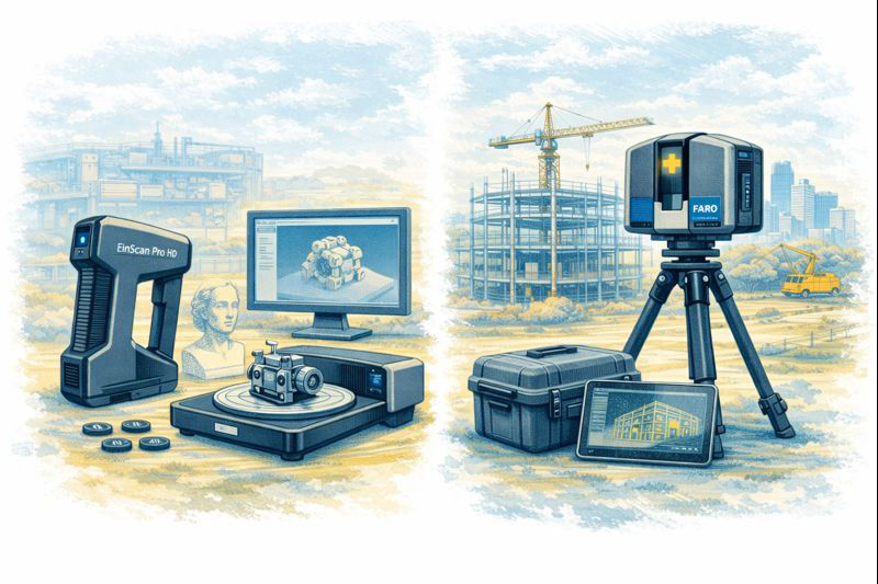
Comparison illustration showing EinScan structured-light scanner on left and FARO LiDAR terrestrial laser scanner on right.

Terrestrial LiDAR Scanner Price โ€“ Buy or Hire Options

When organisations first explore terrestrial LiDAR scanning, the biggest question is usually not technical โ€” itโ€™s commercial: should we buy a scanner or hire one for the project?

Terrestrial LiDAR scanners such as FARO and Leica systems are powerful tools for capturing accurate point clouds of buildings, industrial facilities, infrastructure and construction sites. They support as-built documentation, clash detection, shutdown planning and digital twin workflows. However, the right decision between purchase and hire depends on how often the equipment will be used and the level of in-house expertise available.


Visual comparison of EinScan object scanner and LiDAR terrestrial laser scanner in matching sketch style.

Buying a LiDAR Scanner

Purchasing a scanner can make sense for businesses that:

  • undertake regular surveying or as-built capture
  • need immediate access on multiple sites
  • want to build internal reality-capture capability
  • plan to integrate point clouds into ongoing design workflows

Ownership provides flexibility and control, but also involves training, software, calibration and maintenance considerations.

Hiring a LiDAR Scanner

Hiring is often the smarter option when:

  • the requirement is project-specific
  • workloads are seasonal or occasional
  • specialist software and support are needed
  • you want to trial the technology before committing

Hire packages can include advice on setup, data management and export formats so the results integrate smoothly with CAD and BIM platforms.

We Support Both Options

Hamilton By Design offers terrestrial LiDAR scanners for both hire and sale, backed by engineering support to ensure the data delivers real value on your project. Whether you need equipment for a short shutdown, a construction survey, or you are considering building your own scanning capability, our team can guide you through the most practical pathway.

Rather than publishing generic prices, we prefer to understand:

  • the type of site you need to capture
  • required accuracy and deliverables
  • software and CAD integration
  • duration and level of support

This allows us to recommend the right scanner package and commercial model for your specific needs.

3D LiDAR scanning and 3D modelling service button โ€” laser scanner capturing a point cloud for engineering and CAD modelling
Mechanical engineering services

Please contact our team for a price and availability.
Weโ€™ll help you decide whether buy or hire is the best approach for your project.

www.hamiltonbydesign.com.au
[email protected]

Name
Would you like us to arrange a phone consultation for you?
Address

Finite Element Analysis (FEA) engineering simulation button
Mechanical engineering services

Mechanical Engineering | Structural Engineering


Fabrication Integrated Modelling (FIM):

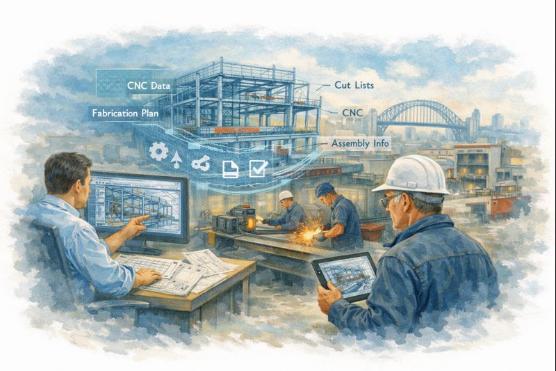
Sydney manufacturing workshop using Fabrication Integrated Modelling to connect engineering design, CNC data, and local steel fabrication.

Fabrication Integrated Modelling (FIM): Why Itโ€™s the Future for Local Fabricators

Why It Is the Future for Local Fabricators

The fabrication industry is undergoing a fundamental transformation. Increasing project complexity, tighter tolerances, compressed schedules, labour shortages, and rising material costs are placing unprecedented pressure on fabricators โ€” particularly local workshops operating in competitive markets. At the same time, clients are demanding greater certainty: certainty of fit, certainty of schedule, and certainty of cost.

Traditional fabrication workflows, built around 2D drawings and manual interpretation, are no longer sufficient to meet these expectations. They rely heavily on experience, assumptions, and rework โ€” all of which introduce risk. In this environment, Fabrication Integrated Modelling (FIM) is emerging not as a luxury, but as a necessity.

FIM represents a shift from drawing-based fabrication to model-driven fabrication, where a single, coordinated digital model governs design intent, fabrication detailing, procurement, machining, assembly, and installation. For local fabricators, this shift offers a path to higher productivity, improved margins, and long-term relevance in an evolving industry.


What Is Fabrication Integrated Modelling (FIM)?

Fabrication Integrated Modelling is a methodology where the fabrication model becomes the primary source of truth across the entire project lifecycle. Instead of treating design, drafting, fabrication, and installation as disconnected stages, FIM integrates them into a continuous digital workflow.

In an FIM environment:

  • Engineering intent is embedded directly into the model
  • Fabrication constraints are considered from the outset
  • Quantities, tolerances, and interfaces are defined digitally
  • Fabrication data flows directly to machines and shop documentation
  • Installation sequencing is validated before material is cut

The model is not merely a visual aid โ€” it is a fully informed digital prototype of the fabricated asset.

From Drawings to Data: A Fundamental Shift

Historically, fabrication has relied on 2D drawings as the primary communication tool. These drawings require interpretation by drafters, trades, and supervisors, each introducing assumptions based on experience and context. While this approach has worked for decades, it becomes increasingly fragile as projects grow more complex.

Fabrication Integrated Modelling replaces interpretation with explicit data. Hole locations, weld preparations, connection details, clearances, and tolerances are all defined within the model. This reduces ambiguity and ensures that everyone โ€” from estimator to machine operator โ€” is working from the same information.

The result is a dramatic reduction in errors, clarifications, and rework.


Why FIM Is Gaining Momentum Now

Several industry pressures are accelerating the adoption of FIM:

  • Increasing complexity of industrial and infrastructure projects
  • Reduced tolerance for errors during shutdowns and brownfield upgrades
  • Labour shortages and loss of experienced trades
  • Higher expectations for schedule and cost certainty
  • Growing integration of CNC and automated fabrication equipment

FIM addresses these challenges by improving coordination, predictability, and efficiency at the source โ€” before fabrication begins.


Fabrication Integrated Modelling in a Sydney workshop showing engineers and fabricators using a shared 3D model to drive CNC fabrication and steel assembly.

Key Benefits of Fabrication Integrated Modelling

Reduced Errors and Rework

Rework is one of the most significant drains on fabrication profitability. Errors discovered on the workshop floor or during installation often result in cascading impacts: delays, additional labour, material waste, and strained relationships with clients.

By resolving interfaces, clashes, and tolerances digitally, FIM enables fabricators to identify and eliminate issues before steel is cut. Assemblies are tested virtually, connections are validated, and fit-up risks are significantly reduced.

This proactive approach shifts problem-solving upstream, where changes are faster, cheaper, and less disruptive.


Improved Fabrication Efficiency and Throughput

Fabrication speed is not achieved by rushing work โ€” it is achieved by removing uncertainty. FIM provides clarity on what needs to be fabricated, in what order, and to what tolerance.

Benefits include:

  • Clear fabrication sequencing
  • Reduced downtime waiting for clarifications
  • Better planning of labour and machine utilisation
  • More predictable workshop flow

Local fabricators using FIM often report smoother operations, fewer interruptions, and a higher percentage of โ€œright-first-timeโ€ components.


Better Use of Skilled Labour

Skilled trades are becoming harder to find and retain. Fabrication Integrated Modelling helps maximise the value of skilled workers by giving them better information, not more guesswork.

Fitters receive assemblies that align as expected. Welders focus on quality rather than correcting geometry. Supervisors make decisions based on accurate model data rather than assumptions. Apprentices gain clarity and confidence by working from model-based instructions.

Rather than replacing experience, FIM captures and amplifies it.


Seamless Integration with CNC and Fabrication Equipment

One of the strongest advantages of FIM is its ability to connect directly with modern fabrication equipment. The same model used for coordination and verification can generate machine-ready data, including:

  • NC files for beam lines and plate processors
  • Cut lists and nesting data
  • Part numbers and assembly marks
  • Machining references

This eliminates duplication of effort and reduces the risk of transcription errors. It also shortens the time between design approval and fabrication start, improving responsiveness to project changes.


Competitive Advantage for Local Fabricators

Local fabricators often compete with offshore suppliers on price alone โ€” a contest that is difficult to win. FIM allows local workshops to compete on value rather than cost.

Key differentiators enabled by FIM include:

  • Faster response to changes
  • Higher confidence in fit-up for complex or brownfield sites
  • Reduced installation risk
  • Stronger collaboration with engineers and constructors

When site conditions change โ€” as they inevitably do โ€” local fabricators using FIM can adapt quickly, update models, and deliver revised components without significant disruption. This agility is a powerful advantage over remote fabrication alternatives.


FIM in Brownfield and Upgrade Projects

Brownfield projects present some of the greatest challenges in fabrication. Existing assets rarely match legacy drawings, and tolerances are often tight. Discovering misalignment during installation can result in costly delays and extended shutdowns.

Fabrication Integrated Modelling, often combined with accurate site capture, allows fabricators to design and fabricate components that align with actual site conditions rather than assumptions.

This approach reduces:

  • On-site modifications
  • Temporary works
  • Installation delays
  • Safety risks associated with forced fit-ups

For local fabricators servicing industrial plants and operational facilities, FIM is rapidly becoming an expected capability.


Financial Benefits: Protecting Margins, Not Just Schedules

While FIM is often associated with speed and accuracy, its most important benefit may be margin protection.

Model-based workflows enable:

  • More accurate pricing through reliable quantities
  • Reduced contingency allowances
  • Predictable labour and machine hours
  • Lower material waste
  • Fewer disputes and variations

By increasing certainty, FIM allows fabricators to price work confidently rather than defensively. Over time, this leads to healthier margins and more sustainable operations.


Earlier Engagement and Better Project Outcomes

Fabricators who adopt FIM often find themselves involved earlier in projects. Engineers and asset owners increasingly recognise the value of fabrication input during design development.

Early collaboration enables:

  • Design for manufacture and assembly
  • Smarter connection strategies
  • Reduced installation complexity
  • Improved safety outcomes

This shifts the fabricatorโ€™s role from reactive supplier to active project partner, strengthening relationships and improving project outcomes for all parties.


Overcoming Barriers to Adoption

Adopting Fabrication Integrated Modelling requires investment โ€” not only in software and systems, but in people and processes. Common challenges include:

  • Training requirements
  • Changes to established workflows
  • Initial productivity adjustments
  • Cultural resistance to new methods

Successful fabricators address these challenges incrementally. They start with pilot projects, focus on repeatable wins, and work closely with engineering and modelling partners to build capability over time.

The risk of maintaining outdated workflows is increasingly greater than the risk of change.


The Future of Fabrication: Integrated Digital Ecosystems

FIM is not the final destination โ€” it is the foundation for a more connected fabrication industry. As digital maturity increases, fabrication models will increasingly link to:

  • Digital twins
  • Quality assurance records
  • Traceability and compliance systems
  • Asset management platforms
  • Automated inspection and verification

In this future, the fabrication model becomes a long-term asset, supporting not only construction but operation and maintenance.


Why Fabrication Integrated Modelling Is the Future for Local Fabricators

Local fabrication is not disappearing โ€” it is evolving. Workshops that continue to rely solely on 2D drawings and manual processes will face increasing pressure from cost, risk, and competition. Those that embrace Fabrication Integrated Modelling will position themselves for long-term success.

By adopting FIM, local fabricators can:

  • Deliver higher quality with greater confidence
  • Reduce rework and wasted effort
  • Protect margins in competitive markets
  • Strengthen relationships with engineers and clients
  • Build resilient, future-ready businesses

Fabrication Integrated Modelling is not about replacing trades or experience. It is about supporting them with better information, clearer intent, and integrated workflows.

For local fabricators willing to invest in capability and collaboration, FIM is not just the future โ€” it is the pathway to remaining relevant, competitive, and profitable in an increasingly digital industry.

3D LiDAR scanning and 3D modelling service button โ€” laser scanner capturing a point cloud for engineering and CAD modelling
Mechanical engineering services
Name
Would you like us to arrange a phone consultation for you?
Address
3D CAD Modelling Australia service banner for Hamilton By Design

3D CAD Modelling Australia service banner for Hamilton By Design


CHPP Engineering title graphic featuring bold white text reading "CHPP Engineering" centred on a blue rounded rectangle background.
Pipework Drafting title graphic featuring bold white text reading "Pipework Drafting" centred on a blue rounded rectangle background.
3D LiDAR Scanning for Engineering Projects title graphic featuring bold white text on a blue rounded rectangle background.


Finite Element Analysis (FEA) engineering simulation button
Structural drafting services button
Mechanical drafting services button


Australian Drafting logo featuring bold white text reading "Australian Drafting" centred on a blue rounded rectangle background.
Engineering Governance title graphic featuring bold white text reading "Engineering Governance" centred on a blue rounded rectangle background.
Engineering-Grade LiDAR Scanning title graphic featuring bold white text on a blue rounded rectangle background.


Mechanical drafting services button
Structural drafting services button


Fabrication and product design services
3D CAD Modelling Australia service banner for Hamilton By Design
Mechanical, Structural & Pipework Drafting service banner by Hamilton By Design featuring white text on a blue background.


3D LiDAR scanning and 3D modelling service button โ€” laser scanner capturing a point cloud for engineering and CAD modelling
Mechanical engineering services

Mechanical Engineering | Structural Engineering


AURA, SolidWorks AI, and 3D Scanning: Why Automated Drawings Just Got Effortless

3D Scanning Meets SolidWorks AI: AURA & Automated Drawings

If youโ€™ve spent any time in SolidWorks, you know the truth: the real work doesnโ€™t start at modelling โ€” it starts at documentation. Drawings, dimensions, revisions, and change control are where hours disappear.

Thatโ€™s exactly where AURA โ€” the AI Virtual Assistant inside 3DEXPERIENCE platform and SolidWorks Connected is quietly changing the game โ€” especially when itโ€™s paired with engineering-grade 3D scanning and LiDAR data.

For engineers, asset owners, and project teams working in brownfield or live environments, this combination is moving work from painful to almost effortless.


What Is AURA in SolidWorks?

AURA is the AI assistant embedded into the 3DEXPERIENCE ecosystem. Itโ€™s not a chatbot bolted on the side โ€” itโ€™s context-aware AI that understands what youโ€™re doing inside SolidWorks and helps automate repetitive, high-friction tasks.

AURA is already leading the way in:

  • Automated drawing creation
  • Intelligent dimension and view suggestions
  • Faster annotation and documentation workflows
  • Reduced manual clean-up during revisions

In short, AURA reduces the time between a finished model and a usable drawing set.


Why 3D Scanning Changes Everything

On its own, AI automation is powerful.
But when you feed it accurate real-world geometry from 3D scanning, it becomes transformational.

Traditional Workflow (The Old Pain)

  1. Manual site measurement
  2. Assumptions about whatโ€™s โ€œsquareโ€ or โ€œlevelโ€
  3. Rework when drawings hit site reality
  4. Revisions, RFIs, delays

Modern Workflow with 3D Scanning + AURA

  1. Site captured with 3D LiDAR scanning
  2. Dense, accurate point clouds imported into SolidWorks
  3. Models built from reality, not assumptions
  4. AURA automates drawing views, dimensions, and documentation
  5. Faster sign-off, fewer clashes, less rework

This is where 3D scanning stops being โ€œnice to haveโ€ and becomes mission-critical.


Automated Drawings Built on Reality

When point cloud data drives the model, AURA has something incredibly valuable to work with: truth.

That means:

  • Drawings reflect as-built conditions, not legacy CAD
  • Dimensions align with real geometry
  • Hidden clashes are identified earlier
  • Fabrication drawings match site conditions the first time

For shutdowns, upgrades, and brownfield projects, this is huge.

The result:
๐Ÿ‘‰ Fewer site variations
๐Ÿ‘‰ Fewer fabrication surprises
๐Ÿ‘‰ Faster approvals
๐Ÿ‘‰ Lower project risk


Why Engineers Are Leaning Into AI + 3D Scanning

Once teams experience this workflow, itโ€™s hard to go back.

Engineers quickly notice:

  • Drawing creation time drops dramatically
  • Less mental load managing repetitive documentation
  • More time spent on engineering decisions, not drafting chores
  • Greater confidence that drawings reflect reality

When 3D scanning feeds SolidWorks and AURA handles the busywork, engineering becomes cleaner, calmer, and far more predictable.


Where Hamilton By Design Fits In

At Hamilton By Design, we sit at the intersection of:

  • Engineering-led 3D scanning
  • Point cloud to SolidWorks modelling
  • Real-world industrial and building services projects
  • Practical deployment of AI-enabled workflows

We donโ€™t just scan โ€” we engineer with the data.

That means:

  • LiDAR scans captured with downstream modelling in mind
  • Clean, structured point clouds optimised for SolidWorks
  • Models built to support AURA-driven automated drawings
  • Outputs that fabrication teams and contractors can actually use

Hamilton By Design logo displayed on a blue tilted rectangle with a grey gradient background

The Rise of the โ€œAURA + LiDAR Consultantโ€

This is a new role emerging in modern engineering teams:
someone who understands 3D scanning, SolidWorks, and how AI like AURA fits into real project delivery.

Thatโ€™s exactly the conversation weโ€™re having every day.

If youโ€™re:

  • Struggling with drawing production time
  • Managing upgrades in complex existing facilities
  • Tired of site conditions not matching drawings
  • Curious how AI and 3D scanning actually work together (not just in marketing slides)

๐Ÿ‘‰ Check in at www.hamiltonbydesign.com.au
Weโ€™re always happy to chat with you as your AURA + LiDAR consultant.


Final Thought: This Isnโ€™t the Future โ€” Itโ€™s Already Here

AI-assisted design isnโ€™t replacing engineers.
Itโ€™s removing the friction that slows good engineers down.

When AURA automates drawing creation and 3D scanning ensures models are grounded in reality, the result is simple:

โœ” Better drawings
โœ” Faster delivery
โœ” Fewer surprises
โœ” More time spent engineering

And once you work this way, thereโ€™s no going back.

3D LiDAR scanning and 3D modelling service button โ€” laser scanner capturing a point cloud for engineering and CAD modelling
Mechanical engineering services
Name
Would you like us to arrange a phone consultation for you?
Address
3D LiDAR scanning and 3D modelling service button โ€” laser scanner capturing a point cloud for engineering and CAD modelling
Mechanical engineering services
Finite Element Analysis (FEA) engineering simulation button
Mechanical engineering services

How AS 1100 and LiDAR Scanning Work Together: From Point Cloud to Compliant Drawings

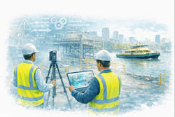
Graduate engineer and senior engineer using LiDAR scanning on a Parramatta River construction site, reviewing point cloud data for accurate design.

AS 1100 & LiDAR Scanning: Compliant Engineering Drawings from Point Clouds

If youโ€™ve ever tried to update old plant drawings, verify a brownfield tie-in, or issue โ€œas-builtโ€ documentation after a shutdown, youโ€™ll know the pain: the site never matches the drawings, access is limited, and the smallest dimensional miss can cascade into rework, clashes, and schedule blowouts.

Thatโ€™s where engineering-grade LiDAR scanning and AS 1100 (the Australian Standard for technical drawing) make a powerful combination. LiDAR gives you truth data (reality capture), and AS 1100 gives you a shared language for turning that truth into clear, consistent, contract-ready documentation.

At Hamilton By Design, we treat scanning and drawing as one joined workflow: capture accurately โ†’ model intelligently โ†’ document to AS 1100 so everyone downstream can build, fabricate, install, and sign off with confidence.
(If you want to see the service side of this workflow, start here: https://www.hamiltonbydesign.com.au/home/engineering-services/3d-laser-scanning/3d-laser-scanning-for-engineering-projects/ and here: https://www.hamiltonbydesign.com.au/home/3d-lidar-scanning-digital-quality-assurance/)


What AS 1100 actually โ€œdoesโ€ in the real world

AS 1100 standardises the way we communicate engineering information through drawings: layout, line types, projection methods, dimensioning rules, tolerancing conventions, symbols, notes, and drawing presentation.

In practice, AS 1100 helps you answer questions like:

  • Which edges are visible vs hidden? (line conventions)
  • How are views arranged and interpreted? (projection and view layout)
  • How do we dimension so the fabricator canโ€™t misread it? (dimensioning rules)
  • How do we document what matters vs whatโ€™s โ€œreference onlyโ€? (notes and drawing hierarchy)
  • How do we keep drawing sets consistent across multiple contributors? (formatting + standards)

That consistency is exactly whatโ€™s needed after a scanโ€”because point clouds are rich, but theyโ€™re not automatically โ€œcommunicableโ€ in the way a compliant drawing set is.


What LiDAR scanning adds that drawings alone canโ€™t

A LiDAR scanner captures millions (often billions) of spatial points that represent real surfacesโ€”steel, concrete, pipe, equipment, structureโ€”creating a point cloud that can be registered into a unified coordinate system.

Dassault Systรจmes SolidWorks Professional Weldments certification badge

In the engineering context, the big advantages are:

  • Speed: capture complex geometry quickly, often with minimal disruption
  • Coverage: see whatโ€™s hard to measure with tape/total station (overhead services, congested pipe racks, odd geometry)
  • Context: capture โ€œeverything,โ€ not just what someone remembered to measure
  • Traceability: you can always โ€œgo backโ€ to the scan for verification and queries
  • Clash prevention: scan-to-CAD makes it far easier to design upgrades that actually fit

But hereโ€™s the key: a point cloud isnโ€™t a deliverable most trades can fabricate from directly.
Thatโ€™s why AS 1100 becomes the bridge between capture and construction.


The combined workflow: Point cloud โ†’ model โ†’ AS 1100 drawings

1) Capture the site as it really is

We scan the area of interest and register scans into a coordinated dataset. This becomes the base truth for everything that follows. If the project is shutdown-driven, we plan scanning around access windows and risk controls (often capturing adjacent tie-in zones too, because โ€œnearbyโ€ services are where surprises live).

2) Establish intent: โ€œWhat are we delivering?โ€

Not every project needs the same output. Typical outcomes include:

  • As-built drawings for existing assets
  • As-found models to support new design work
  • Dimensional verification for fit-up and prefabrication
  • Digital QA against design intent (scan-vs-model comparison)

Hamilton By Design leans hard into this QA piece where it matters mostโ€”because catching a misalignment early is cheaper than discovering it on install day.
More on the QA angle here: https://www.hamiltonbydesign.com.au/home/3d-lidar-scanning-digital-quality-assurance/

3) Convert scan data into engineering geometry (as much as needed)

Sometimes the best output is a controlled 3D model (plant layout, pipe spools, structural members). Other times the project is best served by 2D drawings extracted from a model.

Weโ€™ll typically create:

  • key datums and grids
  • primary steel / structure
  • equipment envelopes and critical interfaces
  • piping runs and connection points (where relevant)
  • floor levels, platforms, access constraints, clearance zones

4) Document to AS 1100 so the drawing set is unambiguous

This is where AS 1100 shines. We turn geometry into drawings that read cleanly and consistently across teams.

That includes:

  • correct view layouts (plan/elevation/section/detail)
  • line conventions (visible/hidden/centre lines)
  • clear dimensioning strategy (functional dims first)
  • consistent annotation and notes
  • drawing borders, title blocks, revision control, and drawing register discipline

In short: LiDAR gives accuracy, AS 1100 gives clarity.


Where AS 1100 + LiDAR scanning delivers immediate value

Brownfield upgrades and tie-ins

Tie-ins fail when the โ€œas-builtโ€ condition is wrong. A scan gives you real geometry; AS 1100 drawings package it so designers, fabricators, and installers share the same reference. This is especially useful when multiple contractors are interfacing.

Fabrication and spool accuracy

If youโ€™re fabricating offsite (pipe spools, platform steel, handrail sections, ducting), you need dependable dimensions and an agreed drawing language. Scan-derived models support accuracy; AS 1100 drawings support fabrication interpretation and QA sign-off.

Shutdown planning and constructability

A point cloud is a brilliant planning toolโ€”access routes, crane clearances, removal paths, temporary works, and โ€œwhatโ€™s in the way.โ€ But shutdown packages still need compliant drawings for permits, isolations, install workpacks, and handover packs. AS 1100 keeps those packages readable and defensible.

Verification and โ€œwhat changed?โ€

Sites evolve. A scan provides a timestamped snapshot. Drawings updated to AS 1100 become the controlled record: what was there, what was installed, and what the current state is. That matters for maintenance, safety, and future projects.


Practical example: Turning a congested pipe rack into a buildable upgrade

Imagine youโ€™re adding a new line through an existing pipe rack:

  1. Scan the rack to capture all existing services, supports, cable trays, and steel
  2. Model critical geometry (existing plus proposed) to check routing and supports
  3. Clash check before fabrication begins
  4. Issue AS 1100 drawings for:
    • support details
    • spool isometrics (if applicable)
    • arrangement drawings showing tie-in locations
    • sections through congestion zones
    • installation notes and tolerances where appropriate
  5. Verify post-install with a follow-up scan if required for QA/closeout

Thatโ€™s the โ€œwork togetherโ€ part: the scan stops guesswork, and AS 1100 stops misinterpretation.


Common mistakes when scanning isnโ€™t tied back to AS 1100

  • Delivering point clouds without a drawing strategy (stakeholders canโ€™t use them effectively)
  • Over-modelling everything (time is spent modelling non-critical items instead of delivering useful documentation)
  • Unclear dimensioning (scan accuracy is wasted if dimensions are presented ambiguously)
  • No controlled datums (people argue about โ€œwhere zero isโ€ and models drift between disciplines)
  • Weak revision control (the drawing set becomes untrustworthy fast)

A standards-led drawing approach prevents most of these.


How we approach it at Hamilton By Design

Our angle is simple: engineering-led scanningโ€”not scanning for its own sake.

  • We capture reality with LiDAR.
  • We translate it into the level of model detail the project actually needs.
  • We document outputs with the discipline and consistency expected in Australian engineering environments.

If you want the practical breakdown of how we do scan capture and modelling for projects, start here:
https://www.hamiltonbydesign.com.au/home/engineering-services/3d-laser-scanning/3d-laser-scanning-for-engineering-projects/

And if your priority is dimensional verification, fit-up confidence, or proving compliance against design intent, this page explains our digital QA approach:
https://www.hamiltonbydesign.com.au/home/3d-lidar-scanning-digital-quality-assurance/


Hamilton By Design logo displayed on a blue tilted rectangle with a grey gradient background

Closing thought: accuracy is only valuable if itโ€™s understandable

LiDAR scanning can deliver millimetre-grade spatial truth. But in real projects, truth still has to travel through peopleโ€”engineers, drafters, fabricators, installers, supervisors, and asset owners.

AS 1100 makes that truth readable.
LiDAR makes it reliable.

3D LiDAR scanning and 3D modelling service button โ€” laser scanner capturing a point cloud for engineering and CAD modelling
Mechanical engineering services

Together, they turn messy real-world geometry into clear, controlled documentation that supports safer installs, faster shutdowns, and fewer surprises.

Name
Would you like us to arrange a phone consultation for you?
Address
3D CAD Modelling Australia service banner for Hamilton By Design
3D LiDAR scanning and 3D modelling service button โ€” laser scanner capturing a point cloud for engineering and CAD modelling
Mechanical engineering services
Mechanical drafting services button
Blue rounded button with the text โ€œSolidWorks Designโ€ in white.
Blue banner graphic displaying the text "Point Cloud to CAD - Australia" in large white lettering, representing point cloud processing, scan-to-CAD conversion and digital engineering services across Australia.
Mechanical, Structural & Pipework Drafting service banner by Hamilton By Design featuring white text on a blue background.
Engineering Governance title graphic featuring bold white text reading "Engineering Governance" centred on a blue rounded rectangle background.
Mining Plant Upgrades promotional graphic with bold white text on a blue background representing mining infrastructure, plant improvement, and engineering upgrade projects.
3D Pipework promotional graphic with bold white text on a blue background representing pipework design, modelling, drafting, and engineering services.
Australian Drafting logo featuring bold white text reading "Australian Drafting" centred on a blue rounded rectangle background.
3D Pipework promotional graphic with bold white text on a blue background representing pipework design, modelling, drafting, and engineering services.
Mining Plant Upgrades promotional graphic with bold white text on a blue background representing mining infrastructure, plant improvement, and engineering upgrade projects.
3D LiDAR Scanning for Engineering Projects title graphic featuring bold white text on a blue rounded rectangle background.
Australian Drafting logo featuring bold white text reading "Australian Drafting" centred on a blue rounded rectangle background.
Engineering Governance title graphic featuring bold white text reading "Engineering Governance" centred on a blue rounded rectangle background.
Mechanical, Structural & Pipework Drafting service banner by Hamilton By Design featuring white text on a blue background.
Mechanical engineering services
Blue rounded button with the text โ€œSolidWorks Designโ€ in white.
Finite Element Analysis (FEA) engineering simulation button

Mechanical Engineering | Structural Engineering


3D Laser Scanning in Kirribilli NSW โ€“ Engineering-Grade Reality Capture for Harbour-Side Projects

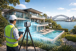
Engineer using a LiDAR scanner to capture a Sydney harbour-front residential property with Sydney Harbour Bridge in the background

3D Laser Scanning in Kirribilli NSW โ€“ Engineering-Grade Reality Capture for Harbour-Side Projects


Harbour-side buildings and infrastructure present unique challenges for refurbishment, compliance and upgrade works. Tight access, ageing structures and complex services make accurate site data critical before design or construction begins.

Hamilton By Design provides engineering-grade 3D laser scanning and LiDAR services in Kirribilli and across Sydneyโ€™s Lower North Shore, delivering accurate point cloud data that supports safe, buildable and cost-effective engineering outcomes.


Why 3D Scanning Is Critical in Kirribilli and Harbour Precincts

Kirribilli is characterised by:

  • heritage and character buildings
  • dense strata developments
  • limited access for survey and construction
  • proximity to critical transport and harbour infrastructure

Traditional measurement methods are often inadequate for:

  • structural modifications
  • mechanical plant upgrades
  • access compliance works
  • fabrication-ready design

3D laser scanning captures millions of accurate spatial data points, creating a true digital record of existing conditions before design begins โ€” reducing rework, RFIs and site clashes.


From Point Cloud to Build-Ready CAD and BIM Models

Our service does not stop at site capture.

We convert scan data into:

  • engineering CAD models
  • fabrication drawings
  • BIM-compatible geometry
  • detailed as-built documentation

This supports downstream workflows such as:

  • steel fabrication
  • mechanical installation
  • access system upgrades (AS 1657)
  • structural strengthening designs

Deliverables are tailored to suit engineers, architects and construction teams โ€” not just visualisation.


Typical Applications in Kirribilli and the Lower North Shore

3D scanning is commonly used for:

  • strata refurbishments and upgrades
  • heritage faรงade documentation
  • lift and stair compliance modifications
  • plant room reconfiguration
  • services routing and clash detection
  • harbour-adjacent infrastructure assessments

Because scanning is non-contact and fast to deploy, it allows data capture in occupied buildings with minimal disruption to residents and businesses.


Engineering-Led Scanning โ€” Not Just Survey Output

Hamilton By Design is an engineering-led consultancy, not just a scanning provider.

This means:

  • scan planning is driven by design requirements
  • critical interfaces are prioritised
  • modelling supports fabrication and construction
  • risk is addressed early in the project lifecycle

This approach is particularly valuable in brownfield and retrofit environments where unknown conditions often drive cost overruns.


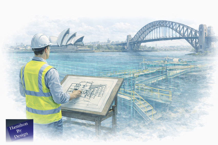
An engineer reviews detailed structural steel drawings at a drafting table while an engineering-grade LiDAR scan captures an existing waterfront structure in Sydney, illustrating data-driven structural drafting based on accurate as-built conditions.

Servicing Kirribilli, North Sydney and Sydney Harbour Precincts

We regularly support projects across:

  • Kirribilli
  • Milsons Point
  • North Sydney
  • Neutral Bay
  • Chatswood
  • Sydney CBD

And integrate scanning with mechanical, structural and drafting services where required.

Whether the project involves refurbishment, compliance or asset documentation, accurate reality capture forms the foundation for reliable engineering decisions.


Supporting Safe Design and Risk Reduction

Accurate site data enables:

  • early hazard identification
  • better access system design
  • improved constructability reviews
  • reduced site modifications during shutdowns

This aligns with Safe Design principles and reduces downstream safety and scheduling risks.


Hamilton By Design logo displayed on a blue tilted rectangle with a grey gradient background

3D LiDAR scanning and 3D modelling service button โ€” laser scanner capturing a point cloud for engineering and CAD modelling
Mechanical engineering services

Talk to Us About 3D Scanning in Kirribilli

If youโ€™re planning refurbishment, compliance upgrades or engineering works in Kirribilli or across Sydneyโ€™s harbour precincts, engineering-grade 3D scanning can eliminate costly unknowns before construction begins.

Contact Hamilton By Design to discuss site capture, modelling and design support for your project.

Blue banner graphic displaying the text "Point Cloud to CAD - Australia" in large white lettering, representing point cloud processing, scan-to-CAD conversion and digital engineering services across Australia.
Blue banner graphic displaying the text "Scan to CAD Sydney" in large white lettering, representing engineering-led point cloud to CAD conversion, LiDAR scanning and digital engineering services in Sydney.
Blue banner graphic displaying the text "Reality Capture Sydney - CBD" in large white lettering, representing engineering-led reality capture, LiDAR scanning and digital engineering services within Sydney CBD commercial buildings and infrastructure.
3D LiDAR scanning and 3D modelling service button โ€” laser scanner capturing a point cloud for engineering and CAD modelling
Mechanical engineering services
Finite Element Analysis (FEA) engineering simulation button
Mechanical engineering services

Mechanical Engineering | Structural Engineering