


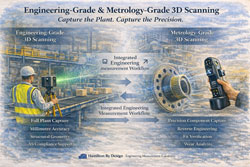
Choosing the Right Tool for the Right Scale
At Hamilton By Design, we do not approach 3D scanning as a visual service — we approach it as an engineering measurement tool.
Different projects require different levels of accuracy, coverage and control. For this reason, we operate with two distinct scanning capabilities:
- Engineering-Grade Terrestrial Laser Scanning
- Metrology-Grade Handheld 3D Scanning
Each serves a specific purpose within industrial, mining and mechanical environments.
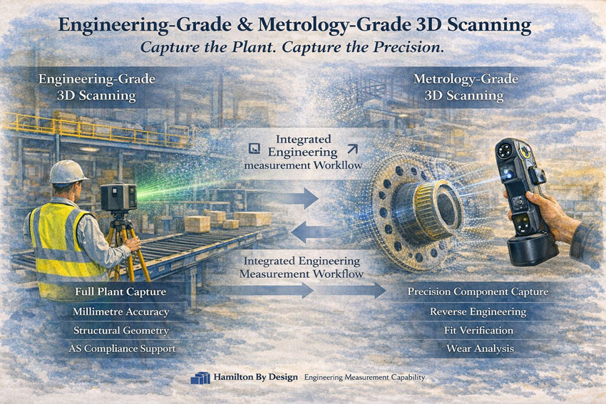
Engineering-Grade 3D Scanning
Capturing Entire Environments with Structural Accuracy
Engineering-grade laser scanning is used when capturing:
- Processing plants
- Conveyor systems
- Structural steel platforms
- Brownfield facilities
- Infrastructure corridors
- Stockpiles
- Full building interiors and exteriors
This system is tripod-based and captures large-scale environments with millimetre-level accuracy across significant distances.
Typical Performance:
- Up to hundreds of metres scanning range
- ~2 mm accuracy at 10 m
- Full 360° environmental capture
- Suitable for survey control alignment
Used For:
- As-built plant documentation
- Structural verification
- Clearance assessments
- Shutdown planning
- Retrofit design
- Compliance validation under AS standards
If you can walk inside it — this is the correct tool.
This system establishes the macro geometry of a site.
Metrology-Grade 3D Scanning
Capturing High-Precision Component Geometry
Metrology-grade handheld scanning is designed for detailed component-level capture.
This system is compact, highly accurate, and capable of sub-0.05 mm precision.
Typical Performance:
- Accuracy to ~0.020 mm
- Volume accuracy to 0.015 mm + scale factor
- Ideal for complex surfaces and confined spaces
- Suitable for reverse engineering
Used For:
- Worn chute liners
- Flanges and bolt patterns
- Pump housings
- Lifting lugs
- Machined components
- Distorted structural connections
- Deep hole geometry
- Fit-up verification prior to fabrication
If you can hold it — this is the correct tool.
This system establishes the micro geometry of a part.
Why Both Matter
Industrial projects often require both levels of capture.
Example: Mining Shutdown
- Engineering-grade scanning captures the entire transfer station.
- Metrology-grade scanning captures the worn liner plate.
- Data is combined to:
- Verify fit
- Model replacement components
- Reduce fabrication risk
- Avoid rework during shutdown
This integrated approach reduces:
- Site time
- Fabrication errors
- Installation clashes
- Cost overruns
Measurement With Engineering Intent
We do not scan for visualisation alone.
We scan to support:
- Structural compliance
- Mechanical design
- FEA validation
- Access verification
- Brownfield modification
- Asset documentation
- Engineering governance
Scanning without engineering oversight introduces risk.
Scanning with engineering intent reduces it.
When To Use Each Scanner
| Scenario | Engineering-Grade Scanner | Metrology-Grade Scanner |
|---|---|---|
| Full plant capture | ✔ | |
| Structural steel verification | ✔ | |
| Conveyor alignment | ✔ | |
| Large-area as-built survey | ✔ | |
| Reverse engineering a component | ✔ | |
| Flange or bolt pattern capture | ✔ | |
| Wear measurement | ✔ | |
| Fabrication fit verification | ✔ | |
| Confined detailed geometry | ✔ |




National Capability
Hamilton By Design provides:
- Engineering-grade terrestrial scanning
- Metrology-grade handheld scanning
- Integrated modelling and verification
- Compliance-aligned documentation
Across mining, industrial and infrastructure environments throughout Australia.
If your project requires both macro capture and micro precision, we can deliver a structured scanning approach aligned with engineering outcomes.
















