EinScan vs LiDAR Terrestrial Laser Scanners โ€“ Choosing the Right Tool for Reality Capture

Comparison illustration showing EinScan structured-light scanner on left and FARO LiDAR terrestrial laser scanner on right.

EinScan vs LiDAR Terrestrial Laser Scanners โ€“ Choosing the Right Tool for Reality Capture


The rapid growth of 3D scanning has given engineers, fabricators and designers access to tools that were once limited to large survey companies. Today you can buy a compact EinScan structured-light scanner for a few thousand dollars or hire a FARO or Leica terrestrial LiDAR scanner capable of mapping an entire processing plant in an afternoon. Both are called โ€œ3D scanners,โ€ yet they serve very different purposes. Understanding the difference between EinScan-style scanners and terrestrial LiDAR systems is essential before investing time or money into reality capture.

Two Technologies, Two Different Jobs

EinScan scanners, produced by SHINING 3D, are primarily structured-light or short-range laser scanners. They project patterns of light onto an object and use cameras to interpret how that light deforms across the surface. The result is a dense mesh model of the objectโ€”typically exported as STL, OBJ or PLY files. EinScan units are designed for objects you can walk around, such as mechanical parts, castings, plastic housings and small assemblies.

Terrestrial LiDAR scanners such as the FARO Focus, Leica RTC360 or Trimble X-series operate on a completely different principle. These instruments sit on a tripod and fire millions of laser pulses across a 360-degree field, measuring the time it takes for each pulse to return. The output is a georeferenced point cloud containing precise XYZ coordinates for everything the laser can seeโ€”buildings, structures, conveyors, tanks, pipework and terrain.

Calling both devices โ€œ3D scannersโ€ is like calling a vernier caliper and a total station the same tool. They both measure, but at entirely different scales.
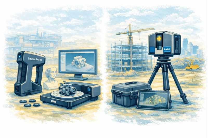

Visual comparison of EinScan object scanner and LiDAR terrestrial laser scanner in matching sketch style.

Scale and Range

The first and most obvious difference is working range.
An EinScan handheld unit is comfortable scanning parts from a few centimetres up to perhaps three or four metres. It is ideal for a gearbox housing on a bench or the plastic bumper of a vehicle. Once the object grows larger than a small room, the scanner begins to lose tracking and accuracy.

A terrestrial LiDAR scanner is built for the opposite end of the spectrum. A FARO Focus S-series can capture data from 0.6 metres out to 70 metres or more, mapping entire buildings or industrial sites from a single setup. Multiple scans are then registered together to create a complete digital twin of a facility.

For workshops and machine shops the question becomes simple:
Are you scanning an object, or are you scanning a place?
Objects suit EinScan; places suit LiDAR.

Accuracy and Tolerance Expectations

Manufacturers often quote impressive numbers, but real-world accuracy must be considered.

  • EinScan desktop and handheld systems typically achieve 0.05โ€“0.2 mm accuracy on small parts when conditions are ideal.
  • Terrestrial LiDAR scanners deliver around ยฑ1 mm to ยฑ3 mm accuracy over distance.

At first glance EinScan appears โ€œmore accurate,โ€ but this is only true at short range. A LiDAR scanner maintains consistent accuracy across tens of metres, something structured-light devices simply cannot do.

For precision mechanical componentsโ€”bearing fits, machined bores, threaded holesโ€”neither technology replaces traditional metrology tools. Scanning excels at capturing shape and context, while micrometers and CMMs remain the authority for tolerance verification.

Type of Data Produced

EinScan produces mesh files made from millions of tiny triangles. These are excellent for visualisation and 3D printing but contain no intelligence about holes, planes or cylinders. CAD systems like SolidWorks or Fusion 360 cannot directly convert these meshes into editable parametric models without additional reverse-engineering work.

LiDAR scanners generate point cloudsโ€”individual points with coordinates and often colour values. Point clouds are perfect for surveying, clash detection, volume calculations and as-built documentation. They are not intended to be edited like CAD models; instead, engineers build new geometry over the top using the cloud as reference.

Understanding this distinction avoids disappointment. Neither scanner delivers a โ€œone-click CAD model.โ€ Human engineering judgement is always required.

Surface and Environmental Limitations

EinScan technology relies on optical cameras and projected light, which introduces several practical limitations:

  • Shiny or black surfaces are difficult to capture
  • Transparent plastics confuse the cameras
  • Deep holes and narrow slots are often missed
  • Sunlight can overpower the projected pattern
  • Tracking can be lost on large flat surfaces

LiDAR systems are more tolerant of environment. They can operate outdoors, in dusty workshops and over long distances. However, they also struggle with highly reflective materials such as polished stainless steel or glass, and they require careful setup to avoid shadows and occlusions.

Workflow Considerations

A typical EinScan workflow looks like this:

  1. Prepare the partโ€”often with scanning spray
  2. Capture multiple passes
  3. Clean and align the mesh
  4. Export STL/OBJ
  5. Rebuild geometry in CAD using the mesh as reference

This process suits reverse engineering of brackets, castings, vehicle parts and consumer products.

A LiDAR workflow is different:

  1. Set up the scanner at multiple locations
  2. Register scans together in software such as FARO Scene or Leica Cyclone
  3. Classify and clean the point cloud
  4. Use the cloud for measurements, modelling or BIM integration

This approach is ideal for as-built surveys, plant upgrades, brownfield design and digital twins.

Cost and Ownership

EinScan systems range from a few thousand to around twenty thousand dollars. They are accessible to small businesses and even serious hobbyists. Software is generally included, and the learning curve is manageable.

Terrestrial LiDAR scanners are capital equipment. Purchase prices often exceed $60,000โ€“$100,000 before software, training and maintenance. For many companies it makes more sense to engage a specialist scanning provider when required.


Hamilton By Design logo displayed on a blue tilted rectangle with a grey gradient background

Choosing the Right Tool

The decision should be driven by the problem you are solving:

Choose EinScan when you need to:

  • Create a bracket to fit an existing motor
  • Reverse engineer a plastic enclosure
  • Modify a vehicle component
  • Capture complex organic shapes
  • Produce meshes for 3D printing

Choose LiDAR when you need to:

  • Document an industrial facility
  • Design around existing plant and pipework
  • Perform clash detection for upgrades
  • Measure volumes and clearances
  • Create a site-wide digital twin

Many organisations ultimately use both. A LiDAR scan provides the big picture, while an EinScan captures detailed components within that environment.


3D LiDAR scanning and 3D modelling service button โ€” laser scanner capturing a point cloud for engineering and CAD modelling
Mechanical engineering services

Integration with CAD

Engineers often ask which scanner works best with SolidWorks or Fusion 360. The honest answer is that neither integrates directly into parametric CAD without intermediate steps. EinScan meshes require reverse-engineering tools or manual modelling. LiDAR point clouds usually pass through Autodesk Recap, FARO Scene or similar before being referenced in CAD.

Scanning is a method of collecting truth, not generating finished design. The value lies in reducing site visits, avoiding clashes and giving designers confidence about existing conditions.

Final Thoughts

EinScan scanners and terrestrial LiDAR systems are not competitors; they are complementary tools on the reality-capture spectrum. One excels at objects on a bench, the other at assets spread across hectares. Selecting the wrong tool leads to frustration, while choosing correctly can transform the way projects are delivered.

For Australian fabricators and engineers, the key question is simple:
Are you capturing a part, or are you capturing a place?
Answer that, and the choice between EinScan and LiDAR becomes clear.


Name
Would you like us to arrange a phone consultation for you?
Address

3D CAD Modelling Australia service banner for Hamilton By Design
Mining & Processing Perth WA banner for Hamilton By Design featuring white text on a blue background.

Scan to BIM Perth WA banner for Hamilton By Design featuring white text on a blue background.
Ship Building Perth WA banner for Hamilton By Design featuring white text on a blue background.
Structural drafting services button
3D LiDAR scanning and 3D modelling services button
Mechanical drafting services button
3D CAD Modelling Australia service banner for Hamilton By Design
3D LiDAR scanning and 3D modelling service button โ€” laser scanner capturing a point cloud for engineering and CAD modelling
Mechanical engineering services
3D CAD Modelling Australia service banner for Hamilton By Design
Mechanical, Structural & Pipework Drafting service banner by Hamilton By Design featuring white text on a blue background.
Australian Drafting logo featuring bold white text reading "Australian Drafting" centred on a blue rounded rectangle background.
Blue banner graphic displaying the text "Point Cloud to CAD - Australia" in large white lettering, representing point cloud processing, scan-to-CAD conversion and digital engineering services across Australia.
CHPP Engineering title graphic featuring bold white text reading "CHPP Engineering" centred on a blue rounded rectangle background.
Engineering Governance title graphic featuring bold white text reading "Engineering Governance" centred on a blue rounded rectangle background.
Mechanical engineering services
Australian Drafting logo featuring bold white text reading "Australian Drafting" centred on a blue rounded rectangle background.
https://www.hamiltonbydesign.com.au/lidar-scanning-brisbane-2
3D LiDAR Scanning Hunter & Newcastle banner with white text on a blue background promoting engineering-grade laser scanning services for industrial, mining and infrastructure projects across the Hunter Valley and Newcastle region.
Mechanical Engineering Hunter & Newcastle banner promoting mechanical engineering services for mining, industrial plants, power generation, manufacturing and heavy industry throughout the Hunter Valley and Newcastle region.
Structural Drafting Hunter & Newcastle banner promoting structural drafting services for mining, industrial plants, power generation, manufacturing and infrastructure projects across the Hunter Valley and Newcastle region.
Mechanical Engineering Perth WA banner for Hamilton By Design featuring white text on a blue background.
3D Laser Scanning Perth WA banner for Hamilton By Design with white text on a blue background.
SolidWorks Perth WA banner for Hamilton By Design featuring white text on a blue background.
Fabrication and product design services
Finite Element Analysis (FEA) engineering simulation button
3D LiDAR scanning and 3D modelling service button โ€” laser scanner capturing a point cloud for engineering and CAD modelling
Blue rounded button with the text โ€œSolidWorks Designโ€ in white.
Mechanical drafting services button
Structural drafting services button

Mechanical Engineering | Structural Engineering


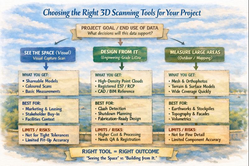
Choosing the Right 3D Scanning Tools for Your Project

Diagram comparing visual scanning, engineering LiDAR and photogrammetry to help choose the right 3D scanning method for construction and engineering projects.

Choosing the Right 3D Scanning Tool for Engineering Projects

3D scanning is now widely used across construction, property, manufacturing, and heavy industry โ€” but not all scanning tools are designed for the same outcomes. Choosing the right technology depends less on the buzzwords and more on what you actually need to do with the data after itโ€™s captured.

This article explains the main types of 3D scanning commonly used in Australia today, what theyโ€™re best suited for, and how to choose the right approach for your project.


1. Visual Capture Scanning (Property, Architecture & Digital Twins)

Best for:

  • Property marketing and virtual tours
  • Design coordination
  • Facilities management
  • Heritage documentation
  • Basic Scan-to-BIM

Typical outputs:

  • Web-based walkโ€‘through models
  • Coloured point clouds
  • Floor plans and simple BIM geometry
  • OBJ / E57 exports for modelling

Strengths:

  • Fast capture
  • Lower cost
  • Easy sharing via web platforms
  • Excellent for stakeholder engagement

Limitations:

  • Lower geometric accuracy
  • Not suitable for fabrication tolerances
  • Not reliable for mechanical or structural fitโ€‘up

This type of scanning is ideal when the goal is visual context and spatial understanding, rather than precise dimensional control.


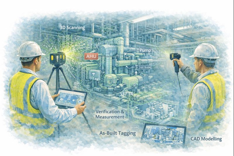
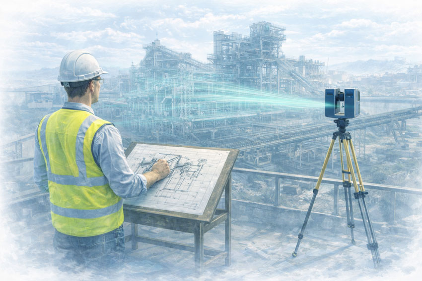
Engineers using LiDAR scanners to capture plant equipment and convert point cloud data into CAD models for verification and as-built documentation.

2. Engineeringโ€‘Grade LiDAR Scanning (Industrial & Retrofit Projects)

Best for:

  • Mechanical and structural design
  • Plant upgrades and brownfield sites
  • Clash detection
  • Fabricationโ€‘ready modelling
  • Shutdown planning

Typical outputs:

  • Highโ€‘density point clouds
  • Registered E57 / RCP datasets
  • CADโ€‘ready reference geometry
  • Scanโ€‘toโ€‘CAD and Scanโ€‘toโ€‘BIM models

Strengths:

  • Millimetreโ€‘level accuracy
  • Longโ€‘range capability
  • Reliable for engineering measurement
  • Suitable for design verification

Limitations:

  • Higher equipment and processing cost
  • Longer setup and registration time
  • Requires engineering workflows to extract value

Engineering LiDAR is used when design decisions and fabrication depend on accurate geometry, not just visual representation.


3. Photogrammetry (Large Areas & Outdoor Mapping)

Best for:

  • Stockpile measurement
  • Terrain mapping
  • Faรงade capture
  • Infrastructure corridors

Typical outputs:

  • Mesh models
  • Orthophotos
  • Surface models

Strengths:

  • Covers large areas quickly
  • Droneโ€‘based access
  • Useful for topography

Limitations:

  • Less accurate for fine detail
  • Poor performance in tight or indoor environments
  • Limited for mechanical components

Photogrammetry is excellent for scale and surface data, but not for highโ€‘precision engineering work.


4. Why the End Use of Data Matters More Than the Scanner

The most common mistake in 3D scanning projects is choosing a capture method before defining:

  • Will the data be used for design and fabrication?
  • Or mainly for visualisation and documentation?
  • Do tolerances matter?
  • Will components be manufactured from this data?

If scanning is only used for:

  • Layout confirmation
  • Space planning
  • Stakeholder communication

Then visual scanning platforms may be entirely sufficient.

If scanning is used for:

  • Equipment replacement
  • Structural modification
  • Pipework or conveyor interfaces
  • Custom fabrication

Then engineeringโ€‘grade LiDAR is essential.


5. Matching the Tool to the Job

Project TypeRecommended Technology
Real estate & virtual toursVisual capture scanning
Office and building refurbishmentsVisual capture or LiDAR depending on tolerances
Plant upgrades & shutdownsEngineeringโ€‘grade LiDAR
Mechanical retrofitsEngineeringโ€‘grade LiDAR
Large outdoor mappingPhotogrammetry or LiDAR
Fabrication from existing assetsEngineeringโ€‘grade LiDAR only

6. Scanning Is Only Step One

Regardless of the technology used, scanning only creates value when paired with:

  • Proper registration and QA
  • Engineering interpretation
  • CAD modelling and documentation
  • Design validation

Without these steps, point clouds remain large files with limited practical use.

The biggest performance gains come when scanning is directly integrated into:

  • Engineering design
  • Constructability reviews
  • Clash detection
  • Fabrication planning

Infographic explaining how to choose the right 3D scanning tool based on whether a project needs visualisation, engineering design, or large-area measurement.

Final Thoughts

3D scanning is not a single solution โ€” it is a group of technologies with very different strengths.

The right approach depends on whether your project is focused on:

  • Seeing the space, or
  • Building from the space

Understanding that difference early can save significant time, cost, and rework later in the project lifecycle.

If youโ€™re unsure which approach fits your project, start by defining what decisions and deliverables will rely on the data โ€” then choose the scanning method that supports those outcomes, not just the fastest or cheapest option.

Hamilton By Design logo displayed on a blue tilted rectangle with a grey gradient background
3D LiDAR scanning and 3D modelling service button โ€” laser scanner capturing a point cloud for engineering and CAD modelling
Mechanical engineering services
Name
Would you like us to arrange a phone consultation for you?
Address
3D LiDAR scanning and 3D modelling service button โ€” laser scanner capturing a point cloud for engineering and CAD modelling
Mechanical engineering services
Finite Element Analysis (FEA) engineering simulation button
Mechanical engineering services

Mechanical Engineering | Structural Engineering


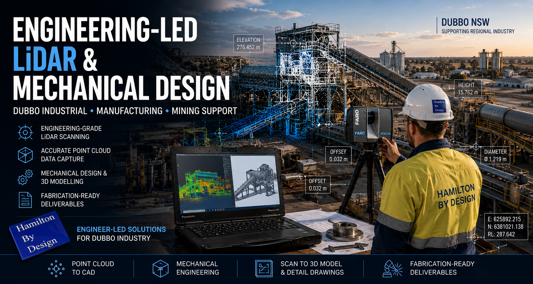
Engineering-Led LiDAR & Mechanical Design for Mining & Heavy Industry โ€“ Dubbo NSW

Engineer operating a terrestrial LiDAR scanner at an industrial facility in Dubbo while capturing point cloud data for mechanical engineering and plant design.

Hamilton By Design provides engineering-led LiDAR scanning and mechanical design services to support mining and heavy-industry projects in Dubbo and Central West New South Wales. Our work focuses on brownfield assets, live operating plant, and shutdown-driven projects where accuracy, constructability, and risk control are critical.

Mechanical engineer capturing a mining plant with LiDAR scanning, showing point cloud data integrated into engineering design workflows.

This is not survey-only scanning. We integrate engineering judgement with high-accuracy reality capture to deliver fabrication-ready, fit-first-time outcomes for mining, processing, and heavy industrial infrastructure across the Central West.


Engineering-Led LiDAR for Central West NSW Mining & Industry

Mining and heavy-industry operations around Dubbo support a mix of base-metals mining, materials handling, processing facilities, and regional industrial infrastructure. These environments commonly involve:

  • Legacy plant and infrastructure with incomplete as-built documentation
  • Multiple generations of modifications and upgrades
  • Restricted access in live operating environments
  • High consequence of errors during shutdowns or short outage windows

Our engineering-led LiDAR approach is designed for operating sites where assumptions introduce safety, cost, and schedule risk.


Integrated Scan-to-Engineering Workflow

We deliver a single, accountable workflow tailored to Central West NSW operations:

  1. On-site LiDAR scanning undertaken by engineers familiar with regional mining and industrial environments
  2. Engineering-grade point-cloud processing aligned to modelling tolerances and fabrication requirements
  3. Mechanical and structural CAD modelling developed directly from scan data
  4. Fabrication-ready drawings suitable for workshop manufacture and site installation
  5. Engineering support through fabrication, installation, and shutdown execution

This workflow reduces interface risk between scanning, design, fabrication, and construction โ€” particularly important where access and shutdown windows are limited.


Mining & Heavy Industry Applications in Dubbo

Brownfield Engineering & Existing Assets

Central West NSW operations rely on long-life assets that have evolved through decades of operation. We support brownfield engineering where:

  • Original drawings are unreliable or unavailable
  • Equipment interfaces are complex or undocumented
  • Clearance, access, and compliance are critical

LiDAR provides accurate existing-condition data, while engineering oversight ensures the information is applied correctly during design and verification.


Shutdown-Driven Projects

Shutdowns in regional operations are tightly planned and often resource constrained.

Our work supports shutdown success by:

  • Capturing existing conditions prior to outages
  • Eliminating site measurement during shutdowns
  • Verifying interfaces, access, and constructability
  • Reducing fabrication and installation risk

Pre-validated designs improve safety, execution quality, and schedule certainty.


Processing Plants & Materials Handling

Mining and industrial operations around Dubbo include complex processing and materials-handling systems.

Our engineering-led LiDAR services support:

  • Conveyors and transfer stations
  • Hoppers, bins, and chutes
  • Crushers, screens, and feeders
  • Walkways, platforms, and guarding upgrades

Accurate scan-to-CAD workflows enable confident redesign, replacement, and compliance upgrades in operating facilities.


Heavy Plant & Industrial Equipment

We support projects involving large and complex equipment where traditional measurement methods are unsafe or impractical, including:

  • Fixed and mobile processing plant
  • Structural steelwork and access systems
  • Maintenance platforms and guarding systems

Engineering-led scanning ensures interfaces, envelopes, and installation constraints are understood before fabrication begins.


Risk Management for Regional Mining & Industrial Projects

In regional centres like Dubbo, risk is driven by unknown conditions, ageing infrastructure, and limited tolerance for rework.

Our approach reduces risk by:

  • Removing reliance on outdated drawings and assumptions
  • Capturing accurate existing conditions prior to design
  • Identifying clashes and access constraints early
  • Reducing site rework and hot works
  • Supporting safer shutdown execution

Risk is managed upstream, where it is cheapest and safest to control.


What Makes Our Approach Different

  • Engineer-led LiDAR scanning, not technician-only capture
  • Mechanical and structural engineering capability in-house
  • Mining and heavy-industry focus
  • Brownfield and shutdown experience
  • Single point of responsibility from scan through to design output

Typical Deliverables

Depending on project scope, deliverables may include:

  • Registered point-cloud datasets
  • Engineering-grade 3D CAD models
  • Mechanical and structural drawings
  • Interface and clearance verification
  • Fabrication and installation documentation

All deliverables are developed with fabrication, installation, and operational use in mind.


Hamilton By Design logo displayed on a blue tilted rectangle with a grey gradient background
3D LiDAR scanning and 3D modelling service button โ€” laser scanner capturing a point cloud for engineering and CAD modelling
Mechanical engineering services

Who We Support

Our services support:

  • Mining asset owners and operators
  • Processing plant operators
  • Maintenance and shutdown teams
  • Project engineers and managers
  • Fabricators and constructors operating in Central West NSW

We work directly with asset owners or as part of multi-disciplinary project teams.


Talk to an Engineer

If you are planning:

  • A brownfield upgrade
  • A shutdown-driven project
  • Processing plant modifications
  • Materials-handling or heavy plant upgrades

Hamilton By Design can support your project in Dubbo and Central West NSW with engineering-led LiDAR scanning and mechanical design.

Contact us to discuss your site, constraints, and project objectives.

Name
Would you like us to arrange a phone consultation for you?
Address

Our clients:


3D CAD Modelling Australia service banner for Hamilton By Design


CHPP Engineering title graphic featuring bold white text reading "CHPP Engineering" centred on a blue rounded rectangle background.
Pipework Drafting title graphic featuring bold white text reading "Pipework Drafting" centred on a blue rounded rectangle background.
3D LiDAR Scanning for Engineering Projects title graphic featuring bold white text on a blue rounded rectangle background.


Finite Element Analysis (FEA) engineering simulation button
Structural drafting services button
Mechanical drafting services button


Australian Drafting logo featuring bold white text reading "Australian Drafting" centred on a blue rounded rectangle background.
Engineering Governance title graphic featuring bold white text reading "Engineering Governance" centred on a blue rounded rectangle background.
Engineering-Grade LiDAR Scanning title graphic featuring bold white text on a blue rounded rectangle background.


Mechanical drafting services button
Structural drafting services button


Fabrication and product design services
3D CAD Modelling Australia service banner for Hamilton By Design
Mechanical, Structural & Pipework Drafting service banner by Hamilton By Design featuring white text on a blue background.


3D LiDAR scanning and 3D modelling service button โ€” laser scanner capturing a point cloud for engineering and CAD modelling
Mechanical engineering services

Mechanical Engineering | Structural Engineering


Engineering-Led LiDAR & Mechanical Design for Mining & Heavy Industry โ€“ Cobar NSW

Engineer-led LiDAR scanning at a mining heavy-industry site with point cloud overlay used for mechanical design and brownfield engineering.

Engineering-Led LiDAR & Mechanical Design for Mining | Cobar NSW

Hamilton By Design provides engineering-led LiDAR scanning and mechanical design services to support mining and heavy-industry projects in Cobar and Western New South Wales. Our work focuses on brownfield assets, live operating plant, and shutdown-driven projects where accuracy, constructability, and risk control are critical.

This is not survey-only scanning. We integrate engineering judgement with high-accuracy reality capture to deliver fabrication-ready, fit-first-time outcomes for base-metals operations, processing facilities, and heavy industrial infrastructure in remote and legacy environments.


Engineering-Led LiDAR for Western NSW Mining

Mining operations in and around Cobar operate within established districts where assets have evolved over decades. Common challenges include:

  • Legacy infrastructure with incomplete or outdated as-built documentation
  • Multiple generations of plant modifications
  • Restricted access and ageing structures
  • High consequence of rework during shutdowns
  • Remote logistics that penalise design errors

Our engineering-led LiDAR approach is designed for operating mine sites and processing facilities where assumptions create safety, cost, and schedule risk.


Mechanical engineer capturing a mining plant with LiDAR scanning, showing point cloud data integrated into engineering design workflows.

Integrated Scan-to-Engineering Workflow

We deliver a single, accountable workflow suited to remote and brownfield mining operations:

  1. On-site LiDAR scanning undertaken by engineers familiar with mining safety, access, and constructability constraints
  2. Engineering-grade point-cloud processing aligned to modelling tolerances and fabrication requirements
  3. Mechanical and structural CAD modelling developed directly from scan data
  4. Fabrication-ready drawings suitable for workshop manufacture and site installation
  5. Engineering support through fabrication, installation, and commissioning

This workflow reduces interface risk between scanning, design, fabrication, and construction โ€” particularly important where site access and logistics are constrained.


Mining & Heavy Industry Applications in Cobar

Brownfield Engineering & Existing Assets

Cobar-region operations rely heavily on long-life assets that have been modified through decades of maintenance and shutdown work. We support brownfield engineering where:

  • Original drawings are unavailable or unreliable
  • Equipment interfaces are complex or undocumented
  • Clearance, access, and compliance are critical

LiDAR provides accurate existing-condition data, while engineering oversight ensures the information is applied correctly during design and verification.


Shutdown-Driven Projects

Shutdown windows in remote mining regions are tightly planned and high consequence.

Our work supports shutdown success by:

  • Capturing existing conditions before outages
  • Eliminating site measurement during shutdowns
  • Verifying interfaces, access, and constructability
  • Reducing fabrication and installation risk

Pre-validated designs improve safety, execution quality, and schedule certainty.


Processing Plants & Materials Handling

Mining operations in Western NSW include complex processing and materials-handling infrastructure.

Our engineering-led LiDAR services support:

  • Conveyors and transfer stations
  • Hoppers, bins, and chutes
  • Crushers, screens, and feeders
  • Walkways, platforms, and guarding upgrades

Accurate scan-to-CAD workflows enable confident redesign, replacement, and compliance upgrades in operating plants.


Heavy Plant & Industrial Equipment

We support projects involving large and complex equipment where traditional measurement methods are unsafe or impractical, including:

  • Fixed and mobile processing plant
  • Structural steelwork and access systems
  • Maintenance platforms and guarding systems

Engineering-led scanning ensures interfaces, envelopes, and installation constraints are understood before fabrication begins.


Risk Management for Remote & Legacy Mining Assets

In established mining districts like Cobar, risk is driven by unknown conditions, ageing infrastructure, and interface complexity.

Our approach reduces risk by:

  • Removing reliance on outdated drawings and assumptions
  • Capturing accurate existing conditions prior to design
    n- Identifying clashes and access constraints early
  • Reducing site rework and hot works
  • Supporting safer shutdown execution

Risk is managed upstream, where it is cheapest and safest to control.


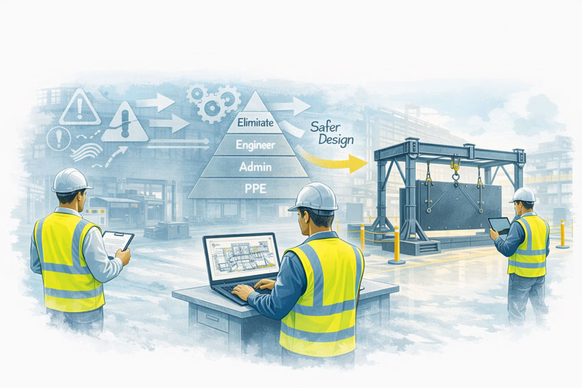
Mining engineers applying design-for-safety principles to improve material handling systems in an industrial workshop

What Makes Our Approach Different

  • Engineer-led LiDAR scanning, not technician-only capture
  • Mechanical and structural engineering capability in-house
  • Mining and heavy-industry focus
  • Brownfield and shutdown experience
  • Single point of responsibility from scan through to design output

Typical Deliverables

Depending on project scope, deliverables may include:

  • Registered point-cloud datasets
  • Engineering-grade 3D CAD models
  • Mechanical and structural drawings
  • Interface and clearance verification
  • Fabrication and installation documentation

All deliverables are developed with fabrication, installation, and operational use in mind.


Who We Support

Our services support:

  • Base-metals mining asset owners
  • Processing plant operators
  • Maintenance and shutdown teams
  • Project engineers and managers
  • Fabricators and constructors operating in Western NSW

We work directly with asset owners or as part of multi-disciplinary project teams.


Hamilton By Design logo displayed on a blue tilted rectangle with a grey gradient background
3D LiDAR scanning and 3D modelling service button โ€” laser scanner capturing a point cloud for engineering and CAD modelling
Mechanical engineering services

Talk to an Engineer

If you are planning:

  • A brownfield upgrade
  • A shutdown-driven project
  • Processing plant modifications
  • Materials-handling or heavy plant upgrades

Hamilton By Design can support your project in Cobar and Western NSW with engineering-led LiDAR scanning and mechanical design.

Contact us to discuss your site, constraints, and project objectives.

Name
Would you like us to arrange a phone consultation for you?
Address

Our clients:


Mechanical Engineering | Structural Engineering


3D LiDAR Scanning Wyong

3D LiDAR Scanning Wyong | Engineering-Grade & Standards-Compliant

Hamilton By Design provides engineering-grade 3D LiDAR scanning in Wyong, delivering accurate as-built data that supports Australian Standardsโ€“compliant design, documentation, and construction.

In power, manufacturing, and building & construction environments, the quality of scan data directly affects whether designs are buildable, compliant, and installable. Our approach focuses on engineering accuracy, control, and verification, not just visual capture.


Why engineering-grade LiDAR scanning matters

Not all 3D scanning is equal.

Low-grade or survey-only scans may look impressive but often lack:

  • Reliable control and datums
  • Verified accuracy suitable for engineering tolerances
  • Context around structural, mechanical, and access systems
  • Confidence that derived drawings will meet Australian Standards

Engineering-grade LiDAR scanning ensures the captured data is suitable for:

  • Mechanical and structural design
  • Fabrication and installation
  • Compliance assessment and upgrade works

This is especially important in Wyong, where many assets are live, brownfield, or undergoing staged upgrades.


3D LiDAR scanning services on the Central Coast providing engineering-grade laser scanning, point cloud capture, scan-to-CAD modelling and industrial reality capture for infrastructure and industrial projects.
Drafting services on the Central Coast providing engineering drawings, fabrication detailing, as-built documentation, reverse engineering and CAD drafting for industrial and infrastructure projects.
Mechanical engineering services on the Central Coast providing industrial design, plant inspections, pump calculations, reverse engineering and engineering support for manufacturing, infrastructure and heavy industry projects.

Supporting Australian Standards through accurate as-built data

3D LiDAR scanning is not a standard on its own โ€” it is an enabling technology that supports compliance with Australian Standards by providing accurate geometry for engineering decisions.

Our scanning services directly support design and documentation aligned with:

  • AS 1100 โ€“ Technical Drawing
    Ensuring scan-derived drawings use correct datums, dimensions, and tolerances.
  • AS 1657 โ€“ Access Systems
    Verifying existing platforms, handrails, head heights, and clearances for upgrades and compliance.
  • AS 3990 โ€“ Mechanical Equipment Steelwork
    Capturing existing steelwork geometry to support loads, interfaces, and fabrication fit-up.
  • AS 4100 โ€“ Steel Structures
    Supporting structural verification, strengthening, and modification works.
  • AS 3774 โ€“ Bulk Solids Containers
    Providing accurate hopper, bin, and chute geometry for load calculations and design checks.
  • NCC โ€“ National Construction Code
    Supporting building upgrades, refurbishments, and as-built documentation.

Engineering-grade scanning ensures that models and drawings derived from the scan can be relied upon during compliance reviews and construction.


Power, manufacturing & construction scanning in Wyong

Wyong and the northern Central Coast support a mix of energy infrastructure, manufacturing facilities, and construction activity, where accurate as-built data reduces risk.

We support scanning for:

  • Power stations, substations, and electrical infrastructure
  • Manufacturing plants, workshops, and industrial facilities
  • Structural steel, platforms, walkways, and access systems
  • Plant rooms, services corridors, and retrofit works
  • Brownfield construction and staged upgrades

LiDAR scanning allows engineering and construction teams to design off-site with confidence, reducing shutdown risk and site rework.


Our Clients:


What makes our scanning engineering-grade

Our approach goes beyond data capture:

  • Scan planning based on engineering intent
  • Controlled datums and registration suitable for CAD and fabrication
  • Accuracy aligned with mechanical and structural tolerances
  • Interpretation by engineers who understand compliance requirements
  • Deliverables designed to integrate into engineering workflows

This ensures scan data is fit for purpose, not just visually accurate.


SolidWorks Certified

SOLIDWORKS Professional Design certification badge by Dassault Systรจmes
SOLIDWORKS Professional Drawing Tools certification badge by Dassault Systรจmes

Deliverables

Depending on project needs, we provide:

  • Registered point clouds (E57 / RCP / LAS)
  • 2D as-built drawings (plans, sections, elevations)
  • 3D CAD models suitable for engineering and fabrication
  • Interface and clash reviews
  • Fabrication-ready dimensions and datum strategies
  • Digital QA documentation supporting compliance and installation

Hamilton By Design logo displayed on a blue tilted rectangle with a grey gradient background
3D LiDAR scanning and 3D modelling service button โ€” laser scanner capturing a point cloud for engineering and CAD modelling
Mechanical engineering services

Wyong & Central Coast coverage

We service Wyong and surrounding areas including Tuggerah, Warnervale, Ourimbah, Somersby, Lake Haven, Gosford, Erina, and across the Central Coast.

We also support projects extending into Newcastle, the Hunter Valley, and Greater Sydney, providing consistent engineering-grade scanning across multiple sites.


Get started

If you require 3D LiDAR scanning in Wyong that supports Australian Standardsโ€“compliant engineering and construction, Hamilton By Design can help.

Request a quote or book a site scan to discuss an engineering-grade scanning solution tailored to your project.

Name
Would you like us to arrange a phone consultation for you?
Address

Our clients


Mechanical Engineering | Structural Engineering


3D Scanning Services Central Coast

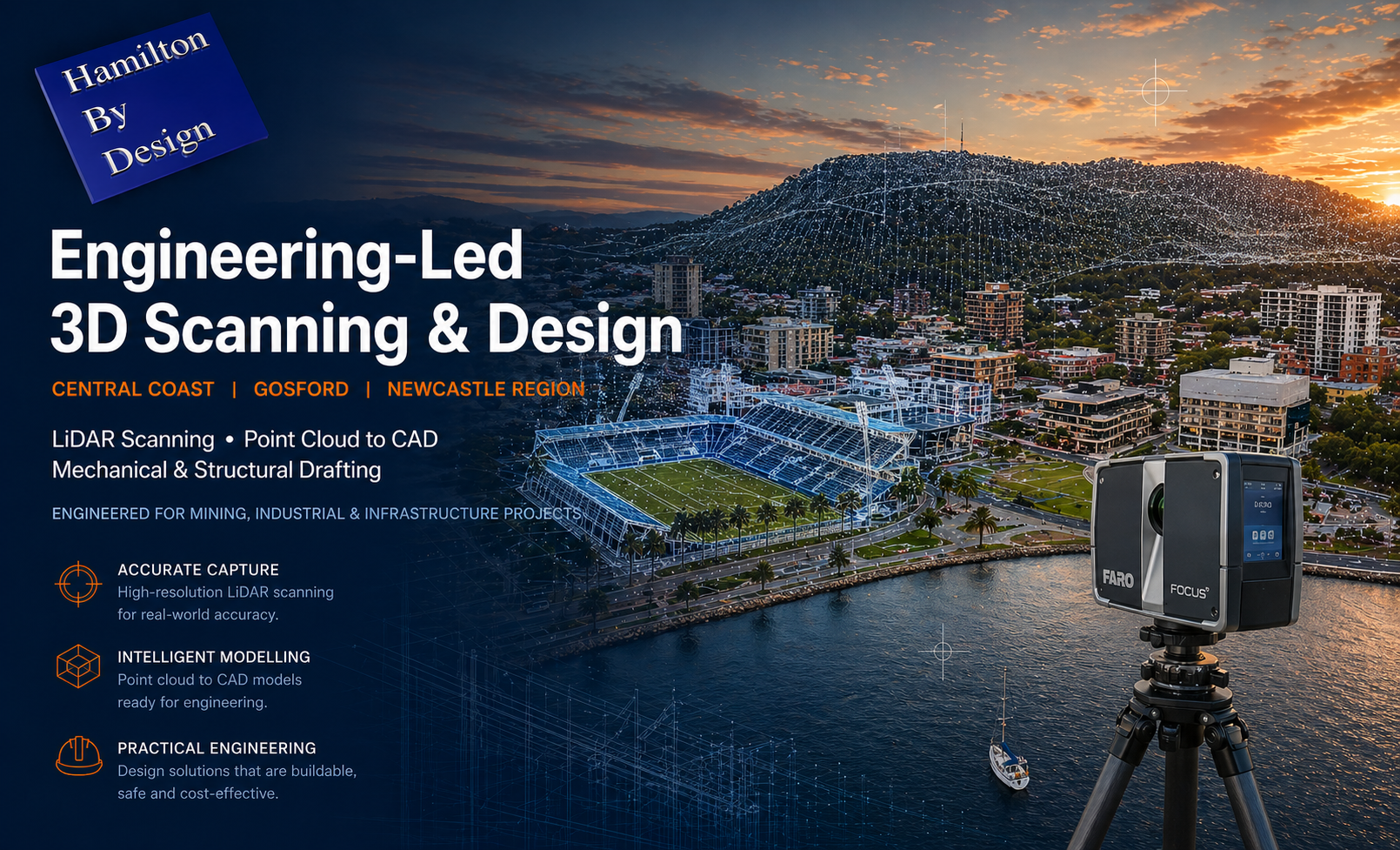
LiDAR 3D scanning services in Gosford Central Coast NSW showing stadium, waterfront and FARO laser scanner with point cloud overlay

3D Scanning Services Central Coast | Power, Manufacturing & Construction

Hamilton By Design provides engineering-grade 3D laser scanning (LiDAR) across the Central Coast NSW, supporting power and electricity generation, manufacturing, and building & construction projects that require accurate, reliable as-built data.

We combine site scanning, CAD modelling, and engineering insight to convert real-world conditions into design-ready information that supports upgrades, refurbishments, expansions, and brownfield works with reduced risk and rework.


3D LiDAR scanning services on the Central Coast providing engineering-grade laser scanning, point cloud capture, scan-to-CAD modelling and industrial reality capture for infrastructure and industrial projects.
Drafting services on the Central Coast providing engineering drawings, fabrication detailing, as-built documentation, reverse engineering and CAD drafting for industrial and infrastructure projects.
Mechanical engineering services on the Central Coast providing industrial design, plant inspections, pump calculations, reverse engineering and engineering support for manufacturing, infrastructure and heavy industry projects.

Power & electricity generation

We support scanning works in and around operating energy and utility assets, where accuracy, access planning, and engineering judgement are critical.

Typical applications include:

  • Power stations and substations
  • Turbine halls, generator rooms, and balance-of-plant areas
  • Switchyards, cable routes, and services corridors
  • Structural steel, platforms, walkways, and access systems
  • Brownfield upgrades and retrofit works

LiDAR scanning allows upgrades to be designed off-site with confidence, reducing shutdown risk and improving constructability.


Manufacturing & industrial facilities

For Central Coast manufacturing and industrial sites, we provide accurate as-built capture to support:

  • Equipment upgrades and machinery replacement
  • Production line modifications and layout changes
  • Structural steel additions and mezzanines
  • Pipework, ducting, conveyors, and services coordination
  • Digital records for ongoing asset management

Our engineer-led scanning ensures data is suitable for CAD modelling, fabrication drawings, and installation planning.


Building & construction

We support builders, contractors, and consultants with 3D scanning for:

  • Existing building documentation and verification
  • As-built capture for refurbishments and extensions
  • Clash detection between structure, services, and new works
  • Interface checks for plant rooms, risers, and roof spaces
  • Construction QA and record models

Scanning eliminates assumptions early and supports confident coordination on active sites.


Deliverables

Depending on project requirements, deliverables may include:

  • Registered point clouds (E57 / RCP / LAS)
  • 2D as-built drawings (plans, sections, elevations)
  • 3D CAD models suitable for design and fabrication
  • Clash detection and interface reviews
  • Fabrication-ready dimensions and datum strategies
  • Digital QA documentation supporting installation

Our clients


Why engineer-led scanning matters

In power, manufacturing, and construction environments, poor as-built data leads to rework, delays, and safety risks.

By integrating scanning with mechanical engineering and CAD expertise, Hamilton By Design ensures scanning outputs are usable, accurate, and construction-ready.


Hamilton By Design logo displayed on a blue tilted rectangle with a grey gradient background
3D LiDAR scanning and 3D modelling service button โ€” laser scanner capturing a point cloud for engineering and CAD modelling
Mechanical engineering services

Central Coast coverage

We service projects across the Central Coast, including:
Gosford, Tuggerah, Wyong, Ourimbah, Somersby, Erina, Lake Haven, Woy Woy, Umina, Terrigal, and surrounding industrial precincts.

We also support projects extending into Newcastle, the Hunter Valley, and Greater Sydney.


Typical workflow

  1. Engineering-led scoping discussion
  2. On-site LiDAR scanning planned around live operations
  3. Registration and verification of point cloud data
  4. CAD, drawing, and QA deliverables issued
  5. Ongoing engineering and fabrication support if required

SolidWorks Certified – Designers

SOLIDWORKS Professional Drawing Tools certification badge by Dassault Systรจmes
SOLIDWORKS Professional Design certification badge by Dassault Systรจmes

Get started

If youโ€™re planning upgrades, refurbishments, or construction works on the Central Coast and need accurate as-built data, we can help.

Request a quote or book a site scan to discuss the right scanning and deliverable package for your project.

Name
Would you like us to arrange a phone consultation for you?
Address

Our clients


Mechanical Engineering | Structural Engineering