


Why LiDAR Delivers Real Engineering Outcomes
In modern engineering, accuracy is everything. Whether you are working in mining, manufacturing, infrastructure, or plant design, the difference between success and costly rework often comes down to how well you understand what has actually been built.
This is where laser scanning for engineering has become a critical tool.
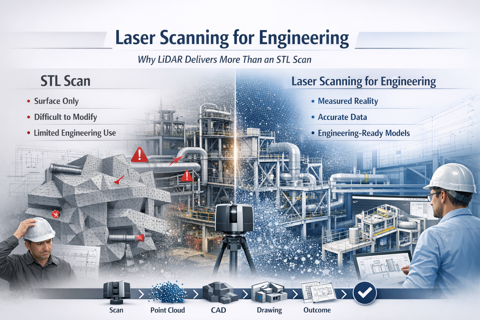
While many providers offer “3D scanning,” not all data is created equal. There is a significant difference between engineering-grade LiDAR point cloud data and basic STL mesh outputs. Understanding that difference can determine whether your project moves forward efficiently—or gets stuck in rework, assumptions, and redesign.



What is Laser Scanning for Engineering?
Laser scanning for engineering uses LiDAR (Light Detection and Ranging) technology to capture millions of precise measurements of a physical environment. The result is a high-density point cloud—a true digital representation of reality.
Unlike traditional measurement methods, LiDAR captures:
- Complex geometry
- Structural relationships
- Equipment positioning
- Real-world deviations from design
This data becomes the foundation for:
- CAD modelling (SolidWorks, AutoCAD, Revit)
- Engineering drawings
- Clash detection
- Retrofit and upgrade design
In short, it bridges the gap between design intent and as-built reality.
The Problem with STL-Based Scanning
Many scanning providers deliver outputs as STL, OBJ, or mesh files. While these formats are useful for visualisation or 3D printing, they fall short in engineering applications.
Key limitations of STL scans:
- No intelligence – Meshes are just surfaces, not structured geometry
- Difficult to modify – Not suitable for parametric design workflows
- Poor for engineering drawings – Cannot easily generate sections, tolerances, or fabrication details
- Heavy and inefficient – Large file sizes with limited usability
- No clear chain of accuracy – Hard to verify measurement reliability
In practical terms, an STL file often becomes a dead-end deliverable—you can look at it, but you can’t engineer from it effectively.
Why LiDAR Point Clouds Are Built for Engineering
LiDAR-based laser scanning for engineering produces structured, measurable, and verifiable data that integrates directly into engineering workflows.
Key advantages:
1. True-to-Reality Accuracy
Point clouds capture millions of measured points, providing a high-confidence representation of the real world.
2. Direct CAD Integration
Data can be converted into:
- Parametric 3D models
- Fabrication-ready drawings
- Plant layouts and assemblies
3. Supports Engineering Decisions
Engineers can:
- Measure directly from the dataset
- Validate clearances and tolerances
- Design with confidence
4. Enables Retrofit and Brownfield Design
In existing plants, nothing is ever exactly “as drawn.” LiDAR ensures your design fits what is actually there, not what was intended years ago.
5. Reduces Risk and Rework
Accurate input data leads to:
- Fewer site revisits
- Reduced fabrication errors
- Lower project costs
6. Maintains Chain of Custody
Engineering-grade scanning supports data governance, traceability, and verification—critical in legal, compliance, and high-risk environments.
Engineering vs Visualisation: A Critical Distinction
A key misunderstanding in the industry is assuming all 3D scanning is equal.
- STL / Mesh Scanning → Visualisation Output
- LiDAR Point Cloud → Engineering Input
If your goal is:
- 3D printing → STL may be enough
- Engineering design, fabrication, or upgrades → LiDAR is essential
Real-World Application: Engineering in Practice
Across mining, manufacturing, and infrastructure, laser scanning for engineering is used to:
- Capture conveyor systems before modification
- Model structural steel for upgrades
- Verify equipment installation
- Design pipework and mechanical systems
- Plan shutdown works with precision
Instead of guessing dimensions or relying on outdated drawings, engineers work from measured reality.
The Workflow That Delivers Results
A proper engineering workflow looks like this:
Scan → Register → Model → Detail → Deliver
Not:
Scan → Export STL → End
That difference defines whether you receive a usable engineering deliverable or just a digital artifact.



Laser scanning for engineering is not just about capturing data—it’s about enabling better engineering outcomes.
LiDAR-based point cloud data provides:
- Accuracy
- Usability
- Engineering value
In contrast, STL-based scanning often limits what you can achieve.
If your project requires real design, real drawings, and real decisions, then the choice is clear:
Use laser scanning for engineering—not just scanning for appearance.
Our clients

























Contact Us













