

Engineering-Grade 3D Laser Scanning for Heritage Restoration, Conservation and Adaptive Reuse in Perth, Western Australia
Perth and Western Australia contain an extensive collection of historically significant buildings, including limestone and sandstone civic structures, heritage courthouses, railway infrastructure, churches, industrial buildings and early commercial architecture.
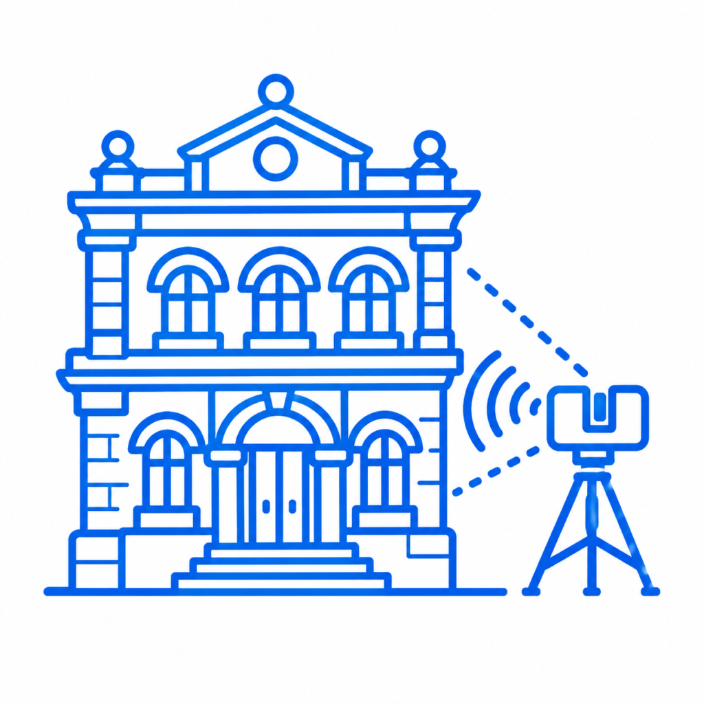
Preserving these structures requires an accurate understanding of their existing geometry, construction details and structural arrangements.
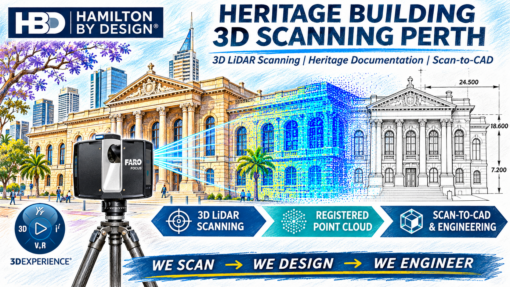
Hamilton By Design provides professional heritage building 3D scanning in Perth, combining terrestrial LiDAR scanning, registered point cloud processing, Scan-to-CAD modelling and engineering expertise to support heritage conservation, restoration, refurbishment and adaptive reuse.
Our approach provides architects, engineers, heritage consultants, restoration contractors and asset owners with measurable digital information derived directly from existing building conditions.
WE SCAN → WE DESIGN → WE ENGINEER
Heritage Building 3D LiDAR Scanning in Perth
Heritage buildings present measurement challenges that are often difficult to resolve using conventional surveying or historical architectural drawings.
Older structures may contain:
- Irregular walls and non-standard building geometry.
- Weathered limestone, sandstone and brick masonry.
- Decorative cornices, arches and architectural mouldings.
- Uneven floors, displaced walls and altered structural elements.
- Undocumented extensions and previous repairs.
- Complex roof structures and concealed construction interfaces.
- Historic machinery, structural steelwork and timber framing.
Terrestrial 3D LiDAR scanning captures millions of spatial measurements to establish a detailed three-dimensional record of visible building surfaces.
Using our FARO Focus terrestrial laser scanner, Hamilton By Design can document complex existing conditions without requiring extensive physical contact with sensitive heritage fabric.
The resulting registered point cloud provides a measurable digital reference for restoration planning, design coordination, dimensional verification and future engineering work.
Why Accurate Heritage Documentation Matters
Historic buildings frequently undergo modifications over many decades. Original drawings may be incomplete, inaccurate or unavailable.
When restoration or refurbishment is based on assumed dimensions, unexpected site conditions can lead to design conflicts, fabrication errors, additional construction costs and unnecessary disturbance to heritage materials.
Engineering-grade 3D scanning provides a practical method of reducing these uncertainties.
Establishing Existing Building Geometry
LiDAR scanning can record the spatial relationship between walls, floors, columns, façades, roof structures and architectural details.
This allows project teams to develop new designs around the building as it exists rather than relying entirely on historic documentation.
Supporting Conservation and Restoration
Detailed dimensional information assists conservation specialists and engineers when investigating deteriorated masonry, replacement building components and proposed restoration works.
Reducing Construction Risk
Accurate existing-condition information supports planning for structural alterations, access upgrades, services installation and adaptive reuse.
Creating a Permanent Digital Record
A registered point cloud can also form part of a building’s digital heritage archive, providing a record of its geometry at the time of scanning.
Heritage Façade Scanning — Limestone, Sandstone and Historic Masonry
Perth’s historic architecture includes buildings constructed from limestone, sandstone, brickwork and other traditional materials.
These façades often contain intricate architectural features that require careful measurement before conservation or restoration work begins.
Hamilton By Design can undertake detailed heritage façade scanning to document:
- Limestone and sandstone block arrangements.
- Brickwork and masonry geometry.
- Decorative cornices, columns and arches.
- Window and door openings.
- Parapets, balconies and balustrades.
- Building elevations and façade alignment.
- Visible surface deformation and irregularities.
- Structural interfaces and connections.
Registered LiDAR data can be used to produce existing-condition elevations, sections and CAD models for architectural and engineering applications.
Where higher-detail component documentation is required, supplementary close-range scanning and dimensional verification can be considered.
Heritage scanning records geometry; it does not, by itself, determine the structural condition or material integrity of the building. Engineering assessment and specialist heritage inspections may be required where deterioration or structural movement is suspected.
Heritage Building 3D Scanning for Perth Courthouses and Civic Buildings
Historic courthouses, government buildings and civic structures are important components of Western Australia’s architectural heritage.
These buildings may contain complex internal layouts, high ceilings, ornamental masonry, timber structures, staircases and architectural features that have been modified over time.
3D LiDAR scanning can support projects involving:
- Existing-condition building surveys.
- Heritage restoration and conservation.
- Roof and drainage refurbishment.
- Accessibility improvements.
- Structural strengthening and modifications.
- Mechanical and electrical services upgrades.
- Fire safety and building compliance works.
- Digital heritage documentation.
For large or operational buildings, scanning can be staged around site access, public occupancy, security requirements and the availability of particular rooms or areas.
Hamilton By Design can develop project-specific scanning methodologies based on the required level of detail, site constraints and intended engineering deliverables.
Scan-to-CAD Perth — Converting Heritage Point Clouds into Engineering Drawings
Capturing a building is only the first stage of the documentation process.
The registered point cloud can be converted into practical architectural and engineering information through Scan-to-CAD modelling.
Hamilton By Design provides engineering-led CAD modelling and drafting using established design platforms, including AutoCAD, SolidWorks and Autodesk Inventor.
Depending on project requirements, deliverables may include:
- Existing-condition floor plans.
- Architectural elevations and sections.
- Roof geometry and structural layouts.
- Steelwork and mechanical interface models.
- Simplified three-dimensional CAD models.
- General arrangement drawings.
- Dimensional drawings for restoration works.
- Fabrication drawings for replacement components.
Our engineering background enables us to consider how the captured geometry will be used for design, construction, fabrication and installation.
This is particularly important when new components must connect accurately to irregular historic structures.
Heritage Scan-to-BIM and Digital Building Models
Historic Building Information Modelling, commonly referred to as HBIM, involves developing a digital representation of an existing heritage building.
Registered LiDAR point clouds provide a measured geometric foundation for this process.
Depending on the scope, a heritage BIM workflow may support:
- Architectural conservation planning.
- Refurbishment and adaptive reuse.
- Existing-condition building models.
- Coordination of building services.
- Structural interface documentation.
- Long-term asset management.
- Digital heritage records.
Hamilton By Design can supply registered point clouds and agreed CAD geometry for integration into BIM workflows.
The required level of modelling detail, element classification and BIM deliverables should be established before commencement.
Heritage Restoration and Reverse Engineering
Many historic buildings contain architectural and mechanical components that are no longer commercially available.
Original manufacturing drawings may have been lost, and replacement components may need to be designed around irregular existing geometry.
Hamilton By Design combines 3D scanning, mechanical engineering, reverse engineering and CAD modelling to support the documentation and potential reproduction of heritage components.
Applications may include:
- Historic brackets and castings.
- Decorative metal components.
- Balustrades and handrails.
- Stair and access components.
- Structural connections.
- Historic machinery and equipment.
- Replacement steelwork.
- Mechanical assemblies and fabricated components.
Where component accuracy requirements exceed those achievable with terrestrial scanning, close-range metrology scanning can be used for suitable accessible items.
The resulting CAD information can support restoration planning, component manufacturing and engineering verification, subject to the relevant conservation requirements.
Industrial Heritage 3D Scanning in Western Australia
Western Australia’s industrial history includes mining infrastructure, railway workshops, port facilities, pumping stations, manufacturing buildings and historic machinery.
These assets frequently contain complex structural and mechanical arrangements that require specialist documentation.
Hamilton By Design is particularly well suited to projects where heritage documentation intersects with mechanical engineering and industrial design.
Our services can support:
- Historic mining and processing equipment.
- Railway workshops and maintenance facilities.
- Industrial buildings and warehouses.
- Historic pumps, valves and mechanical systems.
- Structural steelwork and machinery foundations.
- Port and maritime heritage structures.
- Industrial refurbishment and adaptive reuse.
Engineering-led scanning can help establish the relationship between machinery, structural components, access systems and surrounding building geometry.
Heritage Building Protection and Construction Monitoring
Construction activity near heritage buildings may introduce risks associated with vibration, excavation, ground movement and structural disturbance.
Before nearby construction commences, an existing-condition survey can establish a measurable record of the building.
Hamilton By Design can support heritage building protection through a staged documentation approach.
Before Construction
Undertake baseline 3D LiDAR scanning, photography and existing-condition documentation.
During Construction
Where required, coordinate vibration monitoring, targeted inspections and repeat geometric measurements.
After Construction
Undertake repeat scanning and compare the resulting datasets with the original survey to investigate measurable geometric changes.
This approach can provide useful information for contractors, engineers, heritage consultants and asset owners.
However, point cloud comparisons require appropriate registration controls and measurement uncertainty assessment. They should not be treated as definitive evidence of structural damage without supporting investigation.
Adaptive Reuse of Perth Heritage Buildings
Adaptive reuse allows historically significant buildings to accommodate new functions while retaining important heritage features.
Examples may include converting older commercial buildings, warehouses and institutional properties into offices, hospitality venues, educational facilities or community spaces.
These projects frequently require the integration of modern services into buildings that were never designed to accommodate them.
3D LiDAR scanning can assist with:
- New mechanical services and ductwork routes.
- Electrical and hydraulic services coordination.
- Fire protection system upgrades.
- Structural alterations and strengthening.
- Lift and accessibility upgrades.
- New stairs and access arrangements.
- Building services clearance verification.
- Refurbishment and construction coordination.
By establishing the existing building geometry before detailed design, project teams can identify potential conflicts and develop solutions that minimise unnecessary disturbance to significant building fabric.
Heritage Building 3D Scanning Perth — Areas We Service
Hamilton By Design provides project-based heritage building scanning and engineering documentation services throughout Perth and Western Australia.
Areas of potential service include:
Perth CBD and Inner Suburbs: Perth City, East Perth, West Perth, Northbridge, Highgate, Mount Lawley and Subiaco.
Historic Urban and Commercial Precincts: Fremantle, South Fremantle, Guildford, Midland, Claremont and surrounding metropolitan areas.
Greater Perth: Victoria Park, South Perth, Leederville, Bayswater, Cottesloe, Nedlands and surrounding suburbs.
Regional Western Australia: York, Toodyay, Northam, Bunbury, Geraldton, Kalgoorlie and other regional heritage locations.
Services are provided subject to project scope, site access and scheduling.
Our Heritage Building Scanning Methodology
Hamilton By Design follows a structured scanning and engineering documentation workflow.
Stage 1 — Project Scope and Design Intent
We establish the purpose of the survey, required building areas, deliverables, accuracy requirements and intended downstream use of the information.
Stage 2 — Site Access and Scanning Planning
We assess scanning positions, visibility, access restrictions, elevated areas, occupancy and any requirements for specialist access equipment.
Stage 3 — Terrestrial 3D LiDAR Scanning
Using our FARO Focus scanner, we capture the accessible building geometry through overlapping scan positions.
Stage 4 — Point Cloud Registration and Quality Assurance
Individual scans are registered into a coordinated dataset, with alignment and quality checks undertaken before export.
Stage 5 — Point Cloud Delivery
Registered data can be provided in agreed formats such as .E57, .RCP and .RCS, suitable for use in compatible architectural and engineering software.
Stage 6 — Scan-to-CAD and Engineering Documentation
Where included in the scope, the point cloud is converted into measured drawings, CAD geometry and engineering information.
Stage 7 — Review and Delivery
The completed information is reviewed against the agreed project requirements and delivered for use by the client and project consultants.
Why Choose Hamilton By Design for Heritage Building 3D Scanning in Perth?
Hamilton By Design combines practical engineering knowledge with advanced reality capture and CAD modelling capabilities.
Unlike a survey-only service, our approach considers how the measured data will be used throughout design, fabrication, construction and future asset management.
Engineering-Led Data Collection
Scanning is planned around the project’s dimensional requirements and intended engineering outcomes.
Integrated Scan-to-CAD Capability
We can progress from measured point cloud data into CAD models, drawings and practical engineering documentation.
Experience with Complex Existing Structures
Our engineering and industrial background supports the documentation of irregular geometry, structural interfaces, historic machinery and complex building arrangements.
Flexible Digital Deliverables
We can provide point clouds and CAD information compatible with common engineering and design workflows.
Project-Based Services Throughout Western Australia
Hamilton By Design can support heritage projects in metropolitan Perth and regional Western Australia, subject to scope and availability.
WE SCAN → WE DESIGN → WE ENGINEER
Frequently Asked Questions — Heritage Building 3D Scanning Perth
Can you scan heritage buildings without damaging the structure?
Terrestrial LiDAR scanning is a non-contact measurement technique. It can document visible building surfaces without requiring physical contact with the architectural elements being measured.
Can you scan historic limestone and sandstone façades?
Yes. Accessible limestone, sandstone and brick façades can be captured using terrestrial LiDAR scanning. The achievable level of detail depends on scanning distance, surface characteristics, line of sight and project requirements.
Can heritage point clouds be converted into AutoCAD drawings?
Yes. Registered point clouds can be used to develop existing-condition plans, elevations, sections and CAD models, subject to the agreed modelling scope.
Can 3D scanning assist with heritage building restoration?
Yes. Accurate geometric documentation can support restoration design, replacement components, construction planning and conservation work.
Can you provide files for Revit or ArchiCAD?
We can provide suitable registered point cloud formats and agreed CAD geometry for use in compatible BIM workflows. Native BIM modelling requirements should be confirmed during project scoping.
Can you scan large heritage courthouses and government buildings?
Yes, subject to site access, security arrangements, survey scope and the required level of detail. Large buildings may require multiple scanning days and additional processing time.
Does 3D scanning replace heritage engineering certification?
No. LiDAR scanning establishes geometric information. Heritage approvals, structural assessments and engineering certification are separate professional services that must be addressed where required.
Request a Heritage Building 3D Scanning Quotation in Perth
Whether your project involves a historic courthouse, limestone civic building, heritage-listed commercial property, railway workshop or industrial heritage structure, Hamilton By Design can assist with accurate existing-condition documentation.
We provide:
- Engineering-grade terrestrial 3D LiDAR scanning.
- Registered point cloud processing.
- Heritage façade and building geometry documentation.
- Scan-to-CAD modelling and drafting.
- Engineering and reverse engineering support.
- Digital records for restoration and adaptive reuse.
Contact Hamilton By Design to discuss your Perth heritage building project.
To help us prepare a quotation, please provide the site location, available drawings or photographs, areas requiring scanning, intended use of the data and preferred delivery timeframe.
Contact Us – Talk To Us
Our clients:


















Hamilton By Design — We Scan → We Design → We Engineer