
Heritage Building 3D Scanning Darwin | 3D LiDAR Surveys & Conservation Documentation

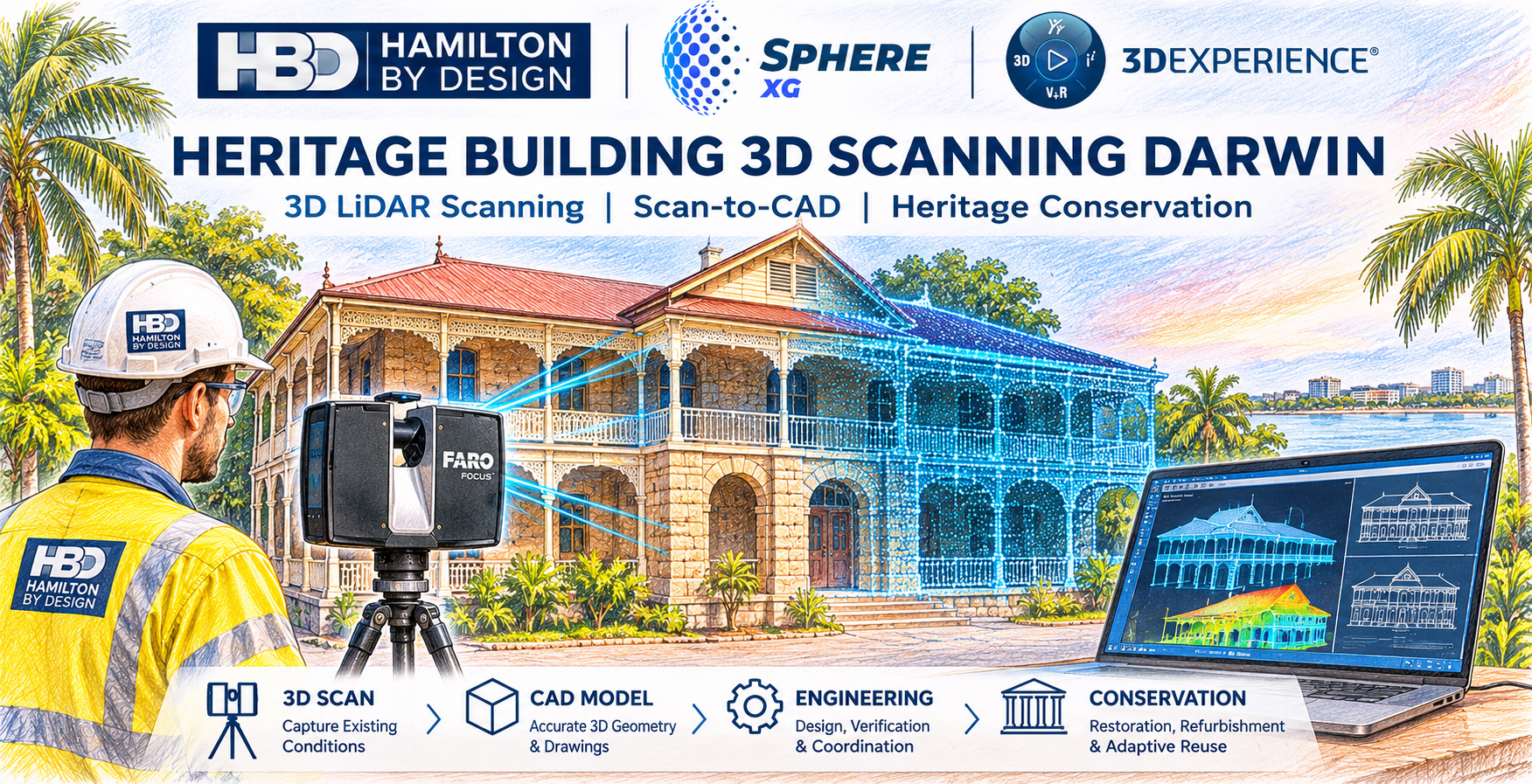
Heritage Building 3D Scanning Darwin illustration showing FARO LiDAR scanning, heritage architecture, point cloud modelling and engineering documentation.

Engineering-Grade 3D Laser Scanning for Heritage Buildings, Restoration and Adaptive Reuse in Darwin, NT
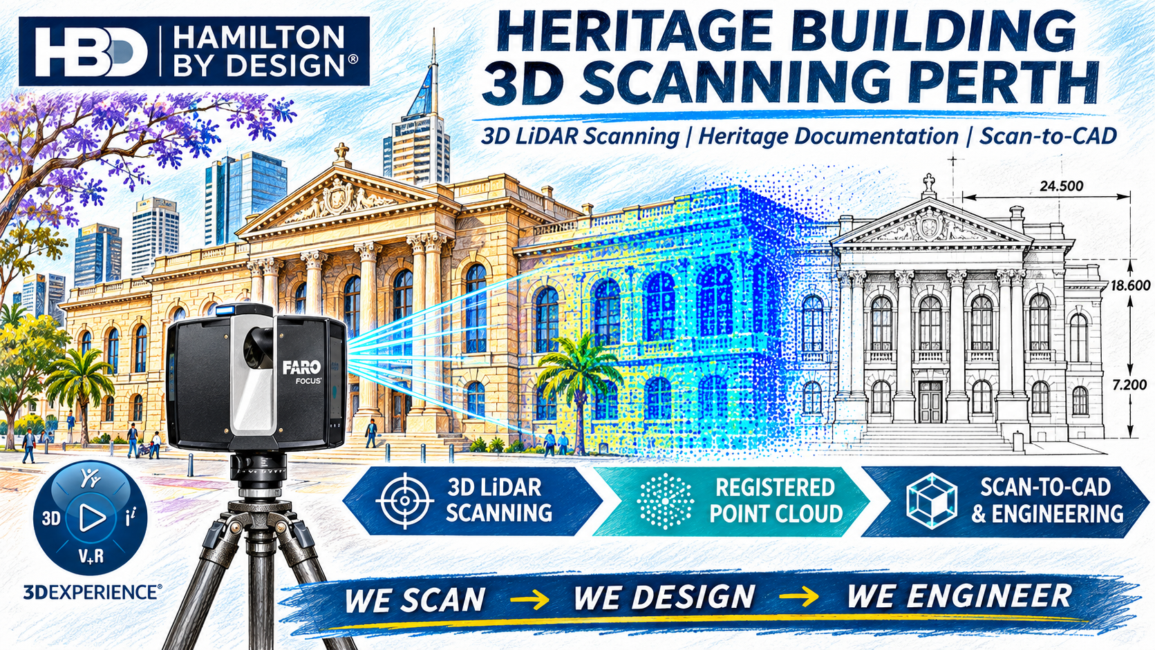
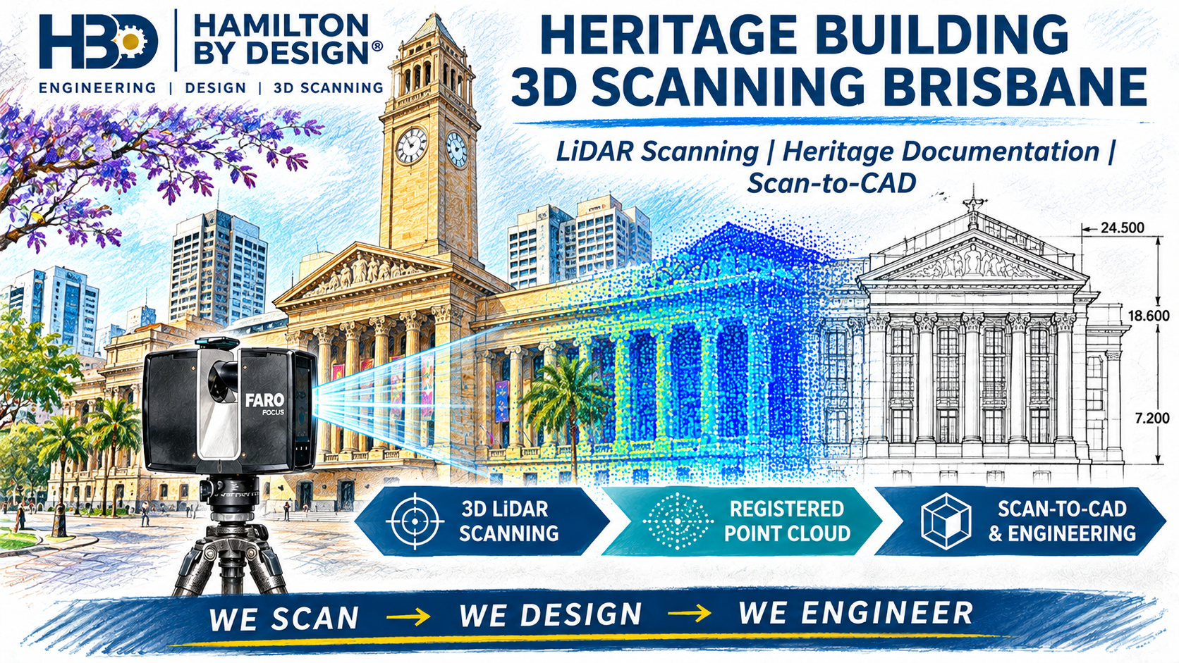
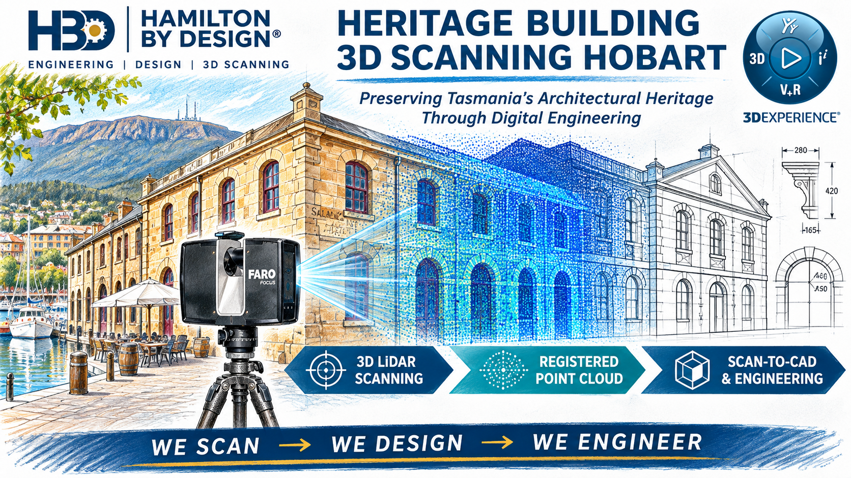
Heritage building 3D LiDAR scanning Australia – blue line illustration of a historic building being measured by a tripod-mounted laser scanner.

Darwin’s built heritage reflects the city’s distinctive architectural, cultural and environmental history. From historic government buildings and early commercial premises to structures associated with the Second World War and post-war reconstruction, preserving these assets requires an accurate understanding of their existing geometry, construction and structural condition.

At Hamilton By Design, we provide engineering-grade heritage building 3D scanning in Darwin, using terrestrial LiDAR technology to capture detailed spatial information for conservation architects, structural engineers, heritage consultants, building owners and restoration contractors.

Our approach combines 3D laser scanning, point cloud processing, mechanical engineering and CAD modelling to support the documentation, assessment and adaptive reuse of existing buildings.

Rather than relying exclusively on traditional measurements or incomplete historical drawings, our scanning process establishes a measurable digital record of the building’s current condition.

1. Why 3D LiDAR Scanning Matters for Darwin’s Heritage Buildings

Heritage buildings frequently contain architectural features, construction details and geometric irregularities that are difficult to document using conventional surveying techniques.

In Darwin, these challenges can be compounded by tropical weather conditions, long-term material deterioration, previous alterations and historical cyclone damage.

3D LiDAR scanning provides a non-contact method of recording visible building surfaces while reducing the need for extensive physical measurement.

Our scanning services can assist with documenting:

  • Existing walls, columns, beams and structural framing.
  • Historic façades, architectural features and decorative elements.
  • Roof structures, gutters, downpipes and drainage arrangements.
  • Floor levels, staircases, openings and internal circulation spaces.
  • Building geometry affected by settlement, movement or previous modifications.
  • Existing mechanical services, pipework and building equipment.
  • Connections between historic structures and later building extensions.

The resulting point cloud provides a spatial reference that can be revisited throughout the design, engineering and conservation process.

2. Heritage Building Documentation in Darwin and the Northern Territory

Darwin contains a range of historically significant structures associated with its development as a port, defence centre and tropical capital.

Examples of heritage environments where 3D scanning may support conservation planning include:

Government and Civic Buildings

Historic administrative buildings, courthouses and public facilities may require detailed geometric documentation before restoration, refurbishment or changes in use.

Military and Defence Heritage

Darwin’s wartime history includes military infrastructure, fortifications, storage facilities and other structures where non-contact digital documentation may support conservation and asset management.

Historic Commercial Buildings

Older commercial premises can contain undocumented structural modifications, irregular wall alignments and complex roof arrangements.

Industrial and Maritime Heritage

Historic workshops, warehouses, port-related structures and industrial equipment may benefit from a combined engineering and 3D scanning approach.

Adaptive Reuse Projects

Where heritage buildings are being converted for contemporary use, accurate existing-condition information assists architects and engineers in coordinating proposed alterations with retained structures.

Hamilton By Design can assist project teams in developing measured digital records to support these activities.

3. Our Heritage 3D Scanning Methodology

Our workflow follows an engineering-oriented approach to data collection, verification and documentation.

Stage 1 — Project Scope and Planning

Before scanning, we review the available building information, drawings and project requirements.

We identify the areas requiring documentation, the required level of detail, access limitations and the intended use of the scanning data.

For heritage buildings, particular consideration is given to sensitive architectural features and areas where physical contact should be minimised.

Stage 2 — On-Site 3D LiDAR Scanning

Using our FARO Focus S70 terrestrial laser scanner, we capture spatial measurements from multiple scanning positions.

The scanner records visible surfaces to develop a three-dimensional representation of the building.

Scanning positions are planned to improve coverage of façades, structural elements, internal spaces and accessible roof structures.

The scanning process is non-contact, although access arrangements may still be required for restricted or elevated areas.

Stage 3 — Point Cloud Registration and Processing

Individual scans are registered into a coordinated point cloud using specialist processing software.

Registration quality is reviewed to identify potential alignment errors and areas of incomplete coverage.

Where required, additional control information can be incorporated to support the project’s dimensional requirements.

Stage 4 — CAD Modelling and Engineering Documentation

The registered point cloud can be used to develop project-specific CAD information, including:

  • Existing-condition plans and elevations.
  • Building sections and structural geometry.
  • 3D CAD models of selected building elements.
  • Roof geometry and drainage layouts.
  • Fabrication and modification drawings.
  • Simplified building geometry for architectural coordination.
  • Engineering drawings for proposed alterations.

This enables the captured geometry to support subsequent design, engineering assessment and restoration planning.

4. Heritage Building Scan-to-CAD Services

One of the principal advantages of our service is the ability to progress from scanning to engineering documentation.

We Scan → We Model → We Engineer

Hamilton By Design uses software including SolidWorks, AutoCAD, Autodesk ReCap and FARO SCENE to transform measured site information into practical engineering and design deliverables.

For heritage refurbishment projects, this can reduce reliance on assumptions about existing building dimensions.

For example, when designing new structural supports, access platforms, mechanical services or building modifications, engineers can reference the recorded geometry to assess available clearances and interfaces.

This is particularly useful where original construction drawings are missing, incomplete or inconsistent with the building’s current configuration.

5. Supporting Heritage Conservation and Adaptive Reuse

Accurate geometric information can assist heritage professionals in planning alterations while retaining significant building fabric.

Our 3D scanning services can support:

Conservation Documentation

Recording existing architectural geometry before restoration, repair or other intervention.

Structural Engineering Assessments

Providing dimensional information for engineers assessing existing structural arrangements, deformation or proposed modifications.

Building Refurbishment

Supporting coordination between retained heritage elements and proposed building services or architectural improvements.

Adaptive Reuse

Documenting existing conditions to assist with planning new building functions and modifications.

Long-Term Digital Records

Creating a reusable spatial record for future building maintenance, refurbishment and asset management.

A point cloud records visible geometry at the time of scanning. It does not, by itself, establish structural adequacy, concealed construction details or material condition. These matters may require additional inspection, testing or engineering assessment.

6. 3D Scanning Deliverables for Heritage Projects

Depending on the agreed project scope, Hamilton By Design can provide:

DeliverableTypical application
Registered E57 point cloudInteroperable 3D survey data
Autodesk ReCap RCP/RCSArchitectural and engineering coordination
LAS point cloudSpatial data exchange
2D CAD drawingsPlans, elevations and building sections
3D CAD geometryExisting-condition modelling and design
STEP or Parasolid filesMechanical engineering and fabrication coordination
General arrangement drawingsEngineering documentation
Roof geometry and falls informationRefurbishment and drainage assessment

The required level of detail, dimensional accuracy and file formats are established during project scoping.

Where heritage conservation requires detailed recording of decorative features, additional close-range scanning or supplementary photographic documentation may be appropriate.

7. Engineering-Grade Scanning and Quality Assurance

Hamilton By Design approaches heritage building documentation from a mechanical engineering and dimensional verification perspective.

Our FARO Focus S70 scanner provides high-density spatial measurements suitable for a broad range of building and industrial applications.

However, the achievable accuracy of a completed heritage building survey depends on factors including scanning distance, surface characteristics, registration quality, survey control and site accessibility.

For larger buildings, the final registered point cloud accuracy must be assessed against the agreed project requirements rather than relying solely on the scanner’s individual measurement specifications.

Our quality assurance process considers scan coverage, registration consistency and the suitability of the resulting information for the intended engineering or architectural application.

8. Heritage Scanning in Darwin’s Tropical Environment

Darwin’s climate creates practical considerations for external laser scanning.

High temperatures, tropical rainfall, reflective surfaces and restricted site access can influence scanning arrangements.

At Hamilton By Design, we do not undertake external laser scanning in the rain.

External scanning activities are planned around suitable weather conditions, while internal scanning may continue where access and site conditions permit.

For occupied heritage buildings, scanning may also be scheduled outside normal operating hours to reduce interference from building users and improve data capture.

Where elevated access is required, suitable access equipment and safety arrangements are considered during project planning.

9. Heritage Building 3D Scanning Across Darwin and the Northern Territory

Hamilton By Design provides project-based 3D LiDAR scanning and engineering documentation services for clients across Darwin and surrounding industrial and commercial areas.

Our service coverage includes Darwin CBD, Winnellie, Berrimah, East Arm, Stuart Park, Parap, Fannie Bay, Palmerston and other Northern Territory locations.

We work with architects, consulting engineers, heritage specialists, building contractors, asset owners and facilities managers requiring reliable existing-condition information.

Projects can range from individual architectural features and building façades through to complete building documentation and complex engineering interfaces.

10. Why Choose Hamilton By Design?

Hamilton By Design combines 3D measurement technology with practical mechanical engineering and CAD capabilities.

Our services are particularly suited to projects where scanning information must be translated into engineering decisions, coordinated models or fabrication documentation.

Our capabilities include:

  • Engineering-grade terrestrial 3D LiDAR scanning.
  • Registered point cloud processing and verification.
  • Scan-to-CAD and reverse engineering.
  • Mechanical and structural interface modelling.
  • Existing-condition drawings and engineering documentation.
  • CAD data suitable for architectural and engineering coordination.
  • Project-specific quality assurance and dimensional review.

By combining data capture and engineering documentation within a coordinated workflow, we help project teams establish a reliable geometric basis for restoration and refurbishment activities.

11. Request a Heritage Building 3D Scanning Quotation in Darwin

Are you planning the restoration, refurbishment or adaptive reuse of a heritage building in Darwin or the Northern Territory?

Hamilton By Design can assist with developing a suitable scanning scope, identifying required deliverables and establishing an engineering-oriented approach to existing-condition documentation.

Whether the project involves a historic façade, government building, industrial heritage structure or complete building refurbishment, accurate spatial information provides a valuable starting point.

Contact Hamilton By Design to discuss your heritage building 3D scanning requirements.

Hamilton By Design logo displayed on a blue tilted rectangle with a grey gradient background

Contact Us – Talk To Us

Name
Would you like us to arrange a phone consultation for you?
Address

Our clients:


Hamilton By Design — 3D LiDAR Scanning | Scan-to-CAD | Mechanical Engineering | Engineering Documentation

We Scan → We Model → We Engineer
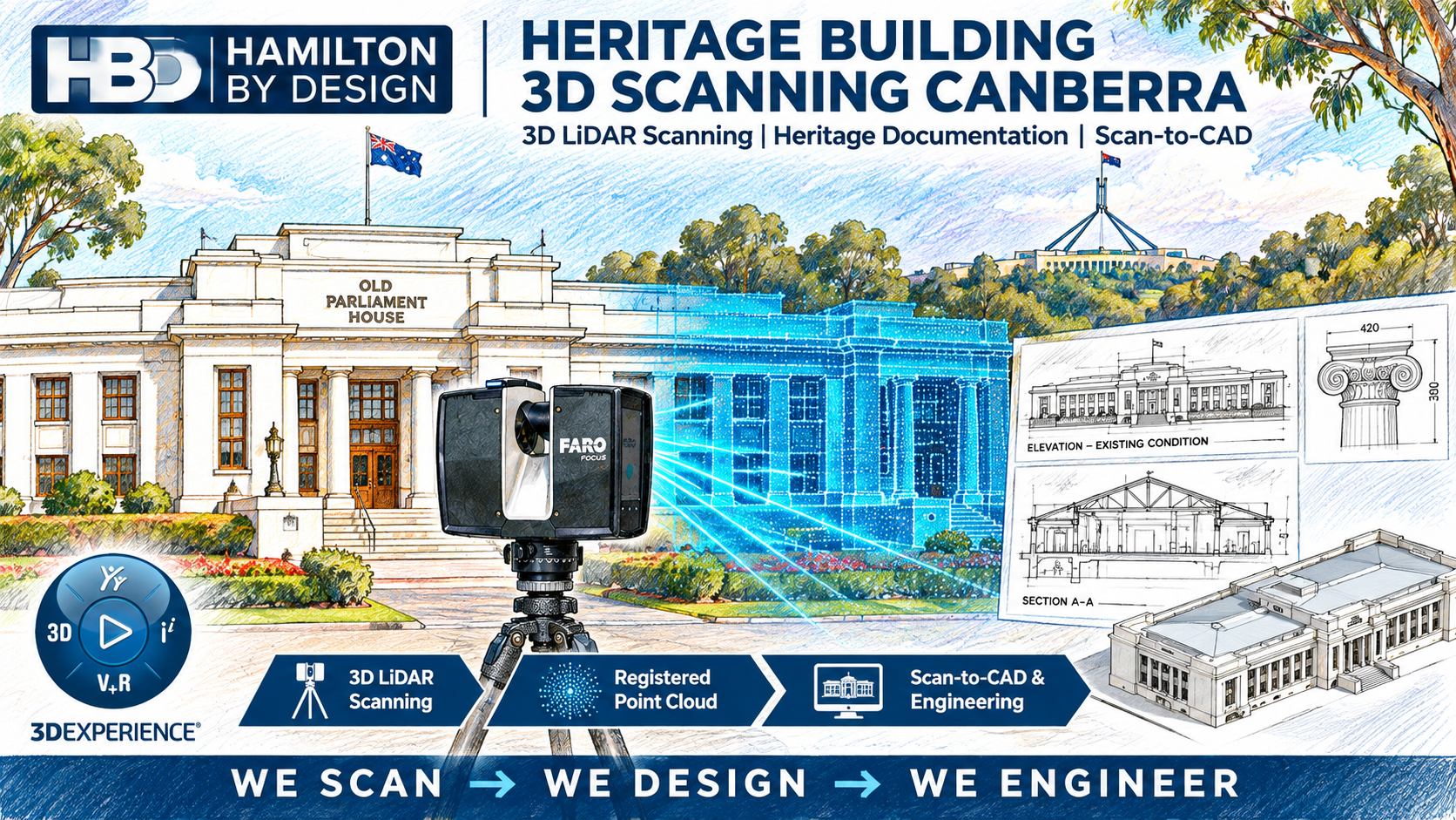
Heritage Building 3D Scanning Canberra | 3D LiDAR Surveys, Heritage Documentation & Scan-to-CAD

Heritage Building 3D Scanning Canberra illustration showing Old Parliament House, a FARO Focus LiDAR scanner, registered point cloud and engineering CAD drawings.

Engineering-Grade 3D LiDAR Scanning for Heritage Buildings in Canberra and the ACT

Canberra’s architectural heritage reflects Australia’s national history, from early twentieth-century civic buildings and institutional architecture to historic residences, memorials, industrial structures and significant public buildings.

Heritage building 3D LiDAR scanning Australia – blue line illustration of a historic building being measured by a tripod-mounted laser scanner.

Preserving these assets requires a detailed understanding of their existing geometry, construction characteristics and architectural features.

Hamilton By Design provides professional heritage building 3D scanning in Canberra, combining terrestrial LiDAR scanning, registered point cloud processing, Scan-to-CAD modelling and mechanical engineering expertise to support heritage conservation, restoration, refurbishment and adaptive reuse projects throughout the Australian Capital Territory.

Our engineering-led approach provides architects, heritage consultants, structural engineers, building owners and contractors with reliable dimensional information for design development, documentation and construction planning.

WE SCAN → WE DESIGN → WE ENGINEER


Why Heritage Building 3D Scanning Is Important in Canberra

Canberra contains a distinctive collection of nationally significant architecture, including early Federal Capital buildings, government institutions, commemorative structures and historic residential precincts.

Many of these buildings incorporate complex architectural geometry, traditional construction methods and materials that are difficult to document accurately using conventional measurement techniques.

Traditional tape measurements and isolated surveying observations may not capture the full geometry of irregular façades, curved architectural elements, roof structures, masonry features or existing building deviations.

3D LiDAR scanning provides a comprehensive digital record of visible building surfaces, allowing project teams to examine and measure existing conditions without relying solely on individual manual measurements.

For heritage conservation and adaptive reuse projects, this information can assist with:

  • Establishing accurate existing-condition documentation before design commences.
  • Recording architectural features that may be affected by refurbishment or restoration.
  • Identifying dimensional variations between existing structures and historical drawings.
  • Supporting coordination between architectural, structural and building services disciplines.
  • Reducing uncertainty when designing new components to interface with existing construction.
  • Providing a reusable digital reference for future conservation and maintenance activities.

For sensitive heritage structures, terrestrial LiDAR scanning also offers the advantage of non-contact dimensional capture.

Heritage Architecture and Historic Buildings in Canberra

<text preserveWhitespace>{“”}</text>

Early Canberra Civic and Institutional Buildings

Canberra’s planned development during the twentieth century produced a collection of public buildings with significant architectural, historical and cultural value.

Buildings such as Old Parliament House, historic administrative buildings and early institutional structures demonstrate the importance of maintaining accurate records of existing architectural geometry.

These buildings may incorporate decorative façades, columns, colonnades, stairways, roof structures and architectural features requiring careful documentation.

Hamilton By Design’s terrestrial scanning methodology can support the dimensional recording of comparable heritage structures for conservation planning and refurbishment design.

References to prominent Canberra landmarks are architectural examples and do not imply that Hamilton By Design has undertaken scanning projects at those properties.

Heritage Residential Buildings and Historic Precincts

Canberra’s older residential areas include buildings associated with the early development of the national capital.

Suburbs such as Ainslie, Braddon, Reid, Forrest and Griffith contain examples of early residential architecture and established building forms.

Heritage refurbishment projects may require documentation of:

  • Existing external walls and façades.
  • Roof geometry, roof pitches and drainage arrangements.
  • Verandahs, columns, entrances and architectural detailing.
  • Floor levels, wall alignment and structural interfaces.
  • Existing building geometry before extensions or modifications.

3D scanning provides a coordinated dimensional reference to assist architects and engineers during design development.

Memorials, Monuments and Architecturally Significant Structures

Canberra’s national significance is reflected in its memorials, monuments and public architectural spaces.

These structures may incorporate curved surfaces, sculptural elements, stonework, complex intersections and non-standard geometry.

Where access and site permissions permit, 3D LiDAR scanning can capture visible geometric features for digital documentation and engineering assessment.

For complex decorative components or smaller features requiring additional measurement detail, supplementary close-range scanning may be appropriate.


Heritage Façade Scanning and Architectural Documentation

Heritage façades often contain irregular geometry that cannot be adequately represented by simplified rectangular measurements.

Canberra’s historic buildings may incorporate rendered masonry, brickwork, sandstone detailing, architectural columns, decorative cornices, arches and other traditional construction features.

Hamilton By Design uses terrestrial LiDAR scanning to capture the visible geometry of these building elements and establish a coordinated point cloud dataset.

Applications of Heritage Façade Scanning

Existing-Condition Elevations

Point cloud data can support the preparation of measured façade elevations showing openings, architectural features, building interfaces and dimensional relationships.

Stonework and Masonry Documentation

Scanning can record the visible geometry of masonry elements, decorative detailing and irregular surfaces for restoration planning.

Building Alterations and Extensions

Measured existing conditions assist designers when integrating new construction with heritage fabric.

Roof and Parapet Documentation

Where sufficient line of sight is available, scanning can capture roof edges, parapets, gutters, roof interfaces and accessible structural geometry.

Façade Refurbishment and Replacement Components

Engineering-led CAD modelling can assist with replacement components, brackets, support systems and other fabricated elements requiring dimensional coordination with existing structures.

The level of detail achievable depends on scanner positioning, surface visibility, scanning distance and the complexity of the building.


3D LiDAR Scanning Technology for Heritage Buildings

Hamilton By Design operates a FARO Focus S70 terrestrial laser scanner for engineering and architectural measurement applications.

The scanner captures large quantities of spatial measurements to create a three-dimensional representation of visible surfaces.

Individual scan positions are registered into a common coordinate system to produce a coordinated point cloud.

Benefits of Terrestrial LiDAR Scanning

Non-Contact Measurement

Scanning records visible building geometry without requiring direct physical contact with delicate architectural surfaces.

High-Density Spatial Information

A registered point cloud provides a substantial dataset that can be examined for dimensional relationships and existing building geometry.

Reduced Measurement Uncertainty

Engineering teams can refer to the same coordinated dataset rather than relying on separate manual measurement records.

Access to Complex Geometry

LiDAR scanning can document many architectural features that are difficult to measure using conventional techniques, subject to line-of-sight and safe access.

Digital Records for Future Use

Registered point clouds can provide a reusable reference for future refurbishment, conservation and engineering work.

The accuracy of the final dataset depends on scanner performance, scan registration, survey control where applicable, site conditions and the required deliverables.


Registered Point Cloud Deliverables for Heritage Projects

Following site scanning, Hamilton By Design processes and registers the individual scan positions into a coordinated point cloud dataset.

Depending on project requirements, deliverables may include:

DeliverableApplication
.E57Interoperable point cloud exchange for architectural, engineering and BIM workflows
.RCP / .RCSAutodesk ReCap and compatible Autodesk applications
.LASPoint cloud exchange and spatial data workflows where appropriate
3D CAD ModelsEngineering design, fabrication and existing-condition modelling
2D CAD DrawingsMeasured elevations, sections, plans and technical documentation
STEP / ParasolidEngineering model exchange where specified

Deliverables are established during project scoping to suit the intended design, conservation or engineering application.

A registered point cloud is not automatically a completed architectural or engineering model. Additional modelling and drawing development are separate services that can be included in the project scope.


Heritage Scan-to-CAD Services Canberra

Converting Existing Building Geometry into Engineering Documentation

One of the principal advantages of working with Hamilton By Design is the ability to progress beyond the collection of scan data.

Our engineering capabilities allow measured point cloud information to be developed into CAD geometry, technical drawings and engineering models.

This integrated process can reduce the need for separate handovers between scanning contractors and engineering designers.

Scan-to-CAD Applications

Measured Building Elevations

Preparation of existing-condition elevations showing façade geometry, openings and architectural features.

Building Sections

Development of sections through existing structures to support refurbishment and design coordination.

3D Building Geometry

Creation of simplified or detailed CAD geometry according to the intended application.

Structural and Mechanical Interfaces

Modelling of existing structural and mechanical components to assist with new design work.

Replacement Components

Reverse engineering of selected building elements and fabricated components where dimensional accuracy and geometry are important.

Construction and Fabrication Drawings

Preparation of technical drawings for new engineering components based on measured site conditions.

The level of modelling detail is agreed before work commences to avoid unnecessary modelling of features that do not contribute to the intended design outcome.


Scan-to-BIM and Heritage Building Information Modelling

Heritage Building Information Modelling, commonly referred to as HBIM, can support the digital documentation and management of historic structures.

Registered point cloud data provides a geometric reference for developing building information models.

Depending on the requirements of the project, these models may include:

  • Existing walls, floors and roof geometry.
  • Structural columns, beams and principal building elements.
  • Building openings and architectural features.
  • Selected mechanical and building services infrastructure.
  • Simplified representations of irregular heritage geometry.
  • Coordinated spatial information for refurbishment planning.

Hamilton By Design can provide point cloud datasets and agreed CAD geometry for use in BIM workflows.

Where a complete architectural Revit model or specialist heritage information model is required, the scope, modelling responsibilities and level of development should be established with the project team.


Heritage Restoration and Adaptive Reuse Projects

Adaptive reuse involves modifying an existing building for a new purpose while retaining elements of its architectural or historical significance.

These projects frequently require the integration of modern building systems and construction methods with existing heritage structures.

Applications in Canberra

Commercial Refurbishment

Documenting existing geometry before converting older buildings into contemporary commercial spaces.

Public Building Upgrades

Supporting the planning of alterations to existing institutional and civic buildings.

Building Services Integration

Capturing existing spaces to assist with the design of mechanical equipment, pipework, ductwork and associated support structures.

Access and Safety Improvements

Providing dimensional information for the design of access platforms, handrails, stair modifications and other engineered components.

Roof and Building Envelope Modifications

Recording existing roof geometry, parapets and building interfaces to support refurbishment design.

Heritage Building Extensions

Establishing reliable geometry where new construction must interface with existing walls, foundations or structural elements.

Engineering-led scanning provides a measured starting point for developing practical design solutions.


Industrial Heritage 3D Scanning Canberra and the ACT

Heritage documentation is not limited to traditional civic buildings and residential architecture.

Historic workshops, pumping stations, utility infrastructure, mechanical installations and industrial buildings may also require detailed existing-condition surveys.

Hamilton By Design’s mechanical engineering background is particularly relevant to projects involving historic machinery and industrial assets.

Industrial Heritage Applications

  • Historic machinery and equipment documentation.
  • Pumping stations and utility infrastructure.
  • Mechanical component reverse engineering.
  • Existing pipework and plant layouts.
  • Structural steelwork and equipment supports.
  • Historic workshops and maintenance facilities.
  • Engineering documentation for equipment refurbishment.

Where appropriate, terrestrial LiDAR scanning can be combined with supplementary close-range scanning to document selected mechanical components in greater detail.

This approach is particularly valuable when original engineering drawings are unavailable or no longer reflect the installed condition.


Heritage Building Monitoring and Construction Risk

Construction work near heritage buildings may create concerns relating to vibration, movement, settlement and potential damage to sensitive structures.

Pre-construction documentation can help establish a record of visible building geometry before nearby works commence.

Baseline 3D LiDAR Surveys

An initial scanning survey can document visible existing conditions and provide a spatial reference for subsequent measurements.

Repeat Scanning and Geometric Comparison

Where appropriate survey control and consistent methodology are established, repeat scanning may assist with assessing changes in selected building geometry over time.

Construction Vibration Monitoring

Vibration monitoring can provide complementary information during construction activities near sensitive buildings.

It is important to distinguish these functions.

LiDAR scanning measures visible surface geometry; it does not independently determine structural integrity, material condition or the cause of building movement.

Structural assessments, monitoring tolerances and engineering conclusions require appropriately scoped investigation and professional engineering judgement.


Heritage Building Scanning Methodology

Hamilton By Design follows a structured process for heritage and existing-building scanning projects.

Stage 1 — Project Scope and Documentation Review

We review the intended project outcomes, available drawings, access arrangements and required deliverables.

This establishes whether the project requires point cloud data only or additional CAD modelling and engineering documentation.

Stage 2 — Site Access and Scanning Planning

Scanning positions are planned to maximise useful coverage while considering safe access, restricted areas, public activity and sensitive heritage surfaces.

For elevated areas, appropriate access equipment may be required.

Stage 3 — Terrestrial LiDAR Data Collection

The FARO Focus scanner is positioned at multiple locations to capture visible building geometry.

Additional scan positions may be necessary around architectural features, internal spaces and areas affected by line-of-sight restrictions.

Stage 4 — Point Cloud Registration

Individual scans are aligned and registered to establish a coordinated point cloud.

Registration quality is reviewed before deliverables are prepared.

Stage 5 — Quality Review and Data Processing

The dataset is examined for registration quality, coverage and suitability for the agreed project scope.

Areas that are not visible to the scanner cannot be assumed to have been measured.

Stage 6 — Scan-to-CAD and Engineering Modelling

Where included in the scope, point cloud information is converted into selected CAD geometry, measured drawings or engineering models.

Stage 7 — Deliverable Preparation

Agreed point cloud files, CAD models and drawings are issued for use by the project team.

This structured workflow supports consistent data handling and provides an opportunity to identify limitations before detailed design proceeds.


Why Choose Hamilton By Design for Heritage Building 3D Scanning Canberra?

Engineering-Led Scanning Services

Hamilton By Design combines 3D measurement technology with mechanical engineering, CAD modelling and design experience.

Rather than treating scanning as an isolated survey activity, we consider how the captured information will be used in subsequent design and engineering workflows.

From Scanning to Engineering Documentation

Our integrated services can include:

  • Terrestrial 3D LiDAR scanning.
  • Registered point cloud processing.
  • Existing-condition CAD documentation.
  • Engineering modelling and reverse engineering.
  • Mechanical and structural interface modelling.
  • Fabrication and technical drawings.
  • Engineering design support.

Practical Deliverables

We establish the required file formats and level of detail with the client before scanning.

This helps ensure the resulting information is appropriate for architectural, heritage, engineering or fabrication applications.

Australia-Wide Project Capability

Hamilton By Design provides scanning and engineering services across Australia, including Canberra and the Australian Capital Territory.

Projects can be scoped to suit individual heritage buildings, industrial facilities or larger existing-condition documentation requirements.

WE SCAN → WE DESIGN → WE ENGINEER


Heritage Building 3D Scanning Service Areas — Canberra and ACT

Hamilton By Design can support heritage and existing-building scanning projects throughout Canberra and the ACT, including:

Central Canberra: Canberra City, Acton, Reid, Braddon, Ainslie and Campbell.

Inner South: Barton, Forrest, Griffith, Kingston, Deakin and Yarralumla.

North Canberra: Dickson, Lyneham, O’Connor and surrounding established suburbs.

Southern Canberra: Woden Valley, Weston Creek and Tuggeranong.

Northern Canberra: Belconnen and Gungahlin.

Surrounding NSW: Queanbeyan and regional locations surrounding the ACT, subject to project requirements.

Project access, site restrictions and scanning methodology are considered individually.


Frequently Asked Questions — Heritage Building 3D Scanning Canberra

Can 3D LiDAR scanning be used on heritage-listed buildings?

Yes. Terrestrial LiDAR scanning is a non-contact dimensional measurement method suitable for documenting many heritage building surfaces.

Scanning remains subject to site permissions, safe access and any applicable heritage management requirements.

Can you scan historic sandstone and brick façades?

Yes. Visible sandstone, brickwork, rendered masonry and other architectural surfaces can generally be captured using terrestrial LiDAR scanning.

Coverage and achievable detail depend on scanning distance, surface characteristics and line of sight.

Can point cloud data be used in AutoCAD and Revit?

Yes. Registered point clouds can be delivered in formats such as .E57 and .RCP/.RCS for compatible CAD and BIM workflows.

The importing and modelling process depends on the software and project requirements.

Can you prepare CAD drawings from the scan data?

Yes. Hamilton By Design can develop agreed existing-condition CAD drawings and engineering models from registered point cloud data.

CAD modelling is scoped separately from the initial scanning and point cloud processing where required.

Can 3D scanning identify structural defects?

LiDAR scanning records visible geometry and may assist in documenting measurable deformation or displacement.

It does not independently determine structural capacity, material deterioration or the cause of a defect.

Structural condition assessments require appropriate engineering investigation.

Can you scan both the interior and exterior of a heritage building?

Yes, subject to access, safety, visibility and the agreed scope of work.

Internal and external scans can be registered into a coordinated dataset where the methodology provides suitable overlap or survey control.

How long does a heritage building scan take?

Scanning duration depends on the building’s size, architectural complexity, access restrictions, occupancy and required detail.

Data processing and any subsequent CAD modelling are additional activities.

Do you provide services outside Canberra?

Yes. Hamilton By Design undertakes engineering and 3D scanning projects throughout Australia, subject to project scope and availability.


Request a Heritage Building 3D Scanning Quotation in Canberra

Are you planning a heritage restoration, building refurbishment, adaptive reuse or existing-condition documentation project in Canberra or the ACT?

Hamilton By Design can assist with engineering-grade 3D LiDAR scanning, registered point cloud deliverables, Scan-to-CAD modelling and engineering documentation.

To help establish an appropriate scope, provide available building drawings, the approximate building size, the areas requiring scanning and the intended use of the resulting data.

Contact Hamilton By Design to discuss your heritage building scanning requirements.


Hamilton By Design logo displayed on a blue tilted rectangle with a grey gradient background

Contact Us – Talk To Us

Name
Would you like us to arrange a phone consultation for you?
Address

Our clients:


Heritage Building 3D Scanning Canberra | 3D LiDAR Scanning | Point Cloud Documentation | Scan-to-CAD | Engineering Design

WE SCAN → WE DESIGN → WE ENGINEER

Heritage Building 3D Scanning Adelaide | LiDAR Survey, Heritage Documentation & Scan-to-CAD

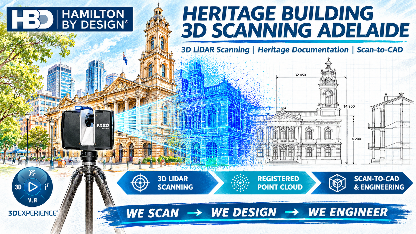
Heritage Building 3D Scanning Adelaide illustration showing a FARO Focus LiDAR scanner, historic sandstone architecture, blue point cloud and engineering CAD drawings.

Engineering-Grade 3D Laser Scanning for Heritage Restoration, Conservation and Adaptive Reuse in Adelaide, South Australia

Adelaide and regional South Australia contain an extensive collection of historically significant buildings, including sandstone and bluestone civic structures, heritage churches, institutional buildings, industrial facilities and nineteenth-century commercial architecture.

Heritage building 3D LiDAR scanning Australia – blue line illustration of a historic building being measured by a tripod-mounted laser scanner.

Preserving these structures requires an accurate understanding of their existing geometry, architectural features and structural arrangements.

Hamilton By Design provides professional heritage building 3D scanning in Adelaide, combining terrestrial LiDAR scanning, registered point cloud processing, Scan-to-CAD modelling and mechanical engineering expertise to support heritage conservation, restoration, refurbishment and adaptive reuse projects.

Our approach provides architects, engineers, heritage consultants, restoration contractors and asset owners with measurable digital information derived from existing building conditions.

WE SCAN → WE DESIGN → WE ENGINEER


Heritage Building 3D LiDAR Scanning in Adelaide

Heritage buildings frequently contain architectural details and construction irregularities that are difficult to document using conventional measurement techniques.

Older structures may include:

  • Irregular walls and non-standard building geometry.
  • Weathered sandstone, bluestone and historic brick masonry.
  • Decorative cornices, arches, columns and architectural mouldings.
  • Uneven floors and displaced structural elements.
  • Undocumented alterations, extensions and previous repairs.
  • Complex roof structures and timber framing.
  • Historic machinery, structural steelwork and mechanical installations.

Terrestrial 3D LiDAR scanning captures millions of spatial measurements to establish a detailed three-dimensional record of visible building surfaces.

Using our FARO Focus terrestrial laser scanner, Hamilton By Design can document complex existing conditions without requiring extensive physical contact with sensitive heritage fabric.

The resulting registered point cloud provides a measurable digital reference for restoration planning, architectural coordination, dimensional verification and subsequent engineering design.

Why Accurate Heritage Documentation Matters

Historic buildings often undergo modifications over many decades. Original construction drawings may be incomplete, inaccurate or unavailable.

When refurbishment or restoration work relies on assumed dimensions, unexpected site conditions can create design conflicts, fabrication errors, construction delays and unnecessary disturbance to heritage materials.

Engineering-grade 3D scanning helps reduce these uncertainties by providing measured geometric information.

Establishing Existing Building Geometry

LiDAR scanning records the spatial relationships between walls, floors, columns, façades, roof structures and visible architectural details.

This allows project teams to develop designs around the building as it exists rather than relying entirely on historical documentation.

Supporting Heritage Conservation

Detailed dimensional records assist conservation specialists, architects and engineers when planning masonry restoration, replacement building components and structural modifications.

Reducing Construction Risk

Accurate existing-condition information supports the planning of services upgrades, structural alterations, access improvements and adaptive reuse.

Creating a Digital Heritage Record

A registered point cloud can form part of a building’s digital archive, providing a geometric record of its condition at the time of scanning.


Heritage Façade Scanning — Adelaide Sandstone, Bluestone and Historic Masonry

Adelaide’s architectural character is strongly associated with traditional stone construction, including sandstone, bluestone and historic brickwork.

Many buildings contain ornate façades, decorative stonework, classical columns and complex masonry detailing.

Hamilton By Design can undertake detailed heritage façade scanning to document:

  • Sandstone and bluestone block arrangements.
  • Historic brickwork and masonry geometry.
  • Decorative cornices, columns, arches and mouldings.
  • Window and door openings.
  • Parapets, balconies and balustrades.
  • Building elevations and façade alignment.
  • Visible surface irregularities and deformation.
  • Structural interfaces and connections.

Registered LiDAR data can be used to develop existing-condition elevations, sections and CAD models for architectural and engineering applications.

Where higher-detail component documentation is required, supplementary close-range scanning and dimensional verification can be considered.

Heritage scanning records geometry; it does not independently determine material condition or structural integrity. Specialist inspections and engineering assessment may be required where deterioration or movement is suspected.

Heritage Building Scanning for Adelaide Civic and Institutional Buildings

Adelaide contains numerous historically significant civic and institutional buildings, including the Adelaide Town Hall, historic government buildings, courthouses, museums, educational institutions and churches.

These buildings may contain high ceilings, complex internal layouts, ornamental masonry, timber roof structures and architectural elements modified over time.

3D LiDAR scanning can support projects involving:

  • Existing-condition building surveys.
  • Heritage restoration and conservation.
  • Roof and drainage refurbishment.
  • Accessibility improvements.
  • Structural strengthening and alterations.
  • Mechanical and electrical services upgrades.
  • Fire safety and building compliance improvements.
  • Digital heritage documentation.

For large or operational buildings, scanning can be staged around site access, public occupancy, security arrangements and the availability of individual rooms or areas.

Hamilton By Design can develop a project-specific scanning methodology based on the required level of detail, building access and intended deliverables.


Scan-to-CAD Adelaide — Converting Heritage Point Clouds into Engineering Drawings

Capturing existing building geometry is only the first stage of the documentation process.

Registered point cloud data can be converted into practical architectural and engineering information through Scan-to-CAD modelling.

Hamilton By Design provides engineering-led CAD modelling and drafting using established design platforms, including AutoCAD, SolidWorks and Autodesk Inventor.

Depending on the project scope, deliverables may include:

  • Existing-condition floor plans.
  • Architectural elevations and sections.
  • Roof geometry and structural layouts.
  • Steelwork and mechanical interface models.
  • Simplified three-dimensional CAD models.
  • General arrangement drawings.
  • Dimensional drawings for restoration works.
  • Fabrication drawings for replacement components.

Our engineering background allows us to consider how captured geometry will be used in design, fabrication, construction and installation.

This is particularly important where new components must connect accurately to irregular historic structures.

Heritage Scan-to-BIM and Digital Building Models

Historic Building Information Modelling, often referred to as HBIM, involves developing a digital representation of an existing heritage building.

Registered LiDAR point clouds provide a measured geometric foundation for this process.

Depending on the agreed scope, a heritage BIM workflow may support:

  • Architectural conservation planning.
  • Refurbishment and adaptive reuse.
  • Existing-condition building models.
  • Building services coordination.
  • Structural interface documentation.
  • Long-term asset management.
  • Digital heritage records.

Hamilton By Design can supply registered point clouds and agreed CAD geometry for integration into BIM workflows.

The required level of modelling detail, object classification and native BIM deliverables should be established before commencement.


Heritage Restoration and Reverse Engineering

Many historic buildings contain architectural and mechanical components that are no longer commercially available.

Original manufacturing drawings may have been lost, and replacement components may need to be developed around irregular existing geometry.

Hamilton By Design combines 3D scanning, mechanical engineering, reverse engineering and CAD modelling to support the documentation and potential reproduction of heritage components.

Applications may include:

  • Historic brackets and castings.
  • Decorative metal components.
  • Balustrades and handrails.
  • Stair and access components.
  • Structural connections.
  • Historic machinery and equipment.
  • Replacement steelwork.
  • Mechanical assemblies and fabricated components.

Where component accuracy requirements exceed those achievable with terrestrial scanning, close-range metrology scanning can be used for suitable accessible items.

The resulting CAD information can support restoration planning, manufacturing and engineering verification, subject to applicable heritage conservation requirements.

Industrial Heritage 3D Scanning in South Australia

South Australia’s industrial history includes railway workshops, manufacturing facilities, port infrastructure, pumping stations, historic machinery and mining-related structures.

These assets frequently contain complex structural and mechanical arrangements that require specialist documentation.

Hamilton By Design is particularly well suited to projects where heritage documentation intersects with mechanical engineering and industrial design.

Our services can support:

  • Historic railway workshops and maintenance facilities.
  • Industrial buildings and warehouses.
  • Historic pumps, valves and mechanical systems.
  • Structural steelwork and machinery foundations.
  • Port and maritime heritage structures.
  • Historic manufacturing equipment.
  • Industrial refurbishment and adaptive reuse.

Engineering-led scanning helps establish the relationship between machinery, structural components, access systems and surrounding building geometry.


Heritage Building Protection and Construction Monitoring

Construction activity near heritage buildings may introduce risks associated with vibration, excavation, ground movement and structural disturbance.

Before nearby construction begins, an existing-condition survey can establish a measurable geometric record of the building.

Hamilton By Design can support heritage building protection through a staged documentation approach.

Before Construction

Undertake baseline 3D LiDAR scanning, photography and existing-condition documentation.

During Construction

Where required, coordinate vibration monitoring, targeted inspections and repeat geometric measurements.

After Construction

Undertake repeat scanning and compare datasets with the original survey to investigate measurable geometric changes.

Point cloud comparisons require suitable survey controls, registration methods and consideration of measurement uncertainty. They should not be treated as definitive evidence of structural damage without supporting engineering investigation.

Adaptive Reuse of Adelaide Heritage Buildings

Adaptive reuse allows historically significant buildings to accommodate new functions while retaining important heritage features.

Examples include converting former warehouses, commercial buildings and institutional properties into offices, hospitality venues, educational facilities and community spaces.

These projects frequently require the integration of modern building services into structures that were not originally designed to accommodate them.

3D LiDAR scanning can assist with:

  • New mechanical services and ductwork routes.
  • Electrical and hydraulic services coordination.
  • Fire protection system upgrades.
  • Structural alterations and strengthening.
  • Lift and accessibility improvements.
  • New stairs and access arrangements.
  • Building services clearance verification.
  • Refurbishment and construction coordination.

By establishing existing building geometry before detailed design, project teams can identify potential conflicts and develop solutions that minimise unnecessary disturbance to significant heritage fabric.


Heritage Building 3D Scanning Adelaide — Areas We Service

Hamilton By Design provides project-based heritage building scanning and engineering documentation services throughout Adelaide and South Australia.

Adelaide CBD and Inner Suburbs: Adelaide City, North Adelaide, Kent Town, Norwood, Unley, Parkside and surrounding areas.

Historic Urban and Commercial Precincts: Port Adelaide, Semaphore, Thebarton, Hindmarsh, Bowden and Mile End.

Greater Adelaide: Prospect, Walkerville, Glenelg, Brighton, Burnside, Mitcham and surrounding suburbs.

Adelaide Hills and Regional South Australia: Hahndorf, Mount Barker, Strathalbyn, Gawler, Tanunda, Kapunda and other regional heritage locations.

Services are provided subject to project scope, access requirements and scheduling.

Our Heritage Building Scanning Methodology

Hamilton By Design follows a structured scanning and engineering documentation workflow.

Stage 1 — Project Scope and Design Intent

We establish the purpose of the survey, areas requiring capture, accuracy requirements, intended use of the data and agreed deliverables.

Stage 2 — Site Access and Scanning Planning

We assess scanning positions, visibility, access restrictions, elevated areas, occupancy and any requirements for specialist access equipment.

Stage 3 — Terrestrial 3D LiDAR Scanning

Using our FARO Focus scanner, we capture accessible building geometry through overlapping scan positions.

Stage 4 — Point Cloud Registration and Quality Assurance

Individual scans are registered into a coordinated dataset, with alignment and quality checks undertaken before export.

Stage 5 — Point Cloud Delivery

Registered data can be supplied in agreed formats such as .E57, .RCP and .RCS, suitable for use in compatible architectural and engineering software.

Stage 6 — Scan-to-CAD and Engineering Documentation

Where included in the scope, the point cloud is converted into measured drawings, CAD geometry and engineering documentation.

Stage 7 — Review and Delivery

Completed information is reviewed against the agreed project requirements and delivered for use by the client and project consultants.


Why Choose Hamilton By Design for Heritage Building 3D Scanning in Adelaide?

Hamilton By Design combines practical engineering knowledge with advanced reality capture and CAD modelling capabilities.

Unlike a survey-only service, our approach considers how the measured information will be used throughout design, fabrication, construction and future asset management.

Engineering-Led Data Collection

Scanning is planned around the project’s dimensional requirements and intended engineering outcomes.

Integrated Scan-to-CAD Capability

We can progress from measured point cloud data into CAD models, drawings and practical engineering documentation.

Experience with Complex Existing Structures

Our mechanical engineering and industrial background supports documentation of irregular geometry, structural interfaces, historic machinery and complex building arrangements.

Flexible Digital Deliverables

We can provide point clouds and CAD information compatible with common engineering and architectural workflows.

Project-Based Services Throughout South Australia

Hamilton By Design can support heritage projects in metropolitan Adelaide and regional South Australia, subject to scope and availability.

WE SCAN → WE DESIGN → WE ENGINEER


Frequently Asked Questions — Heritage Building 3D Scanning Adelaide

Can you scan heritage buildings without damaging the structure?

Terrestrial LiDAR scanning is a non-contact measurement technique. It documents visible building surfaces without requiring physical contact with the architectural elements being measured.

Can you scan historic sandstone and bluestone façades?

Yes. Accessible sandstone, bluestone and brick façades can be captured using terrestrial LiDAR scanning. The achievable level of detail depends on scanning distance, surface characteristics, line of sight and project requirements.

Can heritage point clouds be converted into AutoCAD drawings?

Yes. Registered point clouds can be used to develop existing-condition plans, elevations, sections and CAD models, subject to the agreed modelling scope.

Can 3D scanning assist with heritage building restoration?

Yes. Accurate geometric documentation can support restoration design, replacement components, construction planning and conservation work.

Can you provide files for Revit or ArchiCAD?

We can supply registered point cloud formats and agreed CAD geometry for use in compatible BIM workflows. Native BIM modelling requirements should be confirmed during project scoping.

Can you scan large heritage civic and government buildings?

Yes, subject to site access, security arrangements, survey scope and the required level of detail. Large buildings may require multiple scanning days and additional processing time.

Does 3D scanning replace heritage engineering certification?

No. LiDAR scanning establishes geometric information. Heritage approvals, structural assessments and engineering certification are separate professional services that must be addressed where required.


Request a Heritage Building 3D Scanning Quotation in Adelaide

Whether your project involves a historic courthouse, sandstone civic building, heritage-listed commercial property, railway workshop or industrial heritage structure, Hamilton By Design can assist with accurate existing-condition documentation.

We provide:

  • Engineering-grade terrestrial 3D LiDAR scanning.
  • Registered point cloud processing.
  • Heritage façade and building geometry documentation.
  • Scan-to-CAD modelling and drafting.
  • Engineering and reverse engineering support.
  • Digital records for restoration and adaptive reuse.

Contact Hamilton By Design to discuss your Adelaide heritage building project.

To assist with quotation preparation, please provide the site location, available drawings or photographs, areas requiring scanning, intended use of the data and preferred delivery timeframe.


Hamilton By Design logo displayed on a blue tilted rectangle with a grey gradient background

Contact Us – Talk To Us

Name
Would you like us to arrange a phone consultation for you?
Address

Our clients:


Related 3D Scanning & Engineering Services

Explore additional Hamilton By Design services supporting heritage conservation, historic building restoration, existing-condition surveys, engineering design and 3D LiDAR scanning throughout Adelaide and South Australia.

Heritage 3D Laser Scanning & Building Protection

Engineering-led heritage scanning, condition documentation and digital recording of historic buildings, sandstone facades, industrial heritage structures and architecturally significant assets.

Explore Heritage Scanning →

3D LiDAR Scanning Adelaide

Engineering-grade LiDAR scanning, registered point clouds and Scan-to-CAD services for existing buildings, industrial facilities, infrastructure and refurbishment projects across South Australia.

Explore Adelaide LiDAR Scanning →

Scan-to-BIM & Digital Building Modelling

Convert registered point cloud data into digital building models for heritage restoration, adaptive reuse, architectural coordination and engineering documentation.

Explore Scan-to-BIM Services →

Construction Vibration Monitoring & 3D LiDAR

Pre-construction baseline surveys, vibration monitoring and repeat LiDAR scanning to support construction activities near sensitive and heritage-listed buildings.

Explore Construction Monitoring →

3D Laser Scanning for Engineering

Engineering-grade terrestrial scanning, point cloud processing and CAD modelling for complex structures, building modifications, dimensional verification and fabrication.

Explore Engineering Scanning →

3D LiDAR Scanning Edinburgh SA

Professional 3D scanning and engineering documentation for manufacturing, defence industry suppliers, mechanical equipment, industrial structures and existing facilities in Adelaide’s northern industrial precincts.

Explore Edinburgh Scanning →

3D LiDAR Scanning Across South Australia

Existing-condition surveys and engineering modelling for industrial buildings, historic facilities, mining infrastructure, gas plants and complex assets throughout South Australia.

Explore South Australian Services →

3D Point Cloud Scanning Australia

Learn how 3D point cloud scanning improves existing-condition documentation, dimensional measurement and engineering design compared with conventional manual surveying methods.

Explore Point Cloud Scanning →

Hamilton By Design — We Scan → We Design → We Engineer


Heritage Building 3D Scanning Perth | LiDAR Survey, Heritage Documentation & Scan-to-CAD

Engineering-Grade 3D Laser Scanning for Heritage Restoration, Conservation and Adaptive Reuse in Perth, Western Australia

Perth and Western Australia contain an extensive collection of historically significant buildings, including limestone and sandstone civic structures, heritage courthouses, railway infrastructure, churches, industrial buildings and early commercial architecture.

Heritage building 3D LiDAR scanning Australia – blue line illustration of a historic building being measured by a tripod-mounted laser scanner.

Preserving these structures requires an accurate understanding of their existing geometry, construction details and structural arrangements.

Hamilton By Design provides professional heritage building 3D scanning in Perth, combining terrestrial LiDAR scanning, registered point cloud processing, Scan-to-CAD modelling and engineering expertise to support heritage conservation, restoration, refurbishment and adaptive reuse.

Our approach provides architects, engineers, heritage consultants, restoration contractors and asset owners with measurable digital information derived directly from existing building conditions.

WE SCAN → WE DESIGN → WE ENGINEER


Heritage Building 3D LiDAR Scanning in Perth

Heritage buildings present measurement challenges that are often difficult to resolve using conventional surveying or historical architectural drawings.

Older structures may contain:

  • Irregular walls and non-standard building geometry.
  • Weathered limestone, sandstone and brick masonry.
  • Decorative cornices, arches and architectural mouldings.
  • Uneven floors, displaced walls and altered structural elements.
  • Undocumented extensions and previous repairs.
  • Complex roof structures and concealed construction interfaces.
  • Historic machinery, structural steelwork and timber framing.

Terrestrial 3D LiDAR scanning captures millions of spatial measurements to establish a detailed three-dimensional record of visible building surfaces.

Using our FARO Focus terrestrial laser scanner, Hamilton By Design can document complex existing conditions without requiring extensive physical contact with sensitive heritage fabric.

The resulting registered point cloud provides a measurable digital reference for restoration planning, design coordination, dimensional verification and future engineering work.

Why Accurate Heritage Documentation Matters

Historic buildings frequently undergo modifications over many decades. Original drawings may be incomplete, inaccurate or unavailable.

When restoration or refurbishment is based on assumed dimensions, unexpected site conditions can lead to design conflicts, fabrication errors, additional construction costs and unnecessary disturbance to heritage materials.

Engineering-grade 3D scanning provides a practical method of reducing these uncertainties.

Establishing Existing Building Geometry

LiDAR scanning can record the spatial relationship between walls, floors, columns, façades, roof structures and architectural details.

This allows project teams to develop new designs around the building as it exists rather than relying entirely on historic documentation.

Supporting Conservation and Restoration

Detailed dimensional information assists conservation specialists and engineers when investigating deteriorated masonry, replacement building components and proposed restoration works.

Reducing Construction Risk

Accurate existing-condition information supports planning for structural alterations, access upgrades, services installation and adaptive reuse.

Creating a Permanent Digital Record

A registered point cloud can also form part of a building’s digital heritage archive, providing a record of its geometry at the time of scanning.


Heritage Façade Scanning — Limestone, Sandstone and Historic Masonry

Perth’s historic architecture includes buildings constructed from limestone, sandstone, brickwork and other traditional materials.

These façades often contain intricate architectural features that require careful measurement before conservation or restoration work begins.

Hamilton By Design can undertake detailed heritage façade scanning to document:

  • Limestone and sandstone block arrangements.
  • Brickwork and masonry geometry.
  • Decorative cornices, columns and arches.
  • Window and door openings.
  • Parapets, balconies and balustrades.
  • Building elevations and façade alignment.
  • Visible surface deformation and irregularities.
  • Structural interfaces and connections.

Registered LiDAR data can be used to produce existing-condition elevations, sections and CAD models for architectural and engineering applications.

Where higher-detail component documentation is required, supplementary close-range scanning and dimensional verification can be considered.

Heritage scanning records geometry; it does not, by itself, determine the structural condition or material integrity of the building. Engineering assessment and specialist heritage inspections may be required where deterioration or structural movement is suspected.

Heritage Building 3D Scanning for Perth Courthouses and Civic Buildings

Historic courthouses, government buildings and civic structures are important components of Western Australia’s architectural heritage.

These buildings may contain complex internal layouts, high ceilings, ornamental masonry, timber structures, staircases and architectural features that have been modified over time.

3D LiDAR scanning can support projects involving:

  • Existing-condition building surveys.
  • Heritage restoration and conservation.
  • Roof and drainage refurbishment.
  • Accessibility improvements.
  • Structural strengthening and modifications.
  • Mechanical and electrical services upgrades.
  • Fire safety and building compliance works.
  • Digital heritage documentation.

For large or operational buildings, scanning can be staged around site access, public occupancy, security requirements and the availability of particular rooms or areas.

Hamilton By Design can develop project-specific scanning methodologies based on the required level of detail, site constraints and intended engineering deliverables.


Scan-to-CAD Perth — Converting Heritage Point Clouds into Engineering Drawings

Capturing a building is only the first stage of the documentation process.

The registered point cloud can be converted into practical architectural and engineering information through Scan-to-CAD modelling.

Hamilton By Design provides engineering-led CAD modelling and drafting using established design platforms, including AutoCAD, SolidWorks and Autodesk Inventor.

Depending on project requirements, deliverables may include:

  • Existing-condition floor plans.
  • Architectural elevations and sections.
  • Roof geometry and structural layouts.
  • Steelwork and mechanical interface models.
  • Simplified three-dimensional CAD models.
  • General arrangement drawings.
  • Dimensional drawings for restoration works.
  • Fabrication drawings for replacement components.

Our engineering background enables us to consider how the captured geometry will be used for design, construction, fabrication and installation.

This is particularly important when new components must connect accurately to irregular historic structures.

Heritage Scan-to-BIM and Digital Building Models

Historic Building Information Modelling, commonly referred to as HBIM, involves developing a digital representation of an existing heritage building.

Registered LiDAR point clouds provide a measured geometric foundation for this process.

Depending on the scope, a heritage BIM workflow may support:

  • Architectural conservation planning.
  • Refurbishment and adaptive reuse.
  • Existing-condition building models.
  • Coordination of building services.
  • Structural interface documentation.
  • Long-term asset management.
  • Digital heritage records.

Hamilton By Design can supply registered point clouds and agreed CAD geometry for integration into BIM workflows.

The required level of modelling detail, element classification and BIM deliverables should be established before commencement.


Heritage Restoration and Reverse Engineering

Many historic buildings contain architectural and mechanical components that are no longer commercially available.

Original manufacturing drawings may have been lost, and replacement components may need to be designed around irregular existing geometry.

Hamilton By Design combines 3D scanning, mechanical engineering, reverse engineering and CAD modelling to support the documentation and potential reproduction of heritage components.

Applications may include:

  • Historic brackets and castings.
  • Decorative metal components.
  • Balustrades and handrails.
  • Stair and access components.
  • Structural connections.
  • Historic machinery and equipment.
  • Replacement steelwork.
  • Mechanical assemblies and fabricated components.

Where component accuracy requirements exceed those achievable with terrestrial scanning, close-range metrology scanning can be used for suitable accessible items.

The resulting CAD information can support restoration planning, component manufacturing and engineering verification, subject to the relevant conservation requirements.

Industrial Heritage 3D Scanning in Western Australia

Western Australia’s industrial history includes mining infrastructure, railway workshops, port facilities, pumping stations, manufacturing buildings and historic machinery.

These assets frequently contain complex structural and mechanical arrangements that require specialist documentation.

Hamilton By Design is particularly well suited to projects where heritage documentation intersects with mechanical engineering and industrial design.

Our services can support:

  • Historic mining and processing equipment.
  • Railway workshops and maintenance facilities.
  • Industrial buildings and warehouses.
  • Historic pumps, valves and mechanical systems.
  • Structural steelwork and machinery foundations.
  • Port and maritime heritage structures.
  • Industrial refurbishment and adaptive reuse.

Engineering-led scanning can help establish the relationship between machinery, structural components, access systems and surrounding building geometry.


Heritage Building Protection and Construction Monitoring

Construction activity near heritage buildings may introduce risks associated with vibration, excavation, ground movement and structural disturbance.

Before nearby construction commences, an existing-condition survey can establish a measurable record of the building.

Hamilton By Design can support heritage building protection through a staged documentation approach.

Before Construction

Undertake baseline 3D LiDAR scanning, photography and existing-condition documentation.

During Construction

Where required, coordinate vibration monitoring, targeted inspections and repeat geometric measurements.

After Construction

Undertake repeat scanning and compare the resulting datasets with the original survey to investigate measurable geometric changes.

This approach can provide useful information for contractors, engineers, heritage consultants and asset owners.

However, point cloud comparisons require appropriate registration controls and measurement uncertainty assessment. They should not be treated as definitive evidence of structural damage without supporting investigation.

Adaptive Reuse of Perth Heritage Buildings

Adaptive reuse allows historically significant buildings to accommodate new functions while retaining important heritage features.

Examples may include converting older commercial buildings, warehouses and institutional properties into offices, hospitality venues, educational facilities or community spaces.

These projects frequently require the integration of modern services into buildings that were never designed to accommodate them.

3D LiDAR scanning can assist with:

  • New mechanical services and ductwork routes.
  • Electrical and hydraulic services coordination.
  • Fire protection system upgrades.
  • Structural alterations and strengthening.
  • Lift and accessibility upgrades.
  • New stairs and access arrangements.
  • Building services clearance verification.
  • Refurbishment and construction coordination.

By establishing the existing building geometry before detailed design, project teams can identify potential conflicts and develop solutions that minimise unnecessary disturbance to significant building fabric.


Heritage Building 3D Scanning Perth — Areas We Service

Hamilton By Design provides project-based heritage building scanning and engineering documentation services throughout Perth and Western Australia.

Areas of potential service include:

Perth CBD and Inner Suburbs: Perth City, East Perth, West Perth, Northbridge, Highgate, Mount Lawley and Subiaco.

Historic Urban and Commercial Precincts: Fremantle, South Fremantle, Guildford, Midland, Claremont and surrounding metropolitan areas.

Greater Perth: Victoria Park, South Perth, Leederville, Bayswater, Cottesloe, Nedlands and surrounding suburbs.

Regional Western Australia: York, Toodyay, Northam, Bunbury, Geraldton, Kalgoorlie and other regional heritage locations.

Services are provided subject to project scope, site access and scheduling.

Our Heritage Building Scanning Methodology

Hamilton By Design follows a structured scanning and engineering documentation workflow.

Stage 1 — Project Scope and Design Intent

We establish the purpose of the survey, required building areas, deliverables, accuracy requirements and intended downstream use of the information.

Stage 2 — Site Access and Scanning Planning

We assess scanning positions, visibility, access restrictions, elevated areas, occupancy and any requirements for specialist access equipment.

Stage 3 — Terrestrial 3D LiDAR Scanning

Using our FARO Focus scanner, we capture the accessible building geometry through overlapping scan positions.

Stage 4 — Point Cloud Registration and Quality Assurance

Individual scans are registered into a coordinated dataset, with alignment and quality checks undertaken before export.

Stage 5 — Point Cloud Delivery

Registered data can be provided in agreed formats such as .E57, .RCP and .RCS, suitable for use in compatible architectural and engineering software.

Stage 6 — Scan-to-CAD and Engineering Documentation

Where included in the scope, the point cloud is converted into measured drawings, CAD geometry and engineering information.

Stage 7 — Review and Delivery

The completed information is reviewed against the agreed project requirements and delivered for use by the client and project consultants.


Why Choose Hamilton By Design for Heritage Building 3D Scanning in Perth?

Hamilton By Design combines practical engineering knowledge with advanced reality capture and CAD modelling capabilities.

Unlike a survey-only service, our approach considers how the measured data will be used throughout design, fabrication, construction and future asset management.

Engineering-Led Data Collection

Scanning is planned around the project’s dimensional requirements and intended engineering outcomes.

Integrated Scan-to-CAD Capability

We can progress from measured point cloud data into CAD models, drawings and practical engineering documentation.

Experience with Complex Existing Structures

Our engineering and industrial background supports the documentation of irregular geometry, structural interfaces, historic machinery and complex building arrangements.

Flexible Digital Deliverables

We can provide point clouds and CAD information compatible with common engineering and design workflows.

Project-Based Services Throughout Western Australia

Hamilton By Design can support heritage projects in metropolitan Perth and regional Western Australia, subject to scope and availability.

WE SCAN → WE DESIGN → WE ENGINEER


Frequently Asked Questions — Heritage Building 3D Scanning Perth

Can you scan heritage buildings without damaging the structure?

Terrestrial LiDAR scanning is a non-contact measurement technique. It can document visible building surfaces without requiring physical contact with the architectural elements being measured.

Can you scan historic limestone and sandstone façades?

Yes. Accessible limestone, sandstone and brick façades can be captured using terrestrial LiDAR scanning. The achievable level of detail depends on scanning distance, surface characteristics, line of sight and project requirements.

Can heritage point clouds be converted into AutoCAD drawings?

Yes. Registered point clouds can be used to develop existing-condition plans, elevations, sections and CAD models, subject to the agreed modelling scope.

Can 3D scanning assist with heritage building restoration?

Yes. Accurate geometric documentation can support restoration design, replacement components, construction planning and conservation work.

Can you provide files for Revit or ArchiCAD?

We can provide suitable registered point cloud formats and agreed CAD geometry for use in compatible BIM workflows. Native BIM modelling requirements should be confirmed during project scoping.

Can you scan large heritage courthouses and government buildings?

Yes, subject to site access, security arrangements, survey scope and the required level of detail. Large buildings may require multiple scanning days and additional processing time.

Does 3D scanning replace heritage engineering certification?

No. LiDAR scanning establishes geometric information. Heritage approvals, structural assessments and engineering certification are separate professional services that must be addressed where required.


Request a Heritage Building 3D Scanning Quotation in Perth

Whether your project involves a historic courthouse, limestone civic building, heritage-listed commercial property, railway workshop or industrial heritage structure, Hamilton By Design can assist with accurate existing-condition documentation.

We provide:

  • Engineering-grade terrestrial 3D LiDAR scanning.
  • Registered point cloud processing.
  • Heritage façade and building geometry documentation.
  • Scan-to-CAD modelling and drafting.
  • Engineering and reverse engineering support.
  • Digital records for restoration and adaptive reuse.

Contact Hamilton By Design to discuss your Perth heritage building project.

To help us prepare a quotation, please provide the site location, available drawings or photographs, areas requiring scanning, intended use of the data and preferred delivery timeframe.


Hamilton By Design logo displayed on a blue tilted rectangle with a grey gradient background

Contact Us – Talk To Us

Name
Would you like us to arrange a phone consultation for you?
Address

Our clients:


Hamilton By Design — We Scan → We Design → We Engineer


Heritage Building 3D Scanning Brisbane | LiDAR Survey & Scan-to-CAD

Professional 3D LiDAR Scanning for Heritage Buildings in Brisbane, Queensland

Hamilton By Design provides professional heritage building 3D scanning services in Brisbane and throughout Southeast Queensland, supporting architects, engineers, heritage consultants, restoration contractors and property owners with accurate digital documentation of existing structures.

Heritage building 3D LiDAR scanning Australia – blue line illustration of a historic building being measured by a tripod-mounted laser scanner.

Using engineering-grade FARO Focus terrestrial LiDAR scanning technology, we capture detailed spatial information from historic buildings, including sandstone façades, brick masonry, timber structures, architectural features, roof geometry, internal spaces and accessible structural elements.

Brisbane has a diverse collection of historic buildings, ranging from nineteenth-century sandstone public buildings and traditional Queenslanders to heritage-listed commercial premises, industrial warehouses and civic structures.

Many of these buildings contain irregular geometry, undocumented alterations and construction materials that require careful consideration before restoration, refurbishment or adaptive reuse.

Our integrated approach combines 3D LiDAR scanning, registered point cloud data, scan-to-CAD modelling and engineering design to establish reliable dimensional information for heritage conservation and subsequent design activities.

We Scan → We Design → We Engineer

Why Use 3D LiDAR Scanning for Heritage Buildings in Brisbane?

Historic buildings frequently present dimensional challenges that differ from those encountered in modern construction.

Traditional masonry walls may be irregular, timber structures may have experienced movement, and architectural details may not correspond with available drawings.

Original documentation can also be incomplete, outdated or unavailable.

Terrestrial 3D LiDAR scanning addresses these challenges by capturing millions of spatial measurements and producing a detailed three-dimensional point cloud representing visible building surfaces.

Applications include:

  • Heritage building conservation and restoration planning.
  • Existing-condition surveys before refurbishment.
  • Sandstone and brick façade documentation.
  • Traditional Queenslander and timber building measurement.
  • Historic roof structure documentation.
  • Structural engineering investigations.
  • Adaptive reuse and building modification projects.
  • Architectural elevations, sections and floor plans.
  • Scan-to-CAD and digital building modelling.
  • Replacement architectural component design.
  • Pre-construction dimensional documentation.

The resulting point cloud provides architects, engineers and restoration contractors with a measurable digital reference for understanding existing building geometry.

Unlike conventional contact measurement methods, terrestrial LiDAR scanning can capture complex architectural features from accessible scanning positions while minimising physical contact with sensitive heritage materials.

Heritage Façade 3D Scanning Brisbane

Brisbane’s historic architecture includes sandstone civic buildings, decorative brick façades, traditional timber construction and substantial nineteenth- and twentieth-century commercial structures.

These buildings may incorporate intricate cornices, columns, arches, parapets, window surrounds and ornamental details that are difficult to measure accurately using conventional methods.

Hamilton By Design provides heritage façade scanning to document existing geometry and support restoration, refurbishment and engineering design.

Sandstone and Masonry Documentation

Detailed capture of sandstone blocks, masonry profiles, architectural features and existing surface geometry to assist conservation planning and the design of replacement components.

Historic Window and Door Openings

Accurate measurement of irregular openings and surrounding masonry to support replacement windows, doors, frames and architectural fittings.

Decorative Architectural Features

Three-dimensional documentation of cornices, arches, parapets, columns and other complex architectural elements.

Façade Refurbishment

Existing-condition surveys to support façade repairs, restoration planning, engineering drawings and building modifications.

Structural Assessment Support

Provision of measured geometry to assist structural engineers in reviewing existing structural arrangements and identifying dimensional irregularities.

Heritage Condition Documentation

Establishment of a digital geometric baseline for future comparison, subject to suitable survey control and repeat measurement procedures.

Complex façades may require multiple scanner positions to reduce areas obscured from the scanner’s line of sight.

3D Scanning for Brisbane’s Historic Sandstone Buildings

Brisbane contains several prominent examples of sandstone architecture, including the Old Government House precinct, historic government buildings and traditional institutional structures.

Sandstone heritage buildings can present challenges associated with weathering, irregular stone geometry, historic repairs and the integration of new building services.

Three-dimensional LiDAR scanning can assist project teams by providing detailed measurements of accessible building surfaces.

Typical applications include:

  • Sandstone façade measurement.
  • Documentation of existing masonry profiles.
  • Architectural elevation development.
  • Replacement stone component modelling.
  • Existing-condition records before restoration.
  • Structural modification planning.
  • Interface measurements for new fabricated components.

Registered point cloud data can subsequently be used to develop CAD geometry and technical drawings for architectural and engineering applications.

3D Scanning for Traditional Queenslander Buildings

Traditional Queenslander buildings are an important part of Brisbane’s architectural character.

These structures commonly incorporate elevated timber floors, verandahs, timber framing, pitched roofs, decorative joinery and complex relationships between original construction and later modifications.

Accurate dimensional documentation is particularly valuable where refurbishment, extension, raising or structural modifications are proposed.

Hamilton By Design can capture accessible building geometry to support:

  • Existing floor and wall arrangements.
  • Verandah and balcony geometry.
  • Timber framing and structural interfaces.
  • Roof geometry and support arrangements.
  • Building extensions and refurbishment.
  • Structural modification design.
  • Existing-condition CAD drawings.

Scanning provides a dimensional reference for subsequent design activities, although concealed structural elements and inaccessible spaces require separate investigation where relevant.

Heritage Building Restoration & Adaptive Reuse

Heritage restoration and adaptive reuse projects require an understanding of existing building conditions before replacement components, new services or structural modifications can be designed.

Historic buildings may have experienced settlement, movement, weathering and numerous alterations over their service life.

Consequently, existing dimensions may differ significantly from original construction drawings or nominal design assumptions.

Hamilton By Design uses registered LiDAR point cloud data to establish measured existing conditions and support engineering and CAD activities.

Restoration and adaptive reuse applications include:

Historic Commercial Buildings

Documentation of existing floors, walls, façades and structural arrangements before refurbishment or conversion.

Industrial Heritage Buildings

Scanning of historic warehouses, factories and industrial structures to support adaptive reuse and engineering modifications.

Sandstone and Brick Restoration

Measurement of existing masonry and architectural profiles to assist the design of replacement components.

Structural Modifications

Existing-condition capture to support the design and coordination of new steelwork, platforms, support structures and building interfaces.

Mechanical Services Upgrades

Scanning of existing spaces and service routes to assist with the integration of new mechanical equipment, pipework and associated building services.

Architectural Restoration

Creation of elevations, sections and three-dimensional models based on measured building geometry.

By integrating scanning with engineering design, project teams can reduce dimensional uncertainty and improve coordination between existing structures and proposed modifications.

Scan-to-CAD Modelling for Heritage Buildings

Hamilton By Design provides more than terrestrial laser scanning.

As an engineering and design consultancy, we can convert registered point cloud information into CAD geometry, three-dimensional models and technical drawings suited to the requirements of architects, engineers, builders and fabrication contractors.

Our workflow integrates:

3D LiDAR Scanning → Point Cloud Registration → CAD Modelling → Engineering Design

Depending on the agreed project scope, deliverables may include:

  • Existing-condition floor plans.
  • Building elevations and cross-sections.
  • Simplified three-dimensional building models.
  • Existing structural arrangement drawings.
  • Detailed architectural component geometry.
  • Mechanical and structural interface models.
  • Fabrication and installation drawings.
  • Engineering design models.
  • CAD geometry for consultant coordination.

Working directly from registered scan data allows proposed modifications to be assessed against measured building geometry.

This is particularly beneficial for heritage buildings where irregular construction and undocumented changes can complicate conventional design workflows.

Heritage Building Point Cloud Deliverables

Hamilton By Design can provide registered point cloud data and CAD deliverables in formats compatible with commonly used architectural and engineering software.

File FormatTypical Application
.E57Registered point cloud exchange between scanning and modelling platforms
.RCP / .RCSAutodesk ReCap, AutoCAD and compatible design workflows
.LASPoint cloud data exchange and spatial analysis
.DWG / .DXFCAD drawings, elevations and sections
.STEPThree-dimensional CAD geometry exchange
.PDFArchitectural and engineering drawings

The selection of deliverables depends on the intended use of the data, required level of detail and agreed project scope.

Where BIM or Revit-compatible models are required, modelling methodology and information requirements should be established before commencement.

Engineering-Led Heritage Building Documentation

A distinguishing capability of Hamilton By Design is the integration of 3D LiDAR scanning with mechanical engineering, CAD modelling and technical drafting.

Heritage projects often require more than the collection of dimensional data.

Architects and engineers may need to understand how new structural elements, fabricated components, access systems or mechanical services will interface with an existing building.

Our engineering-led approach allows captured geometry to be used directly in the development of practical design solutions.

Engineering applications include:

  • Replacement steelwork and structural interfaces.
  • Mechanical equipment and services modifications.
  • Access platforms and maintenance systems.
  • Existing roof and support arrangements.
  • Fabricated architectural components.
  • Refurbishment and adaptive reuse projects.
  • Dimensional verification before fabrication.
  • Engineering coordination within constrained existing spaces.

Where specialist heritage conservation advice, structural certification or statutory approvals are required, these must be provided by appropriately qualified professionals within the relevant project scope.

Professional engineering services in Queensland are undertaken subject to applicable registration requirements, including the Registered Professional Engineer of Queensland (RPEQ) framework.

Non-Contact Scanning of Sensitive Heritage Structures

Heritage conservation requires careful consideration of the physical condition and historical significance of existing building materials.

Terrestrial LiDAR scanning is a non-contact measurement technique, making it suitable for documenting fragile masonry, deteriorated architectural elements and sensitive surfaces.

Scanning can often be undertaken from accessible positions without requiring physical measurement of every architectural feature.

However, elevated access may be necessary where roof details, parapets or architectural features are obscured from ground-level scanning positions.

Our scanning methodology considers:

  • Building accessibility and occupancy.
  • Public and pedestrian movements.
  • Heritage material sensitivity.
  • Scanner line-of-sight limitations.
  • Working at heights and elevated access requirements.
  • Site safety and operational constraints.
  • Environmental and weather conditions.

External scanning is scheduled around suitable weather conditions because rainfall can affect LiDAR measurement quality.

Where appropriate, scanning can be coordinated outside normal operating hours to minimise disruption to occupants and surrounding activities.

Heritage Building Scanning Across Brisbane & South East Queensland

Hamilton By Design provides heritage building 3D scanning services for projects throughout Brisbane and the surrounding region.

Service areas include:

  • Brisbane CBD.
  • Spring Hill.
  • Fortitude Valley.
  • New Farm and Teneriffe.
  • South Brisbane and West End.
  • Kangaroo Point.
  • Paddington and Red Hill.
  • Petrie Terrace.
  • Woolloongabba.
  • Newstead and Bowen Hills.
  • Toowong and Indooroopilly.
  • Ipswich.
  • Logan.
  • Moreton Bay.
  • Gold Coast.
  • South East Queensland.

Our services are suitable for individual heritage properties, historic commercial buildings, industrial heritage facilities and larger restoration or adaptive reuse projects.

Project scheduling and mobilisation arrangements are established according to site requirements, building accessibility and the proposed scanning scope.

Why Choose Hamilton By Design?

Engineering and CAD Expertise

Our engineering background allows us to understand how captured building geometry will be used in subsequent design, fabrication and construction activities.

Professional Terrestrial LiDAR Scanning

We use FARO Focus terrestrial laser scanning technology to capture detailed existing-condition geometry.

Integrated Scan-to-CAD Services

Registered point cloud data can be developed into CAD models, elevations, sections and technical drawings.

Flexible Digital Deliverables

We provide point cloud and CAD formats suited to architectural, engineering and construction workflows.

Heritage Restoration Support

Our services assist with the documentation of historic building features, structural interfaces and replacement components.

Australia-Wide Project Capability

Hamilton By Design provides professional scanning and engineering services for projects throughout Australia, including Brisbane and South East Queensland.

Request a Heritage Building 3D Scanning Quotation in Brisbane

Planning the restoration, conservation, refurbishment or adaptive reuse of a heritage building in Brisbane?

Hamilton By Design can assist with accurate existing-condition documentation, registered point cloud data and engineering-led CAD modelling.

Whether your project involves a historic sandstone façade, a traditional Queenslander, an industrial heritage building or structural modifications to an existing property, we can discuss an appropriate scanning and documentation scope.

Contact Hamilton By Design to discuss your heritage building 3D scanning requirements.

Hamilton By Design


Hamilton By Design logo displayed on a blue tilted rectangle with a grey gradient background

Contact Us – Talk To Us

Name
Would you like us to arrange a phone consultation for you?
Address

Our clients:


Engineering-Grade 3D LiDAR Scanning | Scan-to-CAD | Mechanical Engineering

We Scan → We Design → We Engineer

Heritage Building 3D Scanning Hobart | LiDAR Survey & Scan-to-CAD

Heritage building 3D scanning Hobart by Hamilton By Design, showing a FARO Focus LiDAR scanner capturing historic sandstone architecture, point cloud data and CAD drawings.

Professional 3D LiDAR Scanning for Heritage Buildings in Hobart, Tasmania

Hamilton By Design provides professional heritage building 3D scanning services in Hobart and throughout southern Tasmania, supporting architects, engineers, heritage consultants, restoration contractors and property owners with accurate digital documentation of existing structures.

Heritage building 3D LiDAR scanning Australia – blue line illustration of a historic building being measured by a tripod-mounted laser scanner.

Using engineering-grade terrestrial 3D LiDAR scanning technology, we capture detailed spatial information from historic buildings, including sandstone façades, masonry structures, architectural features, roof geometry, internal spaces and structural elements.

Hobart possesses a significant collection of Georgian, Victorian, colonial and industrial heritage buildings. Many of these structures incorporate traditional construction materials, irregular building geometry and architectural details that require careful documentation before restoration, refurbishment or modification.

Our integrated approach combines 3D LiDAR scanning, registered point cloud data, scan-to-CAD modelling and engineering expertise to establish reliable dimensional information for conservation planning and subsequent design activities.

We Scan → We Design → We Engineer

Why Use 3D LiDAR Scanning for Heritage Buildings in Hobart?

Heritage buildings frequently present measurement challenges that differ substantially from those encountered in contemporary construction.

Historic structures may contain irregular masonry, non-standard structural arrangements, undocumented alterations, uneven floors and complex architectural features. Original construction drawings may also be incomplete, inaccurate or unavailable.

Traditional measurement methods can be time-consuming and may not capture the spatial relationships between these elements adequately.

Terrestrial 3D LiDAR scanning addresses these limitations by recording millions of spatial measurements and developing a detailed three-dimensional representation of the building’s existing geometry.

Key applications include:

  • Heritage building conservation and restoration planning.
  • Existing-condition documentation before refurbishment.
  • Historic façade and architectural feature measurement.
  • Structural engineering investigations.
  • Documentation of irregular masonry and building geometry.
  • Adaptive reuse and building modification projects.
  • Development of accurate architectural elevations and sections.
  • Scan-to-CAD and digital building modelling.
  • Fabrication of replacement architectural and structural components.
  • Establishment of dimensional baseline records before construction activities.

The resulting point cloud provides a measurable digital reference that can be examined by architects, engineers and other project stakeholders.

Importantly, LiDAR scanning captures visible surface geometry without requiring extensive physical contact with potentially fragile heritage materials.

Heritage Façade 3D Scanning in Hobart

Hobart’s historic streetscapes contain numerous buildings constructed from sandstone, brickwork and traditional masonry.

These structures frequently incorporate decorative cornices, parapets, arched openings, stone columns, window surrounds and other architectural elements that can be difficult to document using conventional measurement techniques.

Hamilton By Design provides heritage façade scanning to capture the existing geometry of these features and support the development of accurate restoration and refurbishment documentation.

Typical façade scanning applications

Sandstone and masonry restoration

Detailed dimensional capture of existing stonework, masonry joints, architectural profiles and replacement component interfaces.

Historic window and door openings

Measurement of irregular openings and surrounding building geometry to assist with the design and fabrication of replacement elements.

Decorative architectural features

Documentation of cornices, arches, parapets, columns and other significant architectural details.

Façade refurbishment

Existing-condition capture to support repair planning, architectural drawings and coordination of proposed building modifications.

Structural assessment support

Provision of geometric information to assist structural engineers in evaluating existing arrangements and identifying dimensional irregularities.

Heritage condition documentation

Establishment of a digital geometric baseline that may assist subsequent inspections and comparisons where compatible survey methods and reference controls are employed.

Multiple scanning positions may be required to capture complex façades and reduce areas obscured from the scanner’s line of sight.

3D Scanning for Heritage Building Restoration

Restoration and conservation projects require a detailed understanding of existing building conditions before replacement components or structural modifications can be designed.

Historic buildings may have undergone decades of settlement, movement, weathering and alteration, resulting in geometry that differs from the original construction intent.

Reliance on nominal dimensions or incomplete historical drawings can introduce significant uncertainty during fabrication and installation.

Hamilton By Design uses registered LiDAR point cloud data to establish measured existing conditions and support subsequent engineering and CAD activities.

Heritage restoration applications include:

Historic sandstone buildings

Capture of existing masonry geometry, architectural profiles and dimensional interfaces for conservation and restoration planning.

Timber and steel structural elements

Documentation of accessible beams, columns, roof framing and structural connections to support engineering investigations and modification design.

Heritage roof structures

Measurement of accessible roof geometry, parapets, roof interfaces and supporting structural arrangements.

Architectural component replacement

Development of CAD geometry to support the manufacture of replacement components that interface with existing heritage structures.

Building refurbishment

Documentation of internal spaces, floor levels, wall geometry and structural arrangements before refurbishment works.

Adaptive reuse projects

Capture of existing building geometry to support the integration of new building services, access arrangements and structural modifications.

These services provide project teams with dimensional information that can reduce uncertainty during design development and construction coordination.

Scan-to-CAD Modelling for Heritage Buildings

Hamilton By Design provides more than terrestrial laser scanning.

As an engineering and design consultancy, we can convert registered point cloud information into CAD geometry and technical drawings suited to the requirements of architects, engineers, builders and fabrication contractors.

Our workflow integrates:

3D LiDAR Scanning → Point Cloud Registration → CAD Modelling → Engineering Design

Depending on the project scope, deliverables may include:

  • Existing-condition architectural floor plans.
  • Building elevations and cross-sections.
  • Simplified three-dimensional building models.
  • Existing structural arrangement drawings.
  • Detailed component geometry.
  • Fabrication and installation drawings.
  • Engineering design models.
  • CAD geometry for coordination with other consultants.

Working directly from registered scan data allows proposed designs to be assessed against measured building geometry.

This approach is particularly beneficial for heritage projects where existing conditions may differ significantly from conventional construction tolerances.

Heritage Building Point Cloud Deliverables

Following site scanning and point cloud registration, Hamilton By Design can provide digital information in formats compatible with commonly used architectural and engineering software.

File FormatTypical Application
.E57Registered point cloud exchange between scanning and modelling platforms
.RCP / .RCSAutodesk ReCap, AutoCAD and compatible design workflows
.LASPoint cloud data exchange and spatial analysis
.DWG / .DXFCAD drawings, elevations and sections
.STEPThree-dimensional CAD geometry exchange
.PDFArchitectural and engineering drawings

The selection of deliverables depends on the intended use of the data, required level of detail and agreed project scope.

Where Revit or BIM models are required, the modelling methodology, geometric detail and information requirements should be established before commencement.

Engineering-Led Heritage Building Documentation

A distinguishing capability of Hamilton By Design is the integration of terrestrial LiDAR scanning with engineering design and CAD modelling.

Heritage restoration projects often require more than the collection of dimensional data.

Architects and engineers may need to understand how new structural elements, mechanical services or fabricated components will interface with an existing building.

Our engineering-led approach allows captured geometry to be used directly in the development of technical models and drawings.

This capability is particularly relevant to:

  • Replacement steelwork and structural interfaces.
  • Mechanical services modifications.
  • Access platforms and building maintenance systems.
  • Existing roof and support arrangements.
  • Fabricated architectural components.
  • Refurbishment and adaptive reuse projects.
  • Dimensional verification before installation.

By combining scanning, modelling and engineering activities, Hamilton By Design provides a coordinated approach to existing-condition documentation and design development.

Where specialist heritage assessments, structural certification or statutory approvals are required, these are undertaken by appropriately qualified professionals within the relevant project scope.

Non-Contact Scanning of Sensitive Heritage Structures

Conservation work requires careful consideration of the physical condition and historical significance of existing building materials.

Terrestrial LiDAR scanning is a non-contact measurement technique, making it particularly suitable for documenting fragile masonry, deteriorated architectural elements and other sensitive surfaces.

Scanning can often be undertaken from accessible positions without the need to physically measure every architectural feature.

However, elevated access may be required where roof details, parapets or other features are obscured from ground-level scanning positions.

Our scanning methodology considers:

  • Building accessibility and occupancy.
  • Public and pedestrian movements.
  • Heritage material sensitivity.
  • Scanner line-of-sight limitations.
  • Working at heights and elevated access requirements.
  • Site safety and operational constraints.
  • Environmental and weather conditions.

External scanning is scheduled around suitable weather conditions, as rainfall can affect the quality of LiDAR measurements.

Where appropriate, scanning can be coordinated outside normal operating hours to minimise disruption to building occupants and surrounding activities.

Heritage Building Scanning Across Hobart and Southern Tasmania

Hamilton By Design provides heritage building 3D scanning services for projects throughout Hobart and the surrounding region.

Service areas include:

  • Hobart CBD.
  • Battery Point.
  • Salamanca Place and the waterfront.
  • Sandy Bay.
  • North Hobart.
  • South Hobart.
  • West Hobart.
  • New Town.
  • Moonah and Glenorchy.
  • Bellerive and Rosny.
  • Richmond.
  • New Norfolk and the Derwent Valley.
  • Kingston and the Kingborough region.
  • Southern Tasmania.

Our services are suitable for individual heritage properties, historic commercial buildings, industrial heritage facilities and larger restoration or adaptive reuse projects.

Project scheduling and mobilisation arrangements are established according to site requirements, building accessibility and the proposed scanning scope.

Why Choose Hamilton By Design?

Engineering and CAD Expertise

Our engineering background allows us to understand how captured building geometry will be used in subsequent design, fabrication and construction activities.

Professional Terrestrial LiDAR Scanning

We use FARO Focus terrestrial laser scanning technology to capture detailed existing-condition geometry.

Integrated Scan-to-CAD Services

Registered point cloud data can be developed into CAD models, elevations, sections and technical drawings.

Flexible Digital Deliverables

We provide point cloud and CAD formats suited to architectural, engineering and construction workflows.

Heritage Restoration Support

Our services assist with the documentation of historic building features, structural interfaces and replacement components.

Australia-Wide Project Capability

Hamilton By Design provides professional scanning and engineering services for projects throughout Australia, including Hobart and regional Tasmania.

Request a Heritage Building 3D Scanning Quotation in Hobart

Planning the restoration, conservation, refurbishment or adaptive reuse of a heritage building in Hobart?

Hamilton By Design can assist with accurate existing-condition documentation, registered point cloud data and engineering-led CAD modelling.

Whether your project involves a historic sandstone façade, an industrial heritage building, architectural restoration or structural modification, we can discuss an appropriate scanning and documentation scope.

Contact Hamilton By Design to discuss your heritage building 3D scanning requirements.

Hamilton By Design


Hamilton By Design logo displayed on a blue tilted rectangle with a grey gradient background

Contact Us – Talk To Us

Name
Would you like us to arrange a phone consultation for you?
Address

Our clients:


Engineering-Grade 3D LiDAR Scanning | Scan-to-CAD | Mechanical Engineering

We Scan → We Design → We Engineer