

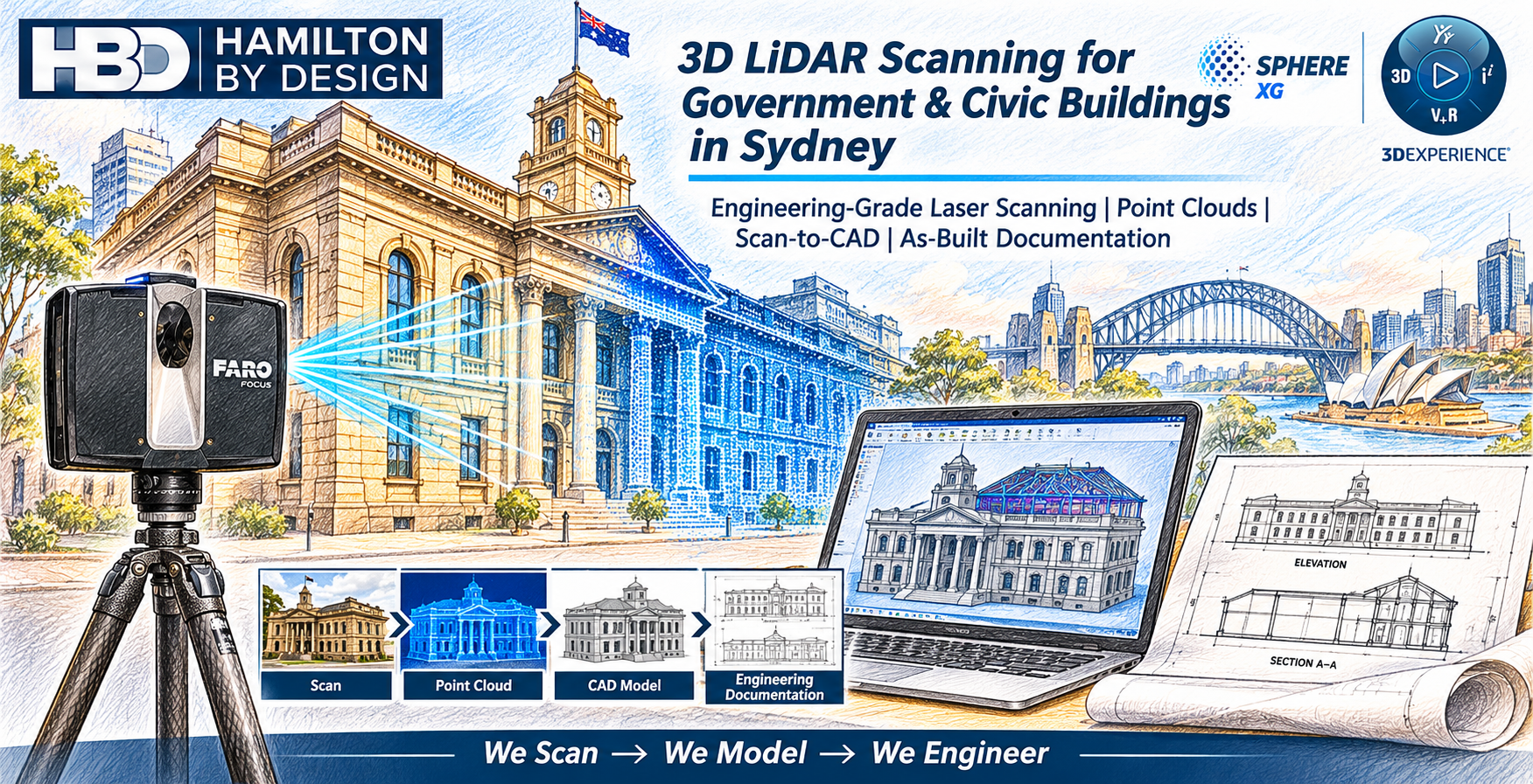
Engineering-Grade 3D Laser Scanning, As-Built Documentation and Scan-to-CAD Services for Government Buildings, Public Facilities and Civic Infrastructure
Government and civic buildings across Sydney represent a significant portfolio of public assets, ranging from historic courthouses and council chambers to contemporary administration centres, libraries, community facilities and operational government buildings.
These facilities frequently require refurbishment, maintenance, structural modifications, accessibility upgrades, building services improvements and ongoing asset management.
At Hamilton By Design, we provide engineering-grade 3D LiDAR scanning for government and civic buildings in Sydney, helping asset owners, architects, engineers and contractors establish accurate digital records of existing structures.
Our services combine terrestrial laser scanning, point cloud processing, CAD modelling and mechanical engineering expertise to support informed design, refurbishment and building management decisions.
We Scan → We Model → We Engineer
1. Why Government and Civic Buildings Require 3D LiDAR Scanning
Government buildings often undergo multiple alterations throughout their operational life.
Original architectural drawings may be incomplete, historical modifications may not have been documented, and existing building services may differ significantly from available plans.
This creates uncertainty when planning refurbishment or engineering work.
3D LiDAR scanning provides a non-contact method of capturing visible building geometry and producing measurable point cloud data.
Applications include:
- Establishing existing building dimensions and spatial arrangements.
- Recording façades, walls, floors, columns and structural elements.
- Documenting mechanical plant rooms and building services.
- Supporting roof replacement and drainage investigations.
- Providing geometric information for accessibility upgrades.
- Assisting with heritage conservation and adaptive reuse.
- Developing existing-condition CAD models and drawings.
- Supporting building maintenance and asset management.
By capturing the building before design work begins, project teams can reduce their reliance on outdated drawings and unverified assumptions.
2. Types of Government and Civic Buildings We Can Scan
Hamilton By Design provides 3D scanning services suitable for a broad range of government-owned and publicly operated facilities.
| Building category | Typical building types | Potential scanning applications |
|---|---|---|
| Courthouses and Judicial | Courthouses, court complexes, judicial administration buildings | Heritage documentation, refurbishment, structural interfaces |
| Local Government | Council chambers, town halls, administration centres | Existing-condition surveys, upgrades, asset records |
| Police and Emergency Services | Police stations, emergency response facilities, operational buildings | Plant room documentation, building modifications |
| Public Libraries | Libraries, archives, public information centres | Refurbishment, accessibility, service coordination |
| Community Facilities | Community centres, public halls, recreation facilities | Building upgrades, roof surveys, structural documentation |
| Government Offices | Departmental offices, administration buildings | Fit-outs, building services upgrades, CAD documentation |
| Heritage Government Buildings | Historic courthouses, former government offices, civic landmarks | Conservation, restoration, adaptive reuse |
| Public Health Facilities | Government clinics, public health buildings, hospital facilities | Mechanical services, plant rooms, refurbishment |
| Educational Facilities | Public schools, TAFE facilities, government training buildings | Roof replacement, building upgrades, existing-condition surveys |
| Transport and Infrastructure | Government depots, transport facilities, maintenance buildings | Engineering layouts, asset documentation |
| Public Works Facilities | Workshops, maintenance depots, operational support buildings | Mechanical engineering, equipment and structural interfaces |
| Cultural Institutions | Museums, galleries, archives, public exhibition buildings | Conservation, building documentation, services coordination |
Each facility presents different requirements depending on building age, construction type, operational restrictions and intended project outcomes.
3. Heritage-Listed Government Buildings and Civic Architecture
Sydney contains a substantial number of historic government and civic buildings.
These structures may include sandstone masonry, load-bearing brickwork, decorative façades, timber roof framing, steel structures and later concrete additions.
Heritage refurbishment projects can be complicated by irregular geometry, previous alterations and limited original construction information.
3D LiDAR scanning can assist with recording:
- Historic façades and architectural features.
- Existing structural geometry.
- Roof profiles and drainage arrangements.
- Internal floor levels and staircases.
- Building extensions and construction interfaces.
- Existing plant rooms and building services.
- Geometric irregularities relevant to restoration planning.
The resulting point cloud can provide a digital reference for conservation architects, heritage consultants and structural engineers.
Where additional heritage documentation is required, the scanning scope can be coordinated with photographic recording, conservation assessments and other specialist investigations.
4. 3D Scanning for Government Building Refurbishment
Government building refurbishment projects frequently involve modifications to existing facilities while maintaining essential operations.
Accurate existing-condition information is particularly valuable where multiple engineering and construction disciplines must work within restricted spaces.
Our scanning services can support:
Roof Replacement and Drainage Upgrades
Recording roof geometry, falls, gutters, downpipes, penetrations and accessible structural interfaces.
Mechanical Services Upgrades
Capturing existing pipework, ductwork, plant equipment and available installation clearances.
Structural Alterations
Documenting columns, beams, walls, slabs and connections to support engineering assessment and proposed modifications.
Accessibility Improvements
Providing measured geometry for ramps, stairs, access routes and proposed building alterations.
Building Services Coordination
Establishing spatial relationships between existing structures and mechanical, electrical and hydraulic installations.
Adaptive Reuse
Supporting the conversion of older civic buildings to contemporary functions while retaining significant building elements.
5. Our Engineering-Led 3D LiDAR Scanning Process
Hamilton By Design approaches 3D scanning as the first stage of an engineering documentation workflow.
Stage 1 — Project Review and Scoping
We review available drawings, project objectives, site access requirements and the intended use of the scanning information.
The scanning methodology is developed around the building elements requiring documentation and the accuracy required for subsequent design activities.
Stage 2 — On-Site Laser Scanning
Using our FARO Focus S70 terrestrial laser scanner, we capture visible building geometry from multiple scanning positions.
Depending on the project scope, this may include external façades, internal spaces, roof structures, plant rooms and structural interfaces.
Stage 3 — Point Cloud Processing and Quality Assurance
Individual scans are registered into a coordinated point cloud.
Registration quality, coverage and alignment are reviewed before the data is issued.
Where required, project survey control can be incorporated into the scanning workflow.
Stage 4 — CAD Modelling and Engineering Documentation
The registered point cloud can be used to develop existing-condition CAD geometry, general arrangement drawings, building sections and selected engineering models.
Stage 5 — Delivery and Project Coordination
Digital information is provided in agreed file formats suitable for the client’s design and engineering workflow.
Additional modelling, design development and engineering documentation can be undertaken where included in the project scope.
6. Scan-to-CAD and Scan-to-BIM for Government Buildings
Government refurbishment projects often require more than a registered point cloud.
Architects, engineering consultants and contractors may need coordinated digital information suitable for developing proposed alterations.
Hamilton By Design can assist with converting scanning data into:
- Existing-condition 2D plans and elevations.
- Building sections and selected structural geometry.
- Mechanical plant room models.
- Pipework and ductwork arrangements.
- Simplified 3D building geometry.
- CAD models for engineering coordination.
- Fabrication and installation drawings.
- Models suitable for integration into broader BIM workflows.
The level of model detail is determined by the project’s intended use.
A point cloud and a CAD or BIM model are separate deliverables. Model development, interpretation and additional verification are scoped according to project requirements.
7. Deliverables for Government and Civic Building Projects
| Deliverable | Typical application |
|---|---|
| Registered E57 point cloud | Interoperable existing-condition data |
| Autodesk ReCap RCP/RCS | CAD and architectural coordination |
| LAS point cloud | Spatial data exchange |
| DWG/DXF drawings | Existing-condition plans, sections and elevations |
| STEP/Parasolid models | Mechanical and structural interface modelling |
| 3D CAD models | Design coordination and engineering review |
| General arrangement drawings | Refurbishment and engineering documentation |
| Roof geometry and falls information | Roof replacement and drainage investigations |
Deliverables are agreed before scanning to ensure the collected data is suitable for the intended project.
8. Accuracy, Verification and Quality Assurance
Government building projects require reliable information that can be used by multiple stakeholders.
Hamilton By Design applies an engineering-oriented approach to point cloud registration, dimensional verification and model development.
The achievable accuracy of the final dataset depends on scanning distance, registration, survey control, surface conditions and the complexity of the building.
Project-specific dimensional tolerances should be established before scanning, particularly where the information will support structural alterations, prefabricated components or tight mechanical interfaces.
3D scanning records visible geometry. It does not independently verify concealed construction, material condition, structural capacity or compliance with the National Construction Code.
Where engineering certification or specialist assessments are required, these must be separately scoped and undertaken by appropriately qualified professionals.
9. Scanning Occupied and Operational Government Buildings
Government facilities can present particular access, security and operational requirements.
Scanning may need to be coordinated around staff, public visitors, restricted areas and essential building operations.
Depending on the facility, project planning may consider:
- Site inductions and security access.
- Restricted or controlled areas.
- After-hours or night scanning.
- Public access and pedestrian management.
- Elevated access equipment.
- Building occupancy and movement.
- Weather conditions affecting external scanning.
- Coordination with facility managers and contractors.
For external work, scanning is planned around suitable weather conditions. Hamilton By Design does not undertake external scanning in the rain.
Our approach aims to reduce disruption while capturing the information required for subsequent engineering and documentation activities.
10. Government and Civic Building Scanning Across Sydney
Hamilton By Design provides project-based 3D LiDAR scanning services across metropolitan Sydney and surrounding regions.
Our service area includes Sydney CBD, Parramatta, North Sydney, Chatswood, Liverpool, Penrith, Blacktown, Eastern Suburbs, Inner West and Western Sydney.
We support projects involving local government facilities, public buildings, historic structures, operational infrastructure and building refurbishment.
Our services are suitable for government asset managers, consulting engineers, architects, heritage specialists, project managers and construction contractors.
11. Why Hamilton By Design?
Hamilton By Design combines 3D LiDAR scanning with practical engineering and CAD capabilities.
Rather than treating scanning as an isolated surveying activity, we consider how the information will be used throughout design, refurbishment and construction.
Our capabilities include:
- Engineering-grade terrestrial 3D LiDAR scanning.
- Registered point cloud processing.
- Scan-to-CAD modelling.
- Mechanical engineering and drafting.
- Structural and mechanical interface documentation.
- Existing-condition drawings.
- Digital quality assurance.
- Engineering coordination for refurbishment projects.
This integrated approach helps clients move from existing-condition capture to practical engineering information.
12. Request a Quotation for Government Building 3D Scanning in Sydney
Are you planning a refurbishment, structural alteration, services upgrade or heritage conservation project involving a government or civic building in Sydney?
Hamilton By Design can assist with establishing the scanning scope, identifying suitable deliverables and developing an engineering-oriented approach to existing-condition documentation.
Contact Hamilton By Design to discuss your project requirements and request a quotation.
Hamilton By Design
Mechanical Engineering | 3D LiDAR Scanning | Scan-to-CAD | Engineering Documentation
Contact Us – Talk To Us
Our clients:












We Scan → We Model → We Engineer