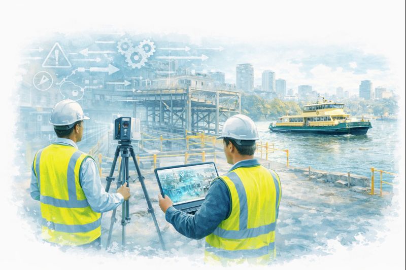
Mechanical Engineering | 3D Scanning | 3D Modelling
Tag: Scan to CAD
Scan to CAD covers the process of converting 3D laser scan and point-cloud data into accurate 2D and 3D CAD models for engineering and construction projects. This tag brings together content showing how scan-to-CAD workflows improve design accuracy, coordination, and fit-for-purpose outcomes by working from verified as-built geometry.
Fly-In Data Capture → Australian Analysis → Capacity Outcomes
Engineer-Led. Practical. Here to Support You.
Hamilton By Design Co. is an engineer-led team that wants to support you. We connect Papua New Guinea mine sites with experienced Australian engineers and designers—flying in to collect your engineering data, then analysing it in Australia to develop upgrades that help you extract the most from your opportunity.
Don’t feel isolated because of your remoteness—we’re here to help. Our role is to stand beside your site teams, capture what really exists, and convert that into practical actions that increase capacity, reliability, and safety.
We adapt our systems to fit yours. Whatever platforms, standards, and workflows your operation already uses, we structure our deliverables to integrate seamlessly with your established processes.
To Mine Management – This Is About Value
You are responsible for getting maximum performance from existing assets while controlling risk and downtime. Hamilton By Design works directly with management to:
Identify constraints limiting throughput
Reduce uncertainty before capital decisions
Turn real conditions into structured engineering plans
Deliver upgrades that increase production, not just paperwork
Our focus is outcomes: Accurate site capture → Australian engineering analysis → measurable capacity improvement.
How We Support Your Operation
1. Fly-In Engineering Data Collection
We mobilise to your PNG site to:
Capture accurate engineering information across plants, structures, conveyors, tanks, and services
Verify tie-ins, access constraints, and maintenance issues
Validate legacy drawings against reality
Engage with operators to understand bottlenecks and operating challenges
2. Australian Engineering & Design
Back in Australia our team will:
Structure the site data into design-ready formats that suit your systems
Analyse structural and mechanical limits
Develop options to increase process capacity
Produce constructable drawings and work packs for shutdown execution
Coordinate with your project teams, fabricators, and contractors
3. Capacity & Reliability Outcomes
Everything is aimed at real improvement:
Debottlenecking of chutes and conveyors
Structural upgrades for higher loads
Safer access and maintenance routes
Brownfields tie-ins with minimal downtime
Reduced rework through accurate as-builts
Practical staging to suit your shutdown strategy
PNG Mines We Can Support
Hamilton By Design can service major operations including:
Porgera Gold Mine – restart and upgrade documentation
Ok Tedi – remote infrastructure and processing areas
Hidden Valley – mountainous brownfields upgrades
Simberi – ROM and conveyor systems
Kainantu – surface/underground interface zones
Why Work With Us
Engineer-led team focused on supporting you
We come to site—no desk assumptions
Australian engineers with mining exposure
Deliverables aimed at throughput and reliability
Understanding of PNG logistics and shutdown pressures
Independent, practical, constructable solutions
Flexible approach that adapts to your existing systems
Typical Deliverables
Registered site data and as-built information
General arrangement and interface drawings
Capacity upgrade concepts
Brownfields modification packages
Photo-annotated engineering reports
Shutdown execution and staging plans
Remote Site? You’re Not Alone.
No matter how remote your operation, you don’t have to tackle engineering challenges on your own. Hamilton By Design can be on the ground capturing your plant conditions and in Australia turning that data into actions that increase production.
Let’s Talk About Your Opportunity
If you are responsible for getting more from your mine, we can help you:
Mobile 3D LiDAR Scanning Services Melbourne | Engineering-Grade Capture
Melbourne’s industrial landscape is built on decades of growth—factories expanded in stages, plant modified during shutdowns, and buildings adapted to new processes. The challenge today is that many of these facilities no longer match their original drawings.
Mobile 3D LiDAR scanning services solve that problem by capturing the site exactly as it exists, providing engineers, designers, and fabricators with reliable data to work from—without guesswork.
At Hamilton By Design we bring engineering-grade reality capture directly to your Melbourne site. Our mobile LiDAR workflows are designed to support real projects: shutdown upgrades, conveyor installations, brownfield modifications, and compliance documentation.
Capture the Real Site – Not an Assumption
Traditional measuring methods struggle in complex industrial environments. Pipe bridges, mezzanines, mixed generations of equipment, and tight access areas make manual measurement risky and inaccurate.
Mobile LiDAR scanning delivers:
Millimetre-level point clouds of structures and equipment
Accurate tie-in points for new installations
Clearance checks for conveyors, elevators, and pipework
As-built records for compliance and asset management
Digital twins ready for design and clash detection
One site visit can capture more information than weeks of manual survey.
A Service Built for Melbourne Industry
From the inner west manufacturing belt to the northern logistics hubs and south-east processing plants, Melbourne projects share common pressures:
Short shutdown windows
Ageing plant with incomplete drawings
Multiple contractors working in the same space
Increasing safety and compliance requirements
Our mobile 3D LiDAR scanning services are structured to fit these realities. Most sites can be captured in a single day with minimal disruption to operations. Extra detail is focused around critical interfaces so new equipment fits first time.
Engineering First – Scanning With Purpose
We are not just data collectors. Hamilton By Design is an engineering business that uses scanning as the foundation for practical outcomes.
From a Melbourne scan we can deliver:
Registered point clouds in industry formats
AutoCAD & SOLIDWORKS models
General arrangement drawings
Fabrication-ready models
Clash and tolerance reports
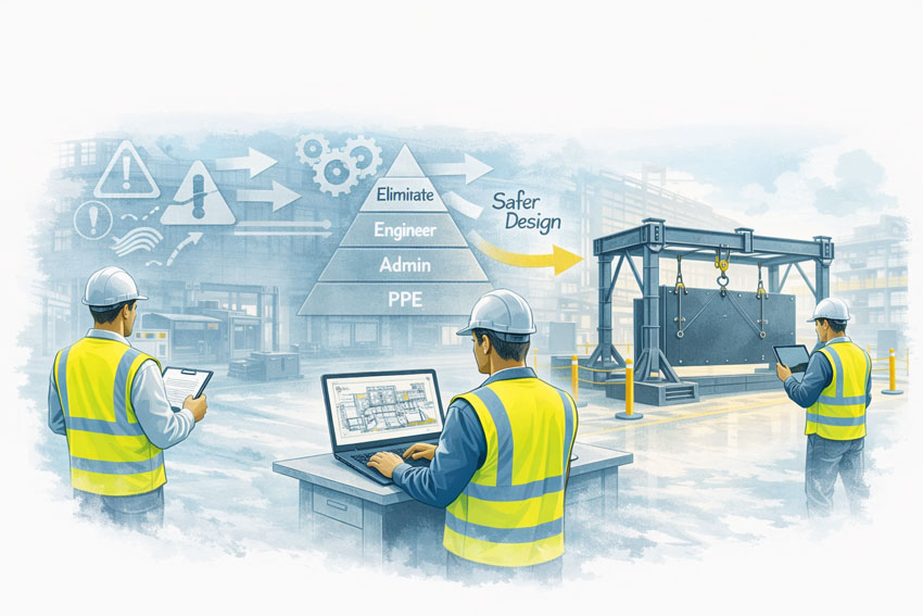
Documentation for Safe Design reviews
Because the team understands fabrication and installation, the data is captured with the end goal in mind—equipment that bolts in without rework.
Applications Across Melbourne
Mobile LiDAR scanning supports a wide range of sectors:
Food & beverage processing
Recycling and resource recovery
Warehousing and logistics
Water & wastewater facilities
Manufacturing upgrades
Conveyor and bulk handling
Heritage building retrofits
Vehicle and specialised fit-outs
Whether it’s a small workshop in Dandenong or a complex plant in the western suburbs, the approach is the same: capture once, design with confidence.
Reduce Risk Before You Build
The cost of getting measurements wrong is far higher than the cost of a scan:
Delayed shutdowns
Steel that doesn’t fit
Emergency redesigns
Additional crane and labour hire
Compromised safety outcomes
Mobile 3D LiDAR scanning removes those uncertainties at the start of the project, giving Melbourne businesses control over time, budget, and risk.
Booking & Delivery
One day onsite is typically sufficient for most facilities
Registered point cloud delivered promptly
CAD outputs tailored to your design platform
50% deposit with purchase order, balance on delivery
Our calendar fills quickly around Melbourne shutdown periods—early booking ensures your project stays on track.
Talk to an Engineering-Led Scanning Team
If you’re planning an upgrade or need accurate as-builts in Melbourne, let’s capture the site properly before design begins.
Hamilton By Design – Mobile 3D LiDAR Scanning Services Engineering-grade capture for real industrial projects.
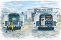
Fitters’ vans – precision tools, parts, and fast access
Boilermakers’ vans – heavy tools, welding gear, safe load distribution
Delivery vans – optimised load space and restraint systems
HVAC / air conditioning vans – gas bottles, units, tools
Painters / decorators – organised storage for finishes and equipment
Locksmiths / security installers – fast access, clean layout
Handymen / general maintenance – flexibility and adaptability
Camper vans – beds, storage, kitchens, and utilities that actually fit
Different trades. Same problem. One-size-fits-all doesn’t work.
Design It Right — Before It’s Built
With a 3D scan, the design team can:
trial different layouts digitally
adjust storage heights and access
confirm everything fits before fabrication
Traditionally, we assist with fit-out design — but scanning takes it further by giving everyone accurate data to work from.
This reduces:
rework
compromises
frustration
You’re Paying for a Fit-Out — Get What You Want
A van fit-out is an investment.
So ask yourself:
Why accept a generic layout?
Why compromise on access or storage?
Why redesign later when you can get it right first time?
Scan the van. Design it properly. Build it once.
The Bottom Line
Customising your van is just like customising your toolbox.
The better it suits you, the faster you work, the easier your days are, and the more value you get from it.
If you’re already spending money on a fit-out, 3D scanning your van is the smartest way to make sure you get exactly what you want — not what happens to fit.
Why Graduate Engineers Quickly Become Addicted to LiDAR Scanning
Ask any graduate engineer what surprised them most in their first few years on the job and you’ll often hear the same answer:
“The drawings were wrong.”
Not maliciously wrong. Not incompetently wrong. Just… out of date, incomplete, or disconnected from what actually exists on site.
That realisation is often the moment graduate engineers discover LiDAR scanning — and once they do, it’s very hard to go back.
Across Greater Sydney, from dense inner-city refurbishments to industrial upgrades in the west, graduate engineers are finding that 3D laser scanning becomes indispensable almost as soon as they’ve worked with it properly. It’s not just helpful. It’s addictive — because it replaces uncertainty with clarity.
The graduate engineer’s first shock: reality doesn’t match the drawing
Most graduate engineers come out of university trained to think in:
idealised geometry
clean load paths
well-defined dimensions
drawings that represent truth
Then they step onto a live site in Sydney CBD, Surry Hills, Parramatta, Mascot, Alexandria, Chatswood, or North Sydney and realise something important:
Existing buildings, plant, and infrastructure are messy.
Services don’t run straight. Columns aren’t perfectly plumb. Steel has been modified, trimmed, plated, or shifted over decades. Mechanical equipment has been replaced multiple times, often without full documentation. In inner suburbs especially, space constraints mean “creative” solutions become permanent.
For a graduate engineer trying to do the right thing, this mismatch creates anxiety:
Am I designing to the right information?
What happens if this doesn’t fit?
How confident should I be signing this off?
This is where LiDAR scanning changes everything.
The first scan changes how graduates think
The first time a graduate engineer works with a real point cloud, something clicks.
Instead of guessing:
they can measure directly
they can see spatial relationships
they can verify assumptions
they can design in context
Suddenly, the question shifts from “what does the drawing say?” to “what actually exists?”
Once that shift happens, it’s very hard to go back to traditional workflows.
Hamilton By Design’s approach to engineering-led LiDAR scanning highlights this transition clearly — scanning isn’t just data capture, it’s digital quality assurance for engineering decisions.
For graduate engineers, this is often the first time they feel genuinely confident that their design inputs reflect reality.
Why LiDAR scanning becomes “addictive”
LiDAR scanning is addictive to graduate engineers for one simple reason:
It removes doubt.
Once you’ve experienced what it’s like to design from verified geometry, going back to hand measurements and assumptions feels risky — even irresponsible.
1. Confidence replaces guesswork
Instead of hoping clearances exist, graduates can prove they exist. Instead of estimating offsets, they can measure them. This builds technical confidence very quickly.
2. Mistakes become learning, not disasters
When designs are checked against a point cloud, errors are caught early — in the model, not on site. Graduates learn faster because mistakes are visible and correctable.
These lessons are difficult to teach from textbooks alone.
Inner Sydney makes scanning essential, not optional
In inner Sydney suburbs, LiDAR scanning is not a luxury — it’s often the only practical way to work.
Areas like:
Sydney CBD
Ultimo
Pyrmont
Surry Hills
Redfern
Alexandria
Zetland
Newtown
are characterised by:
tight sites
layered services
heritage structures
mixed-use refurbishments
minimal tolerance for rework
Graduate engineers working on these projects quickly learn that:
traditional site measurement is slow and disruptive
access is limited and time-boxed
errors are expensive and highly visible
Scanning allows:
rapid capture without extended site shutdowns
remote review and collaboration
fewer repeat site visits
better coordination between disciplines
Once graduates experience this efficiency, they naturally push for scanning on future projects.
How scanning supports better engineering decisions
LiDAR scanning doesn’t replace engineering judgement — it supports it.
Hamilton By Design frames scanning as a core part of engineering projects, not a bolt-on service. That distinction matters, especially for younger engineers still developing confidence.
Point clouds make design reviews clearer. Instead of explaining issues abstractly, graduates can show the problem in 3D context — especially helpful when working with senior engineers, fabricators, or clients.
Safer decisions
Designing from verified geometry reduces the risk of unsafe site improvisation. Graduates learn early that safety is tied directly to design certainty.
The “digital safety net” for early-career engineers
For many graduates, LiDAR scanning acts as a digital safety net.
Early in a career, the fear of “missing something obvious” is real. Scanning provides reassurance:
Have I considered the surrounding structure?
Did I allow enough clearance?
Is this installable?
Instead of relying solely on experience they haven’t yet built, graduates can lean on measured reality.
Over time, this accelerates professional growth:
better spatial awareness
improved constructability thinking
stronger questioning of legacy documentation
Ironically, the more graduates use scanning, the faster they develop the intuition to know when it’s needed — and when it’s not.
Greater Sydney: scanning as a standard workflow
Across Greater Sydney, LiDAR scanning is increasingly becoming standard practice for:
building refurbishments
industrial upgrades
mechanical plant modifications
structural alterations
asset verification and compliance work
In western Sydney industrial areas, scanning supports large-scale plant and warehouse projects. In the north and east, it supports constrained commercial and infrastructure upgrades. In the inner suburbs, it often makes projects feasible at all.
Graduate engineers exposed to this environment quickly learn:
projects that scan early run smoother
fewer RFIs come back from site
fabrication issues drop dramatically
install teams trust the drawings more
Once they’ve seen this pattern a few times, scanning stops being a “special request” and becomes the default question:
“Can we scan this first?”
Why engineers struggle to go back once they’ve scanned
After working with LiDAR scanning, graduates often struggle with projects that don’t include it.
They notice:
more uncertainty
more site clarification calls
more “we’ll fix it on site” language
more reliance on assumptions
This is why scanning feels addictive — not because it’s flashy technology, but because it reduces friction at every stage of an engineering project.
For young engineers trying to build credibility, that reduction in friction is powerful. It allows them to:
deliver cleaner designs
ask better questions
contribute meaningfully earlier in their careers
Digital quality assurance becomes a mindset
Perhaps the biggest shift LiDAR scanning creates is cultural.
Graduate engineers exposed to scanning early start to think in terms of digital quality assurance:
verify before design
check before fabrication
confirm before installation
This mindset aligns closely with modern engineering governance, risk management, and professional accountability.
Hamilton By Design’s emphasis on scanning as digital quality assurance reflects this evolution — scanning isn’t about technology for its own sake, it’s about engineering confidence.
Final thoughts: once you see clearly, you don’t want to design blind again
For graduate engineers, LiDAR scanning often marks a turning point.
It’s the moment they realise engineering doesn’t have to rely on best guesses, inherited drawings, or incomplete information. It’s the moment they understand that good engineering starts with seeing clearly.
In Greater Sydney, especially across dense inner suburbs, that clarity isn’t optional — it’s essential.
Once graduate engineers experience what it’s like to design from reality, not assumption, LiDAR scanning stops being a tool and becomes part of how they think. And that’s why, once they’ve scanned properly, most engineers never want to design without it again.
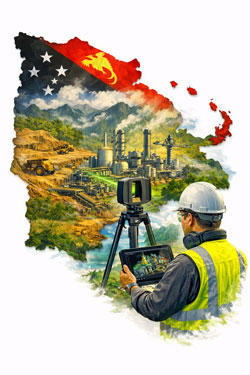
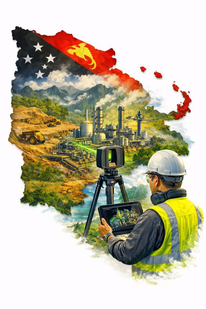
Reality capture that stands up to design, fabrication and installation in remote industrial environments
Papua New Guinea (PNG) is home to complex, high-value industrial assets — from mining and mineral processing plants through to ports, power generation and remote infrastructure. These projects are often delivered under tight shutdown windows, difficult logistics and challenging environmental conditions.
In these environments, engineering-quality 3D scanning is not a “nice to have” — it’s a practical tool that reduces risk by capturing accurate as-built conditions and converting them into deliverables engineers can trust.
Hamilton By Design provides engineering-led LiDAR scanning and scan-to-CAD modelling workflows designed for real project outcomes: upgrades that fit, installations that align, and drawings that reflect reality.
Why “Engineering Quality” Matters in PNG
Remote projects can’t afford rework.
When access is limited and mobilisation costs are high, even a small design error can cause major delays:
fabricated components don’t fit
tie-ins clash with existing pipework
platforms and handrails foul equipment clearances
shutdown windows blow out due to unexpected constraints
Engineering-quality reality capture reduces these risks by ensuring design starts from verified geometry — not assumptions or outdated drawings.
What Engineering-Quality 3D Scanning Includes
Not all scanning services deliver engineering-grade outcomes. “Engineering quality” means the capture and deliverables are suitable for mechanical and structural decisions, including fabrication and installation.
Key elements include:
Survey control and consistent site referencing (where required)
Defined accuracy targets aligned to project tolerances
Model verification against point cloud prior to issue
The goal is simple: data you can design from.
Typical PNG Use Cases
1) Plant Upgrades and Brownfield Modifications
For conveyors, chutes, pipework, pump skids, structural platforms and access upgrades, scanning provides accurate spatial context for clash-free design.
2) Shutdown Planning and Constructability Reviews
Point clouds help teams plan:
access routes and lifting paths
installation sequencing
workpack scoping and constraints
This is especially valuable when shutdown windows are short and remote support is required.
3) Scan-to-CAD for Fabrication and Fit-Up
When components must be fabricated off-site and installed first time, engineering-grade LiDAR scanning provides the geometry needed for:
interface modelling
connection detailing
fabrication drawings
4) As-Built Documentation and Asset Records
Many sites have incomplete legacy drawings. A scanned dataset can become the “single source of truth” for future upgrades and maintenance planning.
Choosing the Right Scanning Tool for PNG Conditions
PNG sites often include large structures, dense plant, tight access and harsh environmental conditions. In these cases, engineering-grade LiDAR is typically required because it provides:
long-range capture across large facilities
reliable geometry in low-light / indoor areas
accuracy suitable for engineering design decisions
Other capture methods (visual scanning or photogrammetry) can be useful for context and surfaces, but if fabrication, tie-ins, and fit-up matter, LiDAR is usually the right choice.
Deliverables That Engineers Actually Use
Engineering-quality reality capture is only valuable if it becomes practical outputs.
Common deliverables include:
Registered point clouds (E57 / RCP / RCS)
2D layouts, sections and elevations extracted from scans
Model extraction and verification against point cloud
Issue deliverables in formats aligned to the project team
This approach reduces site revisits and ensures the data is fit for purpose.
Why Engineering-Led Reality Capture Matters
3D scanning becomes far more valuable when it’s integrated with mechanical and structural engineering — because the deliverables are designed to support:
design decisions
fabrication requirements
installation sequencing
long-term asset management
Engineering-led reality capture means scanning is not the end product — it is the foundation for a better engineering outcome.
Final Thoughts
For industrial projects in Papua New Guinea, engineering-quality 3D scanning helps teams deliver upgrades with confidence — particularly where logistics are difficult, shutdown time is limited, and “measure twice” is expensive.
If the project depends on fit-up, constructability and accurate as-built conditions, start with reality capture that is designed for engineering — not just visualisation.
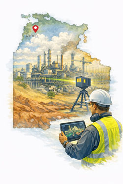
Mechanical Engineering and 3D Scanning Services in Darwin
Supporting defence, industrial and infrastructure projects across Northern Australia
Darwin is a strategic industrial hub for Northern Australia, supporting defence facilities, oil and gas operations, ports, power generation and remote infrastructure servicing. Many of these assets operate in harsh environments and have been upgraded over long periods, making accurate design and modification work highly dependent on reliable as-built information.
Hamilton By Design provides engineering-led 3D laser scanning and mechanical engineering services in Darwin, supporting safer, faster and more accurate project delivery across operating facilities.
Engineering Challenges in Northern Australian Facilities
Industrial and infrastructure assets in the Top End face unique challenges, including:
High humidity and corrosion
Cyclone-rated structural requirements
Remote logistics and limited shutdown windows
Ageing infrastructure with incomplete documentation
These factors increase project risk when modifications rely on outdated drawings or manual site measurements.
Engineering-grade reality capture allows accurate design to be completed off-site, reducing rework and improving safety outcomes during installation.
How 3D Laser Scanning Supports Darwin Projects
Plant and Facility Upgrades
When upgrading mechanical systems, pipework, conveyors or process equipment, laser scanning provides accurate spatial data so new components can be designed to fit existing layouts before fabrication.
This is particularly valuable for:
Fuel and gas facilities
Power generation assets
Water and wastewater plants
Defence infrastructure
Shutdown and Maintenance Planning
Short shutdown windows are common in remote facilities. Point cloud models support:
Access and lifting studies
Installation sequencing
Safety and exclusion zone planning
This reduces uncertainty and improves coordination between trades during critical maintenance periods.
Structural and Mechanical Retrofits
For strengthening structures, replacing worn equipment or installing new platforms, scanning provides geometry suitable for:
Fabrication drawings
Structural connection design
Mechanical interface modelling
Minimising the need for repeated site visits in high-risk environments.
Mechanical Engineering Services Supported by Reality Capture
Hamilton By Design integrates 3D scanning directly into engineering workflows, including:
Mechanical design and drafting
Structural support and modification design
Scan-to-CAD and scan-to-BIM modelling
Fabrication drawing development
Installation and constructability reviews
This ensures reality capture delivers practical engineering outcomes, not just visual documentation.
Industries Supported in the Darwin Region
Our engineering and scanning services support a wide range of industries, including:
Defence and military facilities
Oil and gas processing and storage
Port infrastructure and materials handling
Power generation and utilities
Remote industrial facilities and camps
Food and bulk materials processing
These sectors require high levels of accuracy, safety and reliability when modifying operating assets.
Why Engineering-Grade LiDAR Matters
Not all scanning technologies are suitable for industrial engineering.
For mechanical and structural design, projects typically require:
Millimetre-level accuracy
Long-range capture across large facilities
Reliable reference for fabrication and installation
Engineering-grade LiDAR systems provide the precision required to support fabrication-ready design and clash-free installation.
Benefits for Project Owners and Contractors
Using engineering-led reality capture provides measurable advantages:
Reduced re-measurement on site
Fewer design clashes
Improved constructability
Safer design development
Shorter shutdown durations
Greater confidence in project outcomes
In remote locations, avoiding rework and delays has a major impact on overall project cost and schedule.
Supporting Projects Across Northern Australia
While based on the east coast, Hamilton By Design regularly supports regional and remote projects using a combination of:
On-site scanning campaigns
Remote engineering and modelling workflows
Digital collaboration and model review
This allows Darwin-based projects to access specialist engineering and scanning capability without requiring permanent local resourcing.
Final Thoughts
For industrial and infrastructure projects in Darwin, combining mechanical engineering with engineering-grade 3D scanning provides a safer, faster and more reliable way to deliver upgrades in challenging operating environments.
By integrating reality capture directly into design and fabrication workflows, project teams can reduce risk, improve coordination and achieve better construction outcomes across Northern Australia’s critical assets.
To provide the best experiences, we use technologies like cookies to store and/or access device information. Consenting to these technologies will allow us to process data such as browsing behaviour or unique IDs on this site. Not consenting or withdrawing consent, may adversely affect certain features and functions.
Functional
Always active
The technical storage or access is strictly necessary for the legitimate purpose of enabling the use of a specific service explicitly requested by the subscriber or user, or for the sole purpose of carrying out the transmission of a communication over an electronic communications network.
Preferences
The technical storage or access is necessary for the legitimate purpose of storing preferences that are not requested by the subscriber or user.
Statistics
The technical storage or access that is used exclusively for statistical purposes.The technical storage or access that is used exclusively for anonymous statistical purposes. Without a subpoena, voluntary compliance on the part of your Internet Service Provider, or additional records from a third party, information stored or retrieved for this purpose alone cannot usually be used to identify you.
Marketing
The technical storage or access is required to create user profiles to send advertising, or to track the user on a website or across several websites for similar marketing purposes.