Engineering-Grade 3D Laser Scanning Across Australia

Engineer operating 3D laser scanner at industrial site with point cloud transforming into verified digital model of Australia.

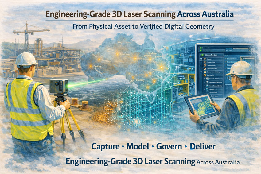
Engineering-Grade 3D Laser Scanning Across Australia | Hamilton By Design

Precision Capture. Engineering Accuracy. National Coverage.

Hamilton By Design delivers engineering-grade 3D laser scanning and LiDAR services across Australia โ€” supporting mining, heavy industry, infrastructure and commercial projects with accurate, design-ready data.

We donโ€™t just capture point clouds.

We deliver engineered geometry ready for decision-making, modification, compliance and fabrication.


Why Engineering-Grade Matters

Not all 3D scanning is equal.

Survey-grade and visual scans may produce impressive imagery, but engineering projects require:

  • Measurable accuracy
  • Structured point cloud management
  • Traceable coordinate systems
  • Cleaned and classified data
  • CAD-ready deliverables
  • Integration into engineering governance workflows

Our scanning workflows are built specifically for:

  • Mechanical modifications
  • Structural upgrades
  • Lifting device verification
  • Brownfield plant upgrades
  • Shutdown planning
  • Retrofit installations
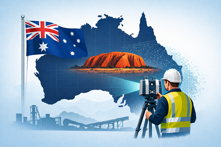
National Coverage

Hamilton By Design provides scanning services across:

  • New South Wales
  • Queensland
  • Western Australia
  • Victoria
  • South Australia
  • Northern Territory

We regularly support projects in:

Sydney โ€ข Newcastle โ€ข Central Coast โ€ข Brisbane โ€ข Mount Isa โ€ข Perth โ€ข Melbourne โ€ข Broken Hill โ€ข Darwin

Remote and regional projects are part of our operating model.


Engineering-grade 3D laser scanning workflow from site capture to CAD modelling across Australia.

Our Engineering Workflow

Site Capture

Using professional LiDAR and engineering-grade scanning equipment, we capture:

  • Existing plant layouts
  • Structural steel
  • Mechanical systems
  • Confined and complex environments
  • Large industrial footprints

Data Processing

We clean, register and align point clouds into structured datasets suitable for:

  • 3D modelling
  • Clash detection
  • FEA preparation
  • Fabrication detailing
  • Engineering verification

Engineering Integration

Unlike survey-only providers, we integrate scans into:

  • Solid models
  • Assembly models
  • 2D drawings
  • Revision-controlled documentation
  • Compliance frameworks

This ensures your scan becomes a working engineering asset โ€” not just a visual reference.


Typical Applications

  • Mining plant modifications
  • Conveyor upgrades
  • Chute redesign
  • Lifting beam retrofits
  • Tank and vessel alterations
  • Brownfield automation projects
  • Shutdown verification and planning
  • As-built validation for compliance

LiDAR scanning survey across Australia with engineer capturing industrial site data

Accuracy & Deliverables

We provide:

  • Registered point clouds
  • Cleaned and segmented datasets
  • STEP / IGES / native CAD formats
  • 2D layouts
  • 3D assemblies
  • Structured file naming and revision control

Deliverables can align with your:

  • Engineering standards
  • ISO document control
  • Mining governance frameworks
  • AS compliance requirements

Governance & Data Security

Engineering data is intellectual property.

We integrate our scanning outputs into structured governance frameworks and can support secure data management workflows using enterprise-level platforms.

This means:

  • Controlled access
  • Version traceability
  • Secure archiving
  • 24/7 accessibility

Your geometry remains protected and usable long-term.


Why Hamilton By Design?

โœ” Engineering-led scanning (not survey-only)
โœ” Mining and heavy industry experience
โœ” National capability
โœ” Governance-focused deliverables
โœ” Integration into design, FEA and fabrication
โœ” Practical understanding of shutdown constraints

We understand how scanning supports real engineering decisions โ€” because we operate inside those environments.


Reduce Risk Before You Fabricate

Incorrect geometry causes:

  • Rework
  • Fabrication delays
  • Misalignment on site
  • Compliance issues
  • Cost escalation

Engineering-grade 3D laser scanning removes uncertainty before steel is cut.


Speak With Our Team

If you require engineering-grade 3D laser scanning anywhere in Australia, contact Hamilton By Design to discuss your project.

Precision capture is only valuable when it supports engineered outcomes.


3D LiDAR scanning and 3D modelling service button โ€” laser scanner capturing a point cloud for engineering and CAD modelling
Mechanical engineering services
Name
Would you like us to arrange a phone consultation for you?
Address

3D CAD Modelling Australia service banner for Hamilton By Design

3D LiDAR Scanning for As-Built & Brownfield Engineering

3D LiDAR Scanning for As-Built & Brownfield Engineering

At Hamilton By Design, we use engineering-grade 3D LiDAR scanning to capture the true as-built condition of your plant, structures and equipment โ€” so you can design, fabricate and install with confidence.

From coal handling preparation plants (CHPP) and hard rock processing lines, through to power stations, manufacturing plants and commercial buildings, our engineer-led scanning process gives you accurate, clash-ready data for every brownfield project.


Why 3D LiDAR Scanning Matters for Brownfield Projects

Brownfield engineering is never โ€œlike the drawingsโ€.

Over years of operation, plants twist, deflect, corrode and get modified during shutdowns. Legacy drawings are often incomplete or out of date. Thatโ€™s where 3D LiDAR scanning changes the game:

  • Capture real geometry, not assumptions
    Record every beam, pipe, chute, cable tray and accessway as it actually exists today.
  • See deformations and historic repairs
    Pick up deflections, sagging, wear, corrosion loss and undocumented modifications that donโ€™t appear in old drawings.
  • De-risk shutdowns and fit-ups
    Use the scan-based model to check new designs for clashes, access, maintenance and installation sequence before you cut steel.
  • Improve safety and compliance
    Support structural integrity assessments, access/egress reviews and compliance checks with a trusted, measurable digital record.
  • Reduce site time for designers
    Capture everything once, then let your engineering and drafting team work from the digital plant model instead of repeated site visits.

What We Scan

Hamilton By Design can scan and model:

  • CHPP and coal handling infrastructure
    • Screens, crushers, transfer towers, chutes, hoppers, conveyors, tripper gantries, stackers and reclaimers
  • Hard-rock and mineral processing plants
    • Mills, cyclones, crushers, bins, slurry pipework, support structures
  • Power stations and energy infrastructure
    • Boiler houses, turbine halls, pipe racks, cable trays, access platforms
  • Manufacturing and industrial facilities
    • Production lines, material handling systems, automation cells, storage areas
  • Commercial and building services
    • Plant rooms, risers, roof services, faรงades and structural frames

If itโ€™s built and you need to understand it, we can scan it.


Engineer-Led Scanning, Not Just Survey

What sets Hamilton By Design apart is that our scanning is driven by mechanical engineers, not just surveyors.

That means we plan each scan campaign based on:

  • The future design work you need to do
  • The critical interfaces (bolt patterns, flanges, centre-lines, datum points)
  • The tolerances needed for fabrication and installation
  • The shutdown and access constraints on site

Because the same team that scans your plant is also involved in modelling, design and checking, we make sure the data captured is actually usable for engineering and drafting โ€” not just a pretty point cloud.


Typical Workflow: From Scan to Engineering Model

  1. Scope & Planning
    • Define the upgrade, problem area or shutdown scope
    • Agree survey tolerances, required deliverables and file formats
    • Plan access, shutdown windows and safety requirements
  2. On-Site 3D LiDAR Scanning
    • Set up control and scanning positions for full coverage
    • Capture high-density scans of structures, equipment and services
    • Minimise disruption to operations where possible
  3. Registration & Quality Checks
    • Register and align scans into a single, unified point cloud
    • Apply QA checks to confirm alignment and global accuracy
    • Provide initial visualisation for client review if required
  4. 3D Modelling & As-Built Geometry
    • Create engineering-ready 3D models in SolidWorks (or other CAD platforms as agreed)
    • Model structural steel, mechanical equipment, chutes, pipework and key interfaces
    • Prepare background models suitable for new design and layout work
  5. As-Built & Brownfield Engineering Support
    • Use the model to support new projects: upgrades, replacements, debottlenecking and layout changes
    • Run fit-up checks, clash detection and access/maintenance reviews
    • Prepare fabrication drawings and installation packages as required
  6. Handover & Ongoing Use
    • Provide point clouds, 3D models and drawings in agreed formats
    • Support future shutdowns and projects using the same trusted digital plant model

Deliverables You Can Expect

Depending on the project, we can provide:

  • Registered point clouds in industry-standard formats
  • 3D CAD models (SolidWorks or exchange formats such as STEP, IGES, DWG)
  • As-built drawings and GA layouts for mechanical and structural systems
  • Clash-check models for integration of new designs
  • Sections and detail views for critical interfaces (bolt patterns, flange faces, datum planes)
  • Visualisations to support stakeholder communication and approvals

All deliverables are produced with fabrication and construction in mind โ€” so your fabricators, installers and site team can act on them immediately.


Applications in As-Built & Brownfield Engineering

3D LiDAR scanning directly supports:

  • Shutdown-driven upgrades โ€“ de-risking installation windows by checking fit-up beforehand
  • Chute and hopper redesign โ€“ improving flow and wear life using accurate existing geometry
  • Conveyor and transfer tower modifications โ€“ adding new equipment or re-routing systems
  • Structural remediation and strengthening โ€“ understanding real load paths and condition
  • Pipework reroutes and tie-ins โ€“ locating existing lines, clashes and tie-in opportunities
  • Compliance and audit documentation โ€“ maintaining accurate records under Australian standards and site governance

Why Choose Hamilton By Design for 3D LiDAR Scanning?

  • Engineer-led, not equipment-led โ€“ we start with the engineering problem, then choose the scanning approach.
  • Single-source accountability โ€“ one team for scanning, modelling, engineering and drawings.
  • Brownfield experience โ€“ extensive work in CHPPs, mineral processing plants, power stations and heavy industry.
  • Fabrication-ready outputs โ€“ deliverables tailored for fabricators, installers and project engineers.
  • National coverage โ€“ servicing sites across NSW, QLD, WA, VIC and SA.

Hamilton By Design logo displayed on a blue tilted rectangle with a grey gradient background
3D LiDAR scanning and 3D modelling service button โ€” laser scanner capturing a point cloud for engineering and CAD modelling
Mechanical engineering services

Next Steps

Planning a shutdown, upgrade or brownfield modification?

Hamilton By Design can help you capture the plant once and then reuse that digital model across multiple projects โ€” reducing risk, improving accuracy and cutting rework.

Contact us to discuss your 3D LiDAR scanning requirements and weโ€™ll help you define:

  • The scanning scope
  • Required tolerances
  • Ideal deliverables for your designers, fabricators and site team

So your next project starts with facts, not assumptions.

Email โ€“ info@hamiltonbydesign.com.au

Phone – (+61) 047 700 2249

Our Clients

Name
Would you like us to arrange a phone consultation for you?
Address
Finite Element Analysis (FEA) engineering simulation button
Mechanical engineering services