Reality Capture Sydney | Property & Real Estate Services
Engineering-Grade LiDAR & Digital Reality Capture for the Built Environment
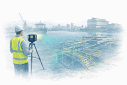
As Sydney’s construction, infrastructure, and industrial assets become more complex, traditional measurement methods are no longer sufficient. Reality capture has become a critical enabler for accurate planning, risk reduction, and confident project delivery across the built environment in Sydney.
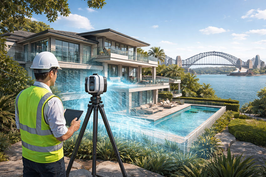
Hamilton By Design provides engineering-grade reality capture services in Sydney, combining high-accuracy LiDAR laser scanning with practical engineering workflows to deliver reliable as-built data, digital twins, and construction-ready models.
Learn more about our Sydney scanning capability:
https://www.hamiltonbydesign.com.au/home/engineering-services/3d-scanning-sydney/3d-scanning-services-in-sydney/
What Is Reality Capture?
Reality capture is the process of digitally recording real-world assets using technologies such as:
- LiDAR laser scanning
- High-resolution spatial data capture
- Registered point clouds
- 3D models aligned to real geometry
The result is an accurate digital representation of existing conditions — enabling engineers, designers, and constructors to work from a single source of truth rather than assumptions or outdated drawings.
Why Reality Capture Matters in Sydney
Sydney projects frequently involve:
- Live operational assets
- Brownfield construction and upgrades
- Tight construction tolerances
- Complex interfaces between structural, mechanical, and architectural systems
Reality capture enables project teams to:
✔ Verify existing conditions before design
✔ Reduce rework and construction clashes
✔ Improve coordination across disciplines
✔ Accelerate approvals and decision-making
✔ Improve safety by minimising site re-visits
This is particularly valuable across commercial buildings, transport infrastructure, industrial facilities, utilities, and large refurbishment projects.
Engineering-Led Reality Capture — The Hamilton By Design Difference
At Hamilton By Design, reality capture is not treated as a standalone surveying task. Our services are engineer-led, ensuring the data captured is fit for downstream use in:
- Mechanical and structural design
- Construction coordination
- Retrofit and upgrade works
- Fabrication and installation planning
Our Sydney reality capture services integrate directly with CAD, BIM, and engineering documentation workflows — ensuring accountability from scan through to design and delivery.
Typical Reality Capture Applications in Sydney
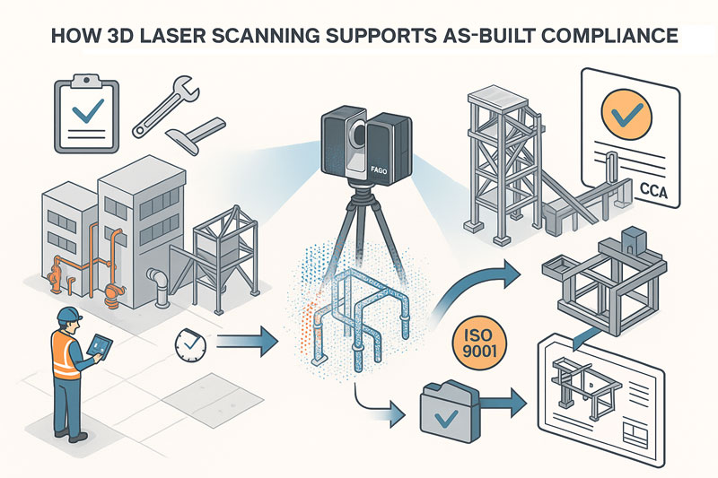
As-Built Documentation
Capture accurate as-built conditions for compliance, certification, handover, or future upgrades.
Construction & Refurbishment Projects
Scan existing buildings and structures prior to modifications, extensions, or adaptive reuse.
Industrial & Infrastructure Assets
Capture complex geometry such as plant rooms, pipework, platforms, and structural steel.
Digital Twins & Asset Records
Create reliable digital records that support ongoing asset management and lifecycle planning.
Deliverables Tailored to Project Needs
Depending on your scope, Hamilton By Design can provide:
- Registered LiDAR point clouds
- CAD-ready geometry
- BIM-compatible models
- Section views and reference drawings
- Engineering drawings derived from scan data
All deliverables are issued to suit engineers, builders, asset owners, and project managers working across Sydney.

Reality Capture Sydney — Build with Confidence
Reality capture removes uncertainty from complex projects. By accurately capturing what exists today, project teams can design, coordinate, and construct with confidence tomorrow.
Hamilton By Design supports Sydney-based projects with engineering-grade reality capture, practical deliverables, and a deep understanding of how digital data is used in real construction and industrial environments.
Contact Hamilton By Design to discuss your Sydney reality capture requirements or arrange a site scan.