What Is the Difference Between a Terrestrial Scanner and a LiDAR Scanner?

Terrestrial, mobile SLAM and drone LiDAR scanners capturing an industrial plant with engineers reviewing point cloud data and drawings

Terrestrial vs LiDAR Scanners | Whatโ€™s the Difference?

Confusion around terrestrial scanning and LiDAR scanning is common โ€” and understandable.
The two terms are often used interchangeably, even though they describe different things.

This page explains the difference in plain language, shows where each approach fits, and helps you decide what level of accuracy and risk is appropriate for your project.


Short Answer (If Youโ€™re in a Hurry)

LiDAR describes the laser measurement technology.
Terrestrial describes how and where that LiDAR scanner is deployed.

Most terrestrial scanners use LiDAR, but not all LiDAR scanners are terrestrial.


Illustration comparing terrestrial LiDAR, mobile SLAM LiDAR and drone scanning on an industrial facility

What Is LiDAR?

LiDAR (Light Detection and Ranging) is a method of measuring distance using laser light.

How LiDAR works

  • A laser pulse is emitted
  • The pulse reflects off an object
  • The return time is measured
  • Distance is calculated and stored as a 3D point

Millions of these points form a point cloud that represents real-world geometry.

What LiDAR is good for

  • Accurate 3D measurement
  • Complex geometry
  • Low-light or enclosed environments
  • Engineering, construction, and industrial sites

LiDAR answers: How is distance measured?


What Is a Terrestrial Scanner?

A terrestrial scanner is a ground-based scanning system, usually mounted on a tripod or fixed position.

Key characteristics

  • Fixed scan position
  • Controlled setup and coverage
  • Known geometry and reference
  • High repeatability and validation

Typical environments

  • Processing plants and CHPPs
  • Structural steelwork
  • Conveyor systems
  • Brownfield tie-ins
  • As-built verification
  • Shutdown-critical fit-up work

Terrestrial answers: Where and how is the LiDAR deployed?


How the Two Terms Relate (This Is the Important Part)

A terrestrial scanner is a platform.
A LiDAR scanner is a technology.

Most modern terrestrial scanners are terrestrial LiDAR scanners.

Example: a tripod-mounted system such as the FARO Focus S-Series is:

  • LiDAR-based (laser measurement)
  • Terrestrial (ground-based, fixed setup)

Other Common LiDAR Scanner Types (And Why It Matters)

Scanner TypeHow Itโ€™s UsedTypical Outcome
Terrestrial LiDARTripod / fixedHighest control & accuracy
Mobile / SLAM LiDARHandheld / walk-throughFast capture, lower control
Vehicle-mounted LiDARCar / trolleyCorridor mapping
Aerial LiDARDrone / aircraftLarge areas, low detail

All are โ€œLiDARโ€, but not all are suitable for engineering design or fabrication.


Why This Distinction Matters for Projects

Many issues occur when:

  • A LiDAR scan is assumed to be engineering-grade
  • A mobile or SLAM scan is used beyond its intent
  • Accuracy, validation, or limitations are not clearly understood

This doesnโ€™t mean one method is wrong โ€” it means each has a purpose.

The key is aligning the scanner type with:

  • Required accuracy
  • Risk tolerance
  • Fit-up criticality
  • Intended use of the data

Our clients:


Simple Decision Guide (Client in Control)

If you need:

  • Fabrication or replacement parts โ†’ Terrestrial LiDAR
  • Shutdown-critical fit-up โ†’ Terrestrial LiDAR
  • Structural verification โ†’ Terrestrial LiDAR
  • Rapid site context only โ†’ Mobile / SLAM LiDAR
  • Large terrain or stockpiles โ†’ Aerial LiDAR

There is no โ€œone best scannerโ€ โ€” only the right scanner for the outcome you want.


Comparison at a Glance

RequirementTerrestrial LiDARMobile / SLAM LiDAR
Accuracy controlHighModerate
RepeatabilityHighLower
Engineering defensibilityStrongLimited
Fit-up confidenceSuitableNot recommended
Capture speedSlowerFaster
Best use caseDesign & fabricationVisualisation & context

A Note on Engineering Use

Where scanning data feeds into engineering design, documentation, or fabrication, higher-control methods are typically required to align with engineering practice and Australian Standards expectations.

That doesnโ€™t remove choice โ€” it simply means the assumptions and limitations must match the intended use.


How We Approach This (Without Locking You In)

Weโ€™re happy to:

  • Work with terrestrial, mobile, or supplied scan data
  • Validate data before design where required
  • Align scanning effort with your risk, budget, and outcome
  • Clearly document assumptions and limitations

You stay in control of the approach โ€” our role is to make sure the data supports the outcome you expect.


Hamilton By Design logo displayed on a blue tilted rectangle with a grey gradient background

Next Step

If youโ€™re unsure which scanning method suits your project:

Fill out the contact form and tell us:

  • What you want to build, replace, or verify
  • How the data will be used
  • Any constraints (budget, time, shutdown windows)

Weโ€™ll help you select a fit-for-purpose scanning approach, not just a scanner.


Name
Would you like us to arrange a phone consultation for you?
Address

3D Construction Scan in Brisbane

Engineering-Grade Reality Capture for Live Construction Environments

Construction projects in Brisbane operate under conditions that place unique pressure on engineers, builders, and asset owners. Subtropical climate, flood-affected sites, reactive soils, dense CBD logistics, and a strong reliance on brownfield upgrades all increase one fundamental risk: designing and constructing from incorrect or outdated site information.

A 3D construction scan in Brisbane provides engineering-grade certainty by capturing what actually exists on site, enabling informed decisions during live construction, refurbishment, and staged delivery projects.


3D construction scanning in Brisbane using a FARO laser scanner at a building site overlooking the Story Bridge and Brisbane River

What Is a 3D Construction Scan?

A 3D construction scan uses high-accuracy LiDAR laser scanning to capture the true as-built condition of a site at a specific point in time. Unlike visual scans or phone-based capture, engineering-grade scanning produces registered point clouds that can be trusted for:

  • Construction coordination
  • Design verification
  • Clash detection
  • Fabrication-ready modelling
  • As-built documentation

Hamilton By Design delivers these outcomes through its engineering-led laser scanning services, where accuracy, downstream use, and construction risk are defined before scanning begins.


https://www.hamiltonbydesign.com.au/laser-scanning-engineering-brisbane-cbd/3d-scanning-brisbane/


Why Brisbane Construction Projects Require a Different Approach

Subtropical Climate & Structural Movement

Brisbaneโ€™s humidity and temperature cycles contribute to thermal expansion, contraction, and cumulative movement across steelwork, pipe runs, conveyors, faรงades, and plant installations.

When construction decisions rely on assumed geometry or legacy drawings, even small movements can result in:

  • Misaligned interfaces
  • Fabrication clashes
  • Installation delays

A 3D construction scan captures the current, in-situ geometry, allowing engineers to design and coordinate based on reality โ€” not historical intent.

Flood-Affected & Modified Assets

Many Brisbane sites โ€” particularly river-adjacent commercial and industrial facilities โ€” have undergone multiple flood recovery and modification cycles. Over time, this results in:

  • Changed floor levels
  • Unrecorded ramps and bunds
  • Altered drainage and gravity-dependent systems

Construction scanning establishes a true datum and elevation baseline, supporting engineering verification of falls, access clearances, and tie-in points.

This capability aligns directly with Hamilton By Designโ€™s broader reality capture and as-built verification workflows.


https://www.hamiltonbydesign.com.au/reality-capture-services/


Brownfield Construction Is the Norm

A significant proportion of Brisbane construction work occurs in live, operational environments, including:

  • Commercial refurbishments
  • Industrial plant upgrades
  • Infrastructure modifications
  • Asset life-extension projects

These sites often contain undocumented steelwork, legacy penetrations, and accumulated modifications. A 3D construction scan enables non-intrusive capture of this complexity, supporting engineering coordination without disrupting operations.

Tight CBD Logistics & Vertical Construction

Brisbaneโ€™s CBD presents unique logistical challenges:

  • Limited laydown space
  • Vertical risers and congested services zones
  • Restricted crane and hoist access
  • Staged installation sequencing

In these environments, components must fit first time. Construction scanning supports:

  • Early clash detection
  • Verification before fabrication
  • Confident off-site prefabrication

This process integrates directly with Hamilton By Designโ€™s 3D point cloud modelling and coordination services.

https://www.hamiltonbydesign.com.au/3d-point-cloud-modelling/

Reactive Soils & Differential Settlement

Reactive clay soils common throughout South-East Queensland contribute to long-term differential settlement, particularly where new construction interfaces with older structures. Over time, this can lead to:

  • Misaligned columns and beams
  • Drift in conveyors and pipe racks
  • Geometry that no longer matches design intent

A construction scan captures current condition, enabling engineers to design extensions and upgrades that reflect actual site geometry.


Construction Scanning vs Generic 3D Scanning

Not all scanning is suitable for construction engineering.

AspectGeneric ScanEngineering-Led Construction Scan
AccuracyVisual or indicativeMillimetre-grade
OutputMeshes or imagesRegistered point clouds
Engineering UseLimitedDesign & fabrication
Risk ReductionLowHigh
Construction ReadyNoYes

Hamilton By Design positions construction scanning as part of an integrated engineering workflow, not a standalone data capture exercise.


https://www.hamiltonbydesign.com.au/3d-engineering-services/


How 3D Construction Scans Are Used on Brisbane Projects

Engineering-grade construction scans are routinely used to support:

  • Clash detection across structure and services
  • Verification scans prior to fabrication
  • Construction sequencing and staging
  • As-built documentation for handover
  • Reduced RFIs, rework, and site delays

These outcomes are particularly valuable on commercial and construction projects where access, timing, and accuracy are critical.


https://www.hamiltonbydesign.com.au/commercial-construction-engineering/


3D laser scanning of a commercial building under construction showing as-built capture and coordination before wall closure

The Hamilton By Design Difference

Hamilton By Design delivers engineering-grade 3D construction scanning with a clear focus on constructability and downstream use.

Our approach combines:

  • Engineer-led scanning strategies
  • Defined accuracy requirements
  • Integration with mechanical and structural design
  • Outputs suitable for fabrication and installation

This approach ensures construction teams can rely on scan data with confidence โ€” especially on complex Brisbane projects.


When should a 3D Construction Scan Be Used?

A 3D construction scan in Brisbane is most valuable when:

  • Working in brownfield or live environments
  • Verifying conditions before fabrication
  • Coordinating multiple trades in tight spaces
  • Managing staged refurbishments
  • Reducing construction risk and uncertainty

Hamilton By Design logo displayed on a blue tilted rectangle with a grey gradient background

In Brisbane, construction risk is rarely driven by poor engineering.
It is driven by decisions made using incorrect or outdated information.

A 3D Construction Scan in Brisbane provides one critical advantage:
certainty about what actually exists on site, at the moment decisions are made.

Finite Element Analysis (FEA) engineering simulation button
3D LiDAR scanning and 3D modelling services button
Building and construction services button

Our clients:

Name
Would you like us to arrange a phone consultation for you?
Address

Engineering Confidence in South Yarra, Melbourne

LiDAR scanning Melbourne

Melbourne has long been recognised as one of Australiaโ€™s most advanced engineering and manufacturing centres, and inner-city hubs such as South Yarra sit at the intersection of design, industry, infrastructure, and innovation. As projects become more complex and timelines more compressed, engineering teams are increasingly seeking partners who can reduce uncertainty, improve accuracy, and provide reliable technical insight from day one.

This is where Hamilton By Design delivers genuine value.

Hamilton By Design operates as an engineer-led consultancy focused on precision, constructability, and real-world outcomes. Rather than working from assumptions or incomplete information, the business is built around capturing existing conditions accurately and transforming that data into practical engineering deliverables that support confident decision-making.

Moving Beyond Assumptions in Modern Engineering

Many engineering challenges in metropolitan Melbourne are not greenfield projects. They involve existing buildings, operating facilities, constrained spaces, legacy assets, or staged upgrades that must integrate seamlessly with what is already in place. In these environments, relying on outdated drawings or manual measurements introduces risk โ€” misalignment, clashes, rework, and delays that can quickly erode budgets and schedules.

Hamilton By Design addresses this challenge by placing reality capture and engineering validation at the front end of projects. This ensures that every downstream decision is based on what truly exists on site, not what is assumed to exist.

For engineering teams working in and around South Yarra โ€” whether supporting manufacturing, infrastructure, plant upgrades, or specialist facilities โ€” this approach significantly reduces technical risk and increases confidence across all stakeholders.

LiDAR Scanning as a Foundation for Accuracy

A key capability that differentiates Hamilton By Design is its use of engineering-grade LiDAR scanning. Unlike traditional surveys that capture selective points, LiDAR scanning records millions of measurements across an entire environment, producing a high-resolution digital representation of buildings, plant, structures, and surrounding context.

This data becomes a reliable reference point for engineers, designers, fabricators, and project managers alike.

LiDAR scanning enables:

  • Accurate capture of complex geometries and tight spaces
  • Clear identification of spatial constraints and interfaces
  • Early detection of clashes and access issues
  • Reduced need for repeat site visits
  • Improved coordination between disciplines

By converting physical assets into precise digital data, Hamilton By Design helps teams eliminate ambiguity and work from a single source of truth.

From Scan Data to Engineering Outcomes

Importantly, Hamilton By Design does not operate as a scanning-only service. The real value lies in how scan data is interpreted, validated, and converted into engineering outputs that directly support delivery.

Scan information is used to develop structured models, layouts, and documentation that reflect real-world conditions. This supports engineering activities such as:

  • Mechanical and structural modifications
  • Plant upgrades and equipment integration
  • Space planning and layout optimisation
  • Fabrication and installation planning
  • Asset documentation and as-built records

Because the work is led by experienced engineers, the focus is always on what needs to be built, installed, or modified, not just on creating visually impressive models.

Supporting Engineering Teams and Decision-Makers

In a business and engineering environment like South Yarra โ€” where projects are often time-sensitive and commercially driven โ€” external engineering support must be reliable, efficient, and technically sound.

Hamilton By Design integrates smoothly with internal teams, consultants, and contractors, providing additional technical depth without adding unnecessary complexity. The consultancy model is deliberately structured to support decision-makers who need clarity, not noise.

This means:

  • Clear communication of constraints and risks
  • Practical recommendations grounded in real site data
  • Deliverables aligned with fabrication and construction needs
  • Engineering documentation that supports approval and execution

The result is fewer surprises downstream and a smoother path from concept through to implementation.

Engineering for Brownfield and Live Environments

One of the most challenging aspects of modern engineering is working within live or brownfield environments โ€” facilities that cannot simply shut down for measurement, redesign, or rework. In these settings, accuracy and planning are critical.

Hamilton By Designโ€™s LiDAR-driven workflows are particularly well suited to these conditions. Rapid data capture minimises disruption on site, while the detailed digital record allows engineering work to continue remotely with confidence.

This approach supports safer planning, better coordination, and reduced exposure to operational risk โ€” outcomes that are highly valued by engineering leaders and project managers alike.

A Practical, Engineer-Led Philosophy

At its core, Hamilton By Design operates on a simple but powerful principle: engineering should be grounded in reality. By combining high-accuracy site data with deep engineering experience, the consultancy helps organisations make informed decisions, avoid costly mistakes, and deliver projects that work the first time.

For organisations operating in South Yarra and the broader Melbourne region, this means access to an engineering partner who understands both the technical and commercial pressures of modern project delivery.

Engineering Certainty in a Complex World

As engineering projects continue to increase in complexity, the margin for error continues to shrink. Those who invest early in accurate data and sound engineering judgement gain a clear advantage โ€” fewer delays, lower risk, and better outcomes.

Hamilton By Design provides that advantage by bridging the gap between the physical site and the engineering office. Through precise LiDAR scanning, practical engineering insight, and a strong focus on constructability, the consultancy supports confident, efficient, and reliable project delivery across Melbourneโ€™s most demanding environments.

LiDAR scanning Melbourne

Hamilton By Design logo displayed on a blue tilted rectangle with a grey gradient background

Our clients:

Name
Would you like us to arrange a phone consultation for you?
Address

From Reality to Results: How Hamilton By Design Delivers Engineering Success Through SolidWorks, Laser Scanning, and Intelligent Data Sharing

In complex engineering environments, success is rarely determined by a single calculation or drawing. It is determined by clarityโ€”clarity of information, clarity of intent, and clarity across every handover point between site, engineer, fabricator, and installer.

Hamilton By Design was created around this idea.

Across mining, heavy industry, infrastructure, and complex buildings, projects increasingly fail not because engineers lack capability, but because teams are working from incomplete, inconsistent, or unreliable information. Assumptions creep in. Measurements are approximated. Old drawings are trusted when they should not be. By the time fabrication or installation begins, risk has already been locked into the project.

Hamilton By Design approaches engineering differently. By combining engineer-led 3D laser scanning, SolidWorks-based mechanical design, and clear, practical data sharing, we reduce uncertainty at the very start of a projectโ€”and that single shift changes everything that follows.


Engineering begins with reality, not assumptions

Every project starts with an existing environment. Whether it is a CHPP in the Bowen Basin, a brownfield processing plant, a congested industrial building, or a live infrastructure asset, the reality on site is often more complex than any drawing suggests.

Hamilton By Design begins with capturing reality as it actually exists.

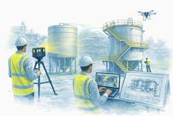
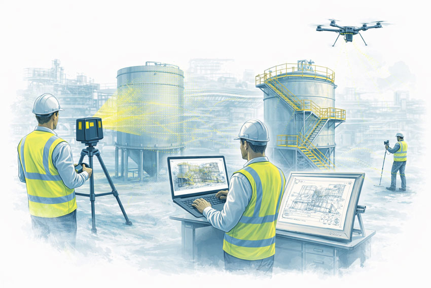
Using high-accuracy 3D laser scanning, site conditions are recorded in full context: structure, equipment, services, clearances, and access constraints. This is not about producing pretty visualsโ€”it is about creating a measurable, defensible digital reference that engineers can trust.

Unlike traditional measurement methods, laser scanning:

  • Captures millions of data points per second
  • Records geometry that is difficult or unsafe to measure manually
  • Preserves site information long after access windows close
  • Eliminates reliance on assumptions and partial measurements

For engineering teams, this changes the starting point of the project from โ€œwhat we think is thereโ€ to โ€œwhat we know is there.โ€


Why the FARO Focus S70 fits Hamilton By Designโ€™s workflow

4

Hamilton By Design uses the FARO Focus S70 laser scanner because it strikes the right balance between accuracy, portability, and ease of useโ€”qualities that matter in live industrial environments.

The Focus S70 is particularly well suited to:

  • Brownfield industrial sites
  • Mining and materials-handling plants
  • Buildings with tight access or active operations
  • Remote locations where speed and reliability matter

From a practical engineering perspective, its ease of deployment is critical. Scans can be completed quickly, often without disrupting operations, and without the need for complex setup or prolonged site occupation. This means:

  • Shorter site visits
  • Reduced exposure to operational risk
  • More flexibility around shutdown or access windows

Just as importantly, the data produced is clean, consistent, and immediately usable within downstream engineering workflows.

At Hamilton By Design, scanning is not outsourced or treated as a separate discipline. The same engineers who design the solution are involved in planning the scan, understanding what information matters, and verifying that the captured data is fit for purpose.

This engineer-led approach is one of the quiet but critical advantages that underpins project success.


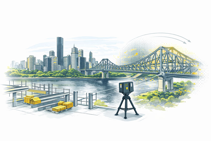
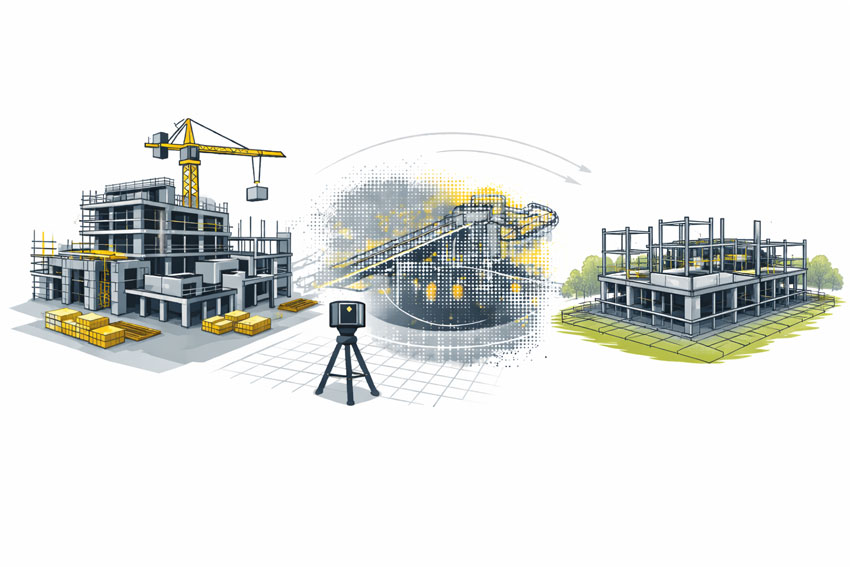
Turning point clouds into engineering intelligence

Raw point clouds are powerfulโ€”but only if they are translated into meaningful engineering information.

This is where Hamilton By Designโ€™s use of SolidWorks becomes central to our workflow.

SolidWorks provides a flexible, parametric modelling environment that allows scanned data to be transformed into:

  • Accurate 3D mechanical models
  • Structural steel frameworks
  • Equipment layouts
  • Platforms, guards, chutes, and pipework
  • Assemblies designed specifically for fabrication and installation

By importing and referencing point clouds directly within SolidWorks, engineers are no longer designing in isolation. Every model is built in context, anchored to the real geometry of the site.

This approach delivers several key advantages:

  • Components fit the first time
  • Clearances are verified early
  • Interfaces with existing assets are fully understood
  • Installation sequencing can be considered during design

Rather than working around uncertainty, engineers are free to focus on optimisation, constructability, and safety.


SolidWorks as a collaboration platform, not just a design tool

One of the most underestimated strengths of SolidWorks is how well it supports collaboration and communication across project teams.

At Hamilton By Design, SolidWorks models are not treated as internal artefacts. They are shared, reviewed, and used as communication tools.

Through native files, neutral formats, and lightweight viewing options:

  • Fabricators can interrogate geometry before cutting steel
  • Site teams can visualise assemblies before installation
  • Clients can understand scope and interfaces without reading complex drawings
  • Engineers can identify risks long before they appear on site

This transparency dramatically reduces misinterpretation. When everyone is looking at the same modelโ€”derived from the same scanโ€”alignment improves naturally.

The result is fewer RFIs, fewer site surprises, and a smoother transition from design to construction.


Fabrication-ready outcomes, not theoretical models

Hamilton By Design places a strong emphasis on fabrication-ready deliverables.

Because models are developed with manufacturing in mind, downstream drawings are clearer, more consistent, and easier to build from. This includes:

  • Clear general arrangement drawings
  • Detailed part and assembly drawings
  • Logical BOMs aligned to procurement
  • Realistic tolerances based on site conditions

Fabricators appreciate drawings that reflect how things are actually builtโ€”not just how they look on screen. By grounding design in scan data and modelling within SolidWorks, Hamilton By Design produces outputs that align closely with workshop reality.

This reduces rework in the shop and stress during shutdowns, where time pressure is highest.


Technology alone does not deliver project success. The real differentiator is how information is shared.

Hamilton By Design places significant emphasis on making data:

  • Accessible
  • Understandable
  • Reusable

Point clouds, models, drawings, and supporting data are structured so they can be:

  • Revisited for future projects
  • Used by different stakeholders
  • Built upon rather than recreated

This is particularly valuable in long-life industrial assets, where todayโ€™s modification becomes tomorrowโ€™s interface.

By maintaining continuity of data across projects, clients build a digital assetโ€”not just a set of drawings. Over time, this reduces engineering cost, shortens project timelines, and increases confidence in future upgrades.


Ease of use drives adoption and value

One of the reasons the FARO Focus S70 and SolidWorks work so well together is their ease of use relative to the value they deliver.

Ease of use matters because:

  • It shortens learning curves
  • It reduces reliance on niche specialists
  • It allows engineers to stay focused on engineering, not software complexity

At Hamilton By Design, tools are selected not because they are fashionable, but because they support repeatable, reliable outcomes.

Scanning workflows are streamlined. Modelling practices are consistent. File structures are logical. This discipline ensures that projects scale smoothly, whether they involve a small retrofit or a major plant upgrade.


Reducing risk where it matters most

In industrial and mining projects, risk concentrates at interfaces:

  • New steel to old steel
  • New equipment to existing plant
  • Design intent to site execution

Hamilton By Designโ€™s integrated workflow reduces risk at these interfaces by ensuring:

  • Geometry is verified early
  • Interfaces are modelled, not guessed
  • Decisions are made with full context

This approach shifts risk out of the shutdown window and into the design phaseโ€”where it is cheaper and safer to manage.


A philosophy built around accountability

What truly differentiates Hamilton By Design is not just technology, but ownership.

The same team is responsible for:

  • Capturing site data
  • Interpreting it
  • Designing the solution
  • Producing fabrication-ready outputs

There is no fragmentation between disciplines, no handover gaps where responsibility becomes unclear. This single-source accountability builds trust with clients, fabricators, and site teams alike.


The compound effect of doing it right

When accurate data, SolidWorks-based design, and clear information sharing come together, the benefits compound:

  • Fewer site visits
  • Shorter design cycles
  • More confident fabrication
  • Smoother installations
  • Better long-term asset knowledge

Over time, this approach changes how projects are delivered. Engineering becomes proactive rather than reactive. Problems are solved digitally instead of on site. Teams collaborate instead of firefighting.


Engineering for real-world success

Hamilton By Designโ€™s workflow is not built around theory. It is built around what actually happens on site.

By grounding every project in reality through laser scanning, translating that reality into SolidWorks models, and sharing information clearly across all stakeholders, Hamilton By Design helps projects succeed where it matters most: in fabrication shops, during shutdowns, and on live sites.

In an industry where uncertainty is expensive and time is unforgiving, clarity becomes the most valuable engineering output of all.

That is the philosophy behind Hamilton By Designโ€”and the reason our approach continues to deliver consistent, practical success across complex engineering projects.

Hamilton By Design logo displayed on a blue tilted rectangle with a grey gradient background

Our Clients:

Name
Would you like us to arrange a phone consultation for you?
Address

3D Scanning Engineering in Broken Hill

3D Scanning Engineering in Broken Hill

Broken Hill is unlike any other engineering environment in Australia. Shaped by one of the worldโ€™s most significant ore bodies, the cityโ€™s infrastructure has evolved over more than a century of continuous mining. Much of what exists today is layered, modified, and adapted over time, creating complex brownfield conditions where original drawings are often incomplete or no longer reflect reality.

Engineering in Broken Hill is therefore highly practical, conservative, and focused on working with what already exists. This is where accurate site data and engineer-led digital workflows become essential.

Hamilton By Design supports projects in Broken Hill by combining 3D LiDAR laser scanning, mechanical and structural engineering, 3D CAD modelling, FEA, and fabrication-ready draftingโ€”helping asset owners and project teams design upgrades that fit first time.

Engineering challenges unique to Broken Hill

Broken Hill engineering is dominated by:

  • Very old and continuously modified infrastructure
  • Underground and surface assets built to historic standards
  • Extreme heat, dust, and isolation
  • Limited tolerance for rework due to logistics and access

In this environment, assumptions are risky. Accurate as-built information is critical before any design, fabrication, or installation begins.

3D Laser Scanning for Broken Hill sites

Hamilton By Design uses high-accuracy 3D Laser Scanning to capture the true as-built condition of mining and industrial assets in and around Broken Hill.

3D laser scanning is particularly valuable for:

  • Brownfield mining infrastructure
  • Historic plant and structural steel
  • Underground and surface interfaces
  • Assets where drawings are outdated or missing

Scanning is completed during controlled site visits, minimising disruption while capturing comprehensive data that can be relied on throughout the project lifecycle.

Turning scan data into practical engineering models

Once scanning is complete, data is transferred off site for processing and engineering. Hamilton By Design converts point cloud data into accurate 3D CAD Modelling that reflects what actually existsโ€”not what drawings suggest should exist.

These models support:

  • Mechanical upgrades and equipment replacements
  • Structural strengthening and retrofits
  • Platforms, access ways, and support steel
  • Integration of new assets into constrained spaces

For Broken Hill projects, this scan-to-model approach significantly reduces uncertainty and design risk.

Mechanical and structural engineering built on reality

Engineering in Broken Hill often involves integrating modern systems into historic assets. Working from scan-derived models allows engineers to:

  • Understand existing load paths and constraints
  • Check clearances and access early
  • Coordinate mechanical and structural elements in one environment

This leads to designs that are practical, buildable, and aligned with site realities rather than idealised assumptions.

FEA to support safety and compliance

Where performance, safety, or compliance is critical, Hamilton By Design applies FEA Capabilities to verify designs.

Finite Element Analysis is commonly used to:

  • Check structural capacity of existing assets
  • Assess modifications to aged steel and supports
  • Review fatigue, vibration, and deflection
  • Support engineering approval and sign-off

Using FEA on scan-based geometry provides confidence that designs will perform as intended in real operating conditions.

Easy-to-build fabrication drawings with engineering approval

Clear documentation is essential for successful delivery in remote locations like Broken Hill. Hamilton By Design produces fabrication-ready Drafting directly from coordinated 3D models.

Typical deliverables include:

  • General arrangement and detail drawings
  • Fabrication and installation drawings
  • Engineering-reviewed and approval-ready documentation

This focus on clarity and constructability helps fabricators and site teams build accurately, safely, and efficientlyโ€”often with limited opportunity for rework.

Reducing site risk through digital engineering

By capturing site conditions once and completing the majority of engineering off site, projects benefit from:

  • Fewer site visits and lower travel costs
  • Reduced safety exposure
  • Better coordination before fabrication
  • Higher confidence during installation

For Broken Hill, where logistics and access matter, this approach delivers measurable value.

Engineering outcomes that respect history and reality

Broken Hill is a place where past and present engineering coexist. Hamilton By Designโ€™s integrated scanning and engineering workflow helps bridge that gapโ€”respecting historic infrastructure while delivering modern, compliant, and buildable solutions.

3D Scanning Engineering in Broken Hill is about using accurate data, sound engineering judgement, and practical documentation to deliver upgrades that work the first time.

Hamilton By Design logo displayed on a blue tilted rectangle with a grey gradient background

Our Clients:

Name
Would you like us to arrange a phone consultation for you?
Address

3D Laser Scanning

3D LiDAR Scanning โ€“ Digital Quality Assurance

As-Built Drawings from a LiDAR Scanner

3D LiDAR Scanning and 3D Modelling – Hamilton By Design

3D Scanning Engineering in Katherine

3D Scanning Engineering in Katherine

Delivering Precision Laser Scanning, Engineering, 3D Modelling & Drafting for the Northern Territory

Katherine is one of the Northern Territoryโ€™s most strategically important regional centres โ€” a crossroads between mining operations, defence activity, agricultural production, remote-area logistics and critical transport routes stretching across northern Australia. Its unique mix of rugged landscapes, flood-influenced terrain, ageing infrastructure and rapidly evolving industrial needs means projects here must be planned with accuracy, resilience and efficiency.

Hamilton By Design supports clients across Katherine and the broader NT by providing 3D LiDAR laser scanning, mechanical and structural engineering, 3D CAD modelling, and fabrication-ready drafting โ€” an end-to-end digital engineering workflow built for remote, high-demand and complex environments.

Whether you are upgrading plant equipment, expanding a depot, documenting as-built assets, or planning remote-area infrastructure works, our engineering-led scanning approach gives you clarity, certainty and confidence.


Why Katherine Is a Unique Engineering Environment

Katherine stands apart due to several defining characteristics:

1. Gateway to Major Mining & Resource Regions

Operations in the Big Rivers region, remote NT mining projects, and transport corridors rely on accurate infrastructure planning and maintenance. Many sites require brownfield upgrades, alignment checks, structural assessments and digital documentation โ€” all supported by LiDAR and 3D modelling.

2. Defence Presence and Strategic Infrastructure

RAAF Base Tindal and associated facilities create continual demand for compliant, precise, and well-documented engineering works. Laser scanning is vital for site upgrades, retrofits, and high-security facility documentation.

3. Flood-Prone and Geographically Complex Terrain

Katherineโ€™s unique landscape โ€” including floodplains, waterways, and uneven terrain โ€” makes traditional surveying difficult and risky. 3D scanning captures real-world geometry safely and with millimetre accuracy.

4. Remote-Area Logistics, Agriculture & Transport Hubs

From agricultural processing to transport depots and maintenance facilities, Katherine relies on accurate digital design to minimise downtime and prevent costly construction errors.

These factors make digital engineering, LiDAR scanning, and precision drafting essential for successful project delivery.


3D LiDAR Laser Scanning for Katherine Projects

Hamilton By Design uses engineering-grade 3D LiDAR scanners to capture complete as-built site data, delivering unmatched accuracy for planning, upgrades and fabrication.

Our scanning captures:

  • structural steel, platforms, walkways and frames
  • mechanical equipment layouts and tie-in points
  • pipework, tanks, conveyors, pumps and processing equipment
  • buildings, depots, workshops and remote facility layouts
  • terrain, drainage paths, access roads and outdoor assets

This level of detail dramatically reduces risk, improves communication between contractors, and enables precise design outcomes.

Learn more:
3D Laser Scanning


3D CAD Modelling โ€” Turning Scans Into Smart Engineering Models

Once scanned, our team converts the point cloud into intelligent CAD models that allow clients in Katherine to design, plan and fabricate with total confidence.

Our modelling supports:

  • mechanical systems (pumps, conveyors, screens, chutes)
  • structural frameworks, footings, platforms and access ways
  • equipment replacement studies and upgrade layouts
  • GA drawings, detailed fabrication drawings and isometrics
  • clash detection and layout optimisation before fabrication

See our modelling capability:
3D CAD Modelling

This digital foundation is especially valuable in remote NT locations where rework, delays and inaccurate measurements are costly.


Engineering & FEA Capability for Katherineโ€™s Industries

Our mechanical and structural engineering services cover everything from feasibility assessments to detailed verification.

We offer:

  • structural integrity assessments
  • mechanical design for processing and handling systems
  • vibration, fatigue and load assessments
  • pressure vessel, piping and equipment support analysis
  • multi-body assemblies and operational load modelling

For advanced validation, our Finite Element Analysis (FEA) capabilities allow us to simulate stresses, heat transfer, vibration, buckling and more โ€” ensuring the final design meets compliance, safety and performance standards.

Explore FEA capabilities:
FEA Capabilities


Drafting Services โ€” Fabrication-Ready Documentation

Hamilton By Design produces clear, accurate engineering drawings that support fabrication, installation and QA requirements.

Our drafting services include:

  • fabrication drawings
  • structural detailing
  • mechanical layouts
  • piping isometrics
  • BOMs and material schedules
  • as-built drawing production from LiDAR scans

View our drafting services:
Drafting

This ensures Katherine workshops, fabricators and contractors can build efficiently and confidently โ€” with no need for guesswork on site.


Why Hamilton By Design Is the Right Fit for Katherine

  • Engineer-led scanning, ensuring accuracy suitable for real engineering and fabrication
  • Fast mobilisation across the NT, Queensland and remote locations
  • Experience with mining, defence, industrial and infrastructure projects
  • A single-source workflow โ€” scan โ†’ model โ†’ engineer โ†’ draft
  • Reduced rework, downtime and installation delays

Whether youโ€™re maintaining infrastructure, upgrading equipment, or planning new facilities in Katherine, Hamilton By Design delivers clarity, precision and reliability at every stage.

Name
Would you like us to arrange a phone consultation for you?
Address