AS ISO 5725 and 3D LiDAR Scanning

Why Accuracy, Precision, and Calibration Matter for Engineering Outcomes

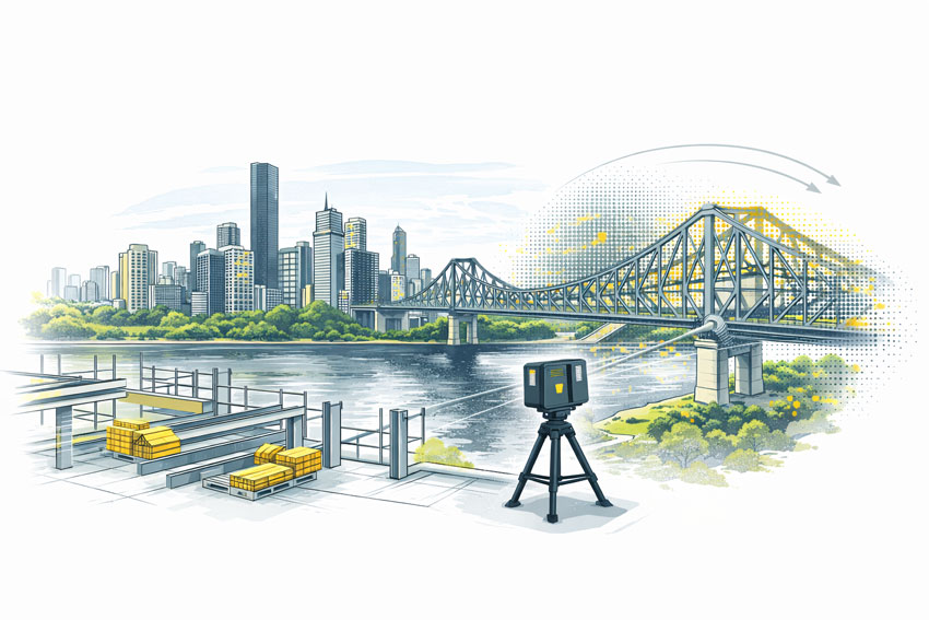
When 3D LiDAR scanning is used for engineering, fabrication, or certification, the most important question is not how detailed the point cloud looks, but whether the measurements can be trusted.

This is where AS ISO 5725 โ€” Accuracy and Precision of Measurement becomes relevant. While AS ISO 5725 is not written specifically for LiDAR scanners, it defines the principles that determine whether any measurement system is suitable for engineering use.

In practical terms, AS ISO 5725 separates data that can support engineering decisions from data that is visually convincing but technically unreliable.


Comparison of calibrated and uncalibrated 3D LiDAR scanning, showing a calibrated scanner with aligned point cloud and steel frame geometry, and an uncalibrated scanner with visibly misaligned measurement data

What AS ISO 5725 Covers

AS ISO 5725 defines how measurement systems should be evaluated in terms of:

  • Accuracy
  • Precision
  • Repeatability
  • Reproducibility
  • Measurement uncertainty

These principles apply directly to 3D LiDAR scanning because a LiDAR scanner is, at its core, a measurement instrument. When scanning data is used to inform design, fabrication, or certification, the expectations set by AS ISO 5725 apply regardless of scanner brand or software.

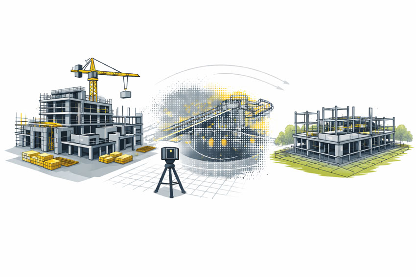
This is why engineering-grade 3D LiDAR scanning requires more than simply capturing a dense point cloud. It requires controlled measurement, understood uncertainty, and validated outputs, as delivered through engineering-grade 3D laser scanning workflows:
https://www.hamiltonbydesign.com.au/home/engineering-services/3d-laser-scanning/


Accuracy vs Precision in LiDAR Scanning

AS ISO 5725 makes a clear distinction between accuracy and precision, a distinction that is often misunderstood in reality capture.

Accuracy describes how close a measurement is to the true value.
Precision describes how consistently the same measurement can be repeated.

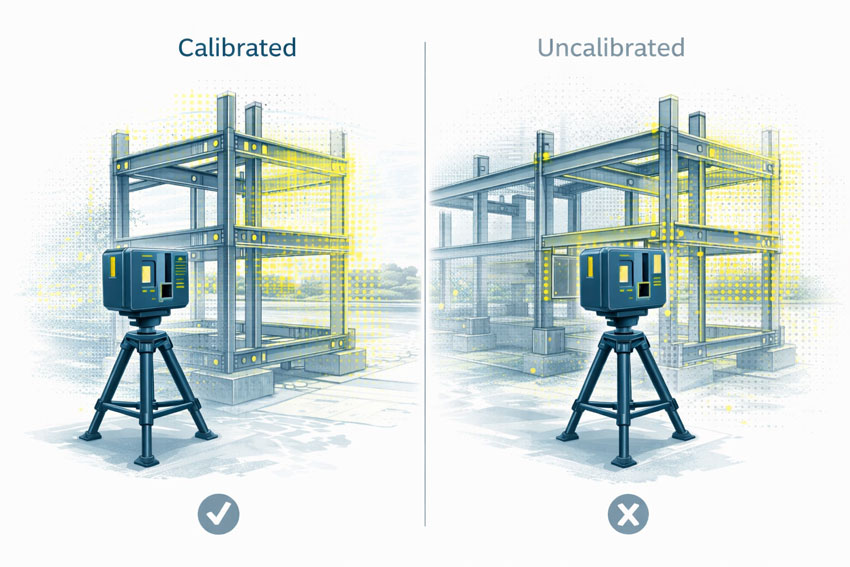
A LiDAR scan can appear highly precise, with clean and consistent geometry, while still being inaccurate if the scanner is miscalibrated or poorly controlled. In engineering terms, repeatable errors are still errors.

For engineering and fabrication, both accuracy and precision are required.


The Role of Calibration

Calibration ensures that a scannerโ€™s distance and angular measurements align with known reference values. Without calibration, a LiDAR scanner may still operate normally and still produce visually impressive results, but the measurements no longer have a known or defensible level of uncertainty.

Calibration directly affects:

  • Distance measurement
  • Angular accuracy
  • Alignment between internal sensors
  • Registration between multiple scans

AS ISO 5725 does not prescribe how calibration must be performed, but it does establish the expectation that measurement uncertainty is understood and controlled.


What Happens When Scanning Is Not Calibrated

When LiDAR scanning is not properly calibrated or verified, errors propagate into every downstream deliverable.

Common outcomes include:

  • Fabricated steelwork that does not fit on site
  • Bolt holes and connection points outside tolerance
  • Frames requiring on-site modification or rework
  • Assumed clearances that do not exist in reality
  • Delays or challenges during engineering sign-off

These issues are often discovered late in a project, where the cost of correction is highest. The root cause is frequently measurement error introduced at the scanning stage, not fabrication quality.

This is particularly critical in design-for-fabrication workflows, where scanning data is used to develop fabrication-ready designs:
https://www.hamiltonbydesign.com.au/fabrication-product-design/


The Compounding Effect of Small Errors

One of the most significant risks in unverified scanning workflows is that errors are often small enough to go unnoticed early.

A few millimetres of error at the scanning stage can compound into much larger discrepancies once geometry is modelled, detailed, and fabricated. Across multiple interfaces, these small deviations can lead to misalignment, rework, or compromised installation quality.

For fit-first-time fabrication, this risk is unacceptable.


Illustrated comparison of ISO 19650 BIM information management, showing an organised digital model with structured data on one side and a disorganised model with fragmented documentation on the other.

Engineering Responsibility and Certification Risk

When LiDAR data is used to support engineering decisions, responsibility does not sit with the scanner or the software. It sits with the engineer relying on the data.

If measurements cannot be demonstrated as accurate, repeatable, and appropriately controlled, they are not suitable to support engineering sign-off. This is particularly relevant where scanning data contributes to certification outcomes, where accountability and defensibility are essential.

Engineering certification must be based on verified measurements, supported by controlled data capture and documented processes:
https://www.hamiltonbydesign.com.au/home/engineering-services/engineering-certification/


Why AS ISO 5725 Matters in Practice

AS ISO 5725 is not about paperwork or compliance for its own sake. It provides the framework that ensures measurement data used for engineering decisions is fit for purpose.

When LiDAR scanning is undertaken with accuracy, precision, and calibration treated seriously, it becomes a powerful engineering tool. When these principles are ignored, scanning becomes a source of hidden risk that only emerges when it is too late to correct cheaply.


Hamilton By Design logo displayed on a blue tilted rectangle with a grey gradient background

Final Thought

3D LiDAR scanning is only as reliable as the measurement discipline behind it.

AS ISO 5725 provides the foundation for understanding whether scanning data can be trusted. In engineering, fabrication, and certification contexts, that trust is not optional โ€” it is essential.


Structural drafting services button
Building and construction services button
Mechanical drafting services button

Our clients:

Name
Would you like us to arrange a phone consultation for you?
Address

3D Construction Scan in Brisbane

Engineering-Grade Reality Capture for Live Construction Environments

Construction projects in Brisbane operate under conditions that place unique pressure on engineers, builders, and asset owners. Subtropical climate, flood-affected sites, reactive soils, dense CBD logistics, and a strong reliance on brownfield upgrades all increase one fundamental risk: designing and constructing from incorrect or outdated site information.

A 3D construction scan in Brisbane provides engineering-grade certainty by capturing what actually exists on site, enabling informed decisions during live construction, refurbishment, and staged delivery projects.


3D construction scanning in Brisbane using a FARO laser scanner at a building site overlooking the Story Bridge and Brisbane River

What Is a 3D Construction Scan?

A 3D construction scan uses high-accuracy LiDAR laser scanning to capture the true as-built condition of a site at a specific point in time. Unlike visual scans or phone-based capture, engineering-grade scanning produces registered point clouds that can be trusted for:

  • Construction coordination
  • Design verification
  • Clash detection
  • Fabrication-ready modelling
  • As-built documentation

Hamilton By Design delivers these outcomes through its engineering-led laser scanning services, where accuracy, downstream use, and construction risk are defined before scanning begins.


https://www.hamiltonbydesign.com.au/laser-scanning-engineering-brisbane-cbd/3d-scanning-brisbane/


Why Brisbane Construction Projects Require a Different Approach

Subtropical Climate & Structural Movement

Brisbaneโ€™s humidity and temperature cycles contribute to thermal expansion, contraction, and cumulative movement across steelwork, pipe runs, conveyors, faรงades, and plant installations.

When construction decisions rely on assumed geometry or legacy drawings, even small movements can result in:

  • Misaligned interfaces
  • Fabrication clashes
  • Installation delays

A 3D construction scan captures the current, in-situ geometry, allowing engineers to design and coordinate based on reality โ€” not historical intent.

Flood-Affected & Modified Assets

Many Brisbane sites โ€” particularly river-adjacent commercial and industrial facilities โ€” have undergone multiple flood recovery and modification cycles. Over time, this results in:

  • Changed floor levels
  • Unrecorded ramps and bunds
  • Altered drainage and gravity-dependent systems

Construction scanning establishes a true datum and elevation baseline, supporting engineering verification of falls, access clearances, and tie-in points.

This capability aligns directly with Hamilton By Designโ€™s broader reality capture and as-built verification workflows.


https://www.hamiltonbydesign.com.au/reality-capture-services/


Brownfield Construction Is the Norm

A significant proportion of Brisbane construction work occurs in live, operational environments, including:

  • Commercial refurbishments
  • Industrial plant upgrades
  • Infrastructure modifications
  • Asset life-extension projects

These sites often contain undocumented steelwork, legacy penetrations, and accumulated modifications. A 3D construction scan enables non-intrusive capture of this complexity, supporting engineering coordination without disrupting operations.

Tight CBD Logistics & Vertical Construction

Brisbaneโ€™s CBD presents unique logistical challenges:

  • Limited laydown space
  • Vertical risers and congested services zones
  • Restricted crane and hoist access
  • Staged installation sequencing

In these environments, components must fit first time. Construction scanning supports:

  • Early clash detection
  • Verification before fabrication
  • Confident off-site prefabrication

This process integrates directly with Hamilton By Designโ€™s 3D point cloud modelling and coordination services.

https://www.hamiltonbydesign.com.au/3d-point-cloud-modelling/

Reactive Soils & Differential Settlement

Reactive clay soils common throughout South-East Queensland contribute to long-term differential settlement, particularly where new construction interfaces with older structures. Over time, this can lead to:

  • Misaligned columns and beams
  • Drift in conveyors and pipe racks
  • Geometry that no longer matches design intent

A construction scan captures current condition, enabling engineers to design extensions and upgrades that reflect actual site geometry.


Construction Scanning vs Generic 3D Scanning

Not all scanning is suitable for construction engineering.

AspectGeneric ScanEngineering-Led Construction Scan
AccuracyVisual or indicativeMillimetre-grade
OutputMeshes or imagesRegistered point clouds
Engineering UseLimitedDesign & fabrication
Risk ReductionLowHigh
Construction ReadyNoYes

Hamilton By Design positions construction scanning as part of an integrated engineering workflow, not a standalone data capture exercise.


https://www.hamiltonbydesign.com.au/3d-engineering-services/


How 3D Construction Scans Are Used on Brisbane Projects

Engineering-grade construction scans are routinely used to support:

  • Clash detection across structure and services
  • Verification scans prior to fabrication
  • Construction sequencing and staging
  • As-built documentation for handover
  • Reduced RFIs, rework, and site delays

These outcomes are particularly valuable on commercial and construction projects where access, timing, and accuracy are critical.


https://www.hamiltonbydesign.com.au/commercial-construction-engineering/


3D laser scanning of a commercial building under construction showing as-built capture and coordination before wall closure

The Hamilton By Design Difference

Hamilton By Design delivers engineering-grade 3D construction scanning with a clear focus on constructability and downstream use.

Our approach combines:

  • Engineer-led scanning strategies
  • Defined accuracy requirements
  • Integration with mechanical and structural design
  • Outputs suitable for fabrication and installation

This approach ensures construction teams can rely on scan data with confidence โ€” especially on complex Brisbane projects.


When should a 3D Construction Scan Be Used?

A 3D construction scan in Brisbane is most valuable when:

  • Working in brownfield or live environments
  • Verifying conditions before fabrication
  • Coordinating multiple trades in tight spaces
  • Managing staged refurbishments
  • Reducing construction risk and uncertainty

Hamilton By Design logo displayed on a blue tilted rectangle with a grey gradient background

In Brisbane, construction risk is rarely driven by poor engineering.
It is driven by decisions made using incorrect or outdated information.

A 3D Construction Scan in Brisbane provides one critical advantage:
certainty about what actually exists on site, at the moment decisions are made.

Finite Element Analysis (FEA) engineering simulation button
3D LiDAR scanning and 3D modelling services button
Building and construction services button

Our clients:

Name
Would you like us to arrange a phone consultation for you?
Address

Engineering Confidence in South Yarra, Melbourne

LiDAR scanning Melbourne

Melbourne has long been recognised as one of Australiaโ€™s most advanced engineering and manufacturing centres, and inner-city hubs such as South Yarra sit at the intersection of design, industry, infrastructure, and innovation. As projects become more complex and timelines more compressed, engineering teams are increasingly seeking partners who can reduce uncertainty, improve accuracy, and provide reliable technical insight from day one.

This is where Hamilton By Design delivers genuine value.

Hamilton By Design operates as an engineer-led consultancy focused on precision, constructability, and real-world outcomes. Rather than working from assumptions or incomplete information, the business is built around capturing existing conditions accurately and transforming that data into practical engineering deliverables that support confident decision-making.

Moving Beyond Assumptions in Modern Engineering

Many engineering challenges in metropolitan Melbourne are not greenfield projects. They involve existing buildings, operating facilities, constrained spaces, legacy assets, or staged upgrades that must integrate seamlessly with what is already in place. In these environments, relying on outdated drawings or manual measurements introduces risk โ€” misalignment, clashes, rework, and delays that can quickly erode budgets and schedules.

Hamilton By Design addresses this challenge by placing reality capture and engineering validation at the front end of projects. This ensures that every downstream decision is based on what truly exists on site, not what is assumed to exist.

For engineering teams working in and around South Yarra โ€” whether supporting manufacturing, infrastructure, plant upgrades, or specialist facilities โ€” this approach significantly reduces technical risk and increases confidence across all stakeholders.

LiDAR Scanning as a Foundation for Accuracy

A key capability that differentiates Hamilton By Design is its use of engineering-grade LiDAR scanning. Unlike traditional surveys that capture selective points, LiDAR scanning records millions of measurements across an entire environment, producing a high-resolution digital representation of buildings, plant, structures, and surrounding context.

This data becomes a reliable reference point for engineers, designers, fabricators, and project managers alike.

LiDAR scanning enables:

  • Accurate capture of complex geometries and tight spaces
  • Clear identification of spatial constraints and interfaces
  • Early detection of clashes and access issues
  • Reduced need for repeat site visits
  • Improved coordination between disciplines

By converting physical assets into precise digital data, Hamilton By Design helps teams eliminate ambiguity and work from a single source of truth.

From Scan Data to Engineering Outcomes

Importantly, Hamilton By Design does not operate as a scanning-only service. The real value lies in how scan data is interpreted, validated, and converted into engineering outputs that directly support delivery.

Scan information is used to develop structured models, layouts, and documentation that reflect real-world conditions. This supports engineering activities such as:

  • Mechanical and structural modifications
  • Plant upgrades and equipment integration
  • Space planning and layout optimisation
  • Fabrication and installation planning
  • Asset documentation and as-built records

Because the work is led by experienced engineers, the focus is always on what needs to be built, installed, or modified, not just on creating visually impressive models.

Supporting Engineering Teams and Decision-Makers

In a business and engineering environment like South Yarra โ€” where projects are often time-sensitive and commercially driven โ€” external engineering support must be reliable, efficient, and technically sound.

Hamilton By Design integrates smoothly with internal teams, consultants, and contractors, providing additional technical depth without adding unnecessary complexity. The consultancy model is deliberately structured to support decision-makers who need clarity, not noise.

This means:

  • Clear communication of constraints and risks
  • Practical recommendations grounded in real site data
  • Deliverables aligned with fabrication and construction needs
  • Engineering documentation that supports approval and execution

The result is fewer surprises downstream and a smoother path from concept through to implementation.

Engineering for Brownfield and Live Environments

One of the most challenging aspects of modern engineering is working within live or brownfield environments โ€” facilities that cannot simply shut down for measurement, redesign, or rework. In these settings, accuracy and planning are critical.

Hamilton By Designโ€™s LiDAR-driven workflows are particularly well suited to these conditions. Rapid data capture minimises disruption on site, while the detailed digital record allows engineering work to continue remotely with confidence.

This approach supports safer planning, better coordination, and reduced exposure to operational risk โ€” outcomes that are highly valued by engineering leaders and project managers alike.

A Practical, Engineer-Led Philosophy

At its core, Hamilton By Design operates on a simple but powerful principle: engineering should be grounded in reality. By combining high-accuracy site data with deep engineering experience, the consultancy helps organisations make informed decisions, avoid costly mistakes, and deliver projects that work the first time.

For organisations operating in South Yarra and the broader Melbourne region, this means access to an engineering partner who understands both the technical and commercial pressures of modern project delivery.

Engineering Certainty in a Complex World

As engineering projects continue to increase in complexity, the margin for error continues to shrink. Those who invest early in accurate data and sound engineering judgement gain a clear advantage โ€” fewer delays, lower risk, and better outcomes.

Hamilton By Design provides that advantage by bridging the gap between the physical site and the engineering office. Through precise LiDAR scanning, practical engineering insight, and a strong focus on constructability, the consultancy supports confident, efficient, and reliable project delivery across Melbourneโ€™s most demanding environments.

LiDAR scanning Melbourne

Hamilton By Design logo displayed on a blue tilted rectangle with a grey gradient background

Our clients:

Name
Would you like us to arrange a phone consultation for you?
Address

3D Scanning Engineering in Orange

3D Scanning Engineering in Orange

Orange is one of Australiaโ€™s most distinctive regional cities. Set high on the Central Tablelands, it combines a cool-climate environment with major health, education, agriculture, infrastructure, and mining-services activity. Engineering in Orange is shaped by altitude, frost, diverse industries, and a mix of modern and legacy assetsโ€”making accuracy, coordination, and practical design essential.

Hamilton By Design supports projects in and around Orange by combining 3D LiDAR laser scanning, mechanical and structural engineering, 3D CAD modelling, FEA, and fabrication-ready drafting. Our approach focuses on capturing real site conditions and turning them into buildable, engineering-approved outcomes.

Engineering challenges in a high-altitude regional city

Unlike many inland centres, Orangeโ€™s elevation brings colder temperatures, frost, and greater thermal movement. At the same time, the city supports critical assets such as hospitals, utilities, agricultural processing facilities, and infrastructure that must remain operational.

Engineering teams commonly deal with:

  • Brownfield sites with assets added over decades
  • Incomplete or outdated drawings
  • Tight staging requirements around live facilities
  • A need for conservative, reliable design

In this environment, assumptions introduce risk. Accurate as-built data is the foundation of successful projects.

3D Laser Scanning for Orange projects

Hamilton By Design uses high-accuracy 3D Laser Scanning to capture the true as-built condition of sites across Orange and the Central Tablelands. Laser scanning records millions of precise measurements, creating a detailed digital record of buildings, plant, structures, and surrounding interfaces.

3D laser scanning is particularly valuable in Orange for:

  • Health, education, and public infrastructure upgrades
  • Industrial and agricultural processing facilities
  • Mining-support and utilities assets
  • Sites where drawings no longer reflect reality

Scanning is typically completed during short, controlled site visits, minimising disruption while delivering data that can be relied on throughout the project.

Turning scan data into accurate 3D models

Once scanning is complete, the data is processed and converted into detailed 3D CAD Modelling. These models represent what actually exists on siteโ€”not what historic documentation suggests.

For Orange projects, scan-based 3D modelling supports:

  • Mechanical upgrades and equipment replacements
  • Structural additions such as platforms, supports, and access ways
  • Integration of new assets into existing facilities
  • Long-term digital records for future maintenance and expansion

Accurate models reduce uncertainty and allow design decisions to be made early and with confidence.

Mechanical and structural engineering built on real conditions

Engineering in Orange often involves coordinating multiple disciplines across constrained or operational sites. Working from scan-derived models allows engineers to:

  • Understand existing load paths and constraints
  • Check clearances and access early in the design
  • Coordinate mechanical and structural elements in a single environment

This leads to designs that are practical, buildable, and aligned with how assets are actually usedโ€”particularly important in a climate-affected region.

FEA to support performance and compliance

Where performance, safety, or compliance is critical, Hamilton By Design applies FEA Capabilities to support engineering decisions.

Finite Element Analysis is commonly used to:

  • Check structural capacity under operational and environmental loads
  • Assess modifications to existing steel and concrete
  • Review fatigue, vibration, and deflection
  • Support engineering approval and sign-off

Using FEA on scan-based geometry provides confidence that designs will perform as intended in real operating conditions.

Easy-to-build fabrication drawings with engineering approval

Clear documentation is essential for efficient constructionโ€”particularly in regional locations where rework can be costly. Hamilton By Design produces fabrication-ready Drafting directly from coordinated 3D models.

Typical deliverables include:

  • General arrangement and detail drawings
  • Fabrication and installation drawings
  • Engineering-reviewed and approval-ready documentation

This focus on clarity and constructability helps fabricators and contractors build accurately the first time.

Reducing risk through digital engineering

By capturing site conditions once and completing the majority of engineering off site, projects in Orange benefit from:

  • Reduced site visits and travel costs
  • Improved safety outcomes
  • Better coordination before fabrication
  • Fewer surprises during installation

This approach aligns well with Orangeโ€™s role as a regional hub supporting diverse industries across central NSW.

Hamilton By Design logo displayed on a blue tilted rectangle with a grey gradient background

Supporting Orange with practical, buildable engineering

Orangeโ€™s strength lies in its balanceโ€”health, agriculture, infrastructure, mining services, and community all intersect here. Hamilton By Designโ€™s integrated scanning and engineering workflow supports this complexity by delivering accurate data, sound engineering judgement, and clear documentation.

3D Scanning Engineering in Orange is about turning real-world site conditions into clear, buildable engineering outcomes that support growth, reliability, and long-term performance across the region.


Our clients:

Name
Would you like us to arrange a phone consultation for you?
Address

3D Scanning Engineering in Dubbo

3D Scanning Engineering in Dubbo

Dubbo is one of Australiaโ€™s most important inland cities. Often described as the capital of western New South Wales, it supports a vast region spanning agriculture, mining, infrastructure, health, education, and logistics. Unlike towns defined by a single industry, Dubboโ€™s strength lies in its diversity and its role as a regional engineering and services hub.

Engineering projects in and around Dubbo range from industrial facilities and infrastructure upgrades to mining support, utilities, and large-scale agricultural assets. Many of these projects involve brownfield conditions, legacy infrastructure, and tight delivery timelinesโ€”making accurate site data and practical engineering essential.

Hamilton By Design supports Dubbo projects with engineer-led 3D LiDAR laser scanning, mechanical and structural engineering, 3D CAD modelling, FEA, and fabrication-ready drafting. Our workflow is focused on accuracy, constructability, and delivering designs that work first time.

Engineering challenges in a regional hub like Dubbo

As a regional centre, Dubbo supports assets spread across a wide geographic area. Engineering teams often deal with:

  • Existing infrastructure that has been extended or modified over time
  • Limited or outdated drawings
  • Projects that must be delivered efficiently to minimise disruption
  • Assets that serve agriculture, mining, transport, and public infrastructure

In these environments, assumptions create risk. Reliable as-built information is critical before design, fabrication, or construction begins.

3D Laser Scanning for Dubbo projects

Hamilton By Design uses high-accuracy 3D Laser Scanning to capture the true as-built condition of sites in and around Dubbo. Laser scanning records millions of precise measurements, creating a detailed digital record of buildings, plant, structures, and surrounding interfaces.

3D laser scanning is particularly valuable for:

  • Brownfield industrial and infrastructure sites
  • Agricultural and processing facilities
  • Mining and quarry support assets
  • Projects where drawings no longer reflect site reality

Scanning is typically completed during short, controlled site visits, minimising disruption while providing data that can be relied on throughout the project.

From scan data to accurate 3D models

Once scanning is complete, the data is processed and converted into detailed 3D CAD Modelling. These models represent what actually exists on site, rather than what historic documentation suggests.

For Dubbo-based and regional projects, scan-based 3D modelling supports:

  • Mechanical upgrades and equipment replacements
  • Structural additions such as platforms, supports, and access ways
  • Integration of new assets into existing facilities
  • Long-term digital records for future maintenance and expansion

Accurate models reduce uncertainty and help project teams make informed decisions early.

Mechanical and structural engineering built on real conditions

Dubboโ€™s engineering projects often involve coordinating multiple disciplines across constrained or operational sites. Working from scan-derived models allows engineers to:

  • Understand existing load paths and constraints
  • Check clearances and access early in the design
  • Coordinate mechanical and structural elements within one environment

This leads to designs that are practical, buildable, and aligned with how assets are actually used.

FEA to support performance and compliance

Where performance, safety, or compliance is critical, Hamilton By Design applies FEA Capabilities to support engineering decisions.

Finite Element Analysis is commonly used to:

  • Check structural capacity under operational loads
  • Assess modifications to existing steel and concrete
  • Review fatigue, vibration, and deflection
  • Support engineering approval and sign-off

Using FEA on scan-based geometry gives confidence that designs will perform as intended in real operating conditions.

Easy-to-build fabrication drawings with engineering approval

Clear documentation is essential for successful deliveryโ€”particularly in regional locations where rework can be costly. Hamilton By Design produces fabrication-ready Drafting directly from coordinated 3D models.

Typical deliverables include:

  • General arrangement and detail drawings
  • Fabrication and installation drawings
  • Engineering-reviewed and approval-ready documentation

This focus on clarity and constructability helps fabricators and contractors build efficiently and accurately the first time.

Reducing risk through digital engineering

By capturing site conditions once and completing the majority of engineering off site, Dubbo projects benefit from:

  • Reduced site visits and travel costs
  • Improved safety outcomes
  • Better coordination before fabrication
  • Fewer surprises during installation

This approach is well suited to Dubboโ€™s role as a regional hub supporting diverse industries across western NSW.

Supporting Dubbo and regional NSW with practical engineering

Dubboโ€™s strength lies in its ability to support many industries across a wide region. Hamilton By Designโ€™s integrated scanning and engineering workflow aligns with this roleโ€”providing accurate data, sound engineering judgement, and clear documentation to support reliable project delivery.

3D Scanning Engineering in Dubbo is about turning complex, real-world conditions into clear, buildable engineering outcomes that support infrastructure, industry, and growth across western New South Wales.

Our Clients:

Name
Would you like us to arrange a phone consultation for you?
Address

3D CAD Modelling | 3D Scanning

3D Scanning Engineering in Cobar

3D Scanning Engineering in Cobar

Cobar is one of Australiaโ€™s classic outback mining towns. Known for its deep underground copper and polymetallic mines, engineering in Cobar is shaped by heat, dust, isolation, and long-life assets that have been modified many times over decades. It is an environment where practical engineering, accurate information, and โ€œright-first-timeโ€ delivery matter.

Hamilton By Design supports projects in and around Cobar by combining 3D LiDAR laser scanning, mechanical and structural engineering, 3D CAD modelling, FEA, and fabrication-ready drafting. This integrated approach helps mining and industrial projects move forward with confidenceโ€”without relying on assumptions or outdated drawings.

Engineering challenges unique to Cobar

Engineering in Cobar rarely starts with a blank slate. Most sites are brownfield, with infrastructure that has evolved over time and documentation that may be incomplete or no longer accurate. Combined with deep underground workings, extreme heat, and long supply chains, this creates a strong need for accurate as-built data before any design or fabrication begins.

This is where digital engineering workflows deliver real value.

3D Laser Scanning for Cobar mining and industrial sites

Hamilton By Design uses high-accuracy 3D Laser Scanning to capture the true as-built condition of mining and industrial assets in Cobar. Laser scanning records millions of precise measurements, creating a complete digital record of existing plant, structures, and interfaces.

3D laser scanning is particularly valuable in Cobar for:

  • Underground and surface mining infrastructure
  • Brownfield plant and steelwork
  • Assets with limited or outdated drawings
  • Projects with tight shutdown windows

Scanning is completed during short, controlled site visits, minimising disruption while providing reliable data that can be used throughout the project.

From scan data to accurate 3D models

Once scanning is complete, data is processed off site and converted into detailed 3D CAD Modelling. These models reflect what actually exists on siteโ€”not what legacy drawings suggest should exist.

For Cobar projects, scan-based 3D modelling supports:

  • Mechanical upgrades and equipment replacements
  • Structural additions such as platforms, supports, and access ways
  • Integration of new assets into constrained layouts
  • Long-term digital records for future maintenance and upgrades

Working from accurate models significantly reduces uncertainty and rework.

Mechanical and structural engineering built on reality

Engineering in Cobar often involves integrating modern equipment into ageing infrastructure. By working directly from scan-derived models, engineers can:

  • Understand existing load paths and constraints
  • Check clearances and access early
  • Coordinate mechanical and structural elements in a single environment

This leads to designs that are practical, buildable, and aligned with site realities.

FEA to verify performance and safety

Where performance, fatigue, or compliance is critical, Hamilton By Design applies FEA Capabilities to support engineering decisions.

Finite Element Analysis is commonly used in Cobar to:

  • Check structural capacity of existing assets
  • Assess modifications to ageing steel and supports
  • Review fatigue, vibration, and deflection
  • Support engineering approval and sign-off

Using FEA on scan-based geometry provides confidence that designs will perform as intended under real operating conditions.

Easy-to-build fabrication drawings with engineering approval

Clear documentation is essential for remote locations like Cobar, where rework is costly and time-consuming. Hamilton By Design produces fabrication-ready Drafting directly from coordinated 3D models.

Typical deliverables include:

  • General arrangement and detail drawings
  • Fabrication and installation drawings
  • Engineering-reviewed and approval-ready documentation

This focus on clarity and constructability helps fabricators and site teams build accurately the first time.

Reducing site risk through digital engineering

By capturing site conditions once and completing most engineering off site, projects benefit from:

  • Fewer site visits and lower travel costs
  • Reduced safety exposure
  • Better coordination before fabrication
  • Higher confidence during installation

For Cobarโ€™s remote and demanding environment, this approach delivers measurable project benefits.

Hamilton By Design logo displayed on a blue tilted rectangle with a grey gradient background

Practical engineering outcomes for Cobar

Cobar engineering demands solutions that are robust, maintainable, and grounded in reality. Hamilton By Designโ€™s integrated scanning and engineering workflow brings together accurate data, sound engineering judgement, and clear documentation to deliver upgrades that work first time.

3D Scanning Engineering in Cobar is about turning complex, brownfield conditions into clear, buildable engineering outcomesโ€”supporting mining operations now and into the future.

Our Clients:

Name
Would you like us to arrange a phone consultation for you?
Address

3D CAD Modelling | 3D Scanning