Mechanical Engineering | 3D Scanning | 3D Modelling
Category: 3D Scanning & Digital Engineering
3D Laser Scanning & Reality Capture covers the practical use of engineering-grade 3D laser scanning, LiDAR, and reality capture technologies to accurately document existing assets and site conditions.
This category focuses on how scan data is planned, captured, verified, and converted into usable engineering outputs, including as-built drawings, 3D CAD models, and scan-to-CAD workflows. Content explores real-world applications across power generation, manufacturing, mining, and building & construction, particularly in brownfield and live-site environments where accuracy and control are critical.
Articles in this category examine the difference between visual capture and engineering-grade scanning, the importance of datums, tolerances, and registration, and how reality capture supports Australian Standards–aligned design and documentation.
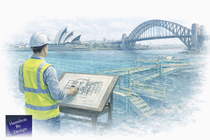
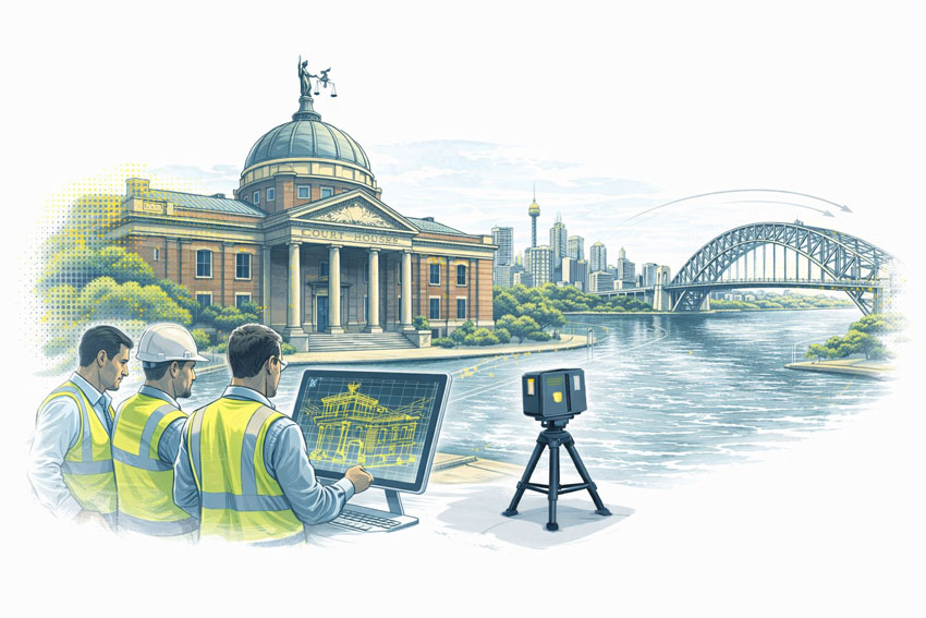
Hamilton By Design provides engineering-led 3D CAD design services in Sydney, supporting construction, infrastructure, manufacturing, and industrial projects where accuracy, coordination, and certifiable outcomes matter.
Our Sydney-based 3D CAD services are built on measured reality, using professional laser scanning and point cloud data to ensure that CAD models reflect what truly exists on site — not assumptions taken from legacy drawings or incomplete information.
This approach reduces risk, prevents rework, and supports engineers, builders, and asset owners in delivering reliable outcomes.
Engineering-Grade 3D CAD Design
A 3D CAD designer working on engineering projects must do more than “draw in 3D”. Engineers rely on CAD models to:
Produce certified drawings
Verify interfaces and tolerances
Coordinate structural and mechanical elements
Support construction sequencing and installation
Reduce clashes and site modifications
Our CAD designers work as part of an integrated engineering workflow, aligned with how designs are reviewed, approved, and built in Sydney.
CAD Built from Real-World Data
Where projects involve existing buildings, plant, or infrastructure, our CAD models are developed directly from LiDAR scan data, ensuring dimensional accuracy and spatial confidence.
Our 3D CAD designers regularly support Sydney construction and engineering teams by delivering models suitable for coordination, shop detailing, and constructability review.
Strong integration with laser scanning and point clouds
Experience across construction, industrial, and infrastructure projects
Models suitable for certified and reviewed engineering outcomes
We do not offer generic drafting. We provide 3D CAD design that engineers can rely on.
Talk to a Sydney-Based 3D CAD Designer
If your project requires accurate CAD models built from real site conditions, Hamilton By Design can support your Sydney project from scan through to CAD delivery.
📩 Contact us to discuss your 3D CAD designer requirements in Sydney.
Related Sydney Services
Hamilton By Design provides engineering-led 3D scanning, LiDAR scanning, mechanical engineering and digital engineering services throughout Sydney and Greater Sydney.
Explore our related Sydney services:
3D Scanning Sydney – Engineering-grade terrestrial laser scanning, as-built surveys and point cloud capture for industrial, infrastructure and commercial projects.
Reality Capture Sydney – High-accuracy reality capture, digital twins, asset documentation and engineering-grade site verification.
Scan to CAD Sydney – Convert point cloud data into AutoCAD, SolidWorks, Inventor and other engineering-ready CAD deliverables.
Point Cloud Modelling Sydney– Engineering-grade point cloud processing, clash detection, as-built verification and 3D modelling.
Mechanical Engineering Sydney – Mechanical design, plant upgrades, materials handling systems, conveyors, chutes, platforms and engineering support.
Structural Drafting Sydney– Structural steel drafting, fabrication drawings, GA drawings, workshop detailing and as-built documentation.
Hamilton By Design supports projects throughout Sydney CBD, Parramatta, Liverpool, Penrith, Blacktown, Chatswood, Alexandria, Mascot, Newcastle and the Central Coast.
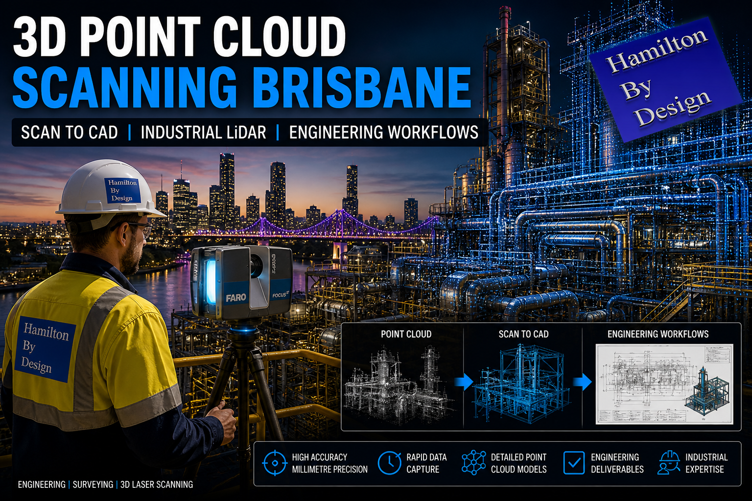
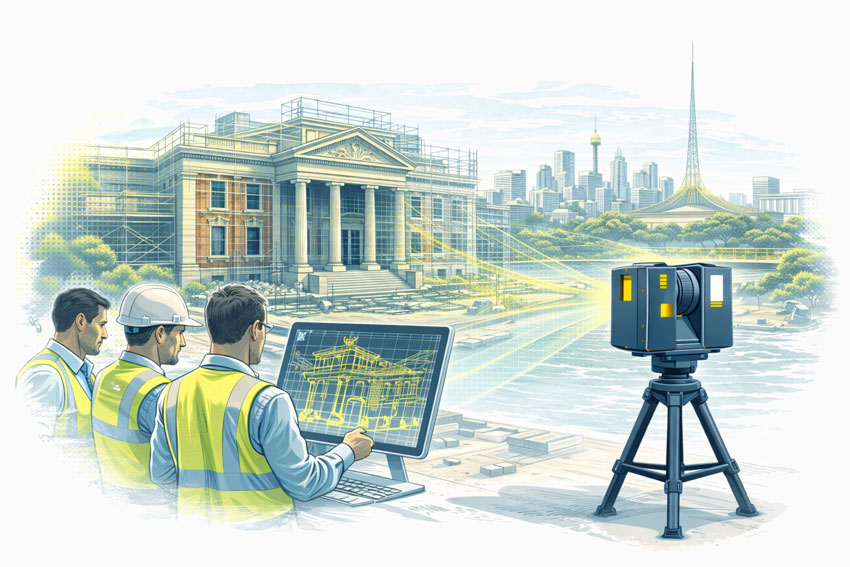
Accurate information is the foundation of every certified engineering decision. At Hamilton By Design, our 3D point cloud scanning in Brisbane delivers engineering-grade spatial data that engineers, designers, and asset owners can confidently rely on when certifying drawings, structures, plant upgrades, and industrial processes.
Engineers are legally and professionally responsible for the decisions they certify. This means the information used must be:
Accurate – true to physical reality
Traceable – derived from verifiable measurement
Repeatable – defensible if reviewed or audited
Fit for purpose – suitable for structural, mechanical, or process design
Consumer-grade scans, photos, or inferred measurements are not sufficient for certified outcomes.
Our engineering-led 3D point cloud scanning provides a measured digital record of what actually exists on site — not what drawings suggest, and not what assumptions fill the gaps.
What Is Engineering-Grade 3D Point Cloud Scanning?
A 3D point cloud is a dense collection of spatial data points captured using professional LiDAR scanners. Each point has a precise X, Y, Z coordinate in real-world space.
When captured correctly, this data allows engineers to:
Verify structural geometry
Measure clearances and tolerances
Identify clashes before construction
Confirm alignment, plumb, level, and deformation
Validate existing conditions for certification
Our Brisbane point cloud services are aligned with the same workflows used for certified mechanical, structural, and process engineering.
Supporting Certified Engineering Outcomes
1. Certified Drawings & Design
Engineers can only certify drawings if they trust the underlying measurements. Our scans support:
3D Point Cloud Modelling Melbourne | Engineering-Led LiDAR Models
Melbourne is home to some of Australia’s most complex industrial, infrastructure, and construction assets. From live manufacturing facilities and transport infrastructure to commercial and brownfield redevelopment projects, accurate understanding of existing conditions is critical.
Hamilton By Design provides engineering-grade 3D point cloud modelling services in Melbourne, supporting projects where precision, constructability, and accountability matter. Our workflows convert high-accuracy LiDAR scan data into usable engineering models that reflect what actually exists on site.
Engineering-Grade Point Cloud Modelling for Melbourne Projects
3D point cloud modelling is not simply about visualisation. For engineering, construction, and industrial projects in Melbourne, point clouds are used to:
Establish accurate existing conditions
Verify interfaces with existing assets
Reduce site rework and clashes
Support constructable design decisions
Enable confident fabrication and installation
Our modelling workflows are developed for engineering and delivery, not presentation.
From 3D Laser Scanning to Usable Engineering Models
All point cloud modelling begins with accurate data capture. Our Melbourne projects are supported by engineering-led 3D laser scanning, producing high-resolution point cloud datasets suitable for detailed modelling and analysis.
Once captured, point cloud data is processed, registered, and validated before being used as the foundation for downstream modelling.
Point Clouds as the Basis for As-Built Modelling
A common challenge on Melbourne projects is the lack of reliable as-built information. Drawings may be outdated, incomplete, or no longer reflect site conditions due to years of undocumented modifications.
Our point cloud modelling services directly address this issue by enabling:
Accurate as-built geometry derived from LiDAR data
Verification of steelwork, plant, and structural interfaces
Confident modelling of upgrades, retrofits, and extensions
For projects requiring documented existing conditions, point clouds are often converted into as-built drawings and models to support engineering, construction, and compliance requirements.
Applications of 3D Point Cloud Modelling in Melbourne
Our Melbourne point cloud modelling services are commonly used across:
Industrial and manufacturing facilities
Mechanical plant upgrades and retrofits
Infrastructure and utilities projects
Construction coordination and verification
Structural steel and access modifications
In these environments, point clouds provide a single, reliable source of truth that engineering teams can trust.
Integration with Engineering and Design Services
Point cloud modelling does not exist in isolation. At Hamilton By Design, point clouds are integrated into broader engineering workflows, supporting:
Mechanical and structural design
CAD modelling and documentation
Constructability review
Interface coordination
Asset information and lifecycle planning
Our point cloud services form part of a wider suite of engineering services delivered nationally, ensuring continuity from site capture through to design and documentation.
For Melbourne projects, the quality of a point cloud model directly affects downstream decisions. Our approach ensures that:
Data is captured with engineering intent
Modelling reflects real-world geometry and tolerances
Assumptions are minimised
Risks are identified early
Models can be relied upon for fabrication and site work
This engineering-owned approach reduces uncertainty and improves project outcomes, particularly on complex or live sites.
3D Point Cloud Modelling Services Across Melbourne
We support projects across metropolitan Melbourne and surrounding regions, including inner-city sites, industrial precincts, and large-scale infrastructure corridors. Whether supporting early project definition or detailed upgrade works, our point cloud modelling services are tailored to the realities of Melbourne’s built environment.
Discuss a 3D Point Cloud Modelling Project in Melbourne
If you require accurate, engineering-grade 3D point cloud modelling in Melbourne, Hamilton By Design can support your project from initial capture through to usable engineering models and documentation.
Contact our team to discuss how point cloud modelling can reduce risk and improve certainty on your next Melbourne project.
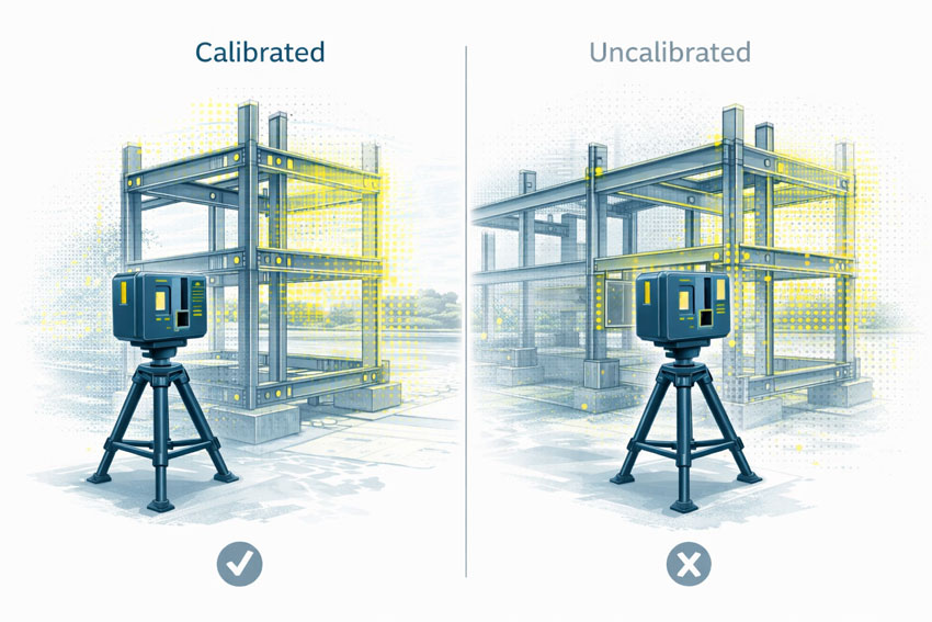
Why Accuracy, Precision, and Calibration Matter for Engineering Outcomes
When 3D LiDAR scanning is used for engineering, fabrication, or certification, the most important question is not how detailed the point cloud looks, but whether the measurements can be trusted.
This is where AS ISO 5725 — Accuracy and Precision of Measurement becomes relevant. While AS ISO 5725 is not written specifically for LiDAR scanners, it defines the principles that determine whether any measurement system is suitable for engineering use.
In practical terms, AS ISO 5725 separates data that can support engineering decisions from data that is visually convincing but technically unreliable.
What AS ISO 5725 Covers
AS ISO 5725 defines how measurement systems should be evaluated in terms of:
Accuracy
Precision
Repeatability
Reproducibility
Measurement uncertainty
These principles apply directly to 3D LiDAR scanning because a LiDAR scanner is, at its core, a measurement instrument. When scanning data is used to inform design, fabrication, or certification, the expectations set by AS ISO 5725 apply regardless of scanner brand or software.
This is why engineering-grade 3D LiDAR scanning requires more than simply capturing a dense point cloud. It requires controlled measurement, understood uncertainty, and validated outputs, as delivered through engineering-grade 3D laser scanning workflows: https://www.hamiltonbydesign.com.au/home/engineering-services/3d-laser-scanning/
Accuracy vs Precision in LiDAR Scanning
AS ISO 5725 makes a clear distinction between accuracy and precision, a distinction that is often misunderstood in reality capture.
Accuracy describes how close a measurement is to the true value. Precision describes how consistently the same measurement can be repeated.
A LiDAR scan can appear highly precise, with clean and consistent geometry, while still being inaccurate if the scanner is miscalibrated or poorly controlled. In engineering terms, repeatable errors are still errors.
For engineering and fabrication, both accuracy and precision are required.
The Role of Calibration
Calibration ensures that a scanner’s distance and angular measurements align with known reference values. Without calibration, a LiDAR scanner may still operate normally and still produce visually impressive results, but the measurements no longer have a known or defensible level of uncertainty.
Calibration directly affects:
Distance measurement
Angular accuracy
Alignment between internal sensors
Registration between multiple scans
AS ISO 5725 does not prescribe how calibration must be performed, but it does establish the expectation that measurement uncertainty is understood and controlled.
What Happens When Scanning Is Not Calibrated
When LiDAR scanning is not properly calibrated or verified, errors propagate into every downstream deliverable.
Common outcomes include:
Fabricated steelwork that does not fit on site
Bolt holes and connection points outside tolerance
Frames requiring on-site modification or rework
Assumed clearances that do not exist in reality
Delays or challenges during engineering sign-off
These issues are often discovered late in a project, where the cost of correction is highest. The root cause is frequently measurement error introduced at the scanning stage, not fabrication quality.
One of the most significant risks in unverified scanning workflows is that errors are often small enough to go unnoticed early.
A few millimetres of error at the scanning stage can compound into much larger discrepancies once geometry is modelled, detailed, and fabricated. Across multiple interfaces, these small deviations can lead to misalignment, rework, or compromised installation quality.
For fit-first-time fabrication, this risk is unacceptable.
Engineering Responsibility and Certification Risk
When LiDAR data is used to support engineering decisions, responsibility does not sit with the scanner or the software. It sits with the engineer relying on the data.
If measurements cannot be demonstrated as accurate, repeatable, and appropriately controlled, they are not suitable to support engineering sign-off. This is particularly relevant where scanning data contributes to certification outcomes, where accountability and defensibility are essential.
AS ISO 5725 is not about paperwork or compliance for its own sake. It provides the framework that ensures measurement data used for engineering decisions is fit for purpose.
When LiDAR scanning is undertaken with accuracy, precision, and calibration treated seriously, it becomes a powerful engineering tool. When these principles are ignored, scanning becomes a source of hidden risk that only emerges when it is too late to correct cheaply.
Final Thought
3D LiDAR scanning is only as reliable as the measurement discipline behind it.
AS ISO 5725 provides the foundation for understanding whether scanning data can be trusted. In engineering, fabrication, and certification contexts, that trust is not optional — it is essential.
Preserving Today’s Information for Tomorrow’s Engineering Decisions
Buildings are long-life assets, but the information describing how they were actually built is often short-lived. Drawings become outdated, undocumented changes accumulate, and critical details disappear once concrete is poured or walls are closed.
Hamilton By Design provides engineering-grade 3D scanning and as-built BIM documentation across Greater Sydney, capturing what actually exists on site and converting it into reliable, decision-ready information that supports maintenance, compliance, refurbishment, sustainability upgrades, and long-term asset planning.
The data we collect today supports the engineering choices of tomorrow.
BIM Is Not a Concept Model — BIM Is As-Built Truth
BIM is often misunderstood as a design or visualisation tool. In practice, BIM only becomes valuable when it documents what was actually built, not what was originally intended.
This approach ensures that BIM outputs reflect real geometry, tolerances, and interfaces, remain useful years after construction, and support future engineering decisions.
Why Preserving As-Built Information Matters
Once a building enters service, change is constant. Services are rerouted during refurbishments and fit-outs, structural elements are modified, penetrations are added, and access conditions evolve.
Without a verified baseline, future engineers are forced to rely on assumptions.
By combining engineering-grade 3D laser scanning in Sydney with fit-for-purpose BIM documentation, we create a defensible digital record of the asset at a known point in time: https://www.hamiltonbydesign.com.au/3d-scanning-sydney/
This record becomes a reference that can be trusted long after drawings, photos, and site knowledge have disappeared.
Capturing Information Before It Becomes Hidden
Timing is critical.
3D scanning delivers the greatest long-term value when undertaken before concrete is poured, before walls or gyprock are fixed, before ceilings are closed, or before major refurbishments begin.
Once these elements are concealed, understanding what exists becomes invasive, interpretive, and costly. Early-stage reality capture creates a permanent digital record of conditions that would otherwise be lost forever.
Engineering-Led Scan-to-BIM
Accurate BIM requires more than software. Our workflows are grounded in engineering-led decision making and documentation, ensuring models are aligned with how assets actually perform and are modified over time: https://www.hamiltonbydesign.com.au/mechanical-engineering-services/
This approach ensures BIM outputs are fit for real engineering use, suitable for upgrades and modification, defensible for compliance and due diligence, and useful for fabrication, coordination, and access planning.
Supporting Commercial Buildings Across Sydney
Greater Sydney contains some of the most complex built environments in Australia, including high-density CBD assets, mixed-use developments, healthcare facilities, campuses, and strata buildings with shared services.
Preserved as-built information reduces uncertainty and allows design teams to plan works with confidence rather than assumptions.
Supporting Long-Life Industrial and Production Assets
Industrial and production facilities demand a higher level of certainty. Equipment upgrades, maintenance access, and future expansion depend on knowing exactly what exists.
In these environments, preserved information is a core risk-management tool.
Defects Investigations in 5–10 Years’ Time
Many building defects do not appear immediately. Water ingress, façade issues, slab movement, services failures, and vibration complaints often emerge years after construction.
A verified as-built scan and BIM baseline allows future engineers to compare conditions over time, identify hidden interfaces and penetrations, reduce destructive investigation, and diagnose issues more efficiently.
Without preserved data, defect investigations often start with uncertainty.
Post-Event Documentation
When an event occurs, whether seismic movement, impact damage, fire, or storm, rapid and accurate documentation becomes critical.
3D scanning after an event can capture a defensible condition record, support engineering assessment and triage, inform reinstatement scope, and assist insurers, owners, and regulators.
When paired with earlier scans, change becomes measurable rather than speculative.
Designing for Sustainability and User Experience Over the Next 10 Years
Sustainability upgrades fail when as-built reality is wrong.
Over the next decade, many Sydney assets will pursue energy upgrades, electrification pathways, improved HVAC performance, and better occupant comfort.
Scan-backed BIM supports these outcomes by ensuring plant rooms and services routes are understood, space constraints are known early, upgrades are coordinated before trades mobilise, and disruption is minimised.
Better information leads to better engineering choices and better outcomes for building users.
Engineering Decisions That Stand the Test of Time
The long-term consequences of poor documentation are well understood in engineering. Decisions made today echo years later.
Accurate as-built information underpins compliance, safety, and long-term asset performance. While 3D scanning and BIM are not mandated by a single Australian regulation, the intent of Australia’s building codes, standards, and information-management frameworks relies on reliable, traceable documentation of what has actually been constructed.
National Construction Code (NCC)
National Construction Code
The National Construction Code establishes performance requirements for structure, fire safety, access, health, amenity, and services. Although the NCC does not prescribe BIM or laser scanning, it assumes building work is supported by accurate and verifiable documentation. Scan-derived as-built BIM supports this intent by reducing reliance on assumptions during refurbishment, compliance reviews, and future upgrades.
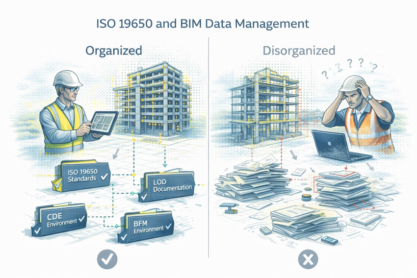
ISO 19650 – Information Management Using BIM
ISO 19650
ISO 19650 defines best practice for managing information throughout the lifecycle of a built asset. Preserving today’s information for tomorrow’s engineering decisions aligns directly with this standard, particularly where as-built BIM is informed by reality capture and maintained as a lifecycle information resource.
Relevant Australian Standards
AS 1100 AS 3600 AS/NZS 3000 AS/NZS 3500 ISO 55000
These standards rely on accurate representation of geometry, services, and constructed conditions. Reality capture and as-built BIM support their intent by improving clarity, traceability, and long-term usability of engineering information.
Hamilton By Design does not claim that BIM itself guarantees compliance. Instead, our workflows support the intent of the NCC, ISO 19650, and relevant Australian Standards by improving the quality and reliability of building information used for engineering decisions.
Coverage Across Greater Sydney
Hamilton By Design provides 3D scanning and BIM documentation across Greater Sydney, including Sydney CBD, North Sydney, Chatswood, Parramatta, Macquarie Park, Ryde, Homebush, Alexandria, Mascot, Botany, Bankstown, Liverpool, Blacktown, Penrith, Castle Hill, Bella Vista, Brookvale, Manly, Hurstville, Sutherland, Cronulla, and surrounding precincts.
The Data We Collect Today Supports the Engineering Choices of Tomorrow
3D scanning and as-built BIM are not about creating a digital model for today’s project alone. They are about preserving truth before it disappears, reducing uncertainty years later, enabling sustainable upgrades, and supporting safer, smarter engineering decisions across the life of an asset.
That is the real value of BIM.
Our clients
Related Sydney Services
Hamilton By Design provides engineering-led 3D scanning, LiDAR scanning, mechanical engineering and digital engineering services throughout Sydney and Greater Sydney.
Explore our related Sydney services:
3D Scanning Sydney – Engineering-grade terrestrial laser scanning, as-built surveys and point cloud capture for industrial, infrastructure and commercial projects.
Reality Capture Sydney – High-accuracy reality capture, digital twins, asset documentation and engineering-grade site verification.
Scan to CAD Sydney – Convert point cloud data into AutoCAD, SolidWorks, Inventor and other engineering-ready CAD deliverables.
Point Cloud Modelling Sydney– Engineering-grade point cloud processing, clash detection, as-built verification and 3D modelling.
Mechanical Engineering Sydney – Mechanical design, plant upgrades, materials handling systems, conveyors, chutes, platforms and engineering support.
Structural Drafting Sydney– Structural steel drafting, fabrication drawings, GA drawings, workshop detailing and as-built documentation.
Hamilton By Design supports projects throughout Sydney CBD, Parramatta, Liverpool, Penrith, Blacktown, Chatswood, Alexandria, Mascot, Newcastle and the Central Coast.
Sydney property and building projects live or die on what is documented—and how confidently that documentation can be relied upon. In a market defined by tight plant rooms, vertical services, constrained access, staged upgrades, and high holding costs, “close enough” drawings can become a legal, commercial, and program risk.
Hamilton By Design provides engineer-led 3D scanning and 3D engineering services in Sydney, focused on producing BIM-ready documentation and defensible building records to support:
Sale and purchase due diligence
Leasing and refurbishment planning
Services upgrades (HVAC, piping, mechanical plant, fire coordination interfaces)
Why Documentation Matters for Property Sale in Sydney
When a commercial or industrial property changes hands, the documentation pack often becomes a key part of:
Pre-purchase due diligence
Capex forecasting
Compliance planning
Tenant fit-out feasibility
Valuation and defect risk assessment
In practice, the biggest issues arise when the “as-builts” are:
Outdated (multiple refurbishments since issue)
Incomplete (plant rooms, risers, roof plant never updated)
Uncoordinated (services don’t match structure or architecture)
Non-dimensional or ambiguous (typical details reused across floors)
Inconsistent with reality (especially in brownfield assets)
A reality-captured, engineering-led approach reduces uncertainty by establishing a reliable baseline: what exists, where it is, and what can fit.
Is BIM a Legal Requirement — or a “Nice to Have”?
BIM is not typically mandated by law for private property transactions. However, the legal and commercial requirement is not “BIM” — it is adequate, accurate, and defensible documentation.
On modern Sydney assets, BIM-style coordination is often the most practical way to:
Demonstrate reasonable verification of existing conditions
Reduce foreseeable clashes and rework
Provide traceable design intent and change control
Support compliance pathways and certification workflows
For property sale and acquisition, BIM and 3D documentation increasingly function as risk controls. They help owners, buyers, and project teams make decisions using verifiable geometry instead of assumptions.
Note: This page is general information, not legal advice. Documentation obligations depend on building type, scope of work, and the relevant approval pathway.
What We Deliver: Documentation Packs That Stand Up to Scrutiny
Our Sydney workflow is designed to create outputs that are useful across multiple stakeholders: owners, facilities teams, designers, contractors, and project managers.
1) Reality Capture and Registered Outputs
Engineering-grade LiDAR / laser scanning
Site constraints captured in high detail (plant rooms, risers, mezzanines, service corridors)
Deliverables structured so they can be used for BIM modelling and coordination
2) BIM-Ready As-Built Models
We produce or support the production of:
Coordinated 3D models suitable for engineering design workflows
For industrial assets, “document confidence” is directly tied to:
Fit-first-time fabrication
Shutdown windows
Safety and access planning
3D engineering outputs support:
Pipe spools and mechanical upgrades
Structural interfaces
Skid and equipment placement validation
Property Sale and Acquisition Due Diligence
For buyers and owners, BIM-ready records can help:
Confirm plant capacity and spatial constraints
Validate feasibility for intended refurbishments
Identify unknowns that should be priced into capex planning
Reduce “latent defect” surprises caused by unknown geometry
Engineer-Led Scanning vs. Generic Capture
Not all scans are equal. The difference is not just the scanner — it’s the workflow and the engineering intent.
Engineer-led reality capture focuses on:
What must be measured for mechanical design
Clearances, access paths, and maintenance envelopes
Interfaces between structure and services
Deliverables that reduce fabrication and installation risk
If the goal is property documentation, the key question is:
“Can this documentation be trusted to make decisions that cost money?”
Typical Deliverables (Choose What You Need)
A Sydney documentation package may include:
Point cloud dataset (registered and organised)
BIM-ready model (scope defined by asset type and use case)
Drawing set (GA layouts and key sections)
Plant and services spatial verification notes (where requested)
Asset record pack structure for ongoing lifecycle updates
Because the “right” package depends on whether you’re:
Selling / buying
Leasing / refurbishing
Upgrading services
Planning staged works
…we build the scope around what decisions the documentation must support.
Common Use Cases for Sale of Property
“We’re selling a building — what does the buyer actually want?”
Most buyers want confidence around:
What exists (geometry and plant placement)
What will fit (upgrade feasibility)
What risks are hidden (unknowns and clashes)
How much capex is coming (services condition + spatial constraint)
“We’re buying — can we validate the fit-out feasibility quickly?”
A scan-to-model workflow can quickly confirm:
Available plant space
Riser and shaft constraints
Ceiling space and structural conflicts
Staging or cranage constraints for replacement plant
“We need a defensible as-built record before we commit.”
If you’re about to spend real money on design or refurbishment, scanning first prevents:
Design rework
Fabrication errors
Program delays caused by surprise constraints
How the Process Works
Define the decision Sale pack, due diligence, upgrade design, or refurbishment planning.
Site capture plan What areas matter most (plant rooms, risers, roof, loading dock, service corridors).
LiDAR scanning and registration Delivered in an organised structure suitable for modelling and coordination.
Model and documentation outputs BIM-ready models and drawings aligned to the defined purpose.
Handover + future update pathway Documentation structured so future projects can update the baseline rather than restart.
Frequently Asked Questions
Do I legally need BIM for a property sale?
Usually, no. But you do need documentation that is accurate enough for decisions and defensible if assumptions are challenged. BIM-quality coordination often becomes the most practical method for complex assets.
Are existing drawings good enough?
Sometimes. But in many Sydney buildings—especially refurbished and service-dense assets—drawings can be incomplete or wrong. Scanning verifies the baseline.
Can you scan only the areas that matter most?
Yes. For sale and due diligence, we often focus on:
Roof plant
Main plant rooms
Key risers / service corridors
Basement services areas
Areas driving upgrade feasibility
Is this useful for strata or mixed-use buildings?
Yes — especially where service routing and riser geometry are uncertain and upgrades need clear feasibility.
Talk to an Engineer About Sydney Documentation
If you need 3D engineering in Sydney focused on BIM documentation and defensible records for property sale, we can help you establish a baseline that reduces commercial risk and improves decision-making.
Hamilton By Design provides engineering-led 3D scanning, LiDAR scanning, mechanical engineering and digital engineering services throughout Sydney and Greater Sydney.
Explore our related Sydney services:
3D Scanning Sydney – Engineering-grade terrestrial laser scanning, as-built surveys and point cloud capture for industrial, infrastructure and commercial projects.
Reality Capture Sydney – High-accuracy reality capture, digital twins, asset documentation and engineering-grade site verification.
Scan to CAD Sydney – Convert point cloud data into AutoCAD, SolidWorks, Inventor and other engineering-ready CAD deliverables.
Point Cloud Modelling Sydney– Engineering-grade point cloud processing, clash detection, as-built verification and 3D modelling.
Mechanical Engineering Sydney – Mechanical design, plant upgrades, materials handling systems, conveyors, chutes, platforms and engineering support.
Structural Drafting Sydney– Structural steel drafting, fabrication drawings, GA drawings, workshop detailing and as-built documentation.
Hamilton By Design supports projects throughout Sydney CBD, Parramatta, Liverpool, Penrith, Blacktown, Chatswood, Alexandria, Mascot, Newcastle and the Central Coast.
To provide the best experiences, we use technologies like cookies to store and/or access device information. Consenting to these technologies will allow us to process data such as browsing behaviour or unique IDs on this site. Not consenting or withdrawing consent, may adversely affect certain features and functions.
Functional
Always active
The technical storage or access is strictly necessary for the legitimate purpose of enabling the use of a specific service explicitly requested by the subscriber or user, or for the sole purpose of carrying out the transmission of a communication over an electronic communications network.
Preferences
The technical storage or access is necessary for the legitimate purpose of storing preferences that are not requested by the subscriber or user.
Statistics
The technical storage or access that is used exclusively for statistical purposes.The technical storage or access that is used exclusively for anonymous statistical purposes. Without a subpoena, voluntary compliance on the part of your Internet Service Provider, or additional records from a third party, information stored or retrieved for this purpose alone cannot usually be used to identify you.
Marketing
The technical storage or access is required to create user profiles to send advertising, or to track the user on a website or across several websites for similar marketing purposes.