Port Infrastructure 3D Scanning Sydney

Watercolour illustration of Sydney port infrastructure showing container cranes, cargo vessels, tank farms, pipelines and a FARO Focus S70 laser scanner capturing reality capture data for port infrastructure engineering projects. Hamilton By Design Port Infrastructure 3D Scanning Sydney services.

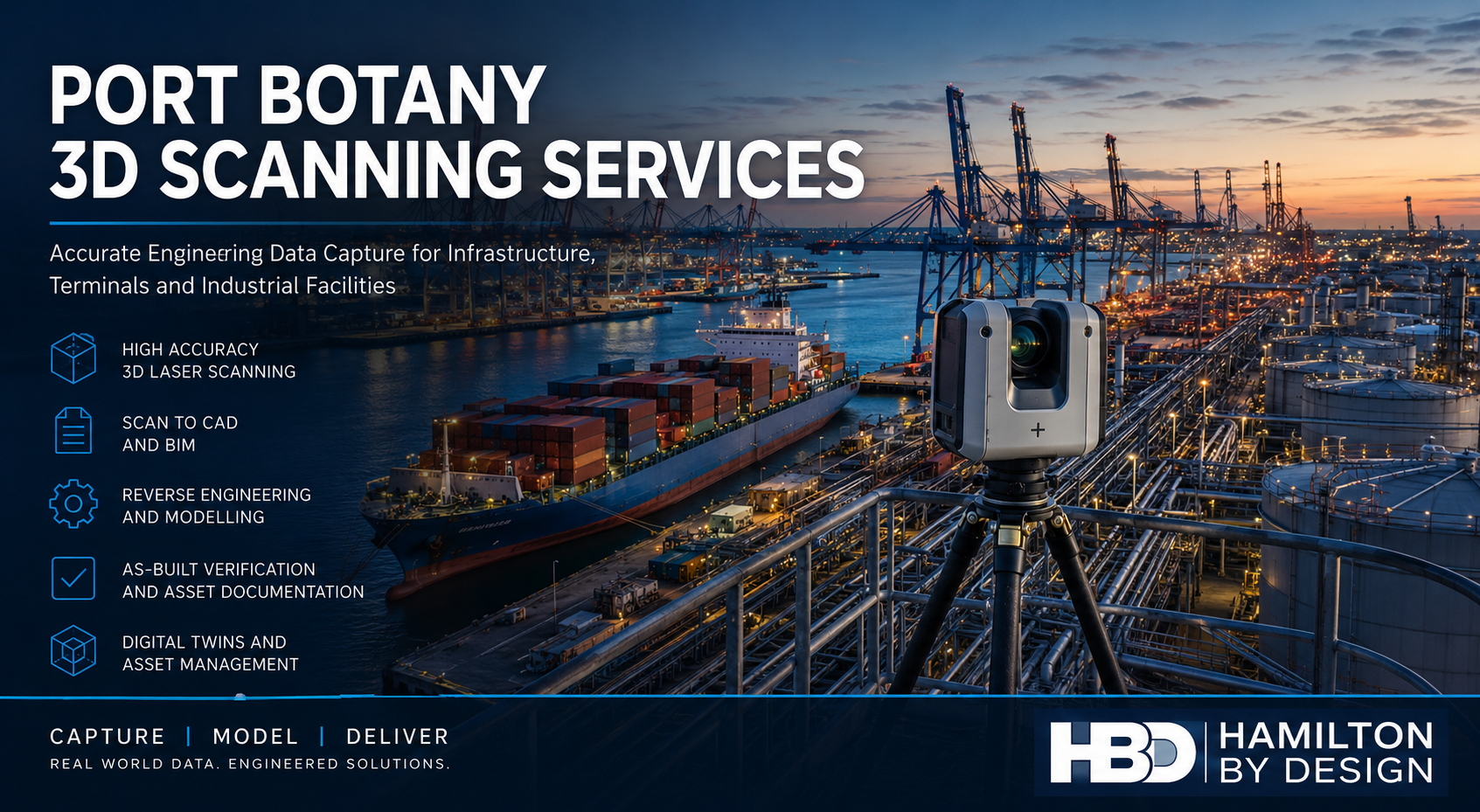
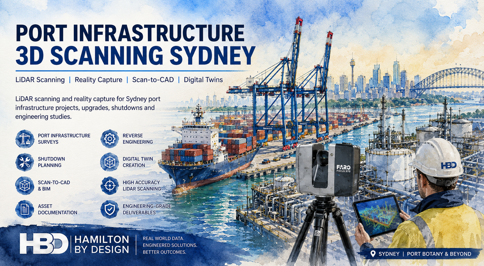
Hamilton By Design provides professional Port Infrastructure 3D Scanning Sydney services for port operators, engineering consultants, contractors, infrastructure owners and industrial facilities throughout Sydney and New South Wales. Using engineering-grade terrestrial LiDAR scanning and reality capture technology, we accurately document existing conditions and create reliable digital datasets that support maintenance, shutdowns, upgrades, asset management and future development projects.

Our scanning services capture highly accurate measurements of wharves, container terminals, bulk handling facilities, rail infrastructure, tank farms, marine structures, conveyors, pipework and industrial assets. The resulting point cloud data can be converted into CAD drawings, BIM models, digital twins, engineering documentation and asset management systems.

Whether your project involves a major terminal upgrade, a brownfield expansion, shutdown planning or reverse engineering of existing assets, Hamilton By Design delivers accurate reality capture data to reduce project risk and improve engineering outcomes.


Engineering-Grade Reality Capture for Sydney Port Infrastructure

Sydney is home to some of Australia’s most critical maritime and logistics infrastructure. Facilities such as Port Botany, intermodal terminals, rail infrastructure, fuel terminals and marine assets are continuously upgraded to meet increasing operational demands.

Many of these facilities have evolved over decades, resulting in incomplete documentation and modifications that differ significantly from original drawings. Engineering projects often require accurate existing-condition information before design work can commence.

3D LiDAR scanning solves this problem by capturing millions of measurement points and creating an accurate digital representation of the facility.

This information becomes the foundation for:

  • Engineering design
  • Asset management
  • Maintenance planning
  • Shutdown preparation
  • Structural modifications
  • Equipment upgrades
  • Construction verification
  • Digital twin development

Port Infrastructure Assets We Scan

Hamilton By Design performs reality capture of a wide range of port and marine infrastructure assets throughout Sydney.

Container Terminals

Container terminals contain complex infrastructure requiring accurate documentation for future upgrades and maintenance projects.

Assets commonly scanned include:

  • Container cranes
  • Rail-mounted gantries
  • Container stacking yards
  • Maintenance facilities
  • Service corridors
  • Electrical infrastructure
  • Stormwater systems

Wharf and Berth Infrastructure

Marine infrastructure often requires detailed surveys to support inspections, maintenance and expansion projects.

Examples include:

  • Wharves
  • Berths
  • Jetties
  • Dolphins
  • Fender systems
  • Mooring structures
  • Access walkways

Bulk Materials Handling Facilities

Bulk handling infrastructure is ideally suited to 3D scanning due to its complexity and ongoing modification requirements.

Typical assets include:

  • Conveyors
  • Transfer towers
  • Chutes
  • Hoppers
  • Ship loaders
  • Stackers
  • Reclaimers

Tank Farms and Fuel Terminals

Storage and fuel facilities require accurate engineering information for maintenance and compliance projects.

Common assets include:

  • Storage tanks
  • Pipe racks
  • Pump stations
  • Loading facilities
  • Valve stations
  • Fire systems
  • Structural steel platforms

Rail and Intermodal Infrastructure

Port-related rail infrastructure often requires accurate as-built documentation for upgrades and future expansion.

Assets may include:

  • Rail sidings
  • Intermodal terminals
  • Service facilities
  • Signalling structures
  • Maintenance depots

Why Use 3D LiDAR Scanning for Port Infrastructure?

Accurate Existing Conditions

Many engineering projects fail because the actual site differs from available drawings.

LiDAR scanning captures the true condition of the facility, allowing engineers to design using real-world information.

Reduced Project Risk

Accurate site data reduces:

  • Design clashes
  • Site rework
  • Installation delays
  • Construction variations
  • Fabrication errors

Improved Safety

Field measurements in operational ports can expose personnel to moving equipment, vehicle traffic, elevated structures and restricted areas.

Laser scanning significantly reduces the amount of time required on-site.

Faster Engineering Delivery

Once captured, point cloud data can be accessed repeatedly without returning to site, allowing engineers and designers to obtain measurements directly from the digital model.

Long-Term Asset Records

The scan becomes a permanent digital record of the facility at the time of capture and can support future maintenance and upgrade projects.


Supporting Port Shutdowns and Maintenance Projects

Shutdowns are among the most time-critical activities undertaken within port infrastructure environments.

Every hour of downtime can result in significant operational costs.

LiDAR scanning supports shutdown planning by providing:

  • Accurate existing-condition models
  • Installation planning
  • Equipment replacement studies
  • Structural verification
  • Prefabrication support
  • Clash detection
  • Construction sequencing

Engineering teams can review and plan modifications before arriving on site, reducing shutdown durations and improving project certainty.


Scan to CAD Services for Port Infrastructure

Point cloud data can be converted into detailed engineering documentation suitable for maintenance, upgrades and future design projects.

Typical deliverables include:

  • Site plans
  • General arrangement drawings
  • Structural layouts
  • Equipment layouts
  • Pipework documentation
  • Existing-condition drawings
  • Sections and elevations

Output formats include:

  • DWG
  • DXF
  • PDF
  • AutoCAD models

Scan-to-CAD services provide engineering teams with accurate documentation for facilities where drawings may be outdated or unavailable.


Scan to BIM and Digital Twin Development

Many infrastructure owners are adopting BIM and digital twin strategies to improve asset management and long-term planning.

Hamilton By Design can convert point cloud data into:

  • BIM models
  • Revit models
  • Asset information models
  • Digital twins
  • Facilities management datasets

These models assist with:

  • Asset lifecycle management
  • Maintenance planning
  • Future upgrades
  • Risk management
  • Operational decision making

Reverse Engineering and Engineering Support

One of the major advantages of working with Hamilton By Design is the ability to combine reality capture with engineering expertise.

In addition to scanning, we can assist with:

  • Mechanical engineering
  • Reverse engineering
  • Structural design support
  • CAD modelling
  • Fabrication drawings
  • Equipment redesign
  • Asset verification

Where original drawings no longer exist, scanned data can be used to recreate components and assemblies for manufacture.

Typical reverse engineering projects include:

  • Pump components
  • Conveyor equipment
  • Structural steel assemblies
  • Marine infrastructure
  • Mechanical systems

Our Port Infrastructure Scanning Process

1. Project Planning

We review project requirements, access constraints, safety requirements and deliverables.

2. Site Capture

Engineering-grade LiDAR scanners are used to capture the required infrastructure with complete coverage.

3. Registration and Processing

Individual scans are registered into a unified point cloud and processed for engineering use.

4. Modelling and Documentation

The point cloud is converted into CAD drawings, BIM models or engineering deliverables as required.

5. Delivery

Final deliverables are supplied in formats suitable for engineering, construction and asset management teams.


Deliverables

Hamilton By Design can provide:

  • E57 point clouds
  • RCP files
  • RCS files
  • LAS files
  • AutoCAD DWG files
  • DXF files
  • PDF drawings
  • Navisworks models
  • Revit models
  • SolidWorks models
  • STEP files
  • Parasolid files
  • General arrangement drawings
  • Asset verification reports

Hamilton By Design logo displayed on a blue tilted rectangle with a grey gradient background

Sydney Port Infrastructure 3D Scanning Services

Hamilton By Design provides professional Port Infrastructure 3D Scanning Sydney services for container terminals, marine infrastructure, logistics facilities, fuel terminals, rail assets and industrial facilities throughout Sydney and New South Wales.

Our engineering-led approach combines LiDAR scanning, Scan-to-CAD, Scan-to-BIM, reverse engineering and mechanical engineering expertise to deliver practical outcomes for infrastructure owners, operators and contractors.

Whether you are planning a shutdown, upgrading existing facilities, developing a digital twin or undertaking a major engineering project, Hamilton By Design can provide the accurate reality capture data required to support informed decision-making and successful project delivery.

Talk to Us – Contact Us

Name
Would you like us to arrange a phone consultation for you?
Address

Our clients:


Port Botany 3D Scanning Services for Infrastructure, Terminals and Industrial Facilities

Port Botany 3D Scanning Services hero image showing a laser scanner overlooking container terminals, fuel storage tanks, pipelines, cranes and industrial infrastructure at Port Botany, Sydney. The image highlights LiDAR scanning, Scan-to-CAD, reverse engineering, asset documentation and digital twin services by Hamilton By Design.
Blue 3D LiDAR scanner icon on a tripod with scanning waves

Hamilton By Design provides professional Port Botany 3D scanning services for infrastructure, container terminals, industrial facilities, logistics operations, fuel terminals and engineering projects throughout Port Botany, Sydney. We use engineering-grade terrestrial LiDAR scanning technology to accurately capture existing conditions and create reliable digital models, drawings and datasets for maintenance, upgrades, asset management and construction projects.

Our 3D scanning services allow asset owners, engineers, contractors and project managers to obtain precise measurements of existing facilities without relying on outdated drawings or manual site measurements. The resulting point cloud data can be converted into CAD models, engineering drawings, BIM models, asset registers and digital twins to support informed decision-making and reduce project risk.

Whether you require a complete terminal survey, structural verification, Scan to CAD services, reverse engineering support or as-built documentation, Hamilton By Design delivers accurate engineering data capture across Port Botany and greater Sydney.


Engineering-Grade 3D Scanning in Port Botany

Port Botany is Australia’s largest container port and one of the country’s most important logistics and industrial hubs. The area contains a wide variety of assets that require ongoing maintenance, upgrades and engineering support, including:

  • Container terminals
  • Wharf infrastructure
  • Rail terminals
  • Bulk liquid storage facilities
  • Fuel terminals
  • Tank farms
  • Pipework systems
  • Pump stations
  • Conveyor systems
  • Warehouses
  • Distribution centres
  • Industrial workshops
  • Utilities infrastructure
  • Stormwater systems
  • Structural steel infrastructure

Many facilities have undergone numerous modifications over several decades, resulting in incomplete or outdated documentation. Accurate 3D laser scanning provides a reliable foundation for future engineering and construction activities.


Why Use 3D Scanning for Port Botany Facilities?

Traditional site measurement methods can be time-consuming, disruptive and prone to errors. Industrial facilities often contain complex structures, congested pipework and restricted access areas that make manual measurement difficult.

3D scanning provides significant advantages:

Improved Accuracy

Modern terrestrial laser scanners capture millions of measurement points per second, creating highly accurate representations of existing assets.

Reduced Site Time

Large facilities can be captured in a fraction of the time required for traditional measurement methods.

Increased Safety

Personnel spend less time working around operational equipment, traffic movements, elevated structures and hazardous areas.

Better Project Outcomes

Designers and engineers can work from accurate site information, reducing clashes, rework and unexpected site issues.

Long-Term Asset Records

The point cloud becomes a permanent digital record of the facility at the time of capture.


Industries We Support in Port Botany

Ports and Marine Infrastructure

Port operators and marine contractors use 3D scanning for:

  • Wharf upgrades
  • Berth modifications
  • Fender replacement projects
  • Structural inspections
  • Asset documentation
  • Marine infrastructure maintenance

Logistics and Distribution

Warehouses and logistics facilities often require:

  • Building surveys
  • Equipment installation planning
  • Conveyor modifications
  • Warehouse expansions
  • Asset verification

Fuel and Energy Facilities

Tank farms and fuel terminals benefit from:

  • Pipework modelling
  • Tank surveys
  • Structural steel verification
  • Equipment replacement projects
  • Brownfield upgrade planning

Manufacturing and Industrial Facilities

Industrial facilities commonly require:

  • Existing condition surveys
  • Reverse engineering support
  • Equipment installation planning
  • Structural modifications
  • Digital asset management

Typical Port Botany 3D Scanning Applications

Scan to CAD

Our Scan to CAD services convert point cloud data into engineering documentation including:

  • General arrangement drawings
  • Site layouts
  • Equipment layouts
  • Structural steel drawings
  • Existing condition plans
  • Sections and elevations

Deliverables may include:

  • DWG files
  • DXF files
  • PDF drawings
  • AutoCAD models

Scan to BIM

For larger infrastructure projects, point cloud data can be converted into BIM models suitable for asset management and project delivery.

Deliverables may include:

  • Revit models
  • Navisworks models
  • BIM coordination models
  • Asset information models

Reverse Engineering

Many industrial facilities contain legacy equipment where original drawings no longer exist.

3D scanning provides accurate geometry for:

  • Pump components
  • Impellers
  • Casings
  • Pipework fittings
  • Structural components
  • Mechanical assemblies

Resulting deliverables may include:

  • SolidWorks models
  • STEP files
  • Parasolid files
  • Manufacturing drawings

As-Built Verification

Construction and maintenance projects often require verification of completed works.

3D scanning enables:

  • Dimensional verification
  • Clash detection
  • Construction validation
  • Asset record updates

Our 3D Scanning Process

1. Site Assessment

We review the project requirements and identify:

  • Scope of work
  • Site access requirements
  • Safety requirements
  • Deliverables required
  • Survey control requirements

2. On-Site Data Capture

Using professional terrestrial LiDAR equipment, we capture the facility from multiple scan positions to ensure complete coverage.

Typical assets scanned include:

  • Buildings
  • Structures
  • Pipework
  • Conveyors
  • Tanks
  • Mechanical equipment
  • Marine infrastructure

3. Point Cloud Registration

Individual scans are registered into a unified coordinate system to create a complete digital representation of the facility.

4. Data Processing

The registered point cloud is cleaned, optimised and prepared for engineering use.

5. Modelling and Documentation

The point cloud is converted into the required deliverables, including CAD drawings, BIM models, engineering models or asset documentation.

6. Project Delivery

Final deliverables are issued in the formats required by the client.


Deliverables Available

Hamilton By Design can provide:

  • E57 point clouds
  • RCP files
  • RCS files
  • LAS files
  • AutoCAD DWG files
  • DXF files
  • PDF drawings
  • SolidWorks models
  • STEP files
  • Parasolid files
  • Navisworks models
  • Revit models
  • General arrangement drawings
  • Sections and elevations
  • Asset verification reports

All deliverables can be tailored to suit engineering, construction, maintenance or asset management requirements.


Supporting Brownfield Upgrade Projects

One of the most common applications for 3D scanning in Port Botany is supporting brownfield infrastructure upgrades.

Industrial facilities rarely match original drawings due to years of modifications, repairs and operational changes. Accurate point cloud data allows project teams to design around existing conditions with confidence.

Typical upgrade projects include:

  • Conveyor replacements
  • Pipework modifications
  • Structural steel upgrades
  • Tank farm expansions
  • Pump station upgrades
  • Equipment replacements
  • Wharf infrastructure improvements

By working from accurate existing-condition data, project teams can reduce site rework, minimise disruptions and improve project outcomes.


Hamilton By Design logo displayed on a blue tilted rectangle with a grey gradient background

Port Botany 3D Scanning Services from Hamilton By Design

Hamilton By Design provides engineering-focused 3D scanning services throughout Port Botany, Sydney and regional Australia. Our experience across ports, infrastructure, manufacturing, mining, utilities and industrial facilities allows us to deliver practical engineering solutions supported by accurate reality capture data.

Whether your project requires Scan to CAD, Scan to BIM, reverse engineering, asset documentation or as-built verification, our team can provide accurate and reliable digital data to support your next project.

Contact Hamilton By Design today to discuss your Port Botany 3D scanning requirements and obtain a tailored proposal for your facility or infrastructure project.

Talk to Us – Contact Us

Name
Would you like us to arrange a phone consultation for you?
Address

Our clients: