In mining and manufacturing, the difference between success and rework comes down to one thing:
The quality of your data—and how you use it.
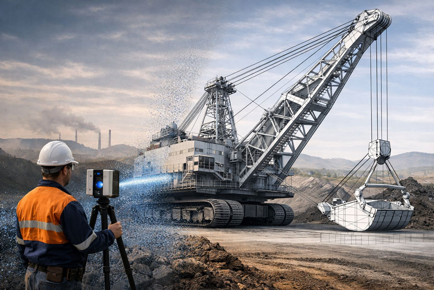
While many providers can “capture a scan,” not all can deliver usable engineering outcomes. This is where FARO laser scanners and the FARO software ecosystem stand apart.
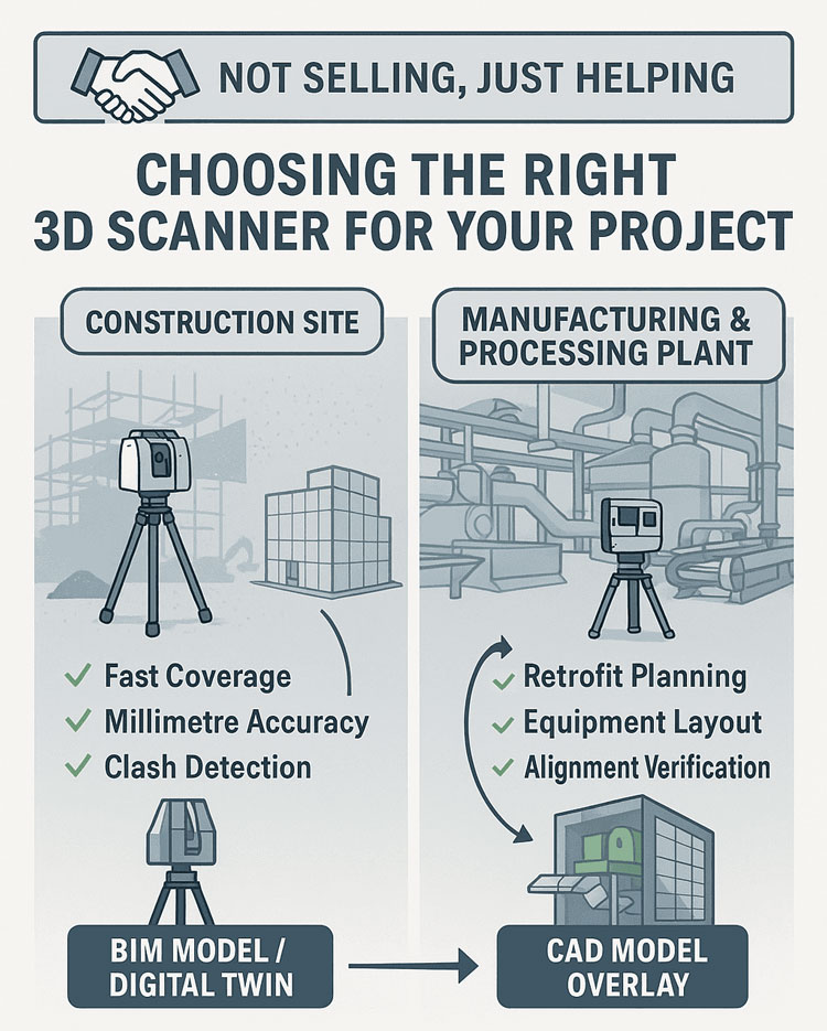
Engineer-Led Scanning vs Generic Data Capture
Most scanning providers deliver:
- Raw point clouds
- Mesh files (STL, OBJ)
- Limited usability for engineering
At Hamilton By Design, we take a different approach:
Engineering-led scanning using FARO tools, built for design, modelling, and fabrication.
The real advantage of FARO is not just the hardware—it’s the software ecosystem that turns scan data into engineering decisions.
The Real Advantage: FARO SCENE Software
At the core of the FARO workflow is FARO SCENE, purpose-built for point cloud processing, registration, and validation.
Unlike generic tools, SCENE allows:
1. Hybrid Registration (Accuracy You Can Trust)
- Combine cloud-to-cloud, targets, and survey control
- Validate alignment visually and numerically
- Eliminate stitching errors before they reach design
➡️ This ensures engineering-grade accuracy, not just visual alignment
FARO SCENE enables flexible registration workflows that combine multiple methods for precise alignment of complex sites
2. On-Site Registration (No Return Visits)
- Register scans in the field
- Identify gaps immediately
- Confirm coverage before leaving site
➡️ Critical for:
- Shutdowns
- Remote mine sites
- High-cost mobilisation environments
SCENE supports real-time, on-site registration and validation, allowing immediate data verification and reducing the need for rework
3. Clean, Usable Point Clouds (Not Just Raw Data)
- Automatic filtering of noise
- Colour balancing
- Duplicate point removal
- Density optimisation
➡️ Result:
Clean datasets ready for CAD, not bloated unusable files
SCENE includes filtering, validation, and optimisation tools to improve data quality and usability for downstream workflows
4. Full Workflow Integration (Scan → CAD → Engineering)
FARO integrates directly into engineering workflows:
- Export to CAD and BIM platforms
- Compatible with tools like:
- SOLIDWORKS
- Revit
- Navisworks
➡️ This is the key difference:
FARO data is built to be engineered, not just viewed
SCENE enables export into multiple CAD and point cloud formats for modelling and engineering applications
5. Visual Validation (What You See Is What You Build)
- 3D visualisation
- VR inspection
- Flythrough and walkthrough capability
➡️ Engineers and stakeholders can:
- Verify design intent
- Identify clashes early
- Reduce construction risk
SCENE supports immersive 2D, 3D, and VR visualisation for detailed project evaluation
6. Scalable for Large Industrial Sites
Mining and manufacturing sites are:
- Large
- Complex
- Often poorly documented
FARO SCENE allows:
- Management of thousands of scans
- Structured project organisation
- Fast visualisation of large datasets
➡️ This is critical for:
- CHPP plants
- Smelters
- Conveyor systems
- Brownfield upgrades
Why This Matters for Mining & Manufacturing
Reduce Rework
Accurate, validated data reduces:
- Site clashes
- Fabrication errors
- Installation delays
Improve Shutdown Efficiency
- Capture once
- Model correctly
- Execute without surprises
Enable Brownfield Engineering
Most sites are not “greenfield”:
- Legacy assets
- Unknown geometry
- Modifications over time
➡️ FARO enables:
True as-built modelling, not assumptions
Support Fabrication-Level Detail
With the right workflow (FARO + engineering):
- Steel detailing
- Mechanical integration
- Conveyor and chute design
- Retrofit design
➡️ Deliverables become:
Fabrication-ready—not conceptual
FARO vs “Other Scanning Solutions”
Many alternatives focus on:
- Speed over accuracy
- Visual outputs over engineering use
- Meshes instead of parametric models
FARO, combined with SCENE, delivers:
- Controlled accuracy
- Transparent registration
- Engineering-ready outputs
The Hamilton By Design Approach
We don’t just use FARO tools—we use them properly.
- Engineer-led scanning
- Structured workflows
- Point cloud to CAD conversion
- SOLIDWORKS-based modelling
- Fabrication-ready deliverables
Our focus is on outcomes—not just data.
Anyone can scan.
Very few can:
- Validate the data
- Convert it into engineering models
- Deliver drawings that can be built
That’s why FARO, when used correctly, is not just a scanning tool—
It’s a complete engineering data solution for mining and manufacturing.


Our Clients