Australian Standards That Shape Engineering, Scanning & Documentation Projects

Australian Standards play a critical role in how engineering, design, and construction work is delivered โ€” particularly on industrial, mining, power, and brownfield projects where safety, reliability, and compliance matter.

At Hamilton By Design, engineering services, 3D scanning, CAD modelling, and as-built documentation are delivered with a clear understanding of how Australian Standards inform real-world engineering decisions. Rather than treating standards as a checklist, they are applied as part of a practical, engineering-led workflow.


Why Australian Standards matter in real projects

Australian Standards exist to ensure that structures, equipment, and systems are:

  • Safe to build, operate, and maintain
  • Fit for their intended purpose
  • Designed and documented consistently
  • Defensible if designs are reviewed or audited

On existing sites, outdated drawings and undocumented modifications make standards-based assessment even more important. Accurate data, clear documentation, and sound engineering judgement are essential to applying standards correctly.


Key Australian Standards referenced across our work

The following Australian Standards are commonly referenced across Hamilton By Design projects and content, particularly where engineering, scanning, drafting, and compliance intersect.


AS 1657 โ€“ Fixed platforms, walkways, stairways and ladders

This standard governs access systems used for operation and maintenance.

It is frequently applied when:

  • Assessing existing platforms and walkways
  • Designing upgrades or retrofits
  • Verifying clearances, handrails, and access geometry

Engineering-grade as-built information is often required to accurately assess compliance on existing sites.


AS 3990 โ€“ Mechanical equipment steelwork

AS 3990 applies to steelwork that supports mechanical equipment.

It is commonly referenced for:

  • Equipment support frames
  • Plant steelwork and interfaces
  • Integration of access systems with equipment

Accurate geometry and documentation are essential when modifying or extending existing steelwork.


AS 4100 โ€“ Steel structures

AS 4100 forms the basis for the design and assessment of steel structures.

This standard is applied to:

  • Structural steel framing
  • Platforms, walkways, and support structures
  • Structural upgrades and strengthening works

Structural engineering decisions rely on accurate understanding of existing member sizes, connections, and load paths.


AS 4991 โ€“ Lifting devices

AS 4991 covers the design and use of lifting devices.

It is relevant when:

  • Designing or modifying lifting points
  • Documenting lifting arrangements
  • Assessing existing lifting equipment

Clear engineering documentation supports safe lifting operations and ongoing compliance.


AS 4024 โ€“ Safety of machinery

AS 4024 relates to machinery safety and risk control.

It is typically referenced where:

  • Machinery interfaces with structures or access systems
  • Guarding or safety systems are affected by modifications
  • Engineering changes may impact operator safety

AS 1100 โ€“ Technical drawing (implied through documentation workflows)

AS 1100 governs technical drawing conventions.

While not always referenced explicitly, it underpins:

  • Engineering drawings
  • Structural and mechanical drafting
  • As-built documentation

Clear, standardised drawings are essential for construction, fabrication, and future asset modifications.


National Construction Code (NCC)

The NCC provides a regulatory framework for building compliance.

Engineering and documentation workflows often support:

  • Existing building upgrades
  • Compliance verification
  • Safety-in-design obligations

Accurate as-built documentation helps ensure engineering decisions align with NCC requirements.


The role of 3D scanning and as-built data in standards-based engineering

Australian Standards often require engineers to understand what actually exists on site, not just what is shown on legacy drawings.

Engineering-grade 3D laser scanning and LiDAR are used to:

  • Capture accurate geometry of existing assets
  • Identify undocumented modifications
  • Support standards-based assessment and design
  • Produce reliable as-built documentation

This is particularly important on brownfield and live sites where assumptions introduce risk.


Applying standards with engineering judgement

Australian Standards do not replace engineering judgement โ€” they rely on it.

Effective application of standards requires:

  • Accurate site information
  • Understanding of real operating conditions
  • Clear documentation of assumptions and limitations
  • Coordination between engineering, drafting, and construction

This is why standards, scanning, drafting, and engineering must work together as part of a single workflow.


Our clients:


Final thoughts

Australian Standards provide the framework for safe and compliant engineering, but outcomes depend on how they are applied.

By combining engineering expertise with accurate data capture and clear documentation, standards can be applied confidently โ€” reducing risk, improving safety, and delivering better long-term asset performance.


Hamilton By Design logo displayed on a blue tilted rectangle with a grey gradient background

Need standards-aware engineering support?

If your project involves upgrades, existing assets, or compliance-driven design, engineering-led scanning, drafting, and documentation can make all the difference.

Hamilton By Design supports projects where Australian Standards, engineering judgement, and real-world conditions must align.

Name
Would you like us to arrange a phone consultation for you?
Address

AS ISO 5725 and 3D LiDAR Scanning

Why Accuracy, Precision, and Calibration Matter for Engineering Outcomes

When 3D LiDAR scanning is used for engineering, fabrication, or certification, the most important question is not how detailed the point cloud looks, but whether the measurements can be trusted.

This is where AS ISO 5725 โ€” Accuracy and Precision of Measurement becomes relevant. While AS ISO 5725 is not written specifically for LiDAR scanners, it defines the principles that determine whether any measurement system is suitable for engineering use.

In practical terms, AS ISO 5725 separates data that can support engineering decisions from data that is visually convincing but technically unreliable.


Comparison of calibrated and uncalibrated 3D LiDAR scanning, showing a calibrated scanner with aligned point cloud and steel frame geometry, and an uncalibrated scanner with visibly misaligned measurement data

What AS ISO 5725 Covers

AS ISO 5725 defines how measurement systems should be evaluated in terms of:

  • Accuracy
  • Precision
  • Repeatability
  • Reproducibility
  • Measurement uncertainty

These principles apply directly to 3D LiDAR scanning because a LiDAR scanner is, at its core, a measurement instrument. When scanning data is used to inform design, fabrication, or certification, the expectations set by AS ISO 5725 apply regardless of scanner brand or software.

This is why engineering-grade 3D LiDAR scanning requires more than simply capturing a dense point cloud. It requires controlled measurement, understood uncertainty, and validated outputs, as delivered through engineering-grade 3D laser scanning workflows:
https://www.hamiltonbydesign.com.au/home/engineering-services/3d-laser-scanning/


Accuracy vs Precision in LiDAR Scanning

AS ISO 5725 makes a clear distinction between accuracy and precision, a distinction that is often misunderstood in reality capture.

Accuracy describes how close a measurement is to the true value.
Precision describes how consistently the same measurement can be repeated.

A LiDAR scan can appear highly precise, with clean and consistent geometry, while still being inaccurate if the scanner is miscalibrated or poorly controlled. In engineering terms, repeatable errors are still errors.

For engineering and fabrication, both accuracy and precision are required.


The Role of Calibration

Calibration ensures that a scannerโ€™s distance and angular measurements align with known reference values. Without calibration, a LiDAR scanner may still operate normally and still produce visually impressive results, but the measurements no longer have a known or defensible level of uncertainty.

Calibration directly affects:

  • Distance measurement
  • Angular accuracy
  • Alignment between internal sensors
  • Registration between multiple scans

AS ISO 5725 does not prescribe how calibration must be performed, but it does establish the expectation that measurement uncertainty is understood and controlled.


What Happens When Scanning Is Not Calibrated

When LiDAR scanning is not properly calibrated or verified, errors propagate into every downstream deliverable.

Common outcomes include:

  • Fabricated steelwork that does not fit on site
  • Bolt holes and connection points outside tolerance
  • Frames requiring on-site modification or rework
  • Assumed clearances that do not exist in reality
  • Delays or challenges during engineering sign-off

These issues are often discovered late in a project, where the cost of correction is highest. The root cause is frequently measurement error introduced at the scanning stage, not fabrication quality.

This is particularly critical in design-for-fabrication workflows, where scanning data is used to develop fabrication-ready designs:
https://www.hamiltonbydesign.com.au/fabrication-product-design/


The Compounding Effect of Small Errors

One of the most significant risks in unverified scanning workflows is that errors are often small enough to go unnoticed early.

A few millimetres of error at the scanning stage can compound into much larger discrepancies once geometry is modelled, detailed, and fabricated. Across multiple interfaces, these small deviations can lead to misalignment, rework, or compromised installation quality.

For fit-first-time fabrication, this risk is unacceptable.


Illustrated comparison of ISO 19650 BIM information management, showing an organised digital model with structured data on one side and a disorganised model with fragmented documentation on the other.

Engineering Responsibility and Certification Risk

When LiDAR data is used to support engineering decisions, responsibility does not sit with the scanner or the software. It sits with the engineer relying on the data.

If measurements cannot be demonstrated as accurate, repeatable, and appropriately controlled, they are not suitable to support engineering sign-off. This is particularly relevant where scanning data contributes to certification outcomes, where accountability and defensibility are essential.

Engineering certification must be based on verified measurements, supported by controlled data capture and documented processes:
https://www.hamiltonbydesign.com.au/home/engineering-services/engineering-certification/


Why AS ISO 5725 Matters in Practice

AS ISO 5725 is not about paperwork or compliance for its own sake. It provides the framework that ensures measurement data used for engineering decisions is fit for purpose.

When LiDAR scanning is undertaken with accuracy, precision, and calibration treated seriously, it becomes a powerful engineering tool. When these principles are ignored, scanning becomes a source of hidden risk that only emerges when it is too late to correct cheaply.


Hamilton By Design logo displayed on a blue tilted rectangle with a grey gradient background

Final Thought

3D LiDAR scanning is only as reliable as the measurement discipline behind it.

AS ISO 5725 provides the foundation for understanding whether scanning data can be trusted. In engineering, fabrication, and certification contexts, that trust is not optional โ€” it is essential.


Structural drafting services button
Building and construction services button
Mechanical drafting services button

Our clients:

Name
Would you like us to arrange a phone consultation for you?
Address

3D Scanning Engineering in Broome

3D Scanning Engineering in Broome

Precision Engineering, 3D LiDAR Scanning, Modelling & Drafting for WAโ€™s Northwest

Broome isnโ€™t just a tourism icon โ€” itโ€™s a strategic industrial gateway for the Kimberley and wider Northwest region. With its mix of coastal infrastructure, aviation hubs, port operations, aquaculture, remote-area logistics, defence presence, and fast-growing construction and industrial service sectors, Broome demands accurate engineering, resilient design, and clear digital documentation.

Hamilton By Design supports Broome and the Northwest with 3D LiDAR laser scanning, advanced engineering, 3D CAD modelling, and fabrication-ready drafting โ€” giving local operators, fabricators, builders, and councils the precise data they need to design, upgrade and maintain complex assets.


Why Broome Is Unique for Engineering & 3D Digital Capture

Broome presents engineering challenges unlike any other region in Australia:

1. Cyclone-Prone Coastal Conditions

Infrastructure must withstand extreme weather, high winds, saltwater exposure and corrosion cycles.

2. Remote-Region Logistics

Every upgrade, installation or fabrication effort must be done right the first time โ€” rework is costly due to distance, travel, and mobilisation requirements.

3. Diverse Infrastructure Portfolio

Broomeโ€™s economy spans:

  • Port and marine services
  • Aquaculture and pearling facilities
  • Aircraft/airport operations
  • Utilities and water assets
  • Community and tourism developments
  • Defence and government infrastructure

Each requires accurate as-built documentation and engineering certainty.

4. Heritage, Environment & Cultural Sensitivity

Design and construction must consider local heritage, Indigenous stewardship, and coastal environmental constraints.

This makes 3D scanning and digital engineering essential for project planning, structural upgrades, fabrication works, and long-term maintenance.


High-Accuracy 3D LiDAR Scanning for Broome Projects

Hamilton By Design provides millimetre-accurate scanning to document existing structures, marine assets, foundations, terrain, utilities, steelwork, and equipment layouts.

Learn more about our scanning capabilities:
3D Laser Scanning

3D scanning reduces site risk, improves precision, and allows remote teams to view and measure the site digitally without multiple visits โ€” ideal for Broomeโ€™s remote context.

We support:

  • Wharf and jetty upgrades
  • Aquaculture processing & pipeline systems
  • Industrial workshops
  • Remote utilities infrastructure
  • Structural condition assessment
  • Coastal facility expansion
  • New-build design coordination

3D CAD Modelling โ€” Digital Twins for Better Engineering Decisions

After scanning, our team converts point-clouds into detailed mechanical, structural and civil 3D models.

Learn more:
3D CAD Modelling

These models support:

  • concept layouts
  • clash detection
  • fabrication planning
  • equipment integration
  • structural and mechanical coordination
  • tender documentation
  • regulator submissions

For Broome operators, digital models mean fewer delays, improved communication, and precise fabrication โ€” even when suppliers are hundreds or thousands of kilometres away.


Engineering & FEA for Coastal, Industrial and Remote-Region Assets

Broome assets must handle corrosion, high wind loads, dynamic forces, mechanical wear and extreme temperatures.

Hamilton By Design provides:

  • structural analysis (steelwork, platforms, frames, supports)
  • mechanical design for machinery, conveyors, pipework and plant equipment
  • fatigue, stress, vibration and pressure modelling
  • load assessments for marine and coastal assets
  • design verification and documentation

Explore our analysis capabilities:
FEA Capabilities

This ensures projects in Broome are safe, compliant and resilient.


Drafting & Documentation for Fabricators, Builders & Councils

We produce complete drawing packages that Broomeโ€™s industries rely on, including:

  • GAs and layouts
  • Structural detailing
  • Isometrics
  • Workshop fabrication drawings
  • As-built records
  • Revision and modification documentation

Learn more:
Drafting

Our drafting aligns directly with field-accurate scan data, giving fabricators and contractors confidence from day one.


Hamilton By Design logo displayed on a blue tilted rectangle with a grey gradient background

Why Broome Operators Choose Hamilton By Design

  • Engineer-led scanning for accuracy, safety and context
  • End-to-end capability โ€” scan โ†’ model โ†’ engineer โ†’ draft
  • Reduced travel cost due to remote digital access
  • Fewer errors, clashes and fabrication issues
  • Fast turnaround even for remote locations
  • Proven experience in mining, marine, industrial and regional projects

Broomeโ€™s infrastructure is growing โ€” and precise engineering is essential. With 3D scanning, modern modelling, and strong engineering expertise, Hamilton By Design helps the Northwest build better, faster and with full confidence.

Our Clients

Name
Would you like us to arrange a phone consultation for you?
Address

3D Scanning Engineering Simplified in Kalgoorlieโ€“Boulder

3D Scanning Engineering Simplified in Kalgoorlieโ€“Boulder

Kalgoorlieโ€“Boulder is unlike any other city in Australia. Built on one of the richest goldfields on Earth, it remains a powerhouse of heavy industry, large-scale mining, metallurgical processing, mechanical maintenance and fabrication. With vast open-cut mines, underground networks, processing plants, workshops, rail infrastructure and expanding industrial precincts, the region demands precision, resilience and engineering that can stand up to harsh environmental conditions.

Hamilton By Design supports these exact needs with 3D LiDAR laser scanning, advanced engineering services, accurate 3D CAD modelling, and fabrication-ready drafting. For brownfield upgrades, shutdown planning, structural assessment or new installations, we simplify engineering by delivering millimetre-accurate digital data and industry-grade design documentation.


Why Kalgoorlieโ€“Boulder Is Unique for Engineering Projects

Kalgoorlieโ€“Boulder is shaped by extreme conditions and complex industrial systems. Its uniqueness comes from:

1. One of the world’s largest open-cut mines

The Super Pit and surrounding operations involve large-scale mechanical systems, crushers, conveyors, structural platforms, heavy mobile equipment and intricate processing facilities. These environments change frequently as operations evolve, making as-built accuracy critical.

2. Harsh, abrasive and high-wear environments

Dust, vibration, heat and heavy loading accelerate wear on structural steel, machinery and plant systems. Engineering assessments and redesigns must factor in high fatigue cycles and abrasive service.

3. A dense concentration of fabrication & maintenance workshops

Kalgoorlieโ€“Boulder supports workshops specialising in mill relining, crusher repairs, structural fabrication, heavy-haul equipment maintenance and mining components. These businesses rely on accurate geometry for reverse-engineering and fit-out of parts.

4. Constant brownfield upgrades

Processing plants, conveyors, crushers, pump stations and underground infrastructure undergo frequent modificationsโ€”making 3D scanning and digital twins essential for reducing shutdown time and project risk.

5. Remote-region reliability demands

Any mistake in fabrication or installation results in delays, lost production and major cost impacts. Thatโ€™s why engineering certainty is paramount.


How Hamilton By Design Supports Kalgoorlieโ€“Boulder Industries

We bring an engineer-led, accuracy-driven approach to projects across gold processing plants, mining workshops, underground facilities, industrial yards and remote infrastructure.


High-Accuracy 3D LiDAR Laser Scanning

Our first step is capturing your site or equipment with millimetre-level precision using 3D laser scanning. This allows your team to design, fabricate and install with full confidence. Laser scanning is perfect for crushers, platforms, conveyor systems, tanks, mechanical rooms, structural steel and plant upgrades.

Learn more here:
3D Laser Scanning

Benefits for Kalgoorlieโ€“Boulder include:

  • Reduced downtime during shutdowns
  • No need for repeat site visits
  • Accurate tie-in points for brownfield modifications
  • Clear visibility of alignment issues, deflections and wear
  • Safe data capture in challenging environments

Intelligent 3D CAD Modelling for Mining & Industrial Assets

Once scanned, we convert the point cloud into accurate 3D CAD models suitable for engineering analysis, fabrication and layout planning.

Learn more here:
3D CAD Modelling

This enables:

  • Clash detection before fabrication
  • Reverse-engineering of components
  • Visualisation of complex plant areas
  • Better coordination between engineers, fabricators & installers

Perfect for rebuilds, relocations, shutdown works and equipment optimisation.


Engineering & FEA for Mining-Grade Demands

Kalgoorlieโ€“Boulderโ€™s high-load and high-fatigue environments require engineering that goes beyond standard design. Hamilton By Design provides mechanical and structural assessment, optimisation, and FEA-based verification.

Learn more here:
FEA Capabilities

Our analysis supports:

  • Structural steelwork validation
  • Chute, tank and vessel assessments
  • Conveyor and machinery load cases
  • Fatigue and vibration studies
  • Repair strategy development

This ensures your equipment remains safe, compliant and production-ready.


Fabrication-Ready Drafting for Workshops & Site Installations

From detailed drawings to GA layouts and isometrics, we deliver drafting packages suited for mining workshops, fabrication yards and onsite installation teams.

Learn more here:
Drafting Services

We provide:

  • Workshop drawings
  • Structural detailing
  • Mechanical layouts
  • Piping/isometric drawings
  • As-built drawing updates

Clear documentation means fewer fabrication errors, less rework and a smoother installation process.


Real-World Use Cases in Kalgoorlieโ€“Boulder

Hamilton By Design supports projects such as:

  • Plant expansion and shutdown upgrades
  • Crusher and conveyor rebuilds
  • Structural assessments and remediations
  • Mill, tank and chute upgrades
  • Workshop fit-outs and equipment design
  • Remote infrastructure and facility upgrades

With accurate scanning, engineering certainty and integrated modelling, your team can make confident decisions at every stage.


Hamilton By Design logo displayed on a blue tilted rectangle with a grey gradient background

Why Hamilton By Design Is a Strong Fit for Kalgoorlieโ€“Boulder

  • Engineer-led scanning ensures precision and technical oversight
  • Mining-grade modelling and engineering
  • Reduced rework, faster fabrication and safer installations
  • End-to-end workflow from scan โ†’ model โ†’ engineer โ†’ draft
  • Ideal for remote or high-complexity environments

Kalgoorlieโ€“Boulder projects demand reliability, clarity and accuracy โ€” and thatโ€™s exactly what we deliver.

Our Clients

Name
Would you like us to arrange a phone consultation for you?
Address

3D Scanning & Engineering in Hervey Bay

Hervey Bayโ€™s Coastal Advantage: How 3D LiDAR Scanning, Engineering & Digital Modelling Are Powering Smarter Regional Projects

Hervey Bay is known worldwide for its calm waters, iconic whale encounters and its role as the gateway to Kโ€™gari (Fraser Island). But behind the postcard coastline lies a fast-growing regional city with expanding infrastructure, marine industries, coastal engineering needs and ongoing urban development. As Hervey Bay continues to grow, so does its need for accurate mapping, reliable engineering and smarter digital-based project delivery.

Hamilton By Design is proud to support the region with 3D LiDAR laser scanning, mechanical and structural engineering services, 3D modelling and CAD drafting โ€” tools that help reduce construction risk, improve upgrade planning, support marine and coastal infrastructure, and streamline fabrication and installation.

Whether you’re upgrading a jetty, renovating a foreshore asset, documenting a marina, expanding a workshop or designing new coastal facilities, our digital engineering approach ensures precision and confidence from the very beginning.


Why Hervey Bay Is a Unique Environment for Engineering & 3D Scanning

Hervey Bay stands apart from other Queensland cities because of its geographical protection, marine behaviour, ecological sensitivity and coastal development patterns. These unique conditions make accurate spatial data and robust engineering essential.

Hereโ€™s what sets the region apart:

1. Calm, Protected Waters Created by Kโ€™gari (Fraser Island)

Hervey Bay sits behind the worldโ€™s largest sand island, which shields the city from ocean swell. This rare geographic feature enables:

  • ideal boating and marine-access conditions
  • predictable marine construction windows
  • lower wave stress on coastal structures
  • consistent eco-tourism operations

Few places on earth have this natural barrier, making precise coastal modelling essential for designing long-life marine assets.

2. World-Famous Whale Nursery

Hervey Bay is the worldโ€™s first Whale Heritage Site, known for the behaviour of humpback whales who stop here with their calves.

Environmental sensitivity means many projects require:

  • accurate as-built documentation
  • ecological planning
  • digital modelling to minimise impacts
  • detailed engineering reports for compliance

3. Rapid Coastal Development and Urban Expansion

The region is one of Queenslandโ€™s fastest-growing coastal centres. New marinas, foreshore upgrades, residential developments and tourism infrastructure require accurate ground modelling and precise design.

4. A Strong Marine, Fabrication & Light-Industrial Sector

Slipways, fabrication yards, marine workshops and coastal civil contractors all depend on precise measurements and accurate drafting to minimise rework.

This mix of marine, civil and light-industry projects is exactly why 3D LiDAR scanning and digital engineering matter in Hervey Bay.
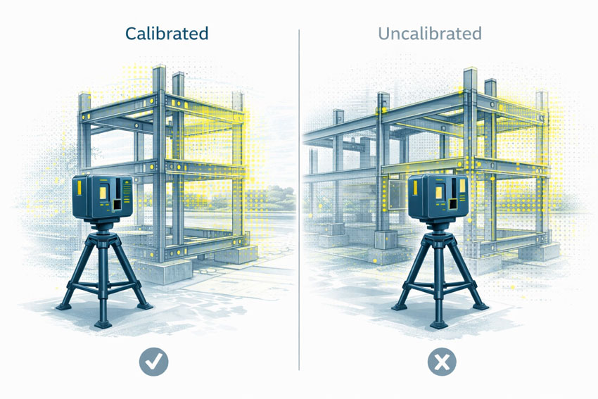

3D LiDAR Laser Scanning โ€” The Foundation of Accurate Coastal & Industrial Projects

Coastal infrastructure often includes complex geometry, ageing assets, variable terrain and environmental constraints that make traditional surveying slow and unreliable. Thatโ€™s where 3D LiDAR scanning becomes a game-changer.

Hamilton By Design provides high-accuracy scanning that captures:

  • marinas, jetties, pontoons and foreshore structures
  • workshops, fabrication sheds and industrial sites
  • terrain, drainage channels and coastal slopes
  • mechanical equipment, platforms and walkways
  • existing buildings for upgrades or conversions
  • complex pipework, tanks and utility lines

The result is a millimetre-accurate digital representation of your site โ€” a data-rich foundation for design, clash detection, feasibility studies and fabrication planning.

Learn more about scanning capabilities here:
3D Laser Scanning

For Hervey Bay clients, this means:

  • fewer site visits
  • faster design turnaround
  • improved coordination between contractors
  • reduced rework and installation errors
  • clearer visualisation for approvals and planning

In a region where weather, tides and tourism windows matter, efficient and accurate design matters even more.


3D Modelling & Drafting โ€” Turning Point Clouds into Build-Ready Designs

Once your site is scanned, Hamilton By Design transforms the data into full 3D CAD models and fabrication-ready drawings. This is essential for:

  • marine structures and coastal engineering
  • industrial and fabrication workshops
  • building upgrades or repurposing
  • mechanical equipment layout and installation
  • compliance and safety documentation

We deliver:

  • structural steel models
  • mechanical assemblies
  • GA and detail drawings
  • pipework and flow system layouts
  • workshop fit-outs
  • clash detection and interference checks
  • complete drawing packages with BOMs

In Hervey Bay, where many facilities evolve in stages over time โ€” marinas, boating facilities, industrial sheds, tourist infrastructure โ€” having an accurate digital model avoids expensive mistakes.


Engineering Services Tailored to Hervey Bayโ€™s Coastal & Industrial Landscape

Hervey Bayโ€™s engineering needs are shaped by:

  • coastal exposure
  • saltwater corrosion
  • tidal influences
  • marine loading
  • environmental sensitivity
  • ageing civil assets
  • strong fabrication and workshop activity

Hamilton By Design supports these needs with comprehensive mechanical and structural engineering including:

Mechanical Engineering

  • equipment layout and optimisation
  • marine-grade design modifications
  • conveyor, pump, motor and mechanical upgrades
  • fatigue and stress analysis
  • flow and process improvements

Structural Engineering

  • wharf and jetty modifications
  • platform and walkway design
  • structural integrity assessments
  • corrosion management & replacement design
  • footings, mounting and support structures
  • upgrades for load, access or compliance

Every project is grounded in real, verified site data, delivered through laser scanning.


Where Our Services Add the Most Value in Hervey Bay

1. Foreshore, Marina & Coastal Infrastructure Upgrades

Scanning provides exact geometry for:

  • seawalls
  • boardwalks
  • jetties
  • pontoons
  • boat ramps
  • retaining structures
  • marine-service assets

2. Workshop, Fabrication & Light-Industrial Facilities

Accurate capture of existing layouts helps:

  • optimise machinery placement
  • design new steelwork
  • eliminate fit-up errors
  • streamline fabrication

3. Tourism & Eco-Experience Infrastructure

Projects near sensitive environmental zones benefit from:

  • low-impact, non-intrusive scanning
  • terrain modelling
  • digital planning documentation

4. Council & Civil Infrastructure

LiDAR supports:

  • drainage upgrades
  • road and footpath modelling
  • structural assessments
  • coastal resilience planning

5. Building Renovations & Commercial Upgrades

Perfect for:

  • repurposed spaces
  • cafes, tourism centres, warehouses
  • multi-stage redevelopment projects

End-to-End Workflow for Bundaberg Projects

Hamilton By Design delivers a fully integrated service:

  1. 3D LiDAR scanning
  2. Point-cloud processing & accuracy verification
  3. 3D CAD modelling
  4. Mechanical & structural engineering
  5. Fabrication-ready drawings
  6. Digital QA & documentation

Thereโ€™s one team, one workflow and one level of accountability โ€” reducing delays, confusion and rework.


Hamilton By Design logo displayed on a blue tilted rectangle with a grey gradient background

Hervey Bayโ€™s Future Is Digital โ€” And Hamilton By Design Is Ready

Hervey Bay is transforming. With coastal development, marina upgrades, eco-tourism expansion, workshop growth and rising residential infrastructure, the region needs accurate, digital, engineering-grade solutions more than ever.

Hamilton By Design is here to provide:

  • precision 3D LiDAR scanning
  • engineering for marine, civil and industrial facilities
  • 3D modelling and drafting
  • digital quality assurance
  • fabrication-ready deliverables

Whether you’re planning a new coastal asset, redesigning a workshop, improving a facility or upgrading existing infrastructure, our team ensures accuracy, safety and efficiency every step of the way.


Our Clients

Name
Would you like us to arrange a phone consultation for you?
Address

Seeing the Unseen: How LiDAR Scanning is Transforming Mining Process Plants

In modern mining, where uptime is money and safety is non-negotiable, understanding the geometry of your process plant is critical. Every conveyor, chute, pipe rack, and piece of equipment must fit together seamlessly and operate reliably โ€” but plants are messy, dusty, and constantly changing. Manual measurement with a tape or total station is slow, risky, and often incomplete.

nfographic showing how LiDAR scanning is used in mining process plants, with illustrations of conveyors, crushers, tanks, mills and chutes. Labels highlight applications such as stockpile volumetrics, crusher inspections, safety and risk management, chute wear and blockages, mill wear measurement, tank deformation monitoring and creating digital twins.

This is where LiDAR scanning (Light Detection and Ranging) has become a game-changer. By capturing millions of precise 3D points per second, LiDAR gives engineers, maintenance planners, and operators an exact digital replica of the plant โ€” without climbing scaffolds or shutting down equipment. In this post, weโ€™ll explore how mining companies are using LiDAR scanning to solve real problems in processing plants, improve safety, and unlock operational efficiency.


What Is LiDAR Scanning?

LiDAR is a remote sensing technology that measures distance by firing pulses of laser light and recording the time it takes for them to return. Modern terrestrial and mobile LiDAR scanners can:

  • Capture hundreds of thousands to millions of points per second
  • Reach tens to hundreds of meters, depending on the instrument
  • Achieve millimeter-to-centimeter accuracy
  • Work in GPS-denied environments, such as inside mills, tunnels, or enclosed plants (using SLAM โ€” Simultaneous Localization and Mapping)

The output is a point cloud โ€” a dense 3D dataset representing surfaces, equipment, and structures with stunning accuracy. This point cloud can be used as-is for measurements or converted into CAD models and digital twins.


Why Process Plants Are Perfect for LiDAR

Unlike greenfield mine sites, processing plants are some of the most geometry-rich and access-constrained areas on site. They contain:

  • Complex networks of pipes, conveyors, tanks, and structural steel
  • Moving equipment such as crushers, mills, and feeders
  • Dusty, noisy, and hazardous environments with limited safe access

All these factors make traditional surveying difficult โ€” and sometimes dangerous. LiDAR enables โ€œno-touchโ€ measurement from safe vantage points, even during operation. Multiple scans can be stitched together to create a complete model without shutting down the plant.


Applications of LiDAR in Process Plants

1. Wear Measurement and Maintenance Planning

LiDAR has revolutionized how mines measure and predict wear on critical process equipment:

  • SAG and Ball Mill Liners โ€“ Portable laser scanners can capture the exact wear profile of liners. Comparing scans over time reveals wear rates, helping maintenance teams schedule relines with confidence and avoid premature failures.
  • Crusher Chambers โ€“ Scanning inside primary and secondary crushers is now faster and safer than manual inspections. The resulting 3D model allows engineers to assess liner life and optimize chamber profiles.
  • Chutes and Hoppers โ€“ Internal scans show where material buildup occurs, enabling targeted cleaning and redesign to prevent blockages.

Result: Reduced downtime, safer inspections, and better forecasting of maintenance budgets.


2. Retrofit and Expansion Projects

When modifying a plant โ€” installing a new pump, rerouting a pipe, or adding an entire circuit โ€” having an accurate โ€œas-builtโ€ model is crucial.

  • As-Built Capture โ€“ LiDAR provides an exact snapshot of the existing plant layout, eliminating guesswork.
  • Clash Detection โ€“ Designers can overlay new equipment models onto the point cloud to detect interferences before anything is fabricated.
  • Shutdown Optimization โ€“ With accurate geometry, crews know exactly what to cut, weld, and install โ€” reducing surprise field modifications and shortening shutdown durations.

3. Inventory and Material Flow Monitoring

LiDAR is not just for geometry โ€” itโ€™s also a powerful tool for tracking material:

  • Stockpile Volumetrics โ€“ Mounted scanners on stackers or at fixed points can monitor ore, concentrate, and product stockpiles in real time.
  • Conveyor Load Measurement โ€“ Stationary LiDAR above belts calculates volumetric flow, giving a direct measure of throughput without contact.
  • Blending Control โ€“ Accurate inventory data improves blending plans, ensuring consistent plant feed quality.

4. Safety and Risk Management

Perhaps the most valuable application of LiDAR is keeping people out of harmโ€™s way:

  • Hazardous Floor Areas โ€“ When flooring or gratings fail, robots or drones with LiDAR payloads can enter the area and collect data remotely.
  • Fall-of-Ground Risk โ€“ High walls, bin drawpoints, and ore passes can be scanned for unstable rock or buildup.
  • Escape Route Validation โ€“ Scans verify clearances for egress ladders, walkways, and platforms.

Every scan effectively becomes a permanent digital record โ€” a baseline for monitoring ongoing structural integrity.


5. Digital Twins and Advanced Analytics

A plant-wide LiDAR scan is the foundation of a digital twin โ€” a living, data-rich 3D model connected to operational data:

  • Combine scans with SCADA, IoT, and maintenance systems
  • Visualize live process variables in context (flow rates, temperatures, vibrations)
  • Run โ€œwhat-ifโ€ simulations for debottlenecking or energy optimization

As AI and simulation tools mature, the combination of geometric fidelity and operational data opens new possibilities for predictive maintenance and autonomous plant operations.


Emerging Opportunities

Looking forward, there are several promising areas for LiDAR in mining process plants:

  • Autonomous Scan Missions โ€“ Using quadruped robots (like Spot) or SLAM-enabled drones to perform routine scanning in high-risk zones.
  • Real-Time Change Detection โ€“ Continuous scanning of critical assets with alerts when deformation exceeds thresholds.
  • AI-Driven Point Cloud Analysis โ€“ Automatic object recognition (valves, flanges, motors) to speed up model creation and condition reporting.
  • Integrated Planning Dashboards โ€“ Combining LiDAR scans, work orders, and shutdown schedules in a single interactive 3D environment.

Best Practices for Implementing LiDAR

To maximize the value of LiDAR scanning, consider:

  1. Define the Objective โ€“ Are you measuring wear, planning a retrofit, or building a digital twin? This affects scanner choice and resolution.
  2. Plan Scan Positions โ€“ Minimize occlusions and shadow zones by preplanning vantage points.
  3. Use Proper Registration โ€“ Tie scans to a control network for consistent alignment between surveys.
  4. Mind the Environment โ€“ Dust, fog, and vibration can degrade data; choose scanners with appropriate filters or protective housings.
  5. Invest in Processing Tools โ€“ The raw point cloud is only the start โ€” software for meshing, modeling, and analysis is where value is extracted.
  6. Train Your Team โ€“ Build internal capability for scanning, processing, and interpreting the results to avoid vendor bottlenecks.

Infographic showing a 3D LiDAR scanner on a tripod surrounded by eight best-practice principles: start with clear objectives, plan your scanning campaign, prioritize safety, optimize data quality, ensure robust registration and georeferencing, establish repeatability, integrate with downstream systems, and train people with documented procedures

LiDAR scanning is no longer a niche technology โ€” it is rapidly becoming a standard tool for mining process plants that want to operate safely, efficiently, and with fewer surprises. From mill liners to stockpiles, from shutdown planning to digital twins, LiDAR provides a clear, measurable view of assets that was impossible a decade ago.

For operations teams under pressure to deliver more with less, the case is compelling: better data leads to better decisions. And in a high-stakes environment like mineral processing, better decisions translate directly to improved uptime, reduced costs, and safer workplaces.

The next time youโ€™re planning a shutdown, a retrofit, or even just trying to understand why a chute is plugging, consider pointing a LiDAR scanner at the problem. You may be surprised at how much more you can see โ€” and how much time and money you can save.

3D Scanning | Mining Surface Ops | 3D Modelling

Mechanical Engineering | Structural Engineering

Mechanical Drafting | Structural Drafting

3D CAD Modelling | 3D Scanning

Chute Design

SolidWorks Contractors in Australia

Hamilton By Design โ€“ Blog