Engineering-Grade LiDAR Scanning

They Donโ€™t Just Scan โ€” They Take Responsibility

Engineering-grade LiDAR scanning is not about collecting point clouds.
It is about taking responsibility for the data that engineering, fabrication, and shutdown decisions are made from.

At Hamilton By Design, engineering-grade LiDAR scanning means the scan is:

  • Planned by engineers
  • Verified by engineers
  • Used directly for design and fabrication
  • Owned by engineers when it matters

If a scan cannot be confidently designed from, fabricated from, and installed from, it is not engineering grade.


โ€œWeโ€™ve seen too many projects fail because everyone assumed the scan was โ€˜good enoughโ€™.
At Hamilton By Design, we donโ€™t just deliver LiDAR data โ€” we take responsibility for whether it can actually be designed and built from.
If weโ€™re involved, someone owns the outcome.โ€

โ€” General Manager, Hamilton By Design


Why Most LiDAR Scans Fail Engineering Projects

We regularly encounter projects where:

  • โ€œWe trusted the data and got burned.โ€
  • โ€œThe drawings didnโ€™t match reality.โ€
  • โ€œNo one wanted to own it when it went wrong.โ€

In most cases, the issue isnโ€™t the scanner.

The issue is that the scan was treated as a data product, not an engineering input.

Scan-only services deliver point clouds.
Engineering-grade LiDAR delivers confidence, accountability, and defensible outcomes.
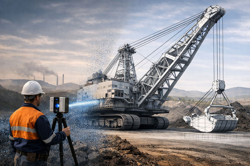
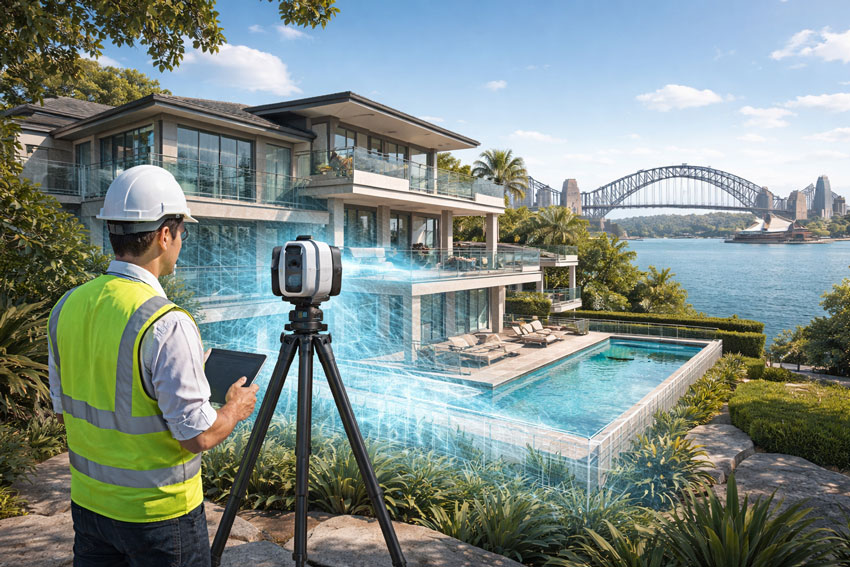

What Makes LiDAR โ€œEngineering-Gradeโ€

Engineering-grade LiDAR scanning is defined by how the scan is controlled, interpreted, and used, not by scan density or marketing claims.

1. Engineering-Led Scan Planning

Before scanning begins, engineers define:

  • What must fit together
  • What tolerances actually matter
  • What will be fabricated, replaced, or installed
  • Where shutdown or safety risk exists

This ensures the scan is fit-for-purpose, not just visually impressive.
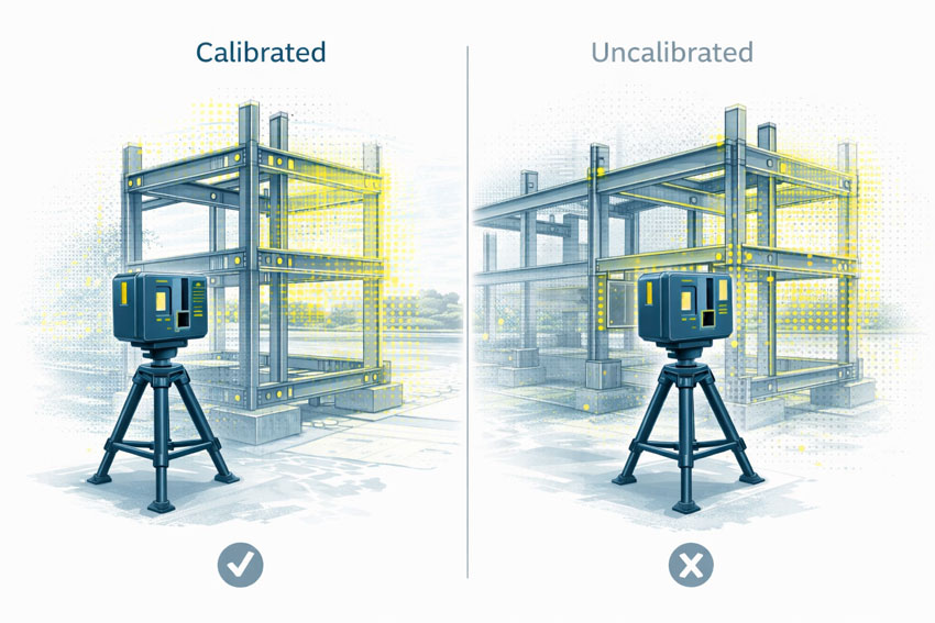

2. Accuracy Is Verified โ€” Not Assumed

Engineering-grade scanning includes:

  • Controlled scan resolution and overlap
  • Registration reviewed using engineering judgement
  • Scale and geometry checked against known site features
  • Accuracy assessed relative to design intent

A dense point cloud does not guarantee engineering reliability.


3. Engineering Interpretation of Brownfield Reality

Real industrial assets are rarely perfect. They are:

  • Worn
  • Modified
  • Repaired
  • Out of square

Engineering-grade LiDAR scanning includes:

  • Interpretation of deformation and wear
  • Identification of unreliable geometry
  • Clear documentation of assumptions and exclusions

This is where engineering experience prevents downstream rework.


4. Data That Works Directly in CAD & Fabrication

Engineering-grade LiDAR data is:

  • Structured for SolidWorks and Inventor
  • Used directly for fabrication-ready models and drawings
  • Suitable for interference checks and constructability reviews

If a scan cannot be confidently used in CAD, it is not engineering-grade.

Point Clouds – 3D Scans – Engineering Quality – Past Projects


  • 3D LiDAR point cloud of an industrial plant structure

5. Ownership When It Matters Most

Engineering-grade LiDAR scanning means:

  • One party owns the scan-to-design interface
  • Assumptions are explicit and traceable
  • Engineering judgement is applied โ€” not avoided

This is critical when:

  • Shutdown windows are tight
  • Fabrication is off-site
  • Parts must fit together first time
  • Designs must be defensible in audits or reviews

Our clients:


Why Fabricators and Shutdown Teams Value This Approach

Engineering-grade LiDAR scanning enables:

  • Seamless delivery where parts fit together
  • Reduced RFIs and site rework
  • Predictable shutdown execution
  • Fit-first-time fabrication

We design with fabrication and installation in mind, because that is where projects succeed โ€” or fail.


Where Engineering-Grade LiDAR Is Essential

  • Mining and minerals processing facilities
  • Power generation and utilities
  • Manufacturing and process plants
  • Brownfield upgrades and tie-ins
  • Shutdown-critical replacement works
  • Reverse engineering of undocumented assets
  • Safety-critical access platforms and structures

Hamilton By Design logo displayed on a blue tilted rectangle with a grey gradient background

Engineering-Grade LiDAR Is Risk Management

At Hamilton By Design, LiDAR scanning is not sold as a standalone service.

It is part of an engineering-led delivery model that connects:

  • Reality capture
  • Mechanical and structural design
  • Fabrication documentation
  • Installation confidence

We do not compete on lowest scan cost.
We compete on ownership, accountability, and outcome.


Hunter Valley Laser Scanning | CAD-Ready SolidWorks & Inventor

Engineering-grade LiDAR scanning of a dragline at a Hunter Valley mine producing CAD-ready data for SolidWorks and Autodesk Inventor

Hunter Valley Laser Scanning | CAD-Ready SolidWorks & Inventor

Engineering-Grade 3D & LiDAR Scanning Built for SolidWorks & Autodesk Inventor

The Hunter Valley is home to critical mining, power generation, manufacturing, and heavy-industry assets. In these environments, laser scanning is only valuable if the data can be used directly in engineering design software.

At Hamilton By Design, we deliver Hunter Valley laser scanning services that are purpose-built for engineering workflows โ€” ensuring scan data can be reliably used in SolidWorks and Autodesk Inventor without rework, approximation, or loss of accuracy.


Why โ€œScan-Onlyโ€ Data Is a Problem

Many laser scanning services focus on data capture only. While the point cloud may look impressive, it often fails at the most important step:

Can the scan be used directly in CAD and engineering design?

If the answer is no, the scan has limited value.

Common issues with low-grade or technician-only scanning include:

  • Point clouds that are not registered or scaled correctly
  • Insufficient accuracy for mechanical design tolerances
  • Poor alignment to real-world coordinate systems
  • Data that cannot be reliably modelled in SolidWorks or Inventor
  • Extra time and cost spent โ€œfixingโ€ scan data before design can begin

Why would you spend money on a scan that cannot be used for engineering?


Engineer performing engineering-grade laser scanning of a dragline excavator at a Hunter Valley mine for SolidWorks and Autodesk Inventor design

Engineering-Grade Laser Scanning โ€” Designed for CAD Use

Hamilton By Design approaches laser scanning as an engineering input, not a visual deliverable.

Our Hunter Valley laser scanning services are planned and executed so that scan data can be:

  • Used directly in SolidWorks
  • Imported and referenced accurately in Autodesk Inventor
  • Modelled into fabrication-ready geometry
  • Trusted for mechanical, structural, and layout decisions

This means the scan is not the end product โ€” it is the foundation for engineering and design.


Why Scanner Capability Matters

Not all scanners โ€” or scanning providers โ€” are equal.

Low-accuracy or inappropriate scanning equipment can result in:

  • Global accuracy drift
  • Poor definition of critical interfaces
  • Inability to confidently model mating parts, pipework, or steelwork
  • Designs that โ€œlook rightโ€ on screen but fail on site

Hamilton By Design uses engineering-grade scanning equipment and workflows, ensuring the captured data supports:

  • Mechanical equipment upgrades
  • Structural modifications
  • Conveyor, chute, and platform design
  • Fabrication and installation planning

Hunter Valley Applications Where CAD-Ready Scans Matter

Mining & CHPP Upgrades

Laser scanning of conveyors, transfer stations, chutes, and structures that must integrate precisely with new mechanical equipment.

Power Generation & Utilities

Accurate capture of plant rooms, pipework, platforms, and access systems for compliance and upgrade works.

Manufacturing & Heavy Industry

Reliable spatial data to support machinery installation, relocation, and layout optimisation.

Brownfield Construction & Retrofits

Engineering-grade scans to avoid clashes, rework, and costly shutdown overruns.


Engineer-Led Scanning โ€” Not Just Data Capture

At Hamilton By Design, laser scanning is delivered by engineers who understand how the data will be used.

This ensures:

  • Scan resolution and accuracy are matched to design intent
  • Critical interfaces are captured correctly
  • Data integrates seamlessly with CAD workflows
  • Accountability is maintained from scan through to design and documentation

You donโ€™t just receive a point cloud โ€” you receive usable engineering data.


Deliverables That Engineers Can Actually Use

Depending on your project, we provide:

  • Registered, engineering-grade point clouds
  • CAD-ready reference data for SolidWorks and Inventor
  • Section views and alignment references
  • Models and drawings derived directly from scan data
  • Documentation suitable for fabrication and construction

Everything is scoped so the scan adds value immediately, not later after rework.


Hunter Valley Laser Scanning โ€” Designed to Be Used, Not Admired

Laser scanning should remove uncertainty, not create more work.

By ensuring scan data can be used directly in SolidWorks and Autodesk Inventor, Hamilton By Design helps Hunter Valley projects move from site capture to design, fabrication, and installation with confidence.

Hamilton By Design delivers engineering-grade laser scanning in the Hunter Valley โ€” built for real engineering outcomes, not just visualisation.

Contact us to discuss your Hunter Valley laser scanning requirements or arrange an engineering-led site scan.

Name
Would you like us to arrange a phone consultation for you?
Address

Reality Capture Sydney

Engineer using a LiDAR scanner to capture a Sydney harbour-front residential property with Sydney Harbour Bridge in the background

Reality Capture Sydney | Property & Real Estate Services

Engineering-Grade LiDAR & Digital Reality Capture for the Built Environment

As Sydneyโ€™s construction, infrastructure, and industrial assets become more complex, traditional measurement methods are no longer sufficient. Reality capture has become a critical enabler for accurate planning, risk reduction, and confident project delivery across the built environment in Sydney.

Hamilton By Design provides engineering-grade reality capture services in Sydney, combining high-accuracy LiDAR laser scanning with practical engineering workflows to deliver reliable as-built data, digital twins, and construction-ready models.

Learn more about our Sydney scanning capability:
https://www.hamiltonbydesign.com.au/home/engineering-services/3d-scanning-sydney/3d-scanning-services-in-sydney/


What Is Reality Capture?

Reality capture is the process of digitally recording real-world assets using technologies such as:

  • LiDAR laser scanning
  • High-resolution spatial data capture
  • Registered point clouds
  • 3D models aligned to real geometry

The result is an accurate digital representation of existing conditions โ€” enabling engineers, designers, and constructors to work from a single source of truth rather than assumptions or outdated drawings.


Reality capture of a Sydney waterfront residential property using LiDAR scanning with harbour and bridge context

Why Reality Capture Matters in Sydney

Sydney projects frequently involve:

  • Live operational assets
  • Brownfield construction and upgrades
  • Tight construction tolerances
  • Complex interfaces between structural, mechanical, and architectural systems

Reality capture enables project teams to:

โœ” Verify existing conditions before design
โœ” Reduce rework and construction clashes
โœ” Improve coordination across disciplines
โœ” Accelerate approvals and decision-making
โœ” Improve safety by minimising site re-visits

This is particularly valuable across commercial buildings, transport infrastructure, industrial facilities, utilities, and large refurbishment projects.


Engineering-Led Reality Capture โ€” The Hamilton By Design Difference

At Hamilton By Design, reality capture is not treated as a standalone surveying task. Our services are engineer-led, ensuring the data captured is fit for downstream use in:

  • Mechanical and structural design
  • Construction coordination
  • Retrofit and upgrade works
  • Fabrication and installation planning

Our Sydney reality capture services integrate directly with CAD, BIM, and engineering documentation workflows โ€” ensuring accountability from scan through to design and delivery.


Typical Reality Capture Applications in Sydney

As-Built Documentation

Capture accurate as-built conditions for compliance, certification, handover, or future upgrades.

Construction & Refurbishment Projects

Scan existing buildings and structures prior to modifications, extensions, or adaptive reuse.

Industrial & Infrastructure Assets

Capture complex geometry such as plant rooms, pipework, platforms, and structural steel.

Digital Twins & Asset Records

Create reliable digital records that support ongoing asset management and lifecycle planning.


Deliverables Tailored to Project Needs

Depending on your scope, Hamilton By Design can provide:

  • Registered LiDAR point clouds
  • CAD-ready geometry
  • BIM-compatible models
  • Section views and reference drawings
  • Engineering drawings derived from scan data

All deliverables are issued to suit engineers, builders, asset owners, and project managers working across Sydney.


Hamilton By Design logo displayed on a blue tilted rectangle with a grey gradient background

Reality Capture Sydney โ€” Build with Confidence

Reality capture removes uncertainty from complex projects. By accurately capturing what exists today, project teams can design, coordinate, and construct with confidence tomorrow.

Hamilton By Design supports Sydney-based projects with engineering-grade reality capture, practical deliverables, and a deep understanding of how digital data is used in real construction and industrial environments.

Contact Hamilton By Design to discuss your Sydney reality capture requirements or arrange a site scan.

Name
Would you like us to arrange a phone consultation for you?
Address

Engineering-Led 3D Laser Scanning in Bathurst

3D laser scanner capturing an industrial structure for engineering-grade digital modelling and verification

3D Scanning Bathurst | Engineering-Grade LiDAR & Scan-to-CAD

Bathurst and the Central West region support a diverse mix of manufacturing facilities, mining operations, quarries, infrastructure assets, utilities, and heritage structures. These environments demand more than survey-grade outputs.

Hamilton By Design combines LiDAR scanning with mechanical engineering expertise, ensuring that:

  • Scan coverage targets critical interfaces and load paths
  • Accuracy supports fabrication-ready design
  • Models reflect real-world constraints, not assumptions

This significantly reduces rework, clashes, and site uncertainty during upgrades or expansions.


Mechanical engineering services by Hamilton By Design, featuring industrial machinery, conveyors, and maintenance engineering.

Our 3D Scanning Services in Bathurst

We provide a complete scan-to-engineering workflow, including:

  • High-resolution terrestrial LiDAR scanning
  • Registered point clouds (colourised and structured)
  • Scan-to-CAD modelling (SolidWorks & engineering CAD)
  • As-built documentation for existing assets
  • Clash detection & design validation
  • Support for mechanical, structural, and fabrication design

All deliverables are tailored to your project scope โ€” from concept planning through to construction and installation.


Typical Bathurst Applications

Our 3D scanning services are commonly used for:

  • Industrial plant upgrades and brownfield modifications
  • Mining and quarry infrastructure
  • Conveyors, chutes, hoppers, and bulk materials handling systems
  • Mechanical equipment replacement and tie-ins
  • Structural steel verification and retrofits
  • Asset documentation and digital twins
  • Risk reduction for shutdown and live-site works

Where required, scanning data is integrated directly into engineering calculations, FEA models, and fabrication drawings.


Hamilton By Design logo displayed on a blue tilted rectangle with a grey gradient background

Why Hamilton By Design

Engineer-Led Scanning

Your scan is planned and executed by engineers who understand loads, tolerances, constructability, and compliance, not just data capture.

Fit-for-Purpose Accuracy

We capture only the data that matters โ€” at the accuracy required for design, fabrication, and installation.

Single-Source Accountability

One team responsible for scanning, modelling, and engineering, eliminating scope gaps between consultants.

Regional & Mobile Delivery

We regularly support projects across Bathurst, Orange, Lithgow, Dubbo, Mudgee, and the broader Central West NSW, mobilising to site as required.


Deliverables You Can Build From

Depending on your project, we can supply:

  • Registered point clouds (E57 / RCP / compatible formats)
  • 3D CAD models aligned to engineering workflows
  • GA drawings and interface layouts
  • Fabrication-ready references
  • Digital records for asset management and future upgrades

Our clients:

3D Scanning Bathurst โ€“ Get Started

If you are planning a retrofit, upgrade, or new installation in Bathurst or Central West NSW, early 3D scanning can significantly reduce risk and cost.

Talk to an engineer about your site
Request a Bathurst 3D scanning proposal
On-site scanning available across the Central West

Name
Would you like us to arrange a phone consultation for you?
Address

Detailing Transfer Stations in the Age of Digital Engineering

Transfer stations and chutes sit at the intersection of bulk materials handling, structural engineering, and fabrication practicality. While the fundamentals of good detailing have not changed, the way engineers now capture, coordinate, and validate these details has evolved significantly over the past decade.

This article revisits the principles of transfer station detailing and places them in a modern digital-engineering context, where accurate site data, constructability, and lifecycle performance are critical.


Engineering illustration of a transfer chute showing a LiDAR point cloud overlay aligned with the same chute geometry for as-built verification.

Why Transfer Station Detailing Still Matters

Poorly detailed transfer stations remain one of the most common sources of:

  • Material spillage and dust generation
  • Accelerated liner and structure wear
  • Unplanned downtime and maintenance escalation
  • Safety risks to operators and maintainers

In many cases, the root cause is not the concept design, but inadequate detailing and incomplete understanding of site geometry.

Even well-intended designs can fail if:

  • Existing structures are misrepresented
  • Conveyor interfaces are assumed rather than measured
  • Fabrication tolerances are not realistically achievable on site

The Shift from Assumed Geometry to Measured Reality

Historically, detailing relied heavily on:

  • Legacy drawings
  • Manual tape measurements
  • Partial site surveys
  • โ€œBest guessโ€ alignment assumptions

Today, engineering-grade reality capture has fundamentally changed what is possible.

Using 3D laser scanning (LiDAR), engineers can now work from:

  • Millimetre-accurate point clouds
  • Verified conveyor centre lines
  • True chute-to-structure interfaces
  • Real as-installed conditions rather than design intent

This shift dramatically reduces site rework and fabrication clashes.

This approach is central to how Hamilton By Design supports bulk materials handling upgrades across mining, ports, and heavy industry.


Detailing Considerations That Still Get Missed

Even with modern tools, certain detailing fundamentals remain critical.

1. Interface Accuracy

Transfer stations often interface with:

  • Existing conveyors
  • Walkways and access platforms
  • Structural steelwork installed decades earlier

Without accurate as-built data, small errors compound quickly. Laser scanning eliminates this uncertainty.

Related reading:
https://www.hamiltonbydesign.com.au/3d-laser-scanning-engineering/


2. Wear Liner Integration

Good detailing must account for:

  • Liner thickness variation
  • Fixing access and replacement paths
  • Load paths through liners into structure

Digitally modelling liners within the chute geometry allows engineers to validate:

  • Clearances
  • Installation sequence
  • Maintenance access before steel is cut

3. Fabrication Reality

A detail that looks acceptable in 2D can become problematic when fabricated.

Modern workflows now link:

  • 3D scanning
  • Solid modelling
  • Fabrication drawings
  • Digital QA checks

This reduces site modifications and ensures components fit first time.

Example of fabrication-ready workflows:
https://www.hamiltonbydesign.com.au/mechanical-engineering-design-services/


Transfer Stations as Systems, Not Isolated Chutes

A key lesson reinforced over time is that transfer stations must be treated as systems, not standalone components.

Good detailing considers:

  • Upstream and downstream belt tracking
  • Material trajectory consistency
  • Structural vibration and dynamic loading
  • Maintenance access under real operating conditions

Digital engineering allows these interactions to be reviewed early, reducing operational risk.


The Role of Engineering-Led Scanning

Not all scans are equal.

For engineering applications, scanning must be:

  • Performed with known accuracy
  • Registered and verified correctly
  • Interpreted by engineers, not just technicians

This distinction matters when designs are used for fabrication and compliance.

Hamilton By Designโ€™s approach combines engineering-led LiDAR scanning with mechanical design, ensuring the data collected is suitable for real engineering decisions.

Learn more:
https://www.hamiltonbydesign.com.au/engineering-led-3d-lidar-scanning/


Closing Thoughts

While detailing principles for transfer stations have stood the test of time, the tools and expectations have changed.

Modern projects demand:

  • Verified geometry
  • Fabrication-ready models
  • Reduced site risk
  • Higher confidence before steel is ordered

By integrating reality capture, detailed modelling, and constructability thinking, transfer station detailing can move from a risk point to a performance advantage.


Hamilton By Design logo displayed on a blue tilted rectangle with a grey gradient background

Our clients:


Name
Would you like us to arrange a phone consultation for you?
Address

Further Reading

AS ISO 5725 and 3D LiDAR Scanning

Why Accuracy, Precision, and Calibration Matter for Engineering Outcomes

When 3D LiDAR scanning is used for engineering, fabrication, or certification, the most important question is not how detailed the point cloud looks, but whether the measurements can be trusted.

This is where AS ISO 5725 โ€” Accuracy and Precision of Measurement becomes relevant. While AS ISO 5725 is not written specifically for LiDAR scanners, it defines the principles that determine whether any measurement system is suitable for engineering use.

In practical terms, AS ISO 5725 separates data that can support engineering decisions from data that is visually convincing but technically unreliable.


Comparison of calibrated and uncalibrated 3D LiDAR scanning, showing a calibrated scanner with aligned point cloud and steel frame geometry, and an uncalibrated scanner with visibly misaligned measurement data

What AS ISO 5725 Covers

AS ISO 5725 defines how measurement systems should be evaluated in terms of:

  • Accuracy
  • Precision
  • Repeatability
  • Reproducibility
  • Measurement uncertainty

These principles apply directly to 3D LiDAR scanning because a LiDAR scanner is, at its core, a measurement instrument. When scanning data is used to inform design, fabrication, or certification, the expectations set by AS ISO 5725 apply regardless of scanner brand or software.

This is why engineering-grade 3D LiDAR scanning requires more than simply capturing a dense point cloud. It requires controlled measurement, understood uncertainty, and validated outputs, as delivered through engineering-grade 3D laser scanning workflows:
https://www.hamiltonbydesign.com.au/home/engineering-services/3d-laser-scanning/


Accuracy vs Precision in LiDAR Scanning

AS ISO 5725 makes a clear distinction between accuracy and precision, a distinction that is often misunderstood in reality capture.

Accuracy describes how close a measurement is to the true value.
Precision describes how consistently the same measurement can be repeated.

A LiDAR scan can appear highly precise, with clean and consistent geometry, while still being inaccurate if the scanner is miscalibrated or poorly controlled. In engineering terms, repeatable errors are still errors.

For engineering and fabrication, both accuracy and precision are required.


The Role of Calibration

Calibration ensures that a scannerโ€™s distance and angular measurements align with known reference values. Without calibration, a LiDAR scanner may still operate normally and still produce visually impressive results, but the measurements no longer have a known or defensible level of uncertainty.

Calibration directly affects:

  • Distance measurement
  • Angular accuracy
  • Alignment between internal sensors
  • Registration between multiple scans

AS ISO 5725 does not prescribe how calibration must be performed, but it does establish the expectation that measurement uncertainty is understood and controlled.


What Happens When Scanning Is Not Calibrated

When LiDAR scanning is not properly calibrated or verified, errors propagate into every downstream deliverable.

Common outcomes include:

  • Fabricated steelwork that does not fit on site
  • Bolt holes and connection points outside tolerance
  • Frames requiring on-site modification or rework
  • Assumed clearances that do not exist in reality
  • Delays or challenges during engineering sign-off

These issues are often discovered late in a project, where the cost of correction is highest. The root cause is frequently measurement error introduced at the scanning stage, not fabrication quality.

This is particularly critical in design-for-fabrication workflows, where scanning data is used to develop fabrication-ready designs:
https://www.hamiltonbydesign.com.au/fabrication-product-design/


The Compounding Effect of Small Errors

One of the most significant risks in unverified scanning workflows is that errors are often small enough to go unnoticed early.

A few millimetres of error at the scanning stage can compound into much larger discrepancies once geometry is modelled, detailed, and fabricated. Across multiple interfaces, these small deviations can lead to misalignment, rework, or compromised installation quality.

For fit-first-time fabrication, this risk is unacceptable.


Illustrated comparison of ISO 19650 BIM information management, showing an organised digital model with structured data on one side and a disorganised model with fragmented documentation on the other.

Engineering Responsibility and Certification Risk

When LiDAR data is used to support engineering decisions, responsibility does not sit with the scanner or the software. It sits with the engineer relying on the data.

If measurements cannot be demonstrated as accurate, repeatable, and appropriately controlled, they are not suitable to support engineering sign-off. This is particularly relevant where scanning data contributes to certification outcomes, where accountability and defensibility are essential.

Engineering certification must be based on verified measurements, supported by controlled data capture and documented processes:
https://www.hamiltonbydesign.com.au/home/engineering-services/engineering-certification/


Why AS ISO 5725 Matters in Practice

AS ISO 5725 is not about paperwork or compliance for its own sake. It provides the framework that ensures measurement data used for engineering decisions is fit for purpose.

When LiDAR scanning is undertaken with accuracy, precision, and calibration treated seriously, it becomes a powerful engineering tool. When these principles are ignored, scanning becomes a source of hidden risk that only emerges when it is too late to correct cheaply.


Hamilton By Design logo displayed on a blue tilted rectangle with a grey gradient background

Final Thought

3D LiDAR scanning is only as reliable as the measurement discipline behind it.

AS ISO 5725 provides the foundation for understanding whether scanning data can be trusted. In engineering, fabrication, and certification contexts, that trust is not optional โ€” it is essential.


Structural drafting services button
Building and construction services button
Mechanical drafting services button

Our clients:

Name
Would you like us to arrange a phone consultation for you?
Address