


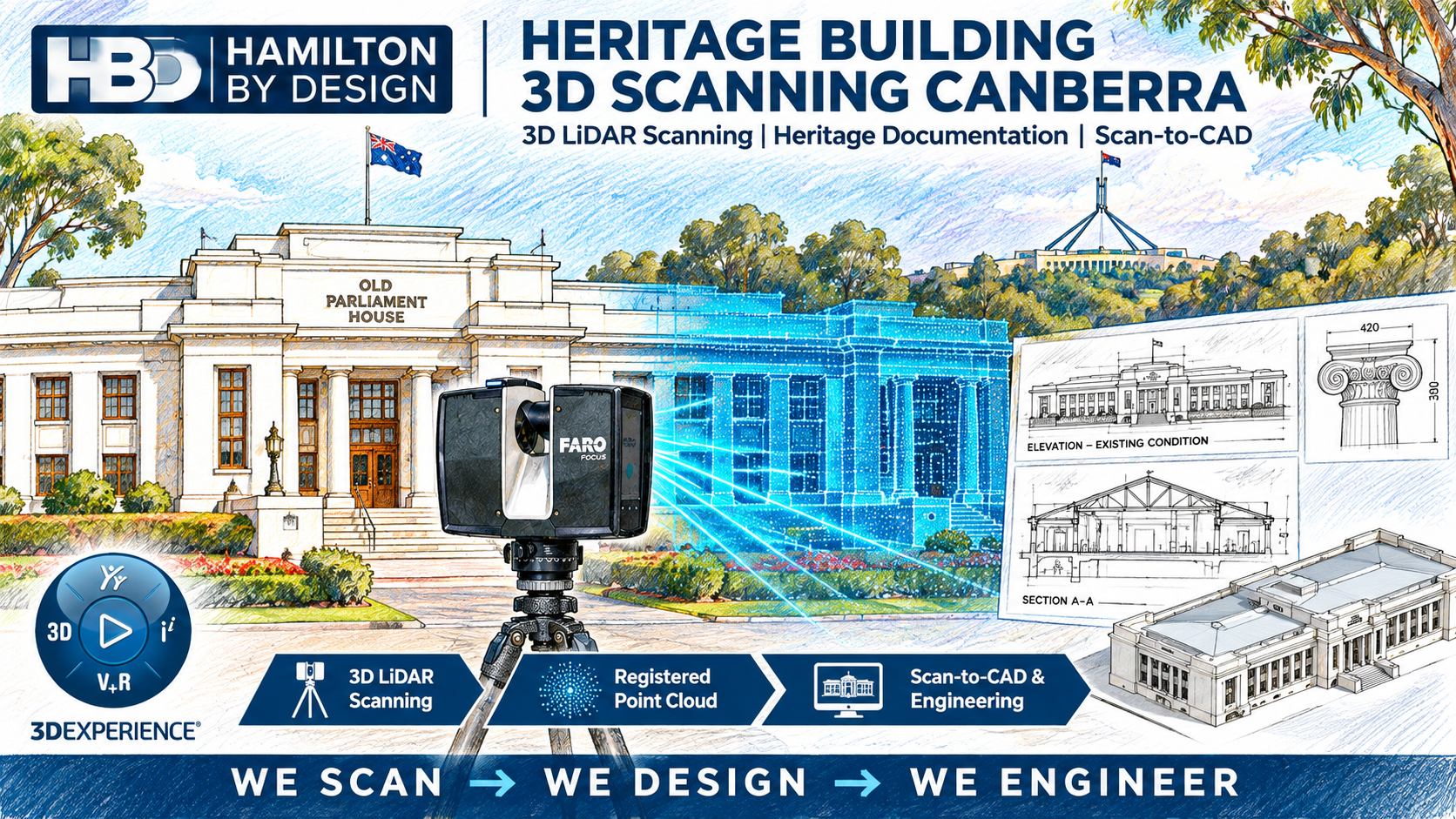
Engineering-Grade 3D LiDAR Scanning for Heritage Buildings in Canberra and the ACT
Canberra’s architectural heritage reflects Australia’s national history, from early twentieth-century civic buildings and institutional architecture to historic residences, memorials, industrial structures and significant public buildings.
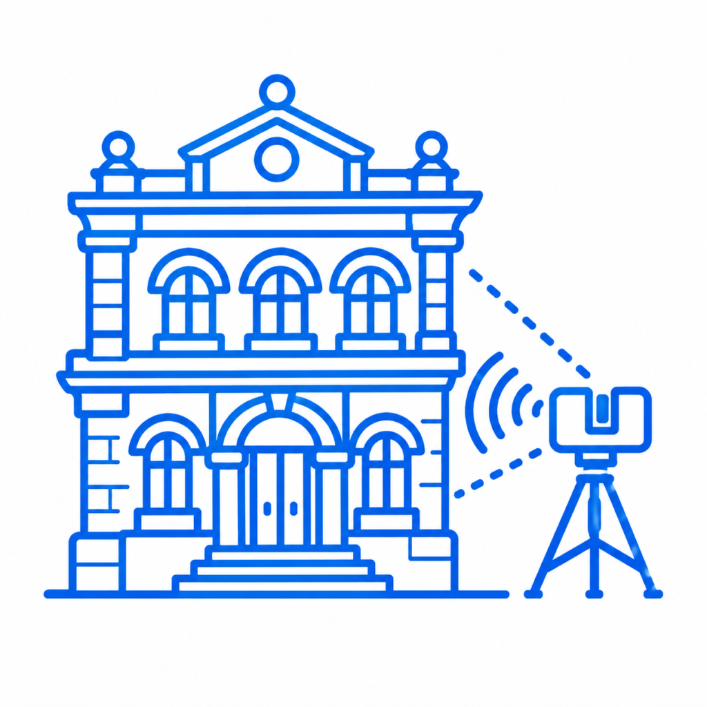
Preserving these assets requires a detailed understanding of their existing geometry, construction characteristics and architectural features.
Hamilton By Design provides professional heritage building 3D scanning in Canberra, combining terrestrial LiDAR scanning, registered point cloud processing, Scan-to-CAD modelling and mechanical engineering expertise to support heritage conservation, restoration, refurbishment and adaptive reuse projects throughout the Australian Capital Territory.
Our engineering-led approach provides architects, heritage consultants, structural engineers, building owners and contractors with reliable dimensional information for design development, documentation and construction planning.
WE SCAN → WE DESIGN → WE ENGINEER
Why Heritage Building 3D Scanning Is Important in Canberra
Canberra contains a distinctive collection of nationally significant architecture, including early Federal Capital buildings, government institutions, commemorative structures and historic residential precincts.
Many of these buildings incorporate complex architectural geometry, traditional construction methods and materials that are difficult to document accurately using conventional measurement techniques.
Traditional tape measurements and isolated surveying observations may not capture the full geometry of irregular façades, curved architectural elements, roof structures, masonry features or existing building deviations.
3D LiDAR scanning provides a comprehensive digital record of visible building surfaces, allowing project teams to examine and measure existing conditions without relying solely on individual manual measurements.
For heritage conservation and adaptive reuse projects, this information can assist with:
- Establishing accurate existing-condition documentation before design commences.
- Recording architectural features that may be affected by refurbishment or restoration.
- Identifying dimensional variations between existing structures and historical drawings.
- Supporting coordination between architectural, structural and building services disciplines.
- Reducing uncertainty when designing new components to interface with existing construction.
- Providing a reusable digital reference for future conservation and maintenance activities.
For sensitive heritage structures, terrestrial LiDAR scanning also offers the advantage of non-contact dimensional capture.
Heritage Architecture and Historic Buildings in Canberra
<text preserveWhitespace>{“”}</text>
Early Canberra Civic and Institutional Buildings
Canberra’s planned development during the twentieth century produced a collection of public buildings with significant architectural, historical and cultural value.
Buildings such as Old Parliament House, historic administrative buildings and early institutional structures demonstrate the importance of maintaining accurate records of existing architectural geometry.
These buildings may incorporate decorative façades, columns, colonnades, stairways, roof structures and architectural features requiring careful documentation.
Hamilton By Design’s terrestrial scanning methodology can support the dimensional recording of comparable heritage structures for conservation planning and refurbishment design.
References to prominent Canberra landmarks are architectural examples and do not imply that Hamilton By Design has undertaken scanning projects at those properties.
Heritage Residential Buildings and Historic Precincts
Canberra’s older residential areas include buildings associated with the early development of the national capital.
Suburbs such as Ainslie, Braddon, Reid, Forrest and Griffith contain examples of early residential architecture and established building forms.
Heritage refurbishment projects may require documentation of:
- Existing external walls and façades.
- Roof geometry, roof pitches and drainage arrangements.
- Verandahs, columns, entrances and architectural detailing.
- Floor levels, wall alignment and structural interfaces.
- Existing building geometry before extensions or modifications.
3D scanning provides a coordinated dimensional reference to assist architects and engineers during design development.
Memorials, Monuments and Architecturally Significant Structures
Canberra’s national significance is reflected in its memorials, monuments and public architectural spaces.
These structures may incorporate curved surfaces, sculptural elements, stonework, complex intersections and non-standard geometry.
Where access and site permissions permit, 3D LiDAR scanning can capture visible geometric features for digital documentation and engineering assessment.
For complex decorative components or smaller features requiring additional measurement detail, supplementary close-range scanning may be appropriate.
Heritage Façade Scanning and Architectural Documentation
Heritage façades often contain irregular geometry that cannot be adequately represented by simplified rectangular measurements.
Canberra’s historic buildings may incorporate rendered masonry, brickwork, sandstone detailing, architectural columns, decorative cornices, arches and other traditional construction features.
Hamilton By Design uses terrestrial LiDAR scanning to capture the visible geometry of these building elements and establish a coordinated point cloud dataset.
Applications of Heritage Façade Scanning
Existing-Condition Elevations
Point cloud data can support the preparation of measured façade elevations showing openings, architectural features, building interfaces and dimensional relationships.
Stonework and Masonry Documentation
Scanning can record the visible geometry of masonry elements, decorative detailing and irregular surfaces for restoration planning.
Building Alterations and Extensions
Measured existing conditions assist designers when integrating new construction with heritage fabric.
Roof and Parapet Documentation
Where sufficient line of sight is available, scanning can capture roof edges, parapets, gutters, roof interfaces and accessible structural geometry.
Façade Refurbishment and Replacement Components
Engineering-led CAD modelling can assist with replacement components, brackets, support systems and other fabricated elements requiring dimensional coordination with existing structures.
The level of detail achievable depends on scanner positioning, surface visibility, scanning distance and the complexity of the building.
3D LiDAR Scanning Technology for Heritage Buildings
Hamilton By Design operates a FARO Focus S70 terrestrial laser scanner for engineering and architectural measurement applications.
The scanner captures large quantities of spatial measurements to create a three-dimensional representation of visible surfaces.
Individual scan positions are registered into a common coordinate system to produce a coordinated point cloud.
Benefits of Terrestrial LiDAR Scanning
Non-Contact Measurement
Scanning records visible building geometry without requiring direct physical contact with delicate architectural surfaces.
High-Density Spatial Information
A registered point cloud provides a substantial dataset that can be examined for dimensional relationships and existing building geometry.
Reduced Measurement Uncertainty
Engineering teams can refer to the same coordinated dataset rather than relying on separate manual measurement records.
Access to Complex Geometry
LiDAR scanning can document many architectural features that are difficult to measure using conventional techniques, subject to line-of-sight and safe access.
Digital Records for Future Use
Registered point clouds can provide a reusable reference for future refurbishment, conservation and engineering work.
The accuracy of the final dataset depends on scanner performance, scan registration, survey control where applicable, site conditions and the required deliverables.
Registered Point Cloud Deliverables for Heritage Projects
Following site scanning, Hamilton By Design processes and registers the individual scan positions into a coordinated point cloud dataset.
Depending on project requirements, deliverables may include:
| Deliverable | Application |
|---|---|
| .E57 | Interoperable point cloud exchange for architectural, engineering and BIM workflows |
| .RCP / .RCS | Autodesk ReCap and compatible Autodesk applications |
| .LAS | Point cloud exchange and spatial data workflows where appropriate |
| 3D CAD Models | Engineering design, fabrication and existing-condition modelling |
| 2D CAD Drawings | Measured elevations, sections, plans and technical documentation |
| STEP / Parasolid | Engineering model exchange where specified |
Deliverables are established during project scoping to suit the intended design, conservation or engineering application.
A registered point cloud is not automatically a completed architectural or engineering model. Additional modelling and drawing development are separate services that can be included in the project scope.
Heritage Scan-to-CAD Services Canberra
Converting Existing Building Geometry into Engineering Documentation
One of the principal advantages of working with Hamilton By Design is the ability to progress beyond the collection of scan data.
Our engineering capabilities allow measured point cloud information to be developed into CAD geometry, technical drawings and engineering models.
This integrated process can reduce the need for separate handovers between scanning contractors and engineering designers.
Scan-to-CAD Applications
Measured Building Elevations
Preparation of existing-condition elevations showing façade geometry, openings and architectural features.
Building Sections
Development of sections through existing structures to support refurbishment and design coordination.
3D Building Geometry
Creation of simplified or detailed CAD geometry according to the intended application.
Structural and Mechanical Interfaces
Modelling of existing structural and mechanical components to assist with new design work.
Replacement Components
Reverse engineering of selected building elements and fabricated components where dimensional accuracy and geometry are important.
Construction and Fabrication Drawings
Preparation of technical drawings for new engineering components based on measured site conditions.
The level of modelling detail is agreed before work commences to avoid unnecessary modelling of features that do not contribute to the intended design outcome.
Scan-to-BIM and Heritage Building Information Modelling
Heritage Building Information Modelling, commonly referred to as HBIM, can support the digital documentation and management of historic structures.
Registered point cloud data provides a geometric reference for developing building information models.
Depending on the requirements of the project, these models may include:
- Existing walls, floors and roof geometry.
- Structural columns, beams and principal building elements.
- Building openings and architectural features.
- Selected mechanical and building services infrastructure.
- Simplified representations of irregular heritage geometry.
- Coordinated spatial information for refurbishment planning.
Hamilton By Design can provide point cloud datasets and agreed CAD geometry for use in BIM workflows.
Where a complete architectural Revit model or specialist heritage information model is required, the scope, modelling responsibilities and level of development should be established with the project team.
Heritage Restoration and Adaptive Reuse Projects
Adaptive reuse involves modifying an existing building for a new purpose while retaining elements of its architectural or historical significance.
These projects frequently require the integration of modern building systems and construction methods with existing heritage structures.
Applications in Canberra
Commercial Refurbishment
Documenting existing geometry before converting older buildings into contemporary commercial spaces.
Public Building Upgrades
Supporting the planning of alterations to existing institutional and civic buildings.
Building Services Integration
Capturing existing spaces to assist with the design of mechanical equipment, pipework, ductwork and associated support structures.
Access and Safety Improvements
Providing dimensional information for the design of access platforms, handrails, stair modifications and other engineered components.
Roof and Building Envelope Modifications
Recording existing roof geometry, parapets and building interfaces to support refurbishment design.
Heritage Building Extensions
Establishing reliable geometry where new construction must interface with existing walls, foundations or structural elements.
Engineering-led scanning provides a measured starting point for developing practical design solutions.
Industrial Heritage 3D Scanning Canberra and the ACT
Heritage documentation is not limited to traditional civic buildings and residential architecture.
Historic workshops, pumping stations, utility infrastructure, mechanical installations and industrial buildings may also require detailed existing-condition surveys.
Hamilton By Design’s mechanical engineering background is particularly relevant to projects involving historic machinery and industrial assets.
Industrial Heritage Applications
- Historic machinery and equipment documentation.
- Pumping stations and utility infrastructure.
- Mechanical component reverse engineering.
- Existing pipework and plant layouts.
- Structural steelwork and equipment supports.
- Historic workshops and maintenance facilities.
- Engineering documentation for equipment refurbishment.
Where appropriate, terrestrial LiDAR scanning can be combined with supplementary close-range scanning to document selected mechanical components in greater detail.
This approach is particularly valuable when original engineering drawings are unavailable or no longer reflect the installed condition.
Heritage Building Monitoring and Construction Risk
Construction work near heritage buildings may create concerns relating to vibration, movement, settlement and potential damage to sensitive structures.
Pre-construction documentation can help establish a record of visible building geometry before nearby works commence.
Baseline 3D LiDAR Surveys
An initial scanning survey can document visible existing conditions and provide a spatial reference for subsequent measurements.
Repeat Scanning and Geometric Comparison
Where appropriate survey control and consistent methodology are established, repeat scanning may assist with assessing changes in selected building geometry over time.
Construction Vibration Monitoring
Vibration monitoring can provide complementary information during construction activities near sensitive buildings.
It is important to distinguish these functions.
LiDAR scanning measures visible surface geometry; it does not independently determine structural integrity, material condition or the cause of building movement.
Structural assessments, monitoring tolerances and engineering conclusions require appropriately scoped investigation and professional engineering judgement.
Heritage Building Scanning Methodology
Hamilton By Design follows a structured process for heritage and existing-building scanning projects.
Stage 1 — Project Scope and Documentation Review
We review the intended project outcomes, available drawings, access arrangements and required deliverables.
This establishes whether the project requires point cloud data only or additional CAD modelling and engineering documentation.
Stage 2 — Site Access and Scanning Planning
Scanning positions are planned to maximise useful coverage while considering safe access, restricted areas, public activity and sensitive heritage surfaces.
For elevated areas, appropriate access equipment may be required.
Stage 3 — Terrestrial LiDAR Data Collection
The FARO Focus scanner is positioned at multiple locations to capture visible building geometry.
Additional scan positions may be necessary around architectural features, internal spaces and areas affected by line-of-sight restrictions.
Stage 4 — Point Cloud Registration
Individual scans are aligned and registered to establish a coordinated point cloud.
Registration quality is reviewed before deliverables are prepared.
Stage 5 — Quality Review and Data Processing
The dataset is examined for registration quality, coverage and suitability for the agreed project scope.
Areas that are not visible to the scanner cannot be assumed to have been measured.
Stage 6 — Scan-to-CAD and Engineering Modelling
Where included in the scope, point cloud information is converted into selected CAD geometry, measured drawings or engineering models.
Stage 7 — Deliverable Preparation
Agreed point cloud files, CAD models and drawings are issued for use by the project team.
This structured workflow supports consistent data handling and provides an opportunity to identify limitations before detailed design proceeds.
Why Choose Hamilton By Design for Heritage Building 3D Scanning Canberra?
Engineering-Led Scanning Services
Hamilton By Design combines 3D measurement technology with mechanical engineering, CAD modelling and design experience.
Rather than treating scanning as an isolated survey activity, we consider how the captured information will be used in subsequent design and engineering workflows.
From Scanning to Engineering Documentation
Our integrated services can include:
- Terrestrial 3D LiDAR scanning.
- Registered point cloud processing.
- Existing-condition CAD documentation.
- Engineering modelling and reverse engineering.
- Mechanical and structural interface modelling.
- Fabrication and technical drawings.
- Engineering design support.
Practical Deliverables
We establish the required file formats and level of detail with the client before scanning.
This helps ensure the resulting information is appropriate for architectural, heritage, engineering or fabrication applications.
Australia-Wide Project Capability
Hamilton By Design provides scanning and engineering services across Australia, including Canberra and the Australian Capital Territory.
Projects can be scoped to suit individual heritage buildings, industrial facilities or larger existing-condition documentation requirements.
WE SCAN → WE DESIGN → WE ENGINEER
Heritage Building 3D Scanning Service Areas — Canberra and ACT
Hamilton By Design can support heritage and existing-building scanning projects throughout Canberra and the ACT, including:
Central Canberra: Canberra City, Acton, Reid, Braddon, Ainslie and Campbell.
Inner South: Barton, Forrest, Griffith, Kingston, Deakin and Yarralumla.
North Canberra: Dickson, Lyneham, O’Connor and surrounding established suburbs.
Southern Canberra: Woden Valley, Weston Creek and Tuggeranong.
Northern Canberra: Belconnen and Gungahlin.
Surrounding NSW: Queanbeyan and regional locations surrounding the ACT, subject to project requirements.
Project access, site restrictions and scanning methodology are considered individually.
Frequently Asked Questions — Heritage Building 3D Scanning Canberra
Can 3D LiDAR scanning be used on heritage-listed buildings?
Yes. Terrestrial LiDAR scanning is a non-contact dimensional measurement method suitable for documenting many heritage building surfaces.
Scanning remains subject to site permissions, safe access and any applicable heritage management requirements.
Can you scan historic sandstone and brick façades?
Yes. Visible sandstone, brickwork, rendered masonry and other architectural surfaces can generally be captured using terrestrial LiDAR scanning.
Coverage and achievable detail depend on scanning distance, surface characteristics and line of sight.
Can point cloud data be used in AutoCAD and Revit?
Yes. Registered point clouds can be delivered in formats such as .E57 and .RCP/.RCS for compatible CAD and BIM workflows.
The importing and modelling process depends on the software and project requirements.
Can you prepare CAD drawings from the scan data?
Yes. Hamilton By Design can develop agreed existing-condition CAD drawings and engineering models from registered point cloud data.
CAD modelling is scoped separately from the initial scanning and point cloud processing where required.
Can 3D scanning identify structural defects?
LiDAR scanning records visible geometry and may assist in documenting measurable deformation or displacement.
It does not independently determine structural capacity, material deterioration or the cause of a defect.
Structural condition assessments require appropriate engineering investigation.
Can you scan both the interior and exterior of a heritage building?
Yes, subject to access, safety, visibility and the agreed scope of work.
Internal and external scans can be registered into a coordinated dataset where the methodology provides suitable overlap or survey control.
How long does a heritage building scan take?
Scanning duration depends on the building’s size, architectural complexity, access restrictions, occupancy and required detail.
Data processing and any subsequent CAD modelling are additional activities.
Do you provide services outside Canberra?
Yes. Hamilton By Design undertakes engineering and 3D scanning projects throughout Australia, subject to project scope and availability.
Request a Heritage Building 3D Scanning Quotation in Canberra
Are you planning a heritage restoration, building refurbishment, adaptive reuse or existing-condition documentation project in Canberra or the ACT?
Hamilton By Design can assist with engineering-grade 3D LiDAR scanning, registered point cloud deliverables, Scan-to-CAD modelling and engineering documentation.
To help establish an appropriate scope, provide available building drawings, the approximate building size, the areas requiring scanning and the intended use of the resulting data.
Contact Hamilton By Design to discuss your heritage building scanning requirements.
Contact Us – Talk To Us
Our clients:



















Heritage Building 3D Scanning Canberra | 3D LiDAR Scanning | Point Cloud Documentation | Scan-to-CAD | Engineering Design
WE SCAN → WE DESIGN → WE ENGINEER