3D LiDAR Scanning Hunter Valley Power Stations

FARO 3D laser scanner set up on a tripod capturing an industrial plant for LiDAR scanning and digital modelling, with Hamilton By Design branding in the corner.

Unlocking Accuracy, Safety and Efficiency for Critical Infrastructure

The Hunter Valley is home to some of Australiaโ€™s most significant power generation assets. These power stations โ€” many of which have operated for decades โ€” supply energy to mining operations, manufacturing facilities, regional communities and industries throughout New South Wales. As these plants age and undergo continual maintenance, upgrades and redevelopment, the importance of accurate, reliable and safe measurement methods becomes increasingly critical.

Traditionally, engineers and maintenance teams have relied on manual measurements, outdated drawings or partial documentation to plan upgrades or execute shutdown work. But in complex, congested and ageing plant environments, this introduces risks, delays and expensive rework.

This is why 3D LiDAR scanning in Hunter Valley power stations has emerged as one of the most valuable tools for modern asset management, engineering and maintenance planning. LiDAR provides a millimetre-accurate digital snapshot of real-world conditions, enabling smarter, safer and more predictable project outcomes.

This article explores the benefits, applications, and pros and cons of 3D LiDAR scanning and explains why Hunter Valley power stations stand to gain significantly from adopting this technology.


Why Power Stations Need Accurate As-Built Data

Power stations are among the most complex industrial facilities in Australia. Over decades of operation, they experience:

  • Structural deformation
  • Settlement and movement
  • Corrosion and wear
  • Numerous undocumented modifications
  • Equipment realignments
  • Tight access restrictions
  • Ageing steelwork and infrastructure

In these environments, original construction drawings rarely match reality. As a result, engineers planning upgrades, shutdowns or replacements often face:

  • Inaccurate interface points
  • Misaligned structures
  • Unpredictable installation conditions
  • High rework costs
  • Safety delays
  • Poor shutdown timing

3D LiDAR scanning offers a precise, digital representation of the site, giving engineers the confidence they need to design upgrades accurately and eliminate guesswork.


The Benefits of 3D LiDAR Scanning for Hunter Valley Power Stations

1. Unmatched Measurement Accuracy for Complex Assets

A power station contains thousands of interconnected components:

  • Boilers
  • Turbines
  • Structural platforms
  • Pipe networks
  • Pressure vessels
  • Ducting systems
  • Conveyor bridges
  • Cooling towers
  • Electrical cabinets
  • Steel supports

Capturing these geometries manually is nearly impossible.

3D LiDAR scanning provides millimetre-level accuracy across enormous plant areas, allowing engineers to:

  • Create precise as-built models
  • Validate structural alignment
  • Check pipe routes and clearances
  • Identify interferences
  • Understand deformation over time
  • Design new works based on real geometry

This level of data is invaluable for maintaining safe and compliant power-generation operations.


2. Major Safety Improvements

Power stations present significant safety risks:

  • High-voltage environments
  • Confined spaces
  • Elevated platforms
  • Hot surfaces
  • Restricted access
  • Operational machinery

Manual measurement often requires workers to climb structures, enter hazardous zones or physically reach difficult areas.

3D LiDAR scanning dramatically reduces risk by:

  • Capturing data from safe distances
  • Eliminating the need for repeated access
  • Reducing time in hazardous zones
  • Minimising interaction with live equipment

For Hunter Valley power stations with strict safety requirements, this is a major benefit.


3. Reduced Shutdown Duration and Cost

Shutdowns are among the most expensive events for power-generation facilities. Every hour counts.

With 3D LiDAR scanning:

  • Engineers define accurate scopes before shutdown
  • Fabricators receive precise data and cut steel correctly
  • Digital fit checks identify issues early
  • Installation is faster and smoother
  • Delays due to bad measurements are eliminated

This leads to shorter outages, safer work and fewer unexpected problems.


4. Supports Engineering, Design and Structural Integrity Works

Power stations frequently require:

  • Boiler upgrades
  • Turbine area modifications
  • Ducting and flue replacements
  • Pipework rerouting
  • Cooling-system upgrades
  • Structural strengthening
  • Platform and walkway replacements
  • Electrical equipment relocations

All of these tasks depend on accurate geometry.

3D LiDAR scanning supports engineering teams by providing:

  • Reference geometry for load calculations
  • Verified connection points
  • True alignment data
  • Accurate slope and deflection measurements
  • High-resolution drawings and 3D models

This ensures engineering decisions are made using verified, real-world information.


5. Perfect for Brownfield and Congested Environments

Power stations are some of the most complex brownfield assets in the industrial landscape. They contain layers of modifications, years of retrofits and areas where access is extremely limited.

3D LiDAR scanning excels at capturing:

  • Tight clearances
  • Overlapping structures
  • Equipment clusters
  • Interconnected pipes
  • Hard-to-reach surfaces

This makes it ideal for planning:

  • New platforms
  • Replacement ducting
  • Pipe realignments
  • Structural upgrades
  • Asset lifecycle extensions

The result: fewer surprises during installation.


6. Better Collaboration Between Teams

Power stations typically involve:

  • Maintenance teams
  • OEMs
  • Engineering consultants
  • Fabricators
  • Shutdown managers
  • Safety personnel
  • Project delivery teams

3D LiDAR scanning enables everyone to work from the same digital truth.

Point clouds and 3D models allow:

  • Remote site understanding
  • Clear communication
  • Digital reviews instead of repeated site visits
  • Improved planning alignment

For Hunter Valley projects involving multiple contractors, this significantly boosts performance.


Pros and Cons of 3D LiDAR Scanning

Like any technology, LiDAR has strengths and limitations. Understanding both helps power station operators make informed decisions.


Pros

โœ” Extremely high accuracy

Millimetre precision for large and complex areas.

Fast data capture

Reduces time spent in hazardous areas.

Clear visibility of congested spaces

Captures geometry that traditional methods miss.

Enhances engineering confidence

Designers base work on verified conditions.

Reduces installation rework

Fabrication matches the real site exactly.

Supports digital engineering workflows

Perfect input for CAD, BIM, simulation and modelling.

Safer measurement practices

Less climbing, reaching and confined-space entry.


Cons

Requires skilled interpretation

Point cloud data must be processed by trained technicians or engineers.

Large file sizes

High-resolution scans require strong computing resources.

Reflective or transparent surfaces can create challenges

Requires technique or matte marking in some areas.

Upfront cost may seem higher

But it eliminates far greater downstream costs in rework and shutdown delays.

Despite these considerations, LiDAR scanning remains the most cost-effective measurement tool for power station environments.


Why Hunter Valley Power Stations Benefit More Than Most

The Hunter Valley industrial landscape presents unique challenges:

  • Ageing energy infrastructure
  • Multiple retrofits and undocumented modifications
  • Extremely tight maintenance windows
  • Harsh environmental conditions
  • Congested structures with difficult access
  • High safety standards
  • Heavy reliance on local fabrication accuracy

3D LiDAR scanning Hunter Valley power stations provides the one thing these facilities need most: confidence.

Confidence in measurements.
Confidence in fabrication.
Confidence during shutdowns.
Confidence in engineering decisions.
Confidence in safety performance.

Few regions stand to gain more from LiDAR than the Hunter.


Hamilton By Design: Supporting Hunter Valley Power Stations with Advanced LiDAR Solutions

Hamilton By Design brings together:

  • Engineering expertise
  • On-site scanning capability
  • CAD modelling and drafting
  • Fabrication-ready documentation
  • Digital fit-checking and clash detection
  • Mechanical and structural design experience

We understand the complex realities of power-station environments, and we deliver precise, reliable and engineering-ready digital data for:

  • Boiler upgrades
  • Turbine hall modifications
  • Structural replacements
  • Pipe rerouting
  • Platform and access upgrades
  • Ducting and flue modifications
  • Cooling tower projects
  • Balance-of-plant improvements

Every model, point cloud and drawing is produced with installation success and fabrication accuracy in mind.


Conclusion: 3D LiDAR Scanning is the New Standard for Hunter Valley Power Stations

As the Hunter Valley transitions into a future of renewable generation, asset extension and industrial redevelopment, 3D LiDAR scanning stands out as a technology that delivers real, immediate value.

It improves safety.
It increases accuracy.
It reduces rework.
It enables better engineering.
It shortens shutdowns.
It lowers project risk.

Power stations across the Hunter Valley rely on critical, ageing and highly complex infrastructure โ€” infrastructure that demands accurate, reliable digital measurement.

Hamilton By Design is proud to support the region with advanced laser scanning technologies that empower engineers, fabricators, supervisors and project managers to work smarter, safer and more efficiently.

Hamilton By Design logo displayed on a blue tilted rectangle with a grey gradient background

3D Laser Scanning

Hunter Valley Laser Scanning: Transforming Engineering Accuracy Across Mining, Manufacturing and Infrastructure

3D Laser Scanning in Singleton and the Hunter: Delivering Accuracy for Mining, Manufacturing and Industrial Projects

Laser Scanning Hunter Valley: Delivering Engineering-Grade Accuracy for Mining, Manufacturing and Industrial Projects

Our clients

Name
Address
You would like to:

3D Scanning for Industrial Projects in Newcastle and the Hunter Valley

Engineering the Hunter: Precision Meets Industry

Few regions in Australia represent heavy industry quite like Newcastle and the Hunter Valley.
From the coal mines at Bengalla and Mount Thorley, to the power stations at Bayswater and Eraring, to the Port of Newcastleโ€™s massive shiploaders and conveyors, this region has powered Australia for generations.

But with age, complexity, and constant upgrades come challenges:
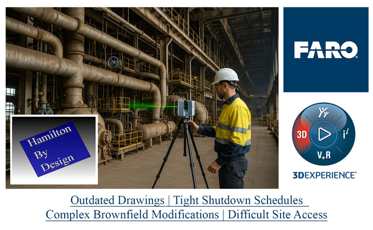
  • Outdated drawings
  • Tight shutdown schedules
  • Complex brownfield modifications
  • Difficult site access

Thatโ€™s where 3D scanning and LiDAR modelling are transforming how industrial projects are designed, verified, and delivered โ€” ensuring every bolt, beam, and bracket fits perfectly the first time.

At Hamilton By Design, we bring together field experience, digital precision, and local knowledge to help the Hunterโ€™s industries design, maintain, and modernise with confidence.


Technician operating a FARO 3D laser scanner inside an industrial plant to capture accurate geometry for brownfield upgrades, shown alongside Hamilton By Design and 3DEXPERIENCE logos with highlighted challenges such as outdated drawings and tight shutdown schedules

What Is 3D Scanning โ€” and Why It Matters in Industry

3D laser scanning, also known as LiDAR (Light Detection and Ranging), captures millions of data points across an industrial site to create a precise digital representation โ€” known as a point cloud.

This point cloud forms the foundation of a digital twin of your plant or asset โ€” an exact, measurable 3D environment that engineers can design within using SolidWorks, AutoCAD, or Navisworks.

The result?
Every measurement is accurate, every clash is detected before fabrication, and every installation happens exactly as planned.


Why Newcastle and the Hunter Valley Need Scanning More Than Ever

The Hunter is an engineering powerhouse โ€” but much of its infrastructure was built decades ago.
Many coal handling plants, power stations, and smelters are now in a constant cycle of refurbishment, retrofit, and compliance upgrade.

The challenges are familiar:

  • Old 2D drawings donโ€™t reflect todayโ€™s reality.
  • Assets have been modified repeatedly over decades.
  • Shutdown windows are shrinking.
  • Every error adds cost and delays production.

By scanning before you design, you remove uncertainty.
You donโ€™t guess clearances โ€” you know them.
You donโ€™t estimate tie-in points โ€” you model them.
You donโ€™t hope it fits โ€” you prove it digitally.

Thatโ€™s the power of 3D scanning in todayโ€™s industrial environment.


FARO 3D laser scanner set up on a tripod capturing an industrial plant for LiDAR scanning and digital modelling, with Hamilton By Design branding in the corner

Where Scanning Adds Value Across the Hunterโ€™s Industries

โš™๏ธ Power Generation

The Bayswater, Eraring, and Vales Point Power Stations are engineering icons.
Upgrades to cooling systems, ducts, platforms, and access structures require millimetre accuracy.
3D scanning ensures:

  • Every retrofit aligns with existing steelwork and pipework.
  • Structural interferences are caught before fabrication.
  • Shutdown work can be completed on time โ€” without rework.

Whether itโ€™s a fan casing replacement or a duct reroute, laser scanning removes the guesswork from aging assets.
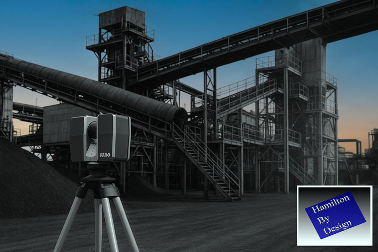

โ›๏ธ Coal Handling and CHPP Facilities

The Hunter Valleyโ€™s CHPP network โ€” Mount Thorley Warkworth, Ravensworth, Bengalla, Hunter Valley Operations โ€” all depend on reliable mechanical systems.
These plants evolve continuously: diverter chutes, screen replacements, conveyors, and wash plant modifications.

Scanning delivers:

  • Accurate as-built geometry for plant upgrades.
  • Clash detection between new and existing equipment.
  • Shutdown planning certainty โ€” no unexpected fit-up issues.
  • Integration of SolidWorks models directly into point clouds for visual verification.

For CHPP managers and maintenance engineers, 3D scanning is now as essential as the plant itself.

Composite image showing an Australian Standard compliance graphic, a LiDAR point-cloud scan of a coal reclaimer with inspection markers, and the Hamilton By Design logo

โš“ Port of Newcastle and Coal Export Terminals

Newcastleโ€™s port is the lifeline of the Hunterโ€™s economy.
Facilities such as Port Waratah Coal Services (PWCS), Newcastle Coal Infrastructure Group (NCIG), and Carrington Terminal handle massive volumes of coal every hour.

The complexity of these sites โ€” shiploaders, conveyors, gantries, and stacker-reclaimers โ€” demands accuracy during maintenance and upgrade works.
3D scanning supports:

  • Shiploader upgrades and boom extensions.
  • Conveyor and transfer tower alignment checks.
  • Wharf structure condition monitoring.
  • Integration with mechanical and electrical systems.

By scanning before modification, downtime is reduced, safety improves, and project teams gain total confidence in every fit-up.


๐Ÿญ Aluminium and Heavy Manufacturing

At Tomago Aluminium Smelter, precision is everything.
The scale of the site โ€” from potlines to switchyards โ€” makes manual measurement impractical and unsafe.

Laser scanning captures geometry accurately across large areas, enabling:

  • Retrofit planning without full shutdowns.
  • Clearance checks for cranes, ducts, and potline infrastructure.
  • Digital twins for long-term maintenance and asset management.

Beyond Tomago, manufacturers in Waratah, Beresfield, and Thornton use scanning to validate jigs, fixtures, and workshop layouts โ€” ensuring local fabrication accuracy that matches site requirements.


๐Ÿ”‹ Emerging Energy and Infrastructure

As the Hunter region transitions toward renewable and low-emission industries, scanning plays a critical role in planning new infrastructure around existing sites.
This includes:

  • Hydrogen and gas pipeline tie-ins.
  • Solar and battery installations near existing grid connections.
  • Conversion of existing power plant structures for new technology.

Accurate point-cloud data ensures new energy meets old infrastructure safely and efficiently.


From Field to Fabrication: The Hamilton By Design Process

At Hamilton By Design, our 3D scanning workflow is built around practical, industrial needs:

  1. Site Scan & Data Capture
    Using high-precision LiDAR scanners, we safely capture full site geometry in hours, not weeks.
    Scans are performed during operation or short shutdowns, without interrupting production.
  2. Point Cloud Registration & Processing
    Multiple scans are aligned to create a unified, accurate model of your facility.
    The result is a true โ€œdigital twinโ€ of your asset, complete with millimetre accuracy.
  3. SolidWorks Modelling & Integration
    Our design team converts scan data into fully functional 3D models โ€” chutes, pipework, platforms, or structural frames โ€” ready for fabrication.
  4. Clash Detection & Design Validation
    Every new design is tested within the digital twin, ensuring it fits the first time.
  5. Fabrication Drawings & e-Drawings
    Detailed 2D and 3D deliverables are provided for fabricators, site crews, and certifiers โ€” ensuring seamless communication between design and construction.

Why Local Expertise Matters

Many engineering firms offer scanning โ€” but few understand what it takes to work on a live plant in the Hunter Valley.

Hamilton By Design combines trade experience, mechanical design, and regional understanding.
Weโ€™ve worked with the same assets, fabricators, and contractors who keep the regionโ€™s power, port, and manufacturing industries running.

We design for real fabrication conditions โ€” using Australian Standards, local materials, and practical build methods.
That means fewer redesigns, faster turnarounds, and safer installations.


Safety and Access: Scanning Without Shutdowns

Traditional site measurement often means working at heights, in confined spaces, or around operating equipment.
3D scanning eliminates those risks.

Our scanners capture data safely from the ground โ€” even in restricted or hazardous areas.
This not only improves safety but also allows projects to continue without halting production.

For large plants like Eraring or PWCS, scanning entire structures during live operation is now standard practice โ€” enabling ongoing maintenance and long-term asset integrity planning.


Case Example: Port Upgrade Without Rework

A local contractor approached Hamilton By Design for a conveyor and tower modification project at the Port of Newcastle.
Existing drawings were decades old, and the structure had been modified repeatedly.

We performed a 3D scan of the tower and adjacent conveyors, capturing the as-built geometry in one day.
The resulting model revealed several misalignments between the planned chute and existing supports.
By correcting these in SolidWorks before fabrication, the contractor avoided at least 48 hours of site rework and kept the shutdown on schedule.

Thatโ€™s measurable ROI โ€” precision that pays for itself.


The ROI of 3D Scanning in Heavy Industry

A single hour of lost production at a CHPP or power station can cost $20,000 to $50,000.
A single dayโ€™s delay can exceed $500,000 in lost revenue and labour costs.

3D scanning reduces that risk by eliminating rework and ensuring every component fits right the first time.
Typical return on investment (ROI):

  • Scanning cost: <1% of total project value.
  • Rework savings: 3โ€“10% of total cost.
  • Downtime reduction: 1โ€“3 days saved per shutdown.

When accuracy drives reliability, 3D scanning isnโ€™t an expense โ€” itโ€™s insurance.


Supporting the Hunterโ€™s Future

Newcastle and the Hunter Valley are evolving โ€” from coal and power to renewables, advanced manufacturing, and logistics.
But one thing hasnโ€™t changed: the regionโ€™s foundation in engineering, precision, and hard work.

Hamilton By Design supports that legacy with the next generation of technology โ€” scanning, digital modelling, and mechanical design that keep the regionโ€™s assets efficient, safe, and ready for the future.

Weโ€™re not an offshore CAD vendor.
Weโ€™re local engineers whoโ€™ve worked in the field, understand your equipment, and speak the same language as your crews.


Letโ€™s Build the Future of Hunter Industry โ€“ Accurately

Every project starts with one question: โ€œDo we have accurate site data?โ€

With Hamilton By Design, the answer is always yes.

We deliver:
โœ… 3D laser scanning and LiDAR modelling
โœ… Point-cloud to SolidWorks integration
โœ… Reverse engineering and FEA validation
โœ… Fabrication drawings tailored for local workshops
โœ… On-site consultation with practical engineering insight

Whether youโ€™re upgrading a conveyor at Bayswater, fabricating platforms for Tomago, or retrofitting process piping at Kooragang, we ensure your next project fits perfectly โ€” before steel is cut.

Banner displaying Hamilton By Design alongside partner and technology logos including SolidWorks, UTS, Dassault Systรจmes 3DEXPERIENCE, and FARO, with the text โ€˜3D Scanning 3D Modellingโ€™ and website www.hamiltonbydesign.com.au.

๐Ÿ‘‰ Get your industrial site scanned and modelled before your next shutdown.
Visit www.hamiltonbydesign.com.au or contact us to request a capability statement today.

Mechanical Engineering | Structural Engineering

Mechanical Drafting | Structural Drafting

3D CAD Modelling | 3D Scanning

Hamilton By Design logo displayed on a blue tilted rectangle with a grey gradient background

Our clients;

Name
Would you like us to arrange a phone consultation for you?
Address