


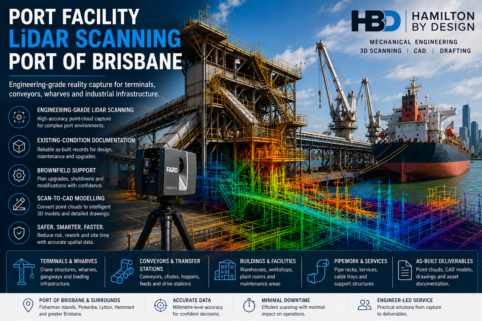
Port Facility LiDAR Scanning Port of Brisbane
Engineering-Grade Reality Capture for Terminals, Wharves, Conveyors and Brownfield Port Infrastructure
Port facilities contain some of the most complex engineering environments in industry. Container-handling equipment, conveyors, transfer stations, structural steel, pipework, access systems, wharf infrastructure and mobile plant often operate within restricted areas and tightly controlled shutdown windows.
Hamilton By Design provides port facility LiDAR scanning at the Port of Brisbane, supporting terminal operators, asset owners, engineering consultants, maintenance teams, contractors and fabricators working across Fisherman Islands, Pinkenba, Lytton, Hemmant and the wider Brisbane port precinct.
Our service is focused on capturing reliable existing-condition data for engineering, asset documentation, maintenance planning, tender development, brownfield modifications and fabrication coordination.
Unlike the broader Port of Brisbane engineering and 3D laser scanning service, this page focuses specifically on facility-wide LiDAR capture, port asset documentation and engineering-ready point-cloud delivery.
Why Port Facilities Need Reliable Existing-Condition Data
Port infrastructure changes throughout its operating life.
Conveyors may be extended, platforms altered, guards replaced, pipework rerouted and equipment upgraded without every modification being transferred back to the original drawings.
This can create uncertainty when planning:
- Terminal upgrades
- Conveyor replacements
- Chute modifications
- New access systems
- Wharf maintenance
- Equipment relocation
- Structural alterations
- Shutdown work
- Fabrication and installation
- Asset-management programs
Traditional site measurement can be slow and incomplete when assets are large, congested, elevated or difficult to access safely.
Engineering-grade LiDAR scanning captures millions of spatial measurements and produces a measurable three-dimensional record of the visible environment. Hamilton By Design uses this approach across industrial and infrastructure projects where point-cloud data must support engineering, design and fabrication decisions.
What Is Port Facility LiDAR Scanning?
LiDAR means Light Detection and Ranging. A laser scanner emits light pulses and records the distance to visible surfaces, creating a dense collection of three-dimensional measurement points known as a point cloud.
For a port facility, the registered point cloud may capture the spatial relationship between:
- Buildings
- Wharves
- Conveyors
- Transfer towers
- Loading equipment
- Structural steel
- Mechanical assets
- Platforms and stairs
- Pipework and services
- Roads and hardstands
- Maintenance areas
- Adjacent infrastructure
The point cloud can then be reviewed, measured and converted into suitable engineering or asset-management deliverables.
Port Assets That Can Be Captured
Hamilton By Design can use terrestrial LiDAR scanning to document visible port and terminal assets such as:
Container-terminal infrastructure
- Container-handling areas
- Crane-support infrastructure
- Equipment clearances
- Terminal buildings
- Maintenance zones
- Traffic and operational interfaces
Bulk-material handling systems
- Conveyors
- Transfer stations
- Chutes
- Hoppers
- Bins
- Feeders
- Drive stations
- Support frames
- Walkways and platforms
Wharf and marine-side infrastructure
- Wharf-access structures
- Loading and unloading equipment
- Gangways
- Mooring-related structures
- Service connections
- Pipe bridges
- Above-water structural geometry
- Crane rails and associated steelwork
Buildings and supporting facilities
- Warehouses
- Workshops
- Plant rooms
- Maintenance buildings
- Service corridors
- Electrical rooms
- Equipment foundations
- Structural framing
Where below-water geometry is required, terrestrial scanning may need to be combined with hydrographic, bathymetric or specialist subsea survey methods.
Facility-Wide Existing-Condition Capture
A port facility scan can extend beyond one isolated item of equipment.
Where required, Hamilton By Design can establish a broader digital record of:
- Multiple conveyor routes
- Transfer stations
- Terminal buildings
- Wharf structures
- Road and equipment interfaces
- Mechanical plant areas
- Access systems
- Existing services
- Maintenance zones
- Surrounding structural steel
This wider capture can help project teams understand how one proposed modification may affect other parts of the terminal.
It can also reduce repeated site visits by allowing engineers, designers and contractors to revisit the measured environment remotely.
Point-Cloud Deliverables
The registered point cloud can be supplied in formats selected to suit the client’s software and intended workflow.
Typical deliverables may include:
- E57 point clouds
- Autodesk RCP files
- Autodesk RCS files
- LAS files
- Registered scan databases
- Scan-location documentation
- Coverage images
- Selected measurements
- Point-cloud viewing files
- Cropped project areas
- Coordinate or survey-control information where applicable
Hamilton By Design also provides 3D point-cloud scanning in Brisbane for projects requiring traceable, fit-for-purpose spatial information for engineering and construction decisions.
Scan-to-CAD for Port Facilities
A point cloud is a measurement dataset rather than a complete engineering model.
Where required, selected geometry can be converted into CAD representations of:
- Structural steel
- Conveyors
- Chutes and hoppers
- Mechanical equipment
- Platforms and access structures
- Pipework
- Machinery guards
- Equipment foundations
- Buildings and plant rooms
- Replacement components
The required modelling level should be defined according to the project purpose.
A broad coordination model may be sufficient for clash detection, while equipment replacement or fabrication work may require more detailed geometry and independently verified interfaces.
Hamilton By Design’s Brisbane scanning and engineering service connects site capture with mechanical and structural engineering, CAD modelling and fabrication-ready drafting.
As-Built Documentation for Port Assets
Port facility LiDAR scanning can support the preparation of:
- Existing-condition plans
- General arrangement drawings
- Floor plans
- Sections and elevations
- Structural layouts
- Equipment-location drawings
- Conveyor layouts
- Pipe and service layouts
- Clearance envelopes
- Access-system drawings
- Asset registers
- Three-dimensional as-built models
These records can provide a more reliable basis for future maintenance, design and tender work than drawings that may not include later site modifications.
Brownfield Port Upgrades
Brownfield work is completed within an existing operational facility, where new equipment must fit around assets that remain in place.
Typical constraints include:
- Incomplete drawings
- Undocumented modifications
- Restricted installation space
- Existing services
- Active operations
- Limited shutdown periods
- Difficult lifting access
- Corrosion or wear
- Multiple project interfaces
Hamilton By Design uses engineering-led LiDAR capture to reduce uncertainty in these environments.
A typical workflow may include:
- Defining the intended engineering use of the scan
- Capturing the existing facility and relevant interfaces
- Registering and reviewing the point-cloud data
- Isolating the project area
- Modelling the proposed equipment
- Positioning the design within the existing point cloud
- Reviewing clashes, access and constructability
- Preparing drawings for fabrication or installation
This approach is similar to the scan-led workflows Hamilton By Design applies to brownfield port engineering and industrial retrofit projects.
Conveyor and Transfer-Station Scanning
Port conveyors and transfer systems are often difficult to measure because they contain elevated steelwork, guarding, moving equipment, worn components and restricted access.
LiDAR scanning can document:
- Conveyor stringers
- Gantries
- Head and tail stations
- Pulley positions
- Drive frames
- Transfer towers
- Chutes
- Hoppers
- Walkways
- Platforms
- Guarding
- Pipework
- Cable trays
- Nearby structures
The resulting dataset can support:
- Conveyor modifications
- Replacement chute design
- Guarding upgrades
- Access improvements
- Structural coordination
- Wear assessments
- Shutdown planning
- Fabrication documentation
Wharf and Berth Infrastructure
Terrestrial LiDAR scanning may be used to document visible wharf and berth infrastructure from safe scanner locations.
Possible applications include:
- Wharf-access upgrades
- Loading-equipment modifications
- Service-routing projects
- Gangway replacement
- Platform alterations
- Structural-steel verification
- Clearance studies
- Crane-support interfaces
- Pipe-bridge modifications
- Maintenance planning
A scanner can capture geometry that would otherwise require numerous manual measurements at height or near operational equipment.
All site work remains subject to the port operator’s access, permit, exclusion-zone and water-edge requirements.
Crane and Heavy-Equipment Interfaces
Port cranes and heavy mechanical equipment frequently interact with surrounding steelwork, rails, services and operational areas.
LiDAR scanning can assist with:
- Existing equipment envelopes
- Crane-support geometry
- Crane rail locations
- Access-platform modifications
- Guarding design
- Structural interfaces
- Maintenance clearances
- Removal and installation paths
- Surrounding obstructions
- Clash detection
Where a project requires formal alignment, settlement, deformation or high-precision tolerance reporting, specialist survey control or metrology may also be needed.
Shutdown Planning and Work-Pack Development
Port shutdowns can involve significant operational and commercial consequences.
Pre-shutdown scanning may help project teams:
- Confirm existing interfaces
- Review demolition boundaries
- Check replacement-component dimensions
- Plan lifting access
- Review crane positions
- Examine installation routes
- Identify obstructions
- Coordinate temporary works
- Prepare contractor work packs
- Reduce dependence on shutdown measurements
The point cloud can be reviewed before mobilisation, allowing more project questions to be resolved while changes remain less expensive.
Clash Detection and Spatial Coordination
Proposed equipment can be positioned within the registered point cloud to identify conflicts with:
- Structural steel
- Conveyors
- Pipework
- Cable trays
- Platforms
- Handrails
- Buildings
- Existing machinery
- Vehicle routes
- Maintenance envelopes
Clash detection does not replace engineering verification, but it can identify spatial conflicts before fabrication or installation.
This is particularly valuable where replacement equipment must be fabricated off site before an existing asset is removed.
Asset Management and Digital Baselines
A registered point cloud can provide a digital baseline of a port facility at a specific time.
Depending on the project methodology, future scans may be compared with the baseline to support:
- Asset-condition monitoring
- Change documentation
- Upgrade records
- Maintenance planning
- Wear studies
- Structural reviews
- Refurbishment planning
- Digital twin development
Reality capture is commonly used as a foundation for digital representations of existing assets and infrastructure. Hamilton By Design’s broader reality-capture services use LiDAR data to support as-built records and digital engineering workflows.
Repeat Scanning and Change Assessment
Repeat scans may help identify geometric change between two points in time.
Applications may include:
- Chute wear
- Hopper wear
- Structural movement
- Equipment replacement
- Progressive modifications
- Stockpile or volume studies
- Construction progress
- As-built verification
Meaningful comparison requires appropriate control, registration, scan coverage, resolution and consistency between datasets.
The methodology should be defined before the first baseline scan if repeat comparison is an important project requirement.
Scanning Around Operating Plant
Some port areas may be captured while surrounding operations continue, provided the work is permitted and suitable controls are in place.
Important considerations include:
- Moving vehicles
- Operating conveyors
- Rotating machinery
- Exclusion zones
- Water edges
- Lighting
- Dust
- Weather
- Reflective surfaces
- Restricted access
- Line-of-sight limitations
Moving surfaces may appear incomplete or distorted in the scan.
Where accurate geometry of a belt, pulley, crane component or other moving equipment is required, the equipment may need to be isolated and stationary.
Engineering-Led Scan Planning
A large point cloud is not automatically a useful engineering deliverable.
The scanning plan should consider:
- What equipment is being modified
- Which interfaces are critical
- Required accuracy
- Required level of detail
- Intended CAD outputs
- Survey-control requirements
- Areas requiring repeat scanning
- Site access restrictions
- File size and software compatibility
- Fabrication and installation tolerances
Hamilton By Design plans scanning around the intended engineering outcome rather than treating scanning as a standalone photographic exercise.
Typical Port Facility Projects
Port facility LiDAR scanning can support:
- Container-terminal modifications
- Conveyor upgrades
- Chute replacement
- Hopper modifications
- Wharf-access projects
- Crane-support work
- Maintenance platforms
- Machine guarding
- Pipework changes
- Warehouse upgrades
- Equipment relocation
- Structural alterations
- Fabrication verification
- Shutdown planning
- Asset documentation
- Brownfield engineering
- Construction coordination
- Digital twin development
Port Safety and Access Requirements
Work within a port facility may require:
- Site-specific inductions
- Maritime Security Identification Card requirements
- Safe work method statements
- Task-risk assessments
- Work permits
- Working-at-heights controls
- Water-edge controls
- Traffic-management arrangements
- Exclusion zones
- Personal protective equipment
- Site escorts
- Operational coordination
- Environmental controls
Hamilton By Design develops the scanning methodology around the requirements established by the relevant facility or terminal operator.
Areas Serviced
Port facility LiDAR scanning can be provided throughout:
- Port of Brisbane
- Fisherman Islands
- Pinkenba
- Lytton
- Hemmant
- Murarrie
- Wynnum
- Eagle Farm
- Greater Brisbane
- South-East Queensland
Hamilton By Design also supports port, industrial, mining and infrastructure projects throughout Australia through its national engineering-grade LiDAR service.
Why Choose Hamilton By Design?
Engineering-led site capture
The scan scope is developed around how the data will be used by engineers, designers, contractors and fabricators.
Port and industrial project focus
Our workflows are suited to conveyors, chutes, mechanical equipment, structural steel, platforms and brownfield infrastructure.
Integrated deliverables
Point-cloud processing, CAD modelling, mechanical engineering and drafting can be provided through a coordinated workflow.
Reduced repeat attendance
A well-planned scan can allow measurements and interfaces to be revisited remotely.
Fabrication and installation support
The captured data can be used to prepare models and drawings around verified existing geometry.
Flexible project scope
Projects can range from registered point-cloud delivery to complete scan-to-CAD and engineering documentation.
Frequently Asked Questions
What is port facility LiDAR scanning?
Port facility LiDAR scanning uses terrestrial laser scanners to create a measurable three-dimensional point cloud of visible port infrastructure, buildings, equipment and surrounding assets.
What can be scanned at the Port of Brisbane?
Visible assets may include conveyors, transfer stations, chutes, hoppers, structural steel, platforms, cranes, wharf equipment, buildings, pipework, roads and terminal infrastructure.
Can a complete terminal be scanned?
Yes, subject to project size, access, line of sight, operational restrictions and the required level of detail. Large facilities may be divided into stages or priority zones.
Can scanning be completed during normal operations?
Some areas may be scanned while operations continue, provided the activity is approved and appropriate controls are established. Moving equipment may need to be stopped when precise component geometry is required.
What files can be supplied?
Typical files include E57, RCP, RCS and LAS point clouds, together with CAD models, drawings or selected measurements where these form part of the scope.
Can the scan data be used in SolidWorks?
Yes. Point-cloud data can be used as a reference for SolidWorks modelling, and selected geometry can be converted into engineering CAD models.
Can the scans support fabrication drawings?
Yes. Where the project includes engineering and drafting, the point cloud can support the preparation of general arrangements, fabrication drawings and installation documentation.
Can scans be compared over time?
Yes, provided suitable control, coverage and registration methods are used. Repeat scanning should be planned from the beginning where change assessment is required.
Is Hamilton By Design affiliated with Port of Brisbane Pty Ltd?
No. Hamilton By Design is an independent engineering and LiDAR scanning service provider. This page describes services available for projects in the Port of Brisbane area and does not imply endorsement, appointment or affiliation.
Discuss Port Facility LiDAR Scanning at the Port of Brisbane
Hamilton By Design can assist with:
- Facility-wide terrestrial LiDAR scanning
- Registered point-cloud delivery
- Port asset documentation
- Existing-condition capture
- Scan-to-CAD modelling
- As-built drawings
- Conveyor and transfer-station scanning
- Wharf and terminal scanning
- Clash detection
- Shutdown planning
- Brownfield project support
- Mechanical engineering and drafting
Explore the broader Port of Brisbane engineering and 3D laser scanning service or contact Hamilton By Design to discuss the facility, scan coverage, required accuracy and intended project deliverables.

Contact Us – Talk To Us
Our clients:
























