


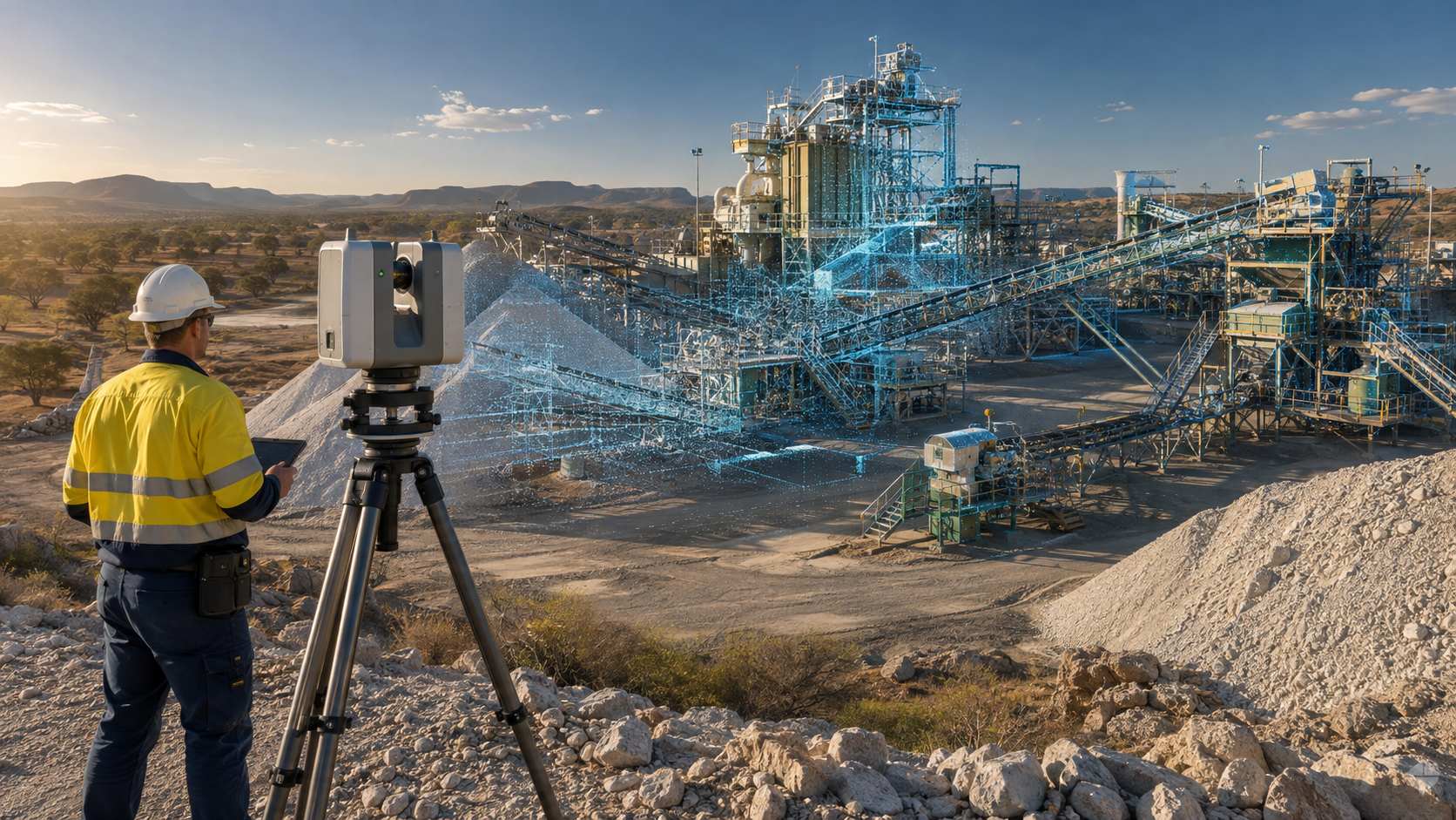
3D LiDAR Scanning for Mineral Processing in Marlborough, Queensland
We provide engineering-grade 3D LiDAR scanning for mines, beneficiation plants and mineral-processing infrastructure throughout Marlborough and the surrounding Central Queensland region.
Our engineering-grade 3D laser scanning services capture the existing geometry of conveyors, crushers, screens, processing equipment, pipework and structural steel.
Registered point-cloud data can then be used for:
- Brownfield plant upgrades
- Shutdown planning
- Scan-to-CAD modelling
- Mechanical engineering
- Structural-steel modifications
- Dimensional verification
- Replacement-equipment design
- Fabrication and installation planning
- As-built documentation
We support mining companies, mineral processors, engineering consultants, fabricators and maintenance contractors working throughout:
- Marlborough
- Kunwarara
- Yaamba
- Livingstone Shire
- Rockhampton
- Parkhurst
- Clarke Creek
- Central Queensland
Engineering-grade reality capture for mineral-processing plants
Mineral-processing facilities frequently contain tightly arranged equipment, complex structural steel and infrastructure that has been modified over many years.
Existing drawings may no longer represent the installed plant accurately. Manual measurement can also be difficult around operating conveyors, elevated structures, enclosed processing areas and restricted-access equipment.
Terrestrial LiDAR scanning captures millions of spatial measurements from multiple scanner positions. These measurements are registered into a coordinated three-dimensional point cloud representing the plant as it exists at the time of scanning.
The resulting dataset provides a reliable foundation for:
- Brownfield modifications
- Replacement-equipment design
- Conveyor and chute upgrades
- Structural-steel additions
- Pipework modifications
- Access-platform design
- Plant-layout verification
- Clash detection
- Fabrication modelling
- Shutdown planning
Our broader 3D laser scanning for engineering projects service combines site capture with engineering-ready models and drawings.
Supporting mineral processing around Marlborough
The Marlborough region is associated with magnesite resources, open-pit mining, screening, washing, beneficiation and bulk-material transport.
After extraction, magnesite ore may pass through several processing stages, including:
- Selective open-pit mining
- Run-of-mine screening
- Primary crushing
- Washing and scrubbing
- Beneficiation
- Dewatering
- Graded stockpiling
- Transport to downstream processing facilities
- Blending and grinding
- Calcination and high-temperature processing
- Product crushing, sizing and dispatch
Each stage contains mechanical equipment, supporting structures and materials-handling systems that may require accurate existing-condition capture before an upgrade or replacement project begins.
LiDAR scanning for crushing and screening plants
Crushing and screening areas contain equipment that can be difficult to document using conventional hand measurements.
A coordinated laser scan can capture:
- Run-of-mine receival areas
- Feed hoppers
- Grizzlies
- Apron and vibrating feeders
- Jaw crushers
- Secondary crushers
- Vibrating screens
- Transfer chutes
- Conveyor structures
- Walkways
- Access platforms
- Equipment foundations
- Guards
- Maintenance clearances
The point cloud can be used to develop an accurate plant model before replacement equipment, support steel or access structures are designed.
This is particularly valuable where a new crusher, feeder or screen must fit within an existing structure with limited installation clearance.
Scanning for beneficiation and washing plants
Magnesite beneficiation may include screening, washing, scrubbing, separation, dewatering and controlled stockpiling.
We can scan beneficiation infrastructure including:
- Washing screens
- Scrubbers
- Pumps
- Pipework
- Launders
- Sumps
- Tanks
- Dewatering equipment
- Cyclones
- Process-water systems
- Structural supports
- Access stairs
- Platforms and walkways
An engineering-grade scan provides a coordinated record of mechanical equipment, pipework, floor levels and supporting steelwork.
This information can be used to plan equipment replacements, modify pipe routes, improve access or design new processing modules.
Conveyor and transfer-point scanning
Conveyors and transfer stations are among the most common areas requiring dimensional verification within mineral-processing facilities.
Even small differences between existing drawings and the installed plant can create problems during fabrication or installation.
LiDAR scanning can capture:
- Conveyor centre lines
- Head and tail pulley locations
- Drive arrangements
- Take-up systems
- Stringers and trestles
- Transfer chutes
- Skirting systems
- Impact beds
- Belt cleaners
- Walkways
- Platforms
- Guards
- Adjacent pipework
- Electrical trays and services
The scan data can support the design of replacement chutes, skirts, guards, access systems and conveyor components.
Point-cloud models can also be incorporated into a structured mining-infrastructure engineering model for upgrade planning, fabrication and installation review.
Chute and hopper engineering
Chutes, hoppers and bins are exposed to abrasive material and may experience wear, corrosion, blockage, spillage and uncontrolled material flow.
Laser scanning allows the surrounding steelwork and equipment interfaces to be captured without relying entirely on original drawings.
The point cloud can support:
- Replacement chute design
- Chute-liner layouts
- Wear-plate detailing
- Hopper modifications
- Spout and transition design
- Transfer-point redesign
- Structural-support modifications
- Fabrication drawings
- Installation clash checks
Accurate existing-condition data is particularly important when a replacement chute must connect to existing conveyors, skirts, support steel and discharge equipment.
Further information is available through our mining conveyor transfer chute design and chute design for mining services.
Plant shutdown scanning
Shutdown periods provide limited opportunities to access equipment that is normally operating, guarded, enclosed or otherwise difficult to approach.
A planned LiDAR survey can capture multiple plant areas during one site mobilisation. Engineers can then return to the point cloud after the shutdown to extract additional measurements without repeatedly returning to site.
Shutdown scanning may support:
- Existing-condition capture
- Replacement-equipment design
- Tie-in verification
- Structural modifications
- Pipe-spool design
- Maintenance planning
- Installation sequencing
- Post-installation verification
- As-built documentation
Our 3D scanning for mining shutdown projects service is designed specifically for plant upgrades and time-sensitive shutdown work.
Structural-steel and access-system scanning
Mineral-processing plants commonly contain extensive structural steel supporting conveyors, screens, bins, platforms and processing equipment.
Terrestrial laser scanning can record:
- Columns and beams
- Equipment support frames
- Conveyor trestles
- Platforms
- Stairs
- Handrails
- Ladders
- Bracing
- Floor penetrations
- Existing connection locations
- Available installation clearances
This information can be converted into an engineering model for new platforms, access improvements or equipment-support modifications.
The point cloud also allows designers to position proposed steelwork within the existing plant and identify potential clashes before fabrication begins.
Pipework and ducting surveys
Processing plants can contain dense networks of process-water pipes, slurry lines, compressed-air services, dust-extraction ducts and drainage systems.
Laser scanning captures the visible route and external geometry of these services within a common coordinate system.
Point-cloud data can assist with:
- Pipe-routing studies
- New tie-in locations
- Replacement pipe spools
- Pump and valve modifications
- Process-water upgrades
- Dust-collection upgrades
- Duct-routing studies
- Support-steel design
- Clash detection
- Shutdown installation planning
Critical connection dimensions can also be verified using direct measurement where the required fabrication tolerance is tighter than the general point-cloud survey tolerance.
Magnesia-processing plant applications
Following beneficiation, magnesite may be transported to a downstream processing facility for stockpiling, blending, grinding and thermal conversion into magnesium oxide products.
Typical downstream plant stages may include:
- Ore receival
- Stockpiling
- Reclaiming
- Blending
- Grinding
- Air classification
- Calcination
- Briquetting
- Shaft-kiln processing
- Electrofusion
- Cooling
- Product crushing
- Screening
- Packaging
- Dispatch
LiDAR scanning can support engineering work around:
- Truck receival hoppers
- Reclaim conveyors
- Grinding mills
- Air classifiers
- Calcination equipment
- Vertical shaft kilns
- Briquetting presses
- Furnace buildings
- Electrode systems
- Cooling systems
- Dust collectors
- Exhaust ductwork
- Product crushing and sizing equipment
- Packaging and dispatch facilities
These areas frequently contain complex steelwork, ducts, pipework and mechanical equipment. Comprehensive reality capture can reduce reliance on incomplete or outdated legacy drawings.
Scan-to-CAD modelling
Point-cloud data can be converted into simplified or detailed CAD geometry depending on the engineering outcome.
Our 3D CAD modelling services can produce:
- Existing-condition 3D models
- Structural-steel models
- Equipment-envelope models
- Conveyor layouts
- Chute and hopper models
- Pipe-routing models
- General arrangements
- Plans, sections and elevations
- Fabrication models
- Installation drawings
Models can be developed around the plant areas directly relevant to the project rather than recreating the entire facility unnecessarily.
This targeted approach can reduce modelling time while providing the level of detail required for engineering, fabrication and installation planning.
Reverse engineering of plant components
Mineral-processing equipment may remain in service long after original drawings, models or suppliers are no longer available.
Laser scanning and detailed measurement can support the reverse engineering of:
- Chute sections
- Hoppers
- Guards
- Machine frames
- Bearing housings
- Duct transitions
- Pipework interfaces
- Wear liners
- Access platforms
- Obsolete mechanical components
Our reverse engineering with 3D scanning process can be used to develop replacement geometry while considering fit-up, manufacturing and installation requirements.
Clash detection and design verification
Proposed plant components can be positioned within the point cloud before fabrication.
This allows the project team to assess potential interference with:
- Existing structural steel
- Conveyors
- Pipework
- Electrical trays
- Guards
- Handrails
- Platforms
- Maintenance-removal paths
- Mobile equipment routes
- Crane and lifting access
Designing against captured plant geometry helps identify potential problems before steelwork or equipment arrives on site.
This can reduce site rework, emergency modifications and installation delays during a restricted shutdown window.
Point-cloud and engineering deliverables
Depending on the project scope, deliverables may include:
- Registered colourised point clouds
- E57 point-cloud files
- Autodesk ReCap RCP or RCS files
- LAS files
- Scan-location plans
- Existing-condition CAD models
- SolidWorks models
- Autodesk Inventor models
- AutoCAD DWG drawings
- STEP models
- Parasolid models
- General arrangements
- Plans, sections and elevations
- Fabrication drawings
- As-built verification reports
- Clash-review models
Deliverables are selected according to the client’s design platform, internal workflow and intended use of the survey.
Why use terrestrial LiDAR scanning?
Reduce manual measurement
A scanner captures complete visible surfaces and surrounding infrastructure rather than a limited number of isolated dimensions.
Reduce repeat site visits
Project teams can revisit the registered point cloud to obtain additional dimensions after the initial survey.
Design around actual plant conditions
The scan records the installed position of equipment and structures rather than relying exclusively on old drawings.
Improve fabrication confidence
Proposed components can be checked digitally against the surrounding plant before manufacturing begins.
Improve shutdown preparation
Interfaces, clearances, access restrictions and potential clashes can be assessed before the shutdown starts.
Improve safety during measurement
The scanner can capture elevated and difficult-to-reach surfaces from accessible locations, subject to line-of-sight limitations and site controls.
Create an enduring site record
The point cloud provides a dated three-dimensional record of the facility for future engineering, maintenance and asset-management projects.
Engineering-led LiDAR scanning
We combine reality capture with practical mechanical engineering, drafting and bulk-materials-handling experience.
Our capabilities include:
- Engineering-grade 3D laser scanning across Australia
- Point-cloud registration
- Scan-to-CAD modelling
- Mechanical design
- Conveyor and chute design
- Reverse engineering
- Structural-steel detailing
- Fabrication drawings
- Existing-condition studies
- Wear and erosion assessments
- Shutdown engineering support
This enables the survey to be planned around the required engineering outcome rather than treated as an isolated scanning exercise.
Mineral-processing equipment we can capture
Our LiDAR scanning services can be applied to:
- Crushers
- Screens
- Feeders
- Conveyors
- Transfer stations
- Chutes
- Hoppers
- Bins
- Scrubbers
- Cyclones
- Pumps
- Tanks
- Mills
- Classifiers
- Briquetting presses
- Kilns
- Furnaces
- Dust collectors
- Exhaust ducts
- Pipework
- Structural steel
- Platforms
- Stairs and access systems
Service area
Project-based scanning and engineering support is available for mineral-processing and industrial facilities throughout Marlborough and the broader Central Queensland region.
Potential service locations include:
- Marlborough
- Kunwarara
- Yaamba
- The Caves
- Parkhurst
- Rockhampton
- Gracemere
- Livingstone Shire
- Clarke Creek
- Gladstone
- Central Queensland mining regions
Regional and remote work can be planned around site inductions, shutdown access, travel requirements and operating constraints.
Frequently asked questions
What is 3D LiDAR scanning?
3D LiDAR scanning uses laser measurements to capture the position and shape of visible surfaces within an operating environment.
The measurements are combined into a three-dimensional point cloud that can be viewed, measured and used as a reference for engineering design.
Can an operating mineral-processing plant be scanned?
Yes. Many external plant areas can be captured while the facility remains operational, subject to site rules, exclusion zones and safe access.
Some equipment interfaces may be better captured during a planned shutdown.
Can point-cloud data be used in SolidWorks?
Yes. Point-cloud data can be used as a spatial reference while developing SolidWorks equipment, structural and fabrication models.
The most appropriate workflow depends on the dataset size, required modelling accuracy and level of detail.
Can AutoCAD drawings be created from the scan?
Yes. Registered point-cloud data can be used to prepare AutoCAD general arrangements, plans, sections, elevations and mechanical drawings.
Can LiDAR scanning measure plant wear?
LiDAR scanning can assist with documenting accessible surface loss, deformation and geometric change.
Its suitability depends on the required accuracy, surface visibility, scan density and whether reliable baseline geometry is available.
Can conveyors and transfer chutes be scanned?
Yes. Conveyors, transfer stations, chutes, skirts, walkways, guards and supporting structures are common industrial scanning applications.
What scanning accuracy can be achieved?
The achievable accuracy depends on factors including scanner position, capture distance, surface characteristics, registration methodology and site conditions.
The scanning and verification plan should be established around the tolerances required for the engineering, fabrication or inspection task.
Is scanning-only available?
Yes. A project can include registered point-cloud data only or a combined scope involving scanning, CAD modelling, mechanical design and engineering drawings.
3D LiDAR scanning for Marlborough mineral-processing projects
Accurate existing-condition information is essential when upgrading operating mines and mineral-processing facilities.
Engineering-led LiDAR scanning can support the design, fabrication and installation of plant modifications throughout Marlborough, Kunwarara and Central Queensland.
Whether a project involves a conveyor upgrade, replacement chute, beneficiation-plant modification, new access platform or shutdown survey, the objective is to provide a dependable three-dimensional record of the plant before detailed design begins.
Contact us to discuss 3D LiDAR scanning, Scan-to-CAD modelling or mechanical engineering support for a mineral-processing project in Marlborough or Central Queensland.

Contact Us – Talk To Us
Our clients:
























