


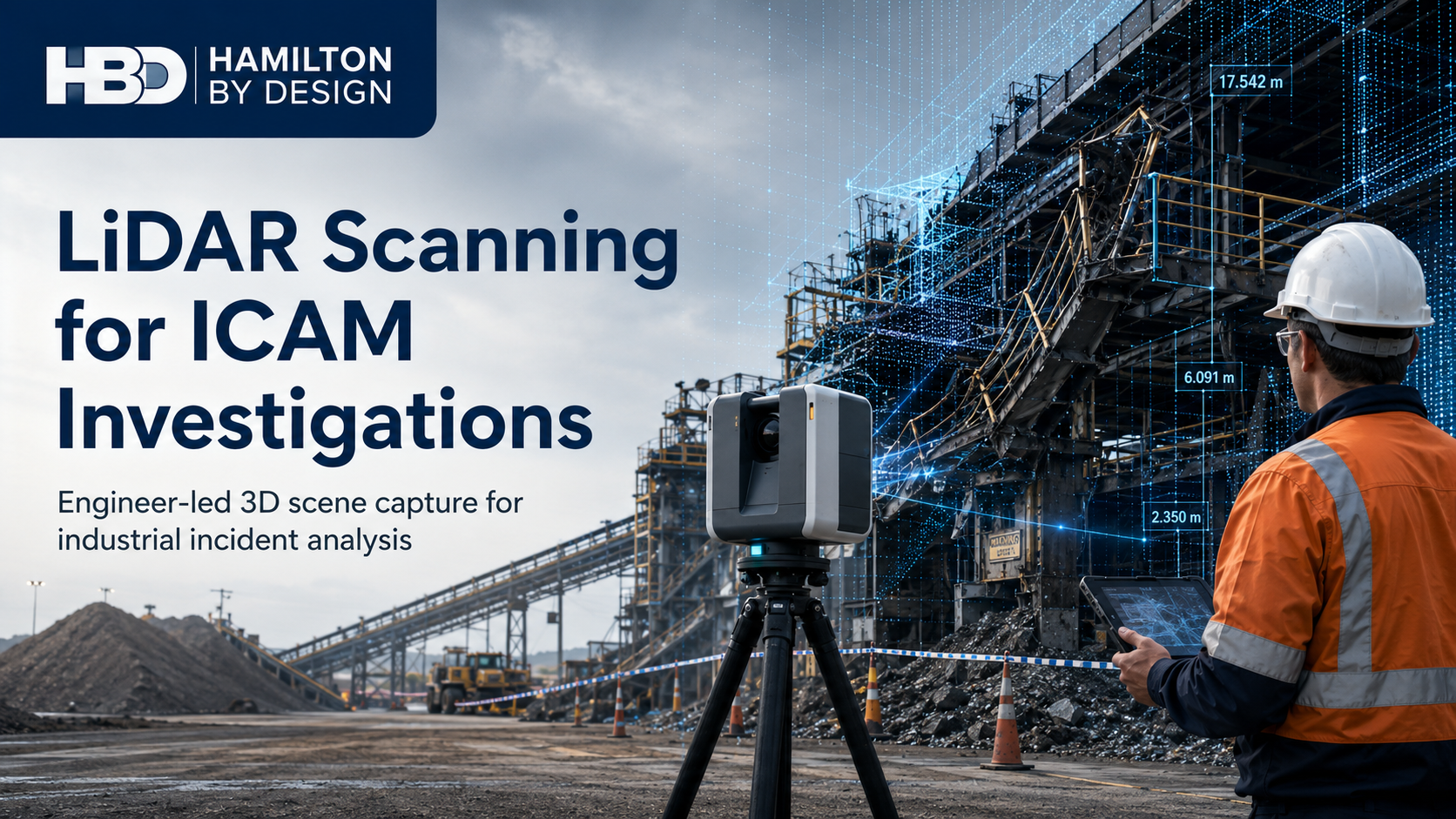
LiDAR Scanning for ICAM Investigations
Accurate 3D Scene Capture to Support Industrial Incident Investigations
Following a workplace incident, investigators need reliable information about what occurred, where equipment was positioned and how the surrounding environment may have contributed to the event.
However, industrial incident scenes can change quickly. Mobile equipment may need to be recovered, damaged components may be removed, production areas may be cleaned, and temporary controls may be installed before the investigation is complete. Once these changes occur, important dimensional and spatial evidence may be difficult to recover.
Hamilton By Design provides engineering-led LiDAR scanning to support ICAM investigations across mining, mineral processing, manufacturing, heavy industry, transport, utilities and infrastructure.
LiDAR scanning creates a measurable three-dimensional record of the incident scene. The resulting point cloud can document plant, equipment, structures, access systems, ground conditions and surrounding infrastructure as they existed at the time of scanning.
The scan does not replace the ICAM investigation or determine the cause of an incident. Instead, it provides investigators, engineers and site representatives with accurate spatial evidence that can support fact-finding, incident reconstruction and engineering assessment.
What Is LiDAR Scanning for an ICAM Investigation?
LiDAR—Light Detection and Ranging—uses laser measurements to capture the position and geometry of physical objects. A terrestrial laser scanner records millions of measurement points from multiple positions around the investigation area.
These individual measurements are registered together to create a three-dimensional point cloud representing the incident scene.
Unlike photographs, which show the scene from selected viewpoints, a point cloud allows authorised project participants to return to the captured environment and take measurements after the site has changed.
The dataset may be used to examine:
- Equipment positions and orientation
- Distances between plant, people and structures
- Clearances around machinery
- Access and escape routes
- Platform, stairway and handrail geometry
- Vehicle travel paths
- Ground levels and surface conditions
- Impact locations and deformation
- Sightlines from operator positions
- The relationship between damaged components
- The location of guards, barriers and controls
Hamilton By Design’s broader 3D laser scanning services are structured around engineering-grade reality capture and the practical use of point-cloud information.
Why Scan an Incident Scene?
Preserve a Measurable Record
Photographs, witness statements and site sketches are valuable parts of an investigation. However, they may not provide sufficient dimensional information to answer questions that arise later.
A registered point cloud creates a digital record that can be reviewed after equipment has been recovered, repaired or returned to service.
This can be particularly valuable when an investigation expands beyond the questions originally considered during the first site inspection.
Reduce Reliance on Assumptions
Industrial environments are often congested. Structures, conveyors, pipework, vehicles, platforms, guarding and electrical services may all occupy the same working area.
Without reliable measurements, investigators may need to estimate distances or rely on drawings that no longer reflect the installed condition.
LiDAR scanning captures the visible geometry of the actual scene. This gives investigators a stronger factual basis for examining the sequence of events and identifying areas requiring further technical review.
Support Engineering Analysis
An ICAM investigation may identify questions that require mechanical, structural or dimensional assessment.
For example:
- Was the available clearance sufficient?
- Could the operator see the relevant hazard?
- Was equipment aligned with its intended travel path?
- Did a structure deform before or during the incident?
- Was access restricted by installed equipment?
- Could a component move through the available space?
- Where were barriers or exclusion-zone boundaries located?
- Was the damaged equipment consistent with the documented arrangement?
The point cloud can provide the geometry needed for subsequent engineering models, drawings, clearance studies or deformation assessments.
When Should LiDAR Scanning Occur?
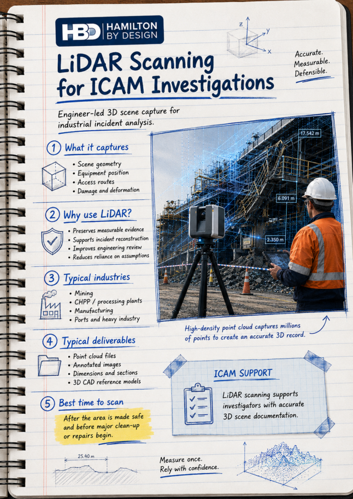
Where practicable, scanning should be considered after the site has been made safe and the appropriate incident-scene controls have been established, but before significant recovery, dismantling, repair or clean-up work begins.
Hamilton By Design works under the direction of the site’s authorised representatives. The investigation team, site management and relevant regulatory or legal stakeholders remain responsible for determining when access is permitted and what evidence-preservation requirements apply.
Before scanning, the proposed scope should identify:
- The incident-scene boundaries
- Areas that must not be disturbed
- Site access and permit requirements
- Existing hazards and exclusion zones
- Required scan density
- Critical components or interfaces
- Survey-control requirements
- Required photographs and supporting records
- File formats and intended deliverables
- Restrictions on data access and distribution
Early communication helps ensure the scan captures the information likely to be required during the investigation.
Applications Across Mining and Heavy Industry
Hamilton By Design provides engineering-grade 3D scanning for mining and industrial plants, where complex equipment arrangements can make conventional measurements difficult.
Mining and Mobile Plant
LiDAR scanning may support investigations involving:
- Haul-truck collisions or rollovers
- Light-vehicle and heavy-vehicle interactions
- Dozer, loader and excavator incidents
- Workshop maintenance events
- Uncontrolled equipment movement
- Tyre-handling and component-handling incidents
- Falling objects or dropped loads
- Damaged trays, chassis or mounting points
- Equipment contact with structures or services
For incidents involving large mining vehicles, the scanner can capture both the vehicle and the surrounding environment. Hamilton By Design also provides specialised 3D laser scanning for mining haul trucks, supporting geometric assessment of trays, chassis, frames and associated components.
Coal Handling and Mineral Processing
CHPPs and mineral-processing facilities contain interconnected mechanical and structural systems. An incident in one area may involve several surrounding assets.
Relevant scenes may include:
- Conveyors and transfer stations
- Chutes, bins and hoppers
- Access platforms and walkways
- Structural steelwork
- Drives, pulleys and rotating equipment
- Pipework and services
- Mobile equipment access areas
- Maintenance and lifting zones
Our Hunter Valley CHPP scanning case study demonstrates how LiDAR can capture conveyors, chutes, structural steel, platforms, pipework and surrounding equipment as one coordinated existing-condition dataset.
Manufacturing and Processing Plants
Manufacturing incidents may involve machinery, guarding, access, workstations, forklifts or material-handling systems.
Scanning can document the physical relationship between the machinery, surrounding structures and the area in which the work was being performed.
Steelmaking, Smelting and Heavy Industry
Potential applications include crane and lifting incidents, vessel or ladle events, machinery failures, structural impacts and access-related incidents.
In these environments, remote measurement can also reduce the need to manually measure every feature within a complex or potentially hazardous area.
Ports, Rail and Logistics
LiDAR scanning can support investigations involving loading operations, vehicle interactions, rail infrastructure, conveyors, ship-loading equipment, warehouses and loading docks.
The point cloud may assist with vehicle-path analysis, clearance assessment, operator sightlines and the positioning of surrounding assets.
What Can Be Delivered?
Deliverables are selected according to the investigation requirements and may include:
- Registered colourised point clouds
- E57, RCP, RCS, LAS or other agreed point-cloud formats
- Site overview images
- Orthographic views
- Plan, elevation and section drawings
- Dimensional records
- Equipment-position diagrams
- Clearance measurements
- 3D CAD models of selected components
- Comparison of damaged and reference geometry
- Deformation or alignment assessments
- Annotated investigation images
- Scan-location and coverage records
The original scan data should generally be retained as the primary record. Any model, drawing or measurement extracted from the point cloud can then be treated as a derived deliverable.
Engineering-Led Evidence Capture
Hamilton By Design is not simply a scanning provider. Our background in mechanical engineering, drafting, fabrication and industrial plant allows the scanning strategy to be developed around how the data may be used.
During planning and capture, attention can be given to:
- Mechanical interfaces
- Potential movement paths
- Structural connections
- Damaged mounting points
- Equipment alignment
- Maintenance access
- Guarding and barriers
- Fabricated components
- Areas of deformation
- Critical dimensional relationships
This engineering-led approach helps avoid producing a visually impressive point cloud that does not capture the information needed for the investigation.
Service Locations
Hamilton By Design can provide LiDAR scanning for ICAM investigations throughout Australia, subject to access, availability and project requirements.
Priority service areas include:
- Central Coast
- Newcastle
- Hunter Valley
- Sydney
- Wollongong and Port Kembla
- Regional New South Wales
- Brisbane
- Central Queensland
- Mount Isa
- Perth
- Kalgoorlie and regional Western Australia
- Melbourne and regional Victoria
Projects can range from a local manufacturing incident to remote mining and mineral-processing sites requiring travel, inductions and coordinated site access.
Frequently Asked Questions
Does Hamilton By Design conduct the complete ICAM investigation?
Hamilton By Design primarily provides LiDAR scanning, dimensional evidence, engineering interpretation and 3D scene documentation to support the investigation. The formal ICAM process should remain under the control of the appointed investigation leader and authorised investigation team.
Can scanning determine the cause of an incident?
LiDAR scanning does not determine causation by itself. It records visible geometry and spatial relationships. The data can help investigators test assumptions, compare accounts and identify matters requiring further engineering analysis.
How soon after an incident should the site be scanned?
Scanning should generally occur as early as practicable after the area has been made safe and access has been authorised. Earlier capture reduces the risk that recovery, clean-up or repair activities will alter important spatial evidence.
Will the scanner disturb the incident scene?
Terrestrial LiDAR scanning is a non-contact measurement process. The scanner is positioned at selected locations and records visible surfaces without touching the equipment being examined. Access must still comply with site controls and evidence-preservation requirements.
Can measurements be taken after the site has been cleared?
Yes. One of the main benefits of a registered point cloud is that authorised users can return to the captured dataset and take additional measurements after the physical scene has changed.
Can LiDAR capture internal damage?
LiDAR records surfaces that are visible from a scan position. It cannot see through machinery, structures or enclosed components. Additional scans may be completed during controlled dismantling where staged documentation is required.
Can photographs be included?
Yes. Colour imagery, scanner photographs and separate site photographs may be used alongside the point cloud. Photographs provide visual context, while the point cloud provides measurable geometry.
Can the data be compared with existing drawings or models?
Yes. The point cloud can be compared with existing drawings, CAD models, manufacturer information or earlier scans to identify differences, movement, deformation or undocumented changes.
Is LiDAR scanning suitable for legal or insurance matters?
The data may assist legal advisers, insurers and technical specialists, but the required methodology, controls, data handling and expert evidence arrangements should be agreed before work begins. Hamilton By Design does not provide legal advice.
Arrange LiDAR Scanning for an ICAM Investigation
When an industrial incident occurs, preserving accurate spatial information can improve the quality of the subsequent engineering and incident analysis.
Hamilton By Design provides engineer-led LiDAR scanning to capture mining, industrial and infrastructure incident scenes before critical geometry is altered or removed.
Contact Hamilton By Design to discuss the incident location, access requirements, scene boundaries, required deliverables and the intended use of the scan data.

Contact Us – Talk To Us
Our clients:
























