

Engineering-Grade Reality Capture for Construction Projects
3D LiDAR construction scanning is transforming how engineers, builders, and project teams capture and understand existing site conditions.
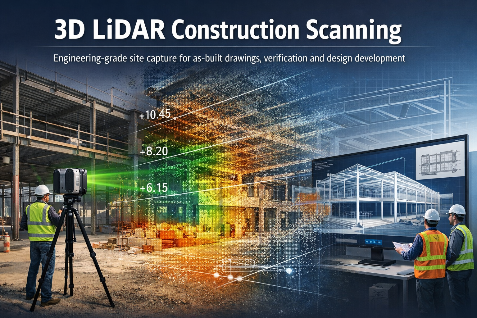
Hamilton By Design provides engineering-grade 3D LiDAR scanning services for construction projects, helping capture accurate digital models of buildings, structures, and construction sites before, during, and after construction works.
Using advanced laser scanning technology, millions of precise measurements can be captured within minutes to produce detailed 3D point clouds and digital models of real-world structures. These models provide reliable information for planning, design, verification and as-built documentation.
Our scanning workflows allow project teams to move from existing construction conditions to accurate engineering models, helping reduce uncertainty and improve project outcomes.
What is 3D LiDAR Construction Scanning?
3D LiDAR scanning uses laser-based sensors to measure distances between the scanner and surrounding surfaces. The system records millions of measurements which form a point cloud representing the exact geometry of the construction environment.
These point clouds create highly detailed digital representations of buildings, infrastructure and construction sites that can be measured, analysed and modelled in engineering software.
For construction projects this provides a powerful way to:
- capture existing building geometry
- verify construction progress
- generate accurate as-built drawings
- support design coordination
- analyse levels, clearances and spatial constraints
Modern LiDAR scanning allows engineers to capture entire buildings and construction sites quickly and accurately, creating reliable digital data for planning and engineering workflows.
Applications of LiDAR Scanning in Construction
3D LiDAR scanning supports a wide range of construction and engineering tasks.
As-Built Documentation
Construction drawings often become outdated as projects evolve. LiDAR scanning provides accurate as-built documentation of structures, capturing the exact conditions present on site.
These datasets can be used to generate:
- floor plans
- elevations
- cross sections
- building models
- digital twins of facilities
Learn more:
Construction Verification and Quality Control
Scanning can be used during construction to verify that structures match the design intent.
Point cloud data can be compared against design models to identify:
- structural deviations
- alignment issues
- level variations
- installation conflicts
This helps project teams identify problems early before they become costly construction errors.
Renovation and Refurbishment Projects
Older buildings often have incomplete or inaccurate drawings.
3D LiDAR scanning provides a reliable way to capture existing conditions before renovation works begin. Engineers and designers can then develop new designs directly from the scanned data.
This reduces risk and ensures that new components fit correctly within existing structures.
Related page:
Structural and Architectural Analysis
Construction scanning can also be used to analyse structural geometry and building profiles, including:
- roof profiles and screed levels
- slab levels and floor flatness
- façade alignment
- structural steel positioning
- drainage and fall verification
These measurements allow engineers to identify geometry problems early and support accurate construction planning.
The Scan to Engineering Model Workflow
Hamilton By Design integrates LiDAR scanning with engineering modelling workflows.
Typical project workflow:
Existing Construction Site
↓
3D LiDAR Scanning
↓
Point Cloud Processing
↓
Scan-to-CAD Modelling
↓
Engineering Analysis and Design
This workflow allows engineers to work from accurate digital representations of real-world conditions, reducing the need for repeated site visits and manual measurements.
Benefits of LiDAR Scanning for Construction Projects
3D LiDAR scanning provides several advantages compared with traditional measurement methods.
Accurate Site Data
Laser scanners capture millions of measurements quickly, producing detailed datasets that accurately represent site conditions.
Reduced Project Risk
Accurate site data reduces the risk of design errors, construction conflicts and unexpected site conditions.
Faster Site Surveys
Entire buildings and construction areas can be captured in a short time, reducing the need for multiple survey visits.
Improved Project Coordination
Point cloud data can be shared between architects, engineers and contractors, ensuring everyone works from the same information.
Support for Digital Engineering Workflows
LiDAR scanning supports modern design processes such as:
- scan-to-CAD modelling
- digital twins
- BIM coordination
- construction verification
Engineering-Grade 3D Laser Scanning
Hamilton By Design provides professional scanning services focused on engineering and industrial applications, not just visualisation.
Our scanning workflows support projects across:
- industrial facilities
- infrastructure projects
- buildings and structures
- construction sites
- mechanical and structural engineering projects
Learn more about our scanning capabilities:
When is LiDAR Construction Scanning Most Valuable?
3D scanning is particularly useful in situations where accurate geometry is critical.
Examples include:
- building renovations
- structural modifications
- plant installations within buildings
- roof level and drainage analysis
- verifying construction tolerances
- documenting existing conditions before construction
In many cases the cost of scanning is small compared with the potential cost of construction errors.

Talk With Hamilton By Design
If you require 3D LiDAR construction scanning for engineering or building projects, Hamilton By Design can help capture accurate digital models of your site.
Our team specialises in scanning workflows that support engineering analysis, design development and construction planning.
Contact Hamilton By Design to discuss your project requirements.