Rockhampton a Unique Environment for Engineering

Why Rockhampton Is a Unique Environment for Engineering & Digital Technology

Rockhampton stands out for several reasons that directly influence how engineering and design work is executed in the region.

1. A City at the Centre of Agriculture, Mining and Defence

Few regional cities in Australia support as many sectors simultaneously:

  • cattle production & feedlots
  • abattoirs and food-processing plants
  • mining workflow (Bowen Basin)
  • fabrication and workshop environments
  • major road & rail logistics
  • defence operations at Shoalwater Bay

This diversity creates an environment where brownfield projects, plant upgrades and operational changes are constant โ€” and where accurate digital engineering is invaluable.

2. A Heritage-Rich Built Environment

Rockhamptonโ€™s colonial architecture and historic precincts add engineering complexity, especially for:

  • renovation and extension planning
  • capturing building geometry
  • ensuring compliance during upgrades
  • modelling concealed or irregular structures

Accurate scanning and modelling reduce the risks associated with modifying older buildings.

3. A Rapidly Growing Industrial Corridor

With expansions across Gracemere, Parkhurst and the Port Alma supply chain, Rockhampton is strengthening its role as a:

  • fabrication hub
  • transport distribution centre
  • industrial service precinct

Digital engineering ensures these facilities deliver maximum efficiency with minimal downtime.
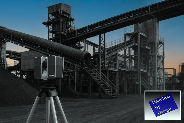

3D LiDAR Laser Scanning: Rockhamptonโ€™s Path to More Accurate, Data-Driven Projects

One of the biggest challenges in Central Queensland is managing complexity in brownfield industrial environments: tight tie-in points, undocumented modifications, legacy equipment, unknown clearances and misaligned plant sections.

This is exactly where 3D LiDAR scanning becomes a game-changing tool.

Hamilton By Design uses engineering-grade scanning to produce:

  • complete as-built environments
  • millimetre-accurate spatial data
  • structural geometry and deflection insights
  • clash detection for new installations
  • alignment checks for equipment
  • precise digital documentation for tendering and fabrication

Learn more about our scanning process here:
3D Laser Scanning โ€“ https://www.hamiltonbydesign.com.au/home/3d-lidar-scanning-digital-quality-assurance/3d-laser-scanning/

For Rockhampton industries, the value is immediate:

  • reduced rework and fewer shutdown overruns
  • accurate fit-up when fabricators install new components
  • better engineering decisions based on real data
  • faster turnaround for designs and feasibility planning

From abattoirs to feed mills, mining workshops to energy infrastructure, LiDAR scanning ensures every project begins with precise, reliable site information.


3D Modelling & Drafting: Turning Reality Into Intelligent Engineering Models

Once the point cloud is captured, Hamilton By Design transforms the data into:

  • SolidWorks parts and assemblies
  • mechanical models for plant upgrades
  • fabrication-ready drawings (GA, detail, isometric & BOMs)
  • structural models for platforms, supports, conveyors and frames
  • mechanical layout concepts and optimisation studies

For Rockhampton businesses, this is particularly valuable because:

  • fabrication teams rely on correct geometry
  • shutdown windows are small
  • misaligned or undocumented equipment is common
  • design changes often must occur quickly

With 3D modelling, plant owners, contractors and fabricators can visualise the project before steel is cut โ€” dramatically improving accuracy and reducing cost.


Mechanical Engineering for Rockhamptonโ€™s Industrial & Agricultural Sectors

Rockhamptonโ€™s diverse economy means the region is constantly upgrading:

  • processing plants
  • abattoirs
  • feed mills
  • grain-handling systems
  • water-treatment infrastructure
  • conveyor systems
  • workshops and industrial machinery

Hamilton By Design provides engineering support such as:

  • mechanical design for new or upgraded equipment
  • structural assessments on frames, platforms, chutes and conveyors
  • vibration, deflection and alignment analysis
  • flow optimisation for materials-handling systems
  • FEA (Finite Element Analysis) for components and assemblies
  • lifting, access and maintenance design

Our engineer-led workflow ensures that every design is based on reality โ€” captured by LiDAR and validated through modelling and analysis.


How Digital Engineering Helps Rockhamptonโ€™s Key Industries

1. Beef Processing & Agri-Food Operations

Rockhamptonโ€™s processing facilities are often complex, space-constrained and continuously operating.

Scanning assists with:

  • plant upgrades
  • layout efficiency studies
  • tie-in accuracy for new conveyors or equipment
  • compliance documentation

2. Bowen Basin Mining Support

Rockhampton is a major hub for:

  • mining contractors
  • fabrication workshops
  • equipment repair
  • maintenance logistics

LiDAR scanning and engineering reduce rework in fabricated components destined for:

  • Moranbah
  • Blackwater
  • Middlemount
  • Dysart and surrounding mines

3. Industrial Precincts & Port Supply Chains

Industrial estates across Parkhurst and Gracemere benefit from:

  • warehouse fit-outs
  • crane runway checks
  • processing-line layout design
  • mechanical and structural upgrades

4. Heritage & Architectural Redevelopment

Scanning enables:

  • accurate modelling of old buildings
  • conflict detection for new internal services
  • faรงade preservation planning

No risk of relying on inaccurate tape-measure surveys.


A Fully Integrated Workflow: Scan โ†’ Model โ†’ Engineer โ†’ Deliver

One of the biggest advantages Hamilton By Design provides to Rockhampton businesses is single-source accountability.

Our streamlined process includes:

  1. 3D LiDAR scanning of the site
  2. Processing & registering point-cloud data
  3. SolidWorks modelling of the environment
  4. Engineering assessments & calculations
  5. Fabrication-ready drawings
  6. Digital QA for installation

Thereโ€™s no handover between scanning companies, designers and engineers โ€” everything is delivered by one team, reducing miscommunication and improving project outcomes.


Rockhamptonโ€™s Future Is Digital โ€” And Weโ€™re Ready to Support It

Rockhampton is experiencing a period of sustained growth driven by agriculture, mining, defence and industrial expansion. As facilities upgrade and capacity increases, accurate engineering data, digital design tools and advanced scanning technology will be central to delivering smarter, safer and more efficient projects.

Hamilton By Design logo displayed on a blue tilted rectangle with a grey gradient background

Hamilton By Design is proud to support Central Queensland with:

  • 3D LiDAR laser scanning
  • Mechanical engineering consulting
  • 3D modelling and drafting
  • Digital documentation and quality assurance

Whether youโ€™re planning an upgrade to a processing plant, modernising a workshop, designing a conveyor system or documenting an entire facility, our engineering-led team provides the precision and reliability your project needs.

Our Clients

Name
Would you like us to arrange a phone consultation for you?

Toowoombaโ€™s Engineering Future

Toowoombaโ€™s Engineering Future: How 3D LiDAR Scanning & Digital Modelling Are Transforming Projects Across the Darling Downs


Toowoomba is quickly becoming one of Australiaโ€™s most important regional powerhouses โ€” a city where agriculture, logistics, mining, construction and manufacturing intersect at a scale rarely seen outside capital cities. With major infrastructure investments, the growth of the Toowoomba Wellcamp Airport, and its position as a gateway to the Surat Basin and the Darling Downs, the region is undergoing a steady shift toward digitally enabled engineering and smarter project delivery.

At Hamilton By Design, weโ€™re incredibly proud to support this growth by providing 3D LiDAR laser scanning, mechanical engineering consulting, 3D modelling and drafting, and digital quality assurance tailored specifically for the demands of Toowoombaโ€™s industrial, commercial and rural sectors.

In this article, we explore why Toowoomba is so unique, the role of modern engineering technology in the region, and how accurate site data and digital models are helping local businesses reduce rework, improve safety and deliver better project outcomes.


Why Toowoomba Is the Perfect Fit for Modern Digital Engineering

Toowoomba is Australiaโ€™s largest inland city outside Canberra, with more than 180,000 people and an economy driven by a mix of agriculture, logistics, manufacturing, construction and energy projects. Its elevated position on the Great Dividing Range, combined with its access to the Surat Basin and major rural supply chains, makes it a critical service hub for heavy industry and regional infrastructure.

But what really sets Toowoomba apart is its transformation into a logistics and engineering centre. With Inland Rail connections, Wellcamp Airportโ€™s freight terminal and constant agricultural expansion, the demand for precise, reliable engineering data has grown rapidly.

This is where 3D LiDAR scanning and digital engineering provide enormous value.


3D LiDAR Laser Scanning: Bringing Millimetre-Level Accuracy to Local Projects

Whether youโ€™re working on a feed mill upgrade, a manufacturing facility expansion, a rural processing plant, a logistics warehouse fit-out or a mining-related modification, accurate site measurements are essential. Traditional surveys struggle to capture the complex geometry, alignment issues or hidden interferences common in brownfield environments.

Engineering-grade 3D LiDAR scanning solves this problem instantly.

Hamilton By Design uses high-accuracy terrestrial laser scanners capable of capturing:

  • complex plant layouts
  • conveyors, chutes, structural frames
  • pipework routing and clashes
  • equipment misalignment
  • deflections, corrosion and wear
  • existing foundations and tie-in points
  • site terrain and building envelopes

All delivered with millimetre-level accuracy.

For Toowoomba businesses, this means:

  • reduced rework
  • faster fabrication
  • fewer shutdown overruns
  • safer installations
  • accurate as-built documentation

In a region where travel, mobilisation and shutdown timing matter, these improvements translate directly into cost savings and smoother project execution.


3D Modelling & Drafting for Toowoomba Industry

After scanning, the next step is turning point-cloud data into intelligent 3D models and fabrication-ready drawings.

Hamilton By Design specialises in:

  • SolidWorks mechanical modelling
  • structural modelling for plant systems
  • equipment layouts and upgrade designs
  • skid-based systems
  • brownfield modification design
  • drawing packages (GA, detail, isometric, BOMs)

For Toowoomba industries โ€” especially manufacturing workshops, agri-processing facilities, grain-handling plants, transport depots and rural engineering contractors โ€” accurate 3D models significantly improve design coordination.

We often hear clients say:

โ€œWe used to rely on tape measures and photos. Now we can see the entire plant from our office.โ€

That is exactly the transformation 3D modelling provides.


Mechanical Engineering for Brownfield Upgrades Across the Darling Downs

The Toowoomba region is rich in brownfield mechanical assets:
farm infrastructure, conveyor systems, grain silos, batching plants, food-processing lines, workshops, energy facilities and quarry machinery.

Hamilton By Design provides engineering support such as:

  • mechanical design for upgrades
  • structural integrity assessments
  • vibration, alignment and deflection reviews
  • buckling, fatigue and stress analysis (FEA)
  • chute, pipework and mechanical flow improvements
  • equipment mounting, lifting and access design

Our combination of engineer-led scanning + mechanical design ensures that every upgrade fits the first time and is supported by real data.


Why 3D Laser Scanning Is a Game-Changer for Toowoomba

Hereโ€™s where Toowoomba really benefits compared to many inland cities:

1. Large Agricultural Facilities Need Accurate Layouts

Feedlots, grain silos, packing sheds, processing plants and cold-storage facilities often evolve over many years. Scanning helps document these environments for compliance, redesign and expansion.

2. The Region Supports Mining & Energy Projects

Toowoomba acts as a service centre for the Surat Basin โ€” Dalby, Chinchilla, Miles, Roma.
LiDAR enables accurate tie-in points, pipe upgrades and shutdown planning.

3. Manufacturing & Fabrication Are Growing

Local workshops need precise data to avoid rework. Models based on point clouds give fabricators total confidence before cutting steel.

4. Logistics Infrastructure Continues Expanding

Wellcamp Airport, industrial estates and new warehousing projects benefit from accurate as-built documentation to speed up development approvals and construction decisions.

5. Reducing Travel Costs Is Critical for Regional Projects

A single scan eliminates multiple site trips โ€” crucial for Toowoombaโ€™s broad geographic service area.


Types of Toowoomba Projects Hamilton By Design Supports

Here are some of the local project types where our team adds immediate value:

  • grain-handling plant upgrades
  • feed mill expansions
  • water treatment & pumping stations
  • abattoir & food facility engineering
  • conveyor & materials-handling systems
  • batching plant upgrades
  • workshop fit-outs and machinery layouts
  • logistics warehouse redesigns
  • rural industrial buildings
  • mechanical equipment retrofits
  • energy & utility infrastructure

Whether itโ€™s a small workshop or a multi-hectare industrial site, LiDAR scanning gives project teams a crystal-clear digital representation of the site.


Single-Source Accountability:

Scanning โ†’ Modelling โ†’ Engineering โ†’ Drawings

One of the biggest frustrations in regional engineering is fragmented contractors โ€” one team scans, another models, another designs, and nobody takes responsibility when things donโ€™t align.

Hamilton By Design solves this with an integrated workflow:

  1. 3D LiDAR scan of the site
  2. Registration and accuracy validation
  3. 3D CAD modelling (SolidWorks)
  4. Mechanical & structural engineering
  5. Fabrication-ready drawings
  6. Digital QA and installation support

Everything is handled by a single engineering-led team.


Toowoombaโ€™s Future Needs Digital Engineering โ€” And Weโ€™re Here to Support It

Toowoomba is entering a decade of growth โ€” new industrial estates, expansions in agri-processing, energy transformation, airport-driven logistics and inland infrastructure.
Digital engineering will be a major part of how these projects are delivered efficiently and safely.

Hamilton By Design logo displayed on a blue tilted rectangle with a grey gradient background

Hamilton By Design is excited to provide Toowoomba businesses with:

  • precise 3D LiDAR scanning
  • mechanical engineering and assessment
  • professional 3D modelling and drafting
  • fabrication-ready design
  • digital documentation and QA

Whether youโ€™re planning a small plant improvement or a major regional upgrade, our data-driven approach helps you design with confidence.

3D LiDAR Scanning Hunter Valley Power Stations

FARO 3D laser scanner set up on a tripod capturing an industrial plant for LiDAR scanning and digital modelling, with Hamilton By Design branding in the corner.

Unlocking Accuracy, Safety and Efficiency for Critical Infrastructure

The Hunter Valley is home to some of Australiaโ€™s most significant power generation assets. These power stations โ€” many of which have operated for decades โ€” supply energy to mining operations, manufacturing facilities, regional communities and industries throughout New South Wales. As these plants age and undergo continual maintenance, upgrades and redevelopment, the importance of accurate, reliable and safe measurement methods becomes increasingly critical.

Traditionally, engineers and maintenance teams have relied on manual measurements, outdated drawings or partial documentation to plan upgrades or execute shutdown work. But in complex, congested and ageing plant environments, this introduces risks, delays and expensive rework.

This is why 3D LiDAR scanning in Hunter Valley power stations has emerged as one of the most valuable tools for modern asset management, engineering and maintenance planning. LiDAR provides a millimetre-accurate digital snapshot of real-world conditions, enabling smarter, safer and more predictable project outcomes.

This article explores the benefits, applications, and pros and cons of 3D LiDAR scanning and explains why Hunter Valley power stations stand to gain significantly from adopting this technology.


Why Power Stations Need Accurate As-Built Data

Power stations are among the most complex industrial facilities in Australia. Over decades of operation, they experience:

  • Structural deformation
  • Settlement and movement
  • Corrosion and wear
  • Numerous undocumented modifications
  • Equipment realignments
  • Tight access restrictions
  • Ageing steelwork and infrastructure

In these environments, original construction drawings rarely match reality. As a result, engineers planning upgrades, shutdowns or replacements often face:

  • Inaccurate interface points
  • Misaligned structures
  • Unpredictable installation conditions
  • High rework costs
  • Safety delays
  • Poor shutdown timing

3D LiDAR scanning offers a precise, digital representation of the site, giving engineers the confidence they need to design upgrades accurately and eliminate guesswork.


The Benefits of 3D LiDAR Scanning for Hunter Valley Power Stations

1. Unmatched Measurement Accuracy for Complex Assets

A power station contains thousands of interconnected components:

  • Boilers
  • Turbines
  • Structural platforms
  • Pipe networks
  • Pressure vessels
  • Ducting systems
  • Conveyor bridges
  • Cooling towers
  • Electrical cabinets
  • Steel supports

Capturing these geometries manually is nearly impossible.

3D LiDAR scanning provides millimetre-level accuracy across enormous plant areas, allowing engineers to:

  • Create precise as-built models
  • Validate structural alignment
  • Check pipe routes and clearances
  • Identify interferences
  • Understand deformation over time
  • Design new works based on real geometry

This level of data is invaluable for maintaining safe and compliant power-generation operations.


2. Major Safety Improvements

Power stations present significant safety risks:

  • High-voltage environments
  • Confined spaces
  • Elevated platforms
  • Hot surfaces
  • Restricted access
  • Operational machinery

Manual measurement often requires workers to climb structures, enter hazardous zones or physically reach difficult areas.

3D LiDAR scanning dramatically reduces risk by:

  • Capturing data from safe distances
  • Eliminating the need for repeated access
  • Reducing time in hazardous zones
  • Minimising interaction with live equipment

For Hunter Valley power stations with strict safety requirements, this is a major benefit.


3. Reduced Shutdown Duration and Cost

Shutdowns are among the most expensive events for power-generation facilities. Every hour counts.

With 3D LiDAR scanning:

  • Engineers define accurate scopes before shutdown
  • Fabricators receive precise data and cut steel correctly
  • Digital fit checks identify issues early
  • Installation is faster and smoother
  • Delays due to bad measurements are eliminated

This leads to shorter outages, safer work and fewer unexpected problems.


4. Supports Engineering, Design and Structural Integrity Works

Power stations frequently require:

  • Boiler upgrades
  • Turbine area modifications
  • Ducting and flue replacements
  • Pipework rerouting
  • Cooling-system upgrades
  • Structural strengthening
  • Platform and walkway replacements
  • Electrical equipment relocations

All of these tasks depend on accurate geometry.

3D LiDAR scanning supports engineering teams by providing:

  • Reference geometry for load calculations
  • Verified connection points
  • True alignment data
  • Accurate slope and deflection measurements
  • High-resolution drawings and 3D models

This ensures engineering decisions are made using verified, real-world information.


5. Perfect for Brownfield and Congested Environments

Power stations are some of the most complex brownfield assets in the industrial landscape. They contain layers of modifications, years of retrofits and areas where access is extremely limited.

3D LiDAR scanning excels at capturing:

  • Tight clearances
  • Overlapping structures
  • Equipment clusters
  • Interconnected pipes
  • Hard-to-reach surfaces

This makes it ideal for planning:

  • New platforms
  • Replacement ducting
  • Pipe realignments
  • Structural upgrades
  • Asset lifecycle extensions

The result: fewer surprises during installation.


6. Better Collaboration Between Teams

Power stations typically involve:

  • Maintenance teams
  • OEMs
  • Engineering consultants
  • Fabricators
  • Shutdown managers
  • Safety personnel
  • Project delivery teams

3D LiDAR scanning enables everyone to work from the same digital truth.

Point clouds and 3D models allow:

  • Remote site understanding
  • Clear communication
  • Digital reviews instead of repeated site visits
  • Improved planning alignment

For Hunter Valley projects involving multiple contractors, this significantly boosts performance.


Pros and Cons of 3D LiDAR Scanning

Like any technology, LiDAR has strengths and limitations. Understanding both helps power station operators make informed decisions.


Pros

โœ” Extremely high accuracy

Millimetre precision for large and complex areas.

Fast data capture

Reduces time spent in hazardous areas.

Clear visibility of congested spaces

Captures geometry that traditional methods miss.

Enhances engineering confidence

Designers base work on verified conditions.

Reduces installation rework

Fabrication matches the real site exactly.

Supports digital engineering workflows

Perfect input for CAD, BIM, simulation and modelling.

Safer measurement practices

Less climbing, reaching and confined-space entry.


Cons

Requires skilled interpretation

Point cloud data must be processed by trained technicians or engineers.

Large file sizes

High-resolution scans require strong computing resources.

Reflective or transparent surfaces can create challenges

Requires technique or matte marking in some areas.

Upfront cost may seem higher

But it eliminates far greater downstream costs in rework and shutdown delays.

Despite these considerations, LiDAR scanning remains the most cost-effective measurement tool for power station environments.


Why Hunter Valley Power Stations Benefit More Than Most

The Hunter Valley industrial landscape presents unique challenges:

  • Ageing energy infrastructure
  • Multiple retrofits and undocumented modifications
  • Extremely tight maintenance windows
  • Harsh environmental conditions
  • Congested structures with difficult access
  • High safety standards
  • Heavy reliance on local fabrication accuracy

3D LiDAR scanning Hunter Valley power stations provides the one thing these facilities need most: confidence.

Confidence in measurements.
Confidence in fabrication.
Confidence during shutdowns.
Confidence in engineering decisions.
Confidence in safety performance.

Few regions stand to gain more from LiDAR than the Hunter.


Hamilton By Design: Supporting Hunter Valley Power Stations with Advanced LiDAR Solutions

Hamilton By Design brings together:

  • Engineering expertise
  • On-site scanning capability
  • CAD modelling and drafting
  • Fabrication-ready documentation
  • Digital fit-checking and clash detection
  • Mechanical and structural design experience

We understand the complex realities of power-station environments, and we deliver precise, reliable and engineering-ready digital data for:

  • Boiler upgrades
  • Turbine hall modifications
  • Structural replacements
  • Pipe rerouting
  • Platform and access upgrades
  • Ducting and flue modifications
  • Cooling tower projects
  • Balance-of-plant improvements

Every model, point cloud and drawing is produced with installation success and fabrication accuracy in mind.


Conclusion: 3D LiDAR Scanning is the New Standard for Hunter Valley Power Stations

As the Hunter Valley transitions into a future of renewable generation, asset extension and industrial redevelopment, 3D LiDAR scanning stands out as a technology that delivers real, immediate value.

It improves safety.
It increases accuracy.
It reduces rework.
It enables better engineering.
It shortens shutdowns.
It lowers project risk.

Power stations across the Hunter Valley rely on critical, ageing and highly complex infrastructure โ€” infrastructure that demands accurate, reliable digital measurement.

Hamilton By Design is proud to support the region with advanced laser scanning technologies that empower engineers, fabricators, supervisors and project managers to work smarter, safer and more efficiently.

Hamilton By Design logo displayed on a blue tilted rectangle with a grey gradient background

3D Laser Scanning

Hunter Valley Laser Scanning: Transforming Engineering Accuracy Across Mining, Manufacturing and Infrastructure

3D Laser Scanning in Singleton and the Hunter: Delivering Accuracy for Mining, Manufacturing and Industrial Projects

Laser Scanning Hunter Valley: Delivering Engineering-Grade Accuracy for Mining, Manufacturing and Industrial Projects

Our clients

Name
You would like to:

3-D Lidar Scanning Hunter Valley: Transforming Industrial Projects with Accuracy, Safety and Engineering Confidence

The Hunter Valley is one of Australiaโ€™s most strategically important industrial regions. It supports large mining operations, CHPP facilities, fabrication workshops, energy infrastructure, civil projects and heavy manufacturing. These industries depend on precision, safety and efficient project delivery โ€” yet most operate in aging brownfield environments where original drawings are outdated, equipment has shifted over time, and modifications have occurred for decades without accurate documentation.

In environments like these, traditional measuring methods often fail to provide the precision required for confident engineering and fabrication. This is why 3-D Lidar scanning in the Hunter Valley has become a critical tool for engineers, supervisors, fabricators and project managers. It captures the real-world site conditions with millimetre accuracy, creating a digital foundation for smarter, safer and more efficient project execution.

This article explores the benefits, pros and cons of 3-D Lidar scanning, and explains why the Hunter Valley is uniquely positioned to gain massive value from this technology.


Understanding 3-D Lidar Scanning

3-D Lidar (Light Detection and Ranging) scanning is a non-contact measurement technology that uses lasers to capture millions of points in seconds. The scanner emits laser pulses and measures the return time to determine distances, building a dense โ€œpoint cloudโ€ of the environment.

This point cloud is a precise 3-D representation of:

  • Structural steel
  • Conveyors and transfer towers
  • Chutes, bins and hoppers
  • Tanks, pipework and mechanical equipment
  • Platforms, walkways and buildings
  • Industrial plant rooms and process areas

Once captured, this digital data becomes the foundation for engineering models, fabrication drawings, digital fit checks and project planning.


Why 3-D Lidar Scanning Matters in the Hunter Valley

The Hunter Valley contains some of the most complex and heavily used industrial assets in Australia. Many facilities have been in operation for decades, and almost all have undergone modifications, expansions and repairs. Over time, the real-world geometry diverges significantly from the old drawings stored on paper or outdated CAD files.

This creates major challenges:

  • Measurements taken by hand are inaccurate or unsafe
  • Shutdown windows are extremely tight
  • Fabricators rely on precise data to avoid costly rework
  • Engineers require true geometry for load calculations and interface design
  • Supervisors need reliable information to scope replacement work

3-D Lidar scanning provides a millimetre-accurate representation of what exists onsite, removing guesswork and supporting engineering best practice.


The Benefits of 3-D Lidar Scanning in the Hunter Valley

1. Millimetre Accuracy Improves Engineering Outcomes

In heavy industrial environments, small measurement errors can create large, expensive problems. Structural misalignment, worn steel, bent frames, sagging conveyors and distorted chutes are all common in brownfield plants.

3-D Lidar scanning captures:

  • True dimensions
  • Variations from design
  • Deformation and misalignment
  • Complex curved surfaces
  • Differences caused by wear and tear

Engineers design with confidence because the digital model reflects actual site conditions โ€” not assumptions.


2. Huge Reduction in Rework and Fabrication Errors

Fabricators in Singleton, Muswellbrook, Rutherford, Tomago and throughout the Hunter region rely on accurate measurements to ensure steel and mechanical components fit the first time.

Without accurate data, common fabrication issues include:

  • Bolt holes misaligned
  • Steel members too short or too long
  • Chutes or hoppers not matching openings
  • Pipe spools missing clearances
  • Platforms not sitting square

These problems lead to:

  • Onsite cutting and welding
  • Delayed installations
  • Extended shutdown time
  • Additional crane costs
  • Extra labour expenses

3-D Lidar scanning eliminates these risks, ensuring every component is manufactured to match the as-built site geometry.


3. Improved Shutdown Planning and Faster Execution

Mining and CHPP shutdowns in the Hunter Valley operate under strict time constraints. Any unexpected measurement issue can cause delays affecting production and safety.

With 3-D Lidar scanning:

  • Scope is defined accurately before shutdown
  • Fabrication is completed correctly the first time
  • Digital fit checks identify problems early
  • Installation is faster and safer

Shutdowns become more predictable and efficient.


4. Massive Safety Improvements

Manual measurement often requires workers to:

  • Enter confined spaces
  • Access heights
  • Work around operating equipment
  • Lean over conveyors
  • Navigate dirty, uneven or hazardous areas

3-D Lidar scanning minimises physical access requirements. Technicians can scan large areas from safe positions, reducing:

  • Fall risks
  • Pinch-point exposure
  • Hot-work hazards
  • Time on elevated structures

This is a major benefit for HSE and maintenance teams across the Hunter Valley.


5. Better Communication, Collaboration and Visualisation

Point clouds and 3-D models make it easier for teams to understand the project environment, especially when stakeholders are spread across:

  • Mine sites
  • Fabrication workshops
  • Design offices
  • Engineering consultancies
  • Projects teams and OEM vendors

Digital data allows remote review, reducing the need for repeated site visits and improving decision-making.


6. Ideal for Brownfield Upgrades and Congested Areas

Many Hunter Valley facilities are decades old, with layers of modifications. Clearances are tight, geometry is irregular, and equipment alignment has changed over the years.

3-D Lidar scanning is perfect for:

  • Transfer towers with layered steel
  • Congested plant rooms
  • Pipe networks
  • Stockpile conveyors
  • Old building footprints
  • Complex structural junctions

The scanner captures the complexity instantly and precisely.

Hamilton By Design logo displayed on a blue tilted rectangle with a grey gradient background

Pros and Cons of 3-D Lidar Scanning

While 3-D Lidar scanning is a game-changing tool, it is important to understand both the advantages and limitations.

3D Scanning in The Hunter Valley

3D Laser Scanning

Hunter Valley Laser Scanning: Transforming Engineering Accuracy Across Mining, Manufacturing and Infrastructure

3D Laser Scanning in Singleton and the Hunter: Delivering Accuracy for Mining, Manufacturing and Industrial Projects

Laser Scanning Hunter Valley: Delivering Engineering-Grade Accuracy for Mining, Manufacturing and Industrial Projects

Name
You would like to:

Laser Scanning Hunter Valley: Delivering Engineering-Grade Accuracy for Mining, Manufacturing and Industrial Projects

The Hunter Valley remains one of Australiaโ€™s most important industrial regions. With world-class mining operations, CHPP facilities, fabrication workshops, power generation assets and major industrial precincts, the region depends on precision, reliability and efficient project planning. As plants age and infrastructure expands, the challenge of capturing accurate site information becomes increasingly critical.

This is why laser scanning in the Hunter Valley has rapidly become a foundational tool for maintenance, engineering, redesign, shutdown preparation and fabrication accuracy. Organisations across the region are turning to laser scanning because the demands of modern industrial work simply cannot be met with traditional tape measurements or outdated drawings.

Hamilton By Design is proud to deliver engineering-grade laser scanning throughout the Hunter Valley, supporting safer worksites, faster project execution and significantly improved installation outcomes. Below, we explore why laser scanning is essential, how the technology works and how it transforms operations across the region.


Why Laser Scanning Has Become Essential in the Hunter Valley

Across the Hunter, very few sites resemble their original drawings. Over decades, plants evolveโ€”structures deform, temporary fixes become permanent, equipment shifts, and countless undocumented modifications occur.

These realities create a major problem:
Projects that rely on inaccurate measurements inevitably face delays, rework and installation challenges.

The consequences of bad data include:

  • Structural steel not fitting on site
  • Conveyor alignment issues
  • Misaligned chutes or transfer points
  • Inaccurate pipe spool lengths
  • Unexpected clashes in congested areas
  • Extended shutdown duration
  • Significant cost blowouts

By contrast, laser scanning in the Hunter Valley provides a millimetre-accurate digital representation of the real site, eliminating uncertainty and enabling confident engineering decisions.


How Laser Scanning Works

Laser scanningโ€”also known as LiDAR (Light Detection and Ranging)โ€”captures millions of precise data points across a site in seconds. These points create a โ€œpoint cloud,โ€ a detailed 3D representation of the scanned environment.

The Hamilton By Design workflow typically includes:

1. On-Site High-Accuracy Capture

We scan assets such as:

  • Structural frames
  • Conveyors, transfer towers and walkways
  • Chutes, bins, hoppers and material-handling systems
  • Tanks and pipe networks
  • Mechanical equipment
  • Buildings and platforms
  • Processing areas and plant rooms

Scanning is performed safely, quickly and with minimal disruption to operations.

2. Point Cloud Processing

Individual scans are aligned and merged into a single, unified as-built dataset.

3. CAD Modelling

From the point cloud, we create:

  • Accurate 3D models
  • General arrangement drawings
  • Fabrication details
  • DXF files for workshop use
  • Digital templates for pattern development

4. Engineering & Fabrication Support

We run digital checks for:

  • Clearances
  • Misalignments
  • Bolt pattern accuracy
  • Clash detection
  • Fit-up assurance

This ensures all new components, structures and mechanical systems integrate correctly the first time.


Industries in the Hunter Valley Using Laser Scanning

1. Mining & Coal Handling Preparation Plants (CHPPs)

The Hunter Valley is one of Australiaโ€™s largest mining hubs, and laser scanning has become indispensable for:

  • Chute redesign and optimisation
  • Conveyor alignment and pulley checks
  • Structural replacements
  • Screening and crushing system upgrades
  • Transfer tower modifications
  • Bin and hopper geometry capture
  • Shutdown planning and scope definition

In CHPP environmentsโ€”where dust, vibration, wear and deformation are constantโ€”accurate as-built data is essential for safe and efficient upgrades.


2. Local Fabrication Workshops

Fabricators across Singleton, Muswellbrook, Rutherford and Thornton rely on precise digital information to ensure their products fit perfectly in the field. Laser scanning supports:

  • Steel replacement projects
  • Pipe spool fabrication
  • Custom chutes and transfer systems
  • Platform and walkway upgrades
  • Reverse engineering worn components

By basing fabrication on exact site geometry, rework and installation delays are dramatically reduced.


3. Power Stations and Energy Infrastructure

The Hunter Valley contains major energy assets requiring constant maintenance and upgrades. These aging facilities benefit greatly from laser scanning for:

  • Structural integrity assessments
  • Boiler house modifications
  • Pipe rerouting and replacements
  • Access platform upgrades
  • Plant room modelling
  • Compliance documentation

Laser scanning supports safe access, better planning and accurate engineering.


4. Industrial, Manufacturing and Infrastructure Projects

The regionโ€™s industrial footprint is expanding, and many facilities require precise as-built data for:

  • Renovations or expansions
  • Facility mapping
  • Mechanical upgrades
  • Brownfield redevelopment
  • BIM integration

Laser scanning provides the detail needed to plan these works correctly.


Benefits of Laser Scanning in the Hunter Valley

1. Millimetre Accuracy

Unlike manual measurements, laser scanning captures true geometryโ€”not assumptions.

2. Reduced Rework

Digitally verified data ensures that fabrication is correct the first time.

3. Improved Safety

No need for workers to climb, stretch, or enter hazardous areas to measure.

4. Faster Shutdowns

Accurate pre-planning reduces onsite delays.

5. Digital Collaboration

Point clouds allow teams, contractors and engineers to review the site remotely.

6. Enhanced Engineering Confidence

Decisions are made on verified data, improving outcomes across the entire project lifecycle.


The Hamilton By Design Advantage

Hamilton By Design delivers more than just scanningโ€”we combine decades of engineering, drafting and fabrication experience to interpret the data with real-world understanding.

What Sets Us Apart:

Engineering-Driven Approach

We understand the mechanical and structural context behind each scan.

Full Digital Workflow

From scan โ†’ point cloud โ†’ 3D model โ†’ fabrication drawings โ†’ installation, we support your entire project.

Local Knowledge of Hunter Valley Industry

We work routinely with mines, CHPPs, fabricators and industrial facilities across the region.

Fabrication-Ready Outputs

All models and drawings are created with workshop requirements and site constraints in mind.

Confidence Before Installation

We digitally confirm fitment before steel is cutโ€”removing risk.


Applications Where Laser Scanning Delivers Immediate Value

  • Chute replacements
  • Conveyor system upgrades
  • Access platforms and walkways
  • Crusher and screen changes
  • Transfer tower redesign
  • Pipe spool fabrication
  • Structural steel alignment checks
  • Bin, tank and hopper measurement
  • Reverse engineering
  • Brownfield plant expansions

Anywhere accuracy matters, scanning is the superior choice.


Laser Scanning in the Hunter Valley: The New Standard

Across the region, laser scanning is now considered a must-have for safe, efficient and predictable project delivery. As plants age and the complexity of upgrades increases, organisations that invest in accurate data significantly outperform those relying on outdated drawings or manual measuring.

For engineering teams, maintenance planners, workshop fabricators and shutdown coordinators, laser scanning provides the certainty required to deliver work on time and on budget.


Partner with Hamilton By Design

When you choose Hamilton By Design for laser scanning in the Hunter Valley, youโ€™re choosing:

  • Accuracy
  • Safety
  • Engineering reliability
  • Better planning
  • Reduced risk
  • Efficient installation

Weโ€™re ready to support your next shutdown, upgrade, redesign or fabrication project with the digital precision it deserves.

Contact Hamilton By Design today to discuss your site and discover how laser scanning can transform your project outcomes.

Hamilton By Design logo displayed on a blue tilted rectangle with a grey gradient background

Hunter Valley Laser Scanning: Transforming Engineering Accuracy Across Mining, Manufacturing and Infrastructure

3D Laser Scanning in Singleton and the Hunter: Delivering Accuracy for Mining, Manufacturing and Industrial Projects

3D Laser Scanning

3D Scanning in The Hunter Valley

Name
You would like to:

3D Laser Scanning in Singleton and the Hunter: Delivering Accuracy for Mining, Manufacturing and Industrial Projects

Singleton sits at the heart of the Hunterโ€™s industrial engine room. Surrounded by major mines, CHPPs, power stations, fabrication workshops and heavy industrial precincts, the region depends on accurate information, efficient planning and safe, predictable project execution. With assets that have operated for decades, countless undocumented modifications and structures that no longer match original drawings, engineering teams face a constant challenge โ€” how to measure, model and design with confidence.

This is exactly where 3D laser scanning in Singleton and Hunter regions is transforming project workflows. Hamilton By Design provides millimetre-accurate digital capture that eliminates guesswork and supports engineering, fabrication, maintenance and shutdown planning across the entire industrial sector.

Whether you’re a CHPP superintendent in Singleton, a fabrication manager in Muswellbrook, a maintenance engineer in the Hunter Valley, or a project manager responsible for upgrades across multiple sites, accurate laser scanning has become essential. This article explores why the demand for 3D scanning has surged, how the technology works, and how Hamilton By Design uses it to support safer, more efficient and more reliable outcomes across the Hunter region.


Why Singleton and the Hunter Need 3D Laser Scanning

The Hunter region is home to some of Australiaโ€™s most active heavy industrial environments. These operations consist of massive structural steel assemblies, conveyors, process equipment, platforms, chutes, bins and pipework โ€” all subject to wear, deformation and ongoing modification. Many facilities were built long before digital documentation became standard. As a result:

  • Original drawings rarely reflect the current condition
  • Measurements taken by hand are slow, risky and often inaccurate
  • Shutdown windows are extremely tight
  • Brownfield constraints make new installations complex
  • Fabricators rely heavily on accurate data to ensure perfect fitment

Incorrect measurements donโ€™t just cause inconvenience โ€” they create costly fabrication errors, installation delays, safety risks and additional shutdown time.

3D laser scanning removes these risks entirely by creating a verified digital record of what is actually on site.


What 3D Laser Scanning Delivers

Hamilton By Design uses engineering-grade LiDAR scanners to capture millions of precise data points across a site. These points form a point cloud, which is a detailed 3D representation of the real environment. This data can then be used to create accurate models, drawings, simulations and digital checks.

With 3D laser scanning in Singleton and Hunter you get:

  • Accurate as-built geometry
  • Digital templates for fabrication
  • Reliable interface points for new steel or equipment
  • Precise alignment and clearance data
  • Clash identification before installation
  • Improved shutdown planning and safety

For engineers, fitters, boilermakers and fabricators, this accuracy becomes the foundation for smarter decision-making and better project outcomes.


Key Industries Using 3D Laser Scanning in Singleton and the Hunter

1. Mining & CHPP Operations

Singleton is surrounded by some of the most productive mines in the country. Mines and CHPP operations rely heavily on scanning for:

  • Chute and hopper replacements
  • Conveyor alignment checks
  • Transfer tower redesigns
  • Structural integrity assessments
  • Bin, screen and crusher upgrades
  • Digital twins for long-term planning

Because these plants operate continuously, shutdown windows are limited. Laser scanning allows accurate pre-planning, reducing time spent onsite during shutdowns and eliminating unexpected clashes.


2. Fabrication & Manufacturing

The Hunter has a strong fabrication industry, supplying steel structures, mechanical components, platforms, tanks and pipework to mining and energy clients. But fabrication quality relies on measurement quality.

3D laser scanning ensures:

  • Components fit the first time
  • Bolt holes align correctly
  • Flanges match perfectly
  • Structural steel connects without modification
  • Expensive rework on site is eliminated

Workshops across Singleton, Muswellbrook, Thornton and Rutherford increasingly depend on digital accuracy to remain competitive.


3. Power Stations & Energy Infrastructure

The Hunter region includes major power generation assets and critical energy infrastructure. Many structures are ageing, and modifications require absolute accuracy.

Laser scanning supports:

  • Platform replacements
  • Pipe rerouting
  • Structural upgrades
  • Boiler house modifications
  • Maintenance planning
  • Deformation analysis

Reliable as-built data ensures compliance and reduces risk during shutdowns.


4. Industrial, Civil and Commercial Upgrades

Singletonโ€™s industrial footprint is expanding, and many facilities require:

  • As-built documentation
  • Renovations and extensions
  • Spatial coordination
  • Facility redevelopment
  • BIM integration

Laser scanning provides the foundation for safe and efficient project planning across commercial and industrial facilities.


The Hamilton By Design Workflow

Hamilton By Design offers a complete digital engineering solution, from scanning to modelling to fabrication-ready drawings. Our workflow includes:

1. On-Site Scanning

We capture every detail โ€” structural steel, mechanical equipment, conveyors, platforms, bins, hoppers, pipework and building geometry.

2. Processing & Registration

Individual scans are stitched together into a single, accurate point cloud representing the full environment.

3. CAD Modelling

We convert point cloud data into:

  • 3D models
  • GA drawings
  • Fabrication details
  • DXF files for laser cutting
  • Assembly and installation references

4. Digital Fit Checks

Before fabrication begins, we overlay new designs to check for:

  • Clashes
  • Misalignments
  • Interference with existing structures
  • Access and maintenance constraints

5. Project Delivery

Clients receive data that supports safe installation and reduces downtime.


Benefits of 3D Laser Scanning in Singleton and the Hunter

Reduced Rework

Accurate digital data means fabricators build with confidence and installers avoid modifications on site.

Safer Data Capture

Laser scanning reduces the need for manual measuring in hazardous areas.

Faster Shutdown Execution

Pre-planning with accurate data speeds up installation and reduces plant downtime.

Improved Engineering and Design

Designers work from verified geometry rather than guessing from old drawings.

Better Communication

Point clouds and 3D models allow all stakeholders to visualise the site clearly.

Cost Savings from Start to Finish

Less rework, fewer delays and more efficient fabrication combine to deliver real financial value.


Why Choose Hamilton By Design?

Hamilton By Design is uniquely positioned to support Singleton and Hunter clients because:

  • We combine laser scanning expertise with real engineering capability
  • We understand mining, CHPP, fabrication and industrial environments
  • We provide end-to-end digital workflows, not just raw data
  • Our models and drawings are created with fabrication and installation in mind
  • We deliver millimetre-accurate results you can trust

Our team works closely with mine sites, fabricators, energy providers and industrial operators across the region, delivering practical solutions built on real data.


Hamilton By Design logo displayed on a blue tilted rectangle with a grey gradient background

Work With Hamilton By Design

If your project requires precise measurement, modelling, redesign or fabrication, 3D laser scanning in Singleton and the Hunter is the most reliable way to ensure accuracy and reduce risk.

Hamilton By Design is ready to support your next upgrade, shutdown, replacement or maintenance campaign with:

  • On-site laser scanning
  • Point cloud processing
  • CAD modelling
  • Fabrication drawings
  • Digital engineering support

Reach out to discuss your upcoming project โ€” and experience the confidence that only accurate, high-quality 3D data can provide.

3D Scanning in The Hunter Valley

Hunter Valley Laser Scanning: Transforming Engineering Accuracy Across Mining, Manufacturing and Infrastructure

3D Laser Scanning

3D LiDAR Scanning โ€“ Digital Quality Assurance