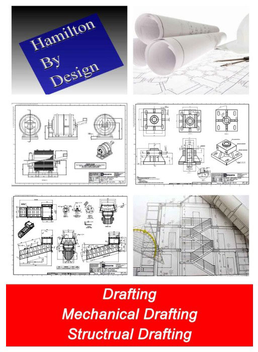
Mechanical Engineering | 3D Scanning | 3D Modelling
Category: Digital Engineering & Reality Capture
Digital Engineering & Reality Capture explores how engineering-grade data capture and digital workflows support accurate design, documentation, and construction outcomes.
This category covers the practical application of 3D LiDAR scanning, laser scanning, point clouds, as-built modelling, and scan-to-CAD workflows, with a focus on engineering intent rather than visualisation.
Articles in this category examine how reality capture integrates with mechanical and structural engineering, supports Australian Standards–aligned documentation, and reduces risk on power, manufacturing, mining, and construction projects—particularly in brownfield and live-site environments.
Content is written for engineers, asset owners, and project teams seeking to understand when digital engineering adds value, how to specify engineering-grade reality capture, and how to convert captured data into design-ready, fabrication-ready information.
Terrestrial LiDAR Scanner Price – Buy or Hire Options
When organisations first explore terrestrial LiDAR scanning, the biggest question is usually not technical — it’s commercial: should we buy a scanner or hire one for the project?
Terrestrial LiDAR scanners such as FARO and Leica systems are powerful tools for capturing accurate point clouds of buildings, industrial facilities, infrastructure and construction sites. They support as-built documentation, clash detection, shutdown planning and digital twin workflows. However, the right decision between purchase and hire depends on how often the equipment will be used and the level of in-house expertise available.
Buying a LiDAR Scanner
Purchasing a scanner can make sense for businesses that:
undertake regular surveying or as-built capture
need immediate access on multiple sites
want to build internal reality-capture capability
plan to integrate point clouds into ongoing design workflows
Ownership provides flexibility and control, but also involves training, software, calibration and maintenance considerations.
Hiring a LiDAR Scanner
Hiring is often the smarter option when:
the requirement is project-specific
workloads are seasonal or occasional
specialist software and support are needed
you want to trial the technology before committing
Hire packages can include advice on setup, data management and export formats so the results integrate smoothly with CAD and BIM platforms.
We Support Both Options
Hamilton By Design offers terrestrial LiDAR scanners for both hire and sale, backed by engineering support to ensure the data delivers real value on your project. Whether you need equipment for a short shutdown, a construction survey, or you are considering building your own scanning capability, our team can guide you through the most practical pathway.
Rather than publishing generic prices, we prefer to understand:
the type of site you need to capture
required accuracy and deliverables
software and CAD integration
duration and level of support
This allows us to recommend the right scanner package and commercial model for your specific needs.
Please contact our team for a price and availability. We’ll help you decide whether buy or hire is the best approach for your project.
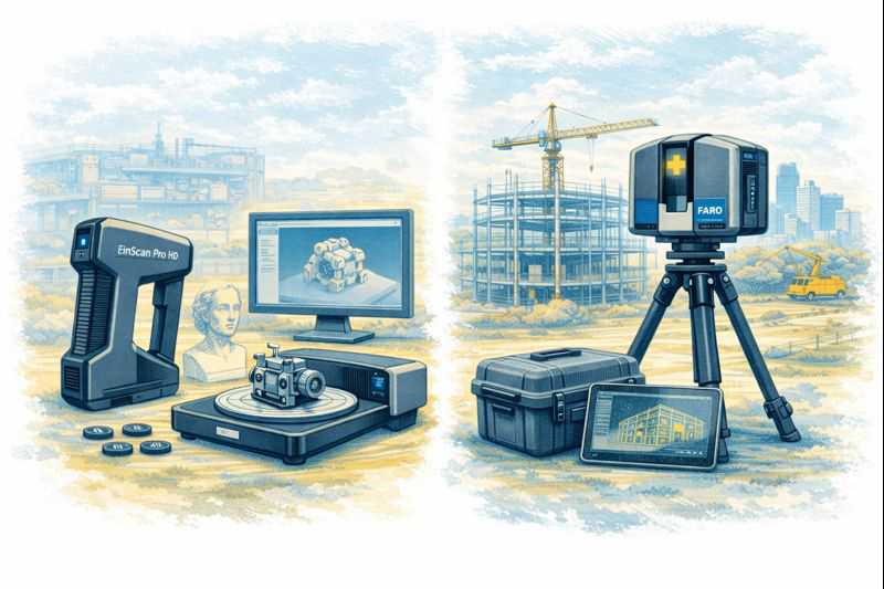
EinScan vs LiDAR Terrestrial Laser Scanners – Choosing the Right Tool for Reality Capture
The rapid growth of 3D scanning has given engineers, fabricators and designers access to tools that were once limited to large survey companies. Today you can buy a compact EinScan structured-light scanner for a few thousand dollars or hire a FARO or Leica terrestrial LiDAR scanner capable of mapping an entire processing plant in an afternoon. Both are called “3D scanners,” yet they serve very different purposes. Understanding the difference between EinScan-style scanners and terrestrial LiDAR systems is essential before investing time or money into reality capture.
Two Technologies, Two Different Jobs
EinScan scanners, produced by SHINING 3D, are primarily structured-light or short-range laser scanners. They project patterns of light onto an object and use cameras to interpret how that light deforms across the surface. The result is a dense mesh model of the object—typically exported as STL, OBJ or PLY files. EinScan units are designed for objects you can walk around, such as mechanical parts, castings, plastic housings and small assemblies.
Terrestrial LiDAR scanners such as the FARO Focus, Leica RTC360 or Trimble X-series operate on a completely different principle. These instruments sit on a tripod and fire millions of laser pulses across a 360-degree field, measuring the time it takes for each pulse to return. The output is a georeferenced point cloud containing precise XYZ coordinates for everything the laser can see—buildings, structures, conveyors, tanks, pipework and terrain.
Calling both devices “3D scanners” is like calling a vernier caliper and a total station the same tool. They both measure, but at entirely different scales.
Scale and Range
The first and most obvious difference is working range. An EinScan handheld unit is comfortable scanning parts from a few centimetres up to perhaps three or four metres. It is ideal for a gearbox housing on a bench or the plastic bumper of a vehicle. Once the object grows larger than a small room, the scanner begins to lose tracking and accuracy.
A terrestrial LiDAR scanner is built for the opposite end of the spectrum. A FARO Focus S-series can capture data from 0.6 metres out to 70 metres or more, mapping entire buildings or industrial sites from a single setup. Multiple scans are then registered together to create a complete digital twin of a facility.
For workshops and machine shops the question becomes simple: Are you scanning an object, or are you scanning a place? Objects suit EinScan; places suit LiDAR.
Accuracy and Tolerance Expectations
Manufacturers often quote impressive numbers, but real-world accuracy must be considered.
EinScan desktop and handheld systems typically achieve 0.05–0.2 mm accuracy on small parts when conditions are ideal.
Terrestrial LiDAR scanners deliver around ±1 mm to ±3 mm accuracy over distance.
At first glance EinScan appears “more accurate,” but this is only true at short range. A LiDAR scanner maintains consistent accuracy across tens of metres, something structured-light devices simply cannot do.
For precision mechanical components—bearing fits, machined bores, threaded holes—neither technology replaces traditional metrology tools. Scanning excels at capturing shape and context, while micrometers and CMMs remain the authority for tolerance verification.
Type of Data Produced
EinScan produces mesh files made from millions of tiny triangles. These are excellent for visualisation and 3D printing but contain no intelligence about holes, planes or cylinders. CAD systems like SolidWorks or Fusion 360 cannot directly convert these meshes into editable parametric models without additional reverse-engineering work.
LiDAR scanners generate point clouds—individual points with coordinates and often colour values. Point clouds are perfect for surveying, clash detection, volume calculations and as-built documentation. They are not intended to be edited like CAD models; instead, engineers build new geometry over the top using the cloud as reference.
Understanding this distinction avoids disappointment. Neither scanner delivers a “one-click CAD model.” Human engineering judgement is always required.
Surface and Environmental Limitations
EinScan technology relies on optical cameras and projected light, which introduces several practical limitations:
Shiny or black surfaces are difficult to capture
Transparent plastics confuse the cameras
Deep holes and narrow slots are often missed
Sunlight can overpower the projected pattern
Tracking can be lost on large flat surfaces
LiDAR systems are more tolerant of environment. They can operate outdoors, in dusty workshops and over long distances. However, they also struggle with highly reflective materials such as polished stainless steel or glass, and they require careful setup to avoid shadows and occlusions.
Workflow Considerations
A typical EinScan workflow looks like this:
Prepare the part—often with scanning spray
Capture multiple passes
Clean and align the mesh
Export STL/OBJ
Rebuild geometry in CAD using the mesh as reference
This process suits reverse engineering of brackets, castings, vehicle parts and consumer products.
A LiDAR workflow is different:
Set up the scanner at multiple locations
Register scans together in software such as FARO Scene or Leica Cyclone
Classify and clean the point cloud
Use the cloud for measurements, modelling or BIM integration
This approach is ideal for as-built surveys, plant upgrades, brownfield design and digital twins.
Cost and Ownership
EinScan systems range from a few thousand to around twenty thousand dollars. They are accessible to small businesses and even serious hobbyists. Software is generally included, and the learning curve is manageable.
Terrestrial LiDAR scanners are capital equipment. Purchase prices often exceed $60,000–$100,000 before software, training and maintenance. For many companies it makes more sense to engage a specialist scanning provider when required.
Choosing the Right Tool
The decision should be driven by the problem you are solving:
Choose EinScan when you need to:
Create a bracket to fit an existing motor
Reverse engineer a plastic enclosure
Modify a vehicle component
Capture complex organic shapes
Produce meshes for 3D printing
Choose LiDAR when you need to:
Document an industrial facility
Design around existing plant and pipework
Perform clash detection for upgrades
Measure volumes and clearances
Create a site-wide digital twin
Many organisations ultimately use both. A LiDAR scan provides the big picture, while an EinScan captures detailed components within that environment.
Integration with CAD
Engineers often ask which scanner works best with SolidWorks or Fusion 360. The honest answer is that neither integrates directly into parametric CAD without intermediate steps. EinScan meshes require reverse-engineering tools or manual modelling. LiDAR point clouds usually pass through Autodesk Recap, FARO Scene or similar before being referenced in CAD.
Scanning is a method of collecting truth, not generating finished design. The value lies in reducing site visits, avoiding clashes and giving designers confidence about existing conditions.
Final Thoughts
EinScan scanners and terrestrial LiDAR systems are not competitors; they are complementary tools on the reality-capture spectrum. One excels at objects on a bench, the other at assets spread across hectares. Selecting the wrong tool leads to frustration, while choosing correctly can transform the way projects are delivered.
For Australian fabricators and engineers, the key question is simple: Are you capturing a part, or are you capturing a place? Answer that, and the choice between EinScan and LiDAR becomes clear.
Why 3D Scan Your Vehicle? Automotive 3D Scanning Explained
At first glance, 3D scanning a vehicle might sound like something reserved for manufacturers or motorsport teams. In reality, 3D vehicle scanning is becoming increasingly common for everyday automotive projects — from restorations and modifications to verification, documentation, and future-proofing.
So why would someone invest in 3D scanning their vehicle? The answer is simple: accuracy, confidence, and better outcomes.
Turning a Car Into Data
A vehicle 3D scan captures millions of precise measurement points across the surface of a car or its components. This data forms a highly accurate digital model — often called a point cloud — which can then be used for CAD design, analysis, and fabrication.
Unlike manual measurement, 3D scanning:
Captures complex curves and surfaces
Eliminates guesswork
Creates a permanent digital record
Once scanned, your vehicle becomes a measurable digital asset, not just a physical object.
1. Reverse Engineering Parts That No Longer Exist
One of the most common reasons people scan vehicles is to recreate parts that can’t be bought anymore.
This is especially relevant for:
Classic and vintage cars
Imported vehicles
Low-production or discontinued models
With a 3D scan, components such as panels, brackets, housings, or trims can be accurately recreated or improved — without relying on worn samples or rough measurements.
2. Custom Modifications That Fit First Time
Custom automotive work only works when parts fit exactly as intended.
People scan their vehicles to design:
Body kits, guards, and aero components
Custom exhausts and mounts
Roll cages and chassis modifications
3D scanning allows designers and fabricators to work from real vehicle geometry, significantly reducing rework, delays, and trial-and-error fitting.
3. Vehicle Restoration and Heritage Preservation
For restoration projects, 3D scanning provides a way to capture the vehicle before changes begin.
Benefits include:
Preserving original geometry
Recording factory alignment and clearances
Digitally archiving rare or historically significant vehicles
This approach is particularly valuable when restoring vehicles where originality and accuracy matter.
4. Accident Damage Assessment and Verification
Not all damage is visible to the naked eye.
After an accident, 3D scanning can:
Detect subtle deformation
Compare damaged areas against original geometry
Provide objective measurement data
This is useful for repair planning, insurance discussions, and verifying whether a vehicle has returned to its intended shape.
5. Motorsport and Performance Development
In motorsport and performance tuning, precision is everything.
Vehicles are scanned to:
Analyse body shape and aerodynamics
Design lightweight performance components
Validate compliance with regulations
3D scanning shortens development cycles and allows performance improvements to be based on measured reality, not assumptions.
6. Quality Control and Build Verification
For custom builds and low-volume manufacturing, scanning provides a way to check what was built against what was designed.
This helps:
Verify panel alignment
Confirm clearances
Identify deviations early
It’s an objective way to ensure quality and reduce risk before a vehicle is signed off or delivered.
7. Creating a Digital Twin of Your Vehicle
Some owners choose to scan their vehicle simply to create a digital twin — a complete virtual representation of the car.
A digital twin can be used for:
Future modifications
Ongoing maintenance planning
Design work without touching the car
Once created, it becomes a long-term reference that adds value over the vehicle’s lifetime.
8. Improving Collaboration Between Trades
Vehicle projects often involve multiple parties:
Owners
Engineers
Designers
Fabricators
A 3D scan ensures everyone works from the same accurate dataset, reducing miscommunication and costly mistakes.
9. Documentation, Insurance, and Peace of Mind
A 3D scan provides:
Timestamped evidence of vehicle condition
Objective, defensible measurement data
Clear documentation for high-value assets
This can be useful for insurance, resale, or engineering certification.
10. Future-Proofing Your Vehicle
Once scanned:
The vehicle never needs to be re-measured
Data can be reused indefinitely
Modifications become easier over time
Many people scan a vehicle once, then benefit from that data for years.
The Real Reason People Scan Their Vehicles
People don’t scan their vehicles because the technology looks impressive.
They scan them because it:
Saves time
Reduces risk
Improves accuracy
Leads to better decisions
In short:
3D scanning transforms a vehicle from something you measure repeatedly into something you understand completely.
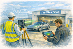
Automotive 3D Scanner Technology | Vehicle & Car Laser Scanning
The automotive industry has always pushed the limits of precision. From body panels and chassis alignment to aftermarket modifications and reverse engineering, accuracy is everything. This is where the automotive 3D scanner has moved from a niche tool to an essential part of modern automotive workflows.
Whether you’re restoring classic vehicles, developing custom components, or validating manufacturing tolerances, 3D scanning of vehicles is now the fastest and most reliable way to capture real-world geometry.
Why Automotive 3D Scanning Matters
Traditional vehicle measurement methods — tape measures, calipers, and manual templates — are slow, subjective, and prone to error. In contrast, vehicle 3D scanning captures millions of data points in minutes, creating a precise digital replica of a car or component.
This digital data can be used for:
Reverse engineering parts
CAD modelling and redesign
Fitment verification
Quality control
Digital archiving of rare or legacy vehicles
For automotive professionals, accuracy is no longer optional — it’s a competitive advantage.
What Is a 3D Scanner for Automotive Applications?
A 3D scanner for automotive use is a device that captures the exact shape and dimensions of a vehicle or its components using laser or structured light technology. The result is a highly accurate point cloud or mesh that can be converted into CAD models.
Common scanner types include:
Laser-based scanners
Structured light scanners
Handheld and tripod-mounted systems
For industrial and engineering use, the car laser scanner remains the preferred option due to its accuracy, repeatability, and ability to scan reflective or complex surfaces.
Automotive Use Cases for 3D Scanning
1. 3D Scanning of Vehicle Bodies
Full 3D scanning of vehicle exteriors allows teams to:
Capture exact body geometry
Design aerodynamic add-ons
Validate panel alignment
Reproduce damaged or unavailable parts
This is particularly valuable for motorsport, restoration, and custom fabrication projects.
2. 3D Scanner for Cars in Restoration & Classic Vehicles
When original drawings no longer exist, a 3D scanner for cars becomes the only way to accurately reproduce parts.
Applications include:
Recreating discontinued components
Digitally preserving rare vehicles
Designing upgrades without altering originality
3. Automotive Laser Scanning for Manufacturing
In production and fabrication environments, laser scanner automotive systems are used to:
Verify tolerances
Compare as-built vehicles to CAD
Detect deformation or misalignment
Reduce rework and scrap
This level of insight is impossible with manual inspection alone.
Choosing the Best 3D Scanner for Automotive Work
Selecting the best 3D scanner for automotive use depends on accuracy requirements, environment, and workflow integration.
Key factors to consider:
Accuracy & resolution (sub-millimetre for engineering)
Speed of capture
Ability to scan reflective surfaces
Compatibility with CAD software
Portability for workshop or site use
For engineering-grade outcomes, tripod-mounted or hybrid systems often outperform consumer-level handheld devices.
Car Laser Scanner vs Traditional Measurement
A car laser scanner provides several advantages over conventional measurement methods:
Traditional Measurement
Automotive 3D Scanning
Manual & subjective
Objective & repeatable
Limited reference points
Millions of data points
Time-consuming
Rapid capture
Difficult to archive
Permanent digital record
This is why 3D scanning of vehicle geometry is now standard practice in high-value automotive work.
Integrating 3D Scanning Into Automotive Design
Once scanning is complete, the data feeds directly into:
CAD design
Simulation & analysis
Fitment studies
Manufacturing workflows
This scan-to-CAD process allows engineers and designers to work from reality, not assumptions.
Automotive 3D Scanning for the Future
As vehicles become more complex — electric drivetrains, lightweight materials, tighter tolerances — vehicle 3D scanning will continue to grow in importance.
Future applications include:
Digital twins of vehicles
Predictive maintenance modelling
AI-driven quality control
Automated inspection systems
What was once cutting-edge is now becoming standard practice.
Final Thoughts
An automotive 3D scanner is no longer just a tool for specialists — it’s a foundational technology for modern automotive design, fabrication, and verification.
Whether you’re selecting the best 3D scanner for automotive work, implementing laser scanner automotive systems in production, or using 3D scanning of vehicle geometry for restoration and reverse engineering, the benefits are clear:
Higher accuracy
Faster workflows
Reduced risk
Better outcomes
In an industry where millimetres matter, 3D scanning of vehicles delivers confidence — from concept to completion.
3D Scanning Meets SolidWorks AI: AURA & Automated Drawings
If you’ve spent any time in SolidWorks, you know the truth: the real work doesn’t start at modelling — it starts at documentation. Drawings, dimensions, revisions, and change control are where hours disappear.
That’s exactly where AURA — the AI Virtual Assistant inside 3DEXPERIENCE platform and SolidWorks Connected is quietly changing the game — especially when it’s paired with engineering-grade 3D scanning and LiDAR data.
For engineers, asset owners, and project teams working in brownfield or live environments, this combination is moving work from painful to almost effortless.
What Is AURA in SolidWorks?
AURA is the AI assistant embedded into the 3DEXPERIENCE ecosystem. It’s not a chatbot bolted on the side — it’s context-aware AI that understands what you’re doing inside SolidWorks and helps automate repetitive, high-friction tasks.
AURA is already leading the way in:
Automated drawing creation
Intelligent dimension and view suggestions
Faster annotation and documentation workflows
Reduced manual clean-up during revisions
In short, AURA reduces the time between a finished model and a usable drawing set.
Why 3D Scanning Changes Everything
On its own, AI automation is powerful. But when you feed it accurate real-world geometry from 3D scanning, it becomes transformational.
Traditional Workflow (The Old Pain)
Manual site measurement
Assumptions about what’s “square” or “level”
Rework when drawings hit site reality
Revisions, RFIs, delays
Modern Workflow with 3D Scanning + AURA
Site captured with 3D LiDAR scanning
Dense, accurate point clouds imported into SolidWorks
Models built from reality, not assumptions
AURA automates drawing views, dimensions, and documentation
Faster sign-off, fewer clashes, less rework
This is where 3D scanning stops being “nice to have” and becomes mission-critical.
Automated Drawings Built on Reality
When point cloud data drives the model, AURA has something incredibly valuable to work with: truth.
That means:
Drawings reflect as-built conditions, not legacy CAD
Dimensions align with real geometry
Hidden clashes are identified earlier
Fabrication drawings match site conditions the first time
For shutdowns, upgrades, and brownfield projects, this is huge.
The result: 👉 Fewer site variations 👉 Fewer fabrication surprises 👉 Faster approvals 👉 Lower project risk
Why Engineers Are Leaning Into AI + 3D Scanning
Once teams experience this workflow, it’s hard to go back.
Engineers quickly notice:
Drawing creation time drops dramatically
Less mental load managing repetitive documentation
More time spent on engineering decisions, not drafting chores
Greater confidence that drawings reflect reality
When 3D scanning feeds SolidWorks and AURA handles the busywork, engineering becomes cleaner, calmer, and far more predictable.
Where Hamilton By Design Fits In
At Hamilton By Design, we sit at the intersection of:
Engineering-led 3D scanning
Point cloud to SolidWorks modelling
Real-world industrial and building services projects
Practical deployment of AI-enabled workflows
We don’t just scan — we engineer with the data.
That means:
LiDAR scans captured with downstream modelling in mind
Clean, structured point clouds optimised for SolidWorks
Models built to support AURA-driven automated drawings
Outputs that fabrication teams and contractors can actually use
The Rise of the “AURA + LiDAR Consultant”
This is a new role emerging in modern engineering teams: someone who understands 3D scanning, SolidWorks, and how AI like AURA fits into real project delivery.
That’s exactly the conversation we’re having every day.
If you’re:
Struggling with drawing production time
Managing upgrades in complex existing facilities
Tired of site conditions not matching drawings
Curious how AI and 3D scanning actually work together (not just in marketing slides)
👉 Check in at www.hamiltonbydesign.com.au We’re always happy to chat with you as your AURA + LiDAR consultant.
Final Thought: This Isn’t the Future — It’s Already Here
AI-assisted design isn’t replacing engineers. It’s removing the friction that slows good engineers down.
When AURA automates drawing creation and 3D scanning ensures models are grounded in reality, the result is simple:
✔ Better drawings ✔ Faster delivery ✔ Fewer surprises ✔ More time spent engineering
And once you work this way, there’s no going back.
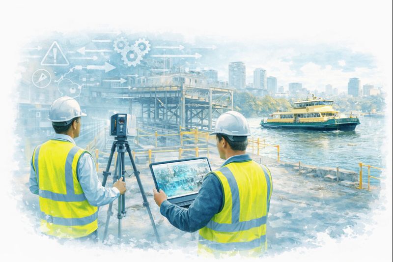
Why Graduate Engineers Quickly Become Addicted to LiDAR Scanning
Ask any graduate engineer what surprised them most in their first few years on the job and you’ll often hear the same answer:
“The drawings were wrong.”
Not maliciously wrong. Not incompetently wrong. Just… out of date, incomplete, or disconnected from what actually exists on site.
That realisation is often the moment graduate engineers discover LiDAR scanning — and once they do, it’s very hard to go back.
Across Greater Sydney, from dense inner-city refurbishments to industrial upgrades in the west, graduate engineers are finding that 3D laser scanning becomes indispensable almost as soon as they’ve worked with it properly. It’s not just helpful. It’s addictive — because it replaces uncertainty with clarity.
The graduate engineer’s first shock: reality doesn’t match the drawing
Most graduate engineers come out of university trained to think in:
idealised geometry
clean load paths
well-defined dimensions
drawings that represent truth
Then they step onto a live site in Sydney CBD, Surry Hills, Parramatta, Mascot, Alexandria, Chatswood, or North Sydney and realise something important:
Existing buildings, plant, and infrastructure are messy.
Services don’t run straight. Columns aren’t perfectly plumb. Steel has been modified, trimmed, plated, or shifted over decades. Mechanical equipment has been replaced multiple times, often without full documentation. In inner suburbs especially, space constraints mean “creative” solutions become permanent.
For a graduate engineer trying to do the right thing, this mismatch creates anxiety:
Am I designing to the right information?
What happens if this doesn’t fit?
How confident should I be signing this off?
This is where LiDAR scanning changes everything.
The first scan changes how graduates think
The first time a graduate engineer works with a real point cloud, something clicks.
Instead of guessing:
they can measure directly
they can see spatial relationships
they can verify assumptions
they can design in context
Suddenly, the question shifts from “what does the drawing say?” to “what actually exists?”
Once that shift happens, it’s very hard to go back to traditional workflows.
Hamilton By Design’s approach to engineering-led LiDAR scanning highlights this transition clearly — scanning isn’t just data capture, it’s digital quality assurance for engineering decisions.
For graduate engineers, this is often the first time they feel genuinely confident that their design inputs reflect reality.
Why LiDAR scanning becomes “addictive”
LiDAR scanning is addictive to graduate engineers for one simple reason:
It removes doubt.
Once you’ve experienced what it’s like to design from verified geometry, going back to hand measurements and assumptions feels risky — even irresponsible.
1. Confidence replaces guesswork
Instead of hoping clearances exist, graduates can prove they exist. Instead of estimating offsets, they can measure them. This builds technical confidence very quickly.
2. Mistakes become learning, not disasters
When designs are checked against a point cloud, errors are caught early — in the model, not on site. Graduates learn faster because mistakes are visible and correctable.
These lessons are difficult to teach from textbooks alone.
Inner Sydney makes scanning essential, not optional
In inner Sydney suburbs, LiDAR scanning is not a luxury — it’s often the only practical way to work.
Areas like:
Sydney CBD
Ultimo
Pyrmont
Surry Hills
Redfern
Alexandria
Zetland
Newtown
are characterised by:
tight sites
layered services
heritage structures
mixed-use refurbishments
minimal tolerance for rework
Graduate engineers working on these projects quickly learn that:
traditional site measurement is slow and disruptive
access is limited and time-boxed
errors are expensive and highly visible
Scanning allows:
rapid capture without extended site shutdowns
remote review and collaboration
fewer repeat site visits
better coordination between disciplines
Once graduates experience this efficiency, they naturally push for scanning on future projects.
How scanning supports better engineering decisions
LiDAR scanning doesn’t replace engineering judgement — it supports it.
Hamilton By Design frames scanning as a core part of engineering projects, not a bolt-on service. That distinction matters, especially for younger engineers still developing confidence.
Point clouds make design reviews clearer. Instead of explaining issues abstractly, graduates can show the problem in 3D context — especially helpful when working with senior engineers, fabricators, or clients.
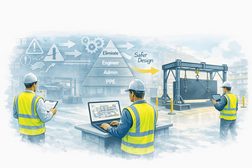
Safer decisions
Designing from verified geometry reduces the risk of unsafe site improvisation. Graduates learn early that safety is tied directly to design certainty.
The “digital safety net” for early-career engineers
For many graduates, LiDAR scanning acts as a digital safety net.
Early in a career, the fear of “missing something obvious” is real. Scanning provides reassurance:
Have I considered the surrounding structure?
Did I allow enough clearance?
Is this installable?
Instead of relying solely on experience they haven’t yet built, graduates can lean on measured reality.
Over time, this accelerates professional growth:
better spatial awareness
improved constructability thinking
stronger questioning of legacy documentation
Ironically, the more graduates use scanning, the faster they develop the intuition to know when it’s needed — and when it’s not.
Greater Sydney: scanning as a standard workflow
Across Greater Sydney, LiDAR scanning is increasingly becoming standard practice for:
building refurbishments
industrial upgrades
mechanical plant modifications
structural alterations
asset verification and compliance work
In western Sydney industrial areas, scanning supports large-scale plant and warehouse projects. In the north and east, it supports constrained commercial and infrastructure upgrades. In the inner suburbs, it often makes projects feasible at all.
Graduate engineers exposed to this environment quickly learn:
projects that scan early run smoother
fewer RFIs come back from site
fabrication issues drop dramatically
install teams trust the drawings more
Once they’ve seen this pattern a few times, scanning stops being a “special request” and becomes the default question:
“Can we scan this first?”
Why engineers struggle to go back once they’ve scanned
After working with LiDAR scanning, graduates often struggle with projects that don’t include it.
They notice:
more uncertainty
more site clarification calls
more “we’ll fix it on site” language
more reliance on assumptions
This is why scanning feels addictive — not because it’s flashy technology, but because it reduces friction at every stage of an engineering project.
For young engineers trying to build credibility, that reduction in friction is powerful. It allows them to:
deliver cleaner designs
ask better questions
contribute meaningfully earlier in their careers
Digital quality assurance becomes a mindset
Perhaps the biggest shift LiDAR scanning creates is cultural.
Graduate engineers exposed to scanning early start to think in terms of digital quality assurance:
verify before design
check before fabrication
confirm before installation
This mindset aligns closely with modern engineering governance, risk management, and professional accountability.
Hamilton By Design’s emphasis on scanning as digital quality assurance reflects this evolution — scanning isn’t about technology for its own sake, it’s about engineering confidence.
Final thoughts: once you see clearly, you don’t want to design blind again
For graduate engineers, LiDAR scanning often marks a turning point.
It’s the moment they realise engineering doesn’t have to rely on best guesses, inherited drawings, or incomplete information. It’s the moment they understand that good engineering starts with seeing clearly.
In Greater Sydney, especially across dense inner suburbs, that clarity isn’t optional — it’s essential.
Once graduate engineers experience what it’s like to design from reality, not assumption, LiDAR scanning stops being a tool and becomes part of how they think. And that’s why, once they’ve scanned properly, most engineers never want to design without it again.
To provide the best experiences, we use technologies like cookies to store and/or access device information. Consenting to these technologies will allow us to process data such as browsing behaviour or unique IDs on this site. Not consenting or withdrawing consent, may adversely affect certain features and functions.
Functional
Always active
The technical storage or access is strictly necessary for the legitimate purpose of enabling the use of a specific service explicitly requested by the subscriber or user, or for the sole purpose of carrying out the transmission of a communication over an electronic communications network.
Preferences
The technical storage or access is necessary for the legitimate purpose of storing preferences that are not requested by the subscriber or user.
Statistics
The technical storage or access that is used exclusively for statistical purposes.The technical storage or access that is used exclusively for anonymous statistical purposes. Without a subpoena, voluntary compliance on the part of your Internet Service Provider, or additional records from a third party, information stored or retrieved for this purpose alone cannot usually be used to identify you.
Marketing
The technical storage or access is required to create user profiles to send advertising, or to track the user on a website or across several websites for similar marketing purposes.