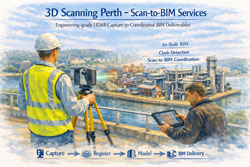
Advancing Digital Engineering through 3D Scanning Perth โ€“ Scan-to-BIM Services

Perth Scan-to-BIM workflow with LiDAR capture converting site conditions into coordinated BIM model for construction and asset management.

3D Scanning Perth โ€“ Scan-to-BIM Services | Hamilton By Design

In an era where digital precision underpins engineering success, the integration of 3D Scanning Perth โ€“ Scan-to-BIM Services has emerged as a vital component of contemporary project delivery. The services offered by Hamilton By Design โ€“ 3D Scanning Services Perth exemplify this integration, aligning advanced engineering-grade LiDAR capture with structured digital modelling workflows that directly support Building Information Modelling (BIM) deliverables.

3D laser scanner operating in Perth with point cloud transitioning into a BIM model illustrating Scan-to-BIM workflow and engineering deliverables.

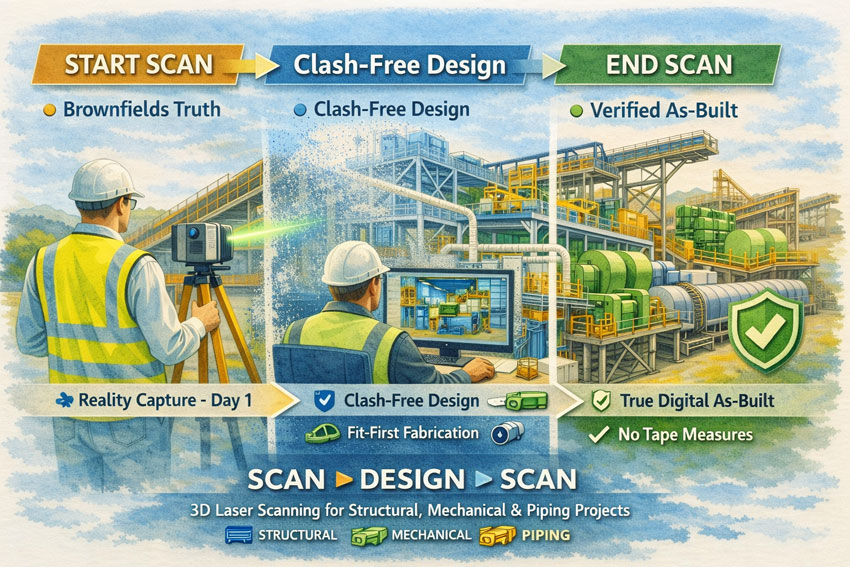
At its core, 3D scanning in Perth is positioned not merely as a mechanism for acquiring visual datasets, but as a fundamental measurement process that transitions physical reality into validated digital representations. Engineering-grade terrestrial laser scanning produces high-resolution point clouds with measurable geometryโ€”data that BIM platforms rely on for spatial coordination, clash detection, and as-built accuracy in complex environments such as industrial plants, construction sites, and marine facilities.

A key advantage of this engineered data capture is its capacity to feed directly into Scan-to-BIM workflows. From the registered point clouds, detailed 3D models can be developed that adhere to the precision expectations of BIM deliverablesโ€”supporting design verification, stakeholder coordination, and multidisciplinary integration. These deliverables typically include:

  • Registered high-accuracy point cloud datasets suitable for BIM import
  • Scan-derived 3D CAD models aligned with BIM spatial and tolerance requirements
  • As-built BIM models that reflect true-to-site geometry for retrofit and renovation projects
  • Documentation packages that underpin regulatory compliance and construction sequencing

Such deliverables ensure that project stakeholders work from a common, reliable digital baseline, effectively bridging the gap between field conditions and model-based project execution. This alignment enhances predictability in engineering coordination and reduces rework associated with discrepancies between assumed conditions and actual site geometryโ€”a fundamental premise of BIM methodology.

Furthermore, when 3D scanning is integrated with BIM workflows in Perth, it supports advanced uses such as clash analysis, spatial coordination, and virtual construction planning. These processes provide multidisciplinary teams with confidence that modelled elements reflect real constraints and interfaces before fabrication and on-site assembly.

Hamilton By Design logo displayed on a blue tilted rectangle with a grey gradient background

In summary, the 3D Scanning Perth โ€“ Scan-to-BIM Services articulated by Hamilton By Design demonstrates how high-accuracy spatial capture, when embedded within an engineering-centric workflow, can produce BIM deliverables that elevate project outcomes. By anchoring digital models to measured realities and structuring data for downstream use, clients are equipped with robust, actionable information that enhances design quality, coordination, and constructability across complex ventures.

Name
Would you like us to arrange a phone consultation for you?
Address

3D LiDAR Laser Scanning Services in Bahrain

Watercolour illustration of 3D LiDAR laser scanning in Bahrain showing engineers capturing an industrial site with a scanner and tablet, styled in Bahrain flag colours with Australian quality standards message.

3D LiDAR Laser Scanning Services in Bahrain | Australian Standards

Engineering Certainty Through Measured Reality

Bahrainโ€™s construction, industrial and infrastructure sectors are evolving rapidly. Successful projects depend on accurate knowledge of existing conditions rather than historical drawings or assumptions. 3D LiDAR laser scanning services in Bahrain provide that verified foundation.

Hamilton By Design delivers engineering-led 3D LiDAR scanning services in Bahrain, capturing complex facilities and structures with millimetre precision so that design, analysis and construction can proceed from fact.


Verification Before Calculation

Many Bahrain projects involve brownfield environments where documentation no longer reflects reality. Modifications, corrosion, settlement and incremental upgrades create risk for designers and contractors.

Terrestrial LiDAR scanning enables:

  • Objective measurement of existing assets
  • Accurate tie-ins for new works
  • Reduction of site variations
  • Shorter shutdown durations
  • Remote engineering collaboration
  • Reliable prefabrication

The scan is the backbone of the project.
The quality of the initial capture determines the ease of every task that follows. If the backbone is compromised, even simple engineering becomes difficult.


3D laser scanning services Bahrain visual showing LiDAR capture, point cloud workflow and Australian Standards compliance in watercolour engineering style.

Engineering-Led 3D LiDAR Scanning in Bahrain

Our services are not limited to data collection. We approach every Bahrain project as engineers first, ensuring the capture supports:

  • Structural and mechanical verification
  • Constructability and access reviews
  • Interface definition for fabrication
  • Maintenance and shutdown planning
  • Risk reduction for project teams

This perspective protects project managers, engineers, designers and fabricators from decisions based on assumption.


Tailored to Your Systems

Hamilton By Design delivers vendor-neutral outputs that integrate with your existing workflows.

We tailor Bahrain LiDAR deliverables to suit your:

  • CAD platforms
  • BIM environments
  • FEA and analysis tools
  • Engineering and asset systems

Our role is to provide accurate engineering information โ€” your team chooses the software.


Australian Quality โ€“ Across All Clients and All Climates

All 3D LiDAR laser scanning services in Bahrain are delivered in accordance with:

  • Australian quality expectations
  • Australian build standards
  • Proven engineering procedures
  • Consistent methodology across all climates

Our workflows are designed for heat, humidity, coastal exposure and heavy industrial environments common to Bahrain, providing defensible and traceable data for every client.


Sectors Supported in Bahrain

  • Oil & gas and process facilities
  • Ports and marine structures
  • Commercial and mixed-use buildings
  • Transport and utilities
  • Manufacturing and logistics
  • Heritage and architectural assets

Whether the requirement is a single tie-in or a full facility digital record, the principle remains the same โ€” measure first, then engineer.


Hamilton By Design logo displayed on a blue tilted rectangle with a grey gradient background

The Hamilton By Design Process

  1. Investigate โ€“ High-accuracy LiDAR capture on site in Bahrain
  2. Verify โ€“ Registration and quality assurance
  3. Design โ€“ Data prepared for your engineering workflow

This structured approach ensures Bahrain projects commence with measured reality rather than interpretation.


Engage 3D LiDAR Laser Scanning Services in Bahrain

If your Bahrain project requires reliable as-built information, Hamilton By Design can mobilise to capture, process and deliver engineering-ready data aligned with Australian standards.

Start your project with certainty, not assumption.

Contact Hamilton By Design to discuss 3D LiDAR laser scanning services in Bahrain.

Name
Would you like us to arrange a phone consultation for you?
Address

SMP Projects: Enabling Project Success Through a Scan โ†’ Design โ†’ Scan Workflow

Watercolour-style illustration showing SMP 3D laser scanning workflow from start capture to clash-free design and final digital as-built.

Successful Structural, Mechanical and Piping (SMP) projects are built on one fundamental principle: decisions must be based on accurate knowledge of existing conditions. In brownfields industrial environments, legacy drawings and manual measurements rarely reflect the current state of an asset. Over years of operation, piping is rerouted, structures are strengthened, and equipment is modified to meet changing production demands.

Commencing design on the basis of incomplete or inaccurate information introduces uncertainty that can affect safety, cost, schedule, and quality. Modern 3D laser scanning provides a disciplined method to remove this uncertainty and establish a reliable foundation for project delivery.


Establishing a Reliable Baseline

An initial 3D laser scan captures a high-resolution digital representation of the facility, recording structural elements, mechanical equipment, and piping systems exactly as they exist. This dataset becomes the authoritative reference for all subsequent engineering activities.

By beginning with a comprehensive reality capture, project teams can:

  • Define accurate tie-in locations for new works
  • Understand spatial constraints and access requirements
  • Identify potential clashes before detailed design
  • Reduce reliance on manual surveys and assumptions
  • Provide designers with objective, measurable data

This approach aligns engineering decisions with actual site conditions, supporting informed planning and reducing the likelihood of downstream rework.


SMP scanโ€“designโ€“scan process illustrated with laser scanner, point cloud model and finished industrial plant.

Designing From Truth Rather Than Assumption

When the design phase is grounded in verified scan data, coordination across structural, mechanical, and piping disciplines becomes more effective. Engineers are able to develop models that reflect the real environment rather than an idealised interpretation of it.

The benefits to project success include:

  • Improved accuracy of fabrication documentation
  • Reduced design revisions and RFIs
  • Greater confidence in constructability
  • More reliable cost and schedule forecasting
  • Enhanced collaboration between designers, fabricators, and site teams

A scan-based workflow supports the objective of โ€œfit-firstโ€ construction, where components are manufactured with confidence that they will integrate with existing assets.


Verifying Outcomes With a Final Scan

Project success is not only measured by installation, but by the quality of information handed to the asset owner. A second 3D scan at project completion provides a verified digital as-built of all SMP works.

This final dataset delivers:

  • An accurate record of installed structural, mechanical, and piping systems
  • Validation that construction matches design intent
  • A foundation for maintenance and asset management
  • Reliable data for future modifications or expansions
  • Elimination of manual tape-based as-built surveys

The organisation is left with a living digital asset rather than static drawings that quickly lose relevance.


Supporting Measurable Project Outcomes

Adopting a Scan โ†’ Design โ†’ Scan methodology directly contributes to recognised measures of project success:

  • Safety: Reduced site rework and unplanned interventions
  • Cost Control: Fewer field modifications and claims
  • Schedule Reliability: Shorter shutdowns and predictable installation
  • Quality: Higher confidence in alignment and tolerances
  • Knowledge Retention: Creation of enduring digital records

These outcomes are particularly critical in SMP environments where interfaces between steel, equipment, and piping are complex and tolerances are unforgiving.


Applications Across Industrial Sectors

This workflow is suited to a wide range of SMP activities, including:

  • Conveyor and materials handling upgrades
  • Plant expansions and debottlenecking
  • Tank, hopper and bin modifications
  • Piping reroutes and tie-ins
  • Shutdown and turnaround works
  • Brownfields engineering studies

In each case, accurate spatial data enables better engineering judgement and more predictable project delivery.


Hamilton By Design logo displayed on a blue tilted rectangle with a grey gradient background

A Framework for Sustainable Project Success

For organisations seeking consistent performance from SMP projects, the integration of 3D laser scanning is not a survey exerciseโ€”it is a strategic project control measure. By capturing reality at project commencement and verifying it at completion, stakeholders gain confidence that engineering decisions, construction outcomes, and asset records are aligned.

Start with verified data.
Design with confidence.
Finish with a true digital as-built.

Hamilton By Design Co. partners with project teams to implement this approach, supporting safer, more reliable, and more successful SMP outcomes.

Name
Would you like us to arrange a phone consultation for you?
Address

3D Scanner Penrith

3D laser scanner in Penrith capturing industrial facility as point cloud for engineering design

3D Scanner Penrith | Engineering LiDAR Scanning

Engineering-grade LiDAR & laser scanning in Penrith, Western Sydney โ€” capture it once, design it right.

When youโ€™re upgrading a plant, refurbishing a building, or tying new steel into an existing structure, you donโ€™t want โ€œclose enoughโ€. You want site truth โ€” fast. Hamilton By Design delivers 3D laser scanning (LiDAR) and point clouds in Penrith and Western Sydney, so your engineers, designers, and fabricators can work from accurate as-built data and reduce rework.

Penrith is in the middle of major growth and infrastructure change across Western Sydney, which makes reliable existing-condition data even more valuable for upgrades and brownfields work.


3D scanner Penrith creating accurate as-built point cloud of factory for upgrades

What โ€œ3D scanningโ€ means for your project

A 3D scanner captures millions of points per second to create a high-density point cloud of your site. That point cloud becomes the backbone of the job:

  • Faster measuring and fewer return site visits
  • Better clash detection and tie-in confidence
  • Cleaner fabrication drawings and install fit-up
  • Reduced variations caused by missing or outdated as-built information

If the initial scan quality is poor, everything downstream gets harder โ€” modelling, detailing, QA checks, and construction coordination all suffer.


3D scanning services in Penrith

We support projects across Penrith, St Marys, Kingswood, Werrington, Emu Plains, Glenmore Park and surrounding industrial/commercial areas.

Typical use cases

  • Structural steel tie-ins & refurbishments (accurate interface points)
  • Industrial sites & plants (brownfields upgrades, shutdown planning)
  • Commercial buildings (facade/elevation capture, services coordination)
  • Mechanical & piping modifications (spools, supports, and retrofit work)
  • Condition capture for tendering (reduce unknowns before you price)

Deliverables that plug into your workflow

We keep deliverables practical and construction-ready, including:

  • Registered point cloud (industry-standard formats)
  • 2D outputs (plans/elevations/sections as required)
  • 3D model support (scan-to-model packages if needed)
  • Interface extraction (critical tie-in set-out points and checks)

(If you tell us what platform your team uses, weโ€™ll align deliverables to suit your workflow.)


How the onsite scan usually runs

  1. Scope & safety planning (access, traffic, operating plant constraints)
  2. Capture (multiple scan positions for full coverage)
  3. Registration & QA (clean, aligned dataset)
  4. Delivery (point cloud + agreed outputs, with notes on any occlusions)

For live environments we can plan around operations, access restrictions, and foot traffic to protect equipment and improve capture outcomes.


Why Hamilton By Design for Penrith scanning

Weโ€™re an engineering-led team. That matters because scanning isnโ€™t just โ€œcollecting dataโ€ โ€” itโ€™s collecting the right data to make design and fabrication easier.

Youโ€™ll get:

  • Practical capture strategies that target tie-ins and risk areas
  • Clear communication on whatโ€™s captured (and what canโ€™t be seen)
  • Outputs designed to reduce RFIs, assumptions, and rework

Penrithโ€™s ongoing development and precinct planning means brownfields interfaces are common โ€” and accurate as-builts help projects stay predictable.


Get a quote for 3D scanning in Penrith

If you want a fast, accurate capture and a dataset your team can trust:

Call / Email: (add your preferred contact details)
Service area: Penrith + Western Sydney
Turnaround: dependent on site size and deliverables

What to include in your enquiry

  • Site address + access constraints
  • What youโ€™re building / modifying
  • Priority areas (tie-ins, steel interfaces, plant items)
  • Required deliverables and required accuracy (if specified)

Hamilton By Design logo displayed on a blue tilted rectangle with a grey gradient background

FAQ

How accurate is a 3D scan?

Accuracy depends on scanner type, site conditions, scan geometry, and required control. For most engineering upgrades, the goal is fit-for-purpose accuracy around tie-in areas, not just a pretty model.

Can you scan operating sites?

Yes โ€” we plan around operations, safe access, and line-of-sight limitations.

Do you do scan-to-model?

Yes. We can deliver point clouds only, or provide scan-to-model packages depending on your scope and downstream needs.


3D Laser Scanning in New Caledonia โ€“ Engineering Certainty in a Remote Environment

Illustration of 3D laser scanning in New Caledonia showing a LiDAR scanner capturing an industrial site over a coloured map with the Kanak flag and point cloud overlay.

3D Laser Scanning New Caledonia | Hamilton By Design

Engineering projects in New Caledonia operate in a unique environment. Nickel processing plants, port facilities, power stations and infrastructure are often decades old, heavily modified and located far from design offices. Accurate site information is the difference between a smooth project and an expensive lesson.

3D laser scanning has become the most reliable way to capture existing conditions across Noumรฉa, Konรฉ and the remote mine sites of the Grande Terre. Instead of relying on tape measures and assumptions, LiDAR technology records millions of precise measurements to create a true digital twin of the asset.


The Challenge of Brownfields Projects in New Caledonia

Many facilities in New Caledonia share the same constraints:

  • Limited shutdown windows
  • Corrosive coastal environments
  • Historical modifications with poor drawings
  • Logistics that make repeat site visits costly
  • Multi-discipline coordination between local and overseas teams

Traditional survey methods struggle to capture congested pipe racks, structural steel distortions or equipment that has shifted over time. When drawings do not match reality, fabrication delays and site rework quickly follow.


3D laser scanning New Caledonia graphic with national colours, flag on map, industrial facility and workflow from scan to first-time fit.

The Scan Is the Backbone of the Project

The initial scan quality sets the tone for every task that follows. The point cloud becomes the backbone of the projectโ€”design, detailing, fabrication and construction all rely on it.

If you start with a broken backbone, you will have problems everywhere else:

  • Simple tasks become difficult
  • Measurements are questioned
  • models need rework
  • fabricators lose confidence
  • schedules start to slip

A clean, well-registered scan makes coordination easy. A poor scan multiplies effort for every member of the team.


Protecting the Whole Project Team

3D laser scanning is not just about creating a modelโ€”it is about protecting everyone involved:

  • Project managers who must control time and cost
  • Engineers responsible for safe and compliant designs
  • Designers and draftspersons who need reliable geometry
  • Fabricators who must build components that fit
  • Construction crews who install the work on short shutdowns

When the as-built data is right, the entire chain works with confidence. When it is wrong, every discipline inherits the problem.


How 3D Laser Scanning Changes the Outcome

A terrestrial laser scanner captures a complete point cloud of the site in hours rather than weeks. The data can then be used for:

  • Accurate as-built models for upgrades and expansions
  • Tie-in design for new conveyors, tanks and platforms
  • Structural verification of aging infrastructure
  • Clash detection before fabrication
  • Shutdown planning and risk reduction
  • Asset documentation for long-term maintenance

For New Caledonian projects, the biggest benefit is capture once, design anywhere. Local scanning crews can collect the data while engineering teams in Australia or New Zealand work from the same digital environment without further travel.


Typical Applications Across New Caledonia

Mining & Processing

  • Nickel plant upgrades
  • Conveyor replacements
  • Chute and transfer redesign
  • Tank and thickener modifications
  • Access platforms and walkways

Ports & Infrastructure

  • Wharf structural assessments
  • Ship loader interfaces
  • Pipe bridges and services
  • Electrical and control building upgrades

Energy & Utilities

  • Power station retrofits
  • Water treatment facilities
  • Fuel storage terminals

From Point Cloud to Deliverables

A professional workflow generally includes:

  1. On-site LiDAR capture with survey control
  2. Registration and quality assurance
  3. Creation of usable formats for Revit, AutoCAD, SolidWorks or Navisworks
  4. Extraction of models, drawings or clash reports
  5. Ongoing support during fabrication and installation

The result is engineering data you can trustโ€”without the need for multiple trips to site.


Hamilton By Design logo displayed on a blue tilted rectangle with a grey gradient background

Ready to De-Risk Your Project?

Whether your project is in Noumรฉa, Konรฉ or a remote mine site, 3D laser scanning provides the foundation for safe, predictable and efficient engineering. Get the backbone right at the start and the rest of the project becomes easier.


Name
Would you like us to arrange a phone consultation for you?
Address

3D Scanning Blue Mountains โ€“ Engineering-Grade LiDAR by Hamilton By Design

3D laser scanning workflow in the Blue Mountains showing FARO Focus capture, point cloud and CAD model for fit-first-time construction

Engineering-Grade LiDAR by Hamilton By Design

The Blue Mountains presents some of the most demanding environments for measurement and design in NSW. Steep escarpments, ageing heritage buildings, bushfire-affected properties, and complex tourism infrastructure mean that traditional survey methods are often unsafe, incomplete, or inaccurate.

Hamilton By Design provides engineering-grade 3D laser scanning across the Blue Mountains โ€” delivering precise point clouds and high-resolution imagery that can be used directly for structural design, drafting, approvals, and construction.


Engineering Data You Can Design From

Our workflow is built around the FARO Focus LiDAR platform, capturing millions of points with millimetre accuracy. Unlike basic reality capture, our service is aimed specifically at engineering and fabrication outcomes:

  • Point clouds aligned to project coordinate systems
  • Accuracy suitable for structural steel interfaces
  • High-resolution HDR imagery from the scanner camera
  • Data prepared for SolidWorks, AutoCAD and BIM workflows
  • Outputs ready for drafting and clash detection

This is not marketing visualisation โ€” it is measurement data that engineers can rely on.


Why the Blue Mountains Demands Professional Scanning

Projects in Katoomba, Leura, Wentworth Falls and Springwood share common risks:

  • Original drawings rarely match existing conditions
  • Buildings sit on rock shelves and irregular terrain
  • Access is limited and weather changes quickly
  • Heritage fabric must not be touched
  • Bushfire rebuilds require objective records

In these environments, even small measurement errors lead to major problems during fabrication and installation. Engineering-grade scanning removes that uncertainty by capturing reality first.


What We Scan in the Blue Mountains

Structural & Industrial

  • Platforms and access structures
  • Steel upgrades and extensions
  • Mechanical plant rooms
  • Conveyor and process equipment
  • Bridges and rail infrastructure

Heritage & Tourism

  • Federation cottages and guesthouses
  • Scenic World structures
  • Lookouts and stone pathways
  • Churches and community buildings

Residential & Bushfire Rebuilds

  • Split-level homes on escarpments
  • Retaining walls and rock faces
  • Pre-loss insurance documentation
  • Extensions with no reliable drawings

Civil Assets

  • Footbridges and carparks
  • Stormwater channels
  • Council buildings
  • Schools and public facilities

FARO Focus 3D scanning in the Blue Mountains for heritage and structural projects

More Than a Point Cloud โ€“ High-Resolution Imagery

The FARO Focus scanner records full panoramic HDR photographs at every scan position. This provides:

  • Visual condition records alongside measurements
  • Colourised point clouds for easy interpretation
  • Virtual site walk-throughs for remote teams
  • Evidence for heritage and insurance reports

Designers can review stone texture, corrosion, timber condition and interfaces without returning to site โ€” a major advantage for Mountain projects where access is costly.


From Scan to Buildable Outcome

Hamilton By Design does not stop at capture. Our service connects directly to:

  • Structural drafting from point cloud
  • SolidWorks modelling of new steel in context
  • Clash detection with existing assets
  • Fabrication drawings and GA documentation

This integrated workflow ensures new work fits first time โ€” reducing:

  • fabrication rework
  • site modifications
  • programme delays
  • unnecessary return visits

Typical Deliverables

Depending on project needs we provide:

  • Registered point clouds (E57, RCP, LAS)
  • Colourised scans with HDR imagery
  • 3D CAD models from scan
  • As-built GA drawings
  • Interface checks for structural steel
  • Condition imagery reports

All data is prepared for use by engineers, architects and fabricators โ€” not just for viewing.


Who This Service Is For

  • Structural and mechanical engineers
  • Fabricators and builders
  • Architects working on heritage
  • Councils and asset owners
  • Insurance and bushfire rebuild teams
  • Mining and tourism operators

Benefits for Blue Mountains Projects

  • โœ” Non-contact capture on fragile heritage fabric
  • โœ” Safe measurement on steep terrain
  • โœ” One visit for geometry + imagery
  • โœ” Accurate data for DA and approvals
  • โœ” Reduced construction lead times
  • โœ” Less rework and variation claims

Local Coverage

Hamilton By Design services:

Katoomba โ€ข Leura โ€ข Wentworth Falls โ€ข Blackheath โ€ข Lawson โ€ข Springwood โ€ข Glenbrook
and surrounding Blue Mountains regions.


Start with Engineering-Grade Reality

If your project relies on existing conditions, start with data you can trust. Hamilton By Designโ€™s 3D scanning provides a professional foundation for structural design, drafting and construction in the Blue Mountains.


Hamilton By Design logo displayed on a blue tilted rectangle with a grey gradient background

Related Services


Hamilton By Design โ€“ Engineering Data for Fit-First-Time Construction


Name
Would you like us to arrange a phone consultation for you?
Address