

Engineering-Grade 3D Laser Scanning for Heritage Buildings, Restoration and Adaptive Reuse in Darwin, NT
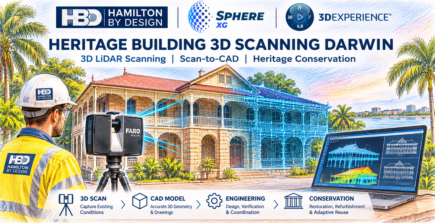
Darwin’s built heritage reflects the city’s distinctive architectural, cultural and environmental history. From historic government buildings and early commercial premises to structures associated with the Second World War and post-war reconstruction, preserving these assets requires an accurate understanding of their existing geometry, construction and structural condition.
At Hamilton By Design, we provide engineering-grade heritage building 3D scanning in Darwin, using terrestrial LiDAR technology to capture detailed spatial information for conservation architects, structural engineers, heritage consultants, building owners and restoration contractors.
Our approach combines 3D laser scanning, point cloud processing, mechanical engineering and CAD modelling to support the documentation, assessment and adaptive reuse of existing buildings.
Rather than relying exclusively on traditional measurements or incomplete historical drawings, our scanning process establishes a measurable digital record of the building’s current condition.
1. Why 3D LiDAR Scanning Matters for Darwin’s Heritage Buildings
Heritage buildings frequently contain architectural features, construction details and geometric irregularities that are difficult to document using conventional surveying techniques.
In Darwin, these challenges can be compounded by tropical weather conditions, long-term material deterioration, previous alterations and historical cyclone damage.
3D LiDAR scanning provides a non-contact method of recording visible building surfaces while reducing the need for extensive physical measurement.
Our scanning services can assist with documenting:
- Existing walls, columns, beams and structural framing.
- Historic façades, architectural features and decorative elements.
- Roof structures, gutters, downpipes and drainage arrangements.
- Floor levels, staircases, openings and internal circulation spaces.
- Building geometry affected by settlement, movement or previous modifications.
- Existing mechanical services, pipework and building equipment.
- Connections between historic structures and later building extensions.
The resulting point cloud provides a spatial reference that can be revisited throughout the design, engineering and conservation process.
2. Heritage Building Documentation in Darwin and the Northern Territory
Darwin contains a range of historically significant structures associated with its development as a port, defence centre and tropical capital.
Examples of heritage environments where 3D scanning may support conservation planning include:
Government and Civic Buildings
Historic administrative buildings, courthouses and public facilities may require detailed geometric documentation before restoration, refurbishment or changes in use.
Military and Defence Heritage
Darwin’s wartime history includes military infrastructure, fortifications, storage facilities and other structures where non-contact digital documentation may support conservation and asset management.
Historic Commercial Buildings
Older commercial premises can contain undocumented structural modifications, irregular wall alignments and complex roof arrangements.
Industrial and Maritime Heritage
Historic workshops, warehouses, port-related structures and industrial equipment may benefit from a combined engineering and 3D scanning approach.
Adaptive Reuse Projects
Where heritage buildings are being converted for contemporary use, accurate existing-condition information assists architects and engineers in coordinating proposed alterations with retained structures.
Hamilton By Design can assist project teams in developing measured digital records to support these activities.
3. Our Heritage 3D Scanning Methodology
Our workflow follows an engineering-oriented approach to data collection, verification and documentation.
Stage 1 — Project Scope and Planning
Before scanning, we review the available building information, drawings and project requirements.
We identify the areas requiring documentation, the required level of detail, access limitations and the intended use of the scanning data.
For heritage buildings, particular consideration is given to sensitive architectural features and areas where physical contact should be minimised.
Stage 2 — On-Site 3D LiDAR Scanning
Using our FARO Focus S70 terrestrial laser scanner, we capture spatial measurements from multiple scanning positions.
The scanner records visible surfaces to develop a three-dimensional representation of the building.
Scanning positions are planned to improve coverage of façades, structural elements, internal spaces and accessible roof structures.
The scanning process is non-contact, although access arrangements may still be required for restricted or elevated areas.
Stage 3 — Point Cloud Registration and Processing
Individual scans are registered into a coordinated point cloud using specialist processing software.
Registration quality is reviewed to identify potential alignment errors and areas of incomplete coverage.
Where required, additional control information can be incorporated to support the project’s dimensional requirements.
Stage 4 — CAD Modelling and Engineering Documentation
The registered point cloud can be used to develop project-specific CAD information, including:
- Existing-condition plans and elevations.
- Building sections and structural geometry.
- 3D CAD models of selected building elements.
- Roof geometry and drainage layouts.
- Fabrication and modification drawings.
- Simplified building geometry for architectural coordination.
- Engineering drawings for proposed alterations.
This enables the captured geometry to support subsequent design, engineering assessment and restoration planning.
4. Heritage Building Scan-to-CAD Services
One of the principal advantages of our service is the ability to progress from scanning to engineering documentation.
We Scan → We Model → We Engineer
Hamilton By Design uses software including SolidWorks, AutoCAD, Autodesk ReCap and FARO SCENE to transform measured site information into practical engineering and design deliverables.
For heritage refurbishment projects, this can reduce reliance on assumptions about existing building dimensions.
For example, when designing new structural supports, access platforms, mechanical services or building modifications, engineers can reference the recorded geometry to assess available clearances and interfaces.
This is particularly useful where original construction drawings are missing, incomplete or inconsistent with the building’s current configuration.
5. Supporting Heritage Conservation and Adaptive Reuse
Accurate geometric information can assist heritage professionals in planning alterations while retaining significant building fabric.
Our 3D scanning services can support:
Conservation Documentation
Recording existing architectural geometry before restoration, repair or other intervention.
Structural Engineering Assessments
Providing dimensional information for engineers assessing existing structural arrangements, deformation or proposed modifications.
Building Refurbishment
Supporting coordination between retained heritage elements and proposed building services or architectural improvements.
Adaptive Reuse
Documenting existing conditions to assist with planning new building functions and modifications.
Long-Term Digital Records
Creating a reusable spatial record for future building maintenance, refurbishment and asset management.
A point cloud records visible geometry at the time of scanning. It does not, by itself, establish structural adequacy, concealed construction details or material condition. These matters may require additional inspection, testing or engineering assessment.
6. 3D Scanning Deliverables for Heritage Projects
Depending on the agreed project scope, Hamilton By Design can provide:
| Deliverable | Typical application |
|---|---|
| Registered E57 point cloud | Interoperable 3D survey data |
| Autodesk ReCap RCP/RCS | Architectural and engineering coordination |
| LAS point cloud | Spatial data exchange |
| 2D CAD drawings | Plans, elevations and building sections |
| 3D CAD geometry | Existing-condition modelling and design |
| STEP or Parasolid files | Mechanical engineering and fabrication coordination |
| General arrangement drawings | Engineering documentation |
| Roof geometry and falls information | Refurbishment and drainage assessment |
The required level of detail, dimensional accuracy and file formats are established during project scoping.
Where heritage conservation requires detailed recording of decorative features, additional close-range scanning or supplementary photographic documentation may be appropriate.
7. Engineering-Grade Scanning and Quality Assurance
Hamilton By Design approaches heritage building documentation from a mechanical engineering and dimensional verification perspective.
Our FARO Focus S70 scanner provides high-density spatial measurements suitable for a broad range of building and industrial applications.
However, the achievable accuracy of a completed heritage building survey depends on factors including scanning distance, surface characteristics, registration quality, survey control and site accessibility.
For larger buildings, the final registered point cloud accuracy must be assessed against the agreed project requirements rather than relying solely on the scanner’s individual measurement specifications.
Our quality assurance process considers scan coverage, registration consistency and the suitability of the resulting information for the intended engineering or architectural application.
8. Heritage Scanning in Darwin’s Tropical Environment
Darwin’s climate creates practical considerations for external laser scanning.
High temperatures, tropical rainfall, reflective surfaces and restricted site access can influence scanning arrangements.
At Hamilton By Design, we do not undertake external laser scanning in the rain.
External scanning activities are planned around suitable weather conditions, while internal scanning may continue where access and site conditions permit.
For occupied heritage buildings, scanning may also be scheduled outside normal operating hours to reduce interference from building users and improve data capture.
Where elevated access is required, suitable access equipment and safety arrangements are considered during project planning.
9. Heritage Building 3D Scanning Across Darwin and the Northern Territory
Hamilton By Design provides project-based 3D LiDAR scanning and engineering documentation services for clients across Darwin and surrounding industrial and commercial areas.
Our service coverage includes Darwin CBD, Winnellie, Berrimah, East Arm, Stuart Park, Parap, Fannie Bay, Palmerston and other Northern Territory locations.
We work with architects, consulting engineers, heritage specialists, building contractors, asset owners and facilities managers requiring reliable existing-condition information.
Projects can range from individual architectural features and building façades through to complete building documentation and complex engineering interfaces.
10. Why Choose Hamilton By Design?
Hamilton By Design combines 3D measurement technology with practical mechanical engineering and CAD capabilities.
Our services are particularly suited to projects where scanning information must be translated into engineering decisions, coordinated models or fabrication documentation.
Our capabilities include:
- Engineering-grade terrestrial 3D LiDAR scanning.
- Registered point cloud processing and verification.
- Scan-to-CAD and reverse engineering.
- Mechanical and structural interface modelling.
- Existing-condition drawings and engineering documentation.
- CAD data suitable for architectural and engineering coordination.
- Project-specific quality assurance and dimensional review.
By combining data capture and engineering documentation within a coordinated workflow, we help project teams establish a reliable geometric basis for restoration and refurbishment activities.
11. Request a Heritage Building 3D Scanning Quotation in Darwin
Are you planning the restoration, refurbishment or adaptive reuse of a heritage building in Darwin or the Northern Territory?
Hamilton By Design can assist with developing a suitable scanning scope, identifying required deliverables and establishing an engineering-oriented approach to existing-condition documentation.
Whether the project involves a historic façade, government building, industrial heritage structure or complete building refurbishment, accurate spatial information provides a valuable starting point.
Contact Hamilton By Design to discuss your heritage building 3D scanning requirements.
Contact Us – Talk To Us
Our clients:
















Hamilton By Design — 3D LiDAR Scanning | Scan-to-CAD | Mechanical Engineering | Engineering Documentation
We Scan → We Model → We Engineer