

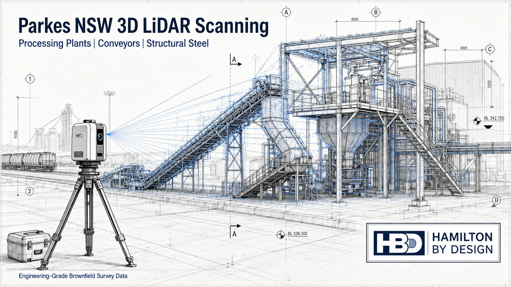
Engineering-Grade 3D LiDAR Scanning in Parkes NSW

Processing plants, logistics facilities, fabrication workshops, recycling plants and materials handling assets around Parkes NSW often rely on equipment that has been modified many times over its working life. Conveyors are extended, chutes are repaired, platforms are added, guards are changed, pipework is rerouted and structural steel is strengthened or replaced.
Over time, the original drawings may no longer match the real site.
That creates a major problem when a business needs to plan a shutdown, install new equipment, fabricate replacement components or upgrade a brownfield plant. If the engineering team is working from old drawings, site assumptions or manual measurements, the risk of clashes, poor fit-up and costly rework increases quickly.
Hamilton By Design provides engineering-grade 3D LiDAR scanning in Parkes NSW for processing plants, conveyors, transfer points, structural steel, pipework, access platforms and shutdown engineering projects. Our scanning service helps turn existing site conditions into reliable engineering information.
For clients who need broader technical support beyond scanning, Hamilton By Design also provides engineering services across mechanical design, structural drafting, 3D CAD modelling, verification and brownfield project support.
Why Parkes NSW Needs Accurate Brownfield Survey Data
Parkes is an important industrial and logistics location in Central West NSW. The region supports freight, rail, agriculture, mining services, fabrication, recycling, resource recovery and industrial development. These industries often depend on conveyors, fixed plant, loading systems, workshops, platforms, stairs, pipework and structural steel.
Many of these assets are not clean greenfield projects. They are existing operating plants where the real challenge is understanding what is already there.
A processing plant may have had years of small upgrades. A conveyor may have been modified during shutdowns. A fabrication package may need to tie into existing steelwork. A chute replacement may need to fit between a belt, a transfer tower and a piece of equipment with limited clearance.
This is where 3D LiDAR scanning becomes valuable. Instead of relying on incomplete drawings or repeated site measurements, the project team can work from a registered point cloud that captures the real plant geometry.
The Biggest Problem: Existing Assets Are Hard to Verify
The biggest problem for processing and materials handling sites is not always the design of the new work. Often, the problem is confirming the existing site conditions before design begins.
Common issues include:
- Existing drawings are missing or outdated
- Plant layouts have changed over time
- Conveyor transfer points have been modified
- Structural steel has been added or repaired
- Access platforms and walkways do not match drawings
- Pipework and services have been rerouted
- Shutdown changes were never fully documented
- Manual measurements are difficult in congested areas
- Fabrication teams do not have reliable tie-in dimensions
When these issues are not resolved early, they can cause problems during fabrication and installation. A chute may not fit. A platform may clash with existing steel. A pipe route may be blocked. A conveyor guard may interfere with access. A shutdown task may take longer than planned because the real site does not match the design model.
3D LiDAR scanning helps reduce those risks by capturing the existing asset before design, fabrication and installation work starts.
What 3D LiDAR Scanning Can Capture
For Parkes NSW industrial and processing sites, 3D LiDAR scanning can capture a wide range of assets, including:
- Conveyor systems
- Transfer stations
- Chutes and hoppers
- Screens, crushers and feeders
- Structural steel frames
- Access platforms and walkways
- Stairs, ladders and handrails
- Pipework and service routes
- Tanks, bins and silos
- Workshop layouts
- Plant rooms and equipment areas
- Shutdown work zones
- Fabrication tie-in points
- Existing mechanical equipment
The scan creates a detailed 3D point cloud of the site. This point cloud can then be used for measurements, layouts, clash checks, CAD modelling, fabrication planning and engineering review.
Hamilton By Design’s 3D laser scanning for engineering is focused on producing data that supports practical engineering decisions, not just visual site records.
How the Scanning Process Works
A typical Parkes NSW 3D LiDAR scanning project starts with a discussion about the asset and the reason for scanning.
The project may involve a conveyor upgrade, a chute replacement, a structural steel modification, a plant layout review, an access improvement or shutdown planning. Once the purpose is understood, the scan scope can be planned around the areas that need to be captured.
On site, the scanner is set up in multiple positions to capture the required plant geometry. These scan positions are then registered together to create a single point cloud. Depending on the project, the point cloud can be aligned to site control, a local coordinate system or a practical project datum.
From there, the data can be exported into common formats such as E57, RCP, RCS or LAS. These files can be used in CAD, modelling and coordination software.
Where required, Hamilton By Design can also convert scan data into CAD models, 2D layouts, sections, elevations, mechanical arrangements or fabrication reference drawings.
Tools That Assist in Solving the Problem
The value of 3D scanning comes from combining the right capture method with the right engineering workflow.
Useful tools include:
- Terrestrial LiDAR scanning for accurate site capture
- Point cloud registration software for scan alignment
- Autodesk ReCap for preparing point cloud files
- Navisworks for coordination and clash checking
- SolidWorks for mechanical design and modelling
- Inventor and AutoCAD for layouts and drafting
- E57, RCP, RCS and LAS point cloud deliverables
- Scan-to-CAD modelling for engineering and fabrication support
Hamilton By Design treats point cloud laser scanning as an engineering tool. The point cloud becomes the base information for design, review, measurement and decision-making.
Common Applications in Parkes NSW
3D LiDAR scanning can support many industrial and materials handling projects around Parkes.
For a conveyor upgrade, scanning can capture the head pulley, tail pulley, belt line, transfer point, support steel, access platforms, guards and surrounding equipment.
For a chute replacement, scanning can capture the existing discharge point, receiving belt, liner access, chute supports, surrounding steel and available installation space.
For a structural steel modification, scanning can capture columns, beams, base plates, bracing, platforms, stairs and handrail geometry.
For a shutdown project, scanning can help the team plan work before the outage begins. This can reduce the need for repeated site visits and help fabrication teams prepare components before the shutdown window.
For a processing plant layout, scanning can help confirm equipment locations, access routes, clearances and installation constraints.
Who Uses This Service?
The service is useful for a range of Parkes and Central West NSW businesses.
Plant managers use scanning to understand existing assets before approving upgrades.
Maintenance managers use scanning to plan repairs, replacements and shutdown work.
Project engineers use point clouds to design around real site conditions.
Fabricators use scan data to confirm dimensions before manufacturing steelwork, guards, chutes, platforms or mechanical components.
Shutdown planners use the data to identify access issues, tie-in points and installation constraints before work starts.
Contractors use the point cloud to understand the work area before arriving on site.
The common benefit is simple: everyone works from the same accurate site information.
Skill Sets Companies Are Looking For
The Parkes industrial market commonly needs practical heavy industry and project delivery skills. These include mechanical fitters, boilermakers, welders, poly welders, fabricators, maintenance technicians, shutdown workers, leading hands, project engineers, draftspersons and site supervisors.
These skill sets all rely on accurate information.
A mechanical fitter needs to know how equipment fits together. A boilermaker needs reliable dimensions. A fabricator needs confidence that the workshop-built item will fit on site. A project engineer needs accurate site context. A shutdown planner needs to understand access and sequence.
Hamilton By Design can also support clients through secondment services where skilled engineering and technical personnel are required for shutdowns, upgrades, project delivery or operational workloads.
Why Use Hamilton By Design?
Hamilton By Design combines 3D LiDAR scanning with mechanical engineering, CAD modelling, structural drafting and brownfield project experience.
This matters because industrial scanning is not only about capturing millions of points. The scan needs to support real engineering work. It needs to help answer practical questions:
Will the new chute fit?
Is there enough access?
Where does the existing steelwork sit?
Can the replacement component be fabricated before shutdown?
Will the pipe route clash with the platform?
Do the old drawings match the real plant?
By combining site scanning with engineering judgement, Hamilton By Design helps clients move from uncertainty to usable project information.
Need 3D LiDAR Scanning in Parkes NSW?
Hamilton By Design provides engineering-grade 3D LiDAR scanning for Parkes NSW and the Central West.
We support processing plants, conveyors, transfer stations, workshops, fabrication contractors, logistics facilities, agribusiness operations, mining-related assets and industrial sites that need accurate brownfield survey data.
If your existing drawings are incomplete, outdated or difficult to trust, 3D LiDAR scanning can help turn the real site into reliable engineering information before design, fabrication or shutdown work begins.
FAQs
What is 3D LiDAR scanning?
3D LiDAR scanning is a method of capturing existing site conditions using laser measurement. The scanner records millions of points to create a 3D point cloud of the asset, structure or work area.
Why is 3D LiDAR scanning useful for Parkes NSW industrial sites?
It is useful because many processing, logistics, fabrication and materials handling sites have existing assets that have changed over time. Scanning helps verify what is actually on site before new work is designed or fabricated.
Can 3D scanning be used for conveyors?
Yes. Conveyors are one of the strongest applications for 3D scanning. The scan can capture belt lines, pulleys, transfer points, guards, supports, access platforms and nearby structures.
Can scan data help with chute replacements?
Yes. Chute replacements often depend on accurate tie-in dimensions and clearances. Scanning can capture the existing conveyor, discharge point, receiving equipment, support steel and access restrictions.
What files can be supplied after scanning?
Depending on the project, deliverables may include E57, RCP, RCS or LAS point cloud files. CAD models, sections, layouts and fabrication reference drawings can also be produced where required.
Does 3D scanning replace engineering design?
No. Scanning captures the existing site. Engineering design is still required to assess, modify, design or document the new work. The benefit is that the design is based on accurate existing conditions.
Is 3D scanning suitable before a shutdown?
Yes. Scanning before a shutdown can reduce uncertainty, support fabrication planning and help identify access or clash issues before the outage begins.
Does Hamilton By Design service areas outside Parkes?
Yes. Hamilton By Design supports Parkes, Central West NSW and industrial projects across Australia, including mining, processing, manufacturing, infrastructure and brownfield upgrade work.

Talk to Us – Contact Us
Our clients:


